Kakalea:
ARA
under construction! preview only!
by Chris Wayan, 2012-2015
for the Saharans
Kakalea basics--map--geology--
creatures--
Building Kakalea
More worlds? Planetocopia!
Kakalea:
ARA
under construction! preview only!
by Chris Wayan, 2012-2015
for the Saharans
Kakalea basics--map--geology--
creatures--
Building Kakalea
More worlds? Planetocopia!
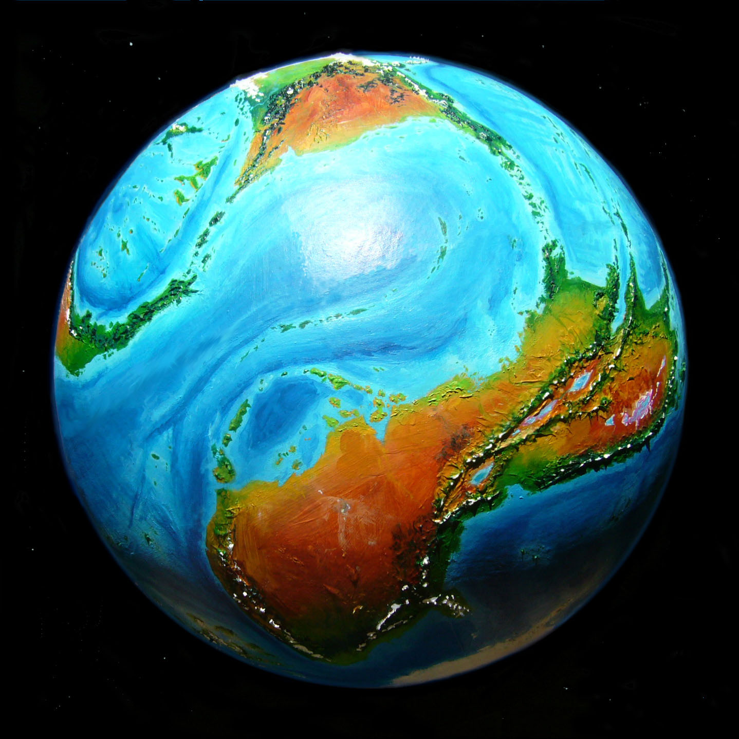
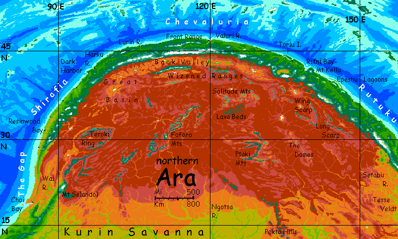
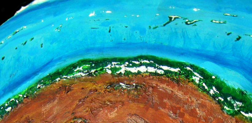
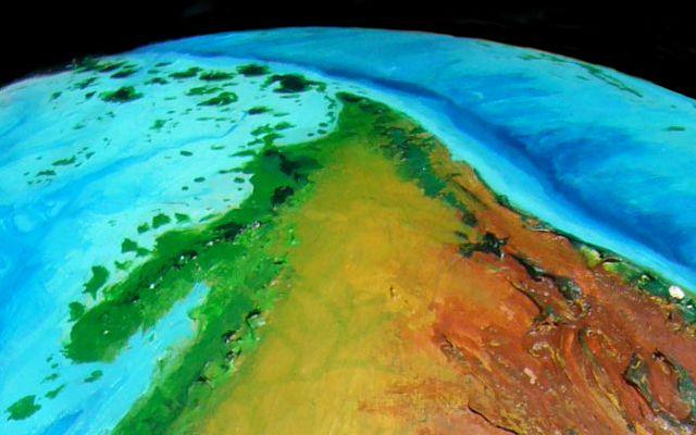
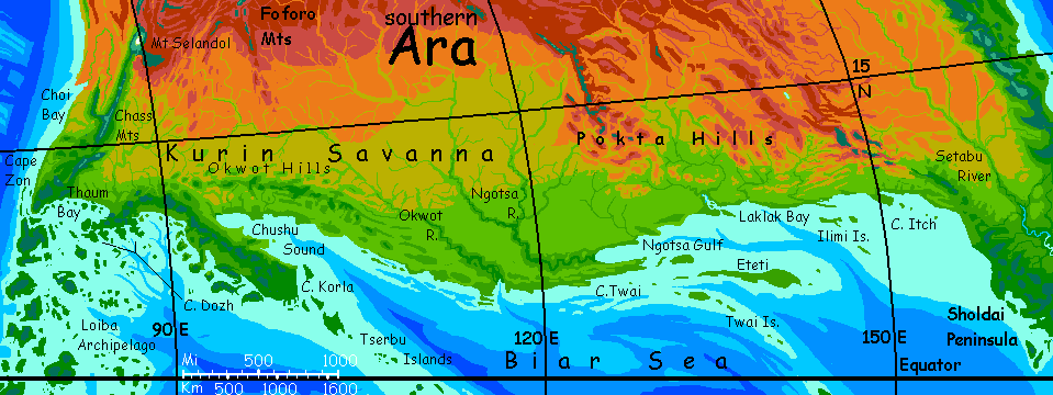
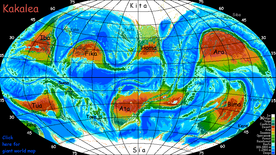
Ara is the third biggest continent in the world; at 33 million square kilometers (over 13M sq mi), it's bigger than Africa, nearly as big as Asia. Unfortunately Ara's also the driest continent overall, with the largest desert. Almost twice the size of our Sahara, it's as big as all North America.
We'll start in the far east and sail round Ara counterclockwise--the arc of the long north coast, the western tip, then the shorter southern shore. Here we may risk a short caravan or two inland.
Eventually we'll sail up this coast on a catamaran--a floating theater, really--and you'll get a port-by-port tour. But for now, it's just outline.
The Dachei Islands, a volcanic chain 2500 km long (1500 mi) links East Ara to Tua, the small Australia-like continent to the southeast. The Dacheis cross the equator; hot and humid, they're covered head to toe in rainforest. The largest, Hubat, is 500 km long (300 mi). Most of the gaps between islands aren't broad or deep, but one deep strait below the equator is 320 km (200 mi) wide; beyond it, people call the archipelago the Kshupas. Not only language and culture are different beyond the Gap! Animals may swim and primitives paddle over lesser straits, but not this--only wind-savvy sailors and fliers will cross between these continents; faunas will be sharply different.
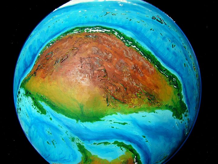
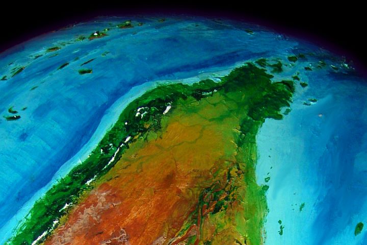
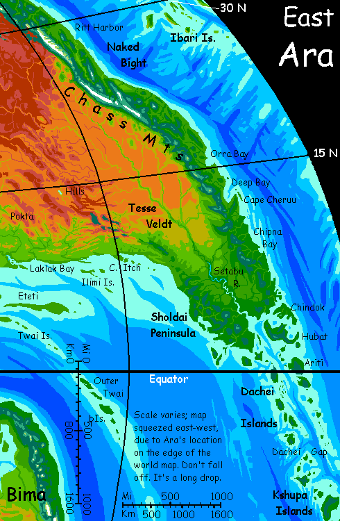
Cape Sholdai, the eastern tip of Ara, is also clad in equatorial forest. This blunt, forked peninsula is Ara's largest forest of any kind, over a million sq km (400,000+ sq mi), bigger than New Guinea. Between two coastal ranges is the broad valley of Setabu River, draining much of eastern Ara. 1000 km upstream, the forested valley floor begins to open in glades, then break up into groves and meadows, then into tree-dotted savanna. 1600 km upriver, the only trees stand on the banks. Dry gold grass plains stretch to a flat horizon--the coastal ranges have retreated, leaving a plain 1000 km wide: Tesse Veldt.
Northern Tesse Veldt frays slowly into red desert. Here the Setabu River is the nearest thing to a Nile we'll find on Ara--a looping green thread in a red plain. To the west are dry washes, but perennial streams descend from the northeast, where the coast ranges hem in the desert. Hills no more, they're now snowcapped ridges 3-4 km high (10-13,000') walling off the coastal forest, but also contributing snowmelt to these forks of the Setabu. Though this is the dry side of the Chass Range, even small streams add up; the great river rarely fails.
The Chass Mountains of Ara aren't as high as the Andes, but then they don't need to be. On Ara, higher gravity and thinner air at sea level mean rain and life thin out only 2-3 km up, not 4-6 as on Earth. So the Chasses, only as high as the Alps or Rockies, are quite enough to block the rains from reaching Central Ara.
The coastal strip, just 2-400 km wide (125-250 mi), varies in width and climate but is consistently fertile. Short rivers run to the sea. We can't possibly climb over the mountains; the air's too thin for Terrans to safely cross even the lowest passes here, not even as passive packages on the backs of caravan beasts.
Not that there's a caravan to carry you. Even for Kakaleans, it's easier to go round the mountains by riverboat.
There are plenty of them, much to your surprise. What's of value on these dusty plains? Well, it may not be scenic, but it's decent grazing land except when the rains fail. Kakaleans wear few clothes and eat less meat than humans, but equivalents of wool fabrics (though the fleeces are airier, more like cotton) and dried meat (highly spiced), plus grain (well, more like sunflower seeds), and cheese (well, more like hard yogurt) and a yucca-like plant fiber make up the bulk of trade.
But they're not the most valuable items, by far. Pebbles are.
Shiny pebbles.
Opals! Australian quality, with intense rainbow fire. The best in the world. The silty soils here hide treasure for the patient, the intuitive and the just plain lucky. Small diggings are scattered all round the upper Setabu--both Tesse Veldt and the fringes of the desert.
So we end up floating back down the Setabu, talking pleasantly with prospectors and ranchers--all of them happy, for they only take weeks off to head for Setmouth when they've made (or found) goods worth the trip. It's not a fair cross-section of Tesse Veldt, but a fun one.
Mind you, the coastal Kakaleans on board are relieved to be heading back toward civilization, even at the lazy Setabu's five km an hour. The coast is the real world, the normal world. They don't trust the Outback (the word translates exactly--and is worldwide). They're right not to, overall. Unreliable. As the Kurinian proverb puts it:
Boom, then bust.
Rain, then dust.
Outback only
when you must.

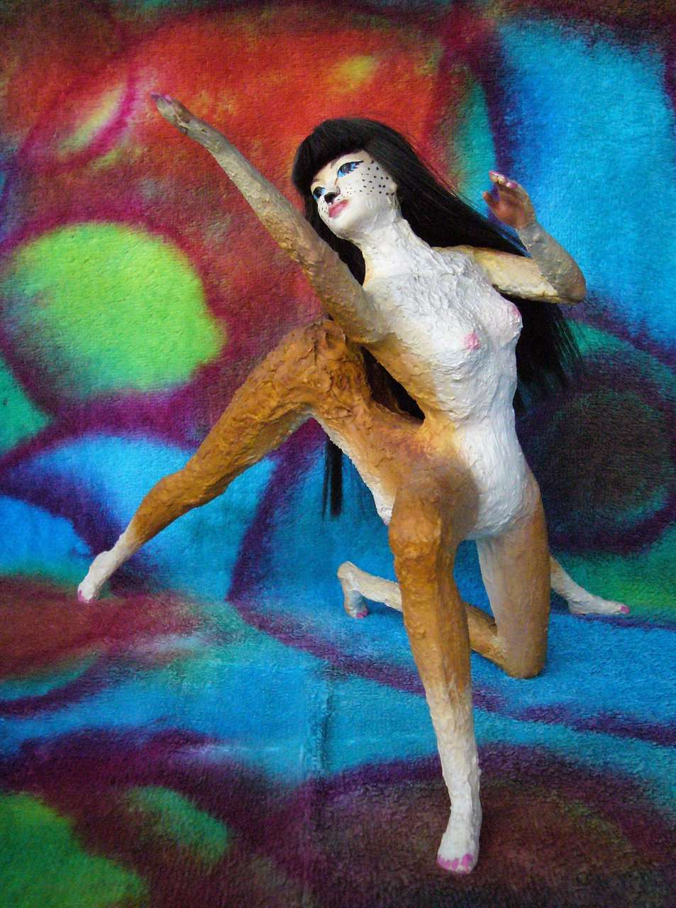
Shya in Rose of the Quilted Plain in Orra Bay; quilt backdrop by Joy-Lily |
As I said, a port-by-port scenic tour will come--eventually. But for now, this long coast, as big as America's or Brazil's eastern seaboard, is just an outline. A green strip below a garden wall--topped with something jagged. And getting jaggeder with every day--the mountains grow taller (though still mostly snowless) behind Chipna Bay...
Cape Cheruu...
Deep Bay...
Orra Bay...
NAKED!
Then comes the Naked Bight, not named because it's so hot and humid you want to strip naked (though it is; the climate is Caribbean). The Kakaleans as I project them have fur, wearing only cloaks occasionally in freezing weather; naked doesn't mean "clothesless" but "bareskinned", and that isn't risqué but pathologically vulnerable. If it weren't too long, I'd have translated it "Shaved Peltless Bight". The place lacks protection.
Oh, there are small fairweather ports at rivermouths, but no sheltered bays of any size; trade is highly seasonal (the worst storms are in summer) and even in spring and fall, boats stand off in high winds or bad weather.
So you endure four days and some 2000 km (1250 mi) of jittery crew and vigilant weatherwatchers, between Orra Bay and Ritt Harbor.
The cultural result? This fertile and well-populated coast is nonetheless culturally backward. Cities are small, news arrives late, foreign books, art and music are costly, circus and theatre boats may not stop at all...
Geography shapes culture--and the lack of it.
RUTUKU
Northeast Ara, from Ritt Harbor on, is called Rutuku.
The next major port: Epeshu, with its long barrier islands and marshy lagoons, home to millions of birds in winter--they fly here from all over the northern ocean as blizzards sweep down from the pole.
Rifni Bay, at the foot of Mt Kellu, a dormant volcano 3800 m high (12,500'--tall as Fuji, though quite a different shape--a great broken ridge). Snowy even now in summer...
Toriport, sheltered from blizzards by the rugged fortress of Toriu Island.
All this talk of snow and blizzards seems incongruous. The coast is still warm and humid--muggy as Carolina! But those aren't the Appalachians inland; more like the Atlas Mountains dividing Mediterranean Morocco from the dry lands to the west...
And as we go north, Ara's outback isn't veldt for long; true desert inland. Rutuku looks entirely to the sea.
CHEVALURIA
Ara's north-central coast, a land called Chevaluria, is only 40-odd degrees north, but it's temperate, with short snowy winters: the Kiaro Ocean to the north is, off Chevaluria, as narrow as it ever gets; the iced-over continent of Kita has a baleful influence, just as much smaller Greenland has on New England ports no farther north, sending down at least a few blizzards most years.
Also, in central Chevaluria, the Chass Range rises to its climax, topping 5 km (16,500'); the coastal strip tilts north, lengthening every shadow, adding a virtual degree or three to the latitude. And the icefields of the central Chasses have a chilling effect.
The Front (coastal) and Back (outback) Ranges are a mile lower, but that's still 3.5 km (11,000') high. Chevaluria's rugged country!
The lowlands here are hardwood groves and orchards; the uplands, cool evergreen forests and alpine meadows. The most productive and heavily settled regions are sheltered from polar gales by the Front Range: the Valuri River valley and the similar Lurin and Harku Valleys to the west. They're drier than the coast, semi-arid in places, with scorching summers. But it's worth it to avoid those blizzards--and the endless cold rains of the North Coast fall, too.

The Three Valleys still see snow most winters, though falls and freezes are brief by Terran standards--two months down to zero in some years. But most breeds of Kakalean evolved in tropical climates; to most, any snow at all seems harsh. Chevaluria's considered grand but austere.
SHIRAFIA
Past Port Harku, at the rivermouth, we enter a different and milder region: Shirafia. I said "milder", but "paradoxical" might have been a better term for Shirafia. The wettest and driest stretches of Ara's long coast lie not far apart here.
Past Dark Harbor, where the coast bends firmly south, the snow-adapted woods (rare on Kakalea; not much land in the temperate zones) start giving way to dense forests luxuriating in mild summers and rainy winters.
|
|
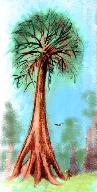
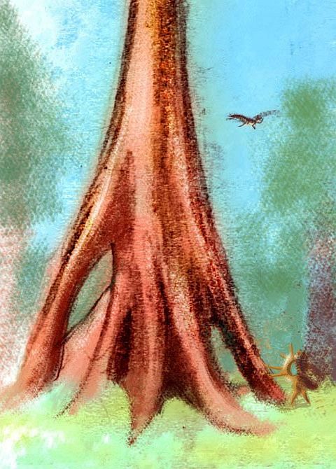
Here rise some of the world's tallest trees--up to 70 m (230'). Kakalean gravity's too high and the air's too thin for trees to reach redwood heights, but garandas are more massive--all buttresses and burls, more mega-baobab than redwood. A strange contrast next to the searing waste just over the mountains to the east. But surely no stranger than redwoods in our Sierra Nevada barely 100 km from the scorching alkali flats of Death Valley.
As we head further southwest, these woods thin and we enter a strip of southern Mediterranean climate--pseudo-oak groves and meadows. A Morocco or California or Perth with dangerously nice weather--perched on the edge of the desert, Shirafians are never quite sure the rains won't fail this year... though snowfed streams from the mountains guarantee at least drinking water. The spicy scent of subtropical fruit makes me suspect the inhabitants may be bohemian or mystical... or both at once.
Nila Resincove in I Married Too Many Rainbows; set by Joy-Lily | |||
|
|

|
|
Further southwest. Sea breezes and summer fogs keep a narrow strip right along the shore more warm than hot; but winter rains grow ever less reliable. For 1000 km or more, the coast is brushy desert, though the inland mountain heights still trap some rain and snow, nourishing woods that send thin feelers down creeks to the coast. It's like Precolumbian Los Angeles.
Without those mountains we'd see unbroken desert from Ara's heart to the western shore, as in Australia or the Sahara at the same latitude. Here, as much precipitation comes in summer thunderstorms as in winter rains.
But next, the winter rains fail almost entirely, along the coast at least: the Gap, as it's called. It's not a long sail past this desert shore for Kakalea's fast, light catamarans, but it's still an anxious few days. Not a place to get beached.
Clearly we're not in the North anymore, but the uncertain West.
The Gap ends abruptly at Choi Bay--not because the climate's suddenly wet, but becauses water's available again, starting at the Wai River, fed by snowmelt from Mt Selandol (4500m or 14,750') and thundershowers along the Wai Hills. And south of the Wai, the low coastal hills send down small but reliable rivulets; they run low in winter, but fail entirely only in the driest years.
From here south, summer rains are consistent enough be dubbed a weak monsoon. The pattern grows stronger yet in the far southwest and the western tip of Ara, where a true summer monsoon--weeks of heavy rain--supports lowland woods again.
We're on more consistently fertile ground here--not as lush and green as the best of Chevaluria or Rutuku, but the desert's pushed well inland again.
Cape Zon, in the far southwest: forested volcanic hills--the very last gasp of the Chass Range. It's warm and dry in winter, drenched but still warm in summer. Buggy in between.
Thaum Bay to the east has similar weather but is flat--the wooded coastal plain opens gradually, almost imperceptibly to tree-dotted savanna 200 km inland. The veldt runs another thousand km north, gradually losing trees, leaving only dry grass, before fading into desert. This veldt, the size of many Terran nations, is just the west end of Kurin Savanna, largest on Kakalea--and that's saying a lot on a world with eight deserts rivaling our Sahara, nearly all bordered by great swaths of savanna. The trouble is, Kurin's also dull. There's no rule that says savanna has to be flat and featureless, but inland from the Chass Mts and Okwot Hills there are places you could walk a week without seeing a knoll. As flat a horizon as at sea. Not even clouds. Blue overhead, ochre below.
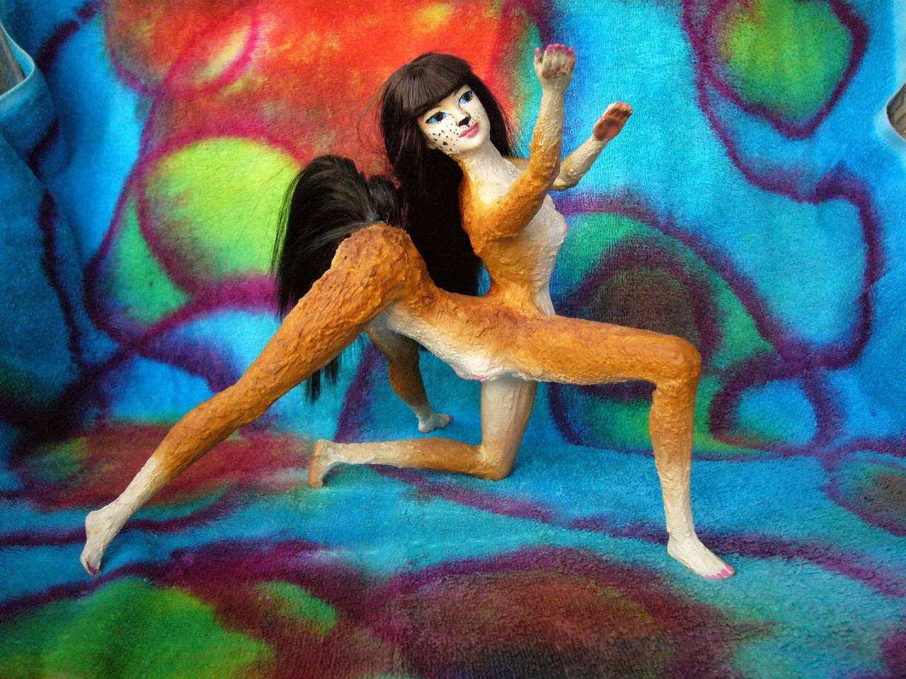
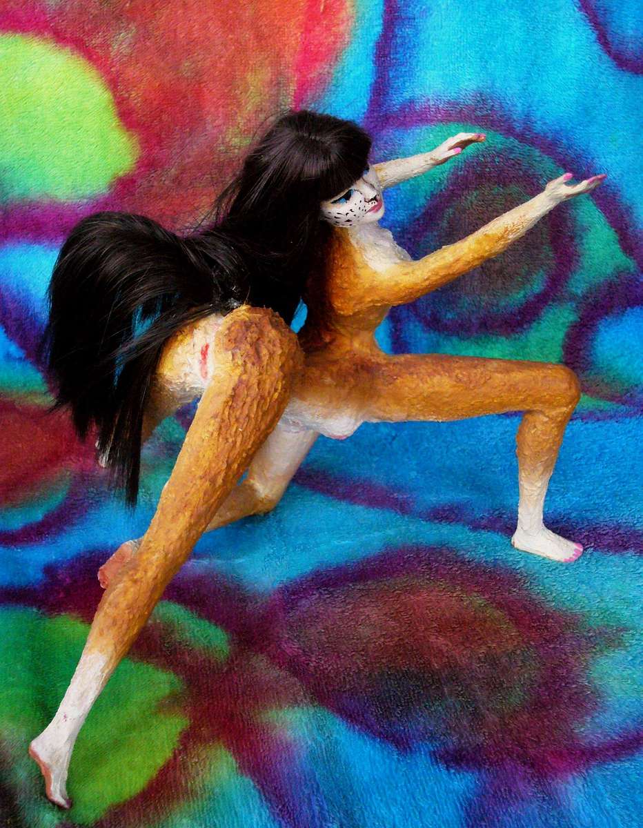
Some Terran poets characterize the moon as fickle or inconstant, because of her phase-changes. Not on Kakalea. The three moons are universally seen as an old married trio, meeting when they can as they sail their regular trade-route, Kakalea's ring. The moons aren't seen as fickle. At least here on Kurin Plain, it's rain who's the Fickle Goddess. Here's Kentaur of Thaum Bay, dramatizing his rejection by a lover he names only as Rain.
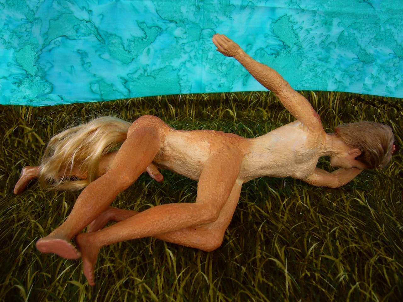
The scene's not as erotic as it looks to a Terran; Kentaur's sad here, not horny. Believe me, you'd know. Not big as a horse, but big. What's going on is that Kakalean males have a spur of cartilage supporting the penis so it doesn't dangle and flop when galloping (lots of Earth mammals have such structures in bone or cartilage); in its normal state, it looks about as large as a human erection. Of course Kentaur does, as a dancer, flirt with his audience unerect; Kakaleans have as much imagination as Terrans.
Cape Dozh southeast of Thaum Bay. Forested volcanic hills again. Muggy much of the year--but at least Rain is reliable.
She grows relentless further south. The hills of Capes Zon and Dozh march on into the sea, forming the Loiba Archipelago. At least nine of these islands are over 250 km across (150 mi); one is 800 long (500 mi). Taken together the Loibas are larger than Japan. Rainy and warm year-round, straddling the equator, these isles are perhaps the largest true rainforest on Kakalea. The Loibas run some 3000 km southwest to Ata, largest continent in the world.
Is this a migration corridor? For birds, absolutely. But few land animals will make it across this almost-bridge. Straits are shallow and warm, but there are half a dozen, and some are to 50 km wide (30 mi); and they're here to stay. Earth is in a flooded, interglacial era; our western Indonesia, which Loiba superficially resembles, is a subcontinent temporarily cut off from Asia by unusually high seas. In contrast, Kakalea's about as iced-over as it ever gets; in deep time, Kita or Sia will drift off the north or south pole and thaw, raising sea levels, not dropping them. So despite the Loibas' quasi-continental platform and shallow straits, they're likely to remain islands for some time.
On the other hand, those exuberant coral reefs guarantee that this great platform will stay shallow indefinitely--they'll build up to the surface of a rising sea; and these volcanoes may build up enough flows, on this shallow base, to fuse into a continent at last. They're not rising from miles-deep abysses, as in Indonesia's Lesser Sundas, beyond Wallace's Line. So the deep future looks good for an Amazonia here, or at least an Indochina. But future landbridges don't help spread present animals! The fauna on Ara and Ata will be quite different.
And until said fauna get smart enough to build decent boats and brave enough to risk paddling toward a mere green smudge on the horizon, their cultures will be isolated too.
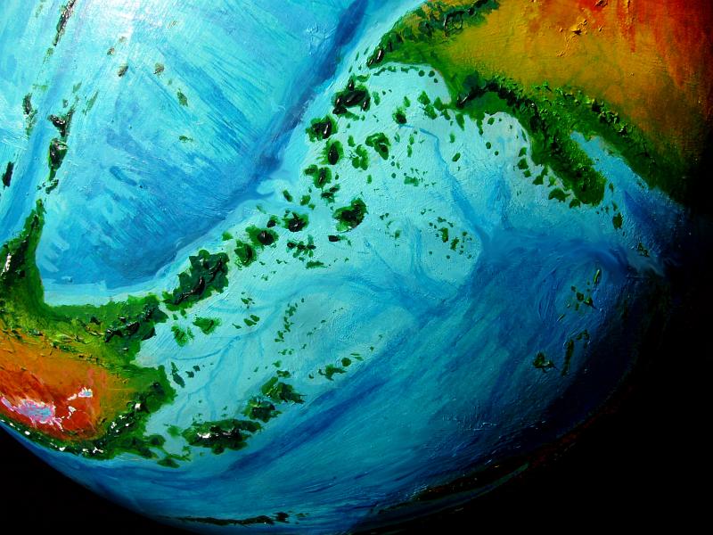
A third peninsula, Cape Korla, on the southwest coast is part of the same low volcanic range creating Cape Dozh. Korla is the biggest chunk of forest in west Ara; the size of our Malay Peninsula. The north shore's an open monsoon wood, with a warm dry winter. But cloud forest mantles the peaks, and the south slope is true equatorial rainforest, wet all year. Half a dozen low, green Jamaicas lie off the south shore, sheltering coral sounds.
The Tserbu Islands off Korla Peninsula's tip are smaller, with much wider gaps, up to 320 km wide (200 mi); a rather tenuous link to the fertile continent of Bima to the southeast. Even more than the Loiba Archipelago, the Tserbus are a bridge fit only for birds or sailors, not swimmers or paddlers--and this is the ONLY nonpolar route to Bima, the most isolated of all Kakalea's large continents.
If intelligence evolves first outside Bima, as is likely from the sheer number (if not fertility) of the continents, then whatever tribe first follows the Tserbus out into deep water will win a great prize.
But it might just work out the other way. Because Bima is large and fertile, intelligence might just rise there first; then the Tserbus become the Bimans' gateway to the world.
The third and most interesting possibility is that either Aran or Biman explorers will follow the Tserbu Chain to discover a new inhabited continent--with civilizations built by a different species! Not a trivial difference like Human versus Neanderthal, either; Bima's been isolated a long time! I'm proposing a shock on the order of human sailors discovering cities full of kangaroos; or feathered dinos stumbling on a civilization built by, of all things, mammals!
Earth has no such deeply isolated continents, not at the moment--every continent's reachable by crude boats. OK, not Antarctica; pretty poor prize, though. And it DOES have an island arc leading right to it (Tierra del Fuego to South Georgia to the South Sandwich Isles to the South Orkneys to the Antarctic Peninsula)--it's just that the weather's a sail-stripping, hull-crushing nightmare. But if you tilted the world so poor Antarctica thawed out, so it was worth getting to (hmm, let's call this alternate Earth Jaredia, or maybe Shiveria, or Seapole), then... across those milder seas, the path is there. You could reach Antarctica on boats little more sophisticated than those that took us to Australia 40,000 years ago.
But not on Kakalea. The passage to Bima is more difficult. And Bima's not alone in that. The mini-continent of Kera's even more isolated. And the shallow seas teem with islands, many of them far offshore--Hawai'i and Galapagos a dozen times over. The odds are high that weirdos will evolve--somewhere.
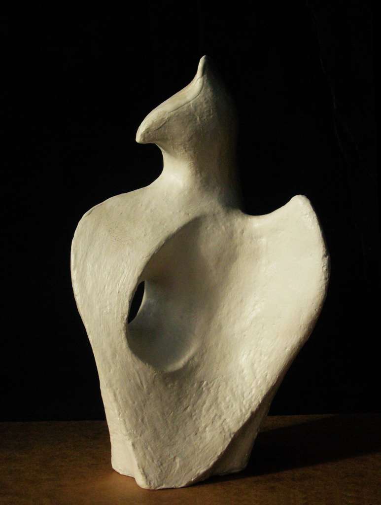
The Eagle of Kurin in The Hole in the Heart is for Resonance |
|
|
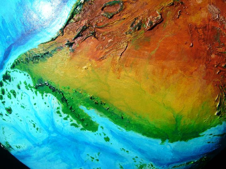
North of the Korla Peninsula, across the coral reefs of Chushu Sound, is a strip of monsoon woods rising to the Okwot Hills. Beyond, dry grassy plains run to the horizon: Kurin Savanna. Like Africa's Sahel, it has no clear northern boundary; just fades imperceptibly into Ara's desert heart. Kurin's the world's largest grassland, a good 5M sq km (2M sq mi). Dusty, difficult country. It's not just the unreliable summer rains in the north. They're over-reliable in the south, flooding the plains every summer.
Still, the intense sun means grass shoots up swiftly whenever rain falls. Grazers follow, and hunters follow them. But the land enforces this nomadism. Not an easy place to build a civilization! Flood, fire, plague, overgrazing, drought--often all in the same year!
Oh, well.
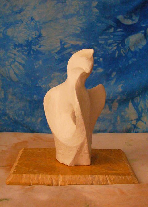
But in deep time, someone did manage to build one lasting monument. Here's a famous carving, roughly human-size, of a highly stylized, almost abstract eagle, of marble, on a pedestal all alone on a broad dry swell in northern Kurin Savanna (well, this is an onstage recreation, like nearly all these Kakalean scenes; but a faithful one. It really has that crest--and that window in the heart.)
|
Nothing beside remains.
'Round the decay of that colossal wreck the lone and level sands stretch far away. "Ozymandias", P. Shelley, 1818 |
And the Eagle's not the only such mystery-relic we'll see. Kakalea's not just rich in deserts, but uncertain borderlands like Kurin, prone to a certain kind of romantic stranding. The wells fail, the people move on, and a century or six later, who knows what such lonely figures of stone once meant to them?
To the east, the coast slowly greens--it runs slightly south, further into the monsoon belt. Mild dry winters and generous if somewhat inconsistent summer rains. The Ngotsa River collects much of the sparse runoff from Kurin Savanna; it's built a huge green delta in the shallow sea, far larger than Louisiana's. Built on way less flow--the Ngotsa is a shallow Nile, not a broad, deep Mississippi--but no wonder. The Mississippi is building land out into deep water; in the Ngotsa Delta shallows extend hundreds of kilometers out. You don't need much mud here to build a country or two.
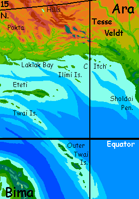
The Ngotsa had help. For 2000 km now the Okwot Hills, though now very low and broken, have been running along the coast. In the Ngotsa Delta they force the river to veer east, then become narrow Cape Twai, sheltering the river's delta-building, still running stubbornly east even as the Aran continental platform retreats a bit north. Modest islands--modest for Kakalea I mean, just 1-200 km long--continue out to sea in several lines, all veering southeast. 460 km out (280 mi) is the Isle of Eteti, nearly as big as Hispaniola--800 km long, though just 120-160 wide (500 by 75-100 mi). Eteti and the lesser Twai Islands are tall-forested.
The humid delta and Ngotsa Bay insulate the islands from dry winds off the savanna and desert to the north; and they're a few degrees closer to the equator than the coast. Summer's wetter, but winter's by no means dry; the droughts that plague the mainland are rare.
The Twai Islands extend another 2000 km southeast, though the first thousand is all tiny atolls and reefs. But the Outer Twais (sorry, off the photo's bottom edge) are bigger than Hawaii. Not much like it, though: low, flat to rolling, and verdant forest shore to shore--no dry side, like Hawaii's islands. Understandable--they're right on the equator. Rain then sun every few days. During the year's cycle, storm-tracks swing around but they never really stop.
From Eteti, we sail north, out of the rainbelt back to Ara's shore. A bay, as it happens--Laklak Bay. With the Okwot Hills behind us, the low shores left and right are just tree-dotted grassy plains. We'll sail to the head of the bay, though, and up the Laklak River for a day or two. It's worth the side trip.
Zara of Laklak in Some In Pokta Like It Hot |
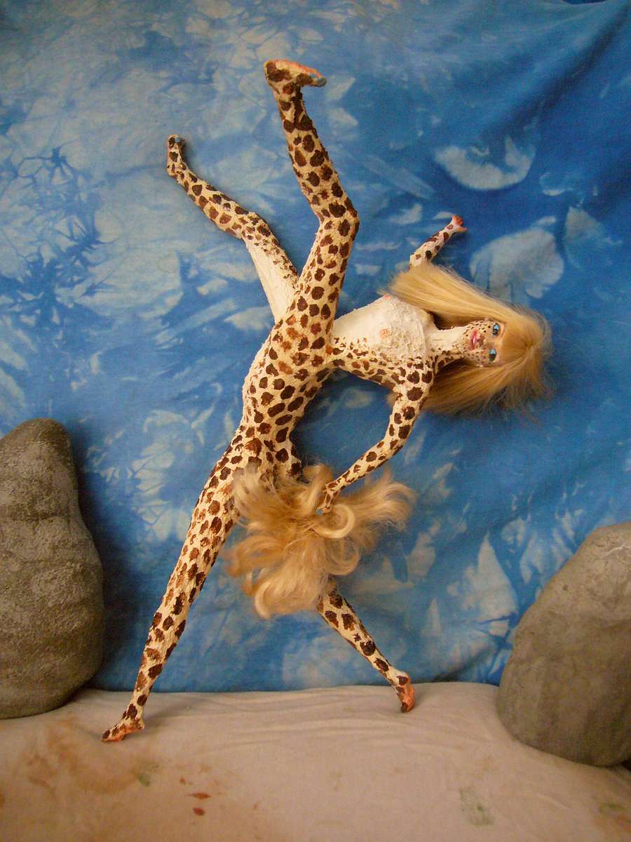
For in the morning, very strange hills rise on the horizon inland--great bare rocks and crags. Though not a high range, the Pokta Hills catch the monsoon rains and concentrate them on this coastal strip. Instead of dry savanna stretching 1000 km inland (or more), a green strip (well, green-yellow-brown depending on the season) just 1-200 km wide, then desert. A desert prone to occasional floods, like Northern Australia, but desert--its nearest approach to the southern shore. Scablands, canyons, rock ribs and ridges stretch 2000 km east from Laklak Bay to Cape Itch. Scenic, if not too fertile or stable.
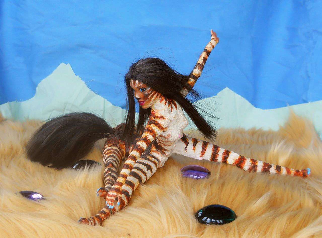
Folks here are deeply heat-adapted. They remind you of giraffes--tall and lanky for heat dissipation, often with short, sandy, reticulated (net-patterned) coats. Zara, our model, is contrastier than most--more like Dalmatian spots (or maybe that IS a light mesh on a dark background?) Otherwise she's quite representative.
Reared up like this she's nearly 3 meters tall (over 9') and can reach to harvest fruit well over 3.5 (almost 12'). Of course, it's worth remembering that most Kakaleans, rearing to their full height, would average 2.5m (8') tall. Their normal centauroid stance leaves their heads at or below the eye level of most Terrans--around 1.5m (5')--giving an illusion of smallness, even doll-like delicacy. Yet many Kakaleans, lean though they are, would outweigh you! Centauroids are larger than they seem--neither height nor length (when in walking stance) is a good measure. Zara, stretching, reveals their real size.
We sail back down Laklak Bay--quickly, confidently, because it has a rare submarine canyon making a safe channel in this muddy maze--but then our voyage slows again. The continental shelf is broad, shallow and island-dotted, demanding cautious navigation and some doglegs well offshore. We're sailing against the prevailing winds, too. Patience!
A few days later, at sunrise, the sea's gone deeper blue and off the port bow is a green hilly promontory, dramatic after the endless South Coast flats--with a volcanic island off its tip. Cape Itch!
We thread through the Itch Islands and sail northeast back to the coast. That day, and the next, it steadily veers east-southeast, back toward the equatorial rainbelt. The hills creep right up to the shore. No long bizarre crags; long low ridges peppered with small volcanic cones.
Nor are they bare. Tree-dotted, then groves. By the next day patchy forests quilt the slopes. We're nearing Cape Sholdai in Eastern Ara, where we began.
The outback's dry--almost universally so. An unbroken desert nearly as large as all Africa--or Luna! The desert has a population of well over four million... but that's about a quarter of a Kakalean per square kilometer. And that's awkward; it's hard to stand with only one leg. Though you'll want to keep as much of you in the air as you can. Whatever bits touch the ground here get burned.
A few snowy ridges in the north and northwest are high enough to sustain trees. Such sky-islands in the desert mostly run parallel to the coast range--tilted fault-blocks that perhaps should be considered outliers of it, like the Back Range behind the Central Chass massif. Creeks from these mountains sustain some life but are short; finding no outlet to the sea, they collect in salt lakes dotting the Back Valley.
A peculiar exception, clearly not part of the Chass Range, is Teroki Ring in the northwest. Despite its concentricity, it's not an impact crater--this near Ara's coast, the geology's too active for such a thing to last long, and besides, Kakalea has a magical shield protecting it from major impacts: its Divine Didactic Designer, the merciful if unimaginative Plod, wouldn't want anything so messy as a worldwide firestorm to disrupt his climatology lesson! Too many readers would blame all these barrens on the Crater of Doom. Plod hates drama. It's all about dull old Agassizian gradualism. Sorry! The devastated land you see is a study in pure geography, not thrilling catastrophe.
Oh, well.
So Teroki isn't a crater, but an eroded anticline--just a popped pimple the size of Belgium, leaving concentric strata tilted up and broken off in ridges. The outermost ridge is of somewhat harder rock rearing 1-2 km above the desert floor, high enough for scattered trees to darken it visibly even from orbit.
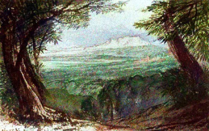
Other substantial mountains rise--notably the Foforos in the midwest, 2-3 km high (7-10,000') ending suddenly on the east in escarpments nearly a kilometer high (3000'). The Foforos are further from the coasts, in furnace-dry air, so even their heights don't sustain dense woods. Grand vistas from those heights, but almost no one there to see. Here's Lina of Ngari in an admittedly stylized representation of the Foforo Scarp:
Similar ridges and escarpments rise in the southeast (lower right of the map)--the Ptaki Range, the Domes, and especially the Pokta Hills--where coastal monsoons and thunderfronts occasionally penetrate, causing flash floods. These desert ranges are like Uluru and the Olgas in central Australia--huge rocks thrusting from eroded plains, hiding waterpockets and slot canyons--as well as a few villages using that shade and water.
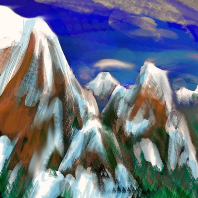
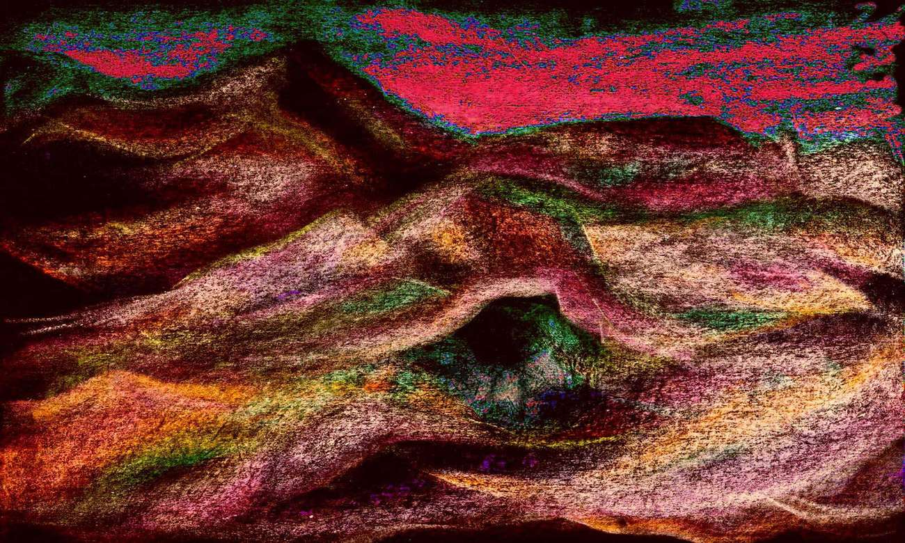
In the northeast, the desert is low basin-and-range country entirely cut off from coastal influences; the pale speckles in the orbital photos are alkaline flats and saltpans. Still, long broken cliffs like Wing Scarp do shelter some oases at their feet and in slot canyons. Many areas are nearly sterile, though. It's dusty when the wind kicks up. At least all the dust makes for fine sunsets--here's a quick pastel sketch of the frayed end of the Solitude Range, silhouetted.
In the central desert, even fair-size ranges like the Solitudes or northern Ptaki Mountains are snowless and nearly treeless--generally supporting just grass and brush, and often bare rock. The air's just too dry, the desert too big. One unEarthly factor may contribute: Kakalea's thinner air can't transport as much moisture in general; sea winds climbing even moderate heights generally dump all their rain, so the coast ranges here are more effective moisture-scrubbers than similar mountains are on Earth.
No real reason--a twist of drainage could have sent one or two rivers south, creating linear oases and migration corridors tripling the wildlife--and population. Just more Kakalean bad luck.
Oh, well.
A refrain that's becoming routine as I write these tours. So many might-have-beens!
LISTS AND LINKS: More worlds? Planetocopia! - dreams of other worlds - ecology - climate change - evolution - natural disasters - terraforming - sculptures and 3D art -
World Dream Bank homepage - Art gallery - New stuff - Introductory sampler, best dreams, best art - On dreamwork - Books
Indexes: Subject - Author - Date - Names - Places - Art media/styles
Titles: A - B - C - D - E - F - G - H - IJ - KL - M - NO - PQ - R - Sa-Sk - Sl-Sz - T - UV - WXYZ
Email: wdreamb@yahoo.com - Catalog of art, books, CDs - Behind the Curtain: FAQs, bio, site map - Kindred sites