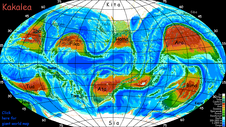
Kakalea:
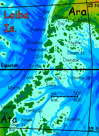
LOIBA ARCHIPELAGO
under construction--preview only!
by Chris Wayan, 2013-14
for all the tribes from the Andamans to the Trobriands
Kakalea basics--map--geology--
creatures--
Building Kakalea
More worlds? Planetocopia!
Kakalea:
LOIBA ARCHIPELAGO
under construction--preview only!
by Chris Wayan, 2013-14
for all the tribes from the Andamans to the Trobriands
Kakalea basics--map--geology--
creatures--
Building Kakalea
More worlds? Planetocopia!
INTRO
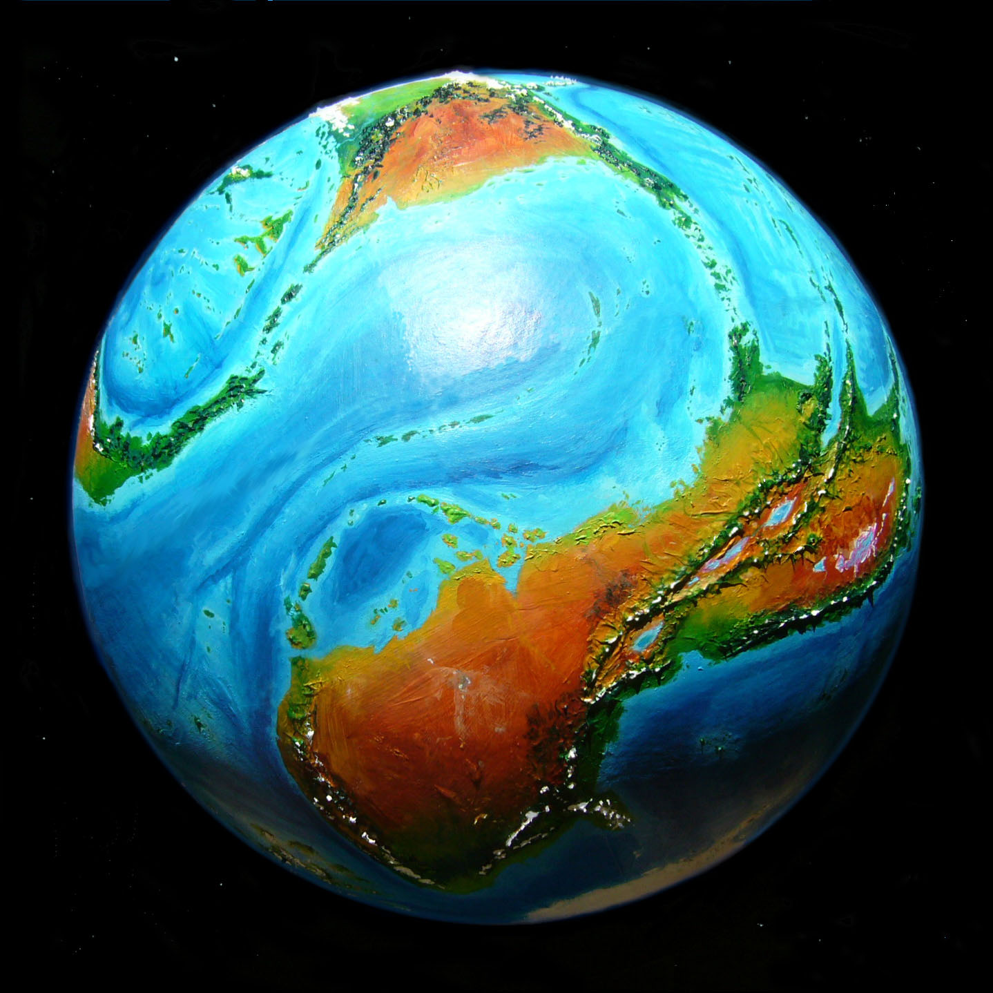
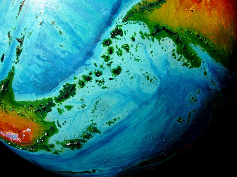
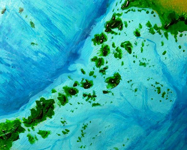
This huge tropical archipelago stretches some 3000 km between Ara to the northeast and East Ata to the southwest. At least nine of these islands are over 250 km across (150 mi); one, Rhetlu, is 800 long (500 mi). Taken together the Loibas are larger than Japan. Rainy and warm year-round, straddling the equator, these isles are perhaps the largest true rainforest on Kakalea.
Soils, being volcanic, are fairly fertile despite leaching from steady rains. Kakalea is a dusty place; nutrient shortages aren't quite as severe in its rainforests. All those deserts are good for something!
Is Loiba a migration corridor between these two giant continents? For birds, absolutely. But few land animals will make it across this almost-bridge. Straits are shallow and warm, but there are half a dozen, and some are to 50 km wide (30 mi); and they're here to stay, unlike, say, western Indonesia--that's just a subcontinent temporarily cut off from Asia by high seas during our flooded, interglacial era.
But Loiba's permanent. Kakalea's about as iced-over as it ever gets; in deep time, Kita or Sia will drift off the north or south pole and thaw, raising sea levels, not dropping them. So despite the Loibas' quasi-continental platform and shallow straits, they've been islands for several million years and are likely to remain so.
On the other hand, Loiba's exuberant coral reefs guarantee that this great platform will stay shallow indefinitely--the reefs will build up to the surface of a rising sea; and the region's many volcanoes may build up enough flows atop that shallow base to fuse into a continent at last. After all, they're not rising from miles-deep abysses, as in Indonesia's Lesser Sundas, beyond Wallace's Line. Ten, twenty million years may well do it.
Still, compare this to Indonesia, a profoundly different place just ten or twenty thousand years ago, and likely to change as much in just the next thousand or ten...
So the deep future looks good for an Amazonia here, or at least an Indochina. But future landbridges don't help spread present animals! The fauna on Ara and Ata will be quite different.
What about flora?
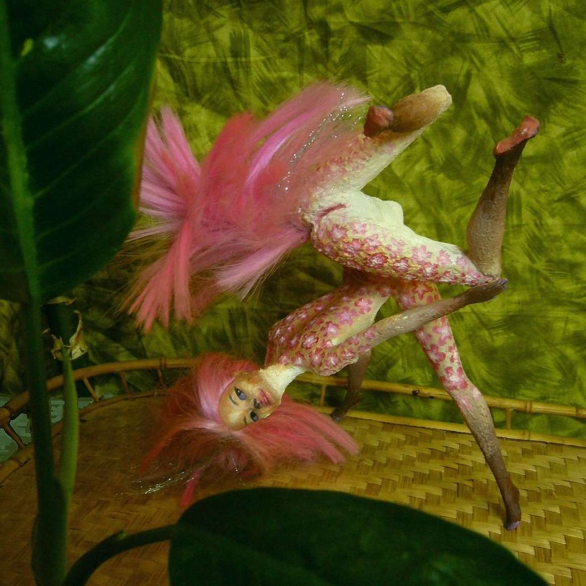
Fuchsia dancing Behind the Green Wall in Port Rhetlu |
At first glance, and second, the Loibas look evenly green. That's because enough is enough; all the islands are rainy enough to be solidly forested. But there are differences--a double gradient's hidden under that green. The middle of the chain straddles the equator; rain's heavy year-round. It feeds such dense jungle that nearly everyone here lives on the coast, looking to the sea not the land; fishing is all.
Those who do live inland on isles like Chendok or Ilit live on riverbanks, traveling and trading by boat and barge, not trekking through the forest if they can avoid it. Mainlanders and even other Loibans consider these equatorials languid, sensual, lazy--all the tropical stereotypes!
But it makes for torrid romance onstage. To the left: Fuchsia, a local dancer with flowerpatterns dyed into her coat, opening a piece set on a raft floating down a jungle river in Enthe; of course Fuchsia, the lonely rafter, will soon meet her future lifemates. They drop in unexpectedly--out of the trees, to be exact. Out to steal some of her kinlu fruit! But they end up with much, much juicier fruit than that...
In contrast, away from the torrid zone, rainfall gets more seasonal; the woods open out and travel becomes easier (in the winter dry spell, at least) on the islands near Ara and East Ata.
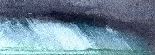
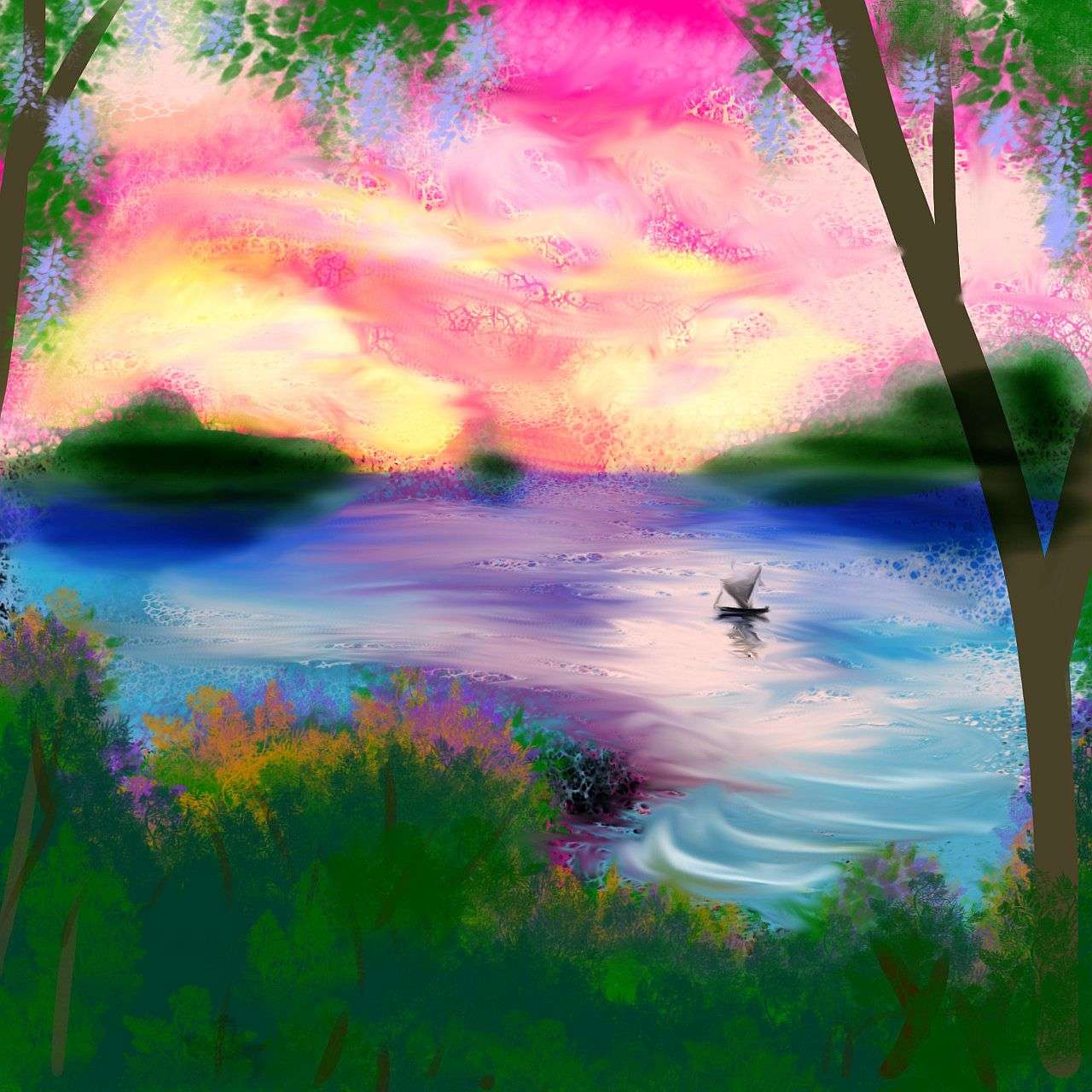
So these north and south edges of the Loibas are more broadly settled and economically diverse--farms, orchards, mines and hardwood forestry, not just fishing or mysterious jungle exports to be over-romanticized, as I'll now do shamelessly with this sunset in the Thethei Islands...
That's the climatological gradient. What cultural gradients sweep across the Loiba complex?
The answer's simple: west is best. The largest islands rise along the western edge, yes, but that's not the only reason most shipping follows that line. Loiba's a maze, a confusing one even for locals and a dangerous one for inexperienced foreigners. The deep water off the simple, straight western edge of the archipelago makes this the safest "coast" for shipping. Also, prevailing winds blow east to west here; so a storm-tossed ship is likely to be blown offshore. Far off course perhaps, but not onto the rocks.
So climatalogical and cultural pressures fuse to make the large islands of the west "coast" the most advanced, and the big isles of the north and south, Kashok and Rhetlu, the most culturally diverse. It's an archipelago under tension between these two cultural poles.
In fact, the Loiba Archipelago is a merely geographical construction, more visible from space than to the locals. Culturally, the islands aren't unified at all; most northerners call themselves Kashokan or just Aran; most southerners, Rhetlan or just Atan. Very few Loibans would ever call themselves Loiban!
For this reason, I was tempted to just append paragraphs on Rhetlu and Kashok to the Ara and East Ata pages, add "... and lesser islands" to each, and omit this page and map. But then Ionesco's play Rhinoceros reminded me: denial never works. So here's the rhino in the parlor! Even if the Kakaleans won't see it.
Loiba is real, even if its own people don't believe in it. The Archipelago may slowly build itself into a solid landbridge as big as western Europe; I couldn't leave it out just because culture blinds the locals to Loiba's essential unity.
As culture blinds us to... what?
Oh, let's not be heavy-handed or anything!
LISTS AND LINKS: More worlds? Planetocopia! - dreams of other worlds - ecology - climate change - evolution - natural disasters - terraforming - sculptures and 3D art -
World Dream Bank homepage - Art gallery - New stuff - Introductory sampler, best dreams, best art - On dreamwork - Books
Indexes: Subject - Author - Date - Names - Places - Art media/styles
Titles: A - B - C - D - E - F - G - H - IJ - KL - M - NO - PQ - R - Sa-Sk - Sl-Sz - T - UV - WXYZ
Email: wdreamb@yahoo.com - Catalog of art, books, CDs - Behind the Curtain: FAQs, bio, site map - Kindred sites