Holmenach
by Chris Wayan, 2006
dedicated to Poul Anderson for his remarkable world-building
Lyr (home) - map - creatures - cultures - evolution - climate - geology - gazetteer - nomenclature - definitions - building Lyr - more worlds? Planetocopia!
ORIENTATION
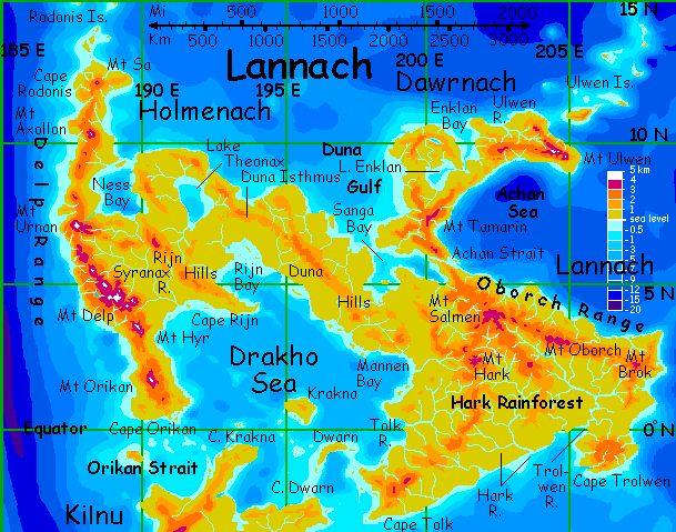
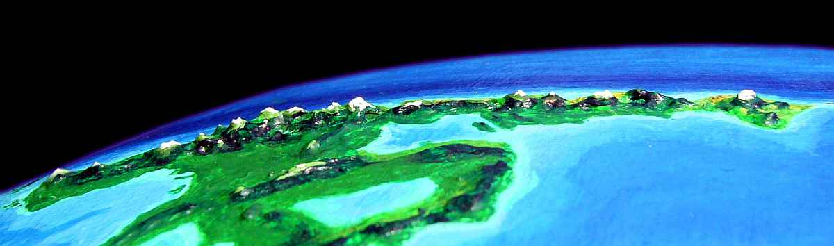
Lannach, the heart of the Diomedes group, is one of the larger continents on Lyr--nearly 8 M sq km (3.1 M sq mi, around the size of Brazil). The east is all equatorial rainforest, but this tour, covering the rugged western subcontinent of Holmenach, will include a wider range of lands--from hot to cold and wet to dry.
I'll assume you've flown in from either the north (Cape Rodonis) or the east (Lannach). Either way, we'll begin at the mouth of Ness Bay, at the base of Cape Rodonis.
Your climb to the summit is slow and tedious, for there's a downdraft--the prevailing winds come over the pass. So by the time you near the summit it's nearly sunset; you're in the mountains' shadow.
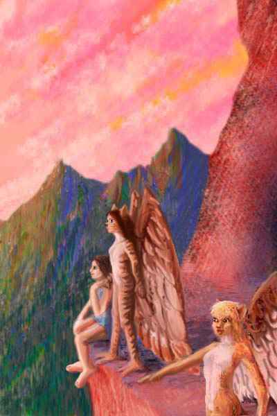
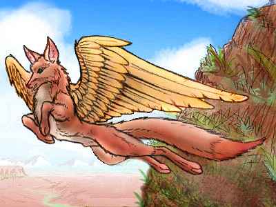
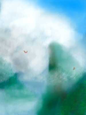
Just over the divide, you find a highland lake with an icarus eyrie--caves and terraces cut into a near-cliff on a bluff over the lake. The icari welcome you. From the eyrie's crag, the wild magenta sunset is triply lurid--lake, sky, and a fiery strip of tropical sea far below you on the western horizon. It's your first glimpse of the Rijn ("Reen") Sea.
The icari stay up to sing, as they do most evenings, but you're exhausted from climbing the pass, and stumble into your guest room onto your strawfilled pallet. Undersized, for a human, but you're too tired to care. No blanket either, but it's not too cold. Soon it's too warm, and purring; several icari on top of you...
What you do about that is your own business.
In the morning, you begin what you'll be doing for a week or so: riding the updrafts created by the sea-wind, sailing south along the growing wall of the Delp Mts. Soon you see why they're called the Spine of Holmenach: the Delps rise from deep sea in a spectacular north-south front some 4000 km (2400 mi) long. While they top out at 4-5 km above sea level (13-16,000'), from base to top they're an unbelievable 20 km (66,000'), for offshore lies the Delp Trench, deeper than any on Earth.
You skirt the shoulder of a nameless volcano two miles high, then ride a long ridge above steep canyons where short white rivers roar down to the sea. Ahead, a white hieroglyph floats impossibly in the southern sky, growing slowly for three hours until it resolves into a snow-streaked giant: Mt Urnan, 4400 m high (14,300'). The peak looks like the white-haired head of a great crouching sphinx staring at the sea. Its long body, to your left, is a tangle of high, rolling ridges over 3 km high, trailing slowly off into the eaxstern jungle--it's the root of the 2000-km spur range called the Rijn Hills, reaching far east to Lannach.
Mt Urnan is the source for something else. You wheel around its flanks to the south side to find several streams converging, heading east into the jungle: the headwaters of the Syranax River, the longest in Holmenach, flowing 1000 km (625 mi) to the shallow Drakho Sea. The Syranax Valley is a huge, unbroken rainforest. The canyons to the west are much drier, though the contrast is less extreme than the nearest Earth danalogy: steamy Amazonia and the bone-dry Atacama Desert just over the Andes. Trees line the streams veining the grassy hills, and pegasus villages dot the highlands, like upturned flower-baskets. Pegasi are fond of color, and don't separate their food- and flower-gardens; even their orchard species are bred partly for interesting leaf- and flower-colors.
But a little ways down these canyons, where the air grows warmer and drier, the bottomland farms have a different look, full of curving, sinuous irrigation ditches. Where humans would have square fields with straight rows, spiral shapes predominate. The cliff walls above are peppered with dark holes--the windows and doors of cliff-dwellings. Flox villages!
Floxes are never numerous, yet they're the nearest thing to a ubiquitous people on Lyr--seven of the ten major regions have at least a few flox settlements in their drier zones. When you stop for lunch in a pegasus village below the crest, you find floxes in the cafe, both as customers and cooks. No surprise--no one calls floxes intellectual, but their sense of smell and taste is unparalleled--as is their sheer enthusiasm for food.

South of Mt Urnan the range swings a bit inland, widening the sunny coastal flox zone; but the highlands widen too; more upland lakes appear. Crag-keeps above their shores with stone landing-terraces but veins of bright trailing flowervines suggest mixed settlements of icari and pegasi. They're so physically different, that sounds to you like oil and water--humanoids and horses?
In fact, when you land in one at evening, you find all three immigrant species, icari, pegasi, and floxes, eating together. More than eating--you meet several inter-species couples at dinner, and there's even one triangular marriage. Size and diet alone would form unbridgeable gulfs between Terran foxes, humans and horses, but the three Lyran species are all much closer in size--between the upper weight limit imposed by flight and the lower limit required to support a sentient brain. And pegasi, while nominally herbivores, aren't as squeamish as, say, antels. As long as they don't have to deal with blood and guts, they don't seem to mind pseudotrout and fried termites on the table. And as long as you have floxes for cooks, the tasty little heads and guts get enthusiastically gobbled up back in the kitchen...
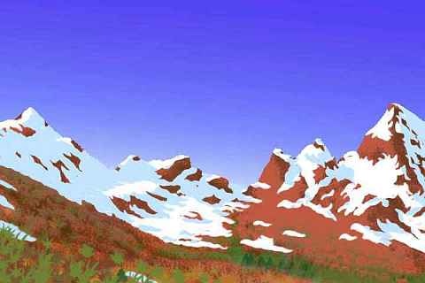
This sketch shows the alps another day south--only five degrees north of the equator! Of course, this is 3 km up in the very heart of the Delp Range, and it is winter. But the very concept of an equatorial winter shows you how different seasons are on a world with an eccentric orbit. Lyr is mild overall--nearly all the lowlands are subtropical, in the sense they rarely freeze, while the highlands (not a large area) are temperate.. but all of Lyr has strong seasons.
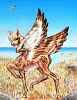
Mt Delp itself, half a day's flight further south, is 4600 m (15,100') high, one of the tallest peaks in the world, and one with the distinction of having at least a small zone of nearly every climate on Lyr somewhere at its tropical feet or temperate shoulders or icy summit or its wet eastern or dry western flanks. Every species in the cluster can live somewhere on its slopes, and most do: koreens, tauraffes, icari, pegasi, cheetaurs, floxes, sphinxes, and even a few eccentric antel and pioneering lebbirds, flown up from the south. As a result, the towns ringing Mt Delp are one of the richest, most diverse artistic cultures in Diomedes.
That's no fluke. Human cultural centers tend to be port cities; mountains are isolated backwaters. But on Lyr, where most travel's by air not sea, tall peaks with many climate zones are the beacons for diversity--the Andromeda Range in Ythri and the mountainous isles of southern Oronesia are similar. Flight shapes more than bodies!
You slip steadily south, riding the sea-winds' updrafts as they slam into the Delps. This sort of wind-riding is like the migration of hawks on America's west coast: you save on physical effort, but you have to be alert to the winds over these jagged slopes. You fall in a trance and your thoughts bake away, leaving only a huge empty eye, light as a soap-bubble, alert to every shift in the air...

Only an hour past Mt Delp, the uplands sag away. The twin peaks, East and West Syranax, each 4 km high, tower over a jumble of lower ridges. Two hours beyond is an exclamation point on the sentence of the Delp Range: Mt Hyr, 4200 m high (13,800'). At first it seems a hulking volcanic cone, but later that day, as you try to pass it, new cones appear behind the first, forming a snowcapped ridge 100 km long (65 mi) long, as white and bumpy as a human spine, and ending as abruptly. By nightfall, you're only a mile high. You notice something else--along with the red mirror in the west at sunset, a dim blue mirror lies east. Smudged and splotched with clouds, but far too wide for a mere lake: the Drakho Sea again. Holmenach is narrowing, turning into Cape Orikan, 900 km long and 250 wide (550 by 160 mi).
The next day the Delps have an afterthought: the hills (you can't think of them as mountains after the last few days) rise steadily all morning until milky blue streaks of snow wink at you from under shaded trees, like blind eyes. Ahead lies more than streaks: a white mass floats on the southern horizon, creeping closer and higher until it looms over you. Only part of it is snow: Mt Orikan is often cloud-wreathed, for unlike the rest of the Delps it's maritime, bathed in moist air off two seas, not one; and it nearly straddles the equator. At 4300 m (14,100'), it's one of the tallest of the Delps, and snowy despite the latitude. Snow, but no glaciers: in orbital summer its alps are ferny and green right to the summit.
A lesser cone, Mt Drakho, a mere two miles high, stands like a lighthouse two hours ahead, a mere hundred miles from the cape's tip. By afternoon you're rounding it. From here the cape is all downhill. As sunset nears, you push a bit--glide down the steady slopes to Cape Orikan itself, a rocky 30-km hook around a shallow, island-speckled bay. It's dusk, and Mt Drakho flames like a bonfire behind you, in Lyr's short sunset. On the cape you spot soft yellow stars of lamplight, and wearily flutter in to land on a sphinx's doorstep, trusting to Lyran hospitality for a bed. Of course, these are sphinxes, so you have to explain you're so exhausted you actually want to sleep alone, disappointing your hosts. Or baffling them at least. Such unsphinxy behavior!
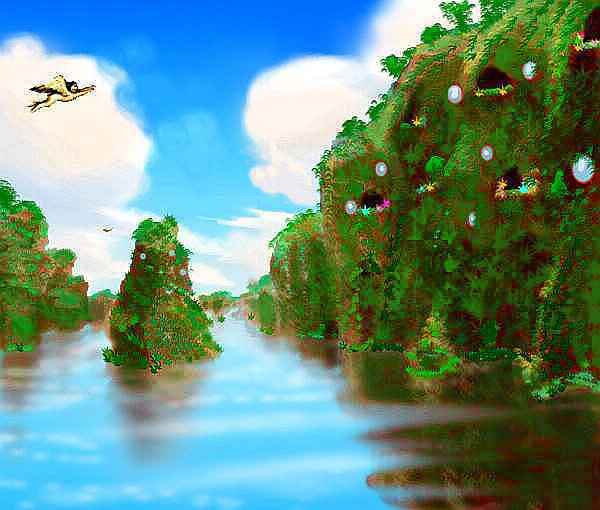
When the sun rises five hours later over the little bay, it could almost be Indochina--or Pulau. Cliff-rimmed islets drop straight into the sea, and are jungle down to the waterline, like green plush mushrooms. The sphinxes you're staying with recommend you rest up a day and explore the bay before leaving Holmenach; the Orikan Strait isn't dangerous, by Lyran standards, but it is wide.
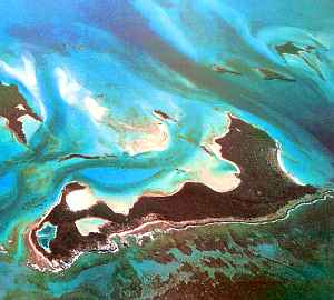
It might be fairer to call it the Orikan Sea--a sort of foyer to the wide Drakho Sea beyond. Orikan's a warm turquoise oval 550 km (350 mi) wide, full of islands and coral reefs. The largest of these, Orikan Island, is 160 km long (100 mi). All are jungle right down to the beach.
Rather than tackle the strait today, you ride the cliff-updrafts round the bay. Beaches here are quite rare, narrow, and often overhung; you don't feel safe about landing. At last you return to the village, shuck your wings, and hike the sphinx-carved path switchbacking down the cliff to the little stone shelf serving the village as a dock. Lucky for you that some cargo's too big to go by air! Here you can dive in; you explore the sheltered coral gardens all afternoon.
Just remember to stay near the surface; here, Rapture of the Deep (nitrogen narcosis) doesn't start 25-30 meters down as on Earth--more like 3-5 meters (10-16'). With the high air pressure, you're always near the edge of rapture on Lyr. Or inside it, a bit drunken and stupid; individuals vary in susceptibility, just like altitude sickness; a minority can't safely visit Lyr at all, or are restricted to highlands. So play safe, and don't push your luck.
Same goes for the evening. Sphinxes really are very, very curious. Just remember they do have claws, so don't get them overexcited. At least if any rapture occurs it won't be chemically induced.
The next morning you ache, but ache pleasantly, in new, non-flying muscles. Whether from swimming, or from sphinxes, I don't know, but by now you're surprised to be reminded that muscles are for anything but flight...
And fly you do, out along the overgrown islets, bulging like lime-green Afros. An hour later they trail off into coral reefs.
Two steady hours south-southeast, over deeper blue, through a brief, unseasonable shower. At least you face no serious storm-winds; orbital winter is the calm season here.
At last, paler shallows, then reefs--the outliers of Midway. Only the hundredth place on Lyr with that name! It's only a few miles long, but verdant. You clumsily land on a travelers' roost in a great tree, peel your wings off, climb out on a limb and pick pseudomangos for lunch.
An hour later you're rested and launch out of the trees. Back over the sea, more east at first, following a pale highway of reefs that dapple the indigo sea with pure spectral cyan. The atoll chain curves slowly south again, and a couple of hours later, craggy islets and then a rugged green head rises to the south...
You've reached the shore of Cape Krakna, on huge Kilnu. But that's another tour...

TOUR LYR! The following route snakes around Lyr, covering all major features:
Ythri -- Polesotechnic Chain -- Troisleons -- Roland -- Oronesia -- Gaiila -- Flandry -- Diomedes -- Ak'hai'i -- Averorn
World Dream Bank homepage - Art gallery - New stuff - Introductory sampler, best dreams, best art - On dreamwork - Books
Indexes: Subject - Author - Date - Names - Places - Art media/styles
Titles: A - B - C - D - E - F - G - H - IJ - KL - M - NO - PQ - R - Sa-Sk - Sl-Sz - T - UV - WXYZ
Email: wdreamb@yahoo.com - Catalog of art, books, CDs - Behind the Curtain: FAQs, bio, site map - Kindred sites