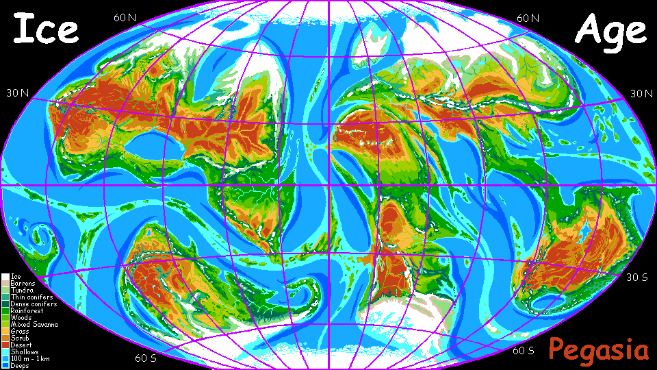
CONTINENT 6 and CONTINENT 7
by Chris Wayan, 2006-9
Pegasia's homepage - Map - Geography & climate - Evolution - Critters - Gazetteer - Sketches - More worlds? Planetocopia!
First-time orientation--strongly advised! Pegasia is weird.
CONTINENT 6 and CONTINENT 7: Joined at the Hip
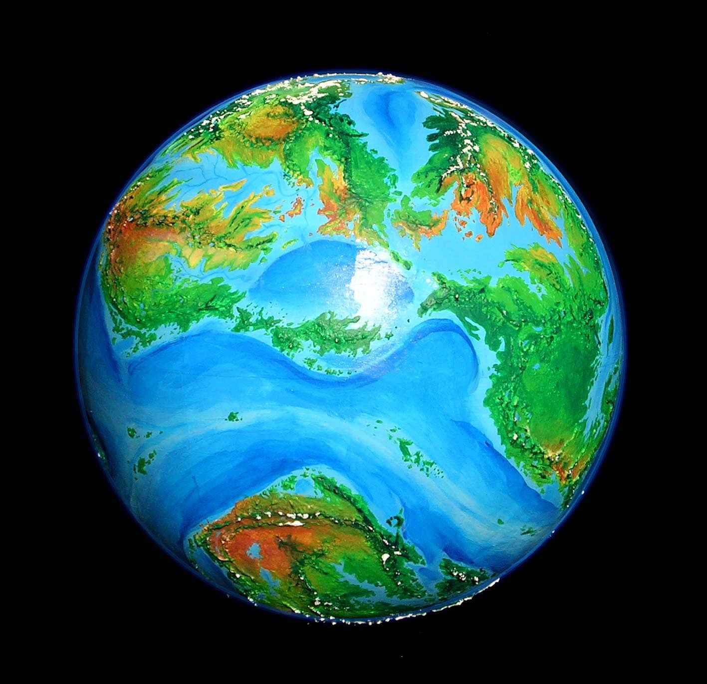
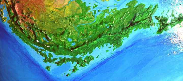
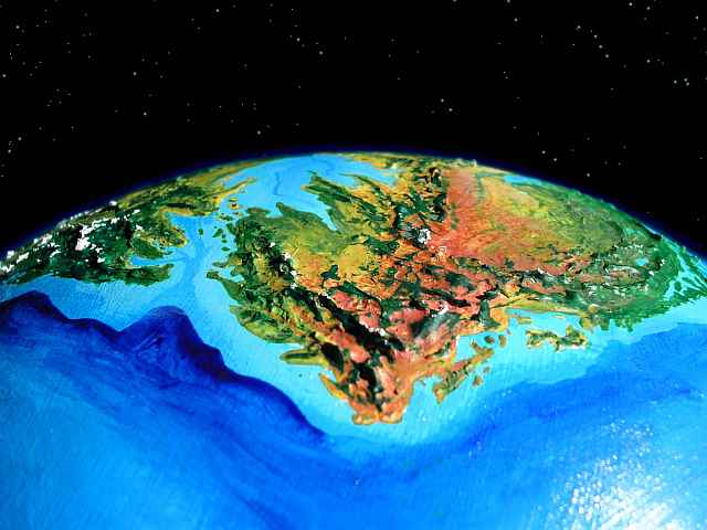
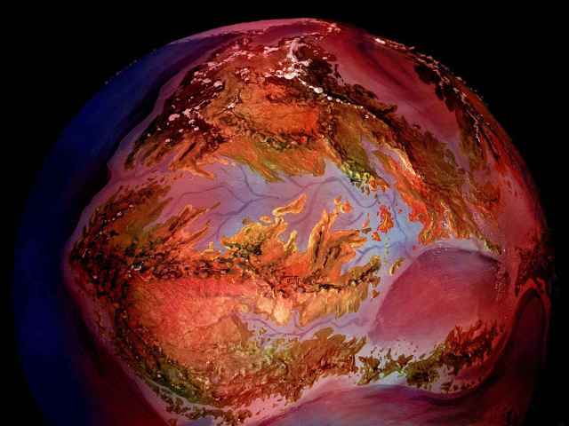
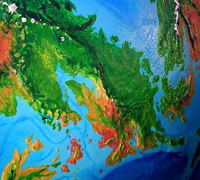
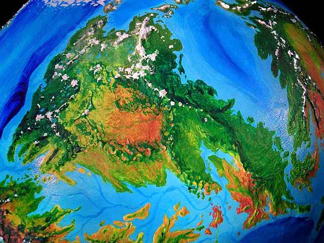
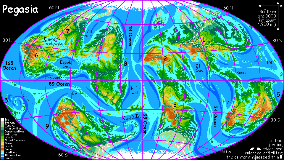
Why just one page for these two landmasses? They're so closely entangled (indeed part of the same continental platform) that I couldn't draw separate maps, or figure out separate tours. I nearly included Continent 8 too, as it stands on the same platform; but it's a somewhat more separate lobe. Still, during ice ages, when the sea level drops, all three form a single supercontinent. In the high orbital photo below, the twins are upper left, with the two lobes of Continent 8 to right. That's Continent 9 way down south; it's both geologically and biologically separate.
CONTINENT 6: OVERVIEW
Continent 6 is a modest-sized continent ranging from the equator to 40 degrees north. It's all tropical or subtropical--except of course for the high mountains no continent on Pegasia lacks. This isn't Australia; the inland desert is broken up not only by mountain ranges but by gulfs and sounds whose moisture moderates the climate. Major regions include:
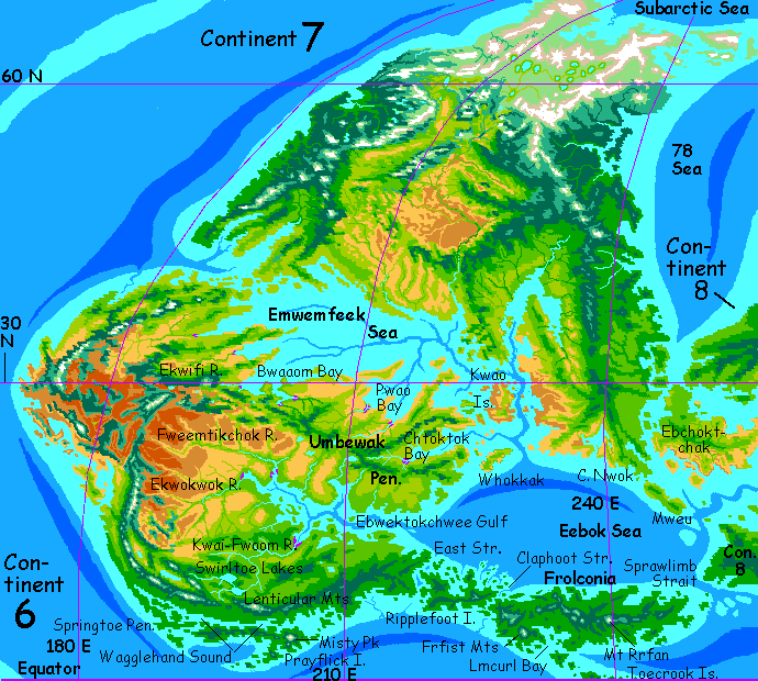
SOUTHERN CONTINENT 6
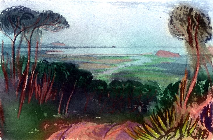
We'll start our tour on huge Frolconia Island in the far southeast. You've read the orientation and have your wing-straps adjusted, right? (If you're thinking "strap? wings?" you'd really better read the orientation before you get yourself killed. Pegasia is weird.)
How'd you arrive here? You may have flown west from Continent 8, over the island chain from the Outer Hemisphere; some of you may have flown north from Continent 9 through the 89 Islands, though that's less likely: it looks to be a long, exhausting flight. But the other flyways into Continent 6 and Continent 7 are even grimmer--a subarctic route from northern Continent 8 to northern Continent 7, and just possibly a difficult sea-passage north from the Outer Curl 5 Islands to the south-central coast of Continent 6.
Let's take the simplest case, and assume we're all flying in from Continent 8. Picture this:
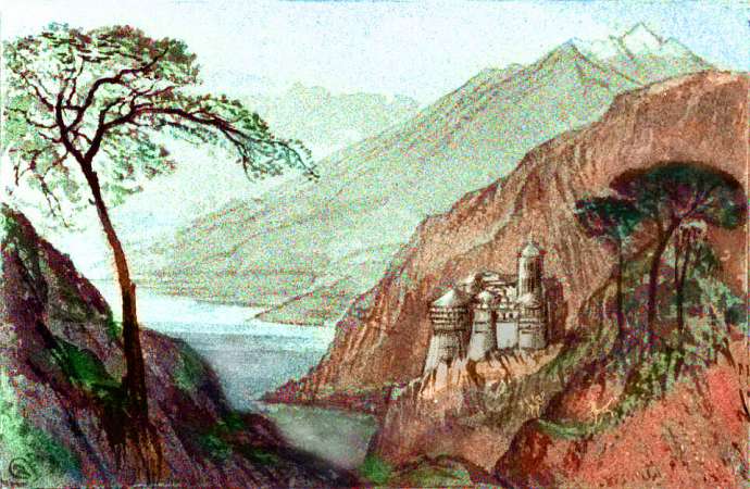
You're on the wing over a wooded coral islet, jade-green in the tropical sea. To the east, the water deepens to cobalt. During the last Ice Age, the inland sea to the north, Eebok Sea, drained through this steep rugged canyon, now drowned. Before you, to the west, stretch turquoise shallows veined with creamy sandbars and dark reefs.
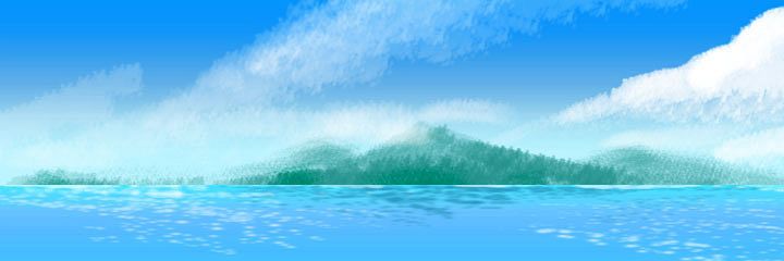
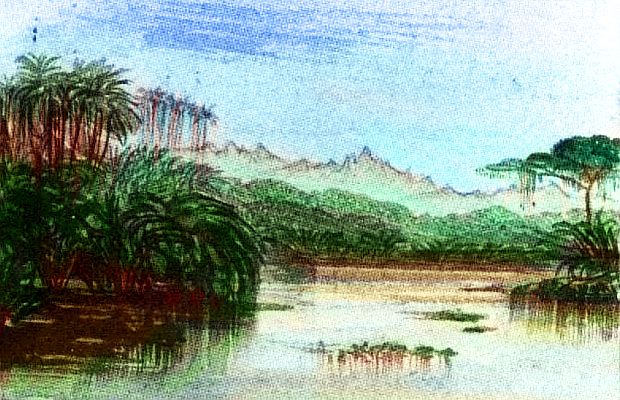
Only it's not. This is merely the eastern tip of Frolconia Island, rivaling Sumatra in size. Frolconia's coast is indented and coral reefs writhe through the shallow sea out to the horizon. Past the beaches, rainforested hills sprawl before us like broccoli on a rumpled rug. All the rest of the long Pegasian morning--nearly eight more hours--we fly east through streamers of steam. These great trees generate their own mist!
The highest of the inland hills look suspiciously conical, though you don't spot any smoke. This stretch may be dormant, but most Pegasian continental rims are volcanic and this is no exception. Ring of Fire? It's a whole Mesh of Fire!
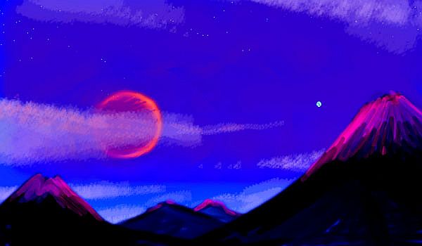
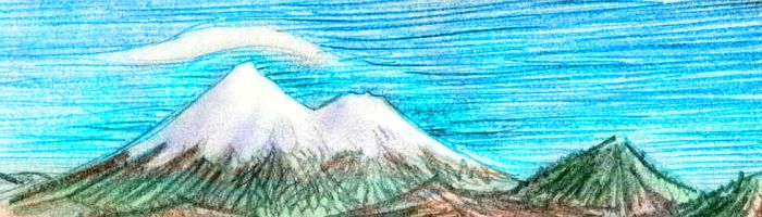
As the sun slowly climbs, most of the mist burns off; but ahead, a far white cloud persists. And grows. And grows more solid: only the outer veil is cloud. The core is ice, here almost on the equator: the glaciers of Mount Rrfan. A freestanding cindercone over 6 km high (20,000'), it's the island's high point.
The giant reddens as the noon eclipse begins. Landing by a creek, you nap through the two-hour red dusk of eclipse, under the bloody ring that Zeus has become, set in a purple sky. In the day's heat you were tempted to find an updraft and ride it to the peak, but with the sun gone, the heat fades and the winds hush. The dim rosy ice-mantle looks forbidding and forbidden: the unreachable realm of gods.
As if the volcano-gods got exhausted building Rrfan, the land slumps back into mere hills for a couple of hours; then the island's spine re-emerges from the jungle as a whole cluster of great cones blocking the horizon ahead, from Fuji- to Ararat-sized. They're an imposing sight; some sport snow, though none have extensive glaciers. You thread your way between them. No horizon now--great piny troughs between stone giants. At last a gap opens to the southwest, down to a great wooded plain. Silver gleams on the horizon. This is Lmcurl Bay, a sound about 400 km (250 mi) long on the south shore of the great island.
West along the shore of the bay. Across the next inlet stand two more ice-capped volcanoes, shoulder to shoulder: North and South Frfist. Tired, you cross the last arm of the sea and creep into the shadow of the twins. As the sun goes under and their snows loom, you start thinking of shelter, though you know the night will be mild, under the hot orange eye of Zeus radiating infrared like a banked fire.
Rrfan, Lmcurl, Frfist--these names, vowelless in the first syllable, are just trade-talk shorthand; their true, local names aren't just unpronounceable but unpronounced. These jungles are the home of a people called frolcons, and they use a complex gestural language. Some frolcon names translate more easily: the wide strait we began at, "Sprawlimb Strait", describing a gesture any Terran would grasp: "It's THAT WIDE!" Or the Toecrook Islands, a curving wedge of volcanic islets like the bumpy knuckles of a curved clawed Frolcon's toe. Other place names are easier to translate directly, like Mt Misty and Mt Lenticular, named for the clouds they typically generate. But some gesture-names are obscure or undescriptive. For these, the first two letters indicate right/left and fore/mid/rear limb, while the rest describes the most distinctive gesture in the full frolcon "word"/dance phrase. They can't all easily be translated into human gestures--Frfist is easy (make a fist with your front right paw--your hand if you're human) but what about Rrfan? Go on, spread the batlike vanes on your right rear limb. And you probably don't have a middle pair of limbs either, so Lmcurl is going to be difficult...
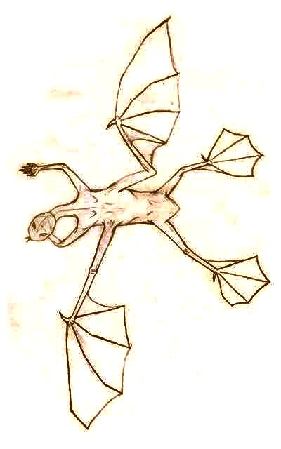
Let's stay the night in a treetop frolcon village. Don't expect to get too much rest, though--frolcons have no consistent sleep patterns, so the village will be busy all night. They're peculiar people in other ways, too, as their name suggests: a mixture of frog and falcon. Nightmarish at first glance, for a Terran--they pounce on you, twitch and flap constantly, bare needle-sharp teeth, and worst of all, open up wet holes in their sides to breathe: spiracles! You can't help thinking of those giant spiders in Middle Earth. But if you defer your panic long enough, they'll come into focus as a playful people for whom all of life's a dance.
Get over your unease? Still not a peaceful night. You're not used to a treetop nest as a bed, even if it does have a woven roof of sort. The whole thing sways and swoops; and if you're pitched out, you can't spread bat-membranes on your four hindlimbs and flap to a soft landing. It's a 50-60 meter fall (165-200'). Definitely the upper bunk at camp!
In the morning, you have a choice: head on toward Continent 6 or bank left and head southeast along the Toecrook Archipelago, an equatorial chain some 800 km long (500 mi), with five major islands, together about the size of Taiwan or Sicily. The volcanic Toecrooks are part of the same arc of fire that gave rise to Mt Frfist. "Toecrook" is a shorthand transliteration of a frolcon gestural phrase, this one hard for humans to imitate: one bends only the outer joint of the third digit of the left forepaw, leaving the other joints straight. Ow. That hurt. I did do it, but... ow.
The Toecrooks are in an active tectonic phase: while Frolconia's mainland volcanoes have been dormant in recent millennia, smaller cones have been building up these islands. Quakes are common here as well. It's a potentially important place: one of the few feasible flyways out of the Inner Hemisphere. If you fly southeast 8-900 km, you reach the lush 89 Islands, midway to Continent 9, from which a land-bridge reaches the other hemisphere. So the Toecrooks, this chain of modest volcanic islands no larger than Bali, may become the main route for north-south travel, seeing fliers from four continents. In time,the southern Toecrooks may develop a great, cosmopolitan, multispecies port.
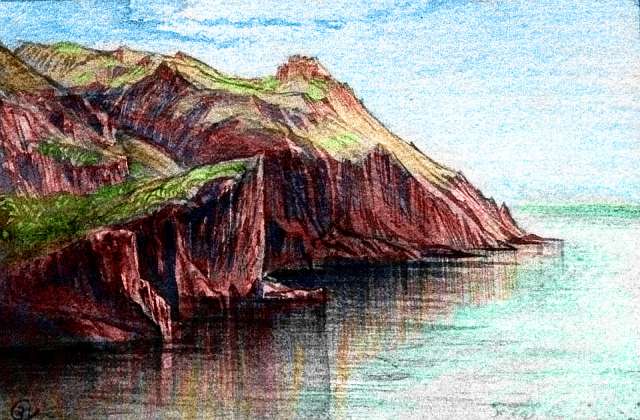
Let's head on west, toward Continent 6. Skirt the twin peaks and slog up the coast to Claphoot Strait, and then the length of Ripplefoot Island, another twisting volcano-studded ridge like Frolconia, but just half as long and a quarter the area. That's still nearly as big as Cuba; even on the wing, you spend all day crossing it--never mind exploring!
Next morning you cross East Strait and reach the mainland of Continent 6. Logically, it should be called West Strait, right? Claphoot was the eastern end of the island, this is the west. The name is a relic of frolcon history: they evolved on the mainland, and only spread east in recent millennia. For frolcons this strait, now the heart of their realm, was once the end of the world.
You know, it's tempting to speculate that a second, semi-aquatic species of people might fish this rich inland sea--something like a huge otter would love it here. And even our small ones use tools...
Or maybe these semi-aquatic natives aren't otters but creatures we'd think of as merely an otter's lunch: lobsters or crabs. Earth has tree-crabs; here, too, forests march down to the sheltered water... maybe arboreal crabs get larger... and as smart as octopi. Or maybe THEY come out of the water, learn to climb trees and pick fruit... I've said it before: you tell me.
Near dusk, after a long Pegasian afternoon of cove-hopping west, the offshore islets grow and fuse into what seems another continent. It's really just a narrow island, but very long: "Prayflick" (its name consists of a prayerlike clasping of forepaws then a flick as if shaking water off) is a good 800 km long, though never over 100 wide (500 by 60 mi). But it's no simple wall, either: capes and satellite islands stretch hundreds of km south into the shallow Pegasian sea. One monstrous volcanic cone, though nearly on the equator, has snow, though it's hard to tell, through the torn banners of cloud veiling it all day: Misty Peak, nearly 5200 m high (17,000').
A full day west. The green range to the north grows taller, too, and jagged in places: it seems this stretch of Pegasia's "Net of Fire" sleeps uneasy. Here volcanoes go apparently dormant, then explode.
Over the next half-day, the great maze of islands gradually narrows to a single ditch, no more than 20 km wide. Ten. A rivermouth... The woods seem to be drying out in sympathy; the trees are still big, but more open. It's monsoon forest now, with a long winter dry season. We've been subtly bending northwest for two days, leaving the equatorial rainbelt at last. Frolcon villages grow scarce.
CONTINENT 6: WEST AND NORTH
The coastal strip slowly grows still drier. Now we're flying up an inland valley of open woods and savanna, the size of the Central Valley in California. But it feels more like Northern Australia--dry most of the year, then torrential rains. Huge pseudo-termite mounds everywhere. Maybe the locals will learn to farm them--to eat directly, or to produce fungus or honey... Or will the termites themselves wise up? In every mound, a mind...
Or not. You tell me.
To the north is a small region of sunny sounds and islands, like Adelaide or the Aegean... The sounds create a mild if dry climate, with warm but bearable summers broken by occasional fogs, and mild rainy winters broken every few days by a cool sunny spell. Seafood should be easy to harvest in these sheltered sounds, and dried foods won't spoil quickly here; it's a recipe for storage, surpluses... civilization!
There's just one drawback: it's so isolated! Desert all around, except south, the way we came. As cut off as Oz (the original, I mean; not Sydney). Crops and creatures, news and ideas will all come last to this backwater! So who lives here? Tell me!
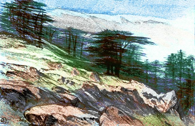
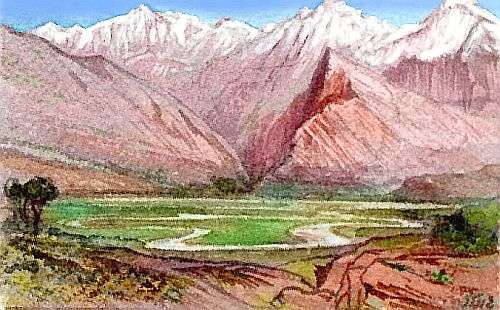
Inland? Rugged ranges form snowcapped, piny sky-islands above red desert valleys. Scenic, but deeply isolated--the largest desert on Continent 6. Let's avoid it, and ride the updrafts over the coastal mountains north instead. Even this is a long dry journey: soon the rains fail, at least at sea level; the only water's up in the mountains now and a few snowfed creeks making it to the sea. It could almost be southern Peru. This desert coast stretches a good 600 km before the mountains swing further inland and the coast starts to green again--as well as drizzle and fog off the western sea, light rains occasionally sweep down from the north now. Soon, trees dot the hillsides.
This coastal strip looks much like Morocco--Mediterranean climate along the coast and snowy mountains 2-300 km inland. At first we ride the mountain winds, but as the land grows greener, we coast down to the sea. A fertile but somewhat lonely land, if not quite as isolated by the desert as the far western tip was. So who lives here? Their cragtop villages of golden sandstone have elegant architecture and spectacular views. Of course they welcome the rare traveler like you, being hungry for news of the wider world; so you stay in this citadel a full day, resting up from your desert passage and telling of your journey so far...
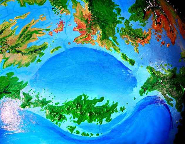
Two pleasant days, flying leisurely northeast. Bays start indenting the increasingly wooded shores; the coastal hills become Grecian islands dotting a shallow, turquoise sea, the Emwemfeek Sea. Here we face a choice: those isles are the bridge to western Continent 7. If you're tired of the subtropical heat, it's a more temperate land. But I promise we'll get there soon enough--there's another strait from northeastern Continent 6. Only a week or two, on the wing...
A few tourists peel off north, but the rest of us head southeast, over a series of low, hilly capes and shallow bays--half-drowned river valleys. The land still feels Mediterranean--scattered "oaks" and aromatic brush along streams and in the hills, prairies on the flats. It's low and rolling, with big vistas from the passes over these low capes. After a couple of days it gets tedious--a big land, and few updrafts to ride.
It's hard to extrapolate who might live here because it's such general-purpose land. There won't be specialized rainforest canopy-dwellers, but I can picture intelligent grass-eaters (equines with a small hand on their snout, or growing from their chest?), leaf-munchers (leggy, hopping mini-elephants with shaggy manes and tails), berry-pickers (kangaroos or bipedal dinos with opposable thumbs?), seed-crackers (giant four-legged parrots, the middle limb-pair evolving into hands), pack hunters (winged wolves throwing atlatls? cat-headed angels?), omnivores (giant raccoons or bears; winged burrowers? Sounds peculiar, but consider the burrowing owl).
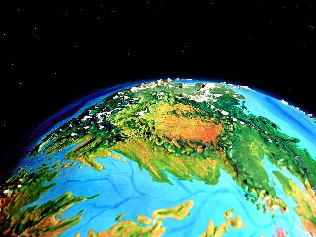
At last, to the south, the Northern 6 Range creeps over the horizon. A cluster of snowy peaks to the southwest, on the edge of the Western Desert we've been skirting all along. For fliers like us (assuming you're competent in those rented wings by now) the range represents a holiday! You can ride its updrafts for miles, as long as you avoid the regular afternoon thunderstorms over the peaks. The long Pegasian days mean afternoons really heat up; hot air rises into towering thunderclouds. Here, lightning-strikes are the leading cause of death. But play it safe, and you'll be fine. Half those deaths are due to overconfidence on the part of expert locals, taking short cuts, pushing the edge. This seems to be a universal problem of intelligence: habituation to everyday risk. As roads get safer and cars and signage improve, car crashes don't disappear; people drive faster, take more chances. Or consider American football players: after helmets improved, head and neck injuries went up; feeling safer, they used their heads as battering rams! Life, it seems, only values itself so much. Along with the law of conservation of mass-energy, there seems to be a law of conservation of, well, death. Or idiocy.
And you're not immune. The first storm you see, you skirt five miles away; but by the third day they seem routine and you want to follow the locals as they spiral up, up, to dizzying heights, riding those huge updrafts... it can't be THAT dangerous, can it? Or they wouldn't be doing it. Would they?
Time for us to wean you from the deadliest sport on Pegasia before you get addicted! I'll scrounge us up a safer route. Aha! Follow me up to that low pass... ignore those little stone watchtowers. I don't know who peoples them, or what they watch for. (But perhaps you do...)
CONTINENT 6: THE EAST
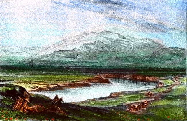
At the summit, a vast plain shimmers to the south: Continent 6's great central plain. It looks African--semi-arid rolling country here, but as we sweep down from the pass and southeast across the drab brown hills, it slowly turns golden with green veins: savanna. Great herds of... animals? Or are those grazers people? Why not? We can't get a closer look, because they're skittish, and not designed yet. Let's leave them in Heisenbergian uncertainty for the time being. Soon we fly over a riverside village--either the herds or the herders aren't completely nomadic, then. But let's head downriver--trust me, we'll see more of these folks. Another hamlet. A village. A small town...
The savanna grows greener, the hills flatten, the river meanders and widens into a wide reedy estuary--the Fweemtikchok Delta on the shore of marshy Ebwektokchwee Gulf, some 1600 km long (1000 mi).
Port Fweemtikchok on the river's north bank is no mere town. It can only be called a city--one of the largest on the continent, though Emfweeowak-Tok, a day's flight south at the mouth of the Kwai-Fwoom, is older and larger--the cultural heart of the Pwokwe nation. These large, flightless people trade all up and down the coasts of eastern Continent 6. We're arriving at the drunken, draggled end of their annual breeding festival, when things get interesting--culturally, I mean, since the Pwokwe get feverishly creative during heat and lapse into sober, skeptical types the rest of the year. (I didn't mean sexually interesting. I don't think. Too many spikes. No, sorry, too many even for you. No, I don't want to see your studs. Oh, go ahead, get lacerated then, see if I care.)
Let's take a side trip up the Kwai-Fwoom River, up into the hills. Within hours, they part to reveal Lake Swirltoe--and that gestural name tells you we've come full circle round Continent 6 to frolcon territory; the lake's their northern frontier. The name also describes it, in a way--that whirling digit, as if stirring a pot... it is a suspiciously round and deep lake-valley, breached only on the east. An old volcanic caldera? Not sure. Could be an impact crater, badly eroded. But given Pegasia's manic tectonics, vulcanism gets my bet. I'm not stopping to dig. This is (ahem) a whirlwind tour.
So the next day we fly back down the river to Emfweeowak-Tok (now sadly sensible and hung over) then northeast along the coastal hills--a green fertile strip between Ebwektokchwee Gulf and broad Lake Chweet, silver to the south.
We sleep in a roadhouse out on a point. The walls writhe with sinuous bas-reliefs, painted ochre, black, red and white, with shell inlay. Almost Maori. If Maori woodcarvers were obsessed with velociraptors, I mean.
Quiet this time of year; we're the only guests. The mating-festival folks are already back on the farm, the warehouse, the fishingboat...
In the morning, we set out north, island-hopping over the narrow mouth of Ebwektokchwee Gulf, and reach the huge, hilly Umbewak Peninsula, sprawling northeast toward the strait to Continent 7. Pwokwe villages at every river-fork, Pwokwe-owned herds out on the savanna. Their ownership of the land is far more visible than, say, the frolcons--but then, the land is barer; does it really say much about their psychology? Not sure. It may be just that flightless folk inherently alter their landscape more than fliers; much of Pwokwe infrastructure is for transport: roads, piers, breakwaters and boats. It all seems familiar and Terran, but... heavy-handed, too? I hope so! If it does, I've started to infect you with the avian viewpoint. I hoped a few weeks with wings, even strap-ons, would help you see how much our human flightlessness has shaped our civilization. And aside from needing wings to tour Pegasia in any reasonable time-span, you need to fly to see this world the way most of its people do.
And you are starting to see with Pegasian eyes now--more aware of flight than you were. No huge updrafts here, but you plot a zigzagging course, wheeling from ridge to knob, and feel pleased at how rarely you have to beat your wings; in such hills, flying is more mental than physical. It's no effortless flyway like the great ranges of the west; more like riding a series of local trams and transfers, or surfing small breakers. Intimate--you have to feel for the wind.
You find you like Umbewak, warm but not as hot as the frolcon lowlands to the south, wooded but open enough for even a tourist in rented wings to land easily, not too humid but with enough streams and lakes for drinking (and swimming before the afternoon siesta.)
Of course you have a siesta--two, in fact, one during the long noon eclipse when the land turns dusky red for two hours, and a second after the sun's re-emerged and reheated the land another six hours or so. Remember, Pegasian afternoons are eleven hours long. Terrans must sleep sometime during the long day, and even the locals do: all that continuous sunlight makes it just too hot. Even the eclipse isn't enough to cool it off. (And just think: only this continental cluster gets this respite; the Outer Hemisphere has uninterrupted sun for 25 hours--and even sharper temperature swings.) Luckily, Pegasia's dense air mitigates this daily heat-seesaw, or the whole world would be... well, livable, but harsh. As harsh as Pegasia's sister moon Tharn. Water helps, but air makes the real difference.
ON THE NOON ECLIPSE
At noon each day, only here in the inner hemisphere, the world turns hushed and red. Zeus hides the sun and becomes a red ring overhead, as all the sunsets around that vast world flame in Pegasia's sky at once. Pegasia orbits so close, Zeus looks gigantic--nearly 20 degrees pole to pole and over 20 across! The Inner Hemisphere stays dim and red for nearly two hours before the sun peers round the ring like a topaz on a coral ring. Without the lensing in Zeus's dense atmosphere it'd last even longer: nearly two and a half hours.
How often do things line up for an eclipse? Are they all full, or are some partial or shorter? These questions reveal you as a Terran, grown up under our peculiar twins--a moon and sun the same apparent size, which must line up perfectly for an eclipse. Not on Pegasia! Its orbit tilts only 3 degrees off the ecliptic, and Zeus is huge; even the worst line-up still causes a full eclipse, barely shortening it.
This long, regular eclipse splits the 25-hour daytime into two quite Earthlike halves. I've called it "the noon eclipse," but of course that depends on your time zone:
The eclipse has climatic benefits. It's a cooling-off period, smoothing the temperature swings induced by Pegasia's long day, and moderating the fierce afternoon storms that often wrack the outer hemisphere.
Even better is Zeus's night-gift to the inner hemisphere. 23 hours of dark aren't so bad when there's always a huge gold lantern in the sky, radiating heat as well as light; enough to feel, faintly, with your eyes closed. Milder nights as well as milder days!
But while the presence of Zeus is convenient for animal life, the eclipse's calming effect on afternoon thunderstorms has its (if you'll pardon the phrase) dark side. The Outer Hemisphere, with wilder temperature swings, sees more rain in dry regions where thundershowers are a major source. The Inner Hemisphere has somewhat more extensive deserts as a result. Not a serious problem in this present geological era, with high sea levels and spidery little half-flooded continents; but during ice ages, when the sea drops and the full continental platforms emerge, a vast inland desert forms over much of the Inner Hemisphere. The outer continents develop deserts too, but not quite on this scale...
THE EEBOK SEA
The shores of the oval Eebok Sea oscillate between quite Indonesian forests during interglacials (like now) and nearly Mediterrean climate during ice ages. Why so much drier? Glaciation locks up so much water that the sea drops over 100 meters, and Eebok becomes nearly as landlocked as the Mediterranean: the northern continents all fuse, and only a shallow strait leads to the ocean in the southeast. At times, even this closes; the Eebok becomes a vast salt lake. Our Mediterranean mostly evaporated the last time this happened; but the Eebok Sea is closer to the equator, where more rain falls even in ice ages; it stays roughly at sea level. It may even end up a true lake, spilling its overflow through a short river; if so, its salinity will slowly drop, though I doubt it'll ever be fully freshwater. Too big, too deep.
Frolconia Island, along the south edge of the sea, we've already toured above. Since it's equatorial, Frolconia's climate stays warm a and rainy even in the deepest ice ages; the woods on the northern shore open up a bit, is all. The Eebok Sea, even shrunken to a great lake, still shields Frolconia from the worst of the desiccating winds off the wide desert that links northern Continent 6, southern Continent 7 and western Continent 8 during major ice ages.
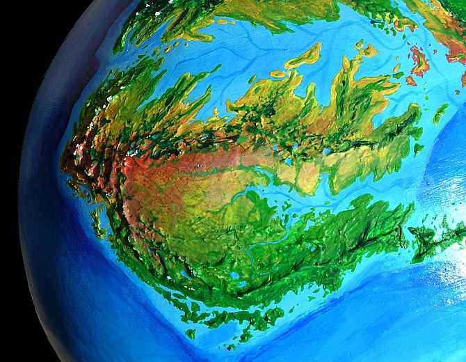
CONTINENT 7: an overview
Continent 7 is a temperate land somewhat smaller than Europe. It more closely resembles a miniature North America, with eastern and western ranges flanking wide inland plains. Major bioregions:
SOUTHERN CONTINENT 7
Continent 7 is to the north of Continent 6 and has a more temperate, fluctuating climate.
I said the Eebok Sea resembles the Mediterranean during Ice Ages; but during warm periods like the present, there's a much better candidate to the west: the Emwemfeek Sea, between Continent 6 and Continent 7. It's truly Mediterranean in size and climate, though far shallower except for a serpentine channel down its middle; a winding river canyon cut during the Ice Ages, when the Emwemfeek basin is a vast arid plain, like the inland plains of Continent 7 today.
The east end of the Emwemfeek Sea looks agrigenic (forget the dictionary, I made it up--it just means a place "encouraging the early development of agriculture.") The region's advantages:
Let's assume you got here by flying northeast from Continent 6 over the arid Kwao Islands in the Emwemfeek Sea. When you reach the Continent 7 mainland, at first you head north along the dividing range, riding the winds--they blow off the sea, directly across the ridges, creating another of those marvelously convenient updraft-flyways.
To the west are the warm Mediterranean shores of a hook-shaped gulf. At first you're not tempted to swerve off your ridge. Dusty savanna plains and brushy hills. Too dry for the Pwokwe. Too dry for most of us. But within a day or so, trees creep down the slopes; lush grasslands freckled with groves fill the basin. So who lives here? You tell me. It matters who; this gulf, bigger than the Adriatic, is large enough to nurture a major civilization.
Look to your right, too. Over the divide to the east is a great subtropical forest rather like primordial South China or Virginia, before humans chopped down the first growth for their fields. Rich country, and a gateway to Continent 8. Who lives there? They don't seem to have chopped down their woods. Maybe they've found a way to exploit their crowns--huge orchards that just look like wild forest, that get harvested from the top?
Let's head west, over this hook-shaped miniature Mediterranean, visiting their whitewashed towns, getting to know... who? Centauroids? Winged monkeys? Fish-eating ospreys with an extra pair of limbs to serve as hands, like a sort of medieval griffin? Catlike, batlike omnivores? Velociraptor-ish creatures semi-adapted for diving? Whoever they are, moderate competence in both air and water seems better than elegance in either one. Even the land vegetation here is so varied that generalists will have the edge over specialists.
If anyone's invented shipping, these people will have. The relatively peaceful Emwemfeek Sea is ideal for trade, with its regular harbors--flooded river-valleys with clear, safe channels--the old riverbeds. At its east end, the Emwemfeek Sea leads into the subtropical Eebok Sea and the 8 Gulf beyond. Bolder sailors can even venture north into the colder, deeper, stormier but still somewhat sheltered 78 Sea, like a Baltic times ten. All together it's a maze of inland seas at least five times bigger than the Mediterranean. Now you see why I emphasized that southeastern Continent 7 is a crossroad!
Port after port, bay after bay. Two full Pegasian days of steady flight west--and that's more like four days, Terran time. Nearly 2000 km? I've lost track! But at last, higher, greener hills rise ahead. And beyond, true mountains rise. Capes and sounds, but steeper, with more woods and clouds. Like France's Maritime Alps--or Japan! You're nearing the west coast now, and oceanic storms add to the gentle but sparse winter rains off the Emwemfeek Sea.
WESTERN CONTINENT 7
Here, we may pick up some fellow travelers from the south, over the water. They've island-hopped from Pseudo-Morocco, on Continent 6, remember it?
Another slow day fighting headwinds--we're nearing the western ocean and sea-winds will be against us for the next few days--and the land crumples; the coast steepens. This far southwest corner of Continent 7 is a bit like France's Maritime Alps: still a bit dry and rocky, but increasingly green with pines and dotted with mountain lakes. Thank the winter storms off the western sea!
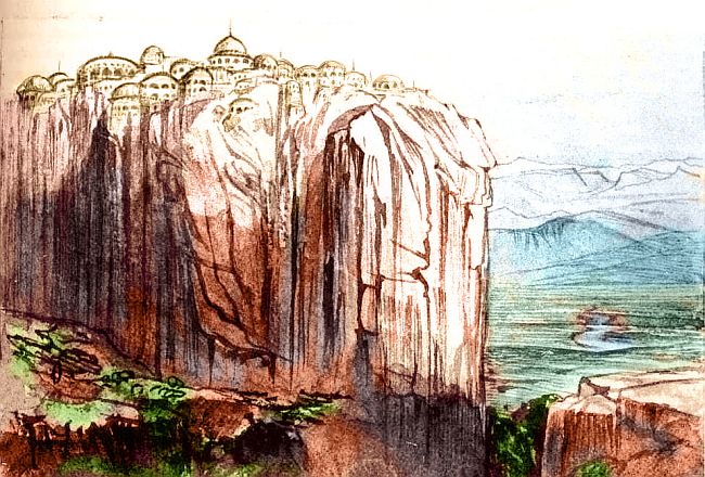
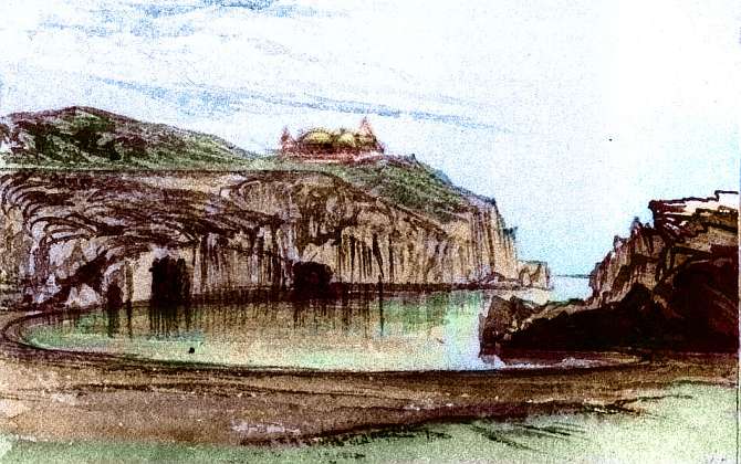
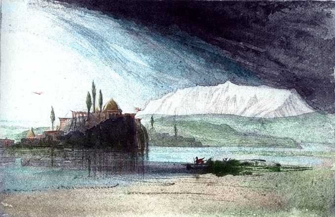
I don't know if the same ebullient people who built those flamboyant domes on scenic bluffs along the south coast also live in the structure I sketched below (I don't know what else to call it)--I suspect it's the same species, since they clearly share a fondness for dramatic cragtop sites (I'd guess they fly; tedious sites to climb to!) and round rooms. If so, this bunch were inspired by the exuberant verticality of the land; this chateau (or, for all we know, museum or temple or music school) isn't quite as froofy as Mad King Ludwig's confection at Neuschwanstein, but it surely goes beyond the elegant impracticality of those coastal domes into a soaring fervor. Or fever. Yet the castle-look shouldn't fool us; maybe such a structure would seem stodgily utilitarian if we understood how these people's spatial needs differ from those of humans. What people, what needs?
And ride it we do, for days, north along a verdant temperate coast. Inland are endless dense-forested hills; on the eastern horizon, a line of high white tents pitched in the sky: the snows of stratovolcanoes three to five km high and a hundred apart. We pass a new one with every long hour...
Who lives along this fertile but cloudy coast? They'll likely cluster along the shore, for the sea's so rich--kelp forests and oysterbeds, every rock encrusted with life. Or the mountains, with its flyways and open meadows conducive to grazing and, well, not claustrophobia. The forests betweeen mountain and sea are so dense yet nutrient-starved (except after the frequent eruptions dump an embarrassment of ash on the land for a few generations) they may not offer promising energy sources for animal life. Like the Pacific Northwest in Emily Carr's paintings, the forest itself is the climax predator here. Stand still too long and it'll swallow you.
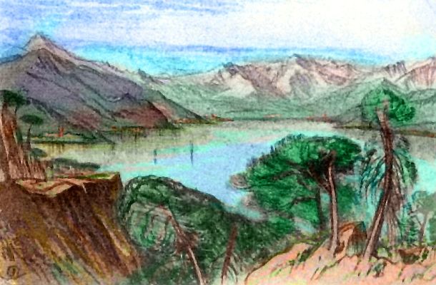
At last, a sort of Puget Sound; here it's time to swing inland, seeking a pass through the coastal range. Follow a winding river; soon enough, a straight, stony, talkative cascade down from a mountain lake. Another. Silver and blue shines through the web of dark evergreens. Up above the basin now. Pegasia's bones peek through the thin soil...
Suggestions, anyone? Herding reindeer, maybe? That phrase was deliberately ambiguous--people who tend and feed on reindeer herds, or people who are reindeer and travel in herds for safety? Or maybe big, flightless, well-insulated bearlike people, storing up berries and meat and starchy reeds for winter--and really strange cheese, from dairy herds of mammalian swans or ducks or something, creatures that can fatten up on the reeds of the ubiquitous marshes here. Or folk like winged Arctic foxes or wolves--you don't HAVE to have a ton of fat to make it through a subarctic winter, if your fur or feathers are good enough. Or maybe the locals are migratory! From that central desert I've been skirting--maybe the locals enjoy the north in summer but winter down south. Solve winter by fleeing it! On a flight-friendly world, it's undoubtedly a more common solution than on Earth.
Or perhaps... all the above? Long winters are certainly more endurable when there's an entertaining variety of people around. Why settle for only one species to tease and pet and watch the antics of, when you can live with three or four? The Inuit and Siberian peoples come close to this, living on close terms with dogs and reindeer; the only difference, on Pegasia, is that the cohabiting species may all be intelligent... domesticating, in effect, each other.
But it's high summer now; no need to fear winter. Let's take an extra day or two and fly northeast to the head of that sheltered subarctic gulf. Steely gray at dawn, when clouds fill the northern sky; but they dissolve long before the noon eclipse, and the bay turns a pale blue. It's not as cold as it looks--more Baltic than Arctic, really, for there's a cape and island arc of massive volcanoes that partly blocks the polar winds and seas. It's possible to imagine a big cold-adapted creature that would make these windy shores its own...
Better still, let's head south again. Leave this basin to the bugs. This life-zone is big, so I wanted you to get at least a taste of it; I forgot it might get more than a taste of you.
EASTERN CONTINENT 7
You chug patiently up into the air until the flies drop away, a thousand feet up. Southeast across the Subarctic Gulf coastal plain, then slowly up between vast white cones, their summits crowned by lenticular clouds. The Subarctics aren't so much a mountain range as a museum collection, with each great volcano set off by wide skirts of pale-green steppe (I first wrote tundra, but it isn't really; Pegasia hasn't suffered a recent ice age, so there's almost no permafrost. These chill plains just have a very short growing season.)
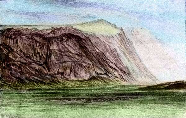
Southeast to the edge of the Lake District--also a pale-green plain, smooth as velvet from this height, dappled with oval silver lakes. On the horizon beyond, a monstrous white wall--the Northeast Mountains, up to 7 km high, forming a continuous icefield 1000 km long. We follow the wall south--crossing it is inconceivable, for it's the largest surviving icefield in this hemisphere--even the Arctic islands to the north can't compare.
All next day we beat south, skirting the mountains. I said beat because you quickly learn to stay over the plain and use muscle power--tedious in your strap-on wings, but the only safe choice. The trade winds from the west should form steady updrafts where it slams into the great wall; but the huge icefield generates tongues of cold air and vicious downdrafts. Chaotic, treacherous flying--with care and experience the locals can ride that tumbling tube of invisible air, but you can't. So it's a slow day; the great peaks are scenic but distant; below you, an endless stretch of subalpine meadows. But imperceptibly, during the afternoon, they warm up and dry out. By the end of the day you're bone-tired and sore, but we're 700 km south of the Subarctic Gulf, and the plains beneath us are golden prairie, and the evening is mild.
We veer southwest near dusk, to avoid a huge spur of icy peaks thrusting out from the massive knot to the east. Around its end, we settle and camp on the shore of a lake, fed by snowmelt from the peaks far above. The spur seems to mark the end of the icefield; while tall, isolated peaks gleam to the east, the way looks clear to the coast.
I wake you near midnight, with Zeus looming like a golden shield in the southeast embossed with red and white paisley swirls--storms the size of Pegasia. The sky's navy blue, the meadows a deep bronze. You can even tell the colors of the small flowers woven into the grasses. This isn't moonlight but PLANETlight!
Time for some night flying. I've avoided this before now, but these vast prairies are a good place to practice, and there's a need. Further south is 1000 km of desert; we need to head east to the coast--directly into the rising sun, and on lazy Pegasia, it'll rise for many hours--glaring straight in your eyes. Better to fly now, in Zeuslight. And so you take off into the cool night air. Not that cool. You notice your right cheek is a bit warmer. There's a palpable glow of warmth off Zeus: not just a nightlight, a heatlamp! Twice the mass of Jupiter, and far closer to its sun, Zeus has never really cooled down.
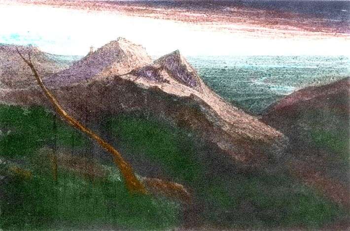
Two hours east, in the foothills--well--toehills--of the Northeast Range, we pass this elegant chateau, or town, or bazaar, or temple--who knows? Is it the center for a scattered plains culture and trade--a sort of Pegasian Samarkand--or is it a finger of the coastal civilizations ahead? I don't know; you tell me.
A few hours later, with peaks around us, we land in an alpine meadow to rest, and snooze through morning. Back in the air before noon, and through the dim red noon eclipse, we head down to the sea. Dense dark forests cover the low hills. It's a rainy coast. Already at noon it's growing hot and muggy like a New York summer. But in winter, this coast gets as cold as Hokkaido or Boston... we're not out of the snow zone yet. Offshore, a long dark forested island creates an inland passage hundreds of km long. We follow this sheltered shore south, then east, then south again. More and more broadleaf trees, fruit trees, and vines enrich the forest-mix; we're creeping out of the temperate zone onto a subtropical peninsula. If we flew back due west now, we'd find that Mini-Mediterranean basin near our first landfall on Continent 7.
But let's stick to the coast; we have business there. It grows drier and more irregular; islands a couple of hundred km across; cliff-lined straits, coves. Is this ancient Greece?
Yes, it's safe to be up here, even in the heat of afternoon. Scattered cumulus tower in places, but thunderstorms are rare here on the coast; the clouds pile up into castles and crash over the inland mountains.
The southern tip of this long strip is called Cape Nwok; yes, another Pwokwe name. We've strayed far enough south to re-encounter these wingless coastal fishers, if only indirectly: just a few fishing and trading settlements on coves along the south coast. As nonfliers, the Pwokwe avoid the hilly spine we've been using as a rapid transit system.
Both continent 7 and the tour come to an end here. Not a dead end of course, not on island-dotted Pegasia! In fact you have choices: the flyway forks here.
TOUR PEGASIA! The following route snakes around Pegasia, covering all major features:
Continent 1 - 165 Is. - Continent 2 - Continent 3 - Rift-Junction and Curl 9 Is. - Busre Is. - Continent 4 - Continent 5 - Curl 5 Is. - Continent 6 - Continent 7 - Continent 8 - 89 Is. - Continent 9
World Dream Bank homepage - Art gallery - New stuff - Introductory sampler, best dreams, best art - On dreamwork - Books
Indexes: Subject - Author - Date - Names - Places - Art media/styles
Titles: A - B - C - D - E - F - G - H - IJ - KL - M - NO - PQ - R - Sa-Sk - Sl-Sz - T - UV - WXYZ
Email: wdreamb@yahoo.com - Catalog of art, books, CDs - Behind the Curtain: FAQs, bio, site map - Kindred sites