CONTINENT 9
by Chris Wayan, 2006-9
Pegasia's homepage - Map - Geography & climate - Evolution - Critters - Gazetteer - Sketches - More worlds? Planetocopia!
First-time orientation--strongly advised! Pegasia is weird.
Overview - Flyways - the East - Southeast Passage - the North - the West - a Chilling Afterthought
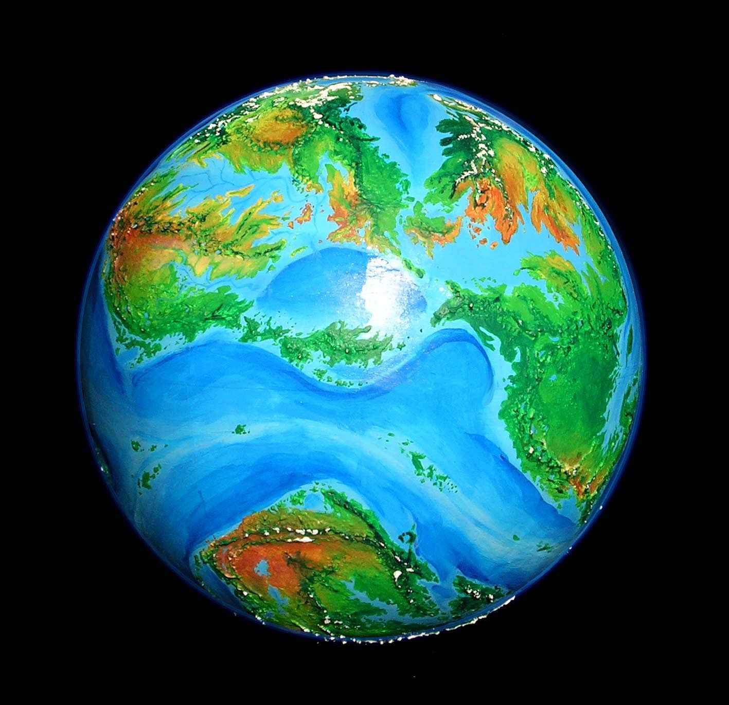
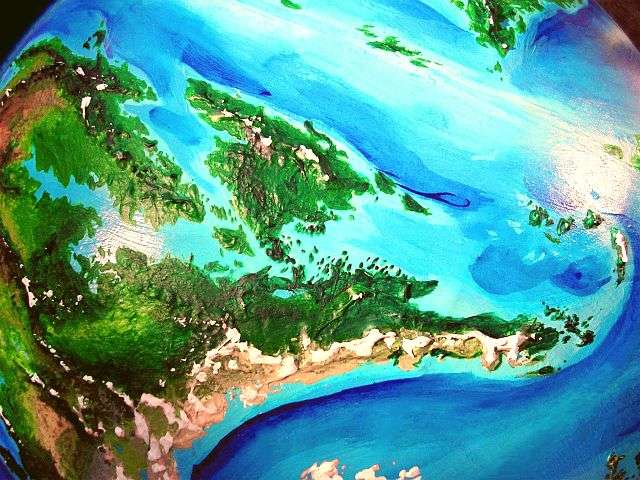
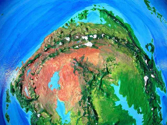
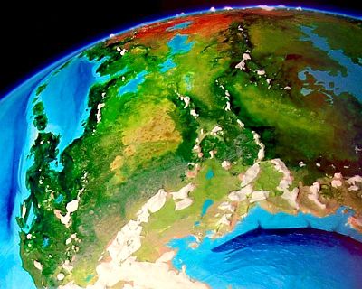
Eventually, an overview of Continent 9 will go here... once the place is settled, names are added, and we have some cultures to view! For now let's just say that this southern continent is larger than North America, largely fertile and temperate, but isolated. In the high-orbital photo below, Continent 9 is the Land Down Under. Way under. No land-bridges, and no island chains; fliers and coastal mariners will not easily reach it (or spread from it, if people evolve here first). The only continent on Earth comparable in its depth of isolation isn't Australia, which has fertile island chains leading to the Eurasian mainland; it's Antarctica. And yet Continent 9 is far more fertile than either Australia or Antarctica even at their best, 50 million years ago. We simply have no parallel: a whole world apart. Even the New World was more linked to the Old.
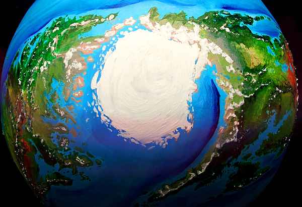
The nearest neighbors are the Inner Hemisphere cluster (center/top of photo; called this because they, like Continent 9, always face Zeus). At least they have each other, plus an east-west flyway to Continent 3 in the Outer Hemisphere. But getting to Continent 9 will be grueling...
Overview - Flyways - the East - Southeast Passage - the North - the West - a Chilling Afterthought
The tour of Continent 9 will start here. Only... where CAN we start from? There's no easy way to reach Continent 9!
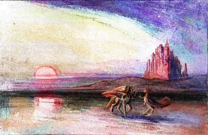
Overview - Flyways - the East - Southeast Passage - the North - the West - a Chilling Afterthought
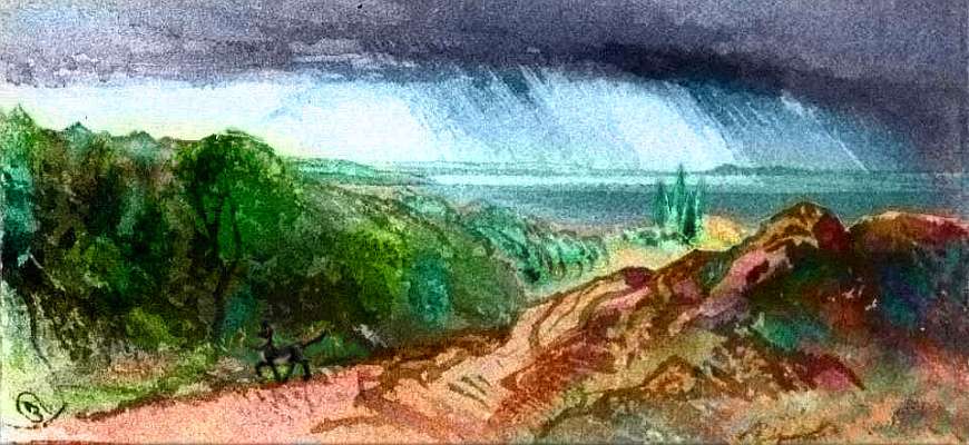
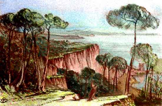
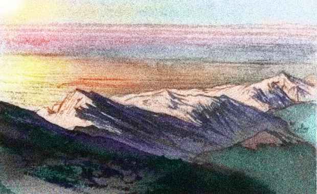
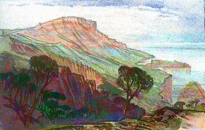
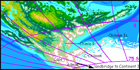
Eastern Continent 9 looks much like the tip of South America, rotated 90 degrees; that long, dark green cape, which for obvious reasons we'll call Cape Curl, is like a lateral Patagonia. But reaching east makes all the difference, climatically. The peninsula is cool, but not cold, and far rainier--thus greener--than Patagonia. No, the watercolor sketch below doesn't mean to imply that black-and-white feline centauroids like Bernard Doove's chakats live here; if you can visit, so can she...
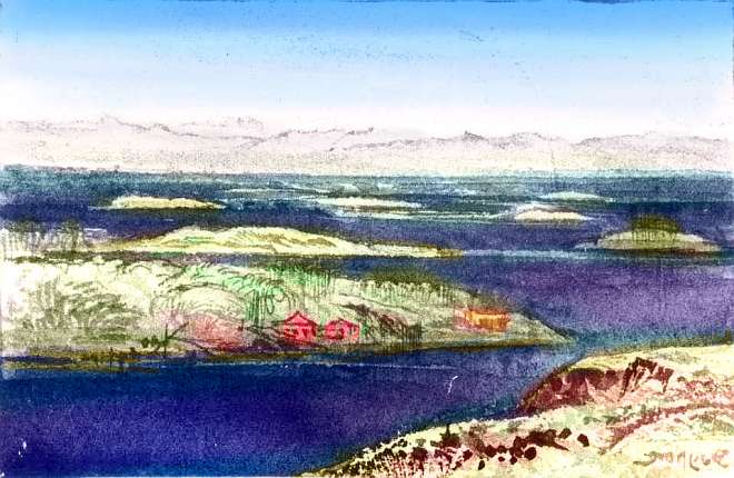
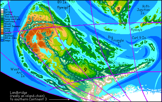
On the mainland west of Big Triangle Island, did you notice that small peninsula and archipelago trailing off north into the deeps? Here's a sketch from its base.
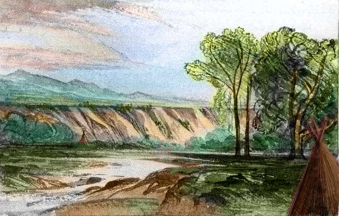
In central Continent 9, around the Gulf's west end, the great forest slowly opens into prairie; it's much like middle America in climate, though winters on the plains aren't nearly as harsh: some frost, but usually snowfree. Agriculture and fishing fade in favor of grazing.
Overview - Flyways - the East - Southeast Passage - the North - the West - a Chilling Afterthought
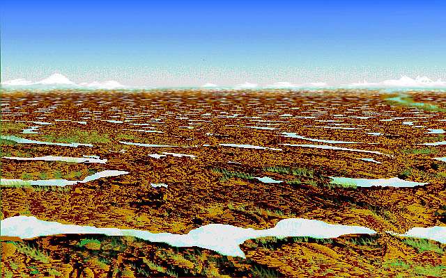
If we were going to try crossing that southern land-bridge, it's easy enough--all you need is a touch of masochism. Just start back at Cape Curl and follow its mountains spine southwest for thousands of km, as the weather turns fouler and the coast slowly goes from somber evergreens to tundra to barrens.
The Southeast Passage! Piece of cake.
I hope I've convinced you that all the routes into Continent 9 are complex and strenuous--but each hop on the sea-route is merely hours of hard flying, not days or weeks of slow sailing. And it's not freezing. Trust me, once the continent's known, most travelers will fly in from the north, from Fizrat to Cape Curl, or through the 89 Islands; the southern landbridge will probably have just a chain of drab little ports serving freighters full of bulk goods from southern Continent 3.
Overview - Flyways - the East - Southeast Passage - the North - the West - a Chilling Afterthought
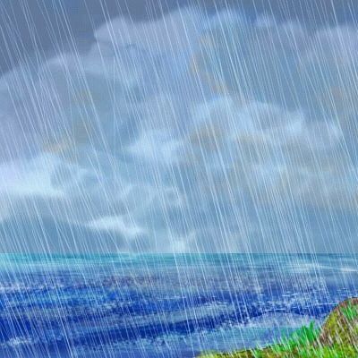
Northwestern Continent 9 is largely dry, but the far northern coast is green--the tradewinds hit the coastal mountains and drop their rain. That northern strip, from the mountains to the sea, is remarkably like South Africa's Natal coast (flipped north-south, of course). Fertile, scenic, pleasant weather...
In summer the inland desert heats up; rising air pulls a monsoon wind south; rain-fronts drench the north every few days for a couple of months, from the coast inland to the great mountains. They taper off quickly in fall; winter and spring are dry, sunny and mild.
To make it through the dry season, plants here are often succulents and store up energy in large roots, or invest in huge crops of nuts and fruit. Animal heaven (if they learn to crack shells and and leach tannins and avoid the alkaloids; plants are sneaky.)
Though just a small corner of Continent 9, this coast is going to be popular (and not just with the inevitable surfers). At least a third of all Westerners will live here. Or should I say loaf here? Not quite lotus land, but Mediterranean climates often do have surpluses and short work hours. The question is, who will they be? What will they do with all that free time--and free lunch?
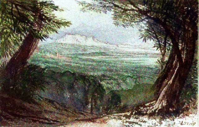
The mild maritime weather extends inland all round the triangular northern gulf, as yet unnamed and uncitied. But it will develop, so let's put a regional map here.
I know this text will expand... just too much potential here.
...at first. But the Dividing Range forces the sea-winds up--thunderstorms grow common. These peaks are up to 5500 m high (18,000'). The high country is a dramatic world, climatically and topographically. Semiarid meadows right next to small cloud- and thunder-forests.
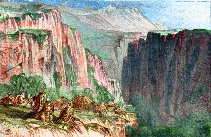
In one hanging canyon on the edge of this unpredictable highland, I stumbled on this village of striped fliers. I'm not sure who these people are. How do they make a living? Herding, maybe, in the alpine pastures? You tell me.
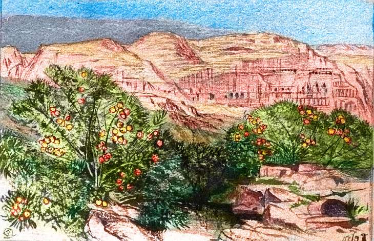
These linear oases would be ideal for fliers who like cliff-dwellings--and pottery. All the ingredients for a pueblo culture are there except decent wood for roofbeams; those would have to come from from the highlands around the basin. Or, as the sandstone is soft, they could dig whole cities into the cliffs, of pure stone.
Overview - Flyways - the East - Southeast Passage - the North - the West - a Chilling Afterthought
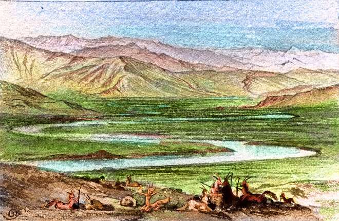
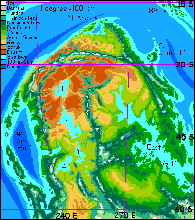
A chain of huge lakes runs from the desert to the southern steppes. The northernmost--call it Lake One--is salty and lies below sea level, like our Caspian Sea, though clearly it did once drain south; but Lake One must have been much larger then. With no outlet, it swells in rainy years and shrinks in dry, leaving salt- and alkali-flats. It's more like Australia's Lake Eyre than the Caspian.
This looks like an old volcanic plug rising by the (current) lakeshore, but it's not; it's a tufa tower, a much softer rock deposited in wetter times when the lake actually covered it. It looks like the locals have burrowed into it like cliff swallows, using it as apartments. I bet they don't have fresh running water, but if you're winged it might be worth a daily water-jug flight, to have a view that spectacular...
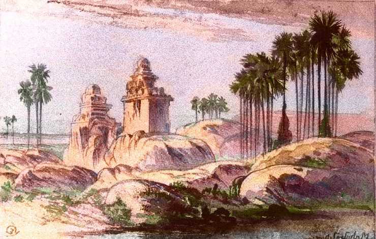
But that tower's an opportunistic exception. Due to the shifting, alkaline shoreline, most of the life in this region lies along the creeks feeding Lake One (or should I say slowly starving it?) I don't know who built this temple complex; perhaps you do.
In contrast, the southern lakes are a true freshwater chain draining to the sea. They're as big as America's Great Lakes, though their coasts are drier--prairie around Lake Two, groves and meadows around quite Mediterranean Lake Three, and forest (if open and patchy) around Lake Four.
The chain survives in a semiarid climate because they drain a much bigger region than the Great Lakes, including high ranges that feed them summer snowmelt. In turn, their evaporation fattens snowpacks and their heat-storage moderates winter temperatures; the shores around Three and Four rarely freeze; around Lake Two, never.
The West, though less fertile overall, has great grasslands--hot savanna in the north, prairie and steppe (freezing in winter) in the south. Such open lands have more available energy for grazing animals than deep forest, where much of the biomass is locked up in deadwood and bark. There will be huge graminivorous herds of... something.
Will they be fliers like so much Pegasian life, or would they be too heavy, with the elaborate digestive apparatus needed for grasses? Grass-equivalents; my guess is, small plants in dry regions that endure steady grazing will don silicon armor just as Earth grasses did. Or other reinforced cellulose fibers. We animals are so annoying! Still, new growth after rains (or fire, in drought) will provide lots of cheap energy, as on Earth.
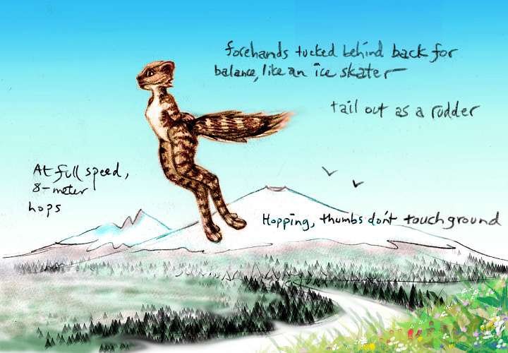
My guess is that fliers or fast hoppers--equivalents of antelope or kangaroo--will flourish, flitting round the plains to the greenest pastures--with or without wings.
I see at least two possible niches for intelligent life here:
And given the new proof that whales and hippos are close relatives, let's rethink the assumption hippos are mere animals. They're big fat and piggy-looking, so they must be dumb? Doesn't that sort of prejudice sound familiar! But which animal's really at the top of the food chain in Africa's waterways? Any local, whether hoofed, crocodilian, or human, knows: hippos always get the right-of-way.

And while you're at it, read up on cameloids (llamas are smart).
Anyway, on the rich prairies of central and western Continent 9, from the upper East Gulf to Lake Two Basin, we can assume that some large herbivore(s) will be intelligent; if they have hands (or tentacles, snouts, prehensile tongues...) they may build a civilization. No, elephants haven't yet, but if we got out of the way, can we be sure they wouldn't in the next five or ten million years?
Remember how unpromising apes were, ten million years ago (still are, if you read the world news). Take the long view!
To the south, where more trees grow, lies a third ecologically rich niche, taking advantage of the tendency of trees in Mediterranean climates with a long dry season to store up their energy in large nuts, seeds, or oilfruits. These often take cracking or processing, or breeding for size and flavor, to be useful--think of acorns, olives, avocadoes. Some functional equivalent of our arboreal primates or large parrots could grow big-bodied and big-brained in this food-rich region requiring just a little ingenuity to be tapped...
The prairie doesn't reach the sea. The west coast, like America's, is an ecological island. It's sheltered offshore by the (almost Japanese) West Arc Islands. The climate is mild--Californian meadows and "oak" groves in the north, greening to dense woods in the center and cool-temperate rainforests in the south. The coast is snow-free all around the sheltered West Arc Sea (at sea level; but both islands and mainland have rugged, snowy mountains dotted with tall volcanoes, deepening the resemblance to the Cascades).
Earth has no true parallel to the West Arc Sea; our island arcs are mostly on east coasts or in polar regions. Because this is a mid-latitude west coast, with a cool current offshore and a sheltered whorl of warming water between islands and continent, weather here is mild--much warmer than the North Sea, cooler and much rainier than the Mediterranean.
An enclosed Bay of Biscay, or a huge Puget Sound? Warm-temperate forest slopes below volcanic peaks, with prairies inland--a fertile eco-island cut off by lakes, desert, steppe, ice and sea. California plus Oregon? New Zealand?
End of the world!

Overview - Flyways - the East - Southeast Passage - the North - the West - a Chilling Afterthought
Southern Continent 9 is a wide zone of cool forests, windy steppes and rugged icecapped mountains--an antipodal Canada. Sorry to be so brief about well over a million square miles of green land, but I'm writing this bit in deep winter, shivering a bit, and the climate down there will be harsh for humans--deep snows, short growing seasons, stunted trees. Still, maybe a better-insulated creature than me would find its dark misty forests Paradise.
Mmm. What sort of creature? Large would be easier to insulate. But too large and you lose Pegasia's blessing: easy flight. Still, being grounded's better than freezing to death, so...
Bear-people?
Air-caribou? Wings would sure ease their migrations. But can you eat grass, with all the heavy digestive equipment that takes, and still fly? Pegasia's air and gravity favor this, but... squeezed by these double constraints, digestion and flight, is there room for a third energy-hogging mechanism: intelligence?
Well, let's separate them. How about tigeroids who learn to herd reindeer?
And why limit the migrations to one pole? Once you have wings... why not monster swans who migrate twice a year between the meadows and lakes of northern Continent 7 and here? Perpetual summer! Hmm, edenic for them, but not for the rest of us. I'd rather face tigers. Swans are grumpy.
But all that's beside the point now. I think we have a probable winner for this huge region--indeed, for all Pegasia's south polar taiga and tundra. Coming soon: the hermaphroditic, burrowing Drimrol. Why fly when you can hop 200 km a day?
TOUR PEGASIA! The following route snakes around Pegasia, covering all major features:
Continent 1 - 165 Is. - Continent 2 - Continent 3 - Rift-Junction and Curl 9 Is. - Busre Is. - Continent 4 - Continent 5 - Curl 5 Is. - Continent 6 - Continent 7 - Continent 8 - 89 Is. - Continent 9
World Dream Bank homepage - Art gallery - New stuff - Introductory sampler, best dreams, best art - On dreamwork - Books
Indexes: Subject - Author - Date - Names - Places - Art media/styles
Titles: A - B - C - D - E - F - G - H - IJ - KL - M - NO - PQ - R - Sa-Sk - Sl-Sz - T - UV - WXYZ
Email: wdreamb@yahoo.com - Catalog of art, books, CDs - Behind the Curtain: FAQs, bio, site map - Kindred sites