THE CURL 5 ISLANDS
by Chris Wayan, 2006
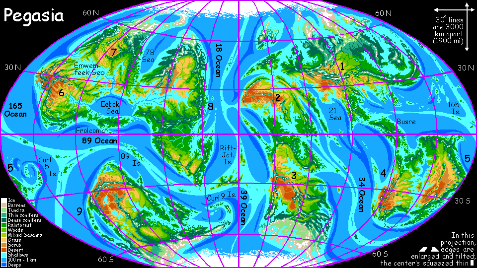
Pegasia's homepage - Map - Geography & climate - Evolution - Critters - Gazetteer - Sketches - More worlds? Planetocopia!
First-time orientation--strongly advised! Pegasia is weird.
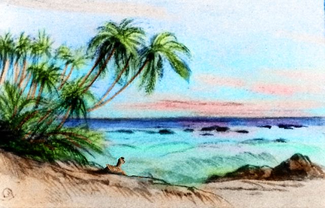
THE CURL 5 ISLANDS
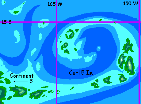
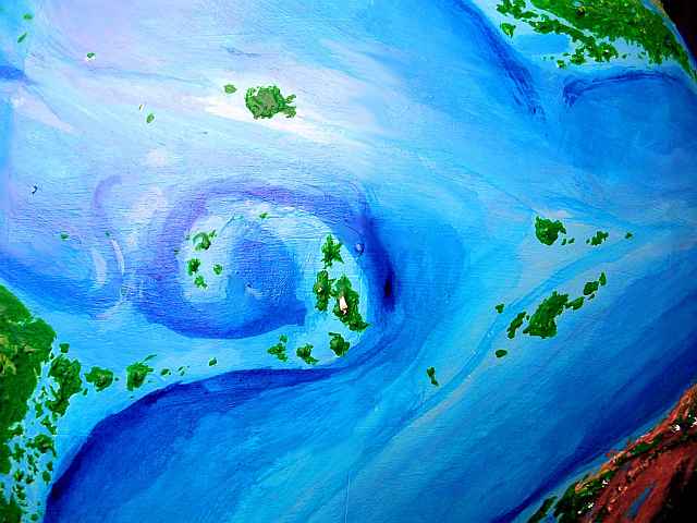
This name is just a placeholder, of course, given because this island arc curls out from the eastern tip of Continent 5. Their inhabitants will call them something more interesting--you tell me what.
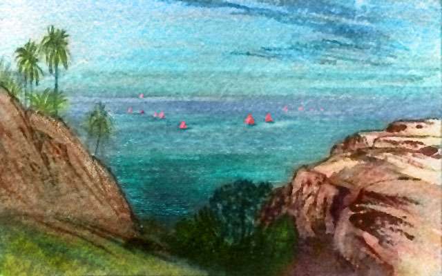
Oh, they'll definitely have inhabitants. Plenty of them. Fertile, warm and rainy, these isles are green nearly from the beaches to the summits of the highest peaks. Tall peaks on some islands cast a rainshadow to the northwest, creating mini-savannas or even pocket deserts. But overall, emerald.
The Curl 5 Islands have an importance out of proportion to their size, too. They may form a risky flyway all the way to Continent 6 and/or Continent 9 far to the east; they definitely create one--if a long, circuitous one--to Continent 1 far to the northwest.
UNDER THE SKIN
The Curl 5 Islands don't just have a Caribbean size and climate, they have a similar geological origin: a curving subduction trench just to the east. The rock forced under the island arc melts and returns to the surface in volcanic eruptions, maintaining the islands despite the heavy erosion of this rainy tropical zone.
Volcanoes dot the archipelago, relieving some of the pressure. The tallest two, on H-Shaped Island (please hurry up and propose some natives for this archipelago; these islands are hungry for names!) are 5 and 5.5 km high (16-18,000'); despite the generally warm climate they're snowcapped most of the year and even bear small glaciers at their summits.
THE OUTER ISLANDS
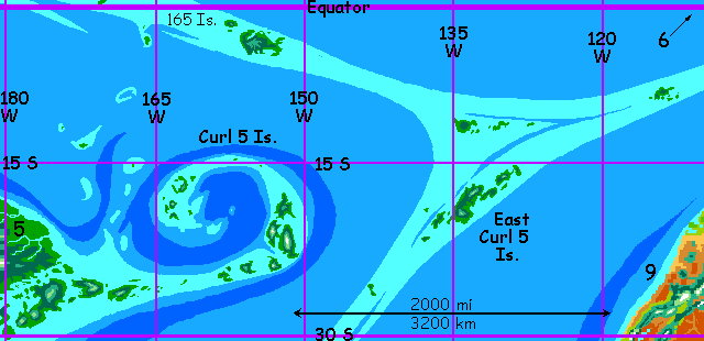
The East Curl 5 Isles are reachable only by ship or on the wing from the Curl 5 Islands. The group is Hawaiian in climate, but ten times bigger: the largest island is 500 km long (300 mi).
That lonely group two days' flight further east along the mid-oceanic rift, around 112 west, is still larger than Hawaii. It's one of the most isolated lands on Pegasia; it may not have even been discovered yet by Pegasians. If these distant islands have been found there's only one reason, and not for its own sake: local cartographers may have realized that these eastern islands come close to being a flyway between hemispheres, and sent out scouts to see if there's any way to reach the mainlands of Continent 6 or Continent 9 safely. This unnamed Hawaii is the best jumping-off point. Still, the orbital photos show over 1500 km of open, unbroken sea (nearly 1000 mi). But much of that sea is shallow, especially along the mid-oceanic rift, and even a single overlooked rock could make the difference. I've detailed elsewhere my growing suspicion (based on higher-resolution scans of our own seafloors) that Pegasia still has too few volcanoes peppering its seabasins and flanking its rifts, though I tried hard to correct what I did to poor Serrana and Tharn. Those endless bland basalt plains!
So I hope such islets are there. But the existing orbital photos do establish a maximum size for them; a few kilometers at most. Still, at this latitude that's enough to offer fresh water, shade, fruit, wood... if they're there at all.
What sorts of species? You tell me.
The gazetteer will have a full index of native placenames, with descriptions--once the contests's over and we have natives to name them.
World Dream Bank homepage - Art gallery - New stuff - Introductory sampler, best dreams, best art - On dreamwork - Books
Indexes: Subject - Author - Date - Names - Places - Art media/styles
Titles: A - B - C - D - E - F - G - H - IJ - KL - M - NO - PQ - R - Sa-Sk - Sl-Sz - T - UV - WXYZ
Email: wdreamb@yahoo.com - Catalog of art, books, CDs - Behind the Curtain: FAQs, bio, site map - Kindred sites