Abyssia: Agassiz
by Chris Wayan, 2012
for Louis Agassiz, geologist and dreamer
Abyssia home - down to map - building Abyssia - geology & geography - critters & cultures - the clash of names - more worlds? Planetocopia!
Abyssia: Agassiz
by Chris Wayan, 2012
for Louis Agassiz, geologist and dreamer
Abyssia home - down to map - building Abyssia - geology & geography - critters & cultures - the clash of names - more worlds? Planetocopia!
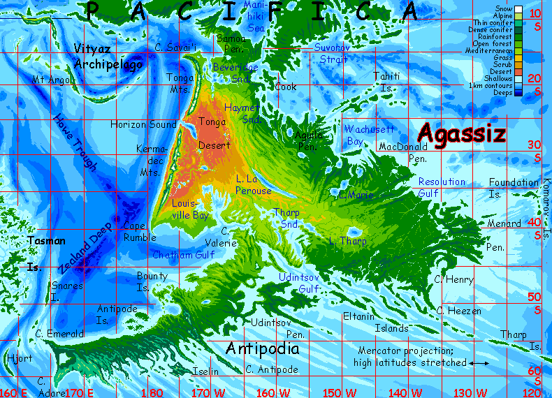
Welcome to Agassiz - North - West - Pits and Pitians - East - Prairie and Equi - Antipodia
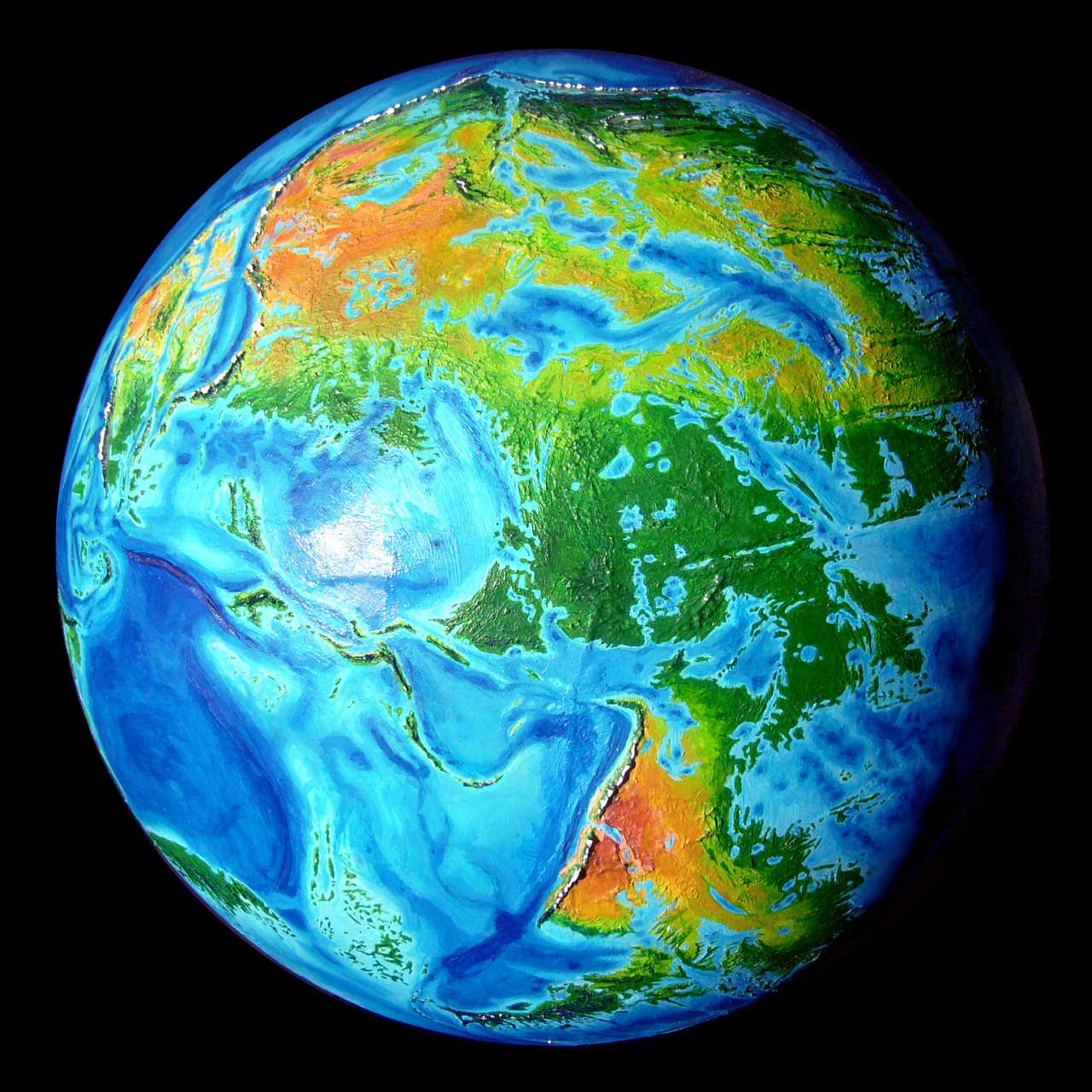
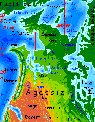
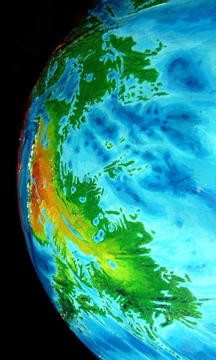
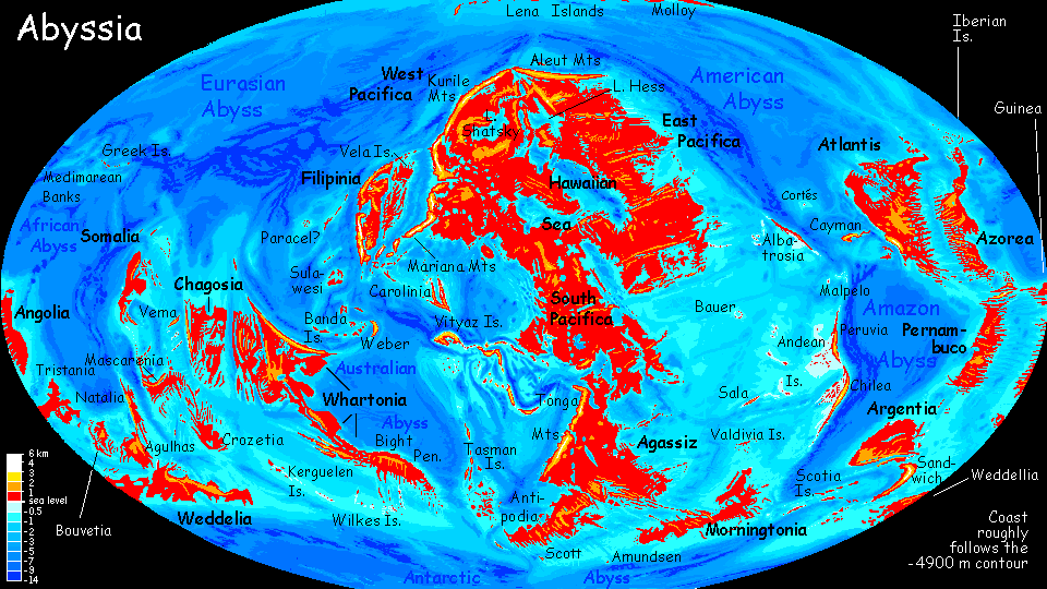
Agassiz is a southern continent (8 million sq km, or 3.3 million sq mi; bigger than Australia, smaller than Europe), east of our New Zealand. Agassiz is much like a half-size South America. The east is low, gentle, green, mostly forest, but with wide savannas inland; the west-coast mountains are the third highest in the world, over 5000 meters. Like the Andes, the mountains create deserts in their rainshadow.
Agassiz has three features not present in South America...
The first: the southernmost corner of Agassiz, its Patagonia so to speak, is nearly cut off--there's either a narrow isthmus, a canal, or a natural strait (almost certainly bridged). I'm not sure which, but in all cases Antipodia is close to southern Agassiz ecologically as well as geologically--probably culturally and economically too. So I've treated it here as part of Agassiz, not as a mini-continent of its own.
Second and more important: in the desert, the Louisville and La Perouse fracture zones run far below sea level; a few pitlakes here are as far as 3 km down, with utterly unearthly conditions along their shores.
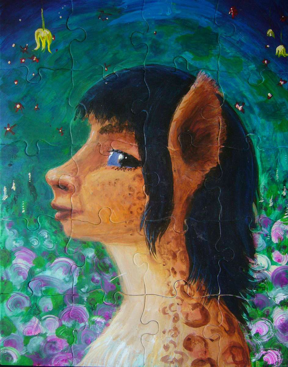
Third and most important: from that evolutionary crucible, some very strange birds will emerge--creatures with consequences for Abyssian civilization. For Agassiz is not South American biologically either. Intelligent fliers we'll have to call Pitians may emerge from those strange desert sinks. I say may not because I doubt that big, brainy fliers will evolve in such pits--they will--but because a second crucible exists to the north, in western Pacifica, even more favorable to megafliers in some ways--so both continents will evolve birds as smart as apes, probably several species of them; the only question is which megabird will slip into the spiral of brain growth, increased social complexity, tool use, language, and the further brain growth that leads to full personhood.
It's worth noting that even if the birds of Agassiz don't beat the Pacificans to the civilization prize, Agassiz as a whole will still not be an empty continent to be settled by primitives rafting (or flying) south from Pacifica. For the wide savannas to the east and south of the desert are remarkably like East Africa, and here it's mammals that make the leap: the Equi, gracile centauroid herbivores. So the issue's not whether explorers find natives or not; it's whether they find more than one species of local people.
Welcome - North - West - Pits and Pitians - East - Prairie and Equi - Antipodia
The far north is tropical. Most of the Samoa Peninsula is jungle, especially the north and east; the forest thins a little to monsoon woods inland.
But further south, around Beveridge Sound, the woods open to groves, meadows, and even some treeless savanna. We're still near the equator--why so dry? Blame those mountains on the western horizon--the north end of the Tonga Range. Even here the peaks are 3-4 km high (10-13,000') and they only grow higher to the south. They block rains from the west, though at this latitude, a summer monsoon sweeps in from the northeast, supplemented by light rains from the southeast spring and fall; these keep the grasslands green most of the year, though they dry and turn gold in the long winter dry season.
South of Beveridge Sound, Agassiz widens and we creep into drier latitudes. The east coast remains verdant, but inland the veldt widens, and becomes true desert at the mountains' feet.
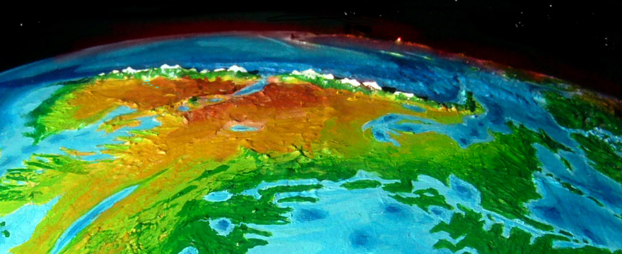
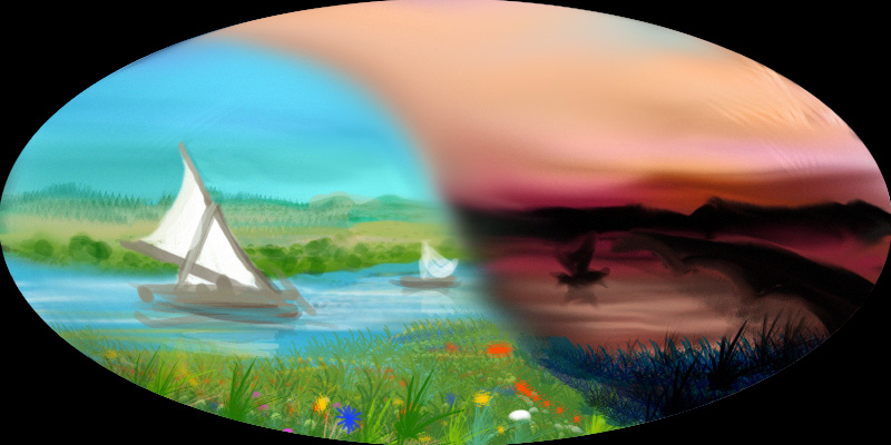
This low orbital photo taken near dawn catches the sheer height and abruptness of the Tonga Range. Oh--that pink spot on the horizon isn't lint on your screen. That's sunrise on snowy Mt Argo, taller than Fuji, in the Vityaz Archipelago 2000 km west of Agassiz.
South of Beveridge Sound, Agassiz widens and we creep into drier latitudes. The east coast remains verdant, but inland the veldt widens, and becomes true desert at the mountains' feet.
Welcome - North - West - Pits and Pitians - East - Prairie and Equi - Antipodia
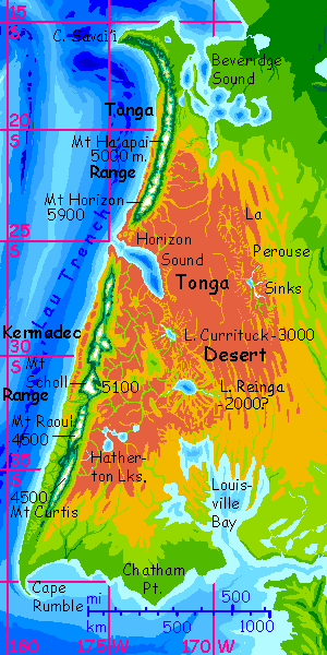
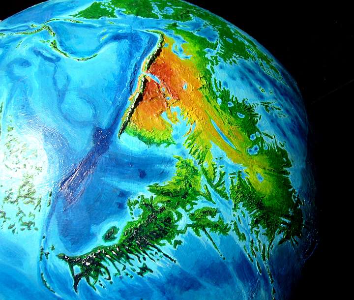
The coastal ranges here are the second highest in the world. The Tongas in the north rise to 5900 m (19,350'; like Kilimanjaro) and the Kermadecs in the south top 5100 m (nearly 17,000'). And that's only their visible half; they rise from offshore trenches another 5 km deep. Measured head to toe they're taller than the Himalaya.
That fact tells you that western Agassiz is a land under ongoing tectonic pressure. Volcanoes, quakes and tsunamis are common. Whoever lives here, they won't build cathedrals. Or anything much, right down at the waterline.
Much of the west coast of Agassiz is dry; the prevailing winds are off the land, not the sea, and rarely bring rains. It's not as extreme as the Bolivian Andes and the Atacama Desert--only the middle is truly desert to sea level, around Horizon Sound (like an axe-gash splitting the Tongas and Kermadecs). The slopes of the Tonga Range get summer rains; the Kermadec Range, summer fogs and light winter rains. Or snow. Yes, tropical snow--the twin ranges are so tall they both get significant snow despite the low latitude.
Not only is the climate like Baja California, Namibia or Atacama, so's the fishing: in most years those seaward winds blow surface water offshore, causing deep water rich in nutrients to upwell, creating some of the richest fishing in the world--and that's saying a lot on Abyssia, with its vast teeming coral reefs. Fishing villages will thrive--though only at the mouths of perennial creeks, snowmelt-fed. Irrigating these sunny coastal valleys will yield rich crops.
Pleasant beaches, too. I've focused on the big picture so far, but here's a close-up for you: half a dozen pebbles on a duny beach below Mt Scholl. Fog keeps the sand relatively damps and clingy, while the wind picks at it; the combination left each pebble on a wind-sculpted ramp of sheltered sand. Micro-Sphinxes!
By the way, there's a theory that the Egyptian Sphinx wasn't built from scratch--it may have been, 6000 years ago, a big wind-carved hoodoo vaguely suggesting a sphinx; the ancient Egyptians saw the resemblance and carved it into clarity. I find it quite plausible, since all over the Western Desert, quite sphinxlike hoodoos crouch. After millennia of sandstorms, that's what resistant rocks leave.
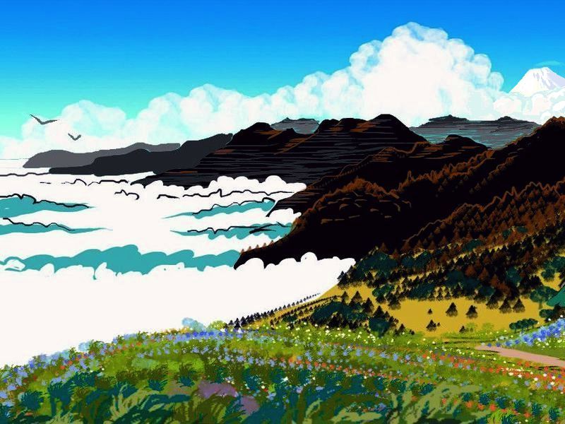
South of Mt Raoul, down to Cape Rumble, the coastal hills grow steadily greener. Summer fogs and more reliable winter rains--more San Francisco than the antipodean Malibu behind us. Savanna, scattered trees at first, then luxuriant forests.
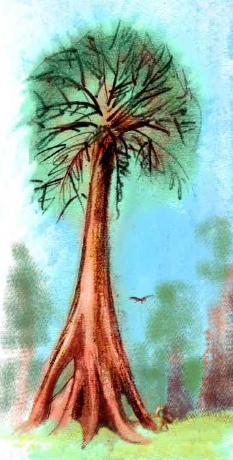
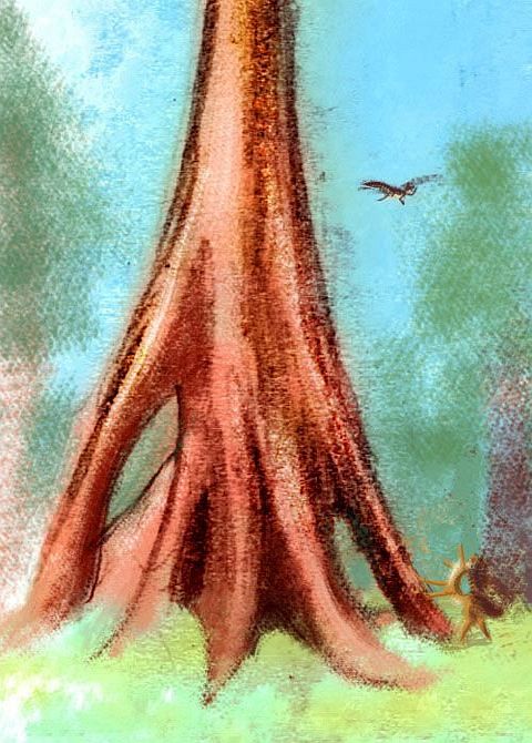
Past Cape Rumble, east around Chatham Point to the mouth of Louisville Bay, storms blow in from Chatham Gulf to the south, not just the west. In sheltered lowlands here you'll find some of the biggest trees in the world. With their shaggy red mammoth-hair bark, feathery leaves and massive buttresses, they look like monster cousins of Earth's dawn redwoods; and they are. Redwood species are more common on Abyssia; only the Ice Ages shrank their range and numbers on Earth. Close relatives of our Big Trees do well all over Abyssia on west coasts around this same latitude, as in Pacifica's Mariana Mountains, or on Atlantis's Laurentian Peninsula.
|
|
Welcome - North - West - Pits and Pitians - East - Prairie and Equi - Antipodia
Climb east over the mountains to the inland plains around and you're in another world--warm dry winters, with occasional savage thundershowers in the scorching summer. Some summers. As sharp a contrast as driving inland from Los Angeles over the mountains into the desert! Though central Agassiz isn't quite as dry as our landlocked Mohave, for the gulfs to the east do bring a little rain. Still, it's one of the driest deserts on Abyssia.
The Agassiz Desert has some very strange places. On most of Abyssia, the inverted equivalents of our volcanoes become pits--deep lakes on land, mere blue holes if they're offshore. But in the deserts of Pacifica and Agassiz, a few of these pits yawn miles deep! Their lakes have receded until the evaporation off their shrunken faces drops to match their scant inflow. Modern Earth's closest equivalent, the Dead Sea, is just a few hundred meters down. These are thousands! On Agassiz, they sink as much as three kilometers below sea level--10,000'!
And in their depths, on the shores of tiny briny seas, along creeks that are more waterfall than stream, life has adapted to what might as well be another planet entirely. Oven-heat, salty and alkaline soils, yet weirdly humid, with mild sun and little ultraviolet--you slowly bake but never sunburn in that hazy light. Strangest of all, air pressure rises down in these pits--up to 1.7 atmospheres!
In these high-pressure pits, the size-constraint on bird-intelligence is lifted; if there's social pressure toward larger brains and higher intelligence in the "handed" Abyssian equivalents of psittacines or corvids, here the body can indulge it; the maximum flight-weight is double Earth's. There is a mild counter-pressure: summer and winter, it's relentlessly hot here. But that can be solved by nocturnality, ranginess, pale colors, less down--or vulturelike baldness except on the vital wings and tail.
Louisville Trough is the most promising, for it slashes diagonally through the driest part of the desert, from Horizon Sound to Louisville Bay. Most likely the deepest of these pits is the Currituck Basin, in the north, 3.2 km deep. Lake Currituck gets some runoff--though not from seasonal rains but from snowmelt alone--and only from the dry side of the Kermadec Range to the west. So I think the lake surface will be about 3 km down. Here the air is densest and the smallest wings are needed. The huge, intelligent fliers of these pits could be considered island gigantism of a sort--if you see the pit as a sky-island in reverse, an island of supportive air in a sea of avian discouragement. Oasis gigantism!
Well, our wise bird wouldn't have to be gigantic; a wingspan of three or four meters perhaps, little wider than Terran albatrosses or condors, though I'm sure they'd be stubbier, with a bigger wing surface; a body weight of 10-15 kilos (22-33 lbs; African bustards this heavy can get off the ground in just one atmosphere, though they're poor fliers). That's plenty big enough to support a brain weighing 200 grams. Seem small? These aren't sloppy mammal neurons! A raven brain is under 20 grams and it reasons just as well as a 600-gram chimp brain. Better, if you ask the raven.
Once evolved, I don't think this tribe of birdbrains will be trapped in its air-womb forever. Terran birds can handle half their natal air pressure; wing designs naturally have a large safety margin. Eventually our big-brained flier will emerge from the crucible by settling progressively shallower pits, like Haymet Lake to the northeast, 2 km down, or Reinga Lake to the south, anywhere from 1 to 2.5 km down--it's a desert lake too, but the Hatherton Lakes upstream, at the foot of the Kermadecs, collect more snowmelt; though the Reinga Pit is bigger and deeper than Currituck, the lake will be larger and deeper too. But that means more evaporation... it's hard to know where the shoreline will be. It'll surely vary a lot over time.
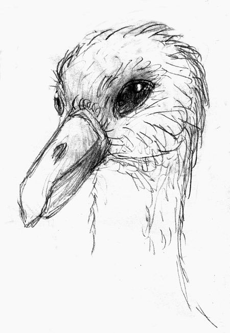
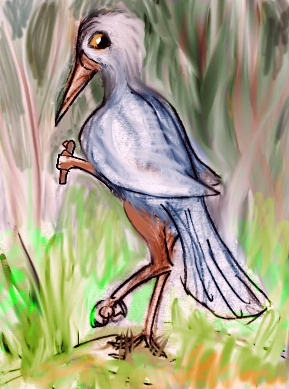
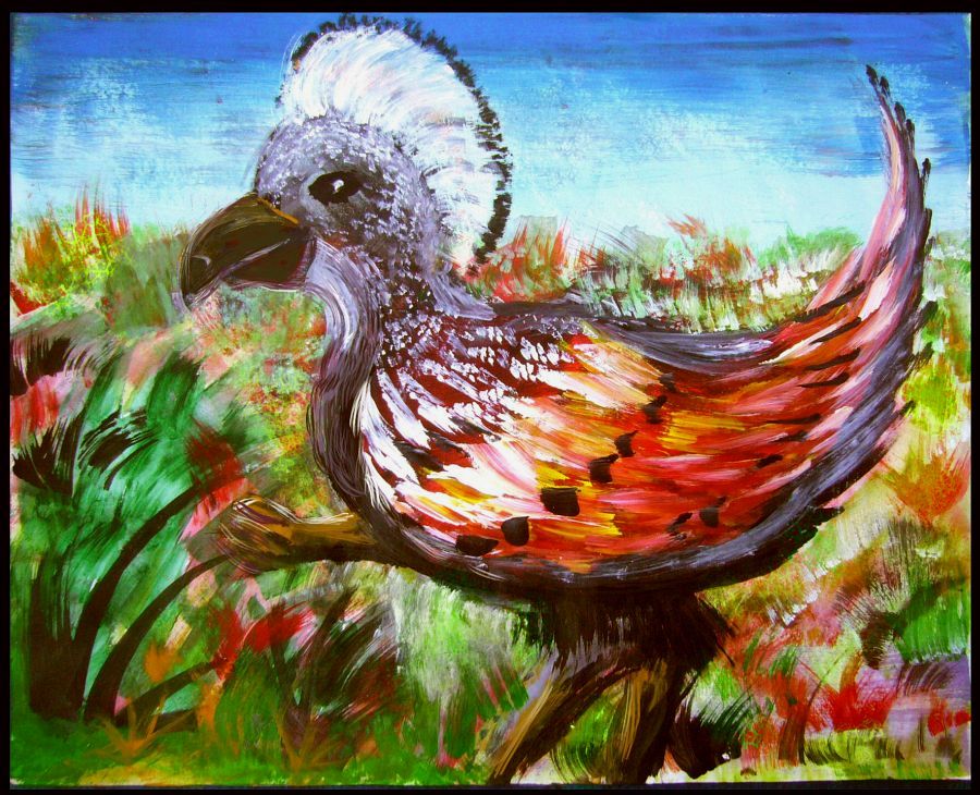
Perhaps our wise birds, our Pitians, will dwarf a bit as they climb out, perhaps become ungainly fliers, perhaps staying flightless longer than most chicks, perhaps needing quite a long runway, like swans, perhaps (in a word) vulnerable; but still the only people on Abyssia with speech, hands, and flight. Species can often radiate, once they've worked out their design bugs in a friendly oasis. Intelligent species will adapt--once they've evolved intelligence.
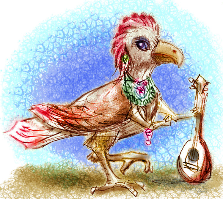
So which of these sketches will turn out to be realistic and which fanciful I'm not sure yet. But I thought I'd give you a range. A crested cockatoo-musician a meter tall, a woman so small she can perch on a branch like a raven (just with four times the brainweight and small hands tucked under those wings), a gullish head the size of a human child's, a big-headed heron two meters tall, a cassowary-ish giant barely able to fly at sea level...
|

|
|
|
|
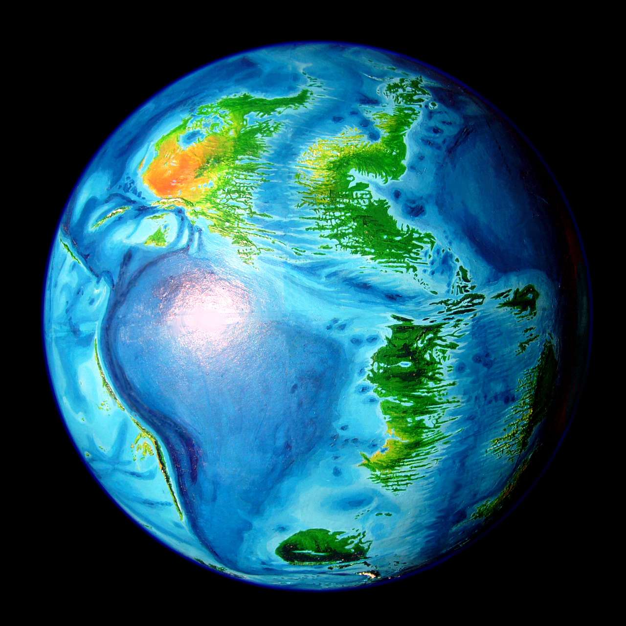
Welcome - North - West - Pits and Pitians - East - Prairie and Equi - Antipodia
The east is warm and green. Capes and sounds and pitlakes--though here, unlike the desert, these deep pockets fill to the brim and well over, forming lake-chains.
The Aguila Coast is clad in great broadleaf forests, though they slowly fray to prairie inland.
The Andean Ocean to the east is wide, and even fair-weather swells are formidable; typhoons can whip up huge waves. The coasts get enough salt spray to discourage most trees; many ridges above the Agassiz coast have prairie or open heath for a mile or so inland. Wide views, especially where the hills reach the sea--Cape Aguila, around Legouve Bay, and Point Resolution.
In the northeast: the Tahiti Islands. They're the Abyssian inverted equivalent of a deep crack that cuts across the three island-chains of our own Polynesia. Since they're surrounded by wide seas at the same latitude as our Polynesia, I think you can figure out what sort of climate they have...
South of the Tahitis are the forest-lined fjords of the Wachusett Gulf. Misty cliffs, crags, waterfalls, lush lowlands. Like a whole coast of Mooreas!
Further east, the Macdonald Peninsula is the climax of these subtropical forests--not quite Amazonia, but perhaps primeval Carolina (pre-druglord of course. The Old South was a mighty big wood before the tobacco barons razed it).
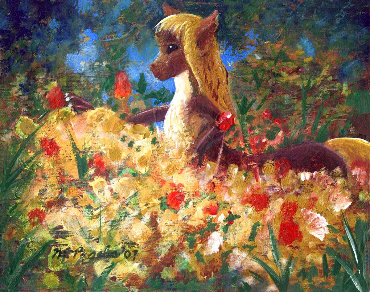
Like the rainforests of eastern and southern Pacifica, these lands are farmed in a pattern unlike anything Terran: in forests all over the Pacifican hemisphere, the dominant Agassizian people are the kasowar, tall, storky, flightless birds who aren't truly arboreal but are much more comfortable high in a tree than most humans are (their wings won't lift them, but they will slow a fall).
Kasowars don't hunt or forage much on the shadowy forest floor--slim pickings down there! Nor do they slash and burn to let in the sun, as humans do. Instead the Kasowar cultivate and harvest fruit, greens and nuts high in the forest canopy. The tall woods of the Macdonald Peninsula and around Resolution GuIf look utterly wild to us, but it is farmland. Just thirty to fifty meters up!
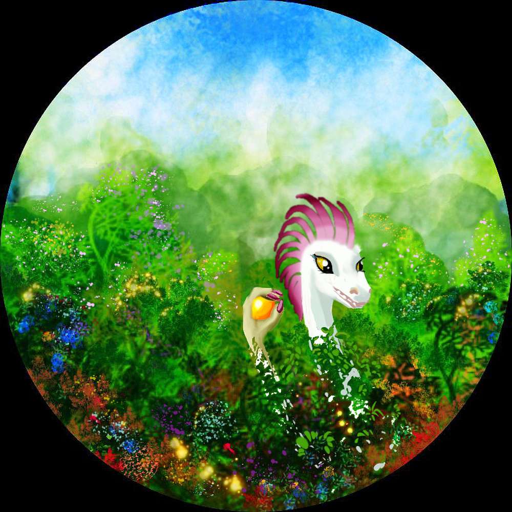
Oh--the sketch shows what appears to be a crested dinosaur not a bird. Teeth, not a beak. That's what an Agassizian kasowar looks like. She's still a bird as Abyssians define birdness. Quite a few avian lineages here look rather like feathered dinosaurs to us. Why are birds here more diverse?
Abyssia is Earth; its mass and orbit are the same. So, therefore, is its history of impacts. About 66 million years ago, a huge comet or asteroid struck our Yucatan Peninsula, near the present town of Chicxulub. It hit Abyssia too--but here, Chicxulub is deep featureless sea, several hundred kilometers northeast of Albatrosia. The impact spread a cloud of vaporized basalt and steam, but not limestone (carbon-rich). After the firestorm, shockwave and worldwide tsunami, the darkness was briefer--months not years--and the climate less destabilized (on Earth, the pulverized limestone and steam reacted to form carbon dioxide... causing a worldwide heatwave after the worldwide winter).
There's a rival theory that what really killed off the dinosaurs were the huge eruptions of the Deccan Traps--climate swings, CO2, sulfur (acid rain!) ash, lead, and mercury. Suppose this theory is correct; then Abyssia still comes out ahead. Here, the Deccan is miles deep; just another basalt plain. Deep-sea eruptions just don't do as much damage.
So either way... with smaller climate swings, more small Abyssian birds and mammals survived. Some bird lineages have teeth, feathered snouts not beaks, and other traits our birds lost in the holocaust.
The Pacifican species to the north truly looks like a Terran bird (except of course for the clever forehands). The Agassizian one is quite unrelated--they can't crossbreed. They're just physically and functionally rather similar. Similar rainforests, similar pressures... convergent evolution. The Abyssians aren't fussy; they call both species kasowar.
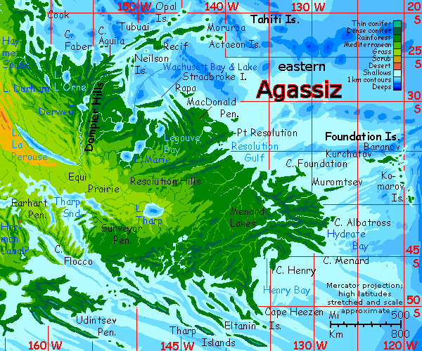
In the far east: the Foundation and Komarov Islands: an arc 1600 km long, reef-girdled until the last of the Komarovs, which drop abruptly into deep water: the East Pacific rift zone. They look lonely, on the edge of the map, but they're busy places--Port Baranov on the largest of the Foundations is the way station to Sala-y-Gomez and the Lima Strait, leading to the vast lands of Atlantis.
Because Abyssia's seas have more shallows and islands than Earth's, transcontinental exploration started early; there are island-chains leading even primitive sailors on deep into the sea, to the next isle on the horizon. There just aren't many islandless blue wastes such as Magellan or Columbus faced. So even though Abyssian technology as I've projected it seems simple, more Polynesian than clipper-ship, world trade and travel are routine. Port Baranov will know all the news from Atlantis before mainlanders do.
The eastern tip of Agassiz is the Menard Peninsula, another dense forest the size of France. A little warmer, though. But only a little. We're now at latitude 40-45°, and there's no Gulf Stream here. On the other hand, there's no Antarctica or Greenland, either. So Menard's woods do see snow, but not much and not often.
But the far southeast around Henry Bay and Cape Heezen gets snowy winters. We're in the temperate zone now. My orbital photos make Eastern Agassiz seem to be one undifferentiated mass of green, but on the ground, these forests look and feel very different--from a vine-woven green jungle wall, to temperate woods seasonally changing color and opening as leaves fall, to relentlessly somber conifer forests in the uplands and southern shores.
Off Cape Heezen are the Tharp Islands, a chain of long narrow whalebacks (a dozen or more of the Tharps run over 100 km long), leading 1600 km east to the small continent of Morningtonia. Cool, damp, dark-forested, the Tharps anticipate what travelers will face on Morningtonia: a pre-agricultural Nordic forest fraying in its uplands to alps and ice. Like a few Swedens plus a Germany or two.
The Tharp chain shelters the southern shore of Agassiz all the way to Cape Eltanin. Blizzards are mostly spent on the Eltanin Islands, the furthest chain offshore.
Tharp Sound is a complex wedge of inland water whose fingers alone are larger than Delaware Bay or Puget Sound (and far deeper; Earhart Bay is at least 3 km / 2 mi deep). From its narrow mouth, only 30 km (20 mi) across, Tharp runs 500 km inland, then splits, spreading fingers another 500 east, west and back south.
Without the moderating influence of its waters, central and southern Agassiz would have searing summers and harsh winters. But the shores of the Sound are wooded and the prairies inland, while sunny, are emphatically not our dusty Central Asian steppes...
Welcome - North - West - Pits and Pitians - East - Prairie and Equi - Antipodia
Long narrow Lake La Perouse is the Lake Tanganyika of Agassiz--just four times as deep. Its long fracture-valley yawns far below sea level; the question is, are the prairies around it rainy enough to fill the lake until it spills over, flushing accumulated minerals and leaving it fresh, or will the lake be below sea level, without an outlet, and brackish?
If Lake La Perouse reall is below sea level, it may function as a halfway house for the fliers that will evolve in the deep pits of the desert to the northwest--both mammals (flying foxes really the size of foxes!) and birds (large enough to have human or superhuman brains). Once they've evolved in deep pits like Lake Currituck, with high air pressure, such pit-creatures might radiate to the pitlakes along the La Perouse fracture--a hot valley with dense air, but nearer Earth-normal. If they can adapt well enough to fly here, a kilometer or two down, they may be able to make it at sea level eventually--with all the momentous consequences for Abyssian civilization that intelligent fliers imply (see Peoples of Abyssia.
Still, I think it's likely La Perouse will get enough rain to overflow, and stay fresh. It's not all that far inland, and the savanna around it isn't that dry. So I suspect the population will be more pedestrian.
Literally, I mean. Walking around. Sigh.
To the southeast is Lake Tharp, a classic pitlake three miles deep. Nearer the rainy east coast than Lake La Perouse, Tharp will almost certainly fill to the brim, and be freshwater. About as much fresh water as half of all Earth's lakes combined.
The Legouve Lakes, a pitlake-chain of three lakes each triple the depth of any on Earth: Marie, Therese and Legouve proper. They empty into Wachusett Bay. Definitely fresh; we're near the coast and in a rainy zone.
The Tharp Sound complex I've already mentioned. All these large bodies of water moderate what would otherwise have been a continental climate from what could have been near-desert steppes to grassy prairies with trees along creeks.
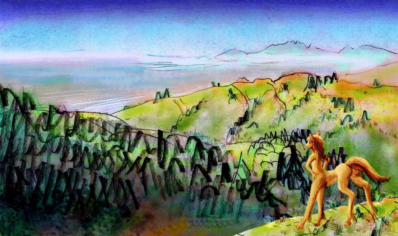
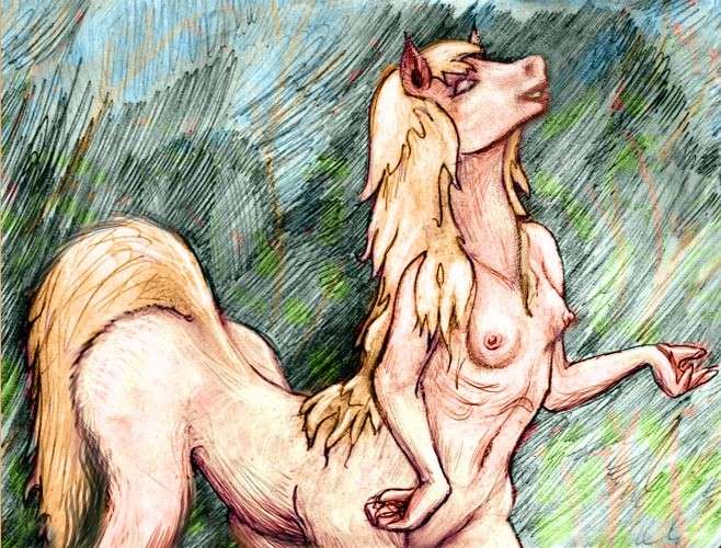
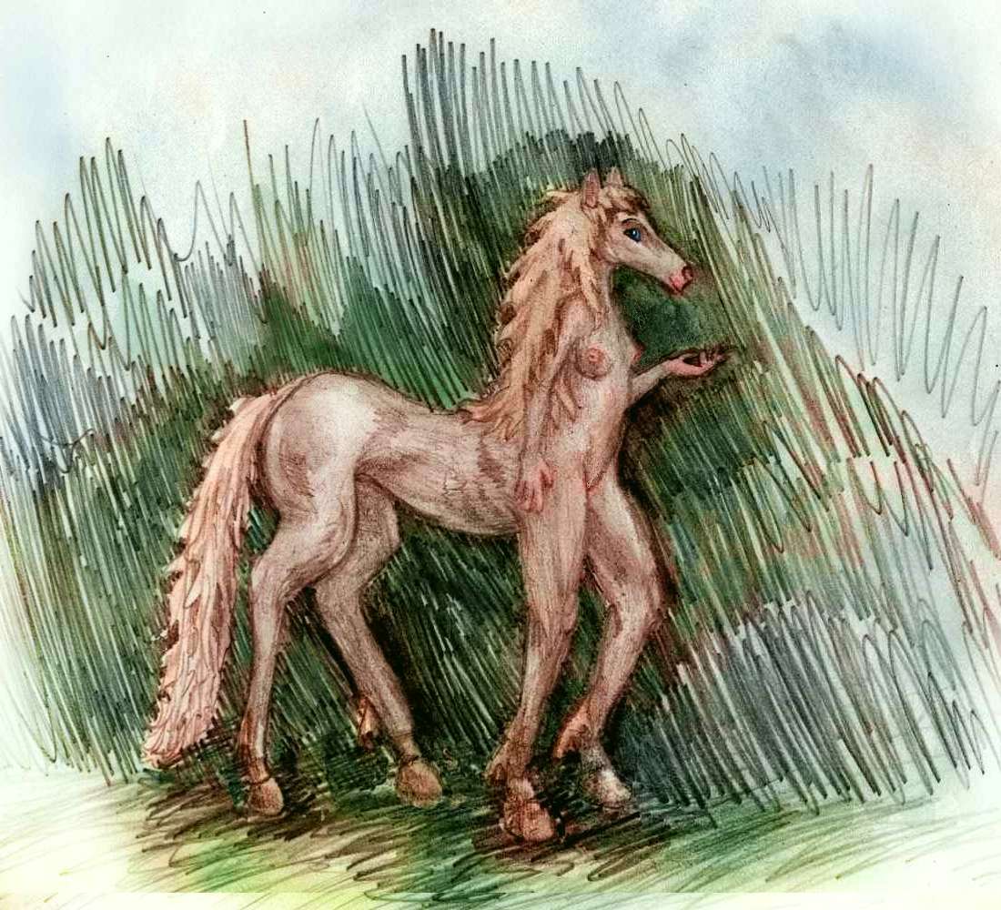
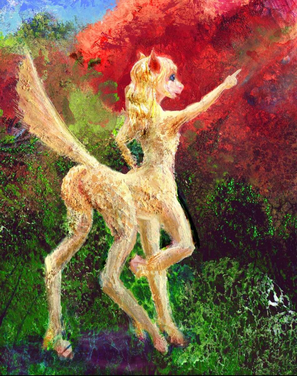
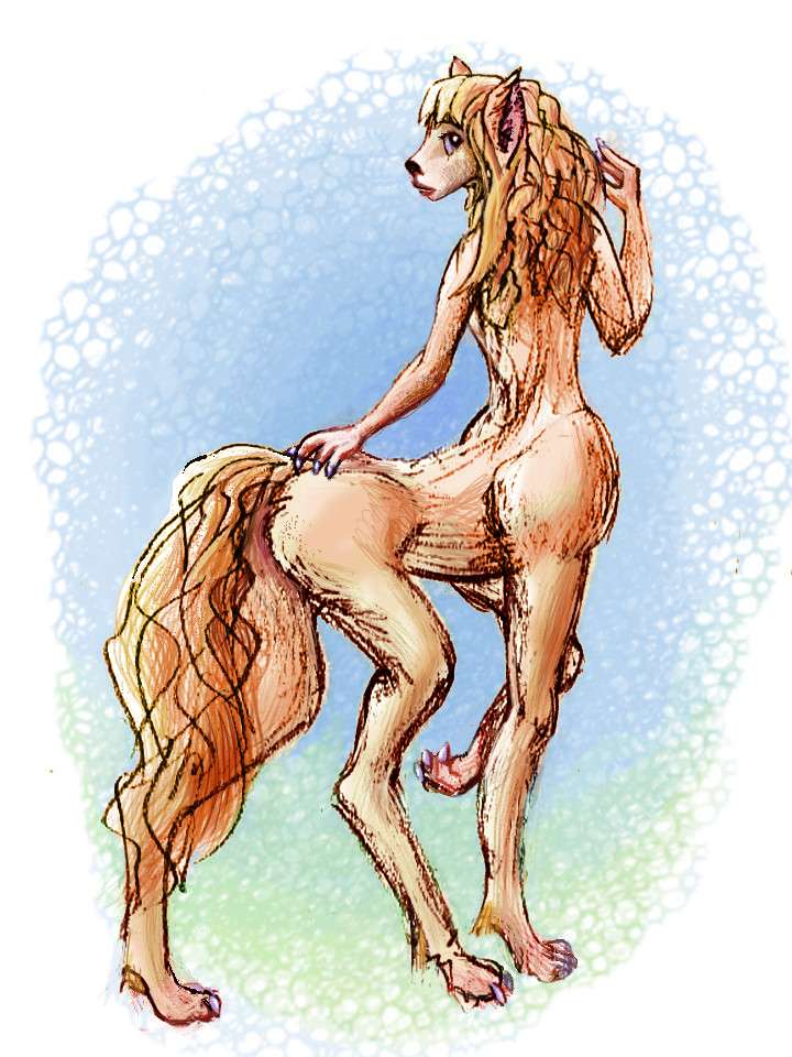
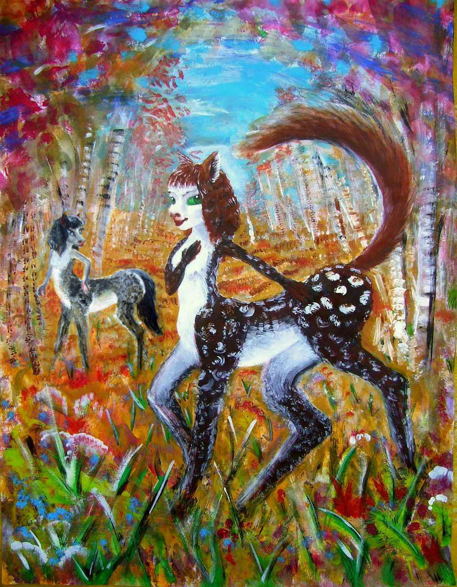
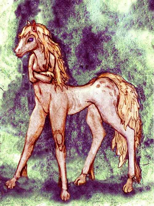
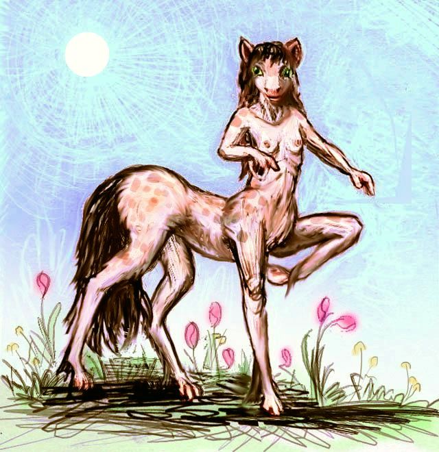
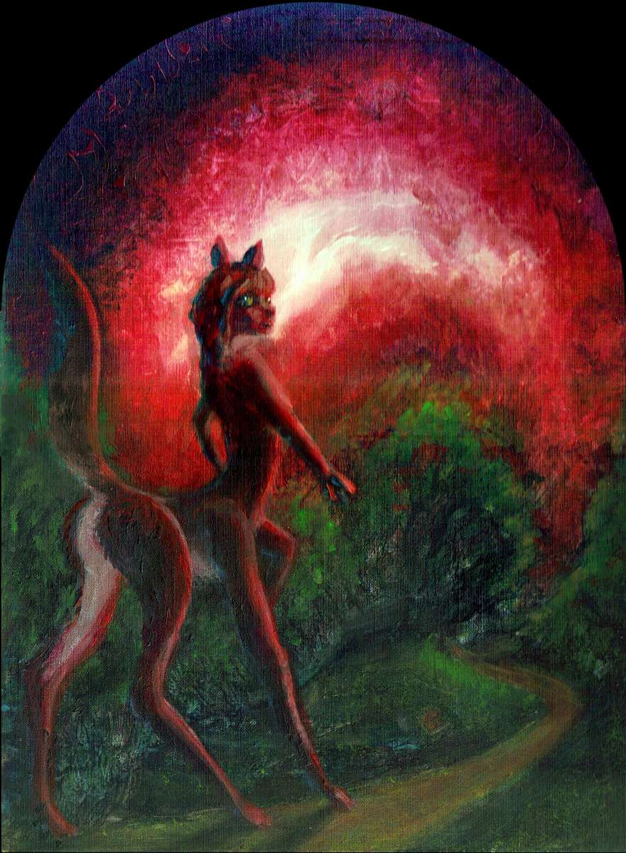
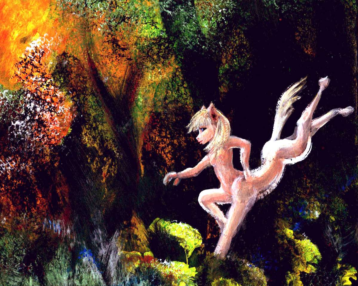
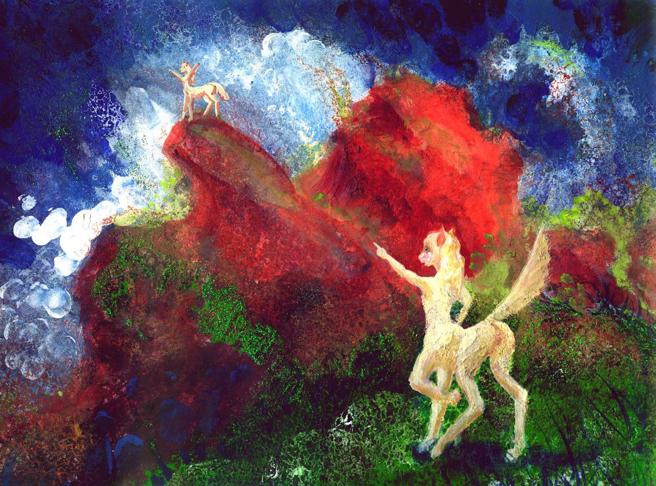
These prairies are the heartland of the Equi, gracile centauroid herbivores about the size of a deer. These amiable people aren't really much like Greek centaurs; more like horsetailed antelope-taurs, or a skinny pony with small forearms emerging from its neck. Equi aren't even very equine: they have paws not hooves, most likely. Hmm. More like llamas? Remember how smart llamas are!
That big brain hides behind very diverse faces, though. Pelts vary by tribe, but so does the cranial index--from long narrow equine/cameloid skulls to almost human (vaguely Neanderthal) proportions--a snout with little chin and low forehead. But wide cheekbones, no brow ridges, and the wideset eyes of an herbivore, though in fact Equi still have a broad field of stereo vision--fruitpickers and tool-users need to judge distance just as accurately as predators do. The facial variation, much more extreme than in (modern) humanity, may be mostly sexual selection and drift, or it may may reflect diverse tribal diets--how fibrous, how many nuts? How much jaw do you need?
|
|
|
| 
| 
| 
|
| 
| 
| 
|
In recent centuries, with the rise of trade, tribes have interbred, borrowed crops, and taken passage to distant continents, so a modern Equi's subspecies says little about her lifestyle. Geographically, too, the Equi have spread far beyond their origins: they're now ubiquitous in the opener lands of Agassiz, and not rare in the forests and even port cities.

To right: an equa from the muggy woods of northeast Agassiz--lanky, gracile deerlike frame (for heat dispersal), short white pelt (ditto), large mobile ears (in dense forest, locating sound matters), small size (forest species tend to run smaller--easier to slip between trees), rather short, feline faces with large catlike eyes (efficient light-collectors are vital; it's shady down on the floor), black mane and tail (beats me why; they're Welsh, I guess).
From the ports, modest numbers of equi emigrated to settle savanna regions all around Agassiz: the northern Tasman Archipelago and beyond, on Whartonia and the other lands of the Indian Rise. Perhaps more surprisingly, they've spread to windward too, in the Andean Islands and the less chilly parts of Morningtonia--the Humboldt Peninsula and the Valdivia Islands.
They're not common in Pacifica to the north, despite lots of prime equi habitat, for foxtaurs already occupy the niche. Nor are they common in the Atlantean lands of the eastern hemisphere, where leptaurs predominate--and they too prefer savanna.
Ports, though, are another matter; in many, you can see all three mammalian species rubbing shoulders (and more than shoulders, often enough; affairs with other species might shock them back on the prairie, but sailors and cityfolk learn tolerance--or else).
Welcome - North - West - Pits and Pitians - East - Prairie and Equi - Antipodia
Antipodia, the southern subcontinent of Agassiz, was one of the hardest areas in the world to map. The reason? Bad mapping in our world. The shallows around New Zealand are well sounded, but this region southeast of the islands is remote and landless, with wretched weather, so the seafloor here is largely mapped only by gravitometric data from satellites, not sonar soundings. The general shape of Antipodia is clear, but coastal details are guesses.
Antipodia's name is as problematic as its coast. The name's unavoidable; like most placenames on Abyssia, it's derived from the true name of this region on Earth--the Antipode Basin. Antipodes are exactly-opposite points on the globe. Antipode Basin is a logical name--it's directly opposite Greenwich Observatory--latitude 180 instead of 0, 50° south instead of north. The region furthest of all from the center of Astronomy, Navigation, Cartography, and (in all British Imperial modesty) Civilization.
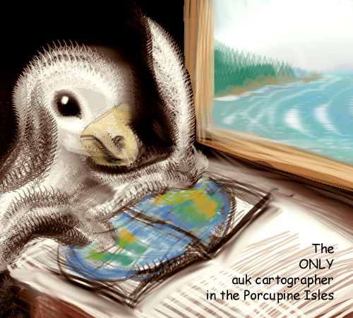
But on Abyssia, Antipodia's antipodal to... not much. The nearest land is modest indeed: the Porcupine Islands north of Azorea. Cool green baby Irelands, inhabited only by fishers, foresters and shepherds.
Not human ones, of course. Abyssian equivalents of great auks--huge penguinlike flightless birds. Yes, they have hands and speech, and even, a few of them, literacy; but they're on the very edge of Abyssian civilization. They will not be building Greenwich Observatory, or declaring their home islets Latitude Zero. Not anytime soon. It's Antipodia itself, as a temperate lobe of the world's land hemisphere, that's more likely to be close to the heart of things.
So I guess I must announce that by an amazing coincidence the phrase where it's at, or the heart of hipness, uttered in Equi (the trade-tongue used all over Agassiz) is pronounced: Ann-ti-pohhhhh-di-ah.
Science is a wonderful thing.
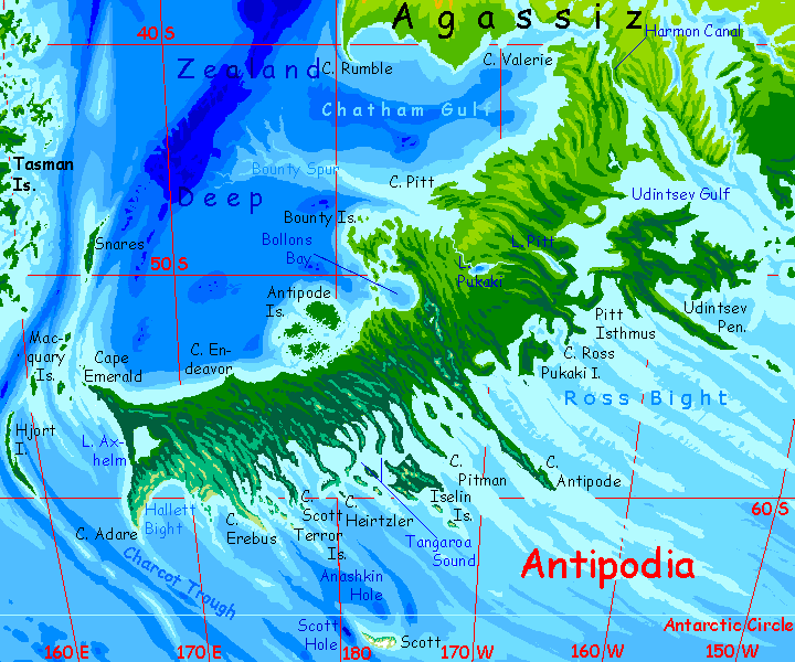
Is Antipodia a peninsula or a huge island? It's hard to be sure. Harmon Sound either narrows to a shallow strait just a kilometer or two wide and a few fathoms deep as it links to Chatham Gulf, or it becomes a low, near sea-level valley. I've mapped it as the latter, which I consider slightly more likely.
If it's a channel, I'm sure the natives will have built a bridge--it wouldn't be hard. Not too wide or deep. If it's an isthmus, they'll have dug a canal. Harder, but...
... they'll be motivated. Not by saving time and money. Those are nice, but a canal won't just shorten trade routes. It's a survival issue. Abyssia's polar seas are milder than ours, but Antipodia stretches very far south indeed; the weather around Cape Adare (62° south) will be nearly as foul as off our Cape Horn (55°S). And the jagged capes and reefs off southern Antipodia make it a deadly place to sail past--rocks and stacks rise from the gray sea even hundreds of kilometers out. Locals no doubt can sail it with confidence--in good visibility, in shallow-draft boats--but it's a ship-killing coast.
The Harmon Canal won't be that hard to dig; the terrain is flat, the distance is short and the climate's mild--neither the deserts of Suez nor the fever-jungles of Panama. Really, they'll only need to dredge the rivers winding along the valley floor, and link them near their headwaters.
So they'll dig a canal, even if it's a modest one by our standards. Even preindustrial people will manage it.
Unlike its coastline and name, Antipodia's climate is both clear and quite unlike Earth's at this latitude. With no Antarctica to cool them, Abyssian lands 40-60° south are much milder. The northern half of Antipodia--the lands around Udintsev Gulf and west to Lake Pukaki and the Bounty Islands--is mild-temperate like southern Agassiz, with occasional winter snows but mostly rains. More northern France than Scandinavia or Patagonia--not even England.
The southern half is distinctly cooler. Antipodia's mountains are low, but at these higher latitudes, they hang onto winter snows well into summer, and you'll even find glaciers in the far south. Think Scotland to southern Norway.
Why not think New Zealand? The wet, misty forests of South Island's west coast (e.g. Milford Sound) would look familiar enough to an Equi or Pitian. But inland, the rawboned wilds below the Cook Range (the stage-set for The Lord of the Rings) would shock our Antipodians. Without an Antarctica's cold dry winds, east Antipodia's mostly wooded, not rangeland and barrens. Only in the far south near Cape Adare do the winds stunt and blast the trees, leaving chill grasslands--not quite tundra, since Abyssia hasn't suffered a recent Ice Age and the ground's not frozen... but cold.
The long rugged capes and "fjords" along the east coast, though dangerous to sail in unless you're a local, have many sheltered north-facing escarpments with shores at their feet unexpectedly warm for these latitudes--broadleaf forests and meadows more Delaware Bay than Labrador.
These aren't true fjords of course--not ice-carved, but born of slippage as the Pacific Trough either spreads or sucks in crust--given Abyssia's inverted geology, it's hard to be sure if this is a spreading zone or a slurping zone! But whichever it's busy doing, it's doing it unequally--fast in some stretches, slow in others. The borders between strips grind and jostle, creating cliffs quite as impressive as any gouged by ice--and microclimates making parts of this coast quite pleasant. Though everyone lives on the sunny side; the ridgetops are all stones and tussocks, and the shady south-facing slopes are pasture and woodlot and wilds. Dark damp mossy woods. Brr.
ANTIPODEAN ISLANDS
Little to say about the islands off the southeast shore; they're part of the false-fjord complex and have similar climates: pleasant when sun-facing and out of the wind, dark-forested on the north and east shores, and grass or bare rock on the heights where the wind really blasts.
Off the western tip of Antipodia, the Macquarie Islands are also Scandinavian. Their main interest is that they're stepping-stones to the Tasman Archipelago to the northwest, and a whole hemisphere of islands and continents beyond. If any Abyssians can fly, they'll cross here; if not, it's likely early mariners will. Since Agassiz and its northern big sister Pacifica are so large and diverse, it's more likely intelligence will evolve there and spread west, through either the tropical Banda Islands or here through the Macquaries. But it could go the other way; maybe Atlanteans will discover a New World twice the size of the old!
Snares, a long thin island well north of the Macquaries, is lonely but much milder in climate; pleasant if isolated. It's quite large, 270 km long and up to 25 wide (160 by 15 mi).
The largest island is Hjort, in the south: a mountainous sliver of Nordic forest and heathy uplands nearly 500 km long and only 50 wide (300 by 30 mi). It's so far south you'd expect it to be pretty dreary, but its mountainous spine rises across the prevailing subpolar winds; so lee shores, in the northwest and around central Hjort Bay, are pleasant and densely settled. Denmark not Siberia. They're here for the fish: the winds generate steady westward currents, and on lee coasts, surface water's blown away from shore; deep nutrient-rich water upwells, and fish swarm close in.
800 km (500 mi) south of Antipodia rises one last island: Scott. It's just east of our own world's Scott Island, which is just the summit of a whole arc of seamounts around a deep hole. Inverted, on Abyssia, we get an arc of deep blue holes around a single teardrop-shaped island a good 160 km long and half as wide (100 by 50 mi). The south shore almost reaches 69° south. Not quite the record: 1200 km to the southeast lies Amundsen, at 71° south--the only other land past the Antarctic Circle, seeing the midnight sun.
But Scott is much colder than Amundsen--the coldest place in this hemisphere. For its volcanic central peak is over 1600 meters (over a mile)--though that's revised downwards from my earlier estimate of 2600 meters or 8600'--at this latitude, either figure is fatal! Glaciers mantle the peak and grind down to the shores, covering most of the island. Parts of the sun-facing north shore, and Cape Anashkin (well northwest of the glaciers) are at least ice-free. Rocky, mossy fells and sea-cliffs ring with the shrieks of a million birds, who nest during the wan, short summer.
Harsh though Scott is, remember: you just saw nearly all the ice in the Antarctic! This single half-sized Erebus is all there is. Even Amundsen Island is windy and bleak but nearly ice-free in summer.
Don't mourn for Abyssia! Land-poor, yes, but weather-blessed.
Abyssia's homepage - map - peoples - regional tours - names
LISTS AND LINKS: More worlds? Planetocopia! - dreams of other worlds - ecology - climate change - evolution - natural disasters - terraforming - sculptures and 3D art -
World Dream Bank homepage - Art gallery - New stuff - Introductory sampler, best dreams, best art - On dreamwork - Books
Indexes: Subject - Author - Date - Names - Places - Art media/styles
Titles: A - B - C - D - E - F - G - H - IJ - KL - M - NO - PQ - R - Sa-Sk - Sl-Sz - T - UV - WXYZ
Email: wdreamb@yahoo.com - Catalog of art, books, CDs - Behind the Curtain: FAQs, bio, site map - Kindred sites