World Dream Bank
home -
add a dream -
newest -
art gallery -
sampler -
dreams by
title,
subject,
author,
date,
places,
names
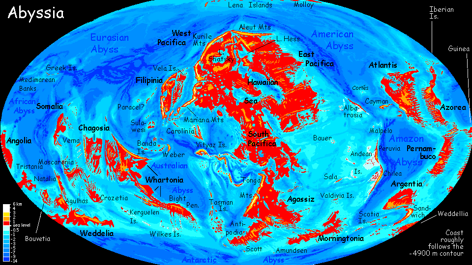
Abyssia:
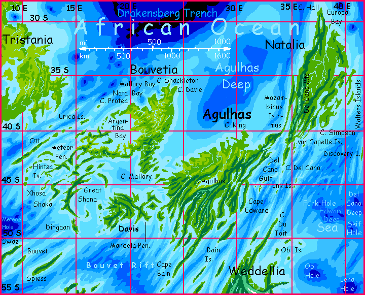
Agulhas, Natalia, and Bouvetia

by Chris Wayan, 2010
for Jean-Baptiste Bouvet, South Atlantic explorer (and sloppy navigator)
Abyssia home - down to
map -
building Abyssia -
geology & geography -
critters & cultures -
the clash of names -
more worlds? Planetocopia!
Introduction
-
Setting -
Topography & Climate -
Bouvetia -
Agulhas -
Natalia -
Geology -
Migration
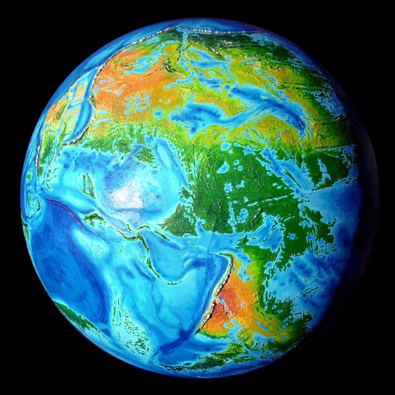
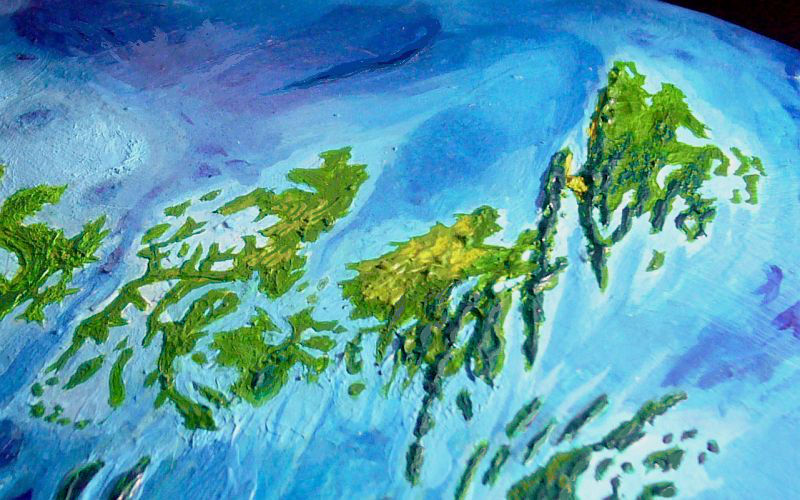
A thousand kilometers south of Africa, there's a hump the size of Borneo: the Agulhas Rise; around it, in a great U shape, are abyssal plains. So on the upside-down world of Abyssia, south of the African Ocean is a great gulf, the Agulhas Deep, cupped in a U-shaped continental shelf. On this platform rise three great islands--Agulhas, Natalia and Bouvetia. The Agulhas group is nearly 2.5 million square km (a million sq mi); as big as the eastern USA. Agulhas (ah-GOOL-yas) and Natalia are one island linked by Mozambique Isthmus, but it's only 16 km (10 mi) across and hundreds long; and they occupy different latitudes, with rather different climates. So I'll treat them separately, below. Bouvetia, though separate from Agulhas-Natalia by narrow and island-choked Mallory Strait, has much the same topography and climate as Agulhas, and clearly belongs in the cluster.
Introduction -
Setting
-
Topography & Climate -
Bouvetia -
Agulhas -
Natalia -
Geology -
Migration
To the west, over much deeper and wider Schmidt-Ott Strait, lies subtropical Tristania, nearly as big as Aghulhas, Natalia and Bouvetia combined.
To the south stretch the cool forests of Weddellia, a subpolar continent nearly twice the size of the Agulhas group. Not quite an Abyssian Siberia, but at least an austral Canada.
To the east is the Crozet Sea. It's not shallow, like the seas around the group; Madagascar Trough is 3-5 km deep (2-3 mi). The nearest land is 800 km northeast: Mascarenia, the size of our Madagascar, and rather like it climatically. But not as isolated; Mascarenia's just the first of sevaral near-continental islands on a great rise equivalent to our Indian Ocean, north south and east from Mascarenia: the Whartonia group.
To the north lies only the African Ocean; beyond the Agulhas Deep lies the Drakensberg Trench, 8.5 km deep (28,000'), as deep as Everest is high; and the Eurafrican Abyss beyond it stretches almost uninterrupted to the pole. There isn't an island, not even a reef or shallows, for 10,000 km (over 6000 mi); even after this, the islands you'd expect, created by inverting our Mediterranean and Black and Caspian Seas, turn out to be mere banks and rises, with only the low Greek Islands breaking the surface at all. And this is only the smaller, western lobe of the Afrasian Ocean. Not an easy crossing--no fresh water for months! Sensible mariners will hug the coast and trade.
Thus, the Agulhas group is a bridge or hinge--a narrow point on the great arc of sea-rise supporting the continents of Whartonia (in our Indian Basin) and Atlantis (guess where!). It doesn't matter what form trade and travel takes on Abyssia--whether ships, planes, dirigibles, or fliers under their own wingpower, Agulhas won't be isolated! Nearly all traffic in the hemisphere must pass through the region.
I suspect most travelers will hug the north shore--shorter route, less indented, deeper water, fewer ship-gutting reefs. That means Agulhas proper won't get much of the trade--Cape King at the northern tip of Agulhas is as good as the island can offer, and it's out of the way, relatively exposed to storms, and with shallows many miles offshore.
In contrast, Cape Hall or Europa Bay on Natalia and Mallory Bay at the northern tip of Bouvetia offer fine sheltered deepwater harbors. They're likely to be major ports known from Atlantis to Pacifica.
Introduction -
Setting -
Topography & Climate
-
Bouvetia -
Agulhas -
Natalia -
Geology -
Migration
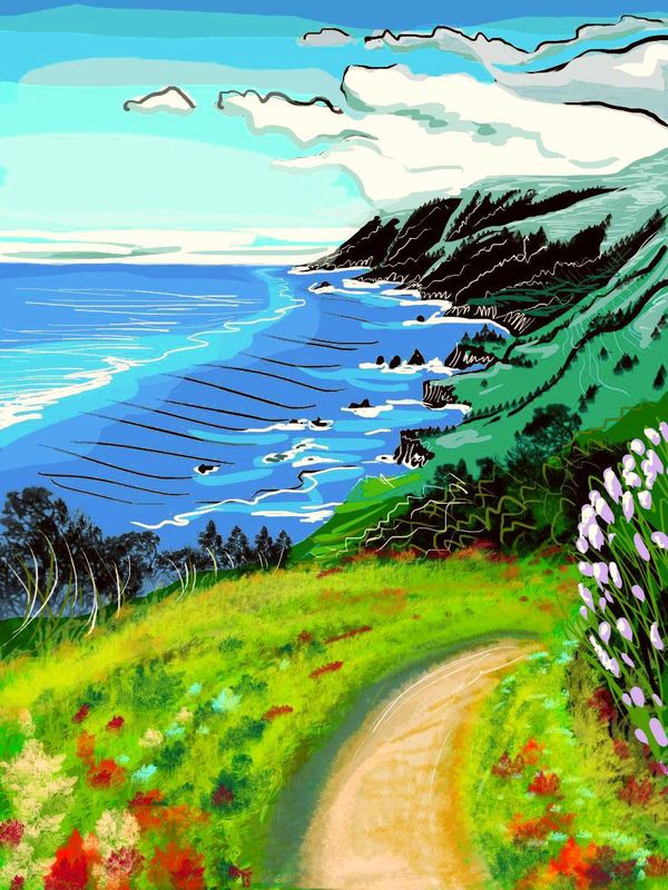
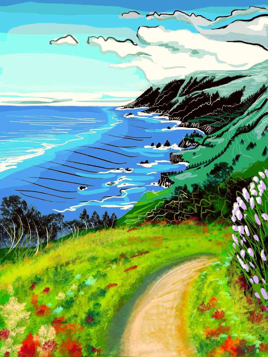
Coast road, northern Meteor Pen., Bouvetia; based on Tom Killion print "Big Sur"
|
Agulhas, Natalia and Bouvetia have intricate shorelines. Parallel ridges and sounds are common--fracture zones from the Atlantic Rift just to the south. While most of the coastal water is shallow, blue holes three miles deep are not that rare, especially off Bouvetia; and the Isthmus is just the visible part of a fault creating a vast escarpment 2 km high, under the surface, dropping into Mozambique Trough.
Bouvetia, like its neighbor Tristania, has low topography--the hills top out at just 800 meters (2600'). That doesn't mean it's flat. Steep sinuous ridges and valleys alternate in many places--a washboard terrain hard to traverse.
Since the land's rugged, most transport is by sea. And why not? Nearly all of Bouvetia's within a day's trek to the sea. Well, in the northwest-center is one patch of hills as much as 100-150 kilometers from the sea (60-90 mi); it's a poor, backward region. Hillbillies. But for the most part it's wiser to think of Bouvetia as a big archipelago; shipping links matter more than land links.
The sketch to right, from the Meteor Peninsula, is typical; lovely scenery, but the coast road was narrow, dirt, and nearly deserted; the few people I met were day travelers, going just a few miles. Bouvetians think of boats first and roads second. If ever...
Agulhas is both more continuous and rougher. The ridges fronting its east coast, part of the Mozambique Isthmus complex, rise up to 1.3 km (4300'); and Natalia's Del Cano Range (part of the same complex) tops 2 km (6600') in places.
Modest though these heights may sound to many Earth readers, they're respectable on gentle Abyssia. The entire neighboring continent of Weddellia has not one peak higher. Australias everywhere! Abyssia has rugged terrain, of course--it matches Earth's exactly, just upside down--but most of it is drowned deep.
The climate is gentle too--maritime subtropical to mild temperate. South Africa may be our world's nearest land, but with desert north of it, it's a poor, dry model for understanding the Agulhas group.
Now, New Zealand on a good day, maybe...
Introduction -
Setting -
Topography & Climate -
Bouvetia
-
Agulhas -
Natalia -
Geology -
Migration
Bouvetia has luxuriant hardwoods, though the land's low ridges, often lying across the prevailing winds, create local savannas here and there (at least in the warmer, drier north); it's something like pre-Columbian Uruguay or the coastal plains of Georgia. Or maybe Louisiana! Summers can get very, very sticky. But swimming's never far; shallow inlets full of coral reefs break up the land into narrow fingers.
This has its dangerous side in summer: storm surge! Typhoons off the southern African Ocean plow into northern Bouvetia once or twice a year from the northeast. Come to think of it, Shackleton Bay faces those storms; so the island's main port is more likely to be on Mallory or Natal Bay, to the west, in the lee of the storm winds, or inside huge, sheltered Argentina Bay, even though all these are a bit further off the shipping lane. A few hours' sailing versus a safer harbor? I'd head for Mallory Bay.
Bouvetia, unlike Agulhas/Natalia, is, as I said, less an island than an accidentally linked-up archipelago. Davis to the south is nearly half as big as Bouvetia proper, and the branching, meandering Meteor Peninsula is longer than Bouvetia's mainland, though narrow. Southern and western islands like Ott, Great Shona, Swazi and Spiess are also hundreds of kilometers long, though rarely more than 50 wide (30 mi). All in all, the Meteor Peninsula and the islands make up fully half the land area.
Climates vary wildly in these outer reaches; Ott and the Meteor Peninsula are like the mainland--subtropical to warm-temperate woods or groves and glades; but the southern isles like Shaka, Great Shona and Davis, and especially Swazi, Bouvet and Spiess, are cool-temperate: dark misty forests on their west coasts, pinewoods and alps on the snowy ridges, hardwoods on the eastern shore, turning red and gold in fall; miniature North Americas. Not much like Bouvetia proper to the north, but familiar to anyone who's toured the subpolar continent Weddelia to the south.
Introduction -
Setting -
Topography & Climate -
Bouvetia -
Agulhas
-
Natalia -
Geology -
Migration
Agulhas, especially the far south, is cooler than Bouvetia, and densely forested. Conifers predominate; it's almost Oregonian. The mountains of Cape Edward and Cape Weddell get snow each winter. But at sea level, snow's ephemeral here most years; and unheard of to the north. Compare this with Earth! Southern Agulhas lies 45° to over 50° south, the latitude of our Tierra del Fuego and Kerguelen--cold, windblasted lands. But Abyssia lacks icecaps! And polar blizzards break themselves on Weddellia to the south.
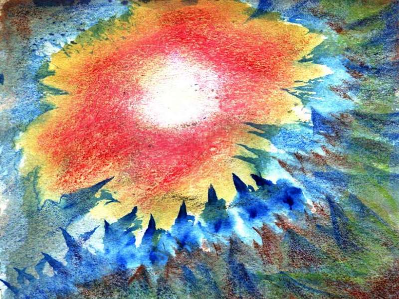
So the woods are piny (Norfolk Island Pine, no doubt) and misty at times, but it's not all cold and gloom. Here's a sketch from Cape Edward--I lay in a clearing and looked up as the sun burned through the morning fog, warming up to a beautiful summer day.
Agulhas's north shore is drier, especially in summer: sunny, if not quite Mediterranean, for there are some thundershowers every year, and occasionally, tropical storms off the African Ocean stray this far south and really drench this coast. But it's not like the damp steamy summers of Bouvetia. You see open woods of oak and olive, with greener laurels and wild plums along the creeks; pines on the heights.
Introduction -
Setting -
Topography & Climate -
Bouvetia
Agulhas -
Natalia
-
Geology -
Migration
Natalia is further north--just 30-40° south. You might expect more hurricanes, but tropical storm-tracks here tend to angle west, and stray storms slam into the coastal mountains along the Mozambique Fracture. So most of Natalia's weather comes from the southeast, off the Crozet Sea: gentler rains, mostly in winter. Only the Del Cano Mts see much snow; Natalian winters are mild, if not quite Caribbean.
Summers can get hot and sticky, even more so than Bouvetia. But there's plenty of shade and water--for lush forests cover Natalia, unbroken from Cape Hall to the Mozambique Isthmus, from the low Walters Islands to the Del Cano heights.
Introduction -
Setting -
Topography & Climate -
Bouvetia
Agulhas -
Natalia -
Geology
-
Migration
Most Atlantean continents and islands (like Azorea and Atlantis itself) have a labyrinth of capes, islands, fracture-fjords and fingerlakes on the coast facing the Atlantic Rift, but a fairly straight shore on the far side. Agulhas and Natalia follow the rule--their southern and eastern shores are a Gothic fretwork of islands and fjords, but the northwest coast (on the Agulhas Deep) is more Earthlike--quite convincingly continental.
Bouvetia's a bit of an exception--its north coast is gnawed and shaped by puckers, those mysterious anti-volcanoes where crust slowly indraws like water down a drain. Mysterious, of course, to us, who find it hard to explain what's slurping crust down like that. Tectonic singularities? Titanic gophers? (You can't just reject these blue holes as impossible--large numbers of similar (if shallower) features really do exist on Venus.) In our world, of course, these monstrous pits are volcanic cones. But Abyssians, used to crust that sucks instead of spews, would no doubt find our Earth, studded with thousands of flaming pimples, just as geologically bizarre. An inflamed world.
You question your world only when it looks unfamiliar. Familiarity breeds... content.
Anyway, whatever the cause, there they are: blue holes surround north and west Bouvetia and define its coastline, along with Schmidt-Ott Trench, another spur of the Atlantic Rift that shaped the Agulhas group. Bouvetia's northeast coast, full of evidence of industrial-scale magma movement offshore, will almost certainly have hot springs, mudpots, geysers, and vulcanism. Rarer and smaller than on Earth, apparently; there are no large cones; but some. Possibly lavas here are even runnier than shield-volcano lavas on Earth, flowing to the sea rather than building up peaks. That takes a certain viscous attitude Abyssia seems to lack.
Sorry for the pun, but it holds a truth; as I write up these regional pages, exploring Abyssia in detail, I'm surprised how gentle the place is, overall. At least visibly, to life on the surface; Abyssia hides its extremes, veils them in deep dark sea. Earth bares its passions! To Abyssians, I suspect Earth would look slightly Martian--rugged, drastic, harsh, dry.
Dang. Abyssia's another girly planet. And I wasn't even trying!
Introduction -
Setting -
Topography & Climate -
Bouvetia
Agulhas -
Natalia -
Geology -
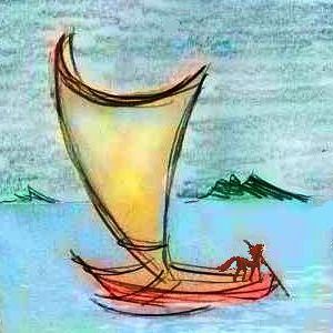
Peoples and Migration
Leptaur Immigrants?
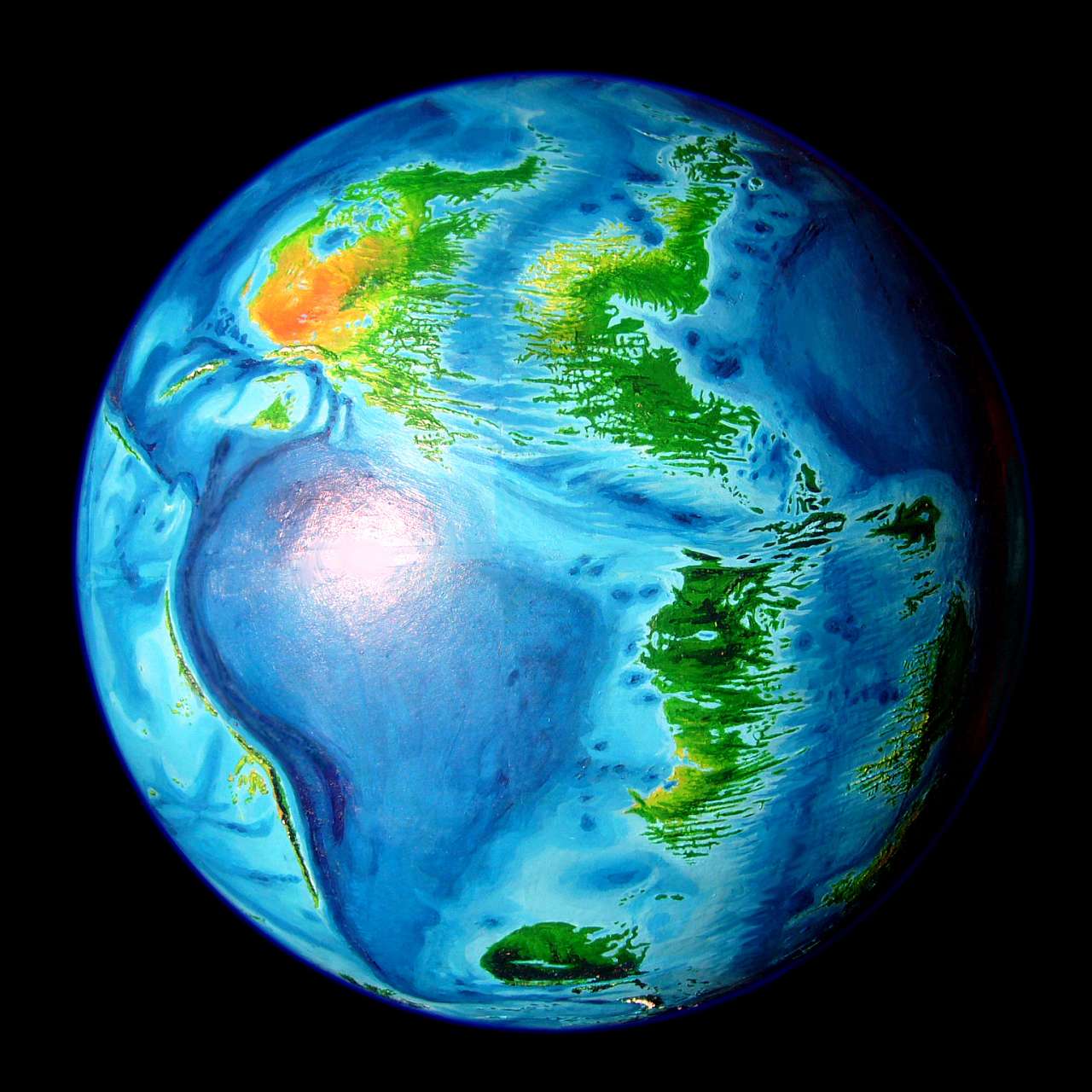
The Agulhas group is part of the long Atlantis Rise--a sinuous strip of big islands and mini-continents corresponding to our Atlantic Ocean. Mariners from the largest continent, Atlantis itself, will have no trouble sailing along this strip as far as Natalia, but there's moat nearly 1000 km wide between it and the next archipelago--the lands on the Indian Rise, corresponding to our Indian Ocean floor.
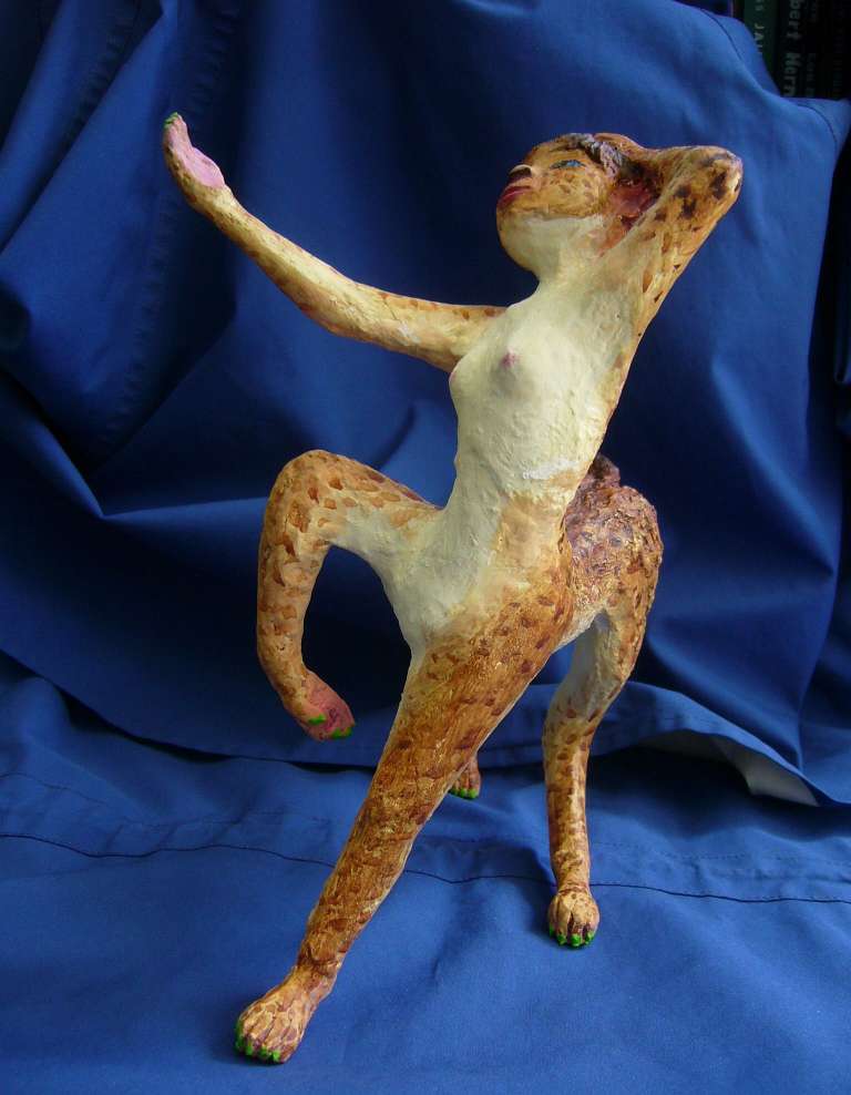
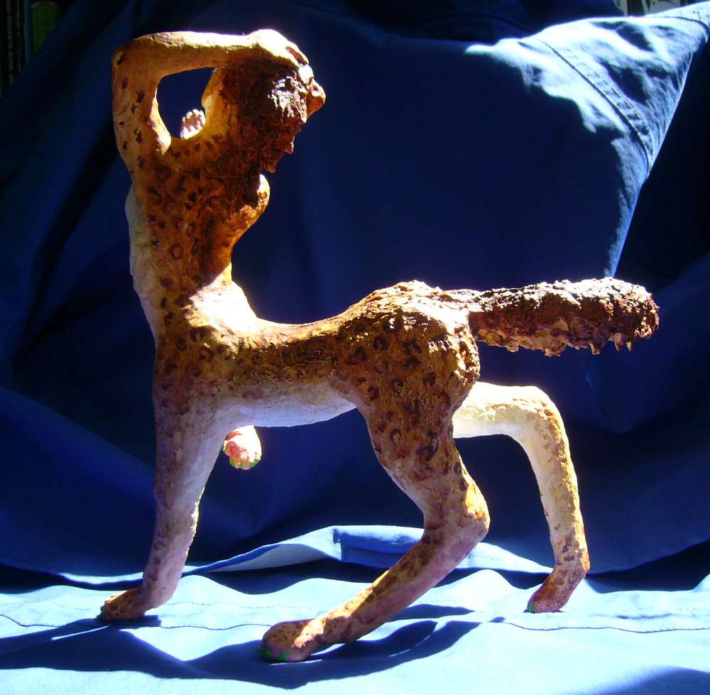
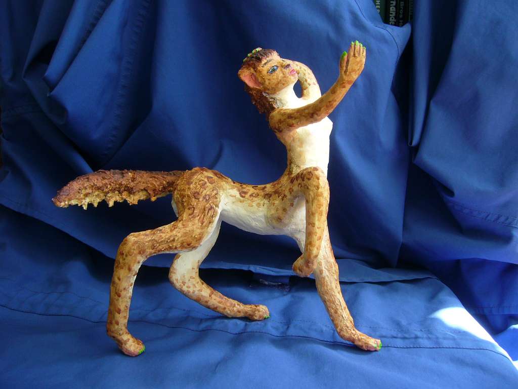
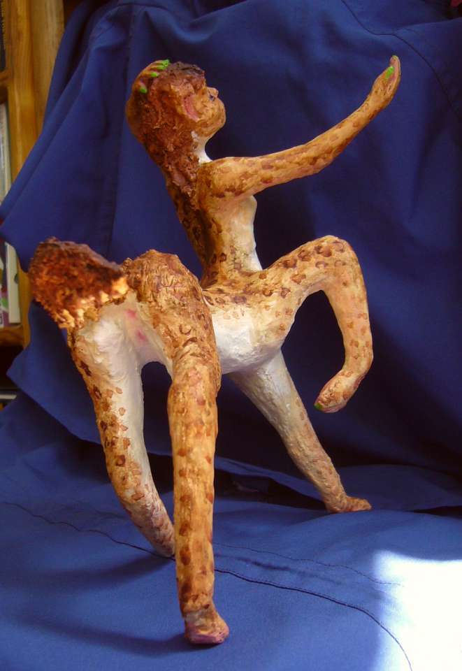
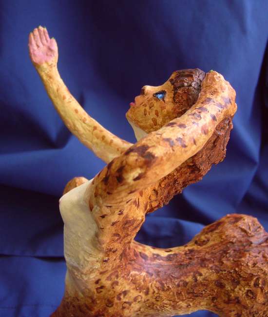
So if any non-natives have settled the Agulhas archipelago, they're likely to come from Atlantis, the largest and most diverse continent on the Rise. That means they'll probably be leptaurs, an intelligent leopardlike centauroid (though omnivorous, not an obligate carnivore). Leptaurs evolved on savanna and prefer sun to rain and hot to cold (and peace to war, and fun to work; these are not conquistadors); they'll settle in the port towns along the shorter, safer route along the northern edge of the archipelago. Settlers may spread into the savanna bottomlands opening between wooded ridges, that cover much of northern Bouvetia and Agulhas. But I doubt many will make homes farther south; too cool and rainy.
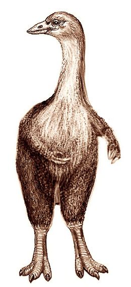
Aepyornis: flightless, 2+ meters tall
|
Here's a sculpture of a leptaur singer-dancer auditioning for a part in a portside cabaret (no, not a lepton; they audition too, but never get the part. "Sorry, you're too short.")
I apologize for the roughness (she's sculpted of coathanger and spackle) but you can get the general idea.
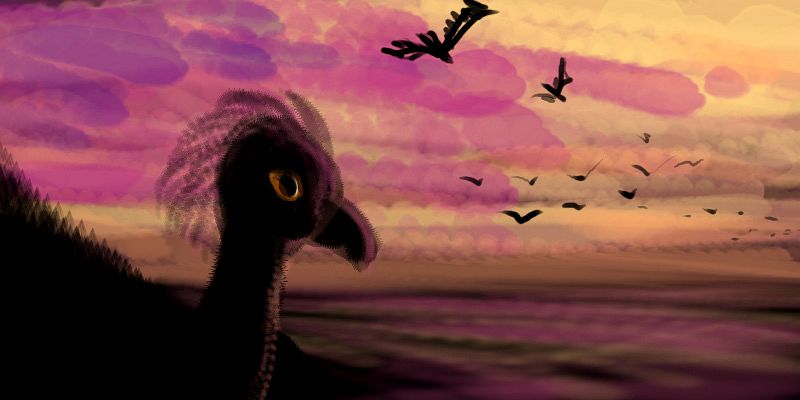
Native Birds?
What about native intelligent life?
The geography and climate of the Agulhas group suggests to me a possibility that happens on Earth, if only in a modest way: the seasonal migration of a whole population!
The island nature of Abyssia increases the odds that intelligent life here (indeed, most land animals) will be avians or similar creatures. Even poor fliers may tempted to migrate seasonally here. If so, there would be profound cultural and biological effects. Migrators need to stay light; you can't carry much. Material culture might be sparse. Worse yet, the stringent fitness required might doom the old, and even put a limit on brain size--those vampire organs are dead weight, burning huge amounts of fuel needed for muscles. On Earth, the smartest birds (parrots and ravens and their kin) aren't fantastic fliers and don't migrate; they adapt to seasonal changes and stay home.
One factor favoring the evolution of intelligent fliers: unlike Earth, Abyssia has deep desert sinks with high enough air pressure to support fliers big enough to have human-level intelligence (details: Angels from the Pit). But such fliers would inevitably be built for extreme heat; they might eventually adapt to the tropics at sea level, but here? I doubt it.
Avian inhabitants of the Agulhas region are more likely to resemble the giant birds of Earth's corresponding region: lumbering flightless monsters like our extinct Moa or Aepyornis (right). Not as tall as giraffes, but topping most basketball players. Big Bird for real! But intelligent or not, they aren't going to fly; these are massive critters.
Still... if the dominant bird here were able to fly, if heavily (say, a great blue heron catching fish with quick, slender hands, not its beak) then to migrate would be temptingly easy here. The Bain Islands lead straight to Weddellia, just to the south.
 Weddellia has a rather Scottish climate (mild summers, dreary winters) while the Agulhas group has sticky hot summers and mild winters. I like heat, so I wouldn't bother migrating, but I'm a subtropical mammal; temperate-belt avians may feel differently. We've inherited fears and compulsions toward territoriality and male dominance that do us no good in a civilized world; birds, even clever birds who've mastered fire, who know very well they can winter over, may simply feel too restless to stay when days grow short. Especially if everyone else is heading north or south to mate in great rookeries! Instinct, envy, and the sense you're missing out are powerful motives.
I did say (having seen the summer migration of vacationers and summer-campers north into New England and Canada, and the winter migration of snowbirds in their motorhomes, and the rowdy, drunken, million-student mating rookeries along America's southern beaches during school breaks) that it happens even on Earth, among mammals. In a modest way.
 TOURS: this route snakes around Abyssia's major lands -
Lena Is. (brr!) -
Greek Is. -
Atlantis -
Azorea -
Cayman and Albatrosia -
Andean Is. -
Scotia Is. -
Morningtonia -
Agassiz -
South Pacifica -
East Pacifica -
Hawaiian Sea -
Pacifica Desert -
Filipinia -
Banda Is. -
Vityaz Archipelago -
Tasman Is. -
The Bight -
Whartonia -
Chagosia -
Somalia -
Mascarenia and Crozetia -
Weddellia -
Argentia -
Pernambuco -
Angolia -
Tristania -
Agulhas group
TOURS: this route snakes around Abyssia's major lands -
Lena Is. (brr!) -
Greek Is. -
Atlantis -
Azorea -
Cayman and Albatrosia -
Andean Is. -
Scotia Is. -
Morningtonia -
Agassiz -
South Pacifica -
East Pacifica -
Hawaiian Sea -
Pacifica Desert -
Filipinia -
Banda Is. -
Vityaz Archipelago -
Tasman Is. -
The Bight -
Whartonia -
Chagosia -
Somalia -
Mascarenia and Crozetia -
Weddellia -
Argentia -
Pernambuco -
Angolia -
Tristania -
Agulhas group
Abyssia's homepage - map - peoples - regional tours - names
LISTS AND LINKS: More worlds? Planetocopia! - dreams of other worlds - ecology - climate change - evolution - natural disasters - terraforming - sculptures and 3D art -
World Dream Bank homepage - Art gallery - New stuff - Introductory sampler, best dreams, best art - On dreamwork - Books
Indexes: Subject - Author - Date - Names - Places - Art media/styles
Titles: A - B - C - D - E - F - G - H - IJ - KL - M - NO - PQ - R - Sa-Sk - Sl-Sz - T - UV - WXYZ
Email: wdreamb@yahoo.com - Catalog of art, books, CDs - Behind the Curtain: FAQs, bio, site map - Kindred sites