World Dream Bank
home -
add a dream -
newest -
art gallery -
sampler -
dreams by
title,
subject,
author,
date,
places,
names
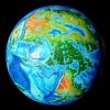
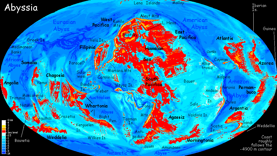
Abyssia:
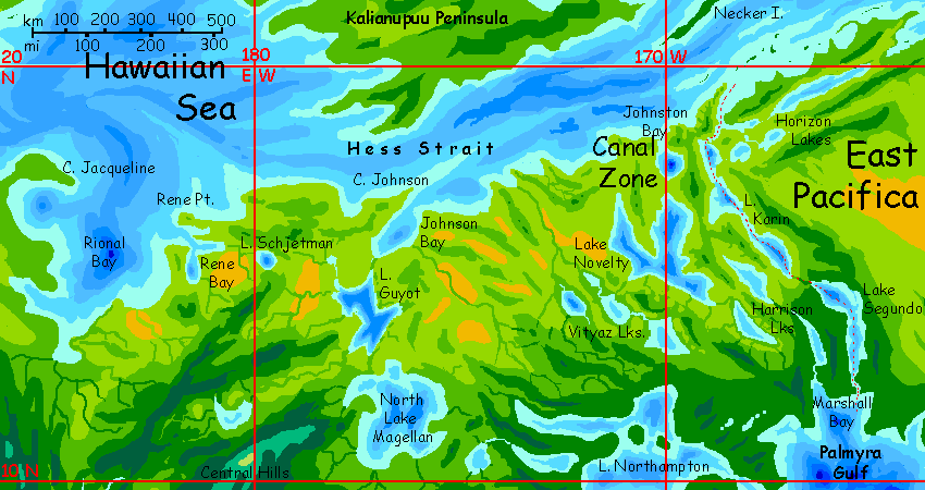
Hawaiian Sea

UNDER CONSTRUCTION!
by Chris Wayan, 2013-
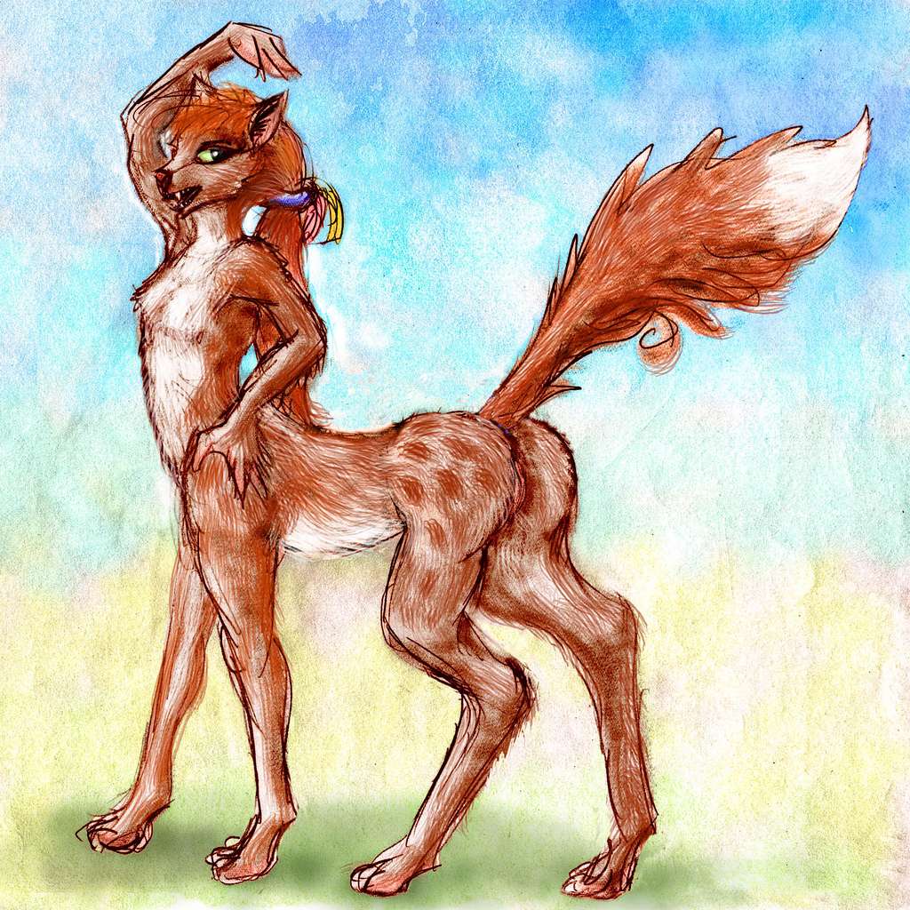
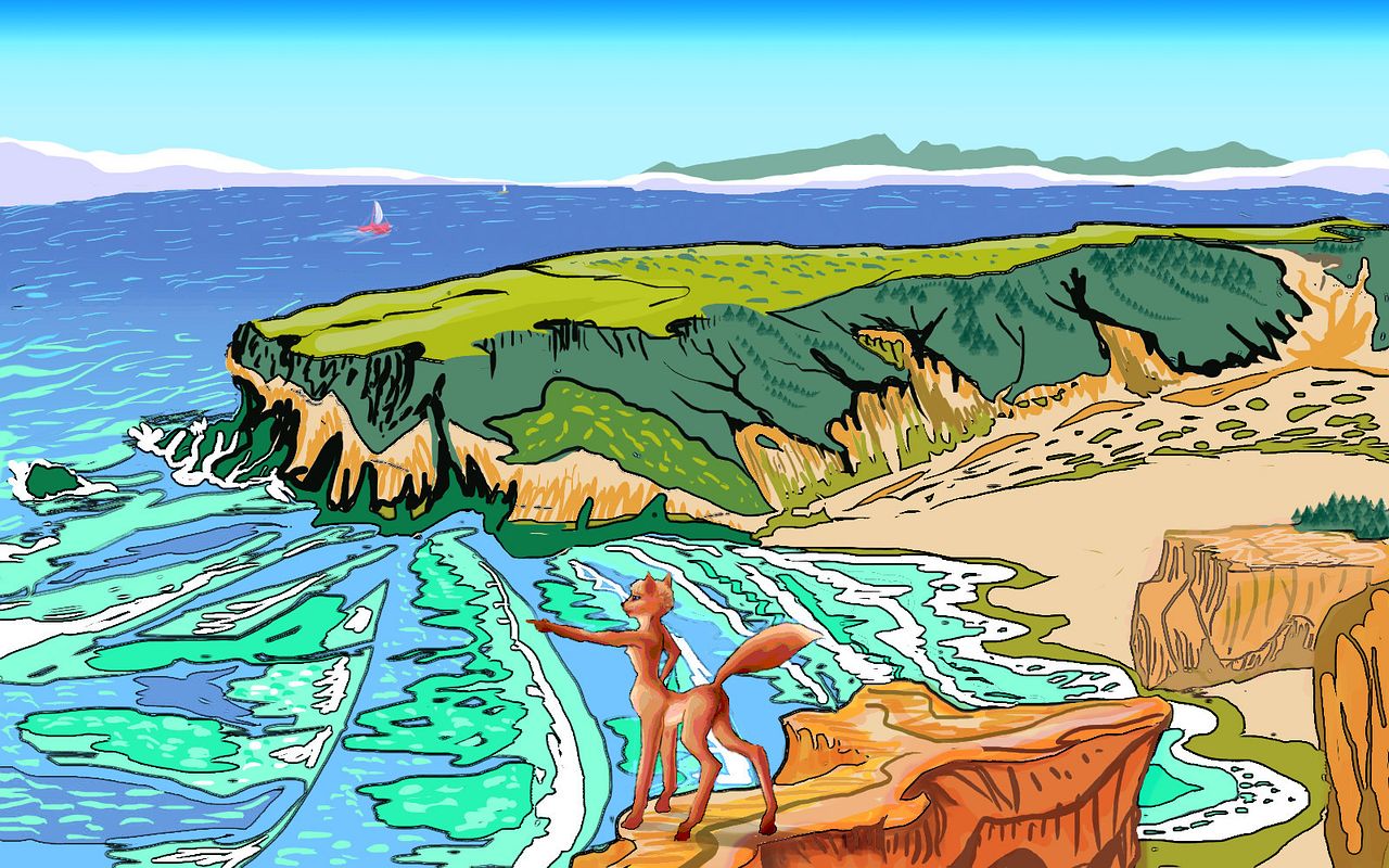
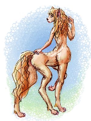
for the fox in The Innkeeper's Song
Abyssia home - down to
map -
building Abyssia -
geology & geography -
critters & cultures -
the clash of names -
more worlds? Planetocopia!
Overview
-
West Arm -
Central -
NW -
Hess Sea -
NE -
Kasowars -
East -
Kamehameha -
Canal
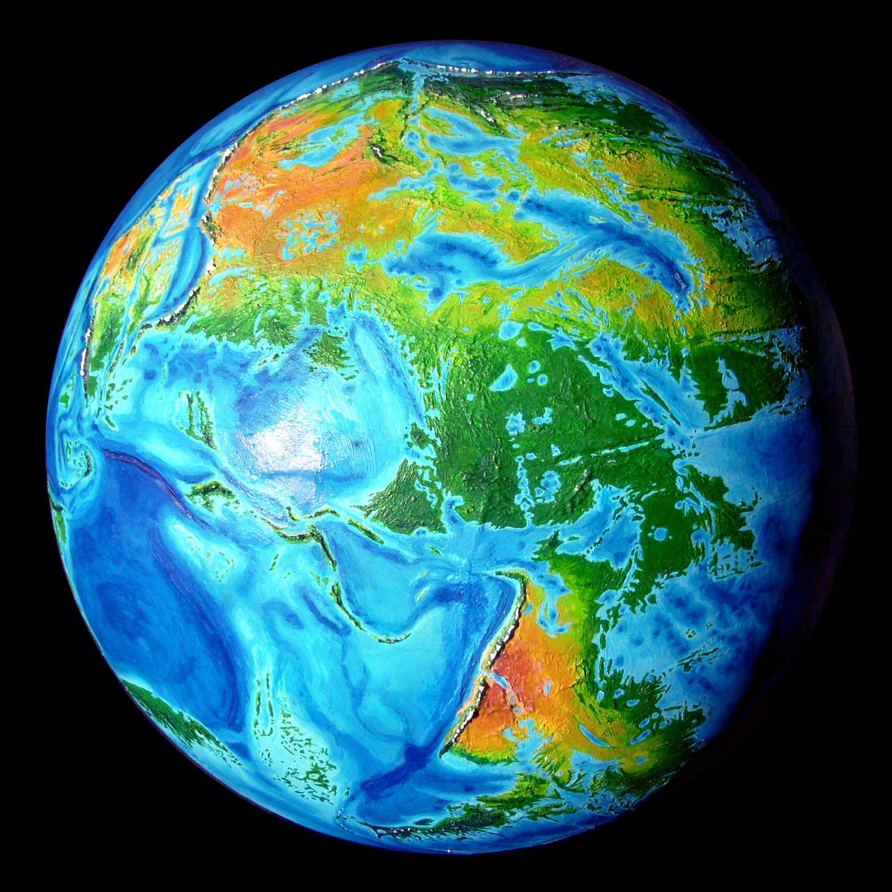
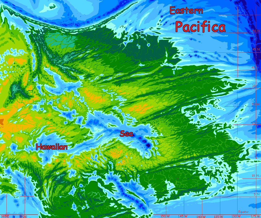
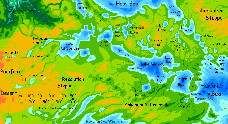
The Hawaiian Sea is the largest landlocked sea on Abyssia--a bit bigger than our Mediterranean-Black Sea complex, and somewhat similar in climate. There's even an equivalent of a Black Sea, smaller and deeper inland: Lake Hess. From a human viewpoint, the eastern shore is more desirable--plains and gentle hills with no barriers to travel or exploration, consistently rainy enough to be fertile. East, away from the shore, stretches a prairie that gradually grows rainier until it's densely forested, rather muggy and hurricane-prone: the coast of East Pacifica.
The western shore of the Hawaiian Sea is drier, but prairie and semiarid, not true desert; though if you go far enough, into western Pacifica, you'll find the biggest, hottest deserts on Abyssia. Still, fertile prairies run a thousand km or more from the Hawaiian Sea.
While relief is mostly low, there are tall, snowy mountains in the northwest, past Lake Hess: the Emperor and Chinook Ranges, topping out at 2-3,000 meters (7-10,000').
 The Hawaiian Sea differs from the Mediterranean in a couple of important ways. At present, rainfall isn't quite enough so it brims over and drains to the ocean; only a canal connects it. Like our Caspian Sea, it's brackish, neither quite freshwater nor sea-salty. In slightly warmer eras, rains are a little more intense, and the Hawaiian Sea spills naturally south into the ocean; during such eras the sea flushes out some of its salt. But it's just too big to flush out entirely. The brine, being heavier, retreats to the deeps, under a surface skin of sweeter water. Brackish not fresh; I doubt it ever got drinkable, at least to human taste. Though the Pacificans, whether burrowing Foxtaurs or vultury Pitians or leathery Tree-squid or huge flightless Aepyornises, may have quite different salt tolerances and water needs. Still, I didn't want you to think that this Abyssian echo of Homer's "wine-dark sea" had suffered a reverse transubstantiation to plain water--there is no backwards Abyssian Jesus undoing all the wine. Ugh, what a sobering thought!
So the Hawaiian Sea deserves its name: not just big, but briny. Just... not as briny as some.
The Hawaiian Basin has another invisible peculiarity, one most of us would see as normal--but which isn't on Abyssia. Quakes are common all over Abyssia; its land is mostly associated with rift zones. Abyssians don't build skyscrapers or cathedrals. Pyramids, maybe--they don't fall over. Now, the continent of Pacifica is no seismic exception; nearly all the coasts are quake-prone. But the Hawaiian Basin has fewer quakes (and their associated tsunamis) than the coasts with their deep trenches. Build here, and you may go generations without a good shaking. And quakes here stay local, in contrast to places like the eastern USA, where quakes are rare but severe and vast in extent--that tightly welded plate resounds like a bell for thousands of kilometers. Central and Eastern Pacifica is broken into strips, at least limiting the extent of the damage along the coast, though a shock can propagate far inland.

So the Hawaiian Sea basin is in many ways nurturing and conducive to civilization--at least if that civilization were human. Will Abyssians feel the same? Hard to say. I'm postulating not a single dominant speces but a diverse cluster of centauroids and giant flightless birds. Still, most of these Abyssians will have origins much like humanity's cradle--savannas and open woods. There are exceptions--the intelligent fliers that may emerge from the desert pitlakes of West Pacifica, and a land-squid or tree-crab crawling into coastal mangrove forests in the tropics--but most Abyssians may prefer the sorts of landscapes that humans do.
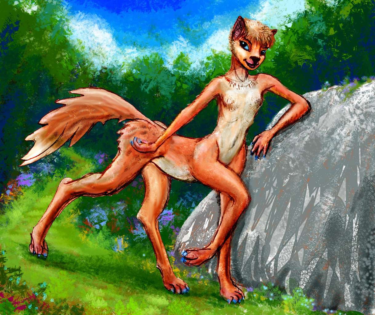
One intelligent species may even originate in this region--on the great steppes west of the Hawaiian Sea. (Well, under them at least--foxtaurs like to burrow.) This savanna looks ideal for these intelligent, child-sized, omnivorous, centauroid canines I postulate as a likely mammalian candidate for civilization.
Eventually the foxtaurs will have a dedicated page, but for now, the best description and sketches are on the "Creatures and Cultures" page, under Foxtaurs.
In the low-orbital photo below, north is to upper left; the tour, still mostly skeletal, will start in the southwest and sail clockwise around the western shores, up to Lake Hess, then down the east coast and end with the economic engine of the whole basin (and the engineering wonder of the age)--the Hawaiian Canal.
Overview -
The West Arm
-
Central -
NW -
Hess Sea -
NE -
Kasowars -
East -
Kamehameha -
Canal
For now we'll just outline a voyage around the shores of the West Arm. It's a large quasi-sea, some 40% of the total area of the Hawaiian Sea complex; larger than our Black Sea.
We'll start on the long south shore west of the Hawaiian Canal. Mediterranean at first--grassy plains, groves and scattered trees on the rocky hills. West for days--broad shallow bays, stony heads.
At last, the much deeper Johnson Bay--a sound several miles deep, almost a separate lake. Plenty of trees still, down along watercourses, but they're growing scarcer on slopes. The rains get less reliable and the summer heat harsher as we creep into the continental interior.
 Hess Strait. Despite the name, it's so broad you can't even see the far side; the modest hills of Cape La Croix and Point Shepard just aren't high enough to thrust above the horizon.
Into the West Arm proper, now. Your boat follows the south shore, trading with villages at every creekmouth. We'll skip Rene Sound--a long deep navigable channel leading nowhere. Farms and fishing villages...
Huge scalloped Rional Gulf. Fishing villages here, too, dotting the shore. Rich waters, a sunny climate, decent pasturland and irrigable flats for gardens. Rional is a good place to live--usually. But now and then the Gulf suffers sudden die-offs. It's unpredictable; not a climatic cycle, but volcanic. There are a lot of deep blue holes out in the Gulf, and some are active, belching out enough carbon dioxide and sulfur compounds to kill off whole shoals. Not now; you'd know by the unbelievable reek of a million dead fish.
Through Wake Passage into Lake Wake. This miles-deep irregular brackish lake or small sea, up to 250 km across, is the westernmost tip of the Hawaiian Sea.
A possible canal-site from the South Wake River to the headwaters of the sluggish, winding Sculpin River winding southwest to the Kapingamarangi Sea. I think it's a little longer and the rivers shallower--this is drier country--so I've placed the Hawaiian Canal well to the east. But a second canal linking these two river systems would make economic sense, saving thousands of miles in transit if you're sailing west.
Your trade-boat circles Lake Wake up to the northern shore, to the mouth of the Ewing River. Your foxtaur-crewed craft is fairly shallow-draft, and can make it north as far as Lake Ewing. You'll have only a day or two at Port Ewing to look around the bazaar--this stop is brief, for there's no heavy loading to arrange. Ewing's exports are all small and light--gems, dried herbs, books, carvings and curios. They have to be--they're all caravaned in from the Pacifica Desert. No flatboats beyond Port Ewing! It's the showcase for products from as much as a million square km of prairie and desert with not a single navigable stream--shallow stony creeks at best. The stuff you see is all impressive--as it had to be, to convince someone to lug it out on foot.
Back down the River to Lake Wake, along the northeast shore to the lakemouth, a slow business against the current--water normally flows into Lake Wake, for evaporation's fast here in this hot dry climate and the streams feeding it are small; the Hawaiian Sea subsidizes it.
Back into the Sea proper. Capes and bays. The only one your boat goes up is deep Hig Bay, for at its head is Port Resolution, at the mouth of a more-or-less navigable river issuing from the long narrow parallel Resolution Lakes--long dry whalebacks between these lonely valleys and their lakes ranches farms and mines. Only flatboats with local pilots dare the rivers; and not many. Trees only along the rivers; arid steppe beyond. You'd think of it as the border of the Wild West--if you hadn't just seen Port Ewing!
Beyond the lakes are a thousand kilometers of steppe with next to no permanent residents. Nomadism is the only practical pattern up there. The culture reflects it.
Here's the Dawn-Star scene from Follow the Dream, a local dance-play set on the Resolution Steppes; it tells of a shaman led by her dreams across the endless dry grass to a hidden lake, village, and eventually, soul-mate.
Nezza dances Follow the Dream
|
| 
Sculpted by Wayan, backdrop & dream-pole by Joy-Lily
|
On around the North shore of the West Arm. Round Hig Point to Ewing Bight, Cape Stetson, Resolution Bay...
The northeast shore and the Kalianapuu Peninsula. The Revelle Fjords. Long prairie ridges and sparsely wooded valleys, greener than the Resolution Lake valleys and oriented at right angles to them, but a similar scale--and like the Resolution complex, they run hundreds of km. I'm not sure what causes these--it's possible they're ancient dunes from a drier era, now anchored by dense prairie sod, fed by the rains off the now-larger sea.
Round Point Shepard and out of the West Arm. On toward the heart of Hawaii.
Overview -
West Arm -
Central Hawaiian Sea
-
NW -
Hess Sea -
NE -
Kasowars -
East -
Kamehameha -
Canal
East along the La Croix Coast to Cape Voyager. Not cliffs, but scenic: ridges rise steeply from the sea, like our Big Sur or the dramatic south shore of Crimea.
Offshore: shall we detour to the Isle of Necker? Like Crete. Well, less mountainous, twice as long, way more fertile, and with many times the population--since there's no fresh water shortage. Not very much like Crete.
And cosmopolitan--most of the shipping lanes fanning out from the Hawaiian Canal pass by Necker.
A slight detour at Cape Voyager--a week or so. Out into the Brooker Islands. Quite Greek, though a bit rainier. Not a bad thing.
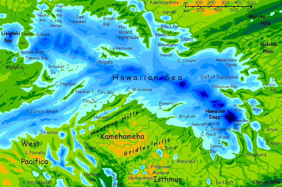
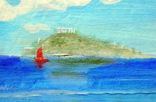
La Perouse, a low twisting narrow island some 300 km long--bigger than Cyprus. Greener; more rain. La Perouse is right off one of our outer Hawaiian Islands (two really): the La Perouse Pinnacles. These are old volcanic plugs, the last eroded tips of once-gigantic volcanoes like Hawaii's. Why is there a deep trench right offshore, deep enough to form Abyssia's Le Perouse Island? We're in the middle of an oceanic plate, not the edge. Well...
On our Earth, the burden of the Hawaiian volcanoes made the surrounding seafloor sag. So on Abyssia, these inverted volcanoes form great puckering holes where crust is (for mysterious reasons) sucked under in a slow, stony whirpool. Seawater is of course lighter than rock, so deeps like these are lighter parts of the plate than the surrounding abyssal plains. Around these light spots, the crust bows up in response, just as it sags on Earth. In places it breaks the surface, like La Perouse. The locals are glad it did. Fertile (rainy for the region) and central, ideal for trading, La Perouse is densely settled, with towns every few miles along both coasts. A second Necker.
Back due west along the northern edge of the Brooker Archipelago. Small, many, each with its fishing village.
Overview -
West Arm -
Central -
Northwest Lakes
-
Hess Sea -
NE -
Kasowars -
East -
Kamehameha -
Canal
The greener shore of Kalianapu'u Peninsula. Tamana Bay. Lake Euphemia.
Through Quixote Strait into Lisiansky Gulf. Up the south and west shores, I think, into Lake Midway.
The huge Lake Midway-Lake Milwaukee chain. A week at least. I'm uncertain about the situation upstream; I now think Lake Yuryaku will drain east into the Hess Sea, not south into Lake Milwaukee as I long assumed. This means the Midway chain will be something of a backwater, like the Musician Lakes, trading local produce only; the ships bearing northern timber, copper and gems will come down through Hess. But even if the total water area and flow are less, the basin is at least as big as Hess's. The shallow, stony rivers feeding western Lake Milwaukee, especially Ferguson Sound and the Wilkinson River, will carry flatboats with wealth from mines and ranches over a vast stretch of prairie and desert. Individually they may not be as rich--biologically, culturally or financially--but the sheer sweep of territory, well over a million square kilometers, makes the Midway-Milwaukee waterway as potentially wealthy as our Great Lakes. If as vulnerable to boom and bust.

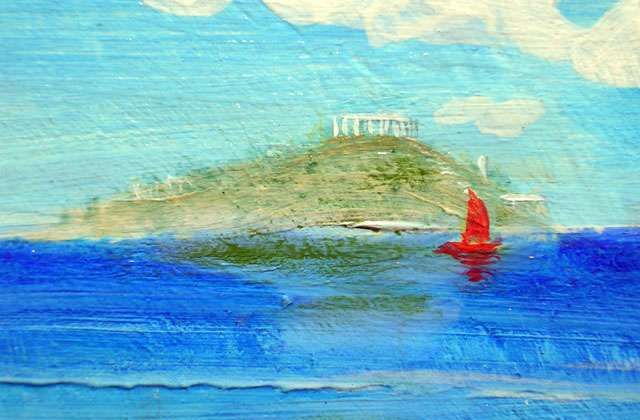
Sunset on mesas above the Mapmaker River, central Pacifica
Eventually we sail back down. We have to sail; little current to help us along. Indeed, in some summers, there's more evaporation in this arm than rainfall; the strait between Lake Midway and Lisiansky Gulf can flow either way.
But eventually we cross the Gulf to Quixote Strait and re-enter the Hawaiian Sea proper. We swing northeast round Cape Raita and follow the base of the Laysan Peninsula north to Nootka Bay, a major port, the northernmost on the Hawaiian Sea itself--at just 29° north--about the same as Orlando, Florida--or Cairo! I've repeatedly compared the Hawaiian Sea to our Mediterranean, but the analogy's only true geographically (landlocked, sunny, the same size), not cartographically: the Hawaiian's so far south that the two seas' latitudes don't overlap even slightly. A truer comparison would be with our Gulf of Mexico and Caribbean. It's that much warmer. Port Nootka's probably never seen snow.
Up the Liliuokalani River. Well, less a river than a chain of freshwater lakes leading us northwest from Nootka Bay: first the Imperial Eagle Lakes, then Lake Grace and Lake Solide to Ann Judge Bay on...
Overview -
West Arm -
Central -
NW -
The Hess Sea
-
NE -
Kasowars -
East -
Kamehameha -
Canal
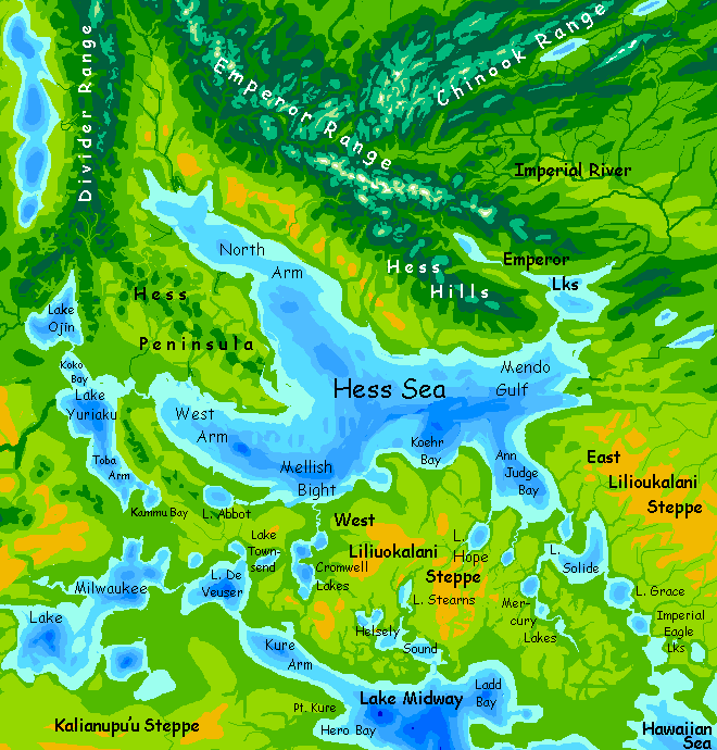
The Hess Sea is bigger than our Caspian, nearly as big as the Black Sea. Our two inland seas don't get enough water to sustain themselves; only inflow from the Mediterranean keeps the Black Sea at sea level, and the Caspian is sunken and fluctuating. So a case can be made that Hess should be a sunken salt lake. Its basin is mostly shallow, but has several pits nearly 5 km deep, so the water could retreat a long, long way...
But the Hess Basin is not Central Asia: East Pacifica's smaller, and only low hills lie upwind, so the steppes and hills around Hess get much more rain than the Caspian's shores. A better analogy's the Great Lakes. So I've shown the Hess Sea full-sized and overflowing south into the Hawaiian Sea.
This drainage implies Hess will be freshwater, though six times the size of any freshwater lake on Earth. The outlet, the Liliuokalani River, will be navigable to fair-sized ships; this means that Hessians will look south to the Hawaiian Sea complex, just as our Black Sea is culturally a chilly annex to the Mediterranean world (yet despite its proximity and similar latitude, the Caspian is not--well, not since the Bronze Age, when rivers still linked the Black, Caspian and even the Aral Seas).
Drainage matters!
The shores of the Hess Sea have scattered woods. Inland it's prairie, seemingly endless--looks like the same old story as the Hawaiian Basin. Not! A day or two up any of the rivers of the West Arm or the great lakes upstream, Yuryaku and Ojin, and you'll hit the dark pine foothills of the Divider and Mercator Ranges, Abyssia's equivalent of the Black Hills. Taller, though; from near sea level the Mercators rise to perhaps 2300 meters (7500'); like the Aleutian Range to their north, they often bear snow well into summer, though no glaciers.
That may not be true of the larger Emperor Range, above the North Arm--Pacifica's closest analogy to the Rockies. But not a perfect one; the Rockies, scarred and sculpted by the Ice Age, rise to over 4000 meters from a plain already a mile high, and only a few thousand km from Greenland's surviving icecap. The Emperors do rear quite a bit higher than the Chinooks or Aleutians or Mercators around them, topping out at 3000 m (10,000'). But they too rise from a prairie barely above sea level, on a milder, ice-free Earth. So the Emperors are pine-forested ridges balding to alpine meadows on the heights; snow-crowned well into summer, but briefly bare in fall. A few small glaciers here on shaded heights, but no deep cirques let alone fins, domes or horns as in our Alps, Rockies or Sierra Nevadas at the same altitude. Such features are Ice Age relics, and ice hasn't carved Abyssia as it has Earth. Not just now; not for many millions of years. Maybe never. Climate here doesn't fluctuate as much.
The only way temperatures and sea levels could fall far is if continental drift ever slips a big landmass right atop a pole so it ices over. And that's unlikely, since Abyssia has so few continents--just a flotilla of modest islands totalling just half of Earth's land area.
The only conceivable Ice Age, and it'd be a mild one more like our interglacials--that is, our present--would be if Pacifica itself ever crawls far north. To ice over it'd have a long, long way to go.
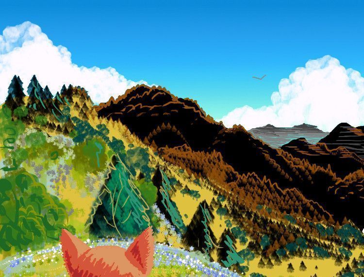
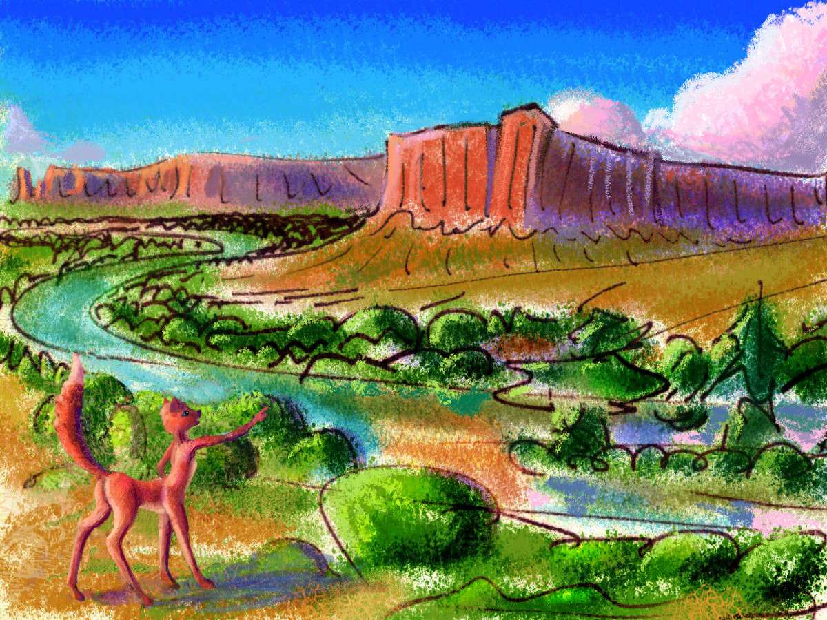
Hess Hills, central Pacifica; based on detail from a Tom Killion print, 'Timbertop'
Still, all this country beyond 40° north is cold by Abyssian standards: civilization up here ("Such as it is", southerners would add) is unispecific; almost entirely foxtaurs, with just scattered eccentrics of other intelligent species. It's the winters--not rough by Terran standards, but most Abyssian peoples can't take any snow at all. These rugged, rocky but not even Alpine hills are, to Abyssians, exotic and a little scary.
This species-monotony has consequences. Foxtaurs here are rather conservative and pious--universally subscribing to nature-worship focused on the all-important cycle of the seasons, rather like old Japan's many seasonal rituals. The result? Less individuality, less innovation. For example, the perennial favorite spring-play, an erotic dance called Bursting Through Old Snow, isn't local; it was created three millennia ago in the Southern Ring, a band of small, rather Siberian continents circling the South Pole.

|

|
|
|
Nezza in Bursting through Old Snow, spring mating dance, NE Pacifica; sculpted by Wayan, quilted backdrops by Joy-Lily
|
The reason's simple; a dozen intelligent species comparing notes are more likely to come up with insights than one alone. The southern-temperate population's much larger and more diverse than this northern-temperate one, for the Southern Ring is maritime not continental; cold seas have rich fishing, and can support more people than these cold woods and prairies.
The local production may be traditional, but the sets are beautiful and the dancing very sexy (assuming you like foxtaurs). Opportunity and innovation may concentrate in big, diverse ports; but artistic talent rises everywhere. Bursts, one might say, through old snow.
-
Overview -
West Arm -
Central -
NW -
Hess Sea -
North Shore & Musician Lakes
-
Kasowars -
East -
Kamehameha -
Canal
Out of the Liliuokalani River into the Nootka Bay. Round King George Peninsula (who, what? Foxtaurs and kasowars aren't patriarchal, so how can they have kings?
They don't. But of course there are always glorious nut cases. "King George" was a local hat salesman (a fussy, difficult trade among foxtaurs; you have to get the earholes just right) who went mad with frustration and declared himself a mythical ruler called a 'king'; everyone went along with his crazy proclamations because he was oddly lovable--much better as a mad king than as a hat salesman. He's still remembered all over the North with affection.
(Yes, I'm adapting the history of Emperor Norton, who really does deserve a seamount somewhere in the Eastern Pacific, but so far hasn't gotten one. Nope, another dreary king got this one, which, inverted on Abyssia, turned into a bay in the Hawaiian Sea. There is no justice.)) Is that the right number of parentheses? Ayeee, the conundrums of nomenclature!

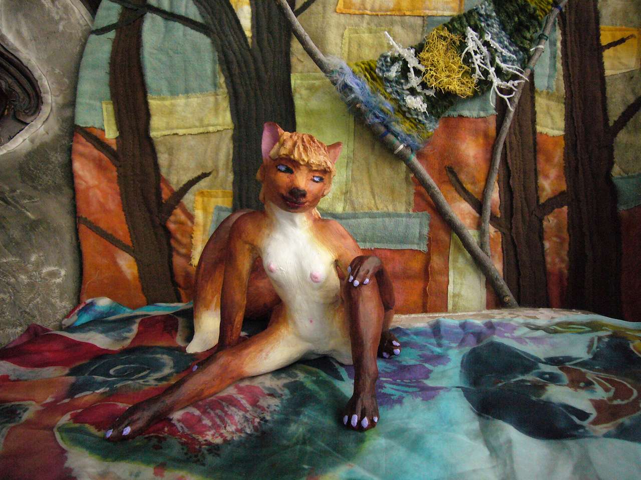
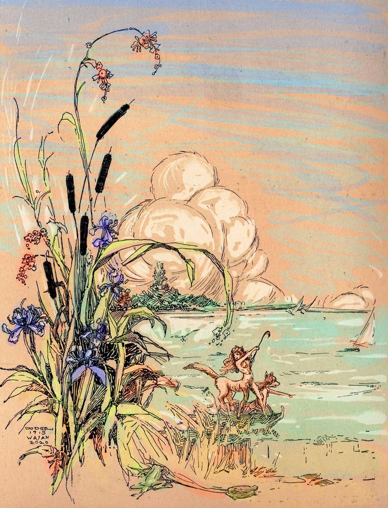
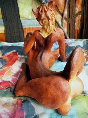
Foxtaurs raft on Musician Lakes, by Wayan, 2020, after
ink/sepia sketch by Katherine Sturges Dodge, 1915
|
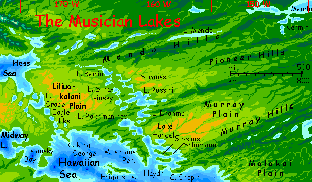
Three days east along a low, fairly straight coast. Then it veers south and gets a bit hillier: the Musicians Peninsula. Round the tip into Blackfin Sound. Islands, capes, fjords. Like Nootka Bay, the water here's drinkable in a pinch. Why? Blackfin is the outlet for a great freshwater basin to the north. Not quite the Ness Sea--much more broken up and confusing.
The Musician Lakes stretch 1000 km north and west. This marshy basin alternates deep lakes, deeper than any on Earth, with broad reed-marshes, surrounded by low, broad whalebacks of prairie. Like the Midway-Milwaukee chain of lakes, it's peaceful and fertile but a bit of a cultural backwater; exporting only some specialty foods. The Shire, basically. Just foxtaurs instead of hobbits. They're even around the same size, and with equally furry feet--just more of them.
The only cultural peculiarity of the basin is that, since so much of it is low-lying and marshy, construction here is mostly aboveground instead of the burrows common in the drier west. Low round lodges with thatched roofs. Don't bang your head on the rafters, set carefully just at human eye-level. Ow! Quite like Bag End. Poor Gandalf...
In contrast, on Liliuoakalani Plain between the Lakes and the Hess Sea, the shortage of wood, the wide swings of heat and cold, and the drier soil combine with foxtaur instincts to make make hobbitlike burrows (not above-ground houses) popular. True hobbitness!
They're not called the Musican Lakes because of the fox-troubadors and little dance bands touring on their reed-boats. These exist of course--but they exist all over the Hawaiian Sea; foxtaurs love to dance. You hear good music all over the Basin, but nothing standout. So why the name? Blame the humans of our non-abyssal Earth. They named the seamounts in this stretch of the Pacific after classical and show-tune composers, then dubbed the chain the Musician Seamounts--no, not Composer or Songwriter Seamounts, that would be consistent, we can't have THAT. The upper basin includes a Lake Berlin and Lake Hammerstein. Songwriters, not performers.
Sorry to be so touchy about it. I'm a good songwriter/composer but a clumsy musician; to me the distinction is obvious. People don't generally confuse photographers with models or screenwriters with actors--or cartographers with explorers, for that matter--what's so difficult?
Poor old Abyssians! Stuck with the real, flawed names for things.
Overview -
West Arm -
Central -
NW -
Hess Sea -
NE -
Enter the Kasowars
-
East -
Kamehameha -
Canal
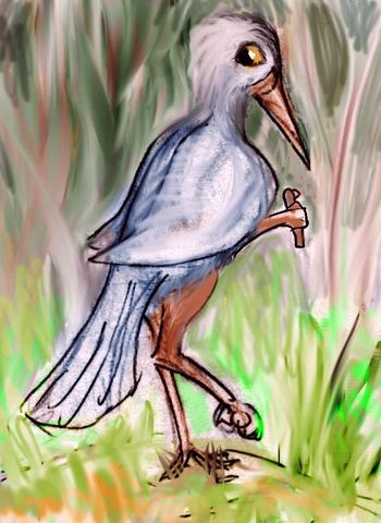
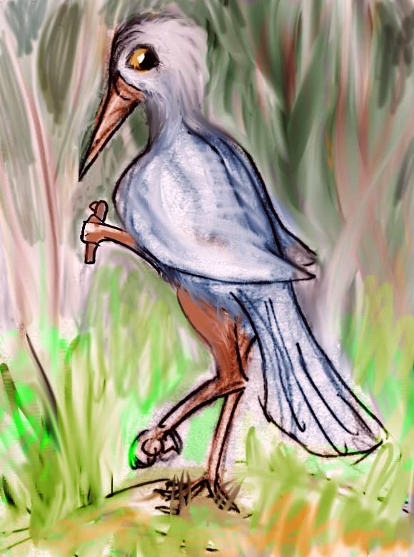
Eastern Pacifican kasowar
|
Here in the milder marine climate south of the Mendo Hills, winters are entirely snow-free. You start to see a significant minority of kasowars: flightless birds native to the equatorial forests to the south. I'm calling them that, of course, because their nearest Earth equivalent (not very) is of course the cassowary. Their own name for the species is "Squawwwwwwk." Not much help.
Kasowars are tall, skinny, a little touchy (that is, they jab you if you touch them). Omnivores tending vegetarian--rather like chimps. Since they're flightless but cover a huge range--all the tropics of the biggest continent in the world--they have many tribes and subspecies, crested or not, wattled or not, sober or brightly colored (some of that is gender of course; pink, red and orange wingfeathers usually indicate males, blue green or yellow, female; but there are tribes disproving that rule.
Their feathers (of any color) shed rain well, and while not utterly waterproof, make them reasonable swimmers; they make confident sailors. Well, but they're confident everything.
Almost everything. A kasowar won't crawl in one of those nasty foxtaur holes! A natural reaction; in the rainforests and swamps where kasowars evolved, such burrows would flood and collapse. And of course mildew you to death. A horrible way to go.
Kasowars can and will fight, but they're rather more solitary than humans; organized violence is not their thing. Organized anything is not their thing.
Though flightless, remember kasowars have hands; some may be able to climb trees like our forest apes. Alone among the flightless birds, kasowars (and a couple of similar rainforest birds on smaller continents) will think in three-dimensional webs, not limited to linear paths on a mere plain of possibilities.
Such pattern-masters may come into their own only when Abyssia advances to the point it really needs starship navigators, climate modelers, polyphonic composers, or (highest calling of all, in any civilization) librarians. Kasowars map the data jungle!
Anyway, with the advent of the kasowars, the weight of Pacifican civilization shifts from inland (for foxtaurs are savanna creatures at heart) to the coastal forests--and ports. For more on this rich region, see southeast Pacifica.
Overview -
West Arm -
Central -
NW -
Hess Sea -
NE -
Kasowars -
Eastern Hawaiian Sea
-
Kamehameha -
Canal
The Murray Hills, another pair of long fracture-zone ridges. Between them, the long straight Murray Lakes. Our Appalachian valleys like the Shenandoah look a bit like it, though their roots are quite unlike. Murray's a young, raw, still-shifting fracture zone; Appalachia's the worn-down bones of Himalayan mountains. A mix of forest and meadow, growing opener inland; first farms, then ranches. Considerable mining all through the Murray Hills--the many exposed, fractured cliff-faces make prospecting easier than in the forests.
South of the Murray Hills sprawls Molokai Plain. Its northern part is the lowest and narrowest point of East Pacifica. Still wide enough so the forest thins a bit inland; but even so, the shores of the Gulf of Tuscaloosa are mostly wooded, not prairie as to the north and west. It's the only stretch of Pacifica where an ape with a good map could swing from the eastern shore all the way to the Hawaiian Sea.
Around the Hawaiian Deep are the Counterweight Hills. These peculiar curving ranges about 1 km high (3300') are easier to explain in reverse. On our Earth, the burden of the Hawaiian volcanoes made the surrounding seafloor sag. So on Abyssia, the puckered-in crust of the Hawaiian Deep makes this great hole--not a trench, but a series of pits 6-10 km deep (20-33,000')--lighter than the surrounding continental crust; and the Counterweight Hills bow up in response.
The Counterweight Hills block rivers from easily entering the Hawaiian Sea; an arc of large lakes pool at the feet--Lake Wini, Brian, Crosley, and Shepard. Storms reaching this far inland from the world-sea snag on the Counterweights, unburdening half their rain on the lakeside of the Hills; this leaves the narrow coastal strip along this lobe of the Hawaiian Sea relatively open for this rainy latitude--grassy with scattered woods. Quite as Mediterranean as anyone could wish!
Except for the foxtaurs, of course...

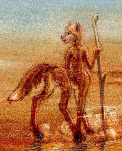
Foxtaur on Point Wini; Hawaiian Peninsula in distance. Print inspired by Tom Killion's Bonny Doon Beach
Overview -
West Arm -
Central -
NW -
Hess Sea -
NE -
Kasowars -
East -
Kamehameha Isthmus
-
Canal
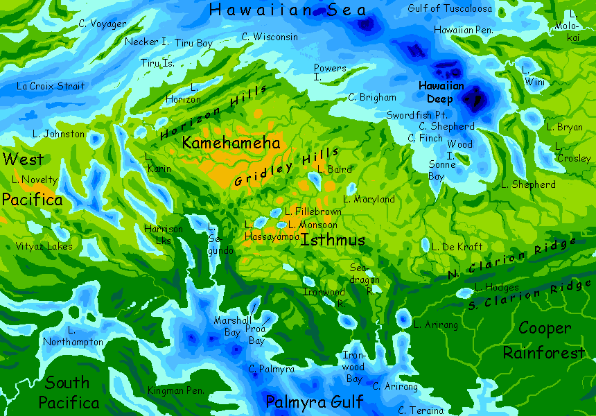
Kamehameha is a broad, sunny land--an isthmus 1000 km wide between Eastern and Southern Pacifica, with Palmyra Sound to the southwest and the Hawaiian Sea to the north. Kamehameha is geographically part of East Pacifica, but ecologically and culturally part of the Hawaiian basin--drier, more open, and dappled with deep pitlakes.
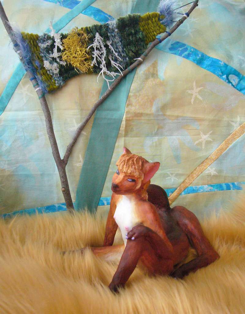
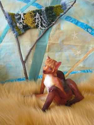
 Left, below: a woman from the Kamehamehan subspecies of foxtaur. She's unusually tall, fully 1.4 meters (about 4'7"), but typically gracile--slender and spidery for radiative heat-loss. Panting or sweating won't work in the southern humidity! Compared to her, most northerners you saw earlier were short, stocky, muscular, busty, and short-necked.
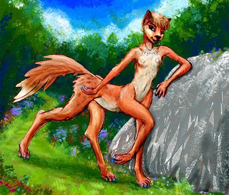
A foxtaur, gracile subspecies; Canal Zone
|
A Kamehamehan equa; Lake Baird
|
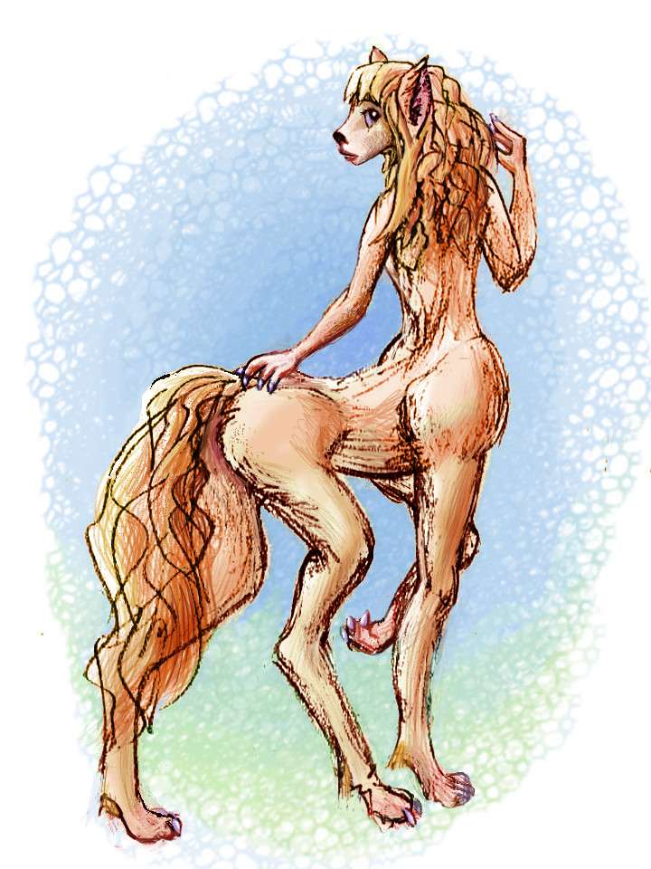
You'll also spot a few tall, slender Equi (above right; 1.8m or 5'10") from the southern continent of Agassiz. At least they originally were, over a thousand years ago; by now they've naturalized. Inland, where the savanna opens out, they're not rare at all; nearly half the population of the Lake Country, from Hassayampa to Baird, and a majority in the north, between the Gridley and Horizon Hills.
It's been so long that these inlanders have subtly diverged from some of their southern cousins, into a gracile (lightly built, for the equatorial heat) subspecies with long deerlike faces. Though Agassizians from Down Under are so diverse they form a dozen subspecies, from short-faced (almost feline or Neanderthal in proportion--a snout, but not a long one) to just as horse-faced as any Kamehamehan. A lone northerner wouldn't stand out, down in Agassiz; it's that they all look this way that makes them, to the Agassizian eye, a distinct tribe.
Overview -
West Arm -
Central -
NW -
Hess Sea -
NE -
Kasowars -
East -
Kamehameha -
The Hawaiian Canal
The north and northwest are the driest lobes of Cooper Rainforest--not a true monsoon wood turning dusty and dry in winter--but the rains do ease for many months. Still green, but without the relentless rain, heat and damp of the south. Forgive my bias; I'm a savanna creature like the foxtaurs. I envy the kasowars; my feathers aren't rainproofed.
In the north near the Hawaiian Sea, open woods and meadows line the fingerlakes on and around the busy Hawaiian Canal. These lakes (and bays like Marshall and Johnston) are the equivalent of our northern Line Islands--well, mostly seamounts in that long chain that don't break the surface. They aren't a simple line but several parallel chains. Together they form Palmyra Gulf; a true saltwater sound, an arm of the... what do we call this ocean, anyway? On Abyssia there's only one, really; the world sea. Well, it's true of Earth too; our explorers, though, are splitters not lumpers--more names to bestow! More fame to claim!
I doubt anyone on Abyssia ever thought to name or claim an ocean. The ocean. That's like claiming the air you breathe.
The Hawaiian Canal carries all shipping to and from the great inland sea--Abyssia's Strait of Gibraltar. 95% of the Canal is natural of course; a watermaze of long lakes like Segundo, Karin, Novelty, and the Harrison Lakes nearly link the seas now, and probably do so directly in slightly wetter eras when the Hawaiian Sea brims a few yards higher.
 I'm not absolutely certain which of these lake-valleys is the lowest and thus most likely to be the canal route--several would be easy to excavate. I've marked what I think is the most likely, being the shortest: Horizon Bay to Lake Karin to Lake Segundo to Marshall Bay. But if I've overlooked hills, nearby Lake Novelty through the Hamilton Lakes looks equally feasible; and even Johnson Bay to Lake Guyot, L. Magellan and L. Northampton, well to the west, looks a bit longer and less direct but quite low-altitude. So the existence of the canal somewhere is a near-certainty: this isn't Suez, hot and dry, nor Panama with its steep muddy hills and jungle fevers. Just short stretches of bottomland in a mild warm climate with modest rains!
It'll be dug. Too easy not to.
 TOURS: this route snakes around Abyssia's major lands -
Lena Is. (brr!) -
Greek Is. -
Atlantis -
Azorea -
Cayman and Albatrosia -
Andean Is. -
Scotia Is. -
Morningtonia -
Agassiz -
South Pacifica -
East Pacifica -
Hawaiian Sea -
Pacifica Desert -
Filipinia -
Banda Is. -
Vityaz Archipelago -
Tasman Is. -
The Bight -
Whartonia -
Chagosia -
Somalia -
Mascarenia and Crozetia -
Weddellia -
Argentia -
Pernambuco -
Angolia -
Tristania -
Agulhas group
TOURS: this route snakes around Abyssia's major lands -
Lena Is. (brr!) -
Greek Is. -
Atlantis -
Azorea -
Cayman and Albatrosia -
Andean Is. -
Scotia Is. -
Morningtonia -
Agassiz -
South Pacifica -
East Pacifica -
Hawaiian Sea -
Pacifica Desert -
Filipinia -
Banda Is. -
Vityaz Archipelago -
Tasman Is. -
The Bight -
Whartonia -
Chagosia -
Somalia -
Mascarenia and Crozetia -
Weddellia -
Argentia -
Pernambuco -
Angolia -
Tristania -
Agulhas group
Abyssia's homepage - map - peoples - regional tours - names
LISTS AND LINKS: More worlds? Planetocopia! - dreams of other worlds - ecology - climate change - evolution - natural disasters - terraforming - sculptures and 3D art -
World Dream Bank homepage - Art gallery - New stuff - Introductory sampler, best dreams, best art - On dreamwork - Books
Indexes: Subject - Author - Date - Names - Places - Art media/styles
Titles: A - B - C - D - E - F - G - H - IJ - KL - M - NO - PQ - R - Sa-Sk - Sl-Sz - T - UV - WXYZ
Email: wdreamb@yahoo.com - Catalog of art, books, CDs - Behind the Curtain: FAQs, bio, site map - Kindred sites