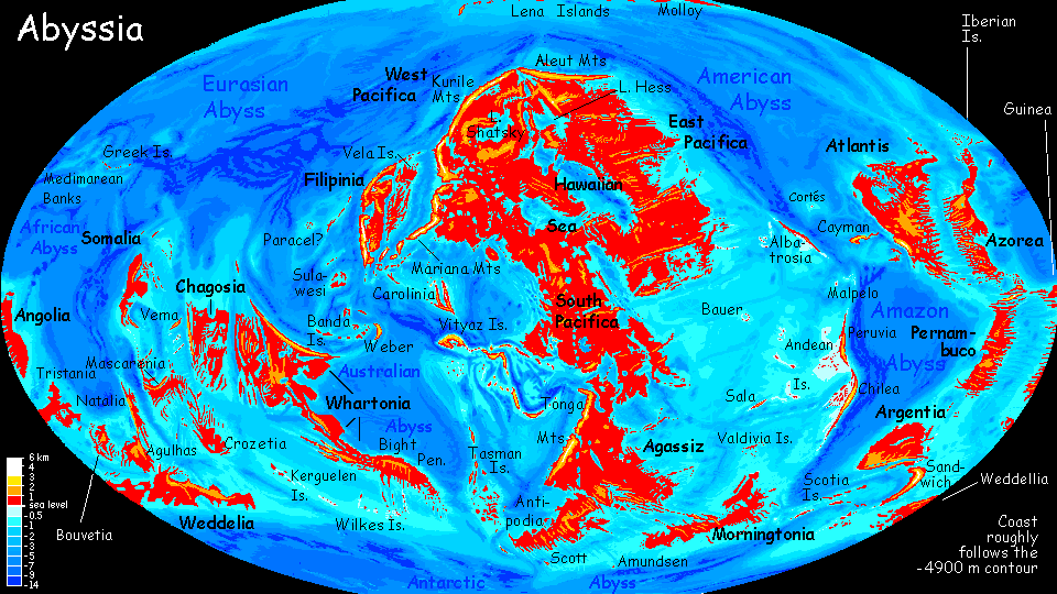
Abyssia:
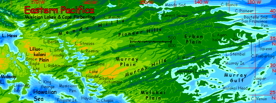
East Pacifica
by Chris Wayan, 2013-2017
for the fox in The Innkeeper's Song
Abyssia home - down to map - building Abyssia - geology & geography - critters & cultures - the clash of names - more worlds? Planetocopia!
Abyssia:
East Pacifica
by Chris Wayan, 2013-2017
for the fox in The Innkeeper's Song
Abyssia home - down to map - building Abyssia - geology & geography - critters & cultures - the clash of names - more worlds? Planetocopia!
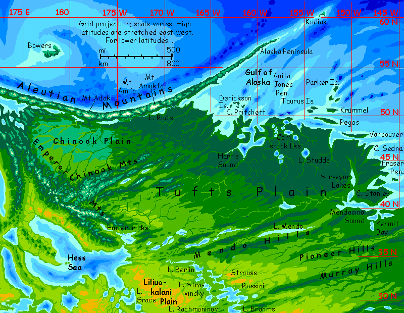
Overview - Far North - Tufts Plain - Cape Mendo - Murray Gulf - Clarion Pen. - Cooper Rainforest
From a human viewpoint, East Pacifica's the most desirable region of Abyssia. Huge, ranging from tropical to cool-temperate, all plains and gentle hills with no barriers to travel or exploration, with an inland sea helping even the hinterland ship goods easily; consistently rainy enough to be fertile but lacking the heavy rains that make Amazonia flood (except the very far south).
So the east favors civilization in many ways--or at least would if that civilization were human. Will Abyssians feel the same? That's harder to say. I'm postulating not a single dominant speces but a diverse cluster of centauroids and giant flightless birds--Abyssia has way more isolated lands than Earth--little Petri dishes of evolution.
Yet most of these Abyssians will have origins much like humanity's cradle--savannas and open woods. There are definite exceptions--the intelligent fliers that may emerge from the desert pitlakes of West Pacifica, and a land-squid or tree-crab crawling into coastal mangrove forests in the tropics--but most Abyssians may prefer the sorts of landscapes that humans do.
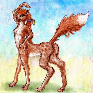
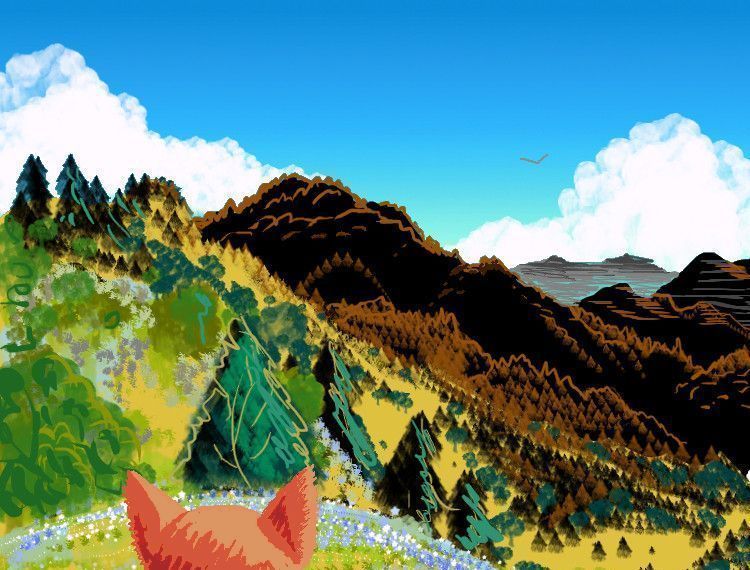
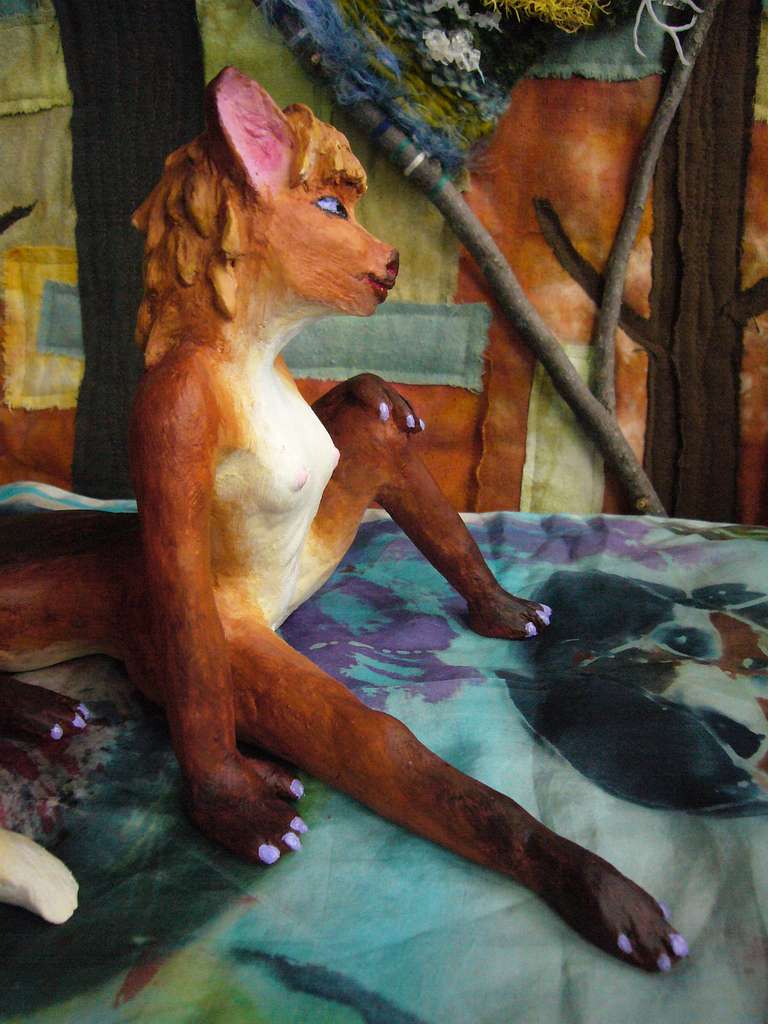
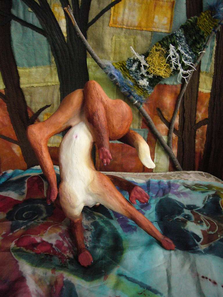
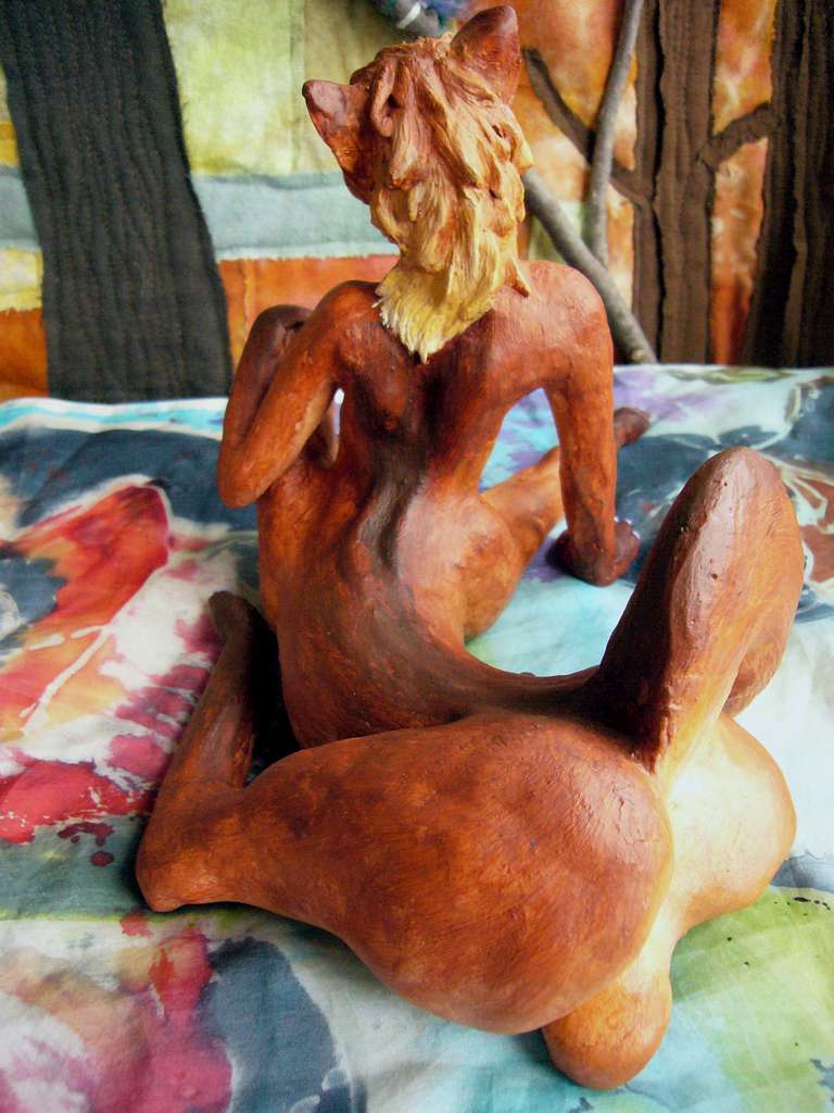
One intelligent species may even originate in this region--on its western shore, on the prairies around the Hawaiian Sea. Well, under them at least--foxtaurs like to burrow. This savanna looks ideal for these intelligent, child-sized, omnivorous, centauroid canines I postulate as one of the likely mammalian candidates for civilization.
Eventually the foxtaurs will have their own page; for now, the best description and sketches are on the Peoples of Abyssia page: Foxtaurs.
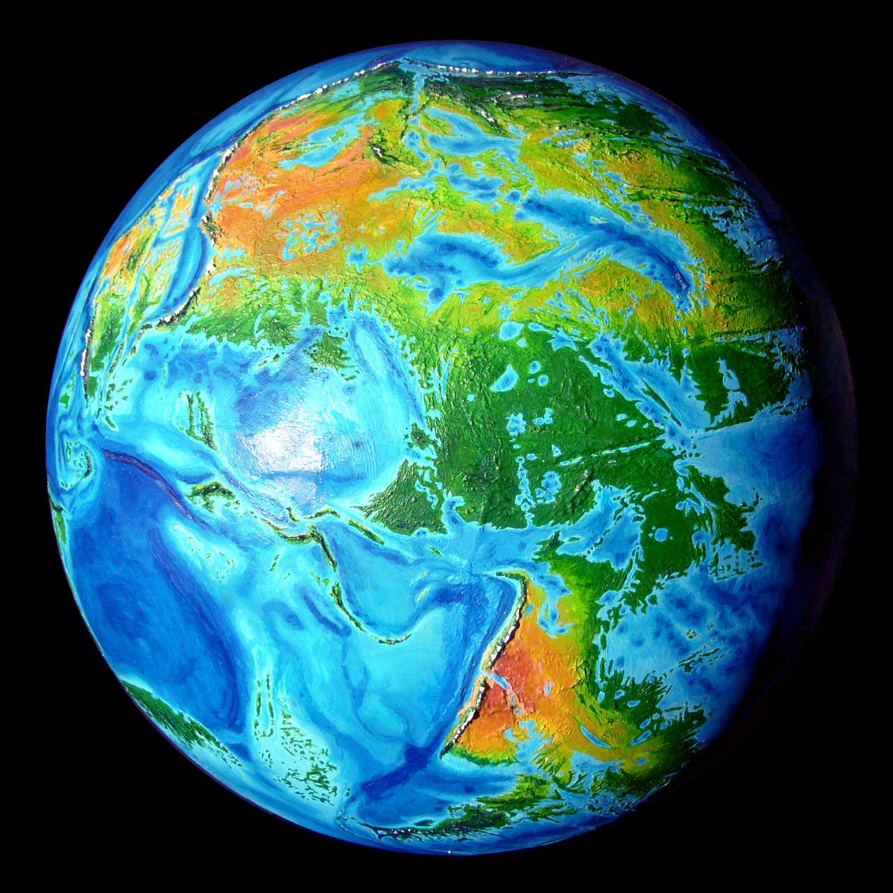
In the low-orbital photo below, north is to upper left; the following tour (still just an outline) wanders north to south, mostly hugging the east coast. The complex shores of the inland sea are sketchily covered here, as they'll get their own tour: the Hawaiian Sea.
Overview - Far North - Tufts Plain - Cape Mendo - Murray Gulf - Clarion Pen. - Cooper Rainforest
We'll begin on the north coast, below the snowy Aleutian Range. By our standards it's merely cool-temperate, not even subpolar. Still, it's the largest cold land in Abyssia's Arctic. Exposed to polar gales, it endures hard freezes and deep snows every winter. Yet this Siberia is just a coastal strip 100 km wide at most--and often as little as ten, for in many places the mountains rise right out of the sea.
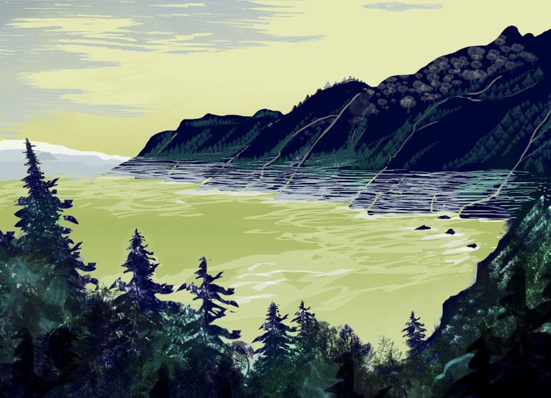
Abyssia has no Greenland ice cap; subpolar regions are milder than Earth's. And the Aleutian Range, 3000 km long, up to 2500 m high (8000'), blocks blizzards from penetrating deep into Pacifica. It does freeze inland, south of the Aleutian Divide, but snow burdens aren't heavy. Deep pine forests line the Aleut River and the shores of Lake Rude.
It's lonely land. Even south of the Aleutian wall, native Abyssians find it cold. You won't find any of the many large Abyssian flightless birds that have achieved intelligence elsewhere. The dominant avian on Pacifica is the kasowar, a tall, often crested bird that likes rainforest--and heat. To them, the cool damp Aleut climate is sheer misery. Death by a thousand drips.
Instead, you'll find only occasional farmsteads and lumber towns along the rivers and lakes, settled by one of the few mammals on the planet that's adapted to snow at all: foxtaurs. It's the very limit of their range--for they too evolved for heat, in the deserts of central-west Pacifica--but they've adapted. These Aleutians are a subspecies larger than most foxtaurs (for heat retention); and like many Terran mammals, they grow a white winter coat and shed it in spring, reverting to the reds and browns typical of their southern kin.

|

|
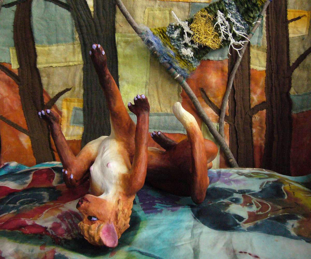
| Hashi, a foxtaur in white winter coat, in "Aleutian Spring", a dance from Pacifica's north coast; sculpted by Wayan | |
The east end of the Aleutian Range creates the Alaskan Peninsula, jutting east over 1000 km, though it's never more than 100 km wide and often just 50. Off its tip is Kodiak Island, which Pacificans firmly believe is...
THE NORTHERNMOST LAND IN THE WORLD
Abyssian geographers have good reason to think Kodiak is the northernmost land; only Bowers Island inside the curve of the Aleutian Range and a few islets off the tip of Atlantis appear to come even close. But all of these candidates are wrong. The arctic Lena Islands are a chain that almost crosses the pole! Nor are they small--Molloy, the largest, is over 400 km long (250 mi).
Why would the Abyssians overlook the Lenas? Well, they're as isolated as the Hawaiian chain is on Earth, and no obvious shallows or reefs hint at their existence until you reach high latitudes. And Abyssians don't. They don't like polar seas--or polar lands, either. They're poorly adapted for cold; Abyssia's had no Ice Ages for at least 50-100 million years, and nearly all the land is tropical or subtropical. Indeed, so little high-latitude land exists that no one's going to go combing empty, deadly polar seas in the hopes of finding a scrap or two. So Kodiak may wear its nominal crown for some centuries yet.
Bowers, the bronze winner in our Arctic Misery Competition, has about the wretchedest climate in the northern hemisphere. Bowers is large but flat barren and windy--naked to Arctic blizzards. It's biologically impoverished too. 400 km north of the Aleutian Coast (250 mi out), Bowers is lonely enough never to have acquired large predators, or any large mammals; the dominant lifeform is a flightless bird the size of a large goose, the Bowers moosebird, found only here, and only on the coasts, not inland where you'll find just rocky downs, sparse spruce taiga and bogs. Rodents and small birds are the largest life forms there. No bear, wolf, raven, Siberian tiger, polar bear, not even an arctic fox. Abyssia's few scattered arctic islands just haven't evolved anything like our cold-tolerant fauna. It isn't just sentient Abyssians who like it hot...
Moosebirds are just as peculiar as they look. It's the female that has that antlerlike headgear--presumably some sort of simple crest or wattles, originally--but by now they really do resemble antlers in shape (though they're permanent). Functionally, too, they're antlers: females bonk heads to compete for mates. The smaller males make up for their combat-exemption by doing most of the incubation; not uncommon in Terran flightless birds.
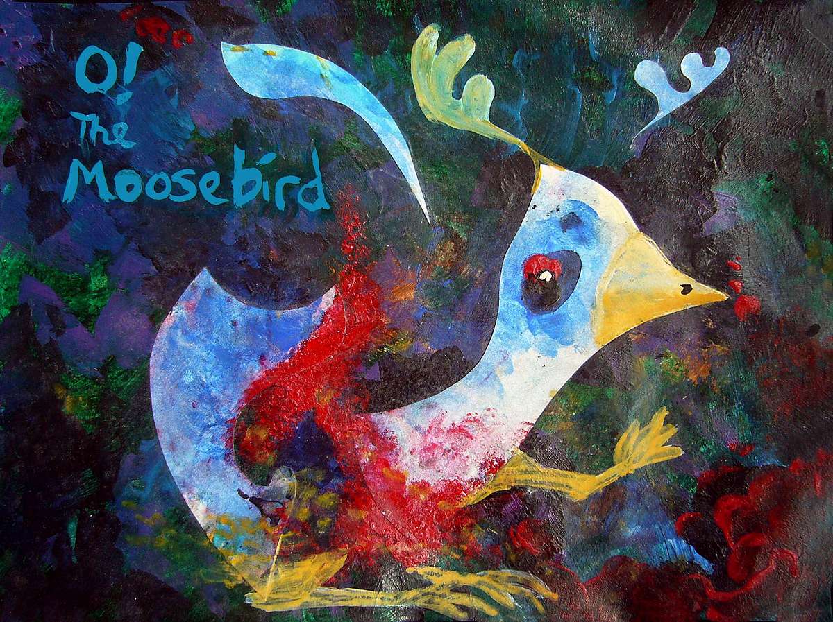
Slow-moving, trusting, endearingly inept (bonk-drunk?), moosebirds survive only because even fishing boats rarely visit. Moosebirds seem well adapted for Kodiak Island to the northeast, too (it's slightly warmer and more sheltered, especially on the south shore), but there are no signs they ever lived there. Presumably they evolved from a gaggle of storm-blown fliers and evolved, or devolved, into the antlered flightless creatures trapped on Bowers today.
Overview - Far North - Tufts Plain - Cape Mendo - Murray Gulf - Clarion Pen. - Cooper Rainforest
South of the Alaska Peninsula, dozens of deep blue holes pock otherwise shallow Kodiak Gulf. They don't stop at the shoreline, but march well inland, dappling northern Tufts Plain, too. Silverblue holes in a somber green forest, otherwise pretty much unbroken. We're still around 50 degrees north--though Abyssia is warmer than Earth at high latitudes, since there are no icecaps like Greenland to sour the weather.
At least until you hit the dark pinewoods of the Chinook Mountains, Abyssia's equivalent of the Black Hills. Taller, though; from near sea level the Chinooks rise to 2800 m (9200'); like the Aleutian Range they bear snow well into summer, though no glaciers.
That may not be true of the larger Emperor Range west of the Chinooks--Pacifica's closest analogy to the Rockies. But not a perfect one; the Rockies, scarred and sculpted by the Ice Age, rise to over 4000 meters from a plain already a mile high, and only a few thousand km from Greenland's surviving icecap. The Emperors rise only a little higher than the Chinooks, to 3000 m (10,000'), from a prairie barely above sea level, on a milder, ice-free Earth. So the Emperors are pine-forested ridges balding to alpine meadows on the heights; snow-crowned deep into spring, but generally not year-round. A few small glaciers, just high-up shady patches really; certainly none of the horns, fins, domes or cirques you see in the Alps, Rockies or Sierras. Those are Ice Age relics, and ice hasn't carved Abyssia as it has Earth.
All this country down to around 40° north is unnatural by Abyssian standards: civilization here ("Such as it is", southerners would add) is unispecific; almost entirely foxtaurs, with just scattered eccentrics of other intelligent species. It's the winters--not rough by Terran standards, but most Abyssian peoples can't take any snow at all.
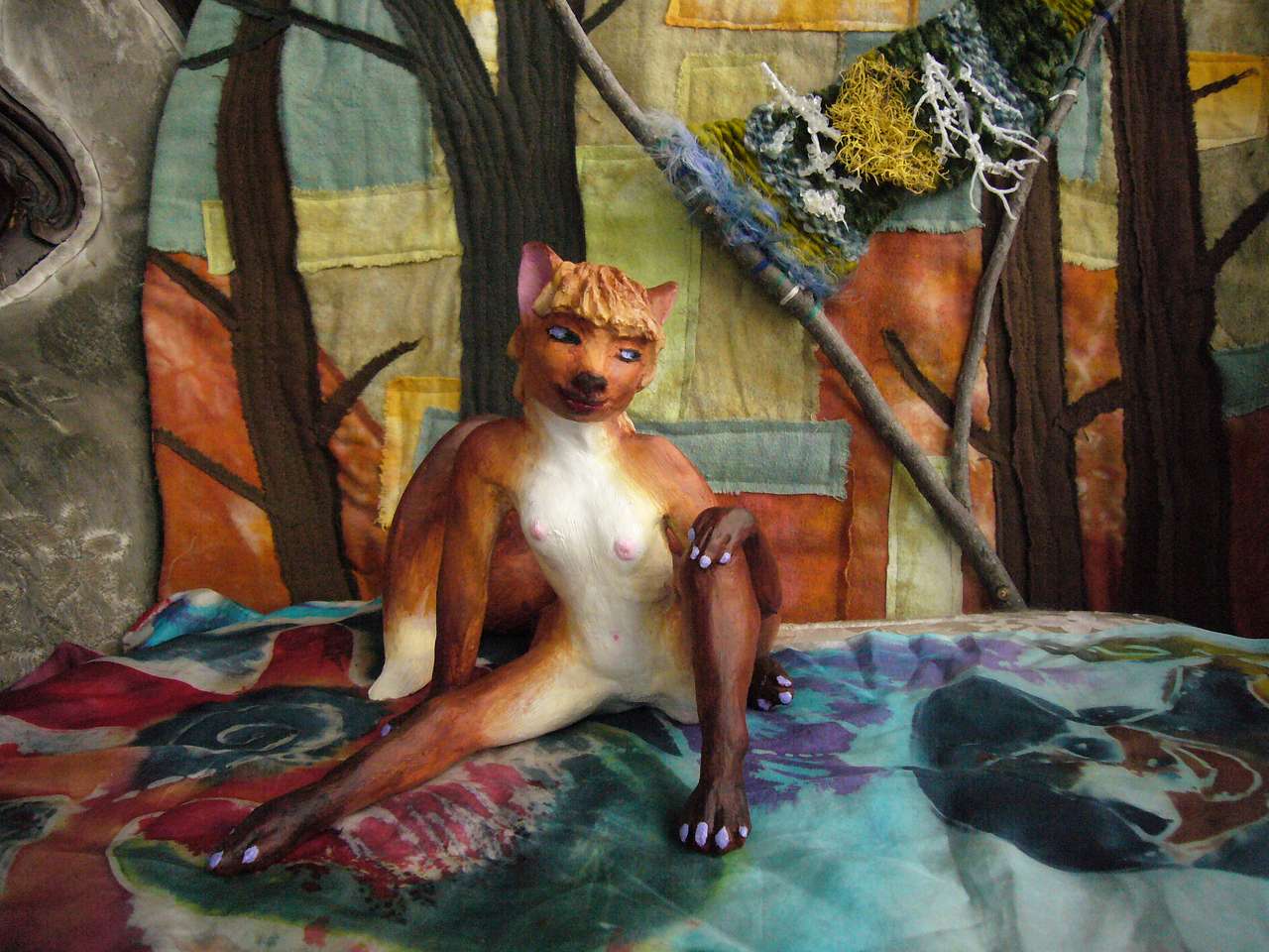
This species-monotony has consequences. It's a conservative and pious society, nature-worship focused on the all-important cycle of the seasons, rather like old Japan's many seasonal rituals. Less innovation; for example, the perennial favorite spring-play, an erotic dance called Bursting Through Old Snow, isn't local; it was created three millennia ago in the Southern Ring, a band of small, rather Siberian continents circling the South Pole. The reason's simple; a dozen intelligent species comparing notes are more likely to come up with insights than one alone. And the southern-temperate population's much larger than this northern-temperate one--the land base is bigger and more diverse.
|
|
|
| Nezza in "Bursting through Old Snow", a spring mating dance, northeast Pacifica; foxtaur by Wayan, quilted backdrops by Joy-Lily | ||
|
|
The local production may be traditional, but the sets are beautiful and the dancing very sexy (assuming you like foxtaurs). Opportunity and innovation may concentrate in big, diverse ports; but talent rises everywhere. Bursts, one might say, through old snow.
Overview - Far North - Tufts Plain - Mendo Peninsula - Murray Gulf - Clarion Pen. - Cooper Rainforest
South of Tufts Plain is the long line of the Mendo Hills, the next fracture zone. These ridges reach east all the way to the Hawaiian Sea--well, Lake Hess, actually, a cut-off part of it comparable to our Caspian or Black Sea. Our two inland seas don't get enough water to sustain themselves; only inflow from the Mediterranean keeps the Black Sea at sea level, and the Caspian is sunken and fluctuating. So a case can be made that Hess should be a sunken salt lake. Its basin is mostly shallow, but has several pits nearly 5 km deep, so the water could retreat a long way...
But the Hess Basin is not Central Asia: East Pacifica's smaller, and only low hills lie upwind, so the steppes and hills around Hess get much more rain than the Caspian's shores; a better analogy's the Great Lakes. So I've shown Lake Hess full-sized and overflowing south into the Hawaiian Sea. This drainage suggests Hess will be a gigantic freshwater lake. This (probably navigable) outlet means that Hessians will look south to the Hawaiian Sea complex, just as our Black Sea is culturally a chilly annex to the Mediterranean world (yet despite its proximity and similar latitude, the Caspian is not--not since the Bronze Age, when rivers still linked the Black, Caspian and Aral Seas). Drainage matters!
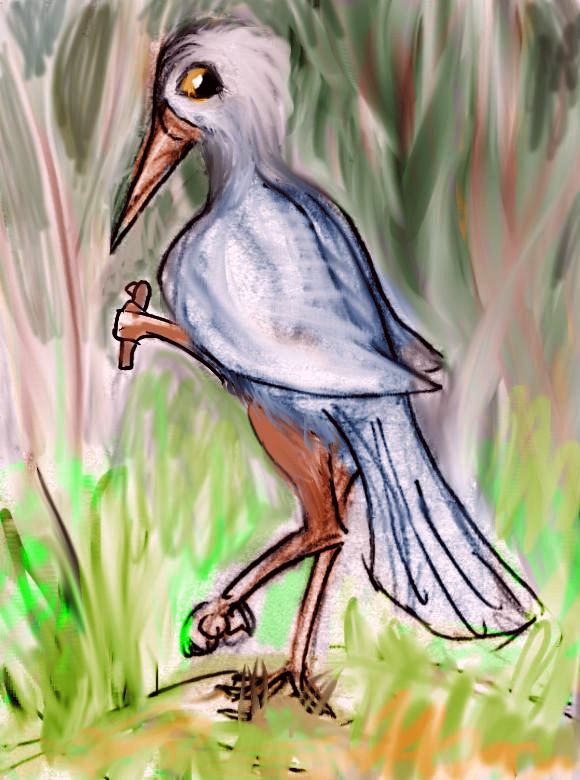
Eastern Pacifican kasowar |
Back to the coast...
Here in the milder marine climate, winters are entirely snow-free south of the Mendo Hills; we start to see a significant minority of kasowars: flightless birds native to the equatorial forests to the south. Tall, skinny, a little touchy (that is, they jab you if you touch them). Omnivores tending vegetarian--rather like chimps. Variously crested and wattled and brightly colored. The model here is the cassowary. Their feathers shed rain well, and while not entirely waterproof, make them reasonable swimmers; they're confident sailors. Well, but they're confident everything.
Kasowars can and will fight, but they're rather more solitary than humans; organized violence is not their thing. Organized anything is not their thing. Though flightless, remember thay have hands; some may be able to climb trees like our forest apes. Alone among the flightless birds, kasowars (and a couple of similar rainforest birds on smaller continents) will think in three-dimensional webs, not limited to linear paths on a mere plain of possibilities. Such pattern-masters may come into their own only when Abyssia advances to the point it really needs starship navigators, climate modelers, polyphonic composers, or (highest calling of all, in any civilization) librarians. Kasowars map the data jungle!
Anyway, with the advent of the kasowars, the weight of Pacifican civilization shifts from inland--foxtaurs are savanna creatures at heart--to the coast forests--and ports.
Climate facilitates this, yes, but geography too. Between the long ridges of the Mendo fracture zone lies narrow Lake Mendo, 640 km long, and its outlet runs east down a long straight rift valley to its saltwater continuation, Mendocino Sound. Produce from halfway to the Hawaiian Sea is shipped down this waterway. At the rivermouth, Port Mendo is the first large city on the east coast. And not the last.
Next: the several lobes of winding Kermit Bay, big as Chesapeake Sound, though shaped more like an oversized San Francisco Bay. Mild, rainy, forested shores. Its rivers access much of the forested Mendo Peninsula. Most exports from Port Kermit are wood products; it's smaller and less interesting than Mendo.
The Pioneer Hills, long fracture-zone ridges. Between them, the long straight Pioneer Valley. Our Appalachian valleys like the Shenandoah look a bit like it, though their roots are quite unlike. Appalachia's the worn-down bones of Himalayan mountains; Pioneer's a young, raw, still-shifting fracture zone. A mix of forest and meadow, growing opener inland; first farms, then ranches. And a lot of mining, all through the Pioneer Hills--the many exposed, fractured cliff-faces make prospecting easier than in the forests.
Capes and bays in steady succession now--Cape Blanco, Pioneer and Boutelle, the San Francisco Peninsula. No, really; named for a nearby seamount in our world, and near the City's latitude, if not longitude--our Frisco is over a thousand miles east (and, of course, several miles down). But because it's on an east coast not a west, with a huge ocean upwind, climatically it's more Carolina than California--hot muggy summers with occasional hurricanes, and cool, rainy but snowless winters.
Inland, subtropical forests stretch thousands of kilometers, slowly opening to wide prairies around the Musician Lakes and on Liliuoakalani Plain between the northern arms of the Hawaiian Sea. Here the shortage of wood, the wide swings of heat and cold, and the drier soil combine with foxtaur instincts to make make hobbitlike burrows (not above-ground houses) popular. Not in the wooded east, though. A kasowar won't crawl in one of those nasty holes! A natural reaction; in the rainforests and swamps where kasowars evolved, such burrows would flood and collapse. And of course mildew you to death. A horrible way to go.
Overview - Far North - Tufts Plain - Cape Mendo - Murray Gulf - Clarion Pen. - Cooper Rainforest
Erben Lake and Cape Fieberling. Warm--still Georgia or Northern Florida, and maritime, and low, so it's rainy too. Unbroken forest, except for the lakes and swamps.
The Murray Hills and associated long lakes, geologically much like Mendo but hotter. Muggy summers full of thundershowers. Or worse: this stretch of East Pacifica suffers frequent hurricanes.
Moonless Island is a name borrowed from our world's Moonless Mountains, an abyssal range whose summits are too deep to see even a trace of moonlight. On Abyssia this range becomes a trough hidden under Murray Gulf just east of the island. Like many names that delight when applied to our deeps, Moonless doesn't fit the island nearly as well; sure, it's a damp Caribbean climate, often cloudy, but it sees plenty of sun and moon. Its real climatic disadvantage: this confined stretch of warm shallow water just helps feed tropical storms, letting them churn deeper inland. Moonless is right in the middle of Hurricane Alley.
Inland from Moonless Island and Murray Gulf is Molokai Plain. Its northern part is the lowest and narrowest point of East Pacifica. Still wide enough so the forest thins a bit inland; but even so, the shores of the Gulf of Tuscaloosa are mostly wooded, not prairie as to the north and west. It's the only stretch of Pacifica where an ape with a good map could swing from sea to sea.
Around the Hawaiian Deep are the Counterweight Hills. These peculiar curving ranges about 1 km high (3300') are easier to explain in reverse. On our Earth, the burden of the Hawaiian volcanoes made the surrounding seafloor sag. So on Abyssia, the puckered-in crust of the Hawaiian Deep makes this great hole--not a trench, but a series of pits 6-10 km deep (20-33,000')--lighter than the surrounding continental crust; and the Counterweight Hills bow up in response. Storms off the ocean snag on the Counterweights, unburdening half their rain; so the coastal strip along this lobe of the Hawaiian Sea is relatively open--grassy with scattered woods.
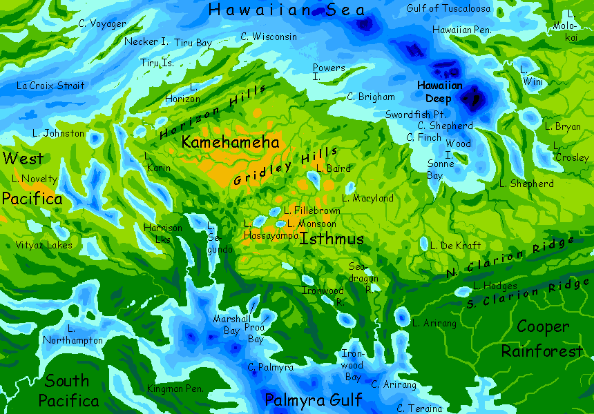
The Hawaiian Sea and its shores FINALLY has its own page. Still skeletal, but mapped now, and I'm sketching hard! Already a much closer look at this fascinating twist on our Mediterranean.
Overview - Far North - Tufts Plain - Cape Mendo - Murray Gulf - Clarion Peninsula - Cooper Rainforest
Cape Moonless and the Jasper Islands. Scenic, fertile, with summer rains often breaking the muggy heat, but cool drier winters. Again, hurricane-prone.
Venus Bay and the Ake-no-Myojo Lakes. Inland, wooded plains for 1000 km. Rainforest? Probably drier than that; seasonally drenched, but with a long winter dry season. Remember Brazil's northeast! Though Brazil's coastal ranges are much higher and block storms better. At the least, the woods will thin inland; possibly to savanna.
The Clarion Hills and their linear lakes. What is this, the sixth fracture zone now? The seventh? These twin cloud-catching ridges about 1-2 km high (3-7000') will shelter the long Clarion Valley between them, leaving it drier, sunnier and more open than the surrounding plains; probably savanna with scattered trees; sustained woods only along watercourses and on lakeshores.
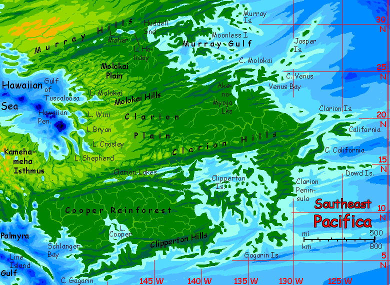
The islands of Clipperton Gulf... More Indonesian echoes. Rainforested islets in shallow coral seas. Fertile, rich, but a real maze to sail; carry a local pilot!
Overview Far North - Tufts Plain - Cape Mendo - Murray Gulf - Clarion Pen. - Cooper Rainforest
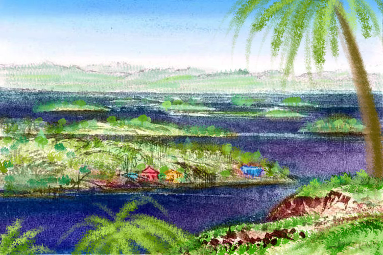
The forests of the Clarion coast were big. But the woods around Clipperton Gulf are huge--tall, diverse, lush, and covering several million square km. Not as big as Amazonia, but... the Congo? Yet like neither: both these continental rainforests are resource-rich but transport-poor. But the Cooper Rainforest is a maze of gulfs and sounds, peninsulas and islands. An Indonesia firmly attached to the mainland, and twice as large, with access to deepwater ships and shipping. So the Cooper region will have a long tradition of trade and shipping--specialty woods, resins, fruit, nuts, rubber, fiber and medicines (recreational and otherwise).
Follow the fractal coastline of Clipperton Gulf long enough and you'll completely circumnavigate Clipperton Island, a green dragon-shape twisting through the sea for over a thousand km. As low, little Java dominates Indonesia by its ease of access--long coasts, extensive plains--you'd expect Clipperton to be the wealthiest part of Cooper Rainforest. It's densely populated and perhaps the most civilized, in the sense the land's been altered the most to suit the inhabitants--shore-to-shore orchards, farms and towns, in some places--"the dragon-garden", they call it--but it's no richer than many mainland ports; they may be cruder, mere outposts on the edge of the region's biggest jungle, but that lets them export wildcrafted rainforest products rafted down the hundred winding rivers round the Gulf.
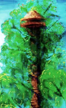
Abyssians aren't cutting down the rainforest in order to farm, of course; why bother? Since kasowar can safely climb (they can't fly with their stubby wings, but they can slow a fall enough to prevent injury), they simply farm the canopy. The larger trees often have spiral stairs built in so traders and inspectors of other species can reach the top and at least examine the "fields" and their produce on-site, if not harvest it.
By all means visit the canopy, unless you have acrophobia.
Though you may think you don't, but learn you do in Cooper. The kasowar don't believe in railings.
By the way--if this kasowar looks strangely toothy, more a feathered dinosaur than a bird, there's a historical reason. A lot of Abyssian birds have teeth and saurian snouts. Plenty of flying dinosaurs had teeth. Our birds don't for a reason: the impact at Chicxulub was so devastating, most creatures built to eat fresh food died in the 'impact winter' or the hot period after--the pulverized limestone caused a spike in CO2, and temperatures. Only a few small birds made it through cold and heat--presumably by eating seeds, the longest-lasting food.
That took beaks. Plant and meat eaters, with teeth, just didn't make it. Modern birds diversified, but even those eating berries, pondweed, bugs, fish, or carrion, all of whom could probably use saurian teeth and jaws, couldn't reverse-engineer them. Evolution lacks an undo button. So they modified beaks and made do.
But was the extinction on Abyssia as severe? I'm skeptical. Here, Chicxulub isn't coastal, but deep sea far from land. Way less dust blocking sunlight or raising CO2 levels later. A worldwide tsunami and firestorms and blast waves, yes, killing most land animals, but a wider variety of small fliers might have survived these briefer scourges.
There's a rival theory that what really killed off the dinosaurs were the huge eruptions of the Deccan Traps--climate swings, CO2, sulfur (acid rain!) ash, lead, and mercury. Suppose this theory is correct; then Abyssia still comes out ahead. Here, the Deccan is miles deep; just another abyssal basalt plain. Deep-sea eruptions just don't do as much damage.
So either way... with smaller climate swings, more small Abyssian birds and mammals survived. Modern Abyssian birds can thus have teeth and other dinosaurian traits lost on Earth. And they've had eons to build on that foundation. Facial muscles, lips, cheek pouches, external ears?
Anyway, this individual is an "Agassiz kasowar"; despite the name, she's no more closely related to the Pacifican kasowar than a wolf is to a Tasmanian wolf (marsupial; closer related to a kangaroo). Identical environments and pressures led to convergent designs--except the lineage here in Pacifica had bills and the one in Agassiz had toothy jaws.
Next our meander south takes a sharp bend west: nearly 2000 km (1250 mi) to reach Cape Gagarin, the southernmost corner of East Pacifica, just three degrees from the equator. Though this long Gagarin Coast fronts the ocean and sees plenty of shipping compared to any individual arm of Clipperton Gulf, few of those ships drop anchor. The coast is poorer and feels more culturally "inland". Why? The Gagarin Hills block easy access to the rainforest inland. In place of the chain of bustling ports of the Clipperton Isles, mere fishing villages. A lot of them, and they're pleasant places--lovely beaches and lush gardens--but it's a narrow settled strip clinging to the seaward slopes. The hills are rugged.
At Cape Gagarin, we've reached the southernmost point of our north-south tour, but we're still not quite done. Round the Cape into Palmyra Gulf, then a day east-northeast--almost back the way we came. Near sunset we reach Port Cooper at the mouth of its great lake-complex. Here's where all the trade vessels dock! The rivers feeding the Cooper Lakes are deep enough for fair-sized ships, and without rapids or Nile- or Congo-type cataracts. The rainforest between the Gagarin and Clipperton Hills is flat and swampy. Trade and travel is by boat, and over half of it all exits here.
One last region! We head northwest, up Palmyra Gulf. The convoluted shores of Schlanger Bay are capped by an unbroken wall of green... on past Teraina Gulf, Arirang Head, Ironwood Bay, and the Seadragon River... the Cooper Rainforest seems endless. Nearly is.
But after a week of steady sailing, around Proa Bay, the forest starts to thin and the sun shows through. We're entering Kamehameha, a broad, sunnier land--an isthmus 1000 km wide between Eastern and Southern Pacifica, with Palmyra Sound to the southwest and the Hawaiian Sea to the north.
Kamehameha is geographically part of East Pacifica, but ecologically and culturally part of the Hawaiian basin--drier, more open, and dappled with deep pitlakes. It just doesn't look like the rest of the south. Many of the people you meet here aren't Kasowar, the lanky rainforest birds ubiquitous for the last hundred ports or more; you start running into foxtaurs and other savanna species.
Left, below: a woman from the southern subspecies of foxtaur. She's unusually tall, fully 1.4 meters (about 4'7"), but typically gracile--slender and spidery for radiative heat-loss. Panting or sweating won't work in jungle humidity! Compared to her, most northerners you saw earlier were short, stocky, muscular, busty, and short-necked.
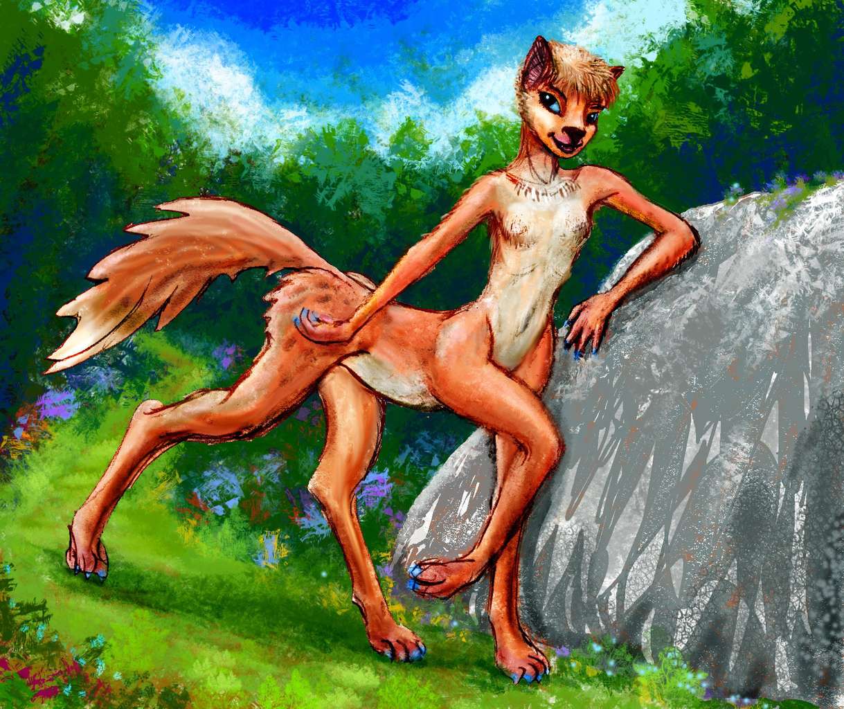
A foxtaur, gracile subspecies; Canal Zone |
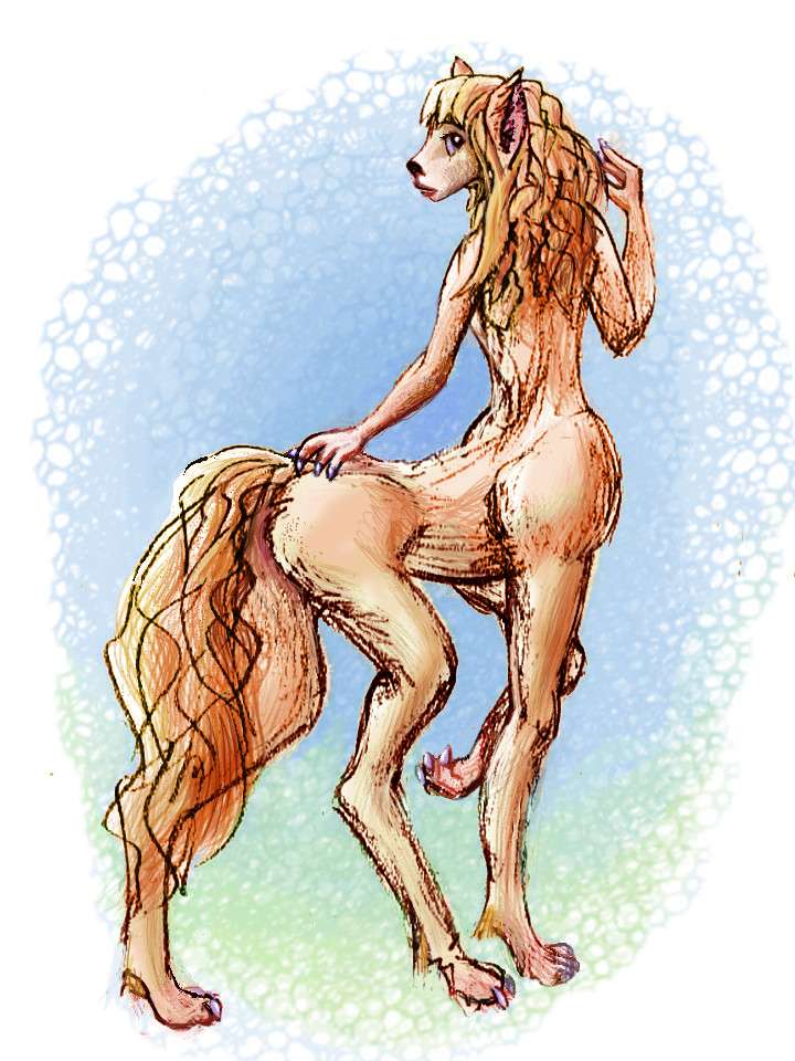
A Kamehamehan equa; Lake Baird |
It's been so long that these inlanders have subtly diverged from some of their southern cousins, into a gracile (lightly built, for the equatorial heat) subspecies with long deerlike faces. Though Agassizians from Down Under are so diverse they form a dozen subspecies, from short-faced (almost feline or Neanderthal in proportion--a snout, but not a long one) to just as horse-faced as any Kamehamehan. A lone northerner wouldn't stand out, down in Agassiz; it's that they all look this way that makes them, to the Agassizian eye, a distinct tribe.
At Kamehameha's west end, the busy Hawaiian Canal carries shipping to and from the great inland sea--Abyssia's Strait of Gibraltar. 95% of the Canal is natural of course; a watermaze of long lakes like Harrison, Segundo, Karin, Novelty, and Johnson nearly link the seas now, and probably do so directly in slightly wetter eras when the Hawaiian Sea brims a few yards higher.
At Canal Port you have several choices:

Abyssia's homepage - map - peoples - regional tours - names
LISTS AND LINKS: More worlds? Planetocopia! - dreams of other worlds - ecology - climate change - evolution - natural disasters - terraforming - sculptures and 3D art -
World Dream Bank homepage - Art gallery - New stuff - Introductory sampler, best dreams, best art - On dreamwork - Books
Indexes: Subject - Author - Date - Names - Places - Art media/styles
Titles: A - B - C - D - E - F - G - H - IJ - KL - M - NO - PQ - R - Sa-Sk - Sl-Sz - T - UV - WXYZ
Email: wdreamb@yahoo.com - Catalog of art, books, CDs - Behind the Curtain: FAQs, bio, site map - Kindred sites