Capsica's homepage, map, giant ref map, geography, gazetteer . More worlds? Planetocopia!
 Capsica: Nohaa and the Polar Flyway
by Chris Wayan, 2010-2011
This one's for you readers, who pestered me until I had to build it
Capsica: Nohaa and the Polar Flyway
by Chris Wayan, 2010-2011
This one's for you readers, who pestered me until I had to build it
INTRODUCTION
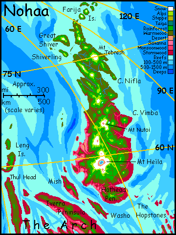
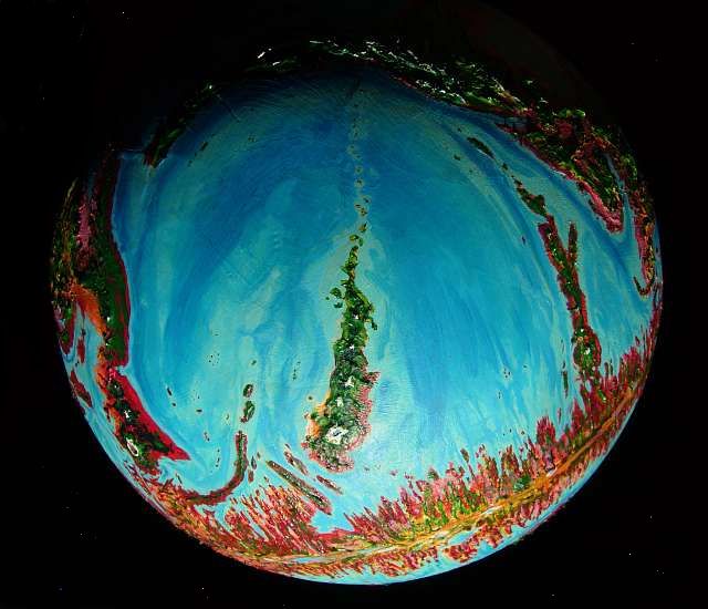
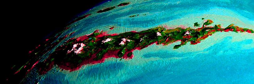
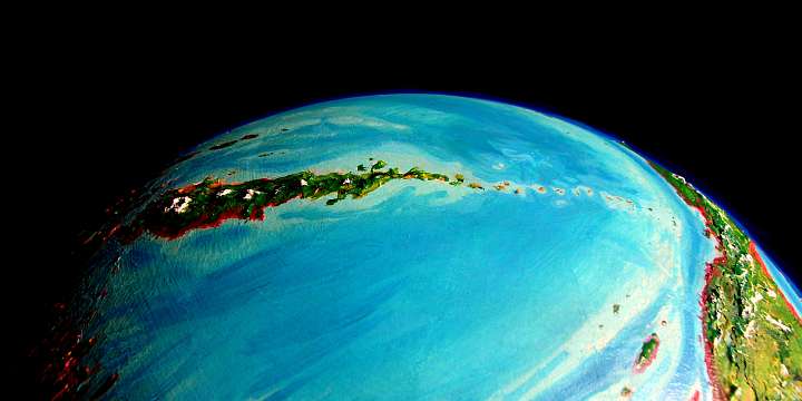
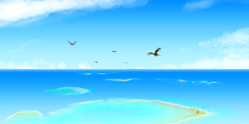
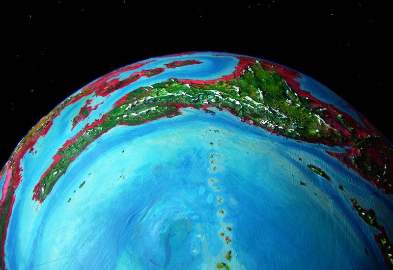
Nohaa is a chain of great shield-volcanoes that spans the Arctic Sea--the trail of a hot spot deep in the mantle. Earth has a close analogue: if you drained the Pacific Ocean, the Hawaiian Islands and Emperor Seamount Chain would look much like this--a long bridge of stepping stones across the world. (Oh wait, I did drain it: see Hawaii exposed to its ankles in Siphonia.) Because the seas here on Capsica are so shallow, the whole height of these volcanoes is revealed; the tallest, Mt Heila, reaches 15 km above sea level (nearly 50,000'!) Instead of mere islands neck deep in an ocean, a solid land-bridge spans half the Arctic Sea; and substantial islands, not mere atolls, lead you most of the way to the far shore.
THE POLAR FLYWAY
Capsica has lower gravity and denser air than Earth, so many of its inhabitants are winged. Capsican travel is mostly by air--hard work, but so much faster than by land or sea that only the infirm (or those shepherding heavy cargo) sail on the slow freighters threading the shallow, reef-choked, labyrinthine seas. Capsicans are used to island-hopping their way around the world. So this polar landbridge, even with its gaps, is a tempting shortcut between hemispheres. It's become the Capsican equivalent of the polar shortcuts of Earth--London to San Francisco or Tokyo is much shorter over the pole, and the same is true here.
Just three small problems:
Since Terran tourists need sunlight just as badly as Capsicans, and summer temperatures in the high arctic are tolerable (if still warm! 25-40°C or 77-104°F) we'll join the great summer migration.
It's hard for a Terran to see it as anything else. As you observe this aerial river of hapless creatures, you feel like you're caught in a Dr. Seuss book about dimwitted birds instinctively migrating but not getting it quite right. It's important to remember these are intelligent people. They're just people as far out of their element as you'd be if you tried to swim the Atlantic--a fair comparison, since they're crossing a cold ocean by their own muscle power. No movies, no meals, no drinks--unless they bring them.
And they need to. At the end shown on the map, the young, active end of the chain, the volcanoes are tall and the land is wide and fertile. Theoretically at least, there's plenty of food--in fact growth is explosive and lush during the light months. This mini-continent is also lower latitude--warmer.
But as we proceed north, the climate cools relentlessly. True, the peaks are lower. For Terrans, who prefer the cool weather on volcanic shoulders, the journey is comfortable--you descend to warm up, or climb to cool. But Capsican travelers hug the coasts from the start, and start shivering as temperatures drop past 35-40°C (95-104°F). As the polar chill worsens they can't descend into their comfort zone--by now it's far underground. Maintaining a body temperature of 70°C (158°F!) gets near-impossible up here. They tend to over-exercise to stay warm--push themselves brutally.
And as the land narrows, there are too many travelers for its carrying capacity, even in summer. Besides, they're in too much of a hurry to hunt or pick fruit; nor do they know how--polar species are highly specialized, full of resinous antifreeze. Like a diet of nothing but pine needles and nuts! It takes some getting used to, and there just isn't time. Cramps, diarrhea...
And ahead, the islands shrink.
So fresh water gets hard to find. Springs are tended carefully; a guild ensures they're protected. But for a couple of days' flights, water has to be rationed and carried, adding to the migrants' misery.
Repeat with variations for a couple of thousand kilometers... and that's the polar route. Suddenly airline delays--even airline food--sound pretty good.

World Dream Bank homepage - Art gallery - New stuff - Introductory sampler, best dreams, best art - On dreamwork - Books
Indexes: Subject - Author - Date - Names - Places - Art media/styles
Titles: A - B - C - D - E - F - G - H - IJ - KL - M - NO - PQ - R - Sa-Sk - Sl-Sz - T - UV - WXYZ
Email: wdreamb@yahoo.com - Catalog of art, books, CDs - Behind the Curtain: FAQs, bio, site map - Kindred sites