FLANDRY GROUP
by Chris Wayan, 2006
Lyr (home) - map - creatures - cultures - evolution - climate - geology - gazetteer - nomenclature - definitions - building Lyr - more worlds? Planetocopia!
INTRODUCTION
New on Lyr? First-time orientation--strongly advised! Lyr is weird.
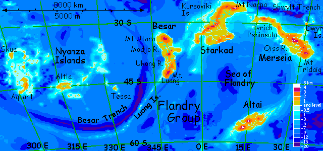
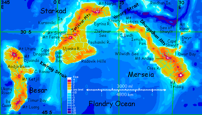
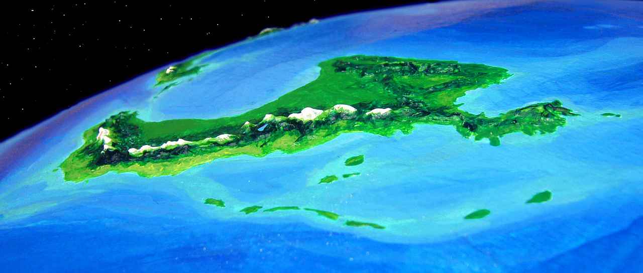
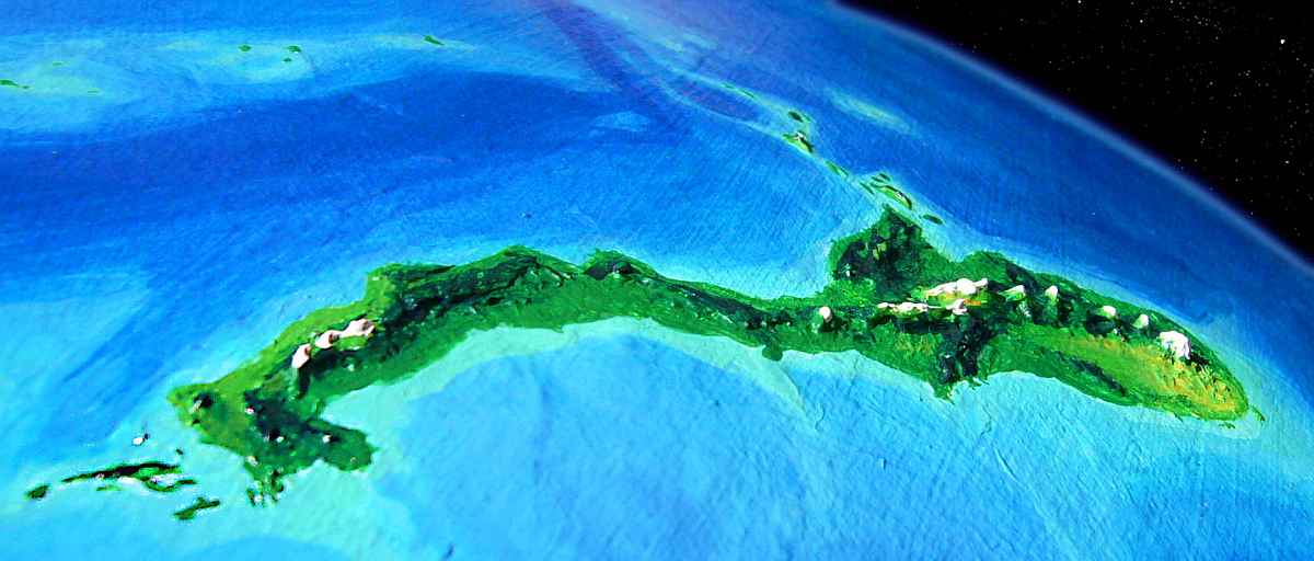
FLANDRY is an isolated southern continent-cluster, the largest archipelago on Lyr, but without a central continent like Diomedes, Ythri, or Troisleons. Total area: 17.2 million sq km (6.7M sq mi), the size of South America; the largest land, Starkad, is a third of that total. The other large lands are Merseia, Besar, Altai, and the Nyanza Is. Climates range from mild (Starkad) to quite chilly (Altai); none is tropical.
This tour covers the central three lands: Besar, Starkad, and Merseia.
BESAR
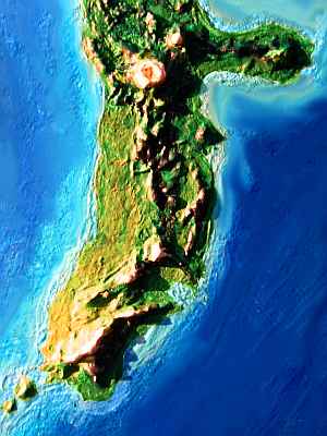
Besar is half the size of Australia. Lyr's a world full of spidery, fractal coastlines, but Besar's a wonderfully simple exception--three neatly spaced volcanic highlands, Utara, Ketjil and Luang (all looking more like coronas on Venus than Terran mountain ranges) separate two wide riverbasins, Modjo and Ukong, covered in warm-temperate rainforests.
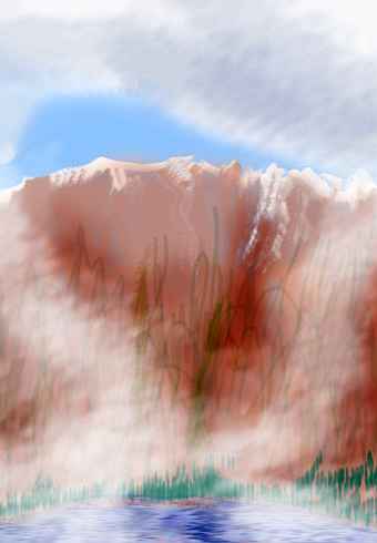
At least most of it is rainforest. But the Luang Archipelago, our gateway into Flandry, leads to the one great exception--Besar's southwest coast is a quilt of Mediterranean groves and dry meadows. The rains are partly cut off by the summit ridge of Mt Luang, a shield volcano 3800 meters high (12,500'); really more of a range than a mountain, with a line of vents topping 3 km/2 mi high for at least 300 km (180 mi). The storms caught by this long ridge, and its northern satellite vents, make the east coast and highlands lush rainforest from Cape Luang well past Timur Bay. But they steal that rain from the west.
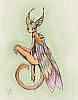
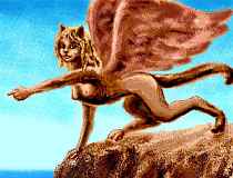
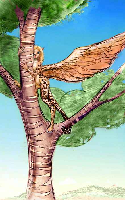
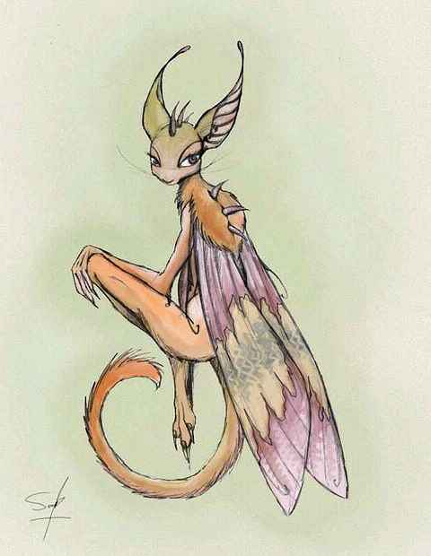
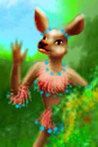
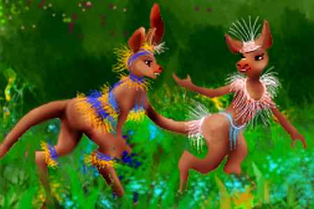
Let's stick to that drier west coast; it's not only pleasanter for human tourists, it's prime habitat for a truly odd-looking species, the bo. Native to nearby Merseia, bos are one of Lyr's few flightless peoples. Kangaroo-like bipeds with flyswatter tails, furry backs and flanks, but a bare scaly belly, bos have the curious habit of covering their bodies with brightly dyed woven plant fibers and feathers. Other Lyrans look down on this bo invention as a sort of substitute fur--more a prosthetic than an advance! In fact, this changeable coloration confuses some Lyran species attuned more to color than form, like pegasi; they often can't recognize bos who change outfits.
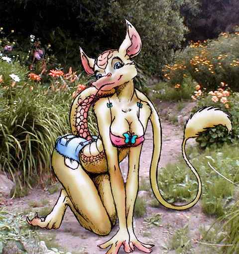
My human readers won't find the concept of clothes difficult, but you may find bo gender confusing. Though males run larger on average, both sexes look female to us, for both sexes breastfeed the young. Though that may not be the whole story; it isn't for humans, after all. Bo males AND females find breasts sexy, doubling the selection pressure--for purely cosmetic reasons.
You'll have noticed that most Lyran species have an Audrey Hepburn look--a light build and big eyes make sense if you fly on a world with a dim red sun. But bos, flightless and breast-obsessed, have sexually selected for a Marilyn Monroe build... at least if Marilyn were a kangaroo-velociraptor-cow.
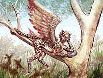
As the illustration suggests, bos like to clown. They're perceptive and subtle clowns, though; they can read other species' moods and social dynamics remarkably well, and those big ears pick up languages fast. Bos can't hear ultrasound as high as sokas (the batlike rainforest people of Flandry), but they can hear most of the speech frequencies sokas use and can grasp at least some sokan speech. Not all, since much Sokan is pure sonar imagery, not words but virtual reality... if you're a soka.
If bos are native to Merseia (a neighbor here in Flandry, but still 7000 km away) how'd they get here? Well, partly their own initiative; long ago bos rafted the Ynvory Strait and settled the drier parts of Starkad. But the second jump to Besar was largely the sokas' doing; wanting to extend the trade-based symbiosis that developed on Starkad, they told the bos of this southwestern land ideal for them (and not sokas), and ferried them over the Kimraig Strait and down the jungle coast. Bos are still rare in northern Besar; this colony is rather isolated.
Isolated from other bos, I mean. They're closely integrated with the soka economy. And, like Tessa in the Nyanza Is. just west of Flandry, the Bo Coast is a patch of relatively open sunny land in a rainforested region, and so, like Tessa, tourists like to settle. The Coast is growing multispecific. Lebbirds are common, and you meet several families of icari and sphinxes. In time, I wonder if it'll become a sophisticated world center like Eyath or Hrill in Oronesia.
| 
| 
|
Two days north, as you're entering the Ukong Basin, the trees grow tall and close in. Warm brief showers become common. The fan-shaped Ukong River, largest on Besar, drains nearly a million sq km of this dense not-quite-rainforest, like the Carolinas or coastal China before deforestation. Bo villages grow scarce here, clinging to the riverbanks where there's more light and undergrowth. You start to see more treetop villages, mostly soka of course, but also one village of lebbirds.
Our flyway heads northeast across the basin. The heights of Luang are gone, inland; low mountains, perhaps 1200 m (4000'), mark the continent's spine. They're not high enough to stop storms from sweeping coast to coast--and they do. The Ketjil River Basin on the east side looks the same as Ukong--just a bit taller and more luxuriant.
The sixth day on Besar, you spot two landmarks: white to the north and silver to the east. The white is snow on the summit of Mt Ketjil, the largest volcano in central Besar. Ketjil is named for the huge sequoia-like ketjil trees found on its slopes. The silver to the east is Ranau Bay on the Flandry Sea. You've crossed Besar.
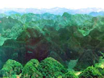
I'm not sure we should tour the Modjo River Basin to the north. It's unbroken rainforest 1000 km wide, and quite Amazonian--the manybranched Modjo River is only 900 km (550 mi) long, but near its mouth it has a huge flow. Modjo is named for a high-canopy fruit growing only here, but exported all over Flandry. The Basin is pure soka country, with only a few foreigners (not even bos--the understory's just too dark to grow much). Flying around Modjo feels like trespassing on someone's private orchard--an orchard the size of France.
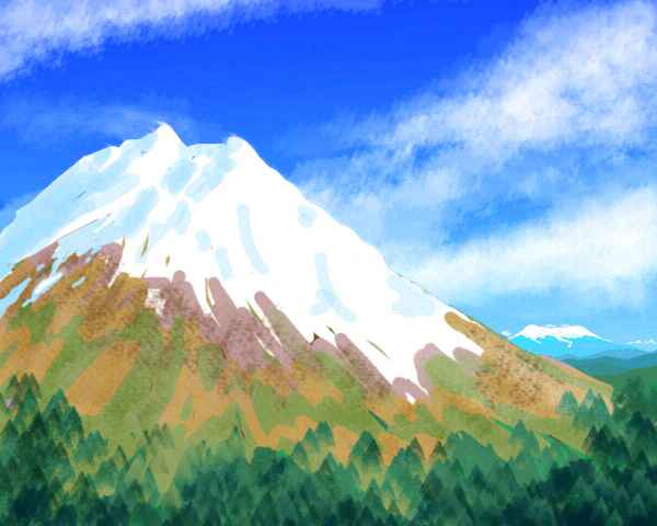
Yet there are lovely sights in northern Besar, beyond Modjo Basin. Mt Djuanda is nearly a twin of Fuji, and to its northwest, Mt Utara's caldera has a snowy rim reaching 3500 m (11,500') dropping in sheer cliffs into misty Lake Utara, 40 km across. Bacteria adapted to its odd chemistry have stained it a wild, improbable violet.
Still, it's a two-week round trip across 700 km of monotonous forest with no one much you can talk to...
Not coincidentally, the trees here are the tallest on Lyr, over 100 m (330'). And that's despite Lyr's high gravity! These are massive, almost conical trees, with long mangrove-buttresses and flanges spreading around their feet, turning the ground into a shadowy interlocking maze, like the convolutions of a huge wooden brain. This impassable surface is the reason bos don't live here. It's a land only arboreal fliers can appreciate, or even explore--like soka and lebbirds.
For two days you fly east to Ranau's tip, guesting in a lebbird treehouse above the shore--a hundred meters above the shore, though the land is quite flat. The trees really are that big! As with sequoias, the whole treetop is burned hollow--lightning often strikes the tops. The lebbirds merely had to add windows (with translucent panes made of something like onion skin, though it smells like cedar) and narrow curtained doorways, onto limbs as wide as terraces. No need for the intricate woven treehouses or plank-platforms found elsewhere on Lyr. The tree itself is big enough for a mansion.
Following the lebbirds' advice, you laze around until afternoon before setting out across Kimraig Strait, avoiding the morning glare. You fly two hours to sundown, then on through the night, spotting the Isle of Kimraig sihouetted in predawn light, landing at sunrise.
You rest a full day on Kimraig, flying only an hour or so across the island to its east shore.
The third day you make the final 350 km flight to Starkad.
STARKAD: South
The largest continent in the Flandry group, Starkad is two-thirds the size of Australia--with six times the biomass! Biologically, it's more like a tiny South America, with eastern Amazonian lowlands, an Andean spine and a drier west coast. (Okay, I've used that analogy before on Lyr--the Diomedes Cluster comes to mind--and I'll probably use it again. South America is small and but wet/fertile as Terran lands go--by far the most Lyran landmass on Earth. If you ignore Indonesia, that is...)
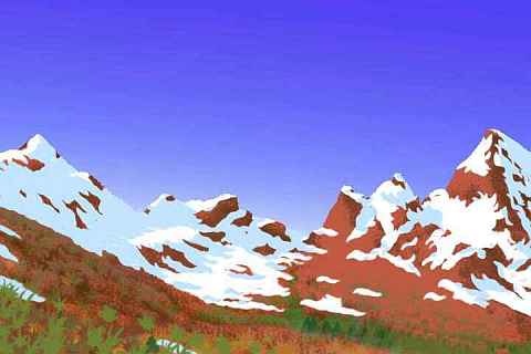
You land on the Dragoika Peninsula, a mountainous cape 1000 km long and 4-500 wide (625 by 250-300 mi). Dragoika is temperate rainforest, though not as drenched as Ranau.
As you climb across the mountains, a few pale subalpine meadows gleam on the slopes and ridges around Mt Dragoika, a volcano 2200 m (7300') high. They aren't just created by winter snows--deforestation here has a more sinister source. Dragoika is now dormant, but historically it's been quite active, burning forests and dropping ash all over the southern peninsula.
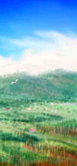
Instead let's just head up the Ujanka. While it's inland and drier than the Radovik Valley, we'll still see plenty of rainforest. A few hours northeast, into the heart of Starkad, and the Ujanka veers suddenly due east. You continue northeast. Soon low hills rise. You're passing into the upper Pechaniki Basin. This huge rainforest covers about 1 million sq km (400,000 sq mi), the largest in Flandry, and one of the largest on Lyr.
You stay the night in a soka village, surrounded by orchards of fruit trees 60 m high (200'). Here you make a real effort to converse with your hosts, speaking aloud then trying to read their signed answers. You're surprised to find your practice has paid off; you get quite a bit. They're quite friendly, eager to talk--but full of odd metaphors and images, all of them tactile and aural, not visual.
Sokas will often pause their signing, obviously thinking hard, trying to convey their experience through metaphors to a creature who simply lacks their primary sense-mode--sonar! It's not culture clash but sensory clash.. Yet behind this deep alienness of perception, you get a sense of sokas as characters. The time, enthusiasm and sheer effort they put into communicating with you reveals a friendly, curious, rather outgoing people belying their appearance. To the eye, sokas seem languid, ironic, even sly. But to a soka, vision is just a trivial, translucent skin over the solid sonar reality.
One of the concrete details you do learn is that the "fruit trees" often aren't. Much of sokan silviculture doesn't involve planting trees, for it can take generations for some of these giants to mature. Instead they plant fruit and nut-bearing vines, selectively trimming the canopy above seedlings to give them a sunlight-boost until they're well up their host trees, which can be of any species. Vines in turn must be planted with colonies of specialized leaf-eating termites, to moderate their sunlight-theft, or a dead tree may result. The termites are farmers too, not eating the leaves directly but feeding them to a fungus, which they eat. The sokas protect the termite mounds but harvest surplus fungus too, like beekeepers. (You try some and find it quite good--a bit like shiitake).
Canopy farming is complex and labor-intensive; if the forest is too densely "vined", whole groves can fall in storms. Long before they met other species and became the chief traders across a hemisphere, sokas learned the hard way not to be too greedy. Their proverb:
STARKAD: West
The next day you curve north, and the plain begins to rise. And rise. And rise! Cloud-wreathed mountains--the Janjevar Range, running 4000 km (2500 mi) down the west coast.
These foothills are even wetter than the lowlands, if possible--the mountains wring the clouds dry. A redwoodlike cloud-forest blankets the hills in somber blue-green. But as the steady winds lift you higher, the trees shrink and the woods open into flowering alpine meadows. To the left and right, two white tents dominate the horizon.
To the left stands Mt. Ferek, highest peak in southern Starkad at 4400 m (14,400'). Some of that snow isn't snow, but true glaciers, the first you've seen on Starkad. On the horizon 300 km east rises Siravo, 100 meters shorter. Near-perfect twins.
Our flyway passes between them, over the Janjevars, and down to the drier west coast. The sun comes out and meadows open up, though thick patches of forest remain. Like the Bo Coast on Besar, nearly 5000 km southwest, this Janjevar Coast isn't just an ecological island but a cultural one. Unlike the soka-dominated east, bos are the majority here and other species have settled in modest numbers. Janjevar, too, may one day be a center of world culture; Flandry's deep isolation has held it back, but soka trade-ships are starting to compensate. Lyr hasn't seen this before; all other hubs were built on air travel. Indeed, they were simply places where flyways meet. Stone Age airports!
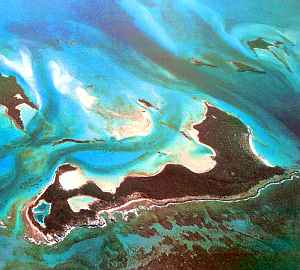
Even the sokas here are different--concentrated in the ports, and concerned with fishing and trade, more than silviculture. Offshore is the birthplace of their maritime culture--the Kursovikis, a great chain of coral atolls and islets sprawling across 2400 km (1500 mi) of shallow sea, marking the edge of Flandry's continental shelf.
The Kursovikis run up to 160 km long but never more than 15 km wide (100 by 10 miles)--greener isles than the Mediterranean, with timber and reliable water even on islets. A few of the islands are small but active volcanoes. Between chain and mainland lies the Kursoviki Sea, sheltered, gentle, as big as the Mediterranean.
It's here, in these friendly waters, that the soka first learned to sail. Like the Greeks and Phoenicians, they started off island-hopping, slowly venturing further out in search of fishing banks.
Later they circled Starkad and explored the fairly sheltered Zletovar and Wilwidh Seas, gaining deepwater skills.
Next they met the bos of Merseia, gaining language- and trade-skills... and kept going.
The Kursoviki Islands today are still a fishing culture; cuisine there is nothing like the mainland's fruit/nut/bug diet. In fact, Kursoviki fishers and deepwater traders form a distinct race, not based on appearance but enzymes. They can digest seaweeds their inland cousins can't, and they manufacture Vitamin 1, which mainlanders get from fruit. Sokan sailors don't get scurvy! That is, not any more. That single, invisible change in their anterior liver is proof of eons of maritime tragedies, until the genes of rare survivors became a new majority.
STARKAD: North
You sail along the shore, sleeping in music-inns every night in the little ports dotting the coast. For all the talk of the Kursovikis, all you see of them is their effects--the trade-boats coming in, the calmness of the sea. They're still 500 km offshore here. Looking inland, the mountains are mostly invisible too. They creep closer to shore as you fare north, but they never crowd the coast. The straightest route to the next continent would head inland over them, but after hearing a bo folksong in a music pub about the Egrina Basin, you're not much tempted to. The Egrina sounds miserable for pluviphobes (creatures who dislike rain, like humans and bos)--just a flat, swampy subtropical forest over 1000 km wide, with constant drizzle. You'd rather stay in the sun.
Janjevar slowly curves east, until the sea turns rougher; the invisible Kursovikis are behind you now, and you're facing the open Kraoka Sea, stretching to the equator 7000 km away. Though the seas are rougher, the land is easy going. There's a highway of rising air above the hillslopes, for they tilt toward the sun. You head due east along this fertile, lovely coast.
There's an invisible empire off this northern shore, in the Sea of Fire. Unlike the Kursovikis, you can't even visit. Nowhere to land! A branching chain of seamounts runs north all the way from Flandry to the Ythri Cluster in the northern hemisphere. On a dry little rock like Earth, they'd form the spine of a continent as big as South America, but not on Lyr. The westernmost fork pokes a few tentative peaks above water, forming the Ayan Islands; another runs all the way to Lokon, in the Sea of Fire. Within this great triangle 8000 km on a side (5000 mi), called Dathyna, there are hundreds of reefs, a scattering of sandbars at low tide, even a few low scrubby atolls, but not one reliable spring of fresh water. No flier has ever crossed Dathyna by air; only by boat, courtesy of the soka, who trade here.
Oh, yes, there are Dathynians to trade with--just not land people. Dathyna's home to two intelligent marine species: the nomadic star-nosed dolphins, and (more important for trade) hexanauts, a settled reef-dwelling people a bit like Terran octopi. I can't show you a picture; images are banned by treaty. Hexanauts have a strong belief that visual images are deceptive; you must experience the real thing to know it.
And you just aren't equipped for that. Sokan trade boats are the only way you could go, and that'd take months. Even if you brought a face-mask, snorkel and fins (by air, all this way? Fool!), it's risky for a Terran to dive on Lyr. Swim, yes; dive ten feet to look at coral, maybe. Below that, the weight of the water mounts rapidly, and the partial pressure of nitrogen in your system rises to dangerous levels. You've heard of Rapture of the Deep? On Lyr, nitrogen narcosis hits most tourists only 5 meters down. (If Lyr had slightly denser air, you'd face Rapture of the Surface! A minority of tourists already do, though for most it fades in a day or two. Bodies are ingenious.) The locals evolved in six atmospheres and can dive freely, of course; but unless that's a helium flask in your pocket, you're banned from hexanaut tourism.
So Dathyna's off-limits; stick to the land! Don't be disappointed; impressive land it is.

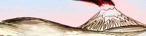
By the next day, a great icy mountain looms over the horizon: Mt. Narpa, 4700 m high (15,400'), highest on Starkad; the culmination of the Janjevar Range. Narpa's massive lava flows have built up a broad upland 2-3 km high (6600-10,000'). It's a pleasant region for humans, with a cool, mild climate like a perpetual spring. But Narpa's summit isn't gentle. A long arc of savage ice-capped cliffs a kilometer high are all that's left of an older cone, the tallest peak on Lyr--until it blew itself apart like Mt St Helens. And not the first time! Narpa explodes a lot--it's been up to a kilometer taller AND shorter at various times in the last 100,000 years. Its eruptions have enlarged eastern Starkad and enriched the soil, but few people live right on the mountain, and valleys downstream of Narpa's glaciers are strictly orchards; villages cling to ridges above, just in case. The Flandry region gets news slowly, since it's on a dead-end flyway, but word of the disastrous mudflows from Mt Hauch on Sherrin (in the Roland cluster, 30,000 km away) finally did reach here. It's made Narpans cautious, for even though the ice on Narpa's ragged jagged summit suggests it's dormant, conditions here are ominously parallel. Geysers and hot springs still flow, all round the mountain. Narpa's just waiting.
Beyond Narpa's highlands, the hills drop quickly. For a full day you flap east over a monotonous wooded plain. With no mountains to block the occasional stray storm from the rainbelt to the south, the Janjevar Coast's quilt of meadow and grove reverts to nearly solid subtropical forest. Now and then small cinder cones jut suddenly from the plain like outsized Mayan pyramids. At last one rears over a km high; can't pretend any species ever built that! And around its feet laps the sea. Cape Ynvory.
The Ynvory Strait is 900 km (560 mi) wide, but it's an easy passage. Five hours out, a narrow, steep-ridged island comes into view. You don't just sleep on Ynvory--all the next day you ride the updrafts over those ridges and seacliffs like a monorail through the Zletovar Sea. From Ynvory's far end, it's only twenty miles to Cape Bedh, on the mainland of Merseia.
Merseia's a temperate, rainy continent over half the size of Australia, shaped like a plesiosaur, or a goose, or a sperm. Take your pick. It's pronounced "mare say a..."
Ahead, though, stands a barrier--Mt. Lifrith, a volcano 3200 m (10,700') high, the tallest peak in northern Merseia. You veer left, skirting Lifrith to the north, because you spot open meadows suggesting it's warmer and drier. It is, but it takes you all day--behind the main peak, Lifrith turns out to be a whole range of cones nearly as high, stretching over 400 km (250 mi). The peaks loom over the long coast, where lesser cones and craters create capes and coves. This relatively sunny coast is bo heaven--certainly one of the earliest settled, and possibly where they evolved. Near sunset, the hills flatten and the coast turns southeast.
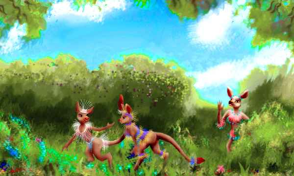
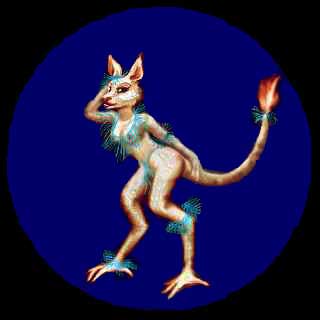
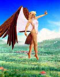
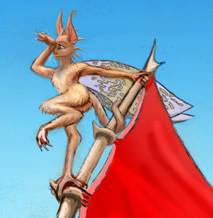
Note the clothing and ornaments--and their very human function of both concealing taboo regions yet drawing the eye with bright colors. Bos are the only one of Lyr's 17 peoples using clothes to conceal taboo regions, and it's suggestive (in both senses) that such parallel behavior occurs despite their quite nonhuman bodies. The normal Bo stance is bipedal but more like kangaroos or dinosaurs than humans. Still, it's upright enough to display genitals and breasts--and remember, rearing up while facing another is a threat display for many species. Other Lyran peoples are mostly quadrupedal. Still, bos aren't uniquely bipedal on Lyr: icari and witweets normally stand upright too, yet they lack the modesty concept. But they're both quite furry; bos facing each other see bare, scaly skin, so breasts (which they rather fetishize) and genitals are more exposed than in other species. Could it be that bipedalism and baldness are the one-two punch that generates the modesty concept... and clothes?
It's true that the bo concept of clothes is more fragmented than the human one. Unless it's quite cold and a robe is needed, bos rarely wear much clothing, yet they never wear just one thing, either. Color-coordinated ensembles closer to our ideas of accessories than clothes are typical--feathery, lacy 'grass skirts' and biblike pectorals, penis-sheaths for males (as in Papua) and string aprons for both sexes... plus belts, tiaras, wristlets, anklets, earlets and tail-lets, and a lot of flowers, sprigs and wreaths. Asymmetrical costuming is common.
The parallels and differences make one aware that there is a pancultural human dress code of sorts: unity, symmetry, a focus on orifices of all kinds (hiding or highlighting faces, nipples, genitals, and excretory orifices), and a habit of dividing the body into horizontal zones, not longitudinal ones. Bos seem to share the "orofice" concept but reject the other three!
You glide down to the sea, and find the Wilwidh Coast is distinctly cooler and wetter--huge trees form a canopy only rivers and lakes break up, clouds march across the sky, and brief showers become an hourly fact. To keep warm, you keep moving--but for three days, you see few changes, chugging down this damp endless coast. I did warn you. Ivrich is long.
One slow change: the inland hills rise steadily until they snag the clouds. The flat gap we crossed won't happen again! The Dhangodhan Range runs unbroken for 4000 km (2500 mi). "Dhangodhan" looks formidable but is quite a gentle word: roughly "thong-a-thon" with "th"s like "then."
A second change: it just gets rainier and rainier. At last you're driven inland, hoping that the hills are a cloud-barrier. Nope. You ride the ridges anyway--trade winds create updrafts here. With effort you can climb above a lot of the clouds. Close up they're patchy, but merge at the horizon into a classic cloud sea. With islands! No metaphor, as you find out a day later. The Dhangodhan uplands are above much of the rain; they really are ecological islands.
I feel like apologizing for Flandry. All this endless green. Doesn't this tectonic plate have any sense of contrast? Flandrian bos never wear green--and after the last few weeks, you can see why. Too much of a good thing.
MERSEIA: South
All next day you flap patiently up the Ardaig Valley (sounds roughly like "our dike"). Its ridges east and west block at least the worst of the rain. Southern Merseia, which we're entering, resembles a cooler New Guinea: rainy lowlands and a sunnier central plateau above the clouds. Ardaig's inner ridges are open pinelike woods, and small farm villages dot the valleys. You stay in one. The people are a large, stocky subspecies of bo, who claim to be the true, original bo, of course. These wingless species are so parochial, so tribal! (Oh, wait, you human readers probably feel insulted.) Still, their bo smugness has a touch of self-mockery in it, but then, all bo emotions have a touch of that.
But really, you don't care what they claim. You're just glad not to be rained on.
| 
| 
|
I'd like you to tour the dramatic east coast, but the mountains are just too high for you to cross; the air's too thin. In Lyr's dense atmosphere, that must sound absurd! But by now, your blood has thinned to cope with Lyr's excess oxygen; on Earth, you'd be diagnosed as severely anemic! And the high gravity here makes pressure drop off fast; there's no more oxygen atop the ridge than at sea level on Earth, and that's air you're no longer adapted to breathe. Not that breathing's the real problem. It's flight itself. Too little air under your wings! A mere two atmospheres isn't enough to hold you up.
Still, I can at least describe the far side. The steep, cascading Dwyr River runs down from cool sunnier highlands into the cloud-sea over Dwyr Bay. On its north side, rugged Cape Shwylt juts 500 km into deep water. Off the tip, a chain of 15 islands, the Dwyrs, winds 1500 km into the Sea of Shwylt. They're a spectacular, jagged half-sunken range with great scarps on their western sides (dropping another mile or two underwater). Runei in the north is 200 km long and rises to 3000 m (9900'). The islands seem to be the west edge of a mini-plate under the Sea of Shwylt, but these triangular, tilted wedges in a scalloped, twisting line look more like turbulence in smoke or laminar flow on Jupiter--just turbulence written in stone!
These scalloped escarpments aren't unique to the Dwyrs: the Ulwen and Driss Islands in the Diomedes Region are larger still. No structures on Earth or Mars resemble them; but the scalloped plateaus on Venus, and the jagged scalloped mountains of Io, both suggest explosive sapping at their bases, as gas-filled lava escapes. However, that seems unlikely under the tremendous pressures of Lyr's deep seas, and these tilting, triangular platelets suggest a different cause. But I truly don't know what.
The northern edge is the Shwylt Trench, a mid-sea trench 16 km deep (52,500'), of puzzling origin. Unfortunately, the cape and islands are a dead end, for though seamounts and reefs (inhabited, too, by small villages of hexanauts) continue in a ridge leading all the way to Kraoka on the equator, not one islet is big enough to have fresh water; it's another failed flyway, used only by soka trade-boats. There is a second, northwesterly arc that does rise above sea level to form the Roidhun Islands
Exploring the parts of Shwylt and Dwyr you can see would take two weeks, even if you could cross the range. Let's not detour.
It's hard enough struggling up to the headwaters of the Ardaig and south over the pass--2.5 km up (8200'). You find yourself on a broad, seemingly endless slope dropping into the cloudsea to the west. To the east, pale green alpine meadows break into bare red rock and the long snowy ridges of Ardaig. Below, mile-high farm villages in patchy woods and meadows.
This is the headwaters of the Oiss River, largest in Merseia. Six of its eight branches arise here in the Dhangodhan Range and wind 1000 km over the Oiss Plain to the Wilwidh Sea. The lower basin is a temperate rainforest nearly 100 m tall--like coast redwoods or the giant cedar forests of the Olympic Peninsula, but here with broadleaf giants in the mix. And it's endless--800,000 sq km (300,000 sq mi--as big as Borneo). It's soka country now, though they settled here only a thousand Lyran years ago. Bos are sparse, mostly in trade-towns along rivers; non-Flandrians are almost unheard of.
For three days you fly steadily south through the Dhangodhan uplands, two km high. You're slow, still adjusting to the thinner air. Still, it's better than the eternal lowland rain. The weather's sunny, but cool, even cold some mornings. Wait, is this a cold spell, or just the climate year-round? You've flown a long way south. In winter, how low does it snow? You begin to see why the bos here bear so much fat--and cloth.
Ahead, a huge peak climbs over the horizon--Mt Tridaig, a massive shield volcano 4600 m (15,100') high, the Mont Blanc of the Dhangodhan Range. It's so high and wide it's not only icecapped--Tridaig bears a snaky crown of glaciers winding down through its alpine meadows and conifer woods. Merseia no longer seems like a mere enlarged New Guinea.
But past Tridaig, the mountains slowly slump back into lowlands, and the air, though not warm, grows much milder. And drier, though you spot the sea ahead. No mystery--you've gone so far south that the rainbelt's storms all come from the north--and huge Tridaig behind you blocks them. Like a cooler version of South Africa's coast, this far southern tip of Merseia is temperate and sunny--not steamy, not drizzly, no sea of cloud...

The people here are different too. The first coastal bos you've seen in how many thousand kilometers? Heavy breasts, broad cow-faces and all, the coastal race of bos seems light and delicate... after those beefy mountain bos.
There are some soka, too, despite the cool dry climate (by their standards). It's fortunate there are! For Merseia just slips meekly under the sea. No long capes, no island chain to follow. No flyway! A single modest island creates a short, sheltered channel where a little port nestles.
You head for it, hoping to book passage on a soka ship sailing southwest...
Because for the last stage of your journey, to Altai, wings just won't make it. Not just for you, a tourist bumbling about in cheap rented wings. No sane Lyran risks that flight, either. It's 4000 km (2500 mi)--so far off every flyway that Altai wasn't even discovered until a storm-blown soka vessel stumbled on it.
And they (warmth-loving folks that they are) don't want it.

TOUR LYR! Climb volcanoes, swim seas, meet weird creatures. First: survival tips! Then, pick a region:
Ythri -- Polesotechnic Chain -- Troisleons -- Roland -- Oronesia -- Gaiila -- Flandry -- Diomedes -- Ak'hai'i -- Averorn
World Dream Bank homepage - Art gallery - New stuff - Introductory sampler, best dreams, best art - On dreamwork - Books
Indexes: Subject - Author - Date - Names - Places - Art media/styles
Titles: A - B - C - D - E - F - G - H - IJ - KL - M - NO - PQ - R - Sa-Sk - Sl-Sz - T - UV - WXYZ
Email: wdreamb@yahoo.com - Catalog of art, books, CDs - Behind the Curtain: FAQs, bio, site map - Kindred sites