Nyanza Archipelago
by Chris Wayan, 2006
Lyr (home) - map - creatures - cultures - evolution - climate - geology - gazetteer - nomenclature - definitions - building Lyr - more worlds? Planetocopia!
New on Lyr? First-time orientation--strongly advised! Lyr is weird.
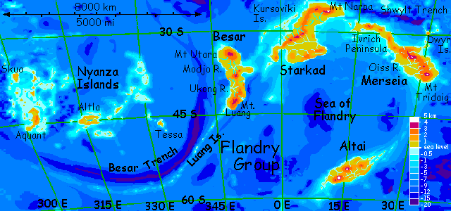
The FLANDRY GROUP is a southern archipelago--isolated, but probably the biggest on Lyr, comprising some 17.2 million sq km (6.7M sq mi), as large as South America. The largest land, Starkad, is a third of that total. The other mainlands are Besar, Merseia, Altai, and the Nyanza Archipelago, which this page covers. Climates range from mild (Starkad) to cold (Altai); none is arctic or tropical.
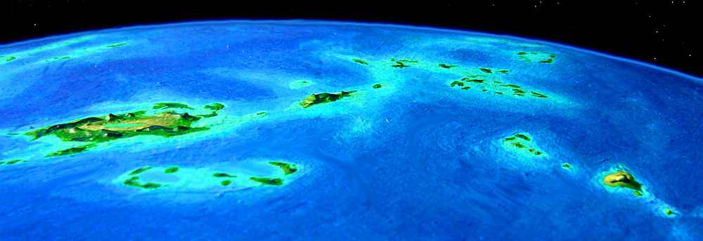
The Nyanza Islands, southeast of Gaiila, sprawl across 6000 km of deep sea. They may look little and lost in all that water--but remember how big Lyr is! Check the scale on the map; Aquant and Altla are each bigger than Britain!
Nyanza looks utterly isolated on the world map, but any fit flier can reach the archipelago from Gaiila via a long chain of islets, the Grimoires (off map to upper left). In fact, Nyanza is the least isolated part of Flandry--all traffic in and out of the whole region must pass the length of the Nyanzas, from Skua to Tessa, for no other flyway exists. Due to all this outside contact, the dominant species of Nyanza are the least peculiar of an otherwiste very peculiar region--Lyr's equivalent of Australia.
One species you'd expect to find, because their heartland is so close (the Tempest Archipelago in southern Gaiila, just up the Grimoires) are antel. But these winged deerlike people are prairie grazers, and Nyanza's rainforests don't suit them at all. Their hooves aren't built for footing in dense leafmold, let alone climbing trees, and the understory is thin and light-starved, except around clearings. You do meet a few eccentrics in coastal villages of other species, grazing the ground-level greenery near the beach. They're as out of place as European beach-bums in Tahiti, unable to climb coconut trees...
WESTERN NYANZA
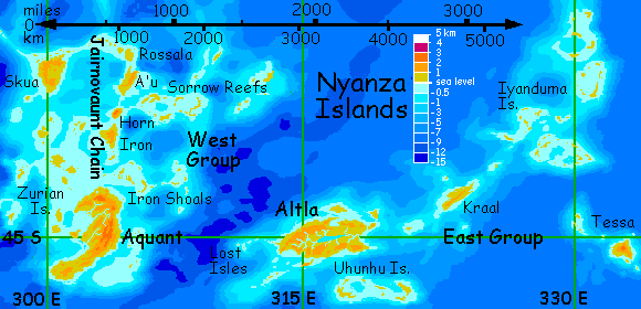
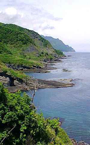
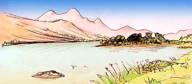
First stop for travelers heading into Flandry is Skua. Fertile and rainy, it's covered with subtropical rainforest. Before you think "Hawaii", check the scale again! Skua's huge, 560 km across (350 mi). We unconsciously assume deep-sea islands are always small, for Earth has few such large islands, and nearly all are close to continents--New Zealand's and Iceland are the only real exceptions. But the western Nyanza archipelago, like many on Lyr, is its own continental platform, called the Aquant Rise--it just had the ill luck to rise on a very wet world.
Even with wings, then, it takes a day or two to cross Skua from the traditional landfall in the northwest. Even before we do, there's a choice to make. From Skua, we can either fly along the arc of the Jairnovaunt Islands, or take a more strenuous short cut south, down Skua and hopping through the much smaller Zurian Isles--gentle hills rising from shallow water, also part of the Aquant Rise. The largest is barely 200 km (125 mi) across and most are just islets. Their warm lush forests resemble northern New Zealand. It's easy flying--even the smallest of the Zurians will have water, fruit trees, friendly villages.
But we'd spend several days flying mostly over featureless sea. Instead, let's take the longer but more scenic route through the larger Jairnovaunts.

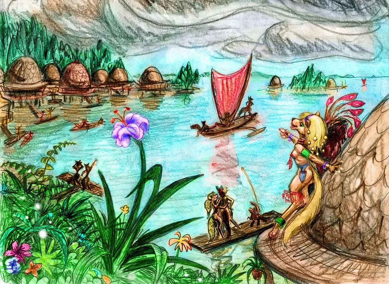
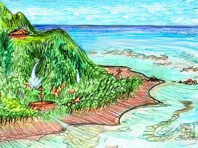
That means heading east along Skua's north shore, staying in sphinx stilt-villages, built above lagoons. The coast gets annual typhoons--slower winds than Earth, but with six times the air pressure, they pack a punch. Local trees, in response, flex a lot; treehouses, common in other parts of Lyr, tend to come apart. Stilt houses, treehouses...
A third choice humans would jump to instantly--clearing the forest--doesn't even occur to the Lyrans!
It's not all sphinxes--you do meet a few antel, and a party of soka, mothlike traders from further east, who sailed here, not flew. Soka are poor long-distance fliers, but they're confident sailors, trading all over Flandry.
This party can't talk to you directly, for they speak in signs, but a sphinx translates for them, saying they're visiting relatives inland. Your host adds "The rest of us cling to the coast, but the soka really like the interior."
Not surprising! They evolved in the rainforest canopy of Besar, not too different from Skua. A mere 9000 km further east--practically neighbors on Lyr!
The Jairnovaunts start unimpressively. You leave Skua's northeast tip and hop from islet to reef for a full day east. Only the smallest are sandy--tall temperate broadleaf rainforest clings even to modest islets. Perhaps pre-Columbian Virginia and its barrier islands looked a bit like this.
Slowly the islets grow respectable, and you stop for the night in a sphinx village in the western Rossala Group. The next day you reach Rossala itself, a land 200 km across (125 mi). Fertile, warm, and very rainy, with dense forests.
Here too, the sphinxes (and a few antel "eco-perverts", to crudely translate the Lyran slang term for people living in a niche unsuited to their species) cling to the coasts, while the soka fill the rainforest canopy with little treetop villages. You wish you could communicate with them, but their speech is largely ultrasonic.
Less than an hour's flight south from Rossala is A'u, a hilly island 400 km long (250 mi) and half as wide, all north-south ridges directly across the path of the storms here in the exact heart of the rainbelt at 36 south. A'u is lush--what you can see of it through the tattered clouds and turbulent air.
You glide down the east side, where the ridges force up a standing wave of air, bursting up into thunderheads around you. At last, nervous about the prickles of static electricity building up around you, you dive through the clouds and flap cautiously along the coast at tree height, getting rained on now and then, but hearing only distant thunder in the hills.

Gray to silver to blue and green, and back to gray, all day.
The sea here is shallow--part of the Aquant Rise. You can't see any islands from shore (even the nearest is over the horizon) but shallows and shoals and islets extend 1600 km (1000 mi) east. They're called the Sorrow Reefs, a double misnomer. They're hardly a sad place (lush in fact) and far more than reefs. Half a dozen isles are 150-250 km long (95-155 mi), though it's true none is over 20 km wide or 50 m high (160 feet). All the Sorrows, big and small, are rainforest right down to the tideline. On the map they look like coral atolls, but those broad shallows are mostly kelp forest, not coral. The region looks more like Japan's Inland Sea than anything Polynesian.
But the Sorrows dead-end in mid-ocean, so our flyway lies south for now, not east. Two hours off A'u lies Horn. You see it miles off--though only 150 km across (90 mi), barely bigger than Hawaii, it's nearly as vertical, with two volcanic peaks almost two miles high, wrapped in thunderheads and capped in lenticular clouds, like hovering saucers. Having learned your lesson on A'u, you glide down the beaches on the lee side this time--the west. And it pays off--it's much drier, indeed often sunny. With scattered showers, of course.
The next day you reach Iron (not "I earn" but "ear ON"), a triangle of rainforest 280 km across (180 mi), with lower peaks and less violent storms than Horn, but still an all-day obstacle course. But what did you expect? Here in the heart of the rainbelt, dodging squalls (and chasing rainbows) is a way of life.
Only you're not quite in its heart any more. Every day south now, the rains ease a bit more, more sun shows through. You spend the day after Horn hopping from islet to islet through a sunny sea (though always with puffy clouds bumbling by like absent-minded elephants). Without large islands to force air masses upward, cooling them and squeezing rain out, it's almost Caribbean. Well, except for the paler, jade-to-turquoise Lyran sky, and that warm-toned sunlight, like a perpetual near-sunset, even at noon...
AQUANT
At true sunset, lurid magenta clouds can't hide the long coast looming ahead. You've reached the northern tip of Aquant, the biggest land in Nyanza. You're too tired to explore, just wheel down to the beach and seek a traveler's hut and sleep til sunup.
Aquant's 1300 km (800 mi) long, shaped like a sharp-beaked bird pecking at the nearby Zurian Islands. It's covered by a forest nearly twice the size of Britain--though not quite rainforest. Many of the huge trees are deciduous broadleaves--pre-Columbian Georgia or Virginia might be the nearest thing on Earth. The mountains look quite Appalachian too: the Aquant Range is only 2200 meters, not much higher than the Smokies, and the heavy rains have eroded the hills to long, parallel, steep, dissected ridges, heavily wooded with pseudopines, with boggy meadows writhing along the valleys like chartreuse snakes.
The next morning you head south over the coastal hills, down a gentle valley and around a mile-high peak, over a low pass and down to Zurian Bay.
Here, for the first time on Lyr, you run into real language problems. Aquant is dominated by soka, and they can't speak standard Trade. I didn't say don't--I said can't! Soka voices are high, mostly ultrasonic, and pitch conveys most of the meaning. In the human sound-range, all they can manage are squeaks and soft hoots (Horn, Iron and A'u are the rough Trade equivalents of three chirping Sokan pitchnames stepped down two octaves to frequencies other species can handle). Soka can understand Trade, but since soka mouths can't enunciate the common trade tongue, they speak to other species in signs. But you don't know Sokan Sign; you can ask questions, but the locals must answer in gestures or by writing notes in Trade script. Clumsy!
I haven't mentioned this worldwide tongue before, since up to now it's been like water to a fish. Trade is a pidgin language, of course, but a pidgin with political muscle behind it. In southern Oronesia, on Arinnian (a multispecies island bigger than England) there's a Trade Institute that doesn't regulate trade. Its sole purpose is to shape and regulate the trade tongue, approving only sounds all participating species can enunciate, and words all can understand. The Academie Francaise of pidgin! The Institute issues two series of publications, both small pouch-books suitable for fliers--a textbook teaching Trade (in many editions for different species, starting with the local language) and a set of guides to Lyr's regions with maps and travel tips. These little round pouch-books (a medium invented by koreens, and originally designed to fit in their marsupial pouch--hence the lack of sharp corners) are now ubiquitous on Lyr--a prime trade item.
But soka are one of the few exceptions. Limiting Trade to what they can pronounce would make it too cumbersome to the 15 other species using it.
You do find a locally-written (though Institute-approved) guidebook on signing and start to study up. You'll need it. Soka are common all through Flandry. But learning the signed version of Trade will take time. You stick to questions answerable with a gesture or a nod (well, a flick of the huge soka ears. Forward yes, back no. Concise!)
This language gap is only a surface manifestation of the perceptual gap! Soka "see" their world more through sonar than visually. Like dolphins, they can generate ultrasound that mimics the sonar signatures of any imaginable object, creating virtual realities with their voices--for other soka! No wonder they're clannish. Soka live in their own universe.
You feel so depressingly cut off, you decide to shorten your tour of Aquant. Rather than visit the long Appalachian ridges of central and southern Aquant, you head due east up the Aquant River, over a pass to the coast. The next day, it's north a couple of hours along the beaches fronting cloudy forest, up to a nameless little point where the shore bends northwest (well, no doubt it has a name, but you're tired of asking questions of soka and having them tediously spell out answers). Here you set out to sea, heading east-northeast to Iron Shoals.
You've already visited some of the Iron Shoals--the islets getting us down to Aquant were their far western outliers. Now, though, you're heading east through the length of the chain. The mid-western part you skipped has the biggest isles, some up to 200 km long (125 mi). These eastern Shoals are still more than that, but truer to their name--low islets a few dozen km long but so narrow you can always hear the sea. The Irons resemble the Sorrow Reefs 600 km to the north, though they're a bit cooler and drier. Still, they're wooded and wet enough so even the smallest have some fresh water. Though you're hopping from speck to speck in a wilderness of mottled blue, you feel quite safe. For two days, you curve east then south... to the last, Shoal's End.
Here you're not safe. It's a dangerous passage from the Iron Chain to the Lost Isles, off Altla. Worse than the length (900 km, 560 mi, ten hours nonstop) is the tricky navigation. A sidewind blowing you slightly off course won't matter if you're alert, but the Lost Isles are low and tiny--easily missed by a tired flier in bad weather. And if you do miss them, it's another four or five hours east to the Altla mainland... if you can make it that far. Every year, a few careless or just plain unlucky travelers drown here.
So, if you're careful, and lucky, and start off in the evening and fly all night and all day, you spot the Lost Isles ahead and not too far off to the side, glowing warm in the sunset of the next day. You glide in, stagger into the trees, and sleep all next day, and much of the next. On the third day, you lift off near noon, so the sun won't be in your eyes as you fly the last few hours to the mainland: Altla.
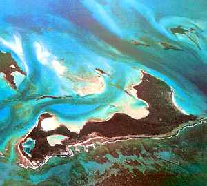
Altla is the second largest of the Nyanzas, 1100 km (700 mi) long. A low, concave, hilly-edged, leaf-shaped island the size of Spain, veined with slow rivers like sleepy snakes winding inward to narrow Lake Altla. Fertile and temperate, Altla's rather like New Zealand: open forests and a few meadows. It's drier than Aquant was, though the two great islands are at the same latitude--Altla is so low it doesn't squeeze rain from every single front.
For the next three days, you follow the rivers east to the lake, then 200 km along the northern lakeshore to the outlet, and down the sinuous Altla, to the Nyanza Sea. Lovely land, but you feel distant from it, for central Altla is soka country too. You've been practicing, but the language barrier is still formidable. Everywhere else on Lyr you've been treated as family; here you feel a foreigner.
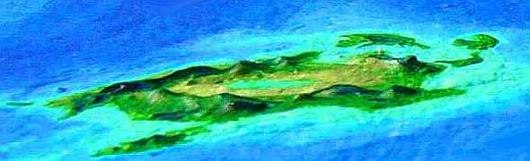
Two days later, you're on Kraal, 400 km long (250 mi) but only a third as wide. Long low Appalachian ridges curve down its length, covered in manycolored hardwoods. You fly up the middle, for a whole day nearly forgetting the sea. Nearly.
The next few days take you through the Iyanduma Islands, a flock of atolls 2500 km across. Like the Sorrows, Iyanduma's islets are up to 200 km long (125 mi), but all just a few miles wide--and a few dozen meters high. Still, they're rainy and green; all but the smallest are thickly wooded and have fresh water, and make excellent rest stops. Our flyway strays north, then east and back south, curving round the southern Iyandumas' lagoons, but the trip's broken into safe hops of a few hours each, and land's rarely out of sight. Only the last flight out is strenuous--a seven-hour flight due south over deep water from dawn to dusk, to the first satellite of Tessa. Two days later you reach the big isle itself.
TESSA
Tessa, 260 km (160 mi) across, is the last major isle of the Nyanzas--after that we'll be hopping rocks for 2500 km to reach the Flandry mainland. And we're just as far by now from Altla, hardly a world hub itself! This far from land of any size, you'd expect biological and cultural isolation--backwardness. Wrong! It's too vital a link--Flandry is the world's biggest archipelago, and Tessa's the only route in or out. It's the furthest south of the Nyanzas, and thus the sunniest--the farthest out of the rainbelt. It resembles New Zealand--a quilt of woods and meadows, mostly gentle but rising as high as 2500 m (8000') in central Mt Tessa. Only a tiny fraction of those passing through stopped to settle here, but they've formed an eclectic, cosmopolitan, multispecies community.
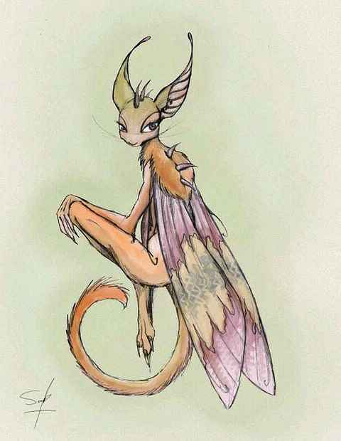
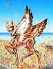
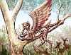
Sphinxes and icari fish Tessa's coasts; antel graze the western savannas; soka tend orchards everywhere; on the rainy east side, so do griffets and lebbirds.

| 
| 
|
| 
| 
|
You linger in Bay Town on the south shore, enjoying the camaraderie and variety of peoples, and the fact that here, there is no native language, so everyone speaks Trade. You're even starting to read some soka signs--you've finally realized that signed Trade isn't like Terran sign languages. With deaf humans you must learn a new grammar and generate signs yourself. With soka you only need to recognize the signs, and they do parallel Trade exactly--indeed they are Trade, expressed through a different medium, like writing.
You like Tessa, and you linger. But even if you disliked the place, you'd need to rest up--leaving the Nyanza Archipelago is no casual hop. Though geologically, you've already left. The Tessa group doesn't stand on the proto-continental rise under Nyanza; it's a hot-spot chain rising from deep water, like Hawaii.
You warm up for the big jump by flapping southeast from Tessa's windward shore, pausing for lunch on one islet, then on toward a speck on the horizon. It grows into a low island, mostly forest--the Tessa group's last outlier, 300 km southeast of the mainland. Its rainy southwest shore is all fruit and nut orchards. Stoke up and sleep well; no food or rest tomorrow.
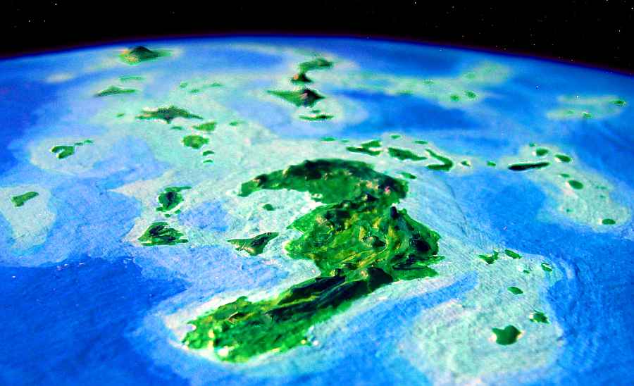
But you're going in--you find the Luangs with ease. Hard not to. They're part of an arc-and-trench structure some 10,000 km long, quite visible from space--one of Lyr's largest features. From mainland Flandry, islands with fresh water stretch 5000 km to the west before they dwindle to atolls, then rocks, then reefs, and finally seamounts only a few miles tall.
If the western Luangs were just a few hundred meters taller, a new flyway would open up, to cool but fertile Tauno in the Averorn Region (just off the map to lower left)--Flandry's great rival for Loneliest Place on Lyr. Check again in twenty thousand years! Luang is an island arc where two plates collide, and active its whole length--it's no hot-spot chain like Tessa, where the lava outflow is massive but concentrated on a few islands. In geologic time, those atolls are young and growing; the Luangs may yet become an interclusteral bridge.
But in your lifetime, the western Luangs are just a flyway to nowhere. Your way lies east. It's only a thousand miles, a few days' easy flight, to the mainland: Besar.

TOUR LYR! Climb volcanoes, swim seas, meet weird creatures. First: survival tips! Then, pick a region:
Ythri -- Polesotechnic Chain -- Troisleons -- Roland -- Oronesia -- Gaiila -- Flandry -- Diomedes -- Ak'hai'i -- Averorn
World Dream Bank homepage - Art gallery - New stuff - Introductory sampler, best dreams, best art - On dreamwork - Books
Indexes: Subject - Author - Date - Names - Places - Art media/styles
Titles: A - B - C - D - E - F - G - H - IJ - KL - M - NO - PQ - R - Sa-Sk - Sl-Sz - T - UV - WXYZ
Email: wdreamb@yahoo.com - Catalog of art, books, CDs - Behind the Curtain: FAQs, bio, site map - Kindred sites