Eastern Gaiila
by Chris Wayan, 2006
dedicated to Poul Anderson for his remarkable world-building
Lyr (home) - map - creatures - cultures - evolution - climate - geology - gazetteer - nomenclature - definitions - building Lyr - more worlds? Planetocopia!
INTRODUCTION
New on Lyr? First-time orientation--strongly advised! Lyr is weird.
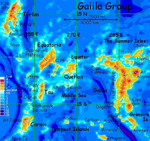
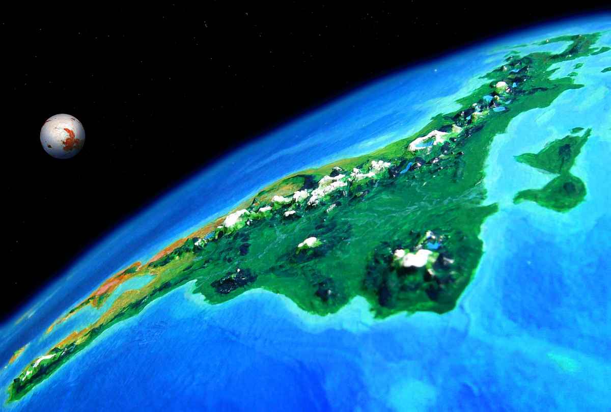
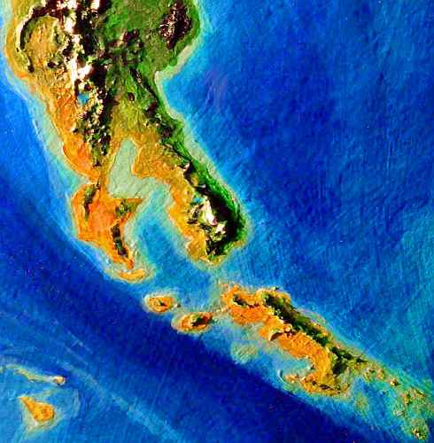
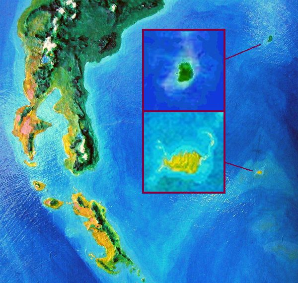
Gaiila is an equatorial cluster containing six large lands. This tour covers Gaiila proper (smaller than Australia) and its satellite islands. To the west lie Quetlan, Equatoria, Tau, Carnoi and Tyrlan. The group totals ten million sq km (4 million sq mi), larger than Europe. There are only three real flyways into the region; we'll enter in the northeast, circle the Middle Sea, and offer exits to the southeast and southwest. A fourth flyway to the northwest leads to Tyrlan and dead-ends there--deep, islandless seas all round.
THE SUMMER ISLES
Flying in from the Quenna Islands of Oronesia, there's no mistaking the border of Gaiila. The western Quennas are low coral islets sheltering great lagoons. The sea's dappled, half turquoise shallows, half indigo deeps. You haven't seen a hill in days.
And then, over the long Lyran horizon, rises a Hawaiian-size peak: Herne. Built of a single great volcano, Herne's 200 km long (125 mi). That's modest for Lyr--barely bigger than Hawaii--but after the western Quennas it seems a giant: Mt Herne rises to 3100 m (10,300'). Rainforest and cloudforest cover all but the windy summit, a fern-brake. Unlike Hawaii, there's no dry side; we're right on the equator.
Because Herne's the only gateway to Gaiila from the northern hemisphere, it's quite cosmopolitan. Representatives of nearly every (flying) people on Lyr nest somewhere on its slopes. A vertical zoo!
An hour from Herne's western tip lies the long low coast of Oberon. A lush, endless rainforest, broken only by meandering rivers. Low conical hills to the south (baby Hernes?) are the only heights; the green plain's 1000 km (625 mi) wide, and the only mountains lie far to the north of our path.
All day, you glide over Amazonian canopy half-hidden by puffy little clouds. Compared to Herne, it's monotonous. You see few signs of habitation, too; just a few wicker villages in the sunny canopy, woven by griffets.
Toward sunset a patch of color draws your eye--the flowervines surrounding one treetop village (griffets love color) in a cloud-gap, spotlit in the low sun. You circle down to a rooftop landing deck. The griffets welcome you, chirping too fast for you to follow, perching on your shoulders and head... but after the obligatory fruit-and-nut feast, you do eventually get some sleep in a swaying, flimsy room (cat-sized, griffets needn't normally reinforce their treehouses much; in their guesthouses, they do try), 50 meters above the invisible forest floor.

In the morning you again flee the dim red sun--what little you can see of it between the puffy clouds dotting Oberon's skies. In the afternoon you reach the western tip, and follow a chain of islets over the shallow sea. Near sunset you reach the coast of Titania, another rainforest 800 km (500 mi) across. In the low light, this luridly backlit, bumpy green plain makes you feel like a gnat in an infinite field of broccoli.
Again you stay in a griffet village--even the smallest has a guesthouse for larger folk. Still, you notice the local greetings and accent are different. Griffets, being so small, aren't well suited for long inter-island flights, so neighboring groups vary culturally. In this, they're more human than most winged Lyrans, whose cultural regions tend to be large.
This village is less flowery, but more musical--they stay up late singing. Pretty harmonies, but with manic rhythms and jangly, squeaky, annoying instruments. You finally realize this isn't some local, feline equivalent of punk: the griffet hearing range and pulse rate are just much higher. This is dignified, full-bodied music--to the griffet ear and heart.
The next morning you continue west along the south shore of Titania. Around noon you reach a blunt point where the coast curves north a bit--the southernmost tip of Titania. Here you head out to sea--such as it is. Reefs and jade lagoons fill the strait to Puck, which appears an hour later. Puck too is a low broad land 800 km (500 mi) across. It's shaped like a rubber duck... cut out of lime-green carpet. The same rainforest, the same little griffet villages. What is this, treetop Munchkinland? Why aren't there any larger people here? It's rich enough country to sustain them, isn't it?
THE IMPACT OF IMPACTS
The Summer Isles really are emptier than normal for a rainforest, though a Terran tourist could never guess why. The Diomedes region has tauraffes, the plains of Troisleons have elaffes, the two largest peoples on Lyr; even the cool forests of Altai have huge (non-sapient) altaffes. Big long-necked flightless browsers often evolve in Lyr's rainforests, though from different stocks; the three just mentioned are convergent forms, quite unrelated.
But the Summer Isles, though seemingly suited for these elephantine giraffoids, lack anything bigger than a sort of long-necked elk (admittedly big for Lyr, where animals generally run smaller than Terra). Are Gaiila's jungles just too hot, dense and damp for a giant? Yet Terran elephants can adapt to jungle. Is it the high gravity, discouraging large and especially tall creatures--it's hard enough to pump blood up to a giraffe's head on Earth, without adding 20-40% more weight, depending on latitude. Still, if Earth could evolve not just giraffes and elephants but seismosaurs and such, able to browse fifty feet up... why can't Lyr manage any ground-dwellers weighing even a ton or two?
Why is this niche empty?
The truth is, flightless giants did evolve here, but were wiped out during the last great flood. Flood? Lyr's sea level is already so high, it's hard to picture it rising more--where would the water come from? There's no ice to melt as on Earth! But Lyr is big, and 7-8 Earth masses can pull in a lot of space debris. Major impacts happen only ten or twenty million years apart, and the tsunamis from these events devastate Lyr's lowlands. Most of the Summer Isles (unlike most of Lyr's lands) have no high mountains, so there may have been little or no untouched forest from which survivors could recolonize. Fliers may survive a catastrophe (though they may be faced afterward with a choice between emigration and starving in a sea of mud); but huge giraffoids, few in number, unable to flee, must re-establish themselves from mountain refuges. If there are none... it may take some millions of years before a new contender, um, arises, head (if not shoulders) above its rivals for the new giraffoid crown. And in the Summer Isles, we seem to be in such an interregnum.
You head southeast over Puck's west-central hills, up to a kilometer high--after the last few days they seem like great mountains, but some Lyran impact-tsunamis may well reach that height. You sleep in a third griffet village near Puck's narrow waist; the sunset sea gleams gold to the north and south. On your fourth morning, you head south along a sheltered shore--coral reefs to the west, jungle plain to the east. By noon you reach the southern tip of Puck, and continue south out of the Summer Isles. An hour over the shallow sea brings you to the endless shoreline of Gaiila, fourth largest continent on Lyr.

GAIILA
Gaiila is 3/4 the size of Australia, a north-south strip 4800 km long (3000 mi). The climate's warm but varied: from rainforest in the north to Mediterranean savanna and groves and deserts in the south, with cloudforests and alpine meadows in the highlands. It's pronounced roughly "guy-EEL-uh."
We make landfall northwest of huge Mt Alayne, the highest peak on Gaiila. Mt Alayne's three fused volcanic cones rise to 4300 m (14,100'). Alayne stands alone; the low, swampy Dee Basin separates it from the Valeria Range, the spine of Gaiila. The distance is geological, too. If you stole all Earth's water and splashed it down on Lyr, swelling its seas a few percent (after all, what's a drop or two among friends?), then Alayne would be revealed as the largest of the Summer Isles--a Herne writ big.
But where we land, Alayne is invisible, beyond the long Lyran horizon. The coast is low and swampy--the Dee Basin. The Dee's a many-branched river 1300 km (800 mi) long, draining all of eastern Gaiila between Mt Alayne and the Valeria Range.
Over the delta of the Dee, two streams of fliers converge: east-west and north-south. The Gaiila Cluster is complex, forming a rough ring around the Tempest Sea, from which several flyways radiate. I can't chart a single course that covers everything neatly--not even mainland Gaiila, for we've landed near its midpoint. Forks are unavoidable.
Arbitrarily, I'll turn south first, down the length of Gaiila and on to the Flandry Region, with the most land of any region on Lyr--but on a dead-end flyway, forcing us to return here--after a couple of months and 40,000 km (25,000 mi).
The westbound route will lead us along the equatorial arm of Gaiila, toward the other main lands of the cluster: Quetlan, Equatoria, north to Tyrlan, south to Tau and Carnoi, and finally west out of Gaiila to the Diomedes Region and the rest of the southern hemisphere-- Rorvan, Ak'hai'i, and chilly Averorn.
Both flyways will have an escape route ( the Tempest Islands) letting you change your mind and switch paths to the other, just before you leave the Gaiila region. They'll also have links letting you return here.
SOUTH THROUGH GAIILA
So, southbound travelers! We skim up the swampy plains of the Dee, with the slopes of Alayne looming to the east--though its snowy head is invisible, wrapped in thunderclouds. Ahead and to the west rise the Valeria Mts, a range over 2000 km long (1300 mi). For the first few hours, our winged reflections often flicker below us through trees standing in shallow water, or through the reeds of wide flooded meadows. Villages here stand on stilts or atop heavily buttressed "mangrove" trees.
At last we veer right and slowly climb through the foothills of the Valeria Range. The muggy equatorial heat grows milder, until, at dusk, two kilometers up, we sleep in a green cloud-forest.
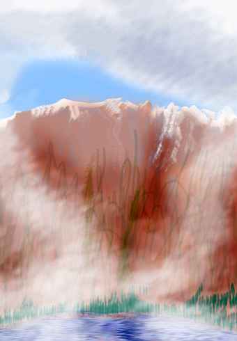
South along the Valerias... All day, a second great volcano looms to the east: Mt Rupert, 4000 m high (13,100'). Off to our right is the wide hazy basin of the Wye River. The Wye drains much of western Gaiila, collecting the streams of the Valeria Range into a valley parallel to the coast, 1000 km long, much like like California's Central Valley. It's hot and fairly dry, with "oak" groves and savanna except for green marshy strips along the Wye and its tributaries. You decide to stay up here in the hills where it's cooler. A fascinating handless people called antel live in that drier land, but we needn't detour, for their homeland lies only a week ahead.
Slowly the forest opens out to drier woods of pseudopine. We camp on the rim of a great caldera, nearly as high as Rupert. I think it's called Mt Wye, but I can't be sure; all around, volcanic cones and the cliffs of other collapsed calderas stud the highlands.
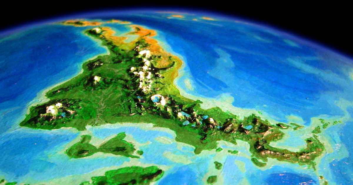
The orbital photo below gives an idea of the sprawling length of this range, though foreshortening inevitably collapses its complexity into a single mountain wall. Oh--that's Oisin setting in the background--a moon as big as Mercury or Titan, and probably bearing life in the ocean under its icy skin.
Largest lake in Gaiila, Boye is an oval 175 km (110 mi) long, set amid "oak" hills. Beyond its silver disk, on the southwest horizon, the hills flatten to a pale gold plain. Though we can't see it from here (even with Lyr's wide low-curvature horizons) the plain is so low it narrows to a neck. Beyond is the Dageram Peninsula, a low, gently rolling patch of savanna, 900 km wide (550 mi), also antel country. The contrast with rugged Cape Sim across Rhys Bay could not be more extreme.

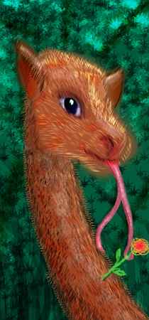
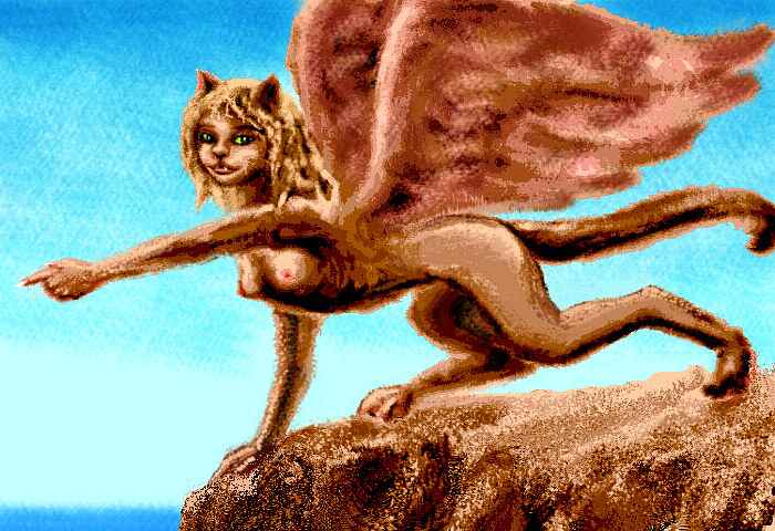
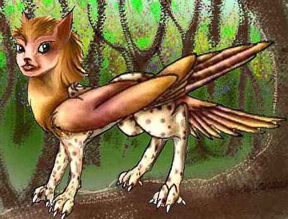
We sleep in a sphinx village on a crag above Lake Boye. Sphinxes are a winged, golden feline like a small cougar, but much lighter, with four handlike paws with opposable digitis. These friendly, curious, sensual, highly intelligent omnivores fish and tend orchards around the lake. This Gaiilan subspecies is small, gracile (lightly built) with big ears--all adaptations to the heat.
While sphinxes in Ythri and Oronesia are cosmopolitan and get along well with other species, the Lake Boye villages are relatively rustic. Sphinxes catnap, and so your new friends, while intellectually aware that other species have different sleep cycles, just don't get it in practice. You keep waking up when raspy tongues lick your face affectionately (or seductively; not much distinction, with sphinxes.) If you let them they'll snuggle in with you, and more than snuggle. However far you let things go, don't expect to get much sleep.
In the morning, a bit drowsy but rather cheerful, you glide slowly down out of the highlands and southeast around the head of Rhys Bay, a gulf cutting 1200 km (750 mi) into southern Gaiila. Invisible to the west is low, gentle Dageram Peninsula; ahead of us rise the first hills of Cape Sim. These shores are rather Mediterranean, with small "oak" groves, brushy aromatic slopes, and little meadowy deltas. Sphinx villages cling to sea-stacks and islets in Rhys Bay.
You have lunch on the cliffside terrace of a music-inn, that quintessential Lyran institution. Your salad's a bowl of huge leaves as full of holes as a philodendron but tasting like mint. Next is a sliced starshaped fruit tasting like sour cinnamon, and the ubiquitous nutbowl, its wedge-shaped sections each full of a different type of seed (many Lyrans get half their calories and protein from nuts; it's not surprising for fliers). Fish is available, but so as not to gross out the herbivorous antel customers, meat is on a supplementary menu, rather like wine menus on Terra.

You notice only half the staff are sphinxes; a couple of winged bipeds are deftly waiting tables. They look like undersized angels wrapped in fur, with somewhat feline heads and typically huge Lyran eyes. Your first icari! These immigrants from distant Diomedes flirt and joke with the sphinxes (and you). Clearly icari are as sociable and sensual as sphinxes. In fact, the two species evolved to fill similar niches on opposite sides of the world, and share many traits despite their different appearances; psychological and behavioral convergence, instead of the physical convergence that's created unrelated giraffoids in so many Lyran forests. Gaiila is the boundary where the two ranges meet.
And meet they do--at the end of her shift, your chef, a sphinx, meets an icarus on the terrace. They sprawl together on the cliff-edge, rubbing faces, licking ears, audibly purring, madly in love. You inquire, and find such couples aren't rare here. Instead of competing, icari and sphinxes apparently find each other exotic and exciting--nearly as adorable as they find themselves...
Fertility isn't a problem for such couples, since both species mate more promiscuously than humans (than humans will admit, at least) and raise their young communally. As they say, "It takes an eyrie to raise a cub."
The next day, the coast grows dry; the mountains inland create a rainshadow here. To the south, steep red desert canyons drop into Rhys Bay. Cliff-villages of sphinxes and icari cling to the canyon walls.
All of it's scenic and some of it's stunning, but the land turns dry and rough ahead, with few landing spots and little fresh water. Not a place for tourists with borrowed wings! It's safer to head inland.
So after lunch you veer up through brush-covered hills into an oak belt. The meadows are dry, but the creeks hold a little water, at least. By late afternoon you've climbed into a much cooler piny upland dotted with small lakes.
By dusk, the ridges are jagged, trees are thin, and the lakes are subalpine tarns. These Shelgrave Uplands are a cool ecological island above the Rhys Desert. Due to Lyr's eccentric orbit, even high peaks at the equator get a little winter snow; but Sim is far enough out of the tropics to get a significant snowpack, and it shows.
Up here, the sphinxes are tawny, robust, leonine... formidable! They look like a completely different species from the little sphinxes down in Rhys Bay. In fact, you're a bit afraid of these winged lions padding across snow patches...
Until you get lost and ask one for directions. She's just as friendly as any coastal sphinx! The sunny, flirtatious temperament is unchanged; her imposing size is an adaptation to cold; those big, lynx-like clawed feet are just natural snowshoes, not primarily weapons. Not even secondarily; these huge beast-paws still have fully opposable thumbs.
The highlands culminate in Mt Shelgrave, a volcano 3900 m high (12,800')--well, really a high-altitude maze of ruined calderas and overlapping cones stretching 100 km or more. Old lava- and mudflows snake through the upland valleys for miles around the complex.
It's dormant for now, its highest cones snowcapped even in summer. But clearly the Shelgrave vents are busy, on a geological timescale. Has it built up the ENTIRE Sim Peninsula unassisted? It seems unlikely, yet it's the only obvious candidate. The Gaiila Trench is fully 1200 km to the west, too far to be the proximate cause.
If Cape Sim stood on a drier, more Terran world, perhaps it would be a continental spine like the Himalaya or Rockies, not a high coastal range like the Andes. Did two plates of light continental rock overlap here, as in Tibet? Yet Gaiila Trench looks like a subduction zone, the exact opposite of the fast-spreading rift you'd need to drive such an overlap. But such rifts don't have to be close, just vigorous... the Rocky Mountains, thousands of kilometers from the Mid-Atlantic Rift, show just how far away such a spreading zone can get--at least on worlds with cooler, inelastic plates, like Earth. But on Lyr?
It's a geological puzzle, and not one easy to unravel; Shelgrave's lava and ash have buried the older, tale-telling strata.
The next day's a long but easy glide, mostly downhill, from the Shelgrave volcanic field through warmer pine forests and Mediterranean slopes to the southern tip of Gaiila to the port town of Cape Sim.
Rest up--tomorrow's a three-hour deepwater passage over Sim Channel to...
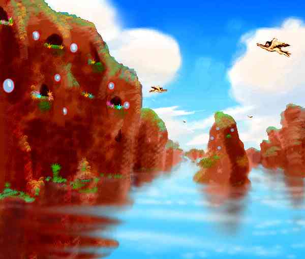
THE GRIMOIRE ISLANDS
You land on the north shore of the largest, Amrtet, a hilly land 1300 km long and 300 wide (800 by 200 miles). It's in a drybelt, a high-pressure zone; its east coast and highlands have some trees and look quite Mediterranean, but the west coast (downwind of the rain-stealing highlands) is a long strip of desert.
Here on Amrtet, two flyways diverge. You can:
In the morning we cross Algastna, a dry journey broken only by the everpresent megalithic art of the antel, a handless species like winged deer, who use prehensile tongues (and kicking) to line up stones into huge drawings viewable only from the air... Thirsty work, but they're desert-adapted, and we're not.
Near noon we goodbye to Algastna (with few regrets) and turn out to sea, heading north for Algar, third of the greater Grimoires. An hour out, we hear a faint rumble and look back. Thunderstorm! Faint slaty sheets are falling on the golden hills--now that we're gone. It figures.
The thunder-front must have passed over Algar yesterday, or the day before; the dry grass is green-tipped and we find several streams in the hills, crossing to the western shore. We fill our pouches and rest on the beach, sleeping early. A long hard day tomorrow--1300 km (810 mi) nonstop, over the Gaiila Trench.
Before dawn, we fly straight out to sea, toward the Tempest Isles...
There is one other route, though the locals don't know it. No one on Lyr does. Due east of Mt Sheldrake, a good 1600 km (1000 mi) out to sea, is an unknown and unnamed island surrounded by deep water. I see no apparent geological links to the mainland. It's about as big as Oahu in our Hawaiian chain, but low and less fertile--dry savanna, coast to coast, like the Tempest Isles west of Gaiila at the same latitude. On the other paw, or wing, sphinxes might still do fine here--coral reefs don't just ring the island but stretch northeast several hundred kilometers; fishing will be good. Folks will just have to conserve water. If they ever find the place at all... it's just too far offshore for fliers; and deepwater sailors stick to established shipping routes. The golden island won't be settled soon.
I should add here that your guides haven't even bothered to mention a known island nearly 1000 km (over 600 mi) north of the unknown one. Miri, this northern isle, has been named and settled for centuries--it's just way, way off the flyway. Reefs do link it to the Quenna Islands to the north, so a few fishing boats a year will visit for a little trade on the side; but there's next to no contact with Gaiila, the nearest land. Around the size of Kauai (say, 40 km / 25 mi across), it's a broad volcanic cone. Unlike the undiscovered isle, Miri's in a rainy equatorial belt, and wooded to the summit, with no dry side. Farming's easy--fertile soil, plenty of rain. Fishing's decent but the reefs are narrow, dropping off quickly into deep water.
SOUTH TO FLANDRY
Now, for those who stuck with me, flying south along Amrtet in the Grimoire Isles... it's a long, dry land--almost continental. You never expected to feel dusty on Lyr, did you? We take a day or two, always on the lookout for rare streams. Luckily, we're on the wetter side; ribbons of oaks wind out of the hills, shading shallow creeks--sometimes.
Lines of dark stones web the gold hills of Amrtet. They form huge pictures from the air, like fill-the-dots puzzles. Handless antel artists patiently nosed each stone into place. You pass one at work, and wonder at the patience involved: not in moving the rocks, but judging the effect: the artist leaps into the air like a springbok, spreads her wings (a 4-meter span!), climbs fifty meters and wheels, swears loudly, dives back down and kicks an offending rock into line...
The things we'll do to impress peers and win a good mate!
These kickrock pictures are everywhere--they even overlap. A tangle of images accreted over eons! This is old antel country, and even handless work adds up over fifty thousand years.
But there are gaps: stolen stones mar all but a few consensus-masterpieces. You'll never spot an antel doing this by day, but by night, now and then, desperate young artists (that is, horny and trying to impress someone) may filch stones from their elders' work.
In spots the stone lines make you feel as if you're gliding high over ruined stone-walled pastures built by extinct Lilliputians. Not at all! Not only the scale's off--so's the meaning. The Amrtet kickrocks are tools and expressions of passion, not control.
Slowly Amrtet narrows; you have a curious feeling it's not dwindling so much as being squeezed together like a sponge--squeezing out all that unwanted stony veldt. Trees and streams and hills grow closer, denser. Only the golden veldt, the canvas for antel art, shrinks and disappears under trees. Creeks are still seasonal but more common.
At last the sea breaks in, and we're hopping between olive-green Mediterranean islands. Most are too small for rivers; it's lucky we're in a rainier zone by now, or they'd have no fresh water at all.
Well, no, not luck: on Lyr, rainbelts and drybelts are predictable as clockwork, and we've been heading due south, right across the grain of this stripy world.
The next day, the isles slowly shrink, the channels grow. But more showers fall, the heat fades, trees cover the islets, shading creeks. Tiny villages of cliff-diving sphinxes are the only people you see.
A day later, on green Last Isle, at 32 degrees south, we camp early to rest up for the long flight to Nyanza in the morning. Its nearest islet is still a good 600 km (380 mi) southeast.
There's no point in flying early--it's a nonstop, all-day flight. If we start any time but late morning, the rising sun will glare in our eyes for an hour at some point.
So we wait a couple of hours til the sun is high, then grab air. If the glare gets to you, zigzag under the puffy fair-weather clouds that bumble across this northern tip of the Flandry Ocean.
An hour after sunset the sky's dark--for Lyr. The huge, life-bearing moon Oisin set hours ago; only the ruddy lesser moon, Manannan, shines half-full in a deep-blue sky. It's a bit smaller than Luna, but as bright as our full moon, for its albedo is high. With its reddish face and white poles, it looks like a miniature Mars. A few stars punch through Lyr's thick damp air, and you spot the dim bronze arch of Lyr's ring, nearly invisible when Oisin's out.
So it's true night, as true as it gets, when you see a brightness below you answering that sullen coal of a moon--pale surf on the reefs of a black islet. Another to the right. And left. And then a looming, mountainous shore. You flutter down to a scalloped beach and collapse on the sand. Congratulations! You've reached Skua, in the Nyanza Archipelago, door to the isolated Flandry Cluster: Lyr's Australia.

NORTHWEST GAIILA
Now for those who chose to head west along the equator from the Summer Isles... welcome! I'll re-orient you, just in case. We're perched in a pseudo-mangrove, looking out over the marshes of the Dee River Delta. Puck is offshore to the north, Mt Alayne looms to the east, the Valeria Mts to the southwest... where we're bound. Step off your perch into the air, spread your wings and follow me!
We head southwest all day, up a winding tributary, sleeping in a sphinx village built atop heavily buttressed "mangrove" trees rising from reedy water.
The next day, we slowly climb through the foothills of the Valeria Range. As the sun climbs, you expect the muggy equatorial heat to be as bad as yesterday's, but we're rising above the worst of the heat. Around noon we reach mile-high Lake Dee, 120 km long and half as wide (80 by 40 miles), and stop for a swim.
To the southwest rises Mt Dee, a 3300-m volcano (11,100'). Unlike an equatorial Terran peak of this height, the forest doesn't reach to the top; Lyr's high gravity makes air pressure drop faster with altitude; climate zones up mountain peaks are narrower. And the eccentric orbit creates a winter of sorts even at the equator. Most winters, Dee's summit gets snow.
You turn northwest toward a second peak on the horizon, Mt Cundaloa. Two hours later you're climbing its outer slope. No, "outer slope" isn't redundant, for there's an inner slope: Cundaloa's a broad volcano with a cliff-walled caldera 60 km (40 mi) wide, holding azure Lake Cundaloa, deepest on the continent. The rim's low point is still two miles high and reaches 4100 m (13,450') on the northwest side.
While it sounds like the big sister of Oregon's Crater Lake, Cundaloa's history is quieter. Crater Lake was born in a catastrophe as violent as nearby Mt St Helens, but Cundaloa peacefully subsided, almost like the caldera of a Hawaiian shield volcano. Why? Lyran stratovolcanoes (steeper conical peaks found near trenches) have lava chemically similar to their Terran sisters, but it's hotter. Cooling on the surface, such lava flows and fountains still create cones nearly as steep as on Earth; but magma vents rarely plug up entirely, so explosions and catastrophic collapses are rarer. Geologically literate readers may have already noticed that many Lyran peaks seem hybrids between Terran shield- and stratovolcanoes. Lyr's high gravity ensures most cones are broader, but heat is the main reason. Lyr's volcanoes resemble Venus's more than Earth's!
Regardless of its origins, the lake's a lovely sight--a startling indigo, a perfect windless mirror near the sheltering walls. The cliffs are sheer in many places but striated with contour lines where the subsiding lava paused. In winter it's even stranger--snowy up top, almost subtropical at the foot of those kilometer-high walls.
You're exhausted, though. The prevailing equatorial winds carried you up Cundaloa's east face, but the air up here is too thin for you to fly easily, and downdrafts at the cliff-rim could easily suck you in. You sleep in a small stone lodge thatched in alpine grass, built by the nearest sphinx village, a kilometer down the slope. No one lives up here; even for sphinxes, flying is too much work at this altitude.
All next day you dance across the uplands in zigzags, gyring up like a hawk over east-facing cliffs, riding their updrafts, then crossing lake-dotted valleys. The country's surprisingly varied--cloud forest worthy of Central America thinning to alpine meadows you'd swear were Swiss. The people are mostly sphinxes; it's too cold up here for antel or griffets.
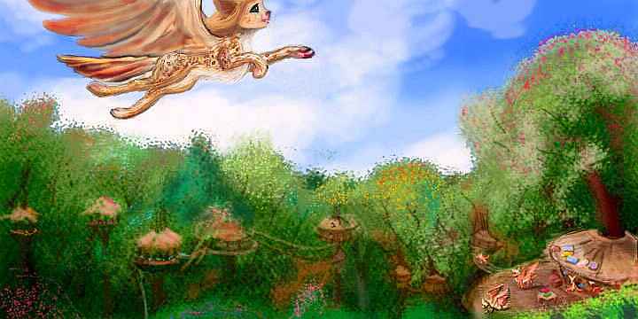
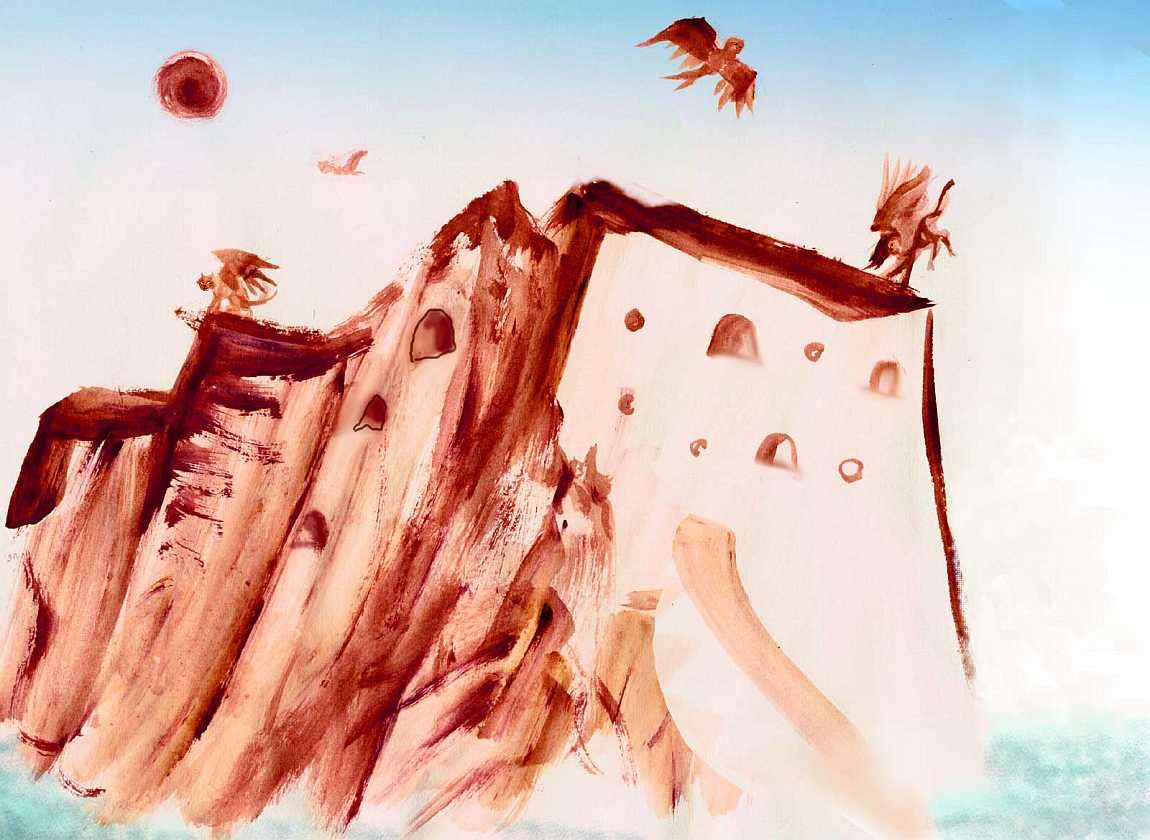
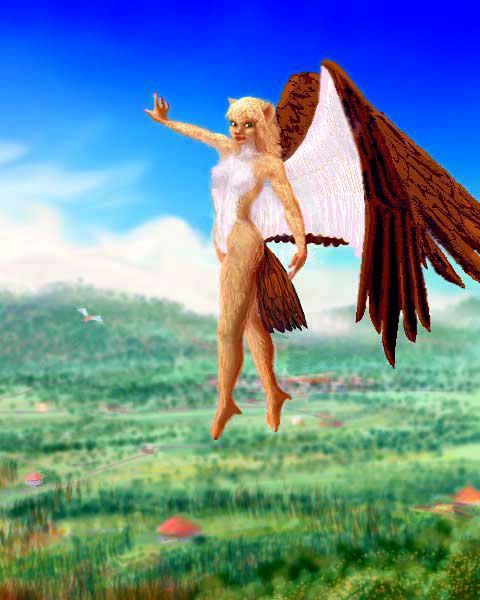
But in many villages you spot a new species, not present in the steamy lowlands: small winged figures walking upright, like angel-children. Angels with thick fur and feline heads! These are icari, who evolved 25,000 km to the west, in Diomedes. You're heading into their edge of their slowly expanding range.
Icari resemble sphinxes in lifestyle (many groups fish off coastal cliffs and others farm nut trees) but are a bit more cold-tolerant. Their similar niche and origins mean they share many psychological traits with sphinxes, and get along well; while of course not cross-fertile, they often intermarry.
Near dusk you slip into a basin only 12-1500 m up (4-5000'). As the sky lights up in red and gold for the shockingly short Lyran sunset, gold fire gleams below, mirroring the sky and the silhouettes of the surrounding peaks. A great lake: Valta. The arc of its south shore sweeps before you; to the north it stretches out of sight.
A finger of shadow tarnishes the clouds across the lake, the elongated shadow of Mt Valta, barely visible to the west--a clean stratovolcanic cone rising to 3300 m (10,800'). Subtropical cloud forest surrounds the lake; the uplands beyond are open pine forest and subalpine meadows.
Valta's not alone. You're entering Gaiila's lake country. North past Valta's end lies Lake Vahino, nearly as large, a good 150 km long; to the west, Lakes Dalton, Skorrogan and Valthak are only the largest of a dozen others, collectively called the Skontar Lakes. The icari love this country, for most of it's high and cool; Lake Valthak is 2 km up (6600').
You stay in an icarus eyrie cut into the rocks of a crag over the lake. You'd swear it was a sphinx village if the residents weren't walking around on their hind legs... but that evening you discover a big behavioral difference. Sphinxes catnap around the clock (and do griffets EVER sleep? Manic!), but icari, thank the gods, are diurnal. An hour after sunset, things quiet down, and you get several hours of uninterrupted sleep--the most you can expect, with Lyr's five-hour nights.
But they're up at sunrise. Way up! Dawn-lit angelcats wheel over the lake and dive like pelicans for freshwater fish. Others perch and chatter in the fruit trees, picking breakfast.
It's a nice spread--"apricots", "mangos", smoky-lemons, "almonds", flatbread from a starchy nut, spread with butter/jam ground from another seed tasting faintly of anise, fish for those who don't feel sorry for them (about half the eyrie), and a nondairy yogurt cultured from a protein-rich treetop "soybean" for the squeamish (excuse me, ethical) half...
And after that breakfast, you fly on. You skirt Lake Valta all morning, then curve northwest, then thread your way inland between 3-km peaks (2 miles high), past lesser lakes no bigger than Tahoe or the Dead Sea. At noon you swim at a black-sand beach on the north shore of Lake Valthak. Mt Valthak rises to the east, and the Fuji-like cone of Mt Skontar to the west, 3700 m (12,100') high, the region's climax, and also, you discover two hours later as you skirt the great peak to the north, past long Lake Skorrogan... also its end. For after you veer west around Skontar's flank, the land starts to drop relentlessly. With mixed feelings you leave the Valeria Range, and slip back into the warm humid embrace of the lowland's cloud-sea.
For the next two days you wind through cloud-forested hills, sleeping in mixed sphinx/icari villages, riding thermals where you can. By now you're altitude-adapted, and this lowland air feels like soup. At least your wings have something to grip!
And you're a stronger flier now, having survived Valeria's heights. An icarus girl even compliments your wing-skill, though of course you really can't match her acrobatics any more than you can aspire to a sphinx's feline grace.
As the altitude drops, the weather grows worse. That's how you know you've reached the Fairweather Peninsula. In a competition for the most laughably inappropriate name on Lyr, this soggy cape ties with the sunny Tempest Isles of southern Gaiila.
Rain, rain, rain. It goes on and on just like Fairweather itself--by some measures the Peninsula begins all the way back at Cundaloa, or even Lake Dee. But even by the narrowest definition--the final, narrow, crooked claw ahead of us, cupping equatorial Clodia Bay--we still have 1000 km to go (625 mi). It's Amazonian jungle with most of its life in the treetops, inhabited almost exclusively by griffets, those hawk-winged catlike little people who fill much the same niche as parrots--if parrots built woven villages, sang chorales, and played 3-D chess.
But you've seen all this before, if you passed through the Then one talks--more articulately than any griffet. Not pets, friends. A new intelligent species: your first koreens. These are pioneers from the west--we'll be seeing lots of them from now on.
From this village near the western tip of the Clodias, it's a 1200-km jump (750 mi) to the mainland of Quetlan. This is the great divide between east and west Gaiila. It's hard enough for you--imagine the challenge for someone cat-sized! That's why the Clodias hold the westernmost significant populations of griffets, and why Quetlan is the eastern edge of the koreens' normal range.
But, Dear Reader, you're (probably) not cat-sized. You have no excuse. It's time to head out to sea, for a full day and night, for Quetlan and the rest of Western Gaiila: Equatoria, Tyrlan, Tau, and Carnoi...
TOUR LYR! The following route snakes around Lyr, covering all major features:
World Dream Bank homepage - Art gallery - New stuff - Introductory sampler, best dreams, best art - On dreamwork - Books

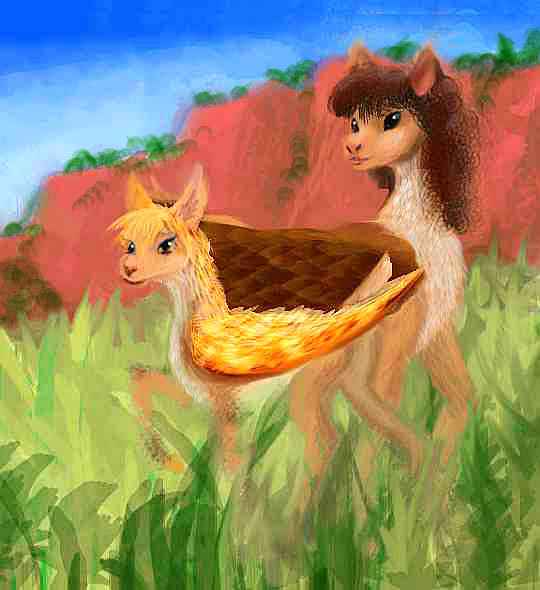
KOREEN
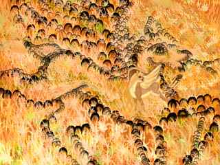
GRIFFET

Ythri -- Polesotechnic Chain -- Troisleons -- Roland -- Oronesia -- Gaiila -- Flandry -- Diomedes -- Ak'hai'i -- Averorn
LISTS AND LINKS: more worlds? PLANETOCOPIA! - dreams of other worlds - ecology - climate change - evolution - populations and eco-crashes - anarchy - utopias - natural disasters - terraforming - orbital dreams - sculptures and 3D art -
Indexes: Subject - Author - Date - Names - Places - Art media/styles
Titles: A - B - C - D - E - F - G - H - IJ - KL - M - NO - PQ - R - Sa-Sk - Sl-Sz - T - UV - WXYZ
Email: wdreamb@yahoo.com - Catalog of art, books, CDs - Behind the Curtain: FAQs, bio, site map - Kindred sites