Sherrin
by Chris Wayan, 2006
Lyr (home) - map - creatures - cultures - evolution - climate - geology - gazetteer - nomenclature - definitions - building Lyr - more worlds? Planetocopia!
INTRODUCTION
New on Lyr? First-time orientation--strongly advised! Lyr is weird.
Sherrin can be reached in only two ways--west from Roland, or up from the south via a flyway some 7000 km long. I've structured this tour assuming you came from Roland, as most of you will, but I circle Sherrin completely, so those flying up from Diomedes won't miss anything--it's just in reverse order for you. So with that in mind...
SHERRIN PROPER
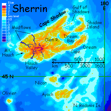
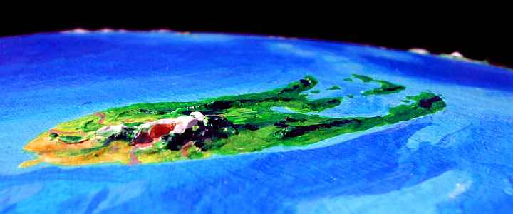
You're heading west over deep sea from Roland to Sherrin, a land some 2100 km (1300 mi) across. You make landfall on Cape Dream--if you make landfall at all. A nonstop flight of 1350 km (850 mi) is always risky.
Cape Dream is narrow but 1000 km long, covered in temperate forest. It shelters the Gulf of Shadows much as the Olympic Peninsula shelters Puget Sound. And the Gulf resembles Puget, with kelp- and oyster-beds off densely forested capes and islets. But it's far larger--800 by 1000 km (500 by 625 mi) across. This southern half, Dream Bay, below Shadow Island, is more sheltered from winter storms. Most of the people here are sphinxes living on the coast, shellfishing and berrying.
Given how different sphinxes look from humans, the resemblances to Northwest Coast culture are uncanny--they even build plank lodges here, elaborately carved, though they lack totem poles. Too much of a flight hazard, I guess.
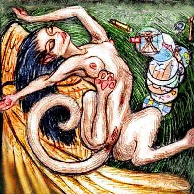
They build elaborate roof-landings and terraces instead, stained with berryjuice spirals, and full of carvings you're meant to feel, not just look at--perches to sprawl sensually on, with odd textures and folds and fins. On sunny mornings a whole village will flap up to the roof and roll and scratch and rub themselves silly. Adolescents use them to flirt--if that word can be used for blatant public sexuality. But for sphinxes, a yowling alleycat performance is quite admired--just so it sounds like you're having fun (and rub any leftover juices into the woodwork for the sun to dry. Sphinxes think it adds luster). "Polishing the roof" is a smutty phrase in Sphinx--but rather complimentary. Even for human tourists from relatively uninhibited cultures, sphinxes' cheerful crudity can feel a bit overwhelming.
Though it's not really crude--just different. For example, sphinxes are highly visual, so giving a sketch or drawing can imply sexual admiration, like a human offering flowers or a poem. One woman asks you about Earth; while you tell her, you sketch each other. To sphinxes, this is incredibly flirtatious, so when you don't carry things further, she rolls and wiggles atop her drawings so you'll notice how turned on she is... teaching an important point. Sphinxes may seem blatant to humans, but to them, you seem blind.
You follow the shore west a full day and stay in a sphinx village again. At least you know what to expect now--an enthusiastic seafood feast, a lot of music and partying and toothy flirtation, and only catnaps later, since quite a few curious singles (and one couple) try crawling into bed with the interesting stranger, just to see what happens. It's not quite the puppy-heap that pegasi prefer (sphinxes have claws, after all) but...
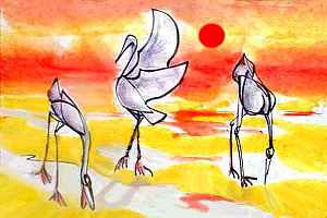
I plan to circle Sherrin, but if you hate cats, or seafood, or if you're in a real hurry to head south, one more day down the south coast will bring you to a jumping-off point to Nicor and the Rodonis Islands, leading south to the tropical Diomedes Region. But the rest of you... let's stick to the Gulf shore of Cape Dream instead, and wind north past coves full of kelp, rocky capes and islands. The largest by far is Shadow, a curving island 450 km (270 mi) long, heavily forested, like a warmer Vancouver Island. To the north, the gulf is shallower, full of mud flats and bars where Lyran toothed herons and stilt-leg griffoids fish and clam.
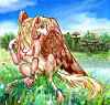
Cape Shadow is the northern tip of Sherrin. It's smaller and notably more somber than Dream--colder, windier, drier. Still, sparse conifer woods cover low ridges 200 km long. Here we turn southwest and fly down the long north coast. Fewer sphinxes, more pegasi--many villages are mixed. The pegasi aren't the shaggy northern race you met in the rest of Roland--smaller and leaner and smooth-pelted, more like winged grayhounds then equines. The adaptations make sense for this much warmer southland.
Three days pass, and slowly the forest opens into cool, windy grasslands, under the ominous shadow of Mt Hauch, a glacier-capped volcano 3200 meters high (10,700'). It resembles a lower but much broader Mt Rainier--or a cool-temperate Mauna Loa, take your pick. Wide alpine meadows drape Hauch's shoulders, and its east face is forested. Ideal climate for gryphons, but there are none--not any more. The trouble is, Hauch's active--and glaciers and heat don't mix! Plumes of steam rise from both the central caldera and a western cone the size of Mt St Helens--before it blew. Like Rainier or St Helens, Hauch can cause sudden catastrophic mudflows, and the highest risk is here on the north and west slopes.
Although most people survived, few had the heart to rebuild, for only sheltered river canyons hold trees here, and their woods were devastated. With all the orchards gone, the region will take decades to replant and recover.

Around the west end of Sherrin, a great cool prairie further from the two active vents, you find a few diehard villages in green valleys and on sea-cliffs--even a couple of flox cliff-dwellings in canyon walls, with irrigated beanfields on the bottomland. They aren't downstream of the active vents, so the floxes have stayed.
As you bend back east, the forest returns--there's more rain here on the south shore. But as you pass under the south face of Hauch, twisting mudflows (now pale green meadows stubby with seedlings) cut through the dark forest. This is what's left of Hauch River Valley, below the caldera itself. The greatest volume of mud came down this short stream, to reach the sea 150 km from the peak. You do see a few settlements up on bluffs--this land is too lush to be entirely abandoned, and orchards here can flourish above the floodplains.
Two hours further southeast, villages grow thick along the coast. This is the southern tip of Sherrin--not a cape, a mere blunt bulge of woods and orchards where the shore bends northeast, back toward Cape Dream. You stay in a sphinx village on the cliffs, apologizing to your hosts for sleeping early and alone. You know by now this is rather rude by sphinx etiquette, but you'll need the rest. For tomorrow you leave Sherrin, heading south into the sea.
NICOR AND AYOCH
From Sherrin, it's a good five hours over deep water to Nicor, first of the Rodonis Chain. Nicor's a low, rolling patch of warm, rainy, temperate forest 200 km across. To a Terran eye Nicor first looks wild, but eventually you start to spot hidden treehouses and carefully tended fruit and nut trees mixed in... sparingly. The Nicorians are very cautious silviculturalists, since smaller islands like theirs are ecologically less stable--they fear to lose their soil. No clearings, no dense orchards that disease might sweep... just a slow selection toward favored tree-crops in the mostly-wild wood.

At noon the next day, you reach much larger Ayoch ("eye-okh"), 500 km (300 mi) long. Ayoch is a low, rolling land of temperate forest. If western Oregon were an island... Here you do find farms and orchards and towns--Ayoch is so big it can tolerate more disturbance, and things grow fast here--it's a bit warmer and further into the rainbelt. Also, Ayochians are flower-mad, competing to breed the most lurid colors. They're not into subtlety. Flaming vines drape the trees around canopy villages, and sea cliffs drip color, as lurid as the magenta-flowered iceplant draping parts of our South African and Californian coasts.
The people look tropical too. You meet a new species, looking like a marsupial winged, feathered monkey with a big-eyed catlike face--koreens, natives of the equatorial Diomedes Cluster. They've spread up the very island chain you plan to fly the other way, the Rodonis Is. But no farther. This is the one subtropical land in Roland. Only a few koreen families live on Nicor, and none on Sherrin; winters get too cold.
THE RODONIS CHAIN
1300 km west of Ayoch is lonely Olivier, an island 100 km (63 mi) wide, with only a couple of satellites several hundred km north and south. We won't visit. Olivier's a pleasant enough patch of warm, lush forest with only one disadvantage: its deep isolation.
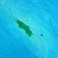
I mention Olivier mainly because it isn't just an island but a type. It has at least one nameless twin 1000 miles southwest of it, further into the depths of the Alianora Ocean--nameless because the Lyrans, not being mariners, have never found it. I didn't either, until I happened by with a magnifying glass on the altimetry scans. Yet it appears to be the size of Hawaii! This blowup is pushing the limit of the orbital camera's resolution, I'm afraid; sorry it's so blurry and noisy. I'm still not sure if that's a satellite island the size of Manhattan, or just a flyspeck.
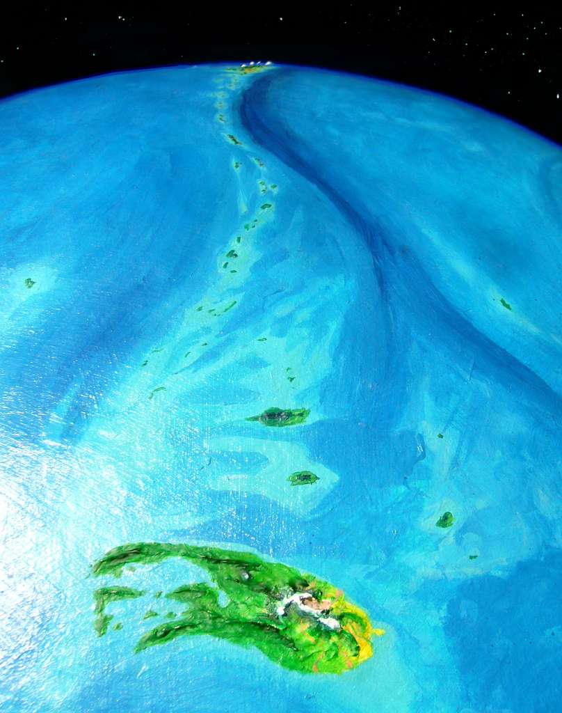
Below is the high-orbital photo that blowup came from. Remember you're looking south from Sherrin, so Olivier, its satellites, and the unexplored isle are to the right--the reverse of map orientation. It gives you the sense of the scale: basically the Rodonis Chain is Polynesia. Which part of Polynesia? Oh, all of it!
To my surprise, the orbital shot reveals a second large island I hadn't spotted at all, to the southeast of the main Rodonis chain (far left). Uncharted lands!
And there are more such, all over Lyr--a nameless isle in the northern Oronesian Sea, and one in the southwestern Sunward Sea, and two east of Gaiila, and at least three a thousand miles southwest of Rorvan, and whole archipelagoes in the far southern seas--the Dahia and Borthu Islands, and tiny Antarctica... if they're over a day's flight from known land, they're likely to have been overlooked.
In a way, this ignorance is a shadow cast by wings. Flight, effortless birdlike flight, is a fond dream for us, but an everyday reality for Lyrans. Over all it's served them well, helping them build a cosmopolitan culture with much lower technology than Earth required--but flight has hidden costs, too. One is impatience with sail and poorly developed shipping except along sheltered coasts. It looks like Polynesia, but the people aren't. They're just not sailors.
The result? No deep-sea exploration. Discoveries are by luck--double luck, really. First a storm-blown flier has to crash on an unknown isle, where the vast majority of windblowns die. Then s/he has to find food and water, rest up, and fly back to known land, often against the prevailing winds. Again, most die. Or live out their castaway lives alone.
Lyr's oceans have no intentional explorers. Just survivors.
On the other wing, let's be fair. It's not that Lyrans are lazy. Lyr's seas are seven times the size of Earth's! Using mere starnose-dolphin gossip and silk charts, they've mapped more surface area more accurately than all our probes of the solar system combined. And they did it in person, using their own effort and skill... risking their lives with every flight.
So let's ignore the occasional outlier they've missed while exploring a world so big we can't conceive it. The settled Rodonis chain will be plenty for this tour! It's 7500 km (4700 mi) to Diomedes, on the equator. I won't even backtrack to explore the northeastern isles on the left of the photo near the sun-glare--they're settled and pleasant, quite as beautiful as Ayoch, but off the main flyway. Due south for us!
South of Ayoch, the Rodonis Isles grow warmer, but smaller too--and the gaps grow longer. You fall into a rhythm--fly all day to reach a green islet, sleep all night and half the next day, find water, collect fruit from the orchards reserved for travelers, eat and sleep again, preparing for a new marathon starting at dawn.
Two weeks down the chain lies a respite--the Isle of Rodonis itself. It's 270 km long (170 mi), a long slender green ridge in mid-ocean. The locals, mostly koreens, grow a great variety of treecrops, exporting food to the lesser islands in the chain. They have to, or watch travelers starve. Many of the chain's islands are just too small to sustain both locals and the steady flow of travelers. This subsidy from big island to small ones makes little Terran economic sense but plenty of Lyran ecological sense; the locals don't want to be isolated, and they will be if the chain's stripped bare. The subsidy doesn't just go north, the way you came, but ahead of you too--an ominous sign hinting the southern flyway is no easier than what you've just crossed.
At first, flying south from the Isle of Rodonis, you're puzzled why the subsidy is needed here. The isles are larger now, the great ridge rises higher from the sea; your flights are shorter and safer. But just as geology's on your side, climate turns against you. These bigger, bonier islands grow dry and scruffy, for here this north-south chain enters a drybelt, a latitude with slack winds and sunnier skies, where small islets lack reliable water. Only the largest islands with hills over 1 km high (3300') force winds up enough to cool them, generating clouds making them visible for hundreds of kilometers; mist and light rains squeezed from those clouds feed sparse forests and small but permanent creeks. The trouble is, many isles in the drybelt aren't high enough to get more than fog.
So every hop here becomes an anxious gamble. You're carrying dried fruit and nuts and fish from the Isle, so you won't starve for a few days, but without water...
The anxiety grows relentless. And it's not just you, a clumsy offworlder in rented wings--every mid-sea flier you meet pauses and wheels, swapping shouted water-warnings.
Several islets tall enough to trap a little rain are still mostly black and bare. Raw lava flows! Few pioneer seedlings yet. One islet off to the side of your flightpath trails a long yellow cloud of ash. The whole Rodonis chain is volcanic, but this southern stretch has been more recently active. In the long run it's great to see, for these islands are growing; perhaps someday they'll fuse to a second Isle of Rodonis. But for now they just add to your worries.
On the fourth day of uneasy flight south from Rodonis, puffy clouds start to crowd over every isle; the lowlands start to green again. Trees! Shade, water, fresh food. Two days of easier flight through Mediterranean islands...
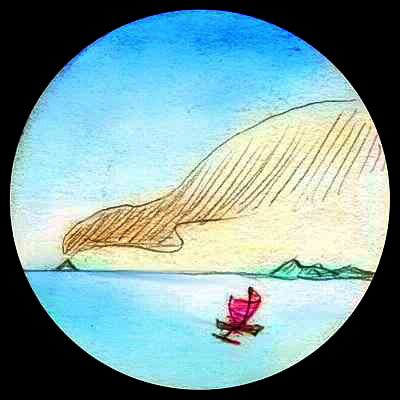
Next day at sunset, you spot a curious cloud ahead: a pink cone that holds its position and glows long after all the general cloud-wrack has purpled into dusk.
It's still there in the morning. And it grows all day. As the haze across 400 km of sea lessens to 300, then 200 (remember how low the curvature is on Lyr; horizons are long, and longer on the wing), meadows and forests beneath that 'cloud' slowly appear. It's the summit of Mt Sa, a subtropical Fuji rising from the tip of Cape Rodonis on Holmenach.
You've reached the Diomedes Group, an equatorial continent-cluster the size of South America. And, of course, you've survived one of the longest flyways on Lyr. Yes, flight sounds faster and easier than our Age of Sail--but now you know something of Lyr's sheer scale.

TOUR LYR! Climb volcanoes, swim seas, meet weird creatures. First: survival tips! Then, pick a region:
Ythri -- Polesotechnic Chain -- Troisleons -- Roland -- Oronesia -- Gaiila -- Flandry -- Diomedes -- Ak'hai'i -- Averorn
World Dream Bank homepage - Art gallery - New stuff - Introductory sampler, best dreams, best art - On dreamwork - Books
Indexes: Subject - Author - Date - Names - Places - Art media/styles
Titles: A - B - C - D - E - F - G - H - IJ - KL - M - NO - PQ - R - Sa-Sk - Sl-Sz - T - UV - WXYZ
Email: wdreamb@yahoo.com - Catalog of art, books, CDs - Behind the Curtain: FAQs, bio, site map - Kindred sites