Oronesia
by Chris Wayan, 2006
Lyr (home) - map - creatures - cultures - evolution - climate - geology - gazetteer - nomenclature - definitions - building Lyr - more worlds? Planetocopia!
New on Lyr? First-time orientation--strongly advised! Lyr is weird.
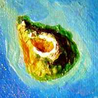
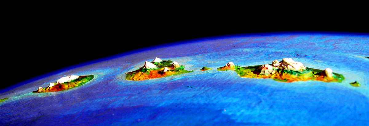
The Oronesian chain stretches an unbelievable 25,000 km across the abyss--that's 16,000 miles, no, not 1600, sixteen thousand. Those little specks look lost, but they add up: Oronesia has as much land as Indonesia or Mexico, 1.8 million sq km (700,000 sq mi). While it looks like the Hawaiian seamount chain (times ten!), it's biologically the opposite: instead of the most isolated land on Lyr, it's the only practical migration path between three continent-clusters, Ythri, Roland and Gaiila. And unlike most regions of Lyr, Oronesia lacks any intelligent natives of its own.
Thus Oronesia today is full of settlers from nearly every winged species on Lyr (even a few flightless ones), living at different latitudes and altitudes on its mountainous islands; the southern stretch around Hrill has become the cultural crossroads of the world!
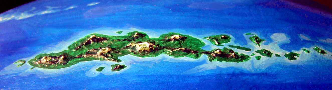
THE TARIAT ISLANDS
The western tip of the Oronesian chain, the Tariat group resembles Hawaii in size, origins, and geography: eight volcanic isles, with Tariat itself as big as all the rest together. None of the peaks rise above 2500 meters at present, nor have any erupted in living memory, but they still may reawaken. They're geologically rather young--without frequent eruptions they'd quickly erode to sea level, for this is a stormy zone.
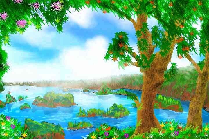
Subtropical rainforest covers all the Tariats, shore to shore--no dry side. More like New Guinea than Hawaii!
The Tariats echo Hawaii in another way--their isolation. They're off the main flyway, accessible only by thousand-mile flights from Li or Carheddin. Most of the Oronesian chain is culturally as well as biologically diverse, because it's a vital flyway between hemispheres (east-west as well as north-south). But Tariat, off the route, is a relative backwater. Several species do share the islands:

| 
| 
| 
| 
|
You zigzag east through the archipelago, taking your time...
You try a form of meditation that consists of climbing a tree and shrieking.
You get accosted by a drunk, horny, flightless marsupial in a bar.
You listen to splendidly bad singer-songwriters in a cafe on Tariat proper.
You watch a political cult put on a skit espousing some weird, number-obsessed, elaborate economic theory a bit like capitalism (as far as you can figure out) on a small-town bandstand. That gets laughed off the stage...
The third day, near dusk, you reach the easternmost islet of the Tariats. You grab air before dawn, and fly all day over unbroken sea. It's dim dusk when you spot a nameless reef-ringed rock. You sleep under its trees (even an island barely two km square has trees and fresh water, at this rainy latitude) for a full day and night, recovering from the Tariat Hop. It's still two days to the mainland of Li, but the three main isles of the Mayaw Chain are nearly the size of the Tariats, and no jump's more than a few hours.
The third night you sleep on crescent-shaped Mayaw itself, just off Li, and wake to see a high green wall over the silver strait.
THE LAND OF LI
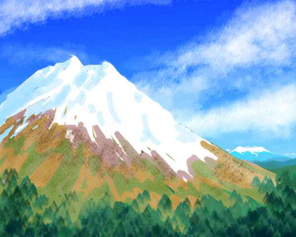
Li is by far the largest island in Oronesia, almost continental: a wedge 3500 km (2200 mi) long and up to 700 (450 mi) wide. It's a mass of overlapping shield volcanoes over a "hot spot" (or maybe two) in the mantle. Just multiply Iceland's geological recipe by twelve, steam gently until subtropical, et voilà! But more vertical than Iceland--from sea floor to summit, central Mt Li rises a good 12 kilometers--forty thousand feet!
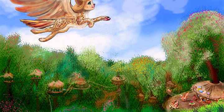
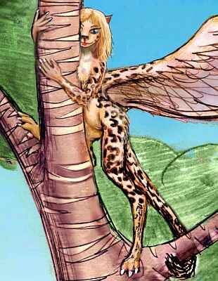
As you land on Li, the cloud-wreathed heights before you are the shoulders of Mount Oherran, 4300 m (14,100'). It's a shield volcano massive enough to create its own peninsula. You fly up the northern shore, where it seems a bit cooler. Two or three hours later you reach the Oherran River delta and head upstream. The Oherran Valley is Li's largest lowland; 1400 km (900 mi) long, it sustains the lushest subtropical rainforest in this part of the world--trees the size of thunderheads rear in a billowing canopy, utterly hiding the ground. For a clumsy human flier wearing strap-on wings, it's as bad as deep sea for landing sites. You're grateful that the arboreal people here, mostly cat-sized griffets, build oversize landing platforms for their villages, to accomodate even giant guests like you. They're used to it; northwestern Li is where all the tired travelers from Roland and Troisleons make landfall.
Be sure to try the hot springs. Nearly every village has them. Or warm mud baths. You see, the Oherran Valley might better be called the Oherran Rift. It wasn't carved by the river; it's apparently a spreading zone, like our East African Rift or the Mid-Atlantic Ridge. Small volcanoes, mud pots and hotsprings dot the riverbanks, and villages cluster nearby to take advantage (well, not TOO close to the sulfur springs or mini-volcanoes. But it's safer for these treetop, flying people than it would be for humans; eruptions along a rift zone tend not to be too violent, and you can flee quickly). The dense woods and damp weather often hide their steam-plumes, so ask your hosts. Just expect a lot of them to follow you and join you, to see what you look like without those clothes... and wings! Wingless bald people! As uncanny and fascinating to the griffet mind as car wrecks seem to be for humans...
For three days you climb upriver, working hard by day, soaking in mineral springs by night. Misty peaks hover to the north; even taller ones to the south, culminating in the ruined crown of Mt Kruath, a caldera that's collapsed into an arc of snow-dappled cliffs above the clouds. We'll skip it: spectacular views up there, of Kruath Island to the south, and volcanoes up to five hundred miles east west and north; but the air's thin and the winds dangerous around those crags.
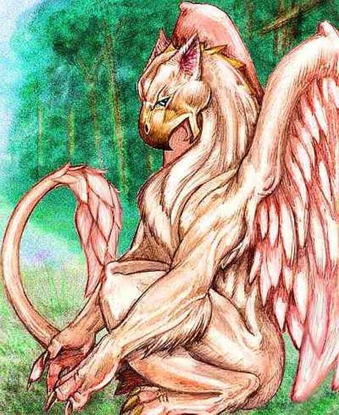
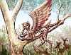
On the third day, a huge mountain of cloud rises to the south, dwarfing the lesser volcanoes: Mt Li, third highest peak in the world at 4900 m (16,100'). Darting in and out of the clouds on its high, cool shoulders, like fish swimming on a reef, great hawks are wheeling--no, you've underestimated the scale. Those are gryphons, as big as you are (if not as heavy--few creatures on Lyr are dumb enough to have solid bones!). These northern people have settled in a ring around the peak. With their arctic insulation, it feels like a tropical sky-island above an insufferably hot sea of jungle, where they herd their flocks in alpine meadows not so different from their sea-level homes in subarctic Roland--except that the flying's harder. The alpine air is only twice Earth's pressure--barely enough for even a heavily muscled gryphon to fly in. Though after centuries here the locals are gracile (lightly built) compared to their subarctic cousins. Gryphons from Roland tend to tease them as stunted--scrawny ill-fed specimens at the edge of their range. To you they look graceful, a masterpiece of adaptation. But you're not a gryphon, hardwired for competition and boasting (well, maybe you are; hardly a gryphon monopoly, is it?)
You stay in a stone music-inn on the shoulder of Mt Li where forest and meadow meet, where lowlanders and gryphons can spread news and boasts and lies, and sing the latest songs--inn-music tends to be participatory, and gryphons especially love to sing. With good evolutionary reason: a fine singer of either sex will incite lust in potential mates. If I'm making gryphons sound like as instinctive as songbirds, I don't mean to. These are civil folk. Gryphon song-duels rarely end in claw-matches these day--mere amiable wrestling bouts ("Take it outside, guys!" is a universally known song; just whistling the tune alone will often sober even the feistiest male til his crest falls in embarrassment).
Besides, my carbon-based readers should know very well about this song-sex link. If you haven't felt it, I pity you. One of those animal thrills that somehow is strangely spiritual, too...
The next morning, the flying's easier: you chug up into the thin air, puffing and swearing, but after that it's a long easy glide down the endless eastern slope of Mt Li. The wind's in your face, blowing up the mountain, so although your progress is slow, you barely have to flick a feather. An updraft lasting 200 km!
Ahead, tongues of silver slowly slip in over the horizon, both left and right. Li is narrowing at last. To the north is silvery Draun Bay, an island-studded sound 1000 km (625 mi) long and 2-400 wide--so wide that even from the height of Li's spine, you can't see Draun Island on the far side, sheltering the inland sea. Lost in puffy little clouds: a herd of cumulus sky-sheep.
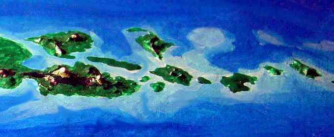
Draun's respectable in its own right, some 700 km (450 mi) long and nearly as wide. It's part of a pattern unique to Lyr. On Earth, when a tectonic plate slides over a hot spot, a line of volcanoes streams behind it, steadily older, less active, more eroded--first isles, then atolls, then mere seamounts. A simple plume. But here two hot spots seem to be marching in tandem! The trough between the two volcano-lines is sometimes above sea level, as in the Oherran Valley, sometimes dipping back under, as in Draun Sound. The northern line of vents extends 2500 km (1600 mi) east as the Highsky Islands, while the southern line you're wind-riding becomes the Choth Peninsula and the southern Highskies--mostly smaller, but a couple like Maukh are still super-Hawaiian.
Overall, Li looks more like Java or Kamchatka--plate-edges, not Terran hot spots. Yet no subduction trench lies offshore. What's going on here--is a new mid-ocean rift forming? Again, Li may be a gigantic Iceland, which straddles the Mid-Atlantic Rift. It's not certain, but that double line is mighty suggestive...
The Choth Peninsula is 800 km (500 mi) long, formed largely by massive lava flows from the two vents of Mt Choth. Its older, higher western summit is 4400 m (14,400'). Choth catches the brunt of storms hitting Li, and gets up to 6 m (240 inches) of rain a year (not quite as wet as it sounds, since a Lyran year is so long; equivalent to 90-100 inches on Earth). With rain like that, even Choth's high shoulders sustain lush cloud-forests--only the two summits float above the perpetual clouds. Unlike Hawaii, there's no dry side; the peninsula's in a low-pressure belt where storms roll in from every direction.
From Cape Choth you hop to the Isle of Maukh, and on through the western Highsky Islands. It's like Japan's Inland Sea--islets everywhere. You hop, and hop--a day of flight, a day or two of rest, and fly again... Is there any end?
I can't see anywhere else to fit this in, but... far south of Cape Choth, about 1600 km out (1000 mi), there's a lone island. Roundish and small--40 km (25 mi) across--it's apparently a solitary volcano, not part of any chain. Rainy, forested, fertile; half Polynesian half Azorean. Subtropical coasts, mild-temperate heights. Apparently it's unknown and unnamed by Lyran natives. Just too far off the flyway!
It's a common pattern. The Lyrans have barely explored or entirely ovelooked the Dahia and Borthu Islands, and tiny Antarctica, and nameless isles in the central and northern Alianora Sea, and the southwestern Sunward Sea, and one a couple of thousand kilometers north of the Oronesia-Ayan Flyway, one of the busiest on the planet... If they're over a day's flight from known land, and not in or near an obvious chain with heavy air-traffic, they're likely to have been missed.
In a way, this ignorance is a shadow cast by wings. Flight has served Lyrans well, building a cosmopolitan culture with much less transport-technology than Earth required--but flight has hidden costs, too. And one is spotty (and mostly accidental) exploration of the deep seas.
On the other wing, let's be fair. It's not that Lyrans are lazy. Lyr's seas are seven times the size of Earth's! Using mere starnose-dolphin gossip and silk charts, they've mapped more surface area more accurately than all our probes of the solar system combined. And they did it in person, using their own effort and skill... risking their lives with every flight.
If you treat all the islands from Draun to Wa as part of the Highskies, they're the longest single chain on Lyr, rising every 500-1000 km for 7000 km (4500 mi). Your tired shoulders explain better than words why small islands way off such safe routes might go undiscovered for centuries...
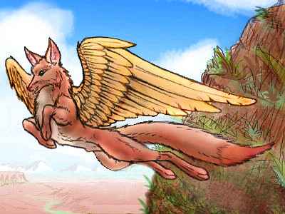
While many of Lyr's peoples evolved in rainforest, the only ones who've yet settled in the Highskies in any numbers are pegasi and griffets. But since the islands are a vital flyway, there are small minorities of many other species--travelers passing through who paused in their three-week passage, liked what they saw (or smelled or ate or fell in love with...) and stayed.
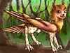
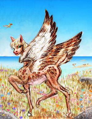
 FLOX |
|---|
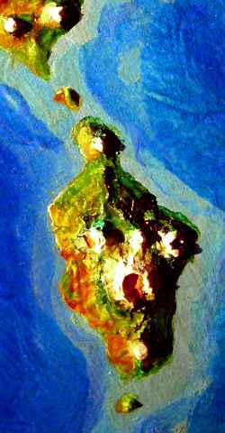
The last in the long line is Wa, another giant shield volcano, 230 km (140 mi) across, rising from the ocean floor to 2500 m (8200').
Around Wa, the chain angles south. And the climate starts changing--not much hotter, (Lyr's tropics are milder than Earth's), but sunnier and drier.
You start to notice it on the twin islands, Chaou and Vodan. Chaou (rhymes with cow) is distinctly more varied. The east coast is still rainforest but the woods thin to quite Mediterranean groves on the west. Chaou's the biggest island since Li, probably because it's formed of two fused volcanoes, not one; the northern peak reaches 3100 m (10,200'), with a belt of "pine" on its shoulders and a crown of alpine meadows; the summit is snowcapped in winter.
Vodan, looming to the northeast over a hundred-km strait, is even larger, a triangular island 650 km (400 mi) long. Its central peak, Mt Vodan, is also clad in rainforest on the east coast, thinning to groves and meadows on the west. The uplands are a broad ring of evergreen forest below alpine meadows fading to a summit-desert with small glaciers--for it's even higher than Chaou's summit, over 4000 m (13,100').
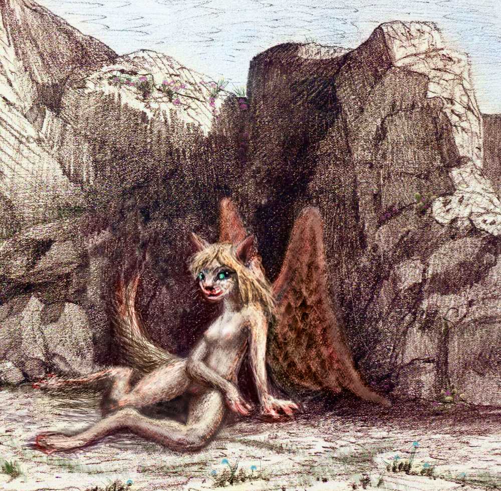
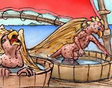
Chaou and Vodan's new niches allow more species to join the population mix. The warm, rocky canyons lure cliffdwelling floxes (above right), while the savanna attracts shy, graceful antel, and a few villages of wingless cheetaurs, who came by boat only a dozen generations ago.
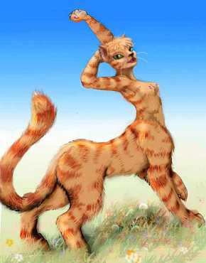 CHEETAUR |
 ANTEL |
|---|
THE BIG THREE
EYATH
Two days of easy island-hopping brings you to the three great lands forming South Oronesia.
First is Eyath, 700 km (450 mi) across. Its summit, volcanic Mt Eyath, is 4500 m (14,800') high--but from its deep-sea feet, it's 11,000 m/36,000' tall, bigger than any mountain on Earth. Lyr's high gravity holds its dense air close to the surface; air pressure drops off more quickly than on Earth, so the caldera's summit ridge resembles Terran mountains 6 km (20,000') high.
Eyath lies between the low-pressure stormbelt drenching northern Oronesia and the high-pressure belt drying Arinnian and Hrill to the south. Its climates are thus the most varied of all: the east side is nearly as lush as Li, while the rainshadowed west coast is quite Californian, with open groves and meadows near the coast, dry chaparral hills inland, and "pine" forests higher up, culminating in a great arc of alpine meadows around the rim of a huge caldera full of glassy cindercones: Haleakala times five!
Indeed, you find all Eyath looks much like a scaled-up Maui. By climbing or circling the great mountain you can find a town with almost any climate, from hot to cold and wet to dry.
As a result, nearly every intelligent species on Lyr has settled Eyath; that diversity's made little Eyath a world center of cultural innovation, surpassing even its big sisters Arinnian and Hrill (pleasant, but lacking the wettest niches), and huge Li to the northwest, lush but uniformly wet.
Eyath's dry side is big enough for really substantial colonies of antel and cheetaurs, as well as cliffdwelling colonies of floxes.
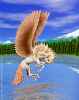
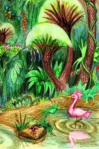
You circle Eyath in a leisurely way, taking several days, glad to have real land under you. On the wet side you encounter two new species: graceful, arboreal lebbirds from the Polesotechnic Strip far to the east, a people you mistake at first for a tropical subspecies of sphinx. But they're quite unrelated--a great example of evolutionary convergence.
LEBBIRD | 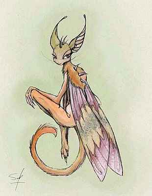
SOKA |
|---|
You can't mistake the other new species at all! They're soka, an indescribable mixture of cat, bat, monkey and moth. They're traders from Flandry in the Southern Hemisphere... Unlike all the other winged species you've seen, the soka sailed here, for their wings are built for fluttering between trees, not crossing oceans. The best sailors on Lyr, they ferried most of the wingless peoples here. Their only maritime rivals are cheetaurs, and they're sailors only from necessity, being flightless.
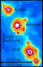
ARINNIAN and the TRADE INSTITUTE
You rest a day on Eyath's south shore, on a beach below subtropical forest laced with treetop hotels and music-inns.
At sunrise you set out for Arinnian, four hours to the south.
Invisible when you take wing, Arinnian soon peeks over the horizon and grows into a continental wall. For it's a huge land, 800 km (500 mi) across, and volcanic Mt Arinnian, 5100 m (16,800') high, is the tallest peak on Lyr--whether you measure the fraction above sea level, or head-to-toe. Again, due to the faster drop-off in air pressure, these heights are colder than you'd expect; even here in the tropics, some glaciers creep as low as 3 km (10,000') in spots; yet in others, alpine meadows bloom at 4 km (13,100').

Arinnian is in a drybelt centered at 18 north, but its four main peaks (Mt Arinnian and three satellite cones) are all high enough to squeeze rain from any passing cloud. The east coast is like the American Southeast, warm and quite lush. But the west coast, downwind and in a rainshadow, has red desert canyons, and savanna higher up, then dry, open "pine" forest and rocky alpine meadows. The west faces of even the lesser volcanoes have small deserts and savannas. As on Eyath, most intelligent species on Lyr can be found living in one of these diverse niches, giving the island a rich, tolerant, innovative culture.
As a result of its simple livability for nearly the full spectrum of Lyran peoples, Arinnian became the home of the Trade Institute--which doesn't regulate what you think. "Trade" is the name of the pidgin you've been speaking with locals all over Lyr.
I haven't mentioned this worldwide tongue much, since it's usually like water to a fish. Trade is a pidgin language, of course, but a sophisticated pidgin with political backing. The Institute's sole purpose is to enrich the trade tongue yet prevent dialects, approving only sounds all participating species can enunciate, and words all can understand. The Academie Francaise of pidgin!
The Institute issues two series of publications, both small pouch-books suitable for fliers--a textbook teaching Trade (in many editions for different species, starting with the local language) and a set of guides to Lyr's regions with maps and travel tips.
These little round pouch-books (a medium invented by koreens, and originally designed to fit in their marsupial pouch--hence the lack of sharp corners) are now ubiquitous on Lyr--a prime trade item. Indeed, they've influenced the book designs of other species to the point where the default shape for most printed pages is round, even publications far too large to fit in a pocket--marsupial or not.
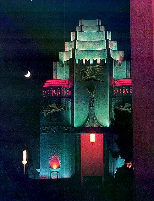
I haven't shown much Lyran architecture up til now, and almost none of it stone--while several species like to burrow into cliffs and enlarge caves, the only large freestanding stone structures are gryphon keeps.
There's a reason few Lyrans build big stone structures. Lyr is tectonically hyperactive, and most land rises very close to trenches and faults. Earthquakes are common--so, like native Californians, Lyrans generally build light and small.
But south Oronesia is about the purest example on Lyr of a chain of Hawaiian shield volcanoes over a magma plume. Pressure here is let off in relatively peaceful eruptions; quakes are modest. Thus, these cosmopolitan islanders can indulge their architectural fantasies. And they have...
Behold the Trade Institute facade, lit up for Festival Night, an annual event in which the year's crop of new words are formally inducted into Trade. It's one of the largest buildings on Lyr, fully 50 meters high (160'). That may not seem like much, but for a world with high gravity and no megalithic architectural tradition, it's a feat.
While Arinnian, Eyath and Hrill aren't a political capital in any human sense (perhaps a weak, consensus-based UN headquarters at most), ceremonial architecture like this does reflect the civic pride of south Oronesia's cosmopolitan people. They do see themselves as Lyr's cultural capital--and they may be right. Certainly, it's hard to think of serious rivals, though the hill towns of southern Corona have their advocates. Not coincidentally, their cultural diversity, too, arises at least partly from south Corona's rugged Andromeda Range, allowing species from very different niches to settle within shouting distance (more importantly, singing and drinking distance). High mountains, a feature that on Earth limits travel and guarantees rusticity if not barbarity, are a plus on Lyr!
The things a little extra air will do...
Offworlders with no time to wander as the Lyrans do can still get a real sense of Lyr's people, as opposed to specific peoples, better here than anywhere else on this immense planet.
HRILL
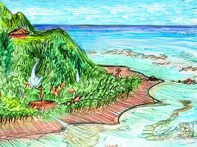
It'll take you nearly two days to reach the last and largest of the Big Three, Hrill. It's an easy, pleasant journey, though--an hour or two over sunny seas, reach a conical, volcanic islet (tea or lunch on the terrace of a lebbird-run music inn or the platform a tree-hotel, maybe a little nap), then repeat...
Some of your lebbird hosts look funny--rangy, spotless, big-eared, like a desert model of this quintessential rainforest creature. Turns out you're wrong again! This really is a heat-adapted subspecies of sphinx--as delicate next to the classic type as a kit fox next to a wolf. You can see the difference in the sketch to the left of a girl working as a part-time cook and part-time musician in a cafe on a crag just off Hrill's north coast.
At first glance, Hrill looks modest after Arinnian--a round island perhaps 200 km wide, rising to a 3-km (2-mi) peak. Just an oversized Bali!
But an hour later, as you wheel round the volcano, a vast orchard-plain appears before you, stretching to huge icecapped peaks on the southern horizon. You're merely on a narrow northern cape, and the snow-streaked volcano rising miles above you is just a satellite.
Hrill is nearly continental--fully 1400 km (900 mi) long and half as wide. Six separate volcanoes top 3 km high; ice-capped Mt Hrill reaches 4600 m (15,100'), one of the tallest mountains in the world. Almost flat-topped from a distance, it looks like Kilimanjaro. Dots spiral round it--not hawks, but gryphons, descendants of ancient diplomats and Trade Institute scholars who settled the highlands to beat the heat. For generations, they were the southernmost gryphons in the world--and how they stopped being so is a tale worth telling.
THE EPIC OF HRILL
A huge, cold, rainy archipelago sprawls across Lyr's southern hemisphere. It's called Averorn. Few Lyran races could live comfortably in its Alaskan forests--but gryphons are ideal. Unfortunately, gryphons evolved in the far north, and to reach Averorn, they had to fly across the equatorial zone. Oh, they tried! But every gryphon that neared the line died of heatstroke. They're just not built for it.
But the soka, those little moth-monkey-people who sail halfway round equatorial Lyr, brought more than word of Averorn to the gryphons of Hrill--they brought opportunity, at least for a small gryphon-group who concocted an outrageous, humiliating plan. Seventeen gryphons plucked themselves naked, and rode soka ships south over the equator, in shaded decktop tents, pouring cold water on their bare, bumpy skin every hour, until they were past the tropics. Three ships raced south, as pelts and feathers regrew... and the gryphons won that race. By the time they had visible down, they were in the south subtropical zone. Heatstroke killed one, and skin infections another, but fifteen survived the voyage--at least physically.
But gryphons are the proudest people on Lyr, and they've never lived it down--that image of warriors and queens all pink, naked, flightless, helpless, plucked as megachickens in a stew-pot. While the icari wrote epics celebrating the courage of their Antarctic explorers, the first two generations of Averornian gryphons were silent and ashamed. It was a shock when their grandchicks grew up, uncovered the truth, and started singing a mock epic of their own, celebrating the moral courage of gryphons brave enough to be laughed at.
Oddly enough, it caught on--there was, after all, some truth in it.
Today Averornian gryphons have a distinct culture, with a wry humor and humility unheard of in the proud north. Perhaps the best analogy is the Australian shame (but eventual pride) in being convicts banished by England--it too fostered a wry egalitarian humor. Or perhaps the cultural divergence was inevitable--like Australians, Averornians faced a harsh, marginal land where solidarity and sharing are essential and pretension is divisive. Culture follows nature? Perhaps.
HRILL CALDERA
Hrill is still in the drybelt, but all the main peaks are high enough to trap storms, so the east coast is as warm and lush as Carolina or Taiwan. The great height of the central peaks leave the west coast in a rainshadow--red desert canyons, and savanna higher up, then dry open "pine" forest and rocky alpine meadows below the summit glaciers. As on Arinnian and Eyath, this ecodiversity encourages the mixing of species and a rich culture.
Mt. Hrill, the highest peak, rivals Mt Olympus on Mars: a cliffwalled oval 1.5 km deep in places (a full mile) and 75 km (45 mi) long. Its floor is a freeze-dried desert. Hrill Caldera is spectacular, but I can't recommend a casual visit; the rim has vicious downdrafts, and the air's so thin (a mere two Earth atmospheres) that you can't possibly fly. Indeed, though the oxygen level is quite Terran, you might faint.
No, it's not CO2 vents poisoning you. Sensible guess, but you're on the wrong track. It's you. After weeks of adapting to dense Lyran air, your blood has turned extraordinarily thin. If you've scratched yourself, you must have noticed you bled a pale, watery orange. Less hemoglobin--indeed, on Earth you'd be diagnosed with severe anemia. Not to worry--it's just your body protecting itself from overoxidation in conditions no Earthling ever faces. Bodies are resourceful!
Of course, this anemia means that when you're ready to leave Lyr, it would be wise to come stay in a gryphon keep near the rim, and hike around for a few days, while your blood turns human-red again. (Oops! I apologize to my other readers; I do try to remember the future. Watch the monkey dance; pardon his limitations.)
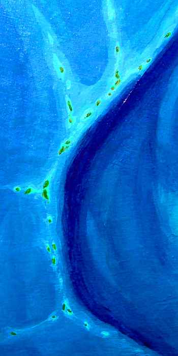
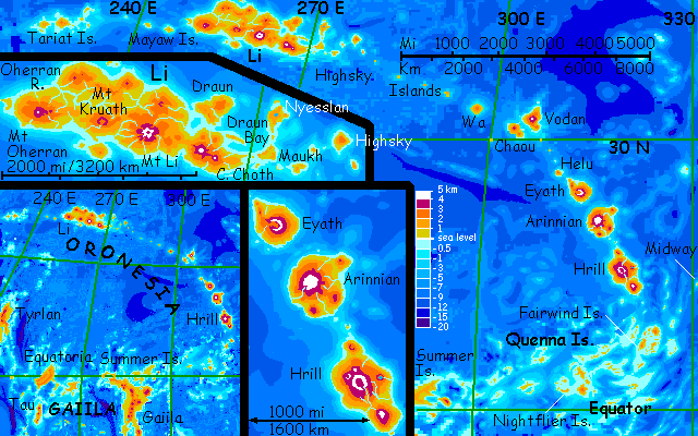
THE QUENNA ARCHIPELAGO
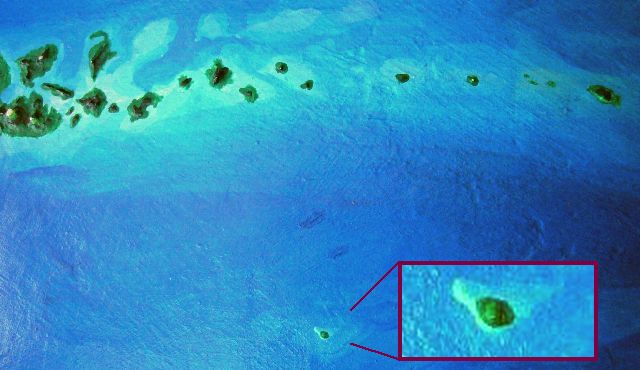
The Quennas are a geological anomaly on Lyr--not an arc or a line knifing through deep sea, but a broad patch of sea of merely Terran depth, studded with apparently random shield volcanoes and bits of uplifted sedimentary rock. It's a geological puzzle; deep soundings reveal a tormented sea floor, with short, crumpled, twisted ridges between vents. Were they once lines or arcs, distorted by relentless pressure? Did Quenna suffer compression like the Tethys Sea on Earth, as it squeezed down into the narrow, modern Mediterranean? There are echoes of Indonesia too, where fast-moving plates collided. Maybe Quenna is the scrunched-up remnant of a once wide ocean. It's a sharply bending sort of elbow-joint between the clean arcs of Oronesia and Gaiila. And joints do face unusual pressures... For what it's worth, a similar, even larger structure appears on the far side of the world, at the sharp bend in the Polesotechnic Strip; and soundings reveal a couple of similar structures that fail to break the surface, like the seamounts in the central Kraoka Sea. Whatever the cause of Quennian terrain, it's not really that rare on Lyr; together, such zones are nearly as big as Africa.
The largest of the Quennas are all low shield volcanoes 100-250 km wide (60-160 mi). They'd quickly erode into the sea (well, "quickly" as in "ten million years or less") if they weren't still active, so whatever stresses gave rise to the Quenna Archipelago are probably ongoing.
The northern Quennas are quite Hawaiian; here the smaller isles are semiarid, if they haven't enough height to snag clouds and squeeze rain from them--though most do. Two or three days' flight gets you through the Fairwind Group, with two islands larger than Hawaii; these volcanoes are quite tall enough to have a wet east side and a dry west; the last savanna we'll see in this region. It's settled by the last cheetaurs, too. From here on, it's rainy.
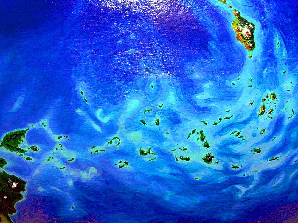
Over the next few days as you hop southwest toward the equator, the Quennas grow lush. The Nightflier Group looks like Indonesia (well, how Indonesia looked before rampant forest-burning), with coasts rainforested down to the waterline. Here every isle has coral barrier reefs; indeed many older volcanoes are now mere seamounts capped with long slender coral islets. Past the Nightfliers, we bend almost due west, and islands with visible volcanic cones or even eroded plugs grow rare; instead, broad seamounts capped with coral atolls around central lagoons. Whatever stresses created the Archipelago seem currently dormant in this stretch, the Hriccal Islands.
Though you're a thousand miles and more from any respectable land, seeking specks in an endless sea, you feel no fear; the flying is easy, the hops fairly short. And the generous year-round equatorial rains give even the least of the Hriccals fresh water, fruit and shade.

On all the Quennas, big and small, fishing villages of both sphinxes and lebbirds are common. You stop at each, not necessarily to beg food or beds, little needed in this friendly climate; but you need directions. The Hriccals may be less geologically fevered than the northern Quennas, but they're still a confusing maze of reefs and lagoons and deep sea--no simple island-chains in these waters! You zigzag from islet to atoll for days.
Our final flight out of the Hriccals is several hundred km, but it's a safe passage: warm water, shallow reefs and lagoons with a few white-sand shoals to rest on in a pinch. And there's no missing our goal: at last a great volcano, Mt Herne, rises from the tropical sea, visible for 300 km over Lyr's long horizon.
And beyond Herne sprawls the long, low coast of Oberon, a jungle land 1000 km across.
You've reached the huge equatorial cluster of Gaiila. If you flew in from Roland, you deserve congratulations--it's been nearly 30,000 kilometers to Gaiila, as the tourist flaps.
Or, to ground it in Earth terms, from Athens west to Albania, over the Adriatic to Naples, Sardinia, the Riviera, Barcelona, Madrid, Lisbon, the short hop to the Azores, the long hop to Cape Cod, New York, St. Louis, Denver, San Francisco, the long, long hop to Hawaii, up the chain to Midway, west to Tori Shima (ouch), then on to Tokyo (ouch, but the last big sea-hop), down to Hiroshima, over the strait to Pusan, Seoul, across the border (caution!) to Pyongyang, west to Beijing, up the Yellow River and the Gansu Corridor to Turfan, through the Dzungarian Gate, down the Silk Road from Alma-Ata to Frunze, Tashkent and Samarkand, over the Caspian narrows to Baku, west to Tbilisi and along the Black Sea coast to Istanbul, and back to Athens.
There, you've circumnavigated Earth around the 38th parallel, that's about right. Oh, I hope you walked, biked or hang-glided the whole way--no powered vehicles, please. How'd you like that Pacific stretch? Sore shoulders?
Hope that peripatea clarified matters. Did this page seem long, overdetailed for a mere island chain? It's a whirlwind tour of a flyway that'd circle our planet! Yet Lyrans fly it routinely.

TOUR LYR! The following route snakes around Lyr, covering all major features:
Ythri -- Polesotechnic Chain -- Troisleons -- Roland -- Oronesia -- Gaiila -- Flandry -- Diomedes -- Ak'hai'i -- Averorn
World Dream Bank homepage - Art gallery - New stuff - Introductory sampler, best dreams, best art - On dreamwork - Books
Indexes: Subject - Author - Date - Names - Places - Art media/styles
Titles: A - B - C - D - E - F - G - H - IJ - KL - M - NO - PQ - R - Sa-Sk - Sl-Sz - T - UV - WXYZ
Email: wdreamb@yahoo.com - Catalog of art, books, CDs - Behind the Curtain: FAQs, bio, site map - Kindred sites