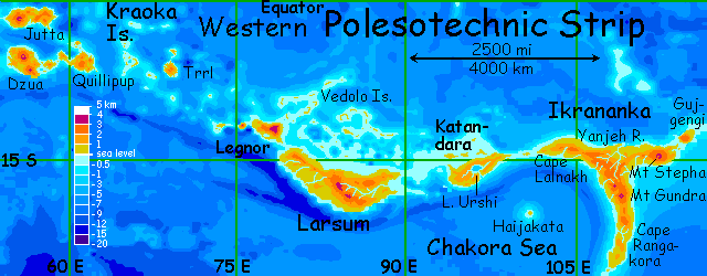
Western Polesotechnic Strip
by Chris Wayan, 2006
Lyr (home) - map - creatures - cultures - evolution - climate - geology - gazetteer - nomenclature - definitions - building Lyr - more worlds? Planetocopia!
INTRODUCTION
New on Lyr? First-time orientation--strongly advised! Lyr is weird. But assuming you know how to navigate, fly, cope with the locals...
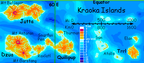
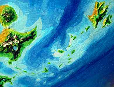
The Polesotechnic Strip is a chain of archipelagoes winding a third of the way round Lyr--some 48,000 km/30,000 miles! From west to east: the Kraoka Islands, Larsum, Katandara, Ikrananka, and Ulash (all on this page), Wersgorix, and the Hisagazi Islands, dominated by Montalir and Erkila (covered in the eastern tour).
Not one's as big as Greenland, and you're never more than 320 km (200 mi) from the sea. Yet the total area of Polesotechnica is larger than Europe--and its biomass is three times greater.
The long strip winds in and out of two climate belts:
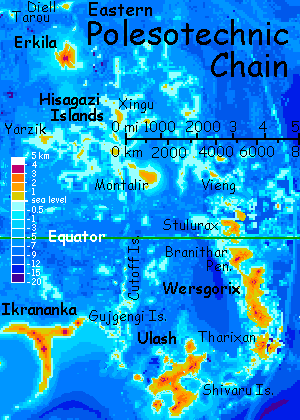
Again: because the region is so large, its tour is split in half; this page covers Kraoka to Ulash, and the eastern covers Wersgorix to Erkila.
THE KRAOKA ARCHIPELAGO
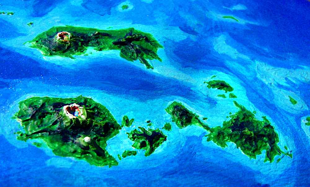
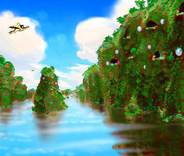
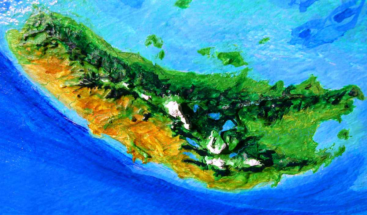
Entering the region from Lokon to the west, you're your first landfall is the Kraoka Archipelago, an equatorial group the size of Borneo. From Lokon, you follow a chain of green volcanic islets for some 2000 km, proceeding in easy hops, a few hours' flight each day. But after a week, the chain abruptly fails. A gap that takes a full day's flight to cross, six hours or more.
So you're exhausted and shoulder-sore and chafed from your strap-on wings when the steep coast of Jutta rises from the sea, coppery in sunset light. It looks continental--and almost is. As big as Britain! And Dzua, to the south, is just as large. The coast is dense jungle, for we're right on the equator.
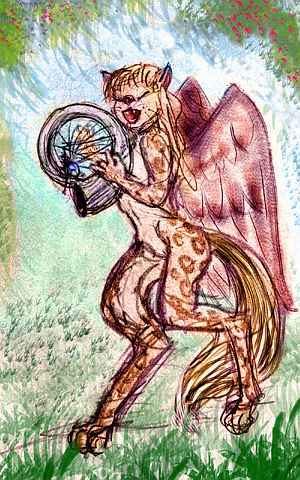
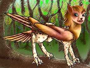
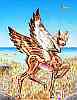
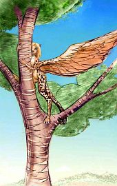
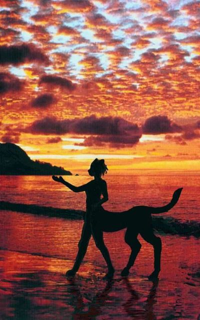
Making landfall, you spot yellow lamps twinkling in the dusk, and spiral down to a round platform ringing the trunk of a tall tree. The villagers flutter up to gawk and greet you as you strip off your wings. This village is shared by two very different species: cat- or parrot-sized griffets (left, on branch) and much larger lebbirds (right, playing ammonite harp). Little griffet huts cluster like wasp-nests in high branches above the much heavier lebbird treehouses, the only ones capable of bearing your weight. Here you sleep, in a guest room--or at least try to sleep, for the whole flimsy thing is woven of rattan, not the solid planks of a human treehouse. The lebbirds are perfectly competent architects--it's just that every flier on Lyr but you is hollow-boned. Lebbirds range from 150-200 cm from nose to tail-tip (5' to 6'7") but weigh only half what you do. Anyway, all that irregular swaying and creaking keeps you up half the night. Luckily, you don't seem prone to treesickness; you keep your dinner down. Not even queasy. Just short on sleep.
The music doesn't help. Well, lebbird voices and musical scales are quite beautiful to human ears, but griffet harmonies range from squeaky to shrieky--and they always chime in. Griffets define the word "irrepressable". For a while you give in, get up and sit in.
The harp is lovely: a single coiled shell, like a Terran ammonite, used both as a resonator and to anchor the harp-strings. Being all one piece, it rings like a Stradivarius--wonderful when you're upright, a bit less so in bed after midnight. Your hosts sleep in catnaps all round the clock; so your strange ambition to sleep all night induces giggles, flirting (this means large sharp-clawed creatures crawling into bed with you) and concern for your, um, health. Not sanity. They're too polite for that.
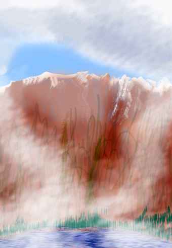
When you (officially) wake and look blearily inland, craggy bluegreen mountains loom ahead: Jutta's coast is lush and warm, but fully half the island is misty tropical uplands covered in cloudforest.
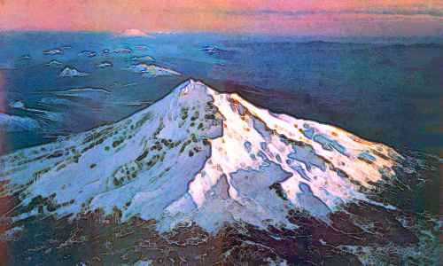
You fly steadily inland all morning, higher and higher, wetter and wetter, blinder and blinder. At last, the ridges start to reach above the clouds; vast blue halls open up between cloud-towers. No, wait, that white tower straight ahead is something more substantial: Mt Beljagor, the highest peak on Jutta. Its caldera rim reaches 3400 meters (11,200'). Remember, Lyr's eccentric orbit means even the equator undergoes a mild winter, so snow regularly dapples Beljagor, melting off in spring. This snowmelt feeds alpine meadows on Beljagor's shoulders, a sunny, flowering patchwork above the cloud-forest--not the alpine desert found on most Terran tropical volcanoes, where strong seasons never come.
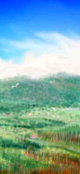
Who lives in these uplands? The cool alpine meadows are a specialized niche; the only people you see are settlers from the north we'll call pegasi--though they're much smaller than the Terran mythical winged horses. Even in Lyr's dense air, no horse could fly. But these hollowboned ponylike creatures fly so well they've migrated here from 10,000 km north... To a Terran they seem almost puppylike in their enthusiasm, but a bit alarming at first--they mob you, pawing and licking everything you own, including your toes. And ears. And everything between. Not a reserved people! Sleeping with them involves even less sleep than a lebbird treehouse: pegasi sleep in a twitching, humping, sniffling heap.
We'll skip eastern Jutta--the easiest flyway leads south from Mt Beljagor: two swift hours down to the coast where you sleep with lebbirds--in some sense or other. For this time, you notice that only some lebbirds of both sexes rub up against you. It isn't a mere greeting-gesture as you thought, as if they're just big housecats. All those who rub and purr are single! You'd have recognized the flirtation--no, serious offers--instantly, even across cultures, if they were human. But culture shock is nothing compared to species shock! Try not to be. Shocked, I mean. They're sensitive people. Still, it's perfectly polite to say plead fatigue and say no. Or don't, if you're feeling brave. They're the most sensual of Lyr's peoples (just ask! They'll tell you so! Modest, eh? But most other species would reluctantly agree). Lovemaking's a lebbird art, and there's no risk of pregnancy or disease...
So, you either sleep with the lebbirds or just sleep with the lebbirds. I'm not nosy. Either way, the next morning you strap on your wings and head out over deep sea...
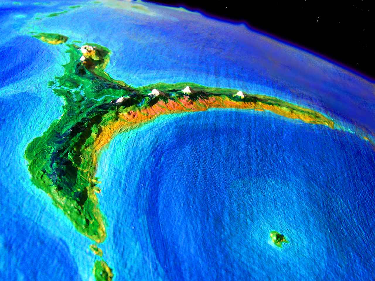
...to Dzua. This island's a rough oval 800 km (500 mi) long, perhaps the largest of the Kraokas (by a hair; the orbital photo above looks north, so Jutta's in the background and appears smaller; but they're nearly twins in size if not shape). Like Jutta, it's mostly tropical highlands--Mt Antoran reaches 3500 meters (11,600'), and Mt Garstang, 3100 (10,200'). Here too, snow falls in winter to melt later; fern-meadows cling to these peaks, not the freeze-dried summit deserts of Terran equatorial peaks like Kilimanjaro. Again the highlands are cloud forest, the lowlands, lush jungle.

Even fewer folks seem to like the perpetual gloom and drizzle of the cloudforests. You spot a few pegasi, but that's all. Most of Dzua's population--sphinxes, pegasi and floxes--live on the coasts, and that's where you stay, flapping steadily south for a day until the shore turns east.
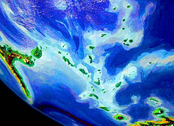
Here I wish I could say that the flyway forked, for there's a chain of shallows leading southwest some 10,000 km (that's 6300 mi as the tourist flies) to the huge continent-cluster of Flandry--the most isolated large cluster, and sorely needing another flyway, especially one this direct; a few crooks of the elbow, but basically, you couldn't ask for a better highway. It's a ridge and trench remarkably like Tonga and the Kermadecs in our South Pacific: a plate boundary, one of the clearest on Lyr--an undersea range 6-8 km tall (20-26,000'). The problem is, this is Lyr, not Earth. Not one rock of this Himalayan range breaks the surface. Okay, I exaggerated. There are a few rocks and sandbars. But no vegetated islets, no freshwater creeks, not even a spring. So as far as fliers are concerned, the foundation's graded but the road is washed out... by all Earth's oceans times thirteen!
That's not to say it's useless for everyone. It's a splendid highway for star-nosed dolphins, an intelligent species that prefers shallow water; a whole nation of them migrates annually from Flandry's shores to Kraoka and back. Quite a few peaks are tall enough to reach into the sunlit zone, and these support coral reefs permanently inhabited by another of Lyr's maritime peoples, the hexanauts: large six-limbed molluscs like more social octopi. Their reefs are lovely, but these communities are isolated and backward compared with those in Kraoka's shallows, which trade regularly with the land-peoples.
Well, no matter. You're a tourist with strap-on wings and mediocre flying skills. You aren't following THAT flyway. My insurance company won't let me mention it any more. Too many suits from next-of-kin.
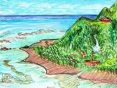
So you have no choice but to bend with Dzua, and stay in the Polesotechnic Strip. You flap east into mild headwinds for another day, sleep in a treetop village, and late next afternoon you reach Roxlatl Strait, a shallow gulf of luminous turquoise in the slanting light. On the eastern horizon rises Roxlatl. From here it looks like a solid green wall, and once it was; but from space it's a ragged, rugged green rose, 300 km wide--an old, eroded shield volcano that the equatorial rains have carved into a maze of jungly ridges and canyons.
Here the floxes come into their own--these canyon walls, with their steady updrafts, are ideal for their cliff-cave communities. Sphinxes, too, have dug in, where old lava flows now form tropical versions of fjords... vertical flower- and herb-gardens (sphinxes like spice) color the cliffs, spangled with circular windows and arched doorways. The village I sketched here was a bit atypical: glazed windows in the style of the northern continents! More decorative than needed, for coastal Roxlatl's never cold.
You negotiate the ridge-maze all day, following updrafts, avoiding downdrafts, trying to head east along Roxlatl's broken north coast. Near the eastern tip of Roxlatl, a sphinx commune hosts you overnight. They're remarkably like lebbirds, but quite unrelated; a good example of convergent evolution. They evolved on the far side of the planet from lebbirds, but in a similar niche demanding similar behaviors. They look less spidery, never stand upright as lebbirds often will, have rather humanoid faces, and act less arboreal--the commune is no treehouse, but an airy warren dug into the rock of a sea-stack. Your arched bedroom door opens on a sheer drop! You're not complaining. It doesn't move...
Over Roxlatl Channel, Midway Crag (a substantial island, really) and Snarfon Sound, to Cape Snarfon. With a ridiculous name like that, you expect something exotic, but it's quite similar to Roxlatl. Snarfon's a peninsula 400 km (250 mi) long, reaching west from the huge island of Quillipup. Only a narrow lava flow links volcanic Mt Snarfon to Quillipup--the two are like Maui or Tahiti writ large. If the neck ever erodes, Snarfon will be one of the larger islands in the Kraokas--as big as Roxlatl, in fact. But Quillipup is bigger still: third biggest of the Kraokas, some 830 km long and up to 500 wide (520 by 300 mi).
On Quillipup's northwest coast, the driest (such as it is), you camp out on the beach.
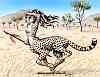
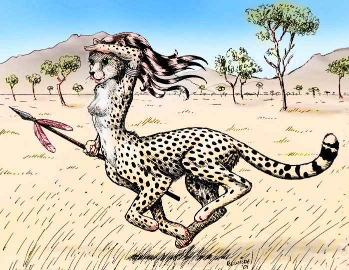
Turns out you're not alone. Several families of fishing cheetaurs live here.
This wingless species evolved on savanna, like humans; they've spread slowly, since they must raft where others fly, and all paths out of their homeland on distant Ikrananka lead through jungle islands where cheetaurs can't run free. Some sailed north, following rumors of savanna in the northern Fiery Islands. A few, stopping here in the Kraokas, fell in love with the lush land. They seem as out of place as Europeans in Tahiti--eco-perverts! Well, to put a more positive spin on it, eco-pioneers.
 They've found a small niche--the beaches. Net-fishing and harvesting shellfish gives them all the protein they need. They splash joyfully around in the shallows, though their bones are so dense they sink in deep water the way gorillas and chimps do--just not built to swim.
Yet!
I wonder. Over time, will they evolve into a new subspecies, something like a wingless sphinx? Cheetaurs aren't normally arboreal either, any more than humans are, but practice makes imperfect--these families can at least get around in trees well enough to harvest fruit. Will natural selection lead to a different mid- and hindpaw grip, now that climbing and paddling, not running on open grass, means survival? Falling out of trees is a big killer in any arboreal population.
Not that they're concerned about deep time or evolution. They're happy now. And why not? Though it's a perilous paradise for them, these perverse cheetaurs are surrounded by beauty. You'd started taking these isles for granted, but now, for a moment, you see Eden through cheetaur eyes.
As you fly on east, a line of turquoise reefs and islets like nappy green hats marches north from Quillipup's shore. On the northern horizon is an emerald wall--Thurman, an older shield volcano 160 km across (100 mi), also smothered in rainforest and rain-eroded into a labyrinth of ridges. We won't detour. Seen that!
Over the next day the coast curves southeast. You follow to the rugged end--a green ferny finger crooking 100 km into the eastern sea. Riding the wind out toward the tip, a narrow sea-gap opens up around thirty miles out, cutting through the cape. The finger-joint beyond is just as narrow, steep and lush; you head on out to the tip, and beyond, over much wider channels between islets, until the water turns azure and the isles end. You sleep early--you'll need it tomorrow. It's 600 km (375 mi) over deep sea to the Sun Atolls.
Smallest of the equatorial Kraoka Islands, the Suns are also the lowest--most are mere reef-capped seamounts now, though once they were towering volcanoes like Jutta or Trrl. Today, only coral islets survive, a few dozen yards high, a few miles wide, along the rims of pale lagoons like milky eyes. Yet one "islet" is 200 km long, and the whole chain sprawls 2000 km! If the Bahamas were built on dead volcanoes... Oh, wait, are they?
Nine islands and three days later, you rest up for the deepwater hop to Trrl.
Trrl lacks more than vowels--it lacks friends. It's 1000 miles to the nearest land of any size. Well, it does have one satellite, Elan, the size of Hawaii... but on Lyr, that's nothing! Even Trrl is only 320 km (200 mi) across, and quite Hawaiian itself--warm and rainy, especially on the north slope. It's another huge, partly eroded volcano, Martian in size but waist-deep in the sea. Its wide summit caldera is 2200 m (7300') high--deep in the cloud zone, so all central Trrl is sparsely populated, though the shores have a lebbird village every few km. Despite Trrl's apparent isolation, they're surprisingly cosmopolitan, for everyone headed for Ythri or other clusters further west must come through Trrl, last of the Kraokas.
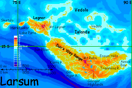
The next day or two are exhausting. We islet-hop hours south over deep water, sleep and rest on an islet, then repeat, heading east for two days. It's 1600 km (1000 mi) to the next big island--Sketulo, first of the Larsum group. The islets grow denser, the last couple of hundred km--Sketulo's the central island of a small archipelago of its own. The main island's low hills and ridges are a patchwork of groves and dry grassland, looking almost Mediterranean. It's a good 180 km (110 mi) long and half as wide; as big as Crete.
Herktaskor, a day to the east, is something else again. Not that much larger in area, 220 km (140 mi) long, it's far more imposing: essentially a single shield volcano rising to 3000 m (10,000'). Your landfall on the west coast finds only treeless, almost African veldt, but as you skirt skirt the central peak, scattered trees and then groves grow denser along the north shore, until, on the east side, the land is quite lush. In this climate belt, sheer verticality will do that for you. Cloud-snagging, rain-squeezing!
Over a strait just 80 km (50 mi) wide lies Legnor. Nearly continental, it's 800 km (500 mi) long. The western hills are Mediterranean and the east shore is tropical forest, but most of Legnor is a tropical highland of cooler, open woods and meadows. The second day on Legnor, though, a break in the plateau opens on your right: the Lake Pario Basin. The lake's 140 km (90 mi) long and fairly deep. Its irregular oval may have been carved out of lava by the Pario River and dammed by a later lava flow, but more likely it's a very old caldera itself, eroded out of recognition.
You skim down to the lake and along its Mediterranean shores. Under the trees are villages of a people you've met more and more in the last week, in Sketulo's grass hills and the veldts of western Herktaskor. But here they come into their own: this is prime cheetaur habitat. Originally hunters and gatherers of the savanna, they've diversified into agriculture, as humans did.
Sphinxes live in a dream; griffets, in a three-dimensional maze of associations without syntax, like the branches they travel on through rainforest canopy; hexanauts live by an indescribable six-valued logic; but cheetaurs, despite their looks, have perhaps the most human worldview of any species on Lyr, for as flightless savanna hunters-turned-farmers, their senses and brains evolved to face humanlike problems. They live in a world we'd recognize.
To the northwest rises a thundercloud. No, it hangs in place. It's a crown of clouds around Mt Legnor, 3250 m (10,700') high--a shield volcano with a desert caldera wider and more spectacular than Haleakala's. It's off our flyway, though--and we've a long way to go.
For the same reason, we won't detour through the reefs of the Vedolo Islands north of Legnor, either, though they dwarf Australia's Barrier Reef. Indeed, these dozens of coral atolls and hundreds of reefs are built on an oceanic rise 2000 km wide--if Lyr were just a bit drier, the continent ahead of us would be twice as big. Vedolo itself, the largest, is 200 km (125 mi) long, but only a few miles wide, and very low. The northern atolls are lush, but the southernmost grow scrubby--they're bordering a drybelt.
Let's skip them all, and fly straight to the Larsum mainland.
LARSUM
Larsum is the nearest thing to a true continent in the Polesotechnic zone, 2600 km (1600 mi) long and half as wide. It's near-tropical but in a relatively dry belt. The coast where we land is Mediterranean, but as you fly east into the hills, they rise steadily to evergreen heights. This is the Sun's Way Range, the spine of Larsum. To your left they drop steeply to a green shore. Islands dot the horizon--part of the far-flung Vedolo archipelago I mentioned a thousand km ago.
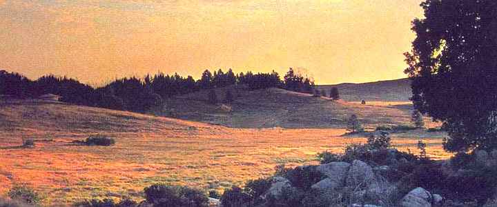
To the right's a shockingly different landscape: long bare ridges and desert canyons to the horizon. This is the Kurro Desert, the rainshadow of the Sun's Way Range. There are oases--branches of the Kurro River descend from these rainy uplands down these canyons, veining the desert beyond. And the Kurro coast gets fog and light rains, sustaining dry, golden veldt. Still, for Lyr, the Kurro is dry and huge--the strip stretches 1500 km. As the watercolor suggests, it's quite Arizonan.
Kurro's all cheetaur country. They didn't evolve here--their homeland is days ahead of us--but they've been here forty thousand years. Kurro was their first great colonization by sea. At least if you ask the locals--but in recent centuries, scholars able to compare the Kurro myths to those of the Zatlach Desert on Ikrananka are less certain. They too have legends that suggest they were actually colonized by the Kurro people!
Archeological digs for truly old bones would perhaps settle the question, but remember how long ago this was; when the mythic voyages happened, Neanderthals still walked on Earth. Since cheetaurs like fine-sounding epics but aren't obsessed with their roots, the question may be unanswered for some time.
But this shows how cheetaurs do differ psychologically from humans. When conflicting claims or origin arise on Earth (and they do!) it's always because two human tribes each claim to be the original people inhabiting their true homeland... it's always egotistical. But here, two cheetaur populations each claim to be settled by the other! "After you, my dear Alphonse!", "No, after you, my dear Gaston..."
Even if the cheetaurs colonized Kurro, they weren't the last. Among them are delicate winged creatures you'd never expect to see here--antel. Their species evolved on the far side of Lyr and have been slowly spreading west along the Polesotechnic Chain for centuries--they only reached Kurro six generations ago. Herktaskor and Sketulo had savanna too, but you met no antel there. There are none to speak of--yet.
Those readers who have toured the great continents to the north, like Ythri, must be puzzled that I said the antel are spreading west. Why not the same way you've just come? There are antel in the Ythri region, right next door, right? But they're on the sunny southwestern island of Halcyon; between here and there are 27,000 km (17,000 mi) of rainy coasts and seas, culminating in the steamy Kraoka Islands. Antel are miserable in the rain--they get constant colds and stop having fawns, as they would in a severe drought. Unlike those families of eccentric cheetaurs we met on the beach, there are no beach-bum antel, and if there are, they have fungal diseases I don't even want to think about. Itch itch itch...
So Larsum was settled by pioneers from the east. Way east. They've spread some 70,000 km from their homeland, Gaiila--most of the way round Lyr! And the antel of Halcyon are the front of a second wave spreading east. Eventually, they may reach dry, sunny Lokon; then only the Kraokas will block the antel from fully girdling Lyr.
If they ever do, if determined pioneers fly down from Lokon through the Kraokas all the way to Sketulo, no one knows if they'd even be cross-fertile with the Larsum antel. They've been separate for perhaps 100,000 years, after all! We'd have to call them two separate species, wouldn't we? Well, maybe not. All other antel, all the way around Lyr's immense equatorial belt, are cross-fertile; but then, individuals rarely fly over a single ocean, let alone a dozen.

Earth birds include a few of these paradoxical "ring species" circling the planet, in which all members of a population are cross-fertile locally, but there's a place in the ring where the two waves of pioneers sweeping round the world must have (re)met at last--and they've diverged so much they're different species! Yet each pioneer-group is fertile with individuals from the center of the long arc, near where they presumably evolved... so they ARE one species.
Such rings prove Aristotle wrong. Sometimes, A=B and B=C, yet A just isn't C.
And the differences aren't trivial. Those of you who have toured Ythri or Gaiila will notice the unnatural calm of these antel-of-the-antipodes. They're far less shy--I mean, fraternizing with predators? Unthinkable back in the Tempest Isles of Gaiila, where they probably evolved. But in their long Magellanic migration through Polesotechnica, they've never found an empty veldt or desert--cheetaur villages were already there. They learned to coexist, then trade, then live together--intimately so, in shared, extended families reminiscent of the sphinx/pegasus families of the Aesir Islands in Ythri.
Of course, the idea that evolution can continue even among civilized people shouldn't surprise you; some geneticists argue (convincingly, I think) that it's still happening among humans today--we're slowly growing more social, less impulsive, less fearful of strangers... and that's just the result of random migrations and technological change. The antel of Larsum have been pushed through a long chain of successive filters, all strongly favoring calm, sociability, and neophilia (no, not necrophilia; you've been on the Web too long).
But we'd best move on. There's a 30,000-km voyage still ahead of us. You can ride updrafts over the Kurro canyons, or follow the cooler mountain-spine down Larsum, but either way, it's time to head east to greener pastures. Even if you can't, like the antel, graze on them directly...
You swing around the windward side of Mt Rebo to ride the updrafts. On the east side are the Trammina Lakes, dappling the uplands like spots on a cheetaur's pelt. You follow their streams east, watching them merge into the Trammina River. The Trammina drains most of eastern Larsum; over the next two days we follow it nearly 1000 km (600 mi) down to Aesca Bay. The hills fringing the Gilrigor Plateau fall away to the south, but on the north, an extension of the Sun's Way range parallels the river, sending down small tributaries--the Ensum Hills, 1500-2500 m high (5-8000'). Most of the people here are lebbirds, living in treehouse villages every few km--the land's that rich.
Silver gleams at last ahead of you, where the Trammina reaches the sea at Aesca Bay, 280 km wide (180 mi). The low, swampy delta and the bay are sheltered from hurricanes by Aesca Island off the southern promontory. Beyond lies open sea. You've flown the length of a continent. (OK, a small one.)
The next phase of the journey requires a counter-intuitive act. It's six or seven hours at least, to Katandara, the next landmass. The Lyran day is only seven hours long, so you figure on starting early. Yet the locals suggest "sleep until noon before setting out to sea!"
You're skeptical, but they're right. Katandara is due east, and in the cloudless sky of this drybelt, the morning sun would glare in your eyes for hours.
So after a light lunch you set out, uneasy... and yes, night falls hours before we reach land. But night's not night on Lyr. Oisin is rising in front of you, a ball of brilliant ice bigger than our full moon and four times as bright. As it climbs higher, it shifts color from horizon-red through orange to a pale gold, spectacular against the indigo sky and shimmering turquoise sea. Not silver--turquoise. Oisin's so bright, you see full color at midnight.
When Katandara's shore creeps over the horizon, there's no mistaking it, no guessing in the dark. No dark!
You land with ease on a golden grassy bluff, stagger into a grove of trees... and sleep 'til noon. Again.
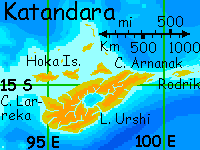
KATANDARA
You wake on Cape Larreka, a hilly triangle 200 km (125 mi) long--the western tip of Katandara. The Hoka Islands lie on the northern horizon--four large and many small islands stretching along the north shore and 600 km out to sea. Ahead of you's the mainland of Katandara, a teardrop shape 1200 km long (750 mi). Most of the island's a low plateau of savanna with scattered woods, drained by central Lake Urshi, a shallow oval 240 km across (140 mi). The lakeshore is patchy tropical forest, about as green as Katandara gets. Unlike Larsum's neat division into a drier antel/cheetaur west coast versus a wetter lebbird east, Katandara's mixed habitat supports villages where all three species coexist.

This triangular society's interspecific relations are intimate and complex, as you learn in Urshi Town, on the lake's south shore near the mouth of its outlet. The evening you arrive, you attend a song-play. You're shocked at its subtlety--oh, you know the language, but you can feel the audience reacting to a whole layer of meanings you're blind to, effects based on the differing perceptions and feelings of the three species, from comic misunderstandings to near-mystical moments of trust or insight. The whole play's tinged with it--not love alone, or understanding, or empathy exactly, but a strange delight we can't name. By the end, you start to wonder if this is what Katandarans value most--this thing you can't even grasp.
And how much more of Lyr are you blind to? Many creatures with perfectly good eyes lack depth perception or color vision--do they ever suspect what they're missing? Humans are a lone-wolf species, cut off from others. Is that really just chance... or genetics? Certainly dogs (and wolves), ravens, dolphins and elephants read us better than we read them. Are we blind to all but ourselves?
East of Lake Urshi, the land grows a bit greener. Fewer meadows break up the groves, though they never merge into true forest. Slowly the low hills narrow and end in Cape Arnanak. Our flyway still heads east... into a new ocean, the Chakora, bigger than the Pacific, deep and quite islandless except here along its border. Even the ridges flanking Chakora Chasma are miles below the surface. Wait, I forgot Haijakata--a solitary mountain 1600 km south of us (1000 mi). The coast ahead of us for the next 5000 km forms a near-perfect arc, suggesting a huge impact crater with Haijakata as the central peak. But the island is in fact volcanic and the curve, a tectonic plate-edge--an overenthusiastic island arc.
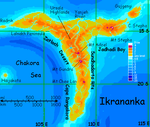
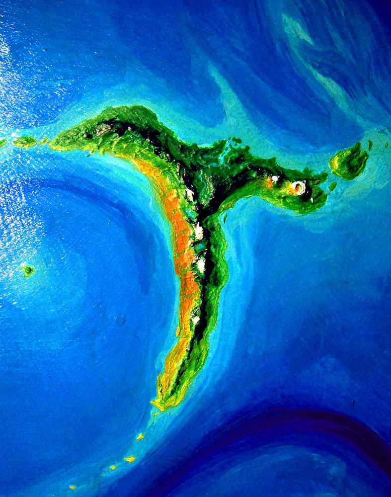
Ikrananka's a tropical terra 3600 km (2250 mi) long; a rugged and ridgy T shape, all capes and no body, like Indonesia's Sulawesi. You make landfall on the western arm, called the Lalnakh Peninsula. This long cape is drier than Rodrik or Katandara; only an occasional tree or small grove breaks the dry veldt. There are villages of mixed cheetaurs and antel, but few lebbirds--they feel uncomfortable without Mother Forest.
But as you keep flying east, Lalnakh rises slowly. The higher hills catch more rain. Trees cluster in groves, and soon groves merge into patchy woods and strips along permanent streams, and conifers start replacing the drought-adapted lowland "acacias" and "baobabs."
By the third day, the hills have widened into the Ursala Highlands, the heart of Ikrananka. You haven't left the fairly dry zone that most of the western Polesotechnica lies in, but Ursala's altitude (1-2 km, 3300-6600') is enough to harvest extra rain; the land is rolling, open conifer forest with grass beneath, strangely parklike. Colorful flowering orchards along the creeks and valley-bottoms tell you even before you land in a treetop village that the lebbirds have returned with the rains.
The ridges start curving south, and you follow. The lowlands downslope to the right start to look rusty through the heat-haze--not even veldt now, except the olive strips around streams dropping from Ursala. This is the first fringe of the Zatlach Desert, one of Lyr's largest. Admittedly, that's not saying much compared to Earth's--Zatlach is a coastal strip nearly 3200 km (2000 mi) long, but only 200 km wide; the mountains that create it also limit its spread.
Curiously, Zatlach is a biological hot spot--in this warm veldt with mountain-fed streams, winged migration wasn't needed, so evolution here favored big, nonflying grazers--and predators to match. One cooperative hunter achieved intelligence: cheetaurs. Small nomadic bands eventually learned agriculture and fishing, allowing them to build streambank villages, then small towns. Diverse little civilizations!
South American readers will feel a sense of deja vu here: isn't it a lot like coastal Peru and Chile? Well, no and yes; the mountains can't match the Andes, and it's never as dry as, say, the Atacama Desert, but these valleys are similar in that they're linear oases, separate little cultural experiments encouraging irrigated agriculture upstream and the development of fishing and boating techniques down at the rivermouths (hence trading)--and the dry climate and the seasonal floods down the creeks both encouraged storing food, studying the past, planning for the future...
So Zatlach is probably where (and how) cheetaurs evolved. Yet the local legends disagree: they insist the Zatlach was colonized in prehistoric times by cheetaurs from the Kurro Desert on Larsum. For a myth it's pretty plausible, since the Kurro's ecology is quite like the Zatlach strip, with similar evolutionary pressures/incentives.
On the other hand, in the Kurro, they have equally plausible legends of being settled by folk from the east--from Zatlach.
Some upland villages sport a few griffets, stragglers from a thriving arboreal civilization down in Yanjeh. Only a few oddballs live here on the edge; these hills are generally too cool for their liking, and the Zatlach coast too dusty and treeless.
But there's always someone who can't stand their relatives...
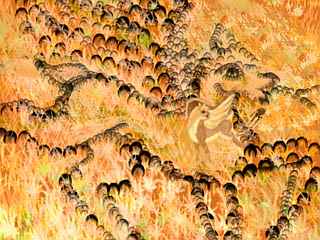
The view from the hills sure gives you a stark lesson in rainshadowing. To the west, the Zatlach Desert; under you, in a great north-south strip, the open park of Ursala; and to the east, into the wind, the land drops steadily away into the lush Yanjeh Basin. The first dense tropical forest since eastern Larsum--fed by the rains stolen from Zatlach. (In the photo to the left, south is to the right, the Yanjeh rainforest to the left.)
As you wing south, Ursala's hills narrow and heighten into true mountains, up to 3 km (10,000')--the Sundhadarta Range. You stop to swim in Lake Ursala, a pleasant oval mountain lake 70 km long (45 mi). You head south all day up the long valley of the Yanjeh River to its source, Mt Adzel, a two-headed volcanic cone. The higher eastern peak is 3300 m (10,800'), dusted with snow near the summit--the first you've seen since Mt Rebo, 6000 km to the west.
South of Adzel, a spectacular Fuji-like peak looms on the southern horizon, 4100 m (13,500') high--Mt Gundra. These higher peaks throw a harsher rainshadow--to the west now are bare red desert canyons, though the few antel in these cool upland villages do say the desert softens again to dry veldt down near the coast. Fogs roll in off the sea in summer--it might almost be the Kalahari, or precolumbian LA. Between the two peaks, a silver sheet shines, set in dark "pine" forest: Lake Gundra, smaller and higher than Lake Adzel was.
How much further south do you want to go? Ikrananka just narrows slowly into the Rangakora Peninsula. There are other Fujis, like the exquisite Mt Chee Lan, a perfect cone 3200 m high, but south of Chee Lan the land lowers slowly, and the sharp wet/dry split fades as you leave the dry zone; southern Rangakora is a quilt of subtropical woods and meadows. Pleasant country.
But the peninsula just sags gradually back into the sea, becoming an endless undersea ridge, a road to nowhere (a nowhere called the Dahia Islands, to be exact--8000 km from land, unexplored, unsettled, and with excellent reasons to stay that way). Dead end! The only flyway leads east.
So you skim down the slopes of the Sundhadartas to the warm green shores of Jadhadi Bay, a wide bight off eastern Ikrananka, 1000 km wide. The prevailing wind's off the sea; you ride updrafts along the headlands all day, back north toward the Stepha Peninsula, the eastern arm of Ikrananka. You camp on an islet where the Jadhadi shore bends east. Really, for an armpit, it's quite nice.
The next day you fly east over Mediterranean shores all day--and you're less than halfway to the tip.
In the morning, the shores grow greener again--storms here come straight in off the sea. Around noon you follow a steep little river inland, past a round lake--an old crater? Could be. Ahead you definitely see volcanoes: Mt Stepha, a cluster of shield-volcano vents over 4000 m (13,000') high, ringed by ecozones from warm lowland forest up to cool cloud forests and alpine meadows on Stepha's shoulders. The summit, snowy in winter, is a cliff-walled caldera like Haleakala on Maui. The caldera's floor is a stark, cindery, high-altitude desert. West of Stepha, in its rainshadow, lies more high desert of "sage" and scattered "pines".
North, over the range, lies rainforest--the east end of the Yanjeh Jungle. But our path lies east--down the Stepha River Valley, also lush and rainy. Takes hours of swooping steadily downstream to reach the rivermouth, in a narrow bay. You ride updrafts along the cliffs above the north shore, past the bay, past a long island, out to the eastern tip of Ikrananka...
THE GUJGENGI ISLES
From here it's a long but not terribly strenuous flight to Ulash, the next great terra. Our way leads through the Gujgengi Islands, a long, twisting, branching chain. Our branch curves slowly southeast out of the torrid equatorial zone. It's still warm year-round, but the rainfall, though still generous overall, is broken by a relatively dry season as long as an Earth year.
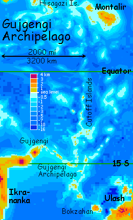
Gujgengi itself, the first and largest isle, is a shield volcano 270 km (170 mi) long, only four times the size of Hawaii. Hardly a pimple, on Lyr! Its warm, wooded slopes are even gentler than Hawaii's shield volcanoes: the summit is barely over 2000 m (6600'). On the lush windward side, villages of chattering griffets tend fruit orchards.
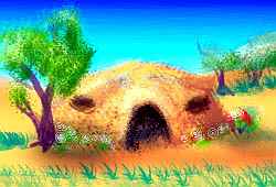
The dry side has such tree-villages only along rivers; the broad plains and slopes are grasslands with only the occasional ring of cheetaur huts--thatched domes with wide lens-shaped windows under protruding shade-eaves, like eyelids.
Five isles past Gujgengi, many travelers peel off north, following a curling tangle of islets (well, one's bigger than Maui, but this is Lyr; islets they are). Most of these travelers are young, and all are fit, for the Cutoff Chain is just that: a great shortcut for voyagers heading out of Polesotechnica to the northern hemisphere. It's a hard flight of 2500 km (1600 mi) due north over the equator to Montalir--not terribly dangerous if you're well prepared, since Montalir is large and hard to miss even if a crosswind blows you a hundred km or two off course, and the equatorial belt is mild and warm with puffy clouds (shade, in case you overheat) and few violent storms this time of year (orbital winter).
Still, it's at LEAST two days nonstop on the wing, and quite often longer. You couldn't do it, you'd chafe to death. But native wings aren't strap-on! They can manage it--usually. Of course, some think they can, and perish; that's why most family groups are doing as you are--going the long way round by easy stages, through Ulash and the Wersgorix Group. It's only an extra 14,000 km or so (9000 mi). Travelers on Lyr can't afford impatience. It's all about the journey, right?
So alongside quite a few native families with pups and bored teens who half-wish they'd ditched their elders and young siblings and risked the Cutoff... you wind slowly but safely for over a week through the lesser Gujgengis--3600 km (2250 mi) over many days, generally southeast. Four of these atolls are over 160 km long (100 mi). Though all are low and narrow and drier than the big island, they have at least some woods, and fresh water's findable if not abundant. Great coral banks and lagoons link the Gujgengis; the way's always clear. That's lucky, for Gujgengi is the only easy route to and from eastern Polesotechnica.
BOKZAHAN
The last of the Gujgengis is nearly as big as the first: Bokzahan, an oval island 240 km (150 mi) wide. It's a typical Lyran shield volcano, with a central caldera 40 km wide (25 mi). High point on the rim: 2700 m (8900'). The coast is open tropical forest--not rainforest, for the mainland of Ulash upwind blocks some storms. The western shoulder and slopes of Mt Bokzahan are drier still, a rainshadow prairie like parts of upland Hawaii.
Maybe, given its size and climate, a better analogy would be Sicily. If Sicily were a ranch run by leopards! Spotted cheetaurs dominate the dry west, herding cowbirds (winged milk-cows the size of a dog). Flox farms are tucked away in the rocky canyons, but only a few; water's too scarce. The greener east is mostly lebbird/griffet orchards, though you meet all four species here--they prefer mixed villages.
ULASH
The next day you make the five-hour crossing to mainland Ulash. If Bokzahan Island was Sicily, Cape Bokzahan is southern Italy--it's big enough, a blunt squarish chunk of Mediterranean land, though it reaches west from Ulash, not south.
Ulash is 2200 km (1400 mi) across. It's all capes and no body, like Indonesia's Sulawesi--just six times bigger. Geologically it's more like a giant Iceland--a bubbling field of overlapping volcanoes. There's an even closer analogy--but on Venus, not Earth: the Eistla region around Pavlova Corona. Wait, let me pour water on it and plant some flowers so you can compare them fairly. There! All terraformed. Now Pavlova's an island of much the same shape and size...
Here in the north, Ulash is dry and quite Mediterranean; the east and south coast are rainier. The lowlands are uniformly hot (though not uniformly humid); the central highlands, mild.

We head south along the shores of Erziran Bay, a gulf 600 km (400 mi) wide between Cape Bokzahan and the Tulitur Peninsula. Erziran's Mediterranean too--rocky shores, groves and fields in the lowlands, forested heights, a mild climate with weak winds and light rains. Small streams are seasonal; the larger rivers cut narrow, rocky canyons where floxes nest in cliff dwellings. Scenic, but harsh, even down by the riverbanks; constrained by canyon walls, these streams are flood-prone. Few trees flourish, though the silt fertilizes fields in the riverbends.
Inland rises the proud snowy head of Mt Fereghur, a volcano 3800 m high (12,400'). Far offshore lies Erziran Island, a rugged wedge of land 300 km long (190 mi), with two peaks over 3000 m (10,000'). Though far under the horizon, its effects are felt here: it shelters the bay, making it very much an inland sea, with gentle waves for Lyr. As close to a Mediterranean as we're likely to get on this deep-sea world!
Despite the sheltered water, only small fishing boats dot the turquoise bay--no deepwater ships. No shipping! Lyrans are millennia behind Terrans in shipbuilding. Wings are the reason, of course--who wants to sail at five or ten knots when you can fly at sixty? A splendid example of how unpredictable causal chains are! A dusty solar system led to a big rocky planet led to a dense atmosphere led to evolutionary pressure toward fliers led to swift communication and light air transport led to atrophy of mass transport by sea--shipping. And that led to one more thing you'll have noticed in the background of many of these regional tours: Lyran regions are self-sufficient. Trade is in ideas and small luxuries and the only shipping is in easy, short coastal hops. A worldwide deep-sea shipping trade has never developed--and if it ever does, it'll be in bulk nonperishables, and lack most of the romance of our Age of Sail. They'll be crawling toward known lands with cargoes shipped only because they're not worth flying.
Even those fishing boats aren't what they seem. No courageous fishermen praying to sea-gods for good weather and good catches. These fishers are whole families, flying casually back home and out to their boats, which are just staging platforms for their line fishing. There's little danger--even children can abandon ship in a storm and make it to shore. Fishing isn't a matter of luck, either; fliers scout out schools and guide boats to the best catches.
Overfishing is the main problem, and regulatory boards hotly debate each season's limit and watch for cheats. Inland buyers fly right out to the boats and select truly fresh fish. (No, they don't haggle; they drop off upland goods, mostly fruit and textiles, at standard exchange rates back on the coasts; Lyrans don't like to waste time haggling; their concepts of money and profit are vague at best. They'd rather spend the time flirting, singing, dancing, trading news and drinking fermented heather-berry juice--a highly exportable uplands fruit product.)
The fishing villages aren't like pre-industrial Earth, either, where fishing villages were often lonely, set on harbors far off landsmen's roads, as if landlubbers and seamen inhabited two superimposed worlds. On Lyr, other towns are only minutes away, and on hot days, farmers and herders flock to the beaches to swim and play.

Pre-industrial? Or post-?
That frames the question wrong. The development of Terran industry masked a second change--mobility. They were twins too tightly bound to see as separate changes. But on Lyr, we see non-industrial mobility. If it looks surprisingly modern--crowded beach-parties instead of dour fishermen--maybe it's time to look again at Earth's "industrial" revolution. Perhaps what really mattered here, too, was fast mobility and communications. Humanity's just now approaching a mobility and the cosmopolitan, civilized behavior it generates that was built into Lyr from its earliest days, when all those rocks accreted.
More rocks, more air, more wings, more cosmopolitan people. Simple. Predictable.
Ah, science!
Let's go all the way to the south end of the bay--it's worth it. The Tulitur Peninsula, the southern tip of Ulash, is a boot like Italy--but a big, stout, unfashionable one. More fertile too--while southern Italy thrusts into a dry zone, Tulitur thrusts out of one centered at 18 degrees south. The land grows steadily greener south of Mt Fereghur; trees start invading the upland savanna, and the volcanic Tulitur Mts, 3650 m high (12,000'), near the southern tip, have "redwood" forests.
Are you bored yet? All this geography, with no new portraits, no new species? There's a reason I can't introduce any new ones--Ulash suffers from its location. This diverse and fertile land is in the middle of the long Polesotechnic Arc, about as far from the flyways at the ends as you can get. The Kraokas, smaller and ecologically monotonous, have more intelligent species than Ulash, purely because they've historically gotten more visitors from the continents to the north, and a few eccentrics chose to settle there. In future millennia, Ulash will no doubt attract intelligent species to fill these varied habitats--or evolve a new one, as Ikrananka probably did. But for now, I'm largely limited to a bare recital of these rich lands because they're barer than they ought to be. In what really matters. Not forever, but now.
As we head east to Cape Shivaru and Shivaru Bay, a gulf 600 km (400 mi) wide on the east coast, the greening continues; this is the rainy side of Ulash. Lebbird and griffet country! I didn't meant to imply Ulash is empty--just full of species you've already met, like the tree-hugging lebbird to the right. They love these warm tropical forests along the coast, though their villages thin out with the trees as you climb into the highlands--lebbirds like it warm. Not that it's truly cold up on the open savanna above the clouds, around the Shivaru Mts and Mt Fereghur again--a very different peak here on the wet side. Springlike weather most of the year, snowless but creeping down near freezing in winter. Still, a lebbird even reading that would shiver...
Yes, of course they read! Little round bark-paper books are quite common on Lyr. Don't let the fur and the lack of gleaming metal tools fool you. Lyrans are sophisticated people, for the most part. Lyr's poor in heavy metals, so shiny tools are expensive; and Lyrans settle only where they don't need a big infrastructure to survive. Why bother? After all, some other people will eventually come along and effortlessly fill that niche.
If not, you'll probably spread the news to the appropriate species and help settlers move in; it's cheaper for all concerned to cultivate neighbors and then trade with their new villages. Human cultural adaptation to lands we're unsuited for (literally unsuited: one of our first infrastructures was clothes) is something Lyrans might understand intellectually, but not emotionally.
We're a species going it alone; it's equally hard for us to grasp the Lyran mindset. It's easier to slip into seeing Lyr as a mere fantasy of a lazy natural Eden--creatures, but no culture. That's partly my emphasis on ecology, and I apologize. But Lyran culture is just less obtrusive, less visible. Flight changes everything. Tools stay portable, towns stay small. Human cities are cultural oases, and urbanites often say it's a cultural desert out there. But on Lyr, ideas spread fast and everywhere--on the wing. It's probably one reason Lyrans have few large cities; they don't hunger for them as humans do, don't need to concentrate their cultural institutions. Little schools and theaters and art festivals are all over the place--in canyons, in caves, tucked atop crags. Why not? Wingless humans congregate in great lumps on the plains, building artificial mountains to satisfy the eye but not block transport and communication. "Civilization" comes from the word city. Lyrans don't have a civilization, or need one. They have a ruralization.
Oops. Where was I, pre-rant? Right. In one of the grand exceptions that proves my point. Poor Ulash! Stuck in the middle of the long lonely arc that's Polesotechnica, it's about as far from cosmopolitan as you can get on Lyr. You can be isolated even on a planet of fliers--it just takes 30,000 kilometers of deep sea to do it. And even so, Ulash is only relatively poor in intelligent species! With five or six, this one island's far richer than all Earth with its sad monoculture...
For example, even this little coastal strip has a greater diversity of viewpoints than anywhere on Earth, for lebbird and griffet brains are wired differently; lebbirds are quite verbal, but griffets think spatially and kinetically; their speech is danced as much as voiced. They cohabit two-tier treetop villages, the lebbirds in round terraced huts clinging to larger treetrunks, the griffets in little cat-sized hutches as high in the canopy as they can build--high enough to get thrashed around in storms. Griffets find that fun... until huts break free and are flung fifty meters to the jungle floor, as residents pop out the windoors and fly off shrieking in the rain. Out comes the sun, and they build that high again. I told you they think differently.
These mixed villages fade out as we head north to Lake Ulash, close to the center of the island. It's a crescent 150 km (90 mi) long and half as wide. Mt Ulash rises above it--a volcano 3700 m high (12,100'). Despite its name, Mt Ulash isn't the tallest peak around here. Mt Yildivan, just to the west, tops 4100 m (13,500'). And that's only the high point of its long caldera rim; the crater's 70 km (45 mi) wide and nearly a mile deep, with a lake at the low west end--sketch to left.
But from here all you can see is a great crown of clouds on the horizon behind Ulash's shoulder, and a single momentary gleam of snow. But Yildivan and Ulash are just the highest of a whole range pocked with lesser calderas, bristly with sparse conifers on twisting lava flows--the Yildivan Highlands. Too dry for lebbirds, too cool for griffets. Cheetaurs might be able to adapt, but you don't spot any. It's a long way up on foot from their lowland savanna-villages! The Yildivan upland extends nearly the length of Ulash, all the way back to Cape Bokzahan where you landed. Eventually cheetaurs may settle here, though I'll bet if they do, they'll be a separate subspecies within relatively few generations, one with much thicker coats. That's not a wild guess--it's precisely what happened on inland Erkila, a nearby land just weeks ahead of us. "Nearby" Lyran style, of course: 16,000 km or 10,000 miles as the lebbird flies. Next door.
In this still-sleeping highland rises the Mukashyat River, draining an area the size of Java on the northern coast from here to Cape Kochihir--the largest basin on Ulash, though none of its dozen major branches is over 400 km long (250 mi). It's a dry, grassy lowland plain, cut off from the eastern rains by Mt Yildivan, Mt Ulash and, further east, Mt Mukashyat, rising to 3100 m (10,200').
This is all cheetaur and antel country, of course--the only ones of the half-dozen local species who really like savanna. They've coexisted here for millennia, long enough so their dietary behavior's changed; these cheetaurs, though nominally still carnivores, herd flocks and eat very little meat, getting much of their protein from cowbird "milk", the eggs of domesticated dragonets (small winged lizards), and oil-rich "beans" (really the seeds of a tall grass, but they taste like peanuts). Butchery of old animals is done ritually in a funeral-temple, for their partners, the herbivorous antel, panic at the sight of blood. At least theoretically--these antel are the calmest you've ever met. They live with predators, not just in the same villages but in extended families, raising young and even occasionally mating together. That's not seen as perverse--ill-starred, perhaps, or unlikely to last, due to their deep differences, but everyone experiments, and some end in marriages. Strange and often complex marriages, with separate fertility- and affinity-partners, but multispecies families that work.
Too Disney for you? Lyrans would see us as low-tech in the technology that matters most to them; social technology. They're simply more experienced in the art of bridging psychological and perceptual differences, since they encounter them daily. And, it seems, enjoy them.
But then, all the Ulashan cheetaurs you've met exude a calm warmth that's just attractive, even if you're not into cats. Maybe they've changed more than their diet. Has living with constitutionally nervous, hyperintuitive antels favored empathy and calm?
What if charm's genetic?
Though you like the people--Lyran evolution has apparently ensured you HAVE to--the Mukashyat Savanna is just too hot for you; soon you ride a thermal back up into the cooler, greener hills, and skirt the basin. You skip Cape Kochihir, 220 km long (140 mi), but hot and dry. Kochihir Island off its tip is much greener--its volcanic central peak is 2200 m high (7300'), enough to harvest rain on its east face. But that's a long side trip to see more of the same.
Instead, let's stick to the Mediterranean highlands. By the next day they're growing greener--pine woods, canyons with perennial streams. This is Cape Lugal, the east end of Ulash, 1200 km long and 400 wide (750 by 250 mi), the size of California, and somewhat like it in appearance (we won't go again into the ways it resembles the Froofy State sociosexually.)
Like most of Ulash, Lugal's an overlapping mass of volcanoes--the highest of the Per Mts ("pear" not "purr") reach 3500 m (11,500'). We've crept even further into the drybelt, but this is the windward, rainy side of Ulash--and the two forces conflict. You head east toward the Per Volcanoes over open pine forest, but if you turn north you'll find red canyons cutting down into old lava flows stretching 2-300 km to the coast. Prime flox habitat--they farm the canyon bottoms and dig cliffhouses in the walls.
A couple of days north is Lugal Bay and Island, low and broad even for a Lyran shield volcano--as wide as Olympus Mons on Mars. Its highest vent is only 2400 m (8000'). At this latitude, even Lugal's low peaks create a rainshadow, so the west coast is dry yet the east is lush--echoing Cape Lugal. Let's not visit and say we did!
The Per range is more interesting, with four grass-shouldered volcanoes 3-4 km high (10,000-13000'), and broad, mild uplands rather like parts of Hawaii's Big Island. Round Lake Per, 80 km (50 mi) wide, lies at their feet on the south side. It's rich grazing land--a bit cool for antel, but tolerable; you see herds of these shy, graceful people everywhere. The alpine summits are dotted with carefully aligned stones forming pictures--not crude, stylized images like Nazca, but lively portraits of antel, cheetaurs, and lebbirds. Some are even in color--some patient antel poked and tongued stones with vivid high-altitude lichens, green, black, yellow and fluorescent orange, until they form living, pointillist designs. Kickrock art! Seurat would applaud.
You skim south down the Per River to its mouth. The air grows warm and wet, the forest lush. We're on the rainy side here. On the southern horizon is the first of the Shivaru Islands, a forested chain stretching from Shivaru Bay some 2400 km (1500 mi) east to the Wersgorix cluster--the only flyway between them.
THE SHIVARU ISLANDS
The Shivarus are old volcanic platforms that have worn down to coral atolls. Most are low and narrow, but some of these snaky islets are up to 250 km long, sheltering equally huge lagoons and coral banks.
And not all the volcanoes consent to being worn down. Two days out, you spot a gray-brown cloud tapering to a red point on the horizon. You wheel right to investigate, and find a small volcanic cone building a new island. You can circle in safety in safety for a good look--like Hawaii, the Shivarus are built of relatively runny lava that rarely plugs vents; fountains are stable and explosions rare.
So the Shivaru field isn't dead, only napping. What causes this odd-shaped patch, instead of the a simple island arc or chain? Shivaru is the sharpest bend in the long Polesotechnic arc we've been following for 10,000 mi (16,000 km), and it may be a sort of hinge, squeezed one way but stretched to the ripping point at other angles. Soundings reveal that these isles are just the tips of tangled, crumpled ridges. Tectonic pressures here are not simple! This really could be said of Ulash and the Gujgengis behind you, too; they all form a great Indonesian/Mediterranean mishmash, a place where plates don't just collide but twist, corrugate and splinter. It's not unique: on the far side of the world, the Quenna Archipelago has a similar structure. It too is a "hinge" between the Oronesian Chain and the quasi-continent of Gaiila. Both structures, Quenna and Gujgengi/Ulash/Shivaru, have a bubbling mud-pot look, with more circular structures and less linear ones, than either Indonesia or the Mediterranean sea floor; what they most resemble are the coronae of Venus. Not too surprising, since Lyr's crust and mantle are hotter and more flexible than Earth's.
But calling Gujgengi, Quenna or Shivaru a "corona field" doesn't say much; it's not clear what coronae really are. Upwellings of new crust, spreading out in all directions? A circular rolling or turnover of crust? Downwellings, sucking and crunching together features as crust is pulled inward? I'd vote for downwelling here if I had to choose, but I'm not that kind of tourguide. Let's leave it a mystery! After all, this geological madness is nearly all invisible, miles undersea; we can ignore it up here in the tropical air.
Unless you're dumb enough to stray downwind of an active volcano. Even these relatively peaceful Shivaruan vents put out ash fine enough to choke and hot enough to burn...
Despite the volcanoes, tropical island-hopping looks pretty good after after all those semideserts on Ulash. The Shivarus are all wooded, if not rainforest; the larger isles offer rest, shade, water and fruit. Take your time--take all week. The gaps between islands are never more than a few hours, and all the local lebbird/griffet communities welcome travelers with news. Easy country.
If you were hoping for real Lyran jungles, denser and wilder than anything on Earth, don't worry. Our next stop, Wersgorix, will deliver.

TOUR LYR! Climb volcanoes, swim seas, meet weird creatures. First: survival tips! Then, pick a region:
Ythri -- Polesotechnic Chain -- Troisleons -- Roland -- Oronesia -- Gaiila -- Flandry -- Diomedes -- Ak'hai'i -- Averorn
World Dream Bank homepage - Art gallery - New stuff - Introductory sampler, best dreams, best art - On dreamwork - Books
Indexes: Subject - Author - Date - Names - Places - Art media/styles
Titles: A - B - C - D - E - F - G - H - IJ - KL - M - NO - PQ - R - Sa-Sk - Sl-Sz - T - UV - WXYZ
Email: wdreamb@yahoo.com - Catalog of art, books, CDs - Behind the Curtain: FAQs, bio, site map - Kindred sites