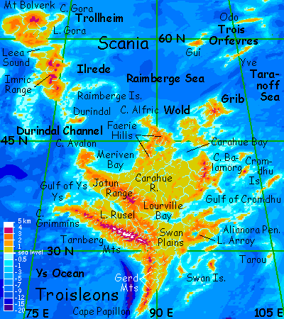
Eastern Polesotechnic Strip
by Chris Wayan, 2004
Lyr (home) - map - creatures - cultures - evolution - climate - geology - gazetteer - nomenclature - definitions - building Lyr - more worlds? Planetocopia!
INTRODUCTION
New to Lyr? First-time orientation--strongly advised! Lyr is weird.
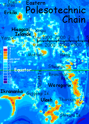
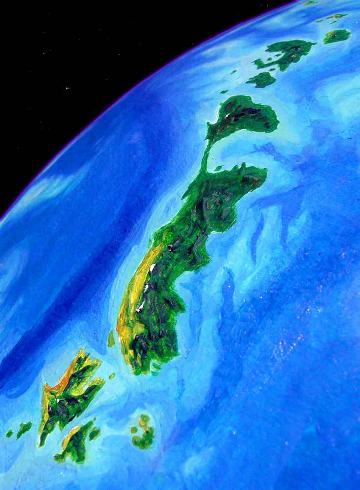
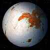
The Polesotechnic Strip is a chain of terras and archipelagoes winding a third of the way round Lyr--some 40,000 km/25,000 miles! From west to east: the Kraoka Islands, Larsum, Katandara, Ikrananka, Ulash (all on the western tour), Wersgorix (where this tour begins), and the Hisagazi Islands, dominated by Montalir and Erkila.
Not one's truly continental, and you're never more than 320 km (200 mi) from the sea; yet the total area of Polesotechnica is larger than Europe, and its biomass is three times as great.
The long strip winds in and out of two climate belts:
1) Equatorial rainbelt--rising air generates storms, nourishing continent-wide rainforests
2) Sub-equatorial drybelt (more complex than the name suggests)--cooler, drier air and high pressures create rather Mediterranean eastern shores, forested highlands, and savannas and deserts downwind of large mountains and along some west coasts.
Due to the equatorial rainforests, Polesotechnica has a high species count and a huge biomass; but it's the diverse ecozones of the drybelt that give the region its wide variety of intelligent species.
Again: this page guides you through the eastern Strip--Wersgorix and Hisagazi. The western half has its own page.
The WERSGORIX CLUSTER
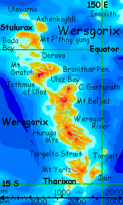
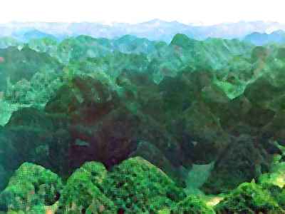
Three tropical lands form the east end of the Polesotechnic Strip: Wersgorix proper, several times the size of the Philippines but a recognizable cousin; Tharixan, cooler, drier, bigger than Java; and steamy Stulurax, a bit smaller than Tharixan but with triple the biomass, for it's right on the equator. A host of lesser islands surround the big three.
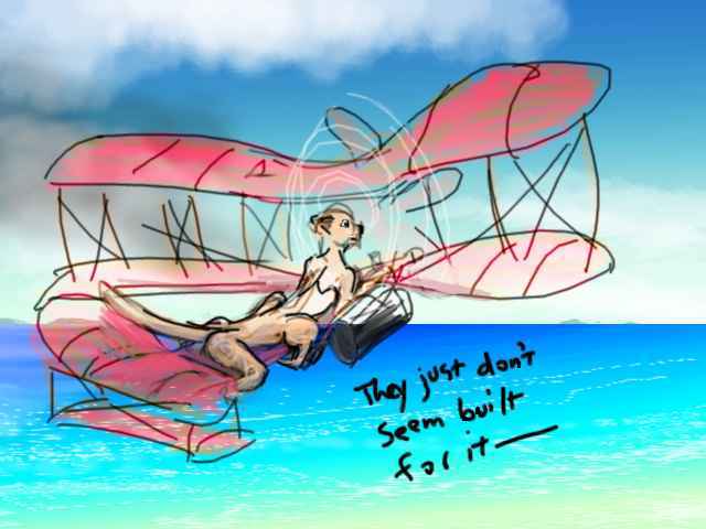
You fly in from Ulash via the Shivaru Islands, a chain of nearly twenty major islands some 3000 km long. None of the hops between islands are long or dangerous. The Shivarus and narrow ridges rising across the prevailing winds, wringing rain from passing clouds; while they aren't all lush, you never hunt long for water. Or food. The half-dozen peoples coinhabiting the chain are friendly and curious about an exotic like you. Quite a few Lyrans play a sort of collection-game, trying to meet at least one representative of every intelligent species in the world--something like birding on Earth, though without standardized scorecards. Are you a joker or a bonus point? You're never quite sure. But they feed you.
THARIXAN
Tharixan is nearly the size of Britain. From space, it looks like a starfish doing yoga: from central Mt Yariz, 3200 m high (10,600'), lava flows writhe 400 km out in all directions. The eastern arms are lush, but the west are savanna and open forest--Tharixan, alone among major Wersgorixan lands, lies just inside the climatic drybelt centered at 18 degrees south, so its higher ridges harvest rain but create small rainshadows downwind.
That land on the eastern horizon is Jair, a wedge of hills and low peaks (eroded volcanoes) 350 km long (220 mi). Being upwind, Jair's fairly lush despite also being in the drybelt. Most of it resembles Carolina or Georgia in climate, though its west coast is much drier. That's the coast facing you, and you're not tempted. You stick to Tharixan--and why not? The wind blows off the sea, so you can ride up the east coast almost without having to beat your wings--updrafts all the way!
A day later, at the north end of Tharixan, Jair is still a shadow on the eastern horizon. If you spiraled up high enough--a couple of miles, I mean--atmospheric lensing might let you spot a dim land far beyond Jair to the northeast: Torgelta, some 400 km out, the easternmost land in the Polesotechnic Strip, which bends sharply north here. Torgelta's a C-shaped main island 120 km long (75 mi), with two large satellites and many islets and coral reefs. Torgelta's forests are fairly lush--they're north of the drybelt. Think Bermuda.
The Jairs and Torgelta have a significance beyond their size. A few of you may have flown in from the Diomedes Region via the Kyrie Islands some 4340 km east (2880 mi). If so, I applaud your courage, if not your judgment--4340 km is bad enough, but if you aren't a pinpoint navigator you'll miss Jair or Torgelta and have to fly 400 km further to Tharixan itself. The Torgelta Gulf is easy flying, yet it's a graveyard--every year, exhausted off-course Diomedean fliers drown just out of sight of land.
But once you're here, the flyway to Wersgorix itself is easy--the tradewinds lift over the lava ridges of Tharixan's Cape Torgelta, letting you ride updrafts like a migrating hawk all the way to its tip. Torgelta Strait, 160 km/100 mi wide, is dotted with little green volcanoes. Easy as stepping stones!
WERSGORIX
At first, the lingering effects of the drybelt make Wersgorix look no different from Tharixan--wooded east coast, drier west. In fact the land conspires to exaggerate the belt--in a couple of hours, you've reached the Huruga Range, highest in southern Wersgorix, running some 800 km (500 mi) northwest. Most Lyran ranges are studded with great volcanoes like Java or the Cascades, but the Hurugas have long parallel ridges like the Appalachians, but higher, up to 3300 m (11,000'). These ridges wall off storms from the east, drying the inland and west coast to savanna, with woods only on east-facing ridges and along rivers. You even spot a few redrock cliffs in the interior.
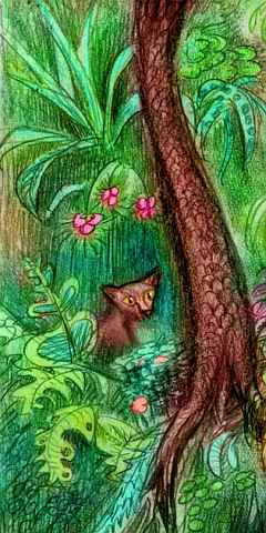
And yet, let's land briefly in the woods on the east side. If you can find any bare land to land on! The trees are dense and lush, and unlike Tharixan's understory of scattered ferns and brush rooting in the lava rock, here fern-trees and flowering vines crowd the forest floor. A lemur-like animal with golden eyes stares at you from the shadows. At last it scurries off on business of its own. Intelligent? I don't know.
For two days you ride the Huruga ridges north. At last the land drops to the Wersgor Basin. A broad fan of short streams merge here into the Wersgor River. The longest, rising on Mt Beljad, is only 500 km (310 mi), yet the basin's bigger than Britain; it's tropical forest much rainier than to the south. A day's flight brings you to silver sheet of Lake Wersgor, the largest on Wersgorix (100 km / 60 mi long)--an oval pool halfway up the main branch.
The next day's a hot one--you have to use muscle power, and our way winds up the Wersgor River. Ahead on the horizon looms a cloud-castle around Mt Beljad, highest peak on Wersgorix. Beljad's a volcanic complex 3700 m high (12,200'), with a caldera wider than Haleakala. As on that Hawaiian peak, Beljad's western slopes are rainshadowed--the last gasp of savanna as we enter the equatorial rainbelt.
Here the Wersgorix coast bends east to Cape Ganturath, a rounded peninsula 250 km across (160 mi)--all rainforest except on Mt Ganturath itself, a steep volcanic cone rising above the clouds to 3600 m (11,900'). It's lush climax forest, a lovely place--but a dead end.
Instead, our flyway makes a surprising turn west, straight into the rainshadow of Mt Beljad, with its tricky downdrafts and cliffs. The land falls away in lava terraces, still wooded, but scruffy and worn... The turquoise tropical sea moves in on both sides as the last lava tongue narrows. But there's no cape--it goes on and on, greening again as it runs out of the rainshadow.
This is the Isthmus of Uloz, a low swampy strip 600 km long, narrowing to 15 km (10 mi) at one point. The west coast drops straight into deep water, the Polesotechnic Ocean. The east is much shallower--Uloz Bay, a gulf 600 by 400 km (400 by 300 mi) sheltered by Cape Ganturath (over the eastern horizon by now), the Isthmus, and huge Branithar Peninsula just ahead.
BRANITHAR
Branithar is 900 km long and 600 wide (550 by 380 mi)--as big as Britain, and linked to the Wersgorixan mainland only by the thread of Uloz Isthmus. Branithar's almost on the equator, and unlike Wersgorix proper, it has no dry side. Rainforest right down to the beach! About the only breaks in the shore-to-shore canopy are the fern meadows on the high shoulders of Mt Gratch, 3600 m (11,900') high, and its modest snowcap in orbital winter (unlike Earth, Lyr's eccentric orbit means even the equator has modest seasons), and a long cloudforested ridge extending 300 km east from Gratch's summit, with narrow wind-cleared fernmeadows along the ridgetop. The peak is just visible as a pale spot in the orbital photos; the ridgemeadows, not at all. Too small, too far.
On the map it looks like a straight run up the west coast of Branithar is the fastest route. But you're flying, and that's the lee shore; winds blow off the land and downdrafts are common. It's a clear day, so let's detour to the east and circle the highlands at waist height, where the rugged foothills force the winds up. It may take an extra day but it's much easier. Yes, you'll have to dodge the clouds and banners that form as the humid air rises and cools, but all those updrafts make the dodging worthwhile. A free ride, if you're alert!
And not just for you. All around, what seem like hawks spiral up and dart across valleys, heading north or south. But they're larger than Terran hawks: travelers like yourself, riding the winds.
By nightfall you're northeast of Mt Gratch, and next morning you reach the very northern tip of Wersgorix. From here it's two hours over a shallow sea to Dorova, a low, rainforested island full of swampy bays and capes. Dorova's 250 km long and half as wide (160 by 80 mi). You angle northwest across the island, rest an hour on the north shore, and with the last hours of daylight, cross to the next major land of the Strip...
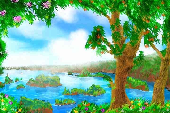
STULURAX
This great curving island, some 700 km across, straddles the equator. But here at the southwest end, it's narrow, just a low ridge smothered in lime-green. You climb sweatily to a pass. It opens to a shallow, island-dotted sound 320 km long and 270 wide (200 by 170 mi)--Boda Bay, Stulurax's inland sea, almost encircled by the jungle island. It's not an impact crater, but it could almost be round enough. The shores are rainforest down to the waterline--islets look like plush green mushrooms, lurid in the low sunset light.
The next morning you follow the ridge northeast. An hour or two, and the misty ridge of forest widens to the horizon--an unbroken sheet of green. Stulurax suddenly looks continental. It's not quite--just 800 km long and 500 wide (500 by 300 mi). Ahead, the forest humps up into a maze of steep, convoluted ridges, with tiny waterfalls in the narrow canyons. You recognize the look from Hawaii's wet side--this is an ancient volcano dissected (indeed flayed down to its rocky ribs) by torrential rains.
You dance along updrafts over the maze, skirting its lofty heart, where clouds hide the summit--Mt P'thng'gung, a crooked black thumb of basalt still rising to 2300 m (7600'). Well, less a thumb than a lopped-off neck; the hard rock of a volcanic vent whose rock never escaped, never frothed and bubbled and weakened out in the open air.
You wonder how high Stulurax was in its prime. Of course, new vents could open up. This one's under ten million years old; even hard stone melts fast in this climate. This isn't a hot spot whose moment has passed, but a plate boundary, and the deep trench offshore says it's still in motion. Peaks and islands come and go, but the Wersgorix Cluster as a whole will go on dancing atop its trench as long as plates collide.
From the north shore of Stulurax, it's only an hour to Ashenkoghli, an even lower shield volcano, but a broad one, 370 km across (230 mi), equally smothered in rainforest. Ashenkoghli's much younger geologically, and far less dissected--lush, radial valleys do corrugate the gentle slopes, but ovarall it's a broad cone, nothing like the jagged maze of P'thng'gung.
Give it a few eons...
DIRECTIONS
On Ashenkoghli's northern beach, you look out uneasily at the featureless sea--the Rijn Sea, as big as the Atlantic. Where's the flyway gone? For ten thousand km or more, the way's been clear. Now, nothing.
A local lebbird picking pseudomangoes up a tree notices your bewilderment, and calls down "You're not heading to Insalith, are you?"
"I don't know; is it on the flyway to Troisleons?"
She laughs, says "Insalith's on a flyway to nowhere. Well, I went there once on a dare. Two days nonstop thataway!" She gestures east, and a coconut drops. "No sleep, no rest... Though it's a beautiful little island, and those coral reefs... and such friendly people! No one ever visits, you see. A little desperate for news..."
"Off the flyway, huh?" I don't mean geographically. On Lyr the phrase means "clueless."
"Utterly. Now for Troisleons, you just head west till the coast turns back south. Rest up, there. It's three or four hours northwest to Ulovarna. And be sure to REALLY rest up for the big hop after that. Not as bad as Insalith, but it's long."
And she's right. Ulovarna is the last gasp of the Wersgorix Group. You've crossed the equator now, but at all of 4 degrees north, it's still rainforested coast to coast--160 km (100 mi) of rumpled green rug.
Really, its only advantage over lonely little Insalith is location--Ulovarna's a link to the Hisagazi Archipelago further northwest--the last part of Polesotechnica. Its nearest island, Vieng, is 1300 km (800 mi) west of Ulovarna. Why, Troisleons itself is getting close, for Lyr--a mere 12,500 km now. Not even eight thousand miles!
So Ulovarna gets visitors, news, inventions. Physically it may be like a lost chunk of the Amazon, but it's on the flyway.
The long flight to Vieng is not quite as bad as the numbers suggested--it's "only" 10-11 hours, due to strong, steady winds blowing west. And this time you're smart--you stay in a lebbird village the night before, ask local advice, and follow it...
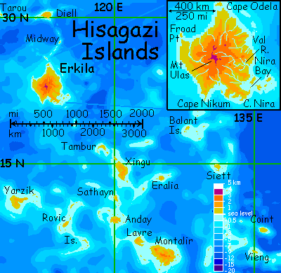
THE HISAGAZI ISLANDS
So you set out just after sunset, in the lurid glow, and fly on through the mild, humid night under the brilliant bronze light of a full Oisin, patchy red and cream--Martian deserts and iced-over seas. Strange to think that creatures up there may be peering back at you through thin spots in the ice--windows on an airless sea. Fishbowl in the sky! Of course to the Oisinians, Lyr looks much the same. Well, bigger--a lot bigger.
You fly on and on, patiently, as dawn bursts under your toes, through a steadily warming day. By afternoon, you're weaving a bit to stay under clouds when you can. At least there are some--there always are, at this humid latitude.
As the sun starts to glare in your eyes, you see a black silhouette ahead. Just before the sunset glare becomes painful, you collapse on the beach. Vieng.
Crawling into a thicket and inflating your foambed, you sleep all night, most of the next day, and the next night. Swimming eases the aches at last, and after one more sleep you wake clear-headed, ready to look around you. Made it alive to Vieng.
It's a low, rolling, wooded island 120 km across (75 mi). The forest is open, less lush than Wersgorix, for we're only on the edge of the tropical rainbelt now--and it's late in the dry season. Lots of fruit and "coconut" trees, but for a tropical island, ripe edible fruit seems scarce.
Off-season, or have travelers like you overharvested? Being on the flyway has its price.
Vieng and its big sister Coint, 3-4 hours' flight to the north, are still a long way from the main Hisagazi group. Exhausting, hungry days ensue. A couple of hours northwest to the long green lip of an atoll. Then southwest three hours over turquoise reefs, but no land until two more islets rise at the brink of an azure dropoff. You sleep here in a rough wayfarers' treehouse, surf booming out on the reef. The next day is worse--five hours over dark sea, from dawn to later afternoon, when the water again grows turquoise. But this too is just an atoll, with a few specks of land, this one so small you can't find fresh water. Perhaps you're just so tired you missed a sign. You sleep badly, and only the lebbirds' carefully drilled directions keep you going through the next grim day, west and west from dawn to dusk, the setting sun blinding you to the next shallows until you hear the breakers roar...
You wake to find this islet's different. A central peak looms over you... this is no coral atoll. Real land. You totter up and let the wind carry you round the islet's shoulder, and hover, stunned. Great green ridges fill the western horizon. The mainland of...
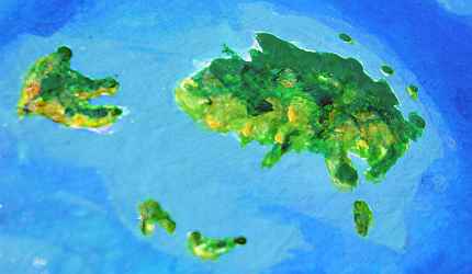
MONTALIR
Tropical, egg-shaped Montalir is 500 km (300 mi) across; heavy rains have eroded its several shield volcanoes into Oahu-like palisades and crags. The greenest of the Hisagazi Islands (being at least in the fringe of the equatorial rainbelt), it's also the second largest. In your case, it very nearly was the last. We'll take our time on Montalir--you need to recover.
From this cone, only one of several islets revealed by the dawn, it's just a gentle half-hour hop to the mainland--a shallow bay with hills behind. A gap opens and you head inland, exploring. No reason not to, since your lebbird guides said you must cross Montalir end to end. You flap up a winding valley between steep, dissected ridges, all thick with trees.
An hour later, the stream below disappears; soon another coalesces out of creeks, but flows the other way, along with you. You've crossed a low divide. The valley opens out again and the sea appears to the north. By cutting inland you merely went behind one low, dissected volcano. Peaks to the south rear higher, still a km above you, wreathed in cloud. A long saddle suggests a pass to the southern half of Montalir; indeed, locals tell you it's the head of a valley running south to a deep, round harbor (possibly an old sunken caldera), the best on the island.
Not that good harbors matter the way they do on Terra; these Hisagazians sail seas of air. Yes, Montalir Bay's a large town, a center of trade and heavy industry, but it developed late--only when the trade volume grew enough to require tedious sea-voyages. But cultural innovation? That's more common inland, where hilltops afford great views--that's where the academies and great music-inns and theaters end up, for it's beauty not industry that attracts scholars and artists. Wings make everywhere seem equally close.
Well, I'm exaggerating. Any flier will tell you that a good meeting-site has nearby water and wood, not just views and convenient updrafts. But my generalization is fair--settlement patterns on Lyr are wildly unlike those of Terra, and flight, not mysterious alien viewpoints, is almost always why.

For example, Montalir Bay's not the the most cosmopolitan part of the island. As on any Lyran landmass, that honor goes to the settlements near the optimal jumping-off points for fliers headed for neighboring islands! Thus, cultural innovation and multispecies settlement climaxes along the coasts all right, as a human might expect, but not around great ports, but airports.
Airports? Sure. They're not obvious to the Terran eye, but they're there--inns full of light food for outbound fliers, and heavier fare and quiet nests for the hungry exhausted incoming flights. Translators, weather services, guides, entertainment, sexual adventurers, importers of lightweight exotic goods (sheet-music dealers, bookshops, jewelers and massage parlors are always signs of a port town; though fewer of the massages are sexual than you think. Try hang-gliding nonstop for, say, 18 hours, and see if YOU want sex... or to have your sore shoulders fixed.)
I think it's time for a warning. By their nature, these tours inevitably give you a narrow, slanted view of Lyr. You're a tourist in strap-on wings; you can't fly like the locals. I have to restrict you to the easiest routes available. And that means major flight routes and airport hubs! Of course it all starts to seem fake--low technology, yet amazingly well-traveled, well-informed people living in a tolerant, multi-species paradise. Pure fantasy? No, a biased sampling method! There are plenty of lonely corners of Lyr, far off the flyways, that are unappealingly backward. Half are long, exhausting dead-end detours (and I do mean dead, as in "tourists trying to fly back out against that headwind kept drowning, so scratch that tour,") and half are places you couldn't even reach to get trapped in...
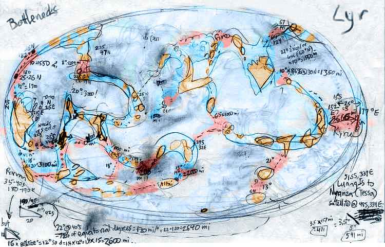
I usually don't show you rough material, but here's my original sketchmap of the major flyways, calculating their longest gaps--and whether you non-winged readers could fly them in strap-on wings. Land is gold, easily crossable water is turquoise, and hazardous passages--bottlenecks--are pink.
So remember you're getting a sunny tourist's view of Lyr, not because I'm really this sappy, but for logistical reasons. The Weak Philanthropic Principle?
If you really want dreary (or dangerous) it's out there--just harder for you to reach.
Ha. As if the existing tours are easy!
For an hour you ride over the low hills and ridges of northern Montalir--green carpet accordioned into near-vertical slopes. While you haven't hit a single rainstorm yet, the erosive power of the "monsoon" season here is obvious--despite the lush ground cover. The hills die away into alluvial fans and merge into a green jungle plain, though mountains hover on the southern and western horizons.
I'm focusing more on the land, and less on creatures and cultures, because by now you'd find the multispecies society here familiar--and far more homogenous than human tribes would be on a rugged jungle island like Montalir. A subtle cost of flight--or is it a blessing? On Earth (notice what nearly all human languages call it!) steep ridges would make for isolated villages, diverse languages and customs; travel and trade would be coastal, risky, and slow. But Montalir's all one culture, for anyone can cross the great island in a day (except for the wingless cheetaurs, who, being savanna dwellers, are rare here.) The whole Polesotechnic Strip is twice the size of the Pacific, with half a dozen intelligent species... yet flight has given it cultural unity. Lyr's a huge world, and yet, seen through native eyes, curiously small.
Sorry. Where were we? Oh, in northern Montalir, flapping west (no updrafts over that rainforest plain). At least there's a tailwind--courtesy of Lyr's fast rotation, equatorial fliers can nearly always find westbound winds not too far up--a sort of low-tech jetstream, speeding journeys 20-40 km/hr. That's why most daredevils and writers who try to circumnavigate the world head west. "Go West, young Lyran!" And you'd better be young--a 90,000-kilometer journey can take a few years!
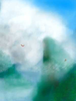
An hour later that welcome west wind lifts you right up the canyons on the east face of one last, lonely, lofty volcanic plug. It looks like a wizard in a nappy green hood, brooding over the plain below, brewing another storm. Clouds wrap the crag, tatter and fray; winds near the face must be savage. You shear away.
Downwind, to the west, lava-flow ridges wind greenly to the sea. You toboggan down the air to the shore, land in a treetop village on a twilit, glassy coral cove, and call it a day. They're eager to host a traveler who's seen nearly all the Strip. Since it's a long curve ending near its beginning, Polesotechnica isn't a shortcut to anywhere else, so most travelers and traders simply fly out from home to their goal (Corona or Troisleons, or even Diomedes) and straight back. No one flies the whole Strip end to end! Your behavior is far more exotic than your looks--for on a world with nineteen known intelligent species, an alien in strap-on wings is, to most folks, just another funny-looking tourist.
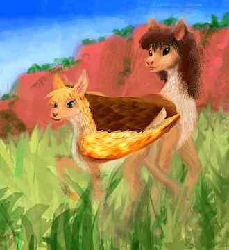
In the morning a flox family--a mom, her pups and her two husbands--swim with you round the cove, diving and paddling nearly as clumsily as you. The lebbirds just wheel and tease.
LAVRE
Two hours' brisk flying over the western sea (again with that convenient tailwind) brings you to Lavre, 210 km (130 mi) across. Heavy tropical storms have eroded its original shield volcano into palisades and crags like Moorea in Tahiti--not quite so lush, but as green as Montalir...
...and unlike the isles to the north where you're headed next. Climate on Lyr comes in belts, and as the flyway bends north-south from east-west, changes come faster.
 Your Lavrean hosts advise a night passage to Anday, for it's a five-hour flight, and a dawn departure means the last few hours will be torture--the sun glaring in your face. And you're leaving the rainbelt; cloud-shade will be sparse up there. So you leave after sundown, aiming more north than northwest--the trade winds will blow you 200 km west. Over the long flight, the cool air grows notably drier. The sea's theatrically lit by a waning Oisin (at three-quarters full, still three times as bright as Luna). Under its ruddy light, only the cloud-shadows are anything like night. Terran night.
ANDAY, SATHAYN and YARZIK
As the sun rises ruby-red in the east, Anday rises in the west, a dawnlit wall of golden green. Anday, 220 km (140 mi) long, is still wooded, but distinctly more open, with a few meadows on western slopes. You find a deep little harbor's gouged into the southeast corner of the island. You sleep here, in the port town, despite the noise, too tired to fly inland to a quieter village.

When you wake after sunset, you spend a few hours dreamily in a music inn listening to a multispecies folk band singing sea-chanties. The music's quite accessible--the scale sounds quite Terran--but where human choruses assign bass and treble parts by gender, Lyrans take advantage of species differences. A female cheetaur in the band sings a growly bass far deeper than both males and females of lighter species like lebbirds and floxes, while the high keening voices of griffets couldn't be matched by any human soprano.
You sleep a few hours more to catch up after your long night flight, and then you lift at dawn.
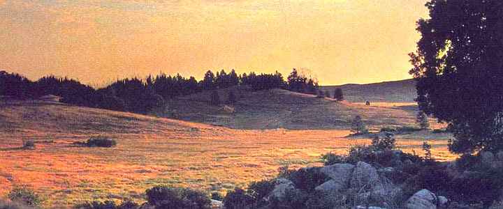
It's only an hour or two over the peaks of central Anday and down the north slope. Ahead, off the low north shore, you spy a confusing halo of islets in every direction. Your way lies north, toward Sathayn, 3-4 hours due north, but a couple of other fliers are heading toward the Rovic Islands, a long day west. The Rovics are a great S-shaped swirl of coral islets, like a galaxy with Rovic proper as the hub--a slender oval 200 km (125 mi) long, all open tropical forest except on the west coast where it dries to savanna. Like Anday, its biomass is sparser than the rainbelt isles to the south, but its culture is richer, for cheetaurs are comfortable in Rovic's drier climate--their villages stud the savannas, and even towns in the open woods have substantial cheetaur minorities.
The same is true of far larger Yarzik, a day beyond the Rovics. Yarzik is a wedge of open tropical forests and small meadows, over 300 km on a side (200 mi). Low, steep ridges dissect the land into deep valleys accessible only by air or sea.
One valley's flooded, winding 50 km into the southeast coast, making a fine harbor. In recent centuries, shipping has made Yarzik more cosmopolitan than you'd expect for an isle so far off the main flyway. Well, also a reputation for shipbuilding and refitting; cheetaurs are the best in the hemisphere for such work, and Yarzikis the best of the best. Off the flyway? Make your own.
But our way lies north, deeper into the drybelt--though Mediterranean belt might be more accurate. When you reach Sathayn in later afternoon, you find it's small, only 150 km (90 mi) long and half as wide--hardly bigger than Hawaii! It looks old--heavily eroded ridges, like Oahu. The land's quite patchy, with Mediterranean scrub, meadows, and groves on the south shore where you land.
STEAMPUNK
The local cheetaurs are (just like every cheetaur group you've met) intrigued by the offworld design of your strap-on wings. Their long, awkward, multilimbed bodies and heavier build makes it hard to design workable cheetaur wings. They're a handy people--they'd have done it long since if it were practical. Large fixed-wing gliders, yes, but gliders depend on updrafts, and those are found mostly over land. And cheetaurs don't need faster land vehicles--they are fast land vehicles, and all-terrain too. They love to run.
No, it's only a way to fly over seas that cheetaurs need and want. And for that, they need powered flight. Alone of all the Lyrans you've met, the Hisagazian cheetaurs are tinkering with small steam engines. It seems unlikely to work, doesn't it? And weight's not the only problem. Reliability!
I mean, would you trust experimental technology to carry you thousands of kilometers over a sea ten miles deep?
Even if they do get off the ground, it'll take a lot of development... and courage. Cheetaurs are all muscle, no fat; unlike humans, if they crash, they sink. Sail has its hazards too, but nothing like steampunk transoceanic aviation by inherent nonswimmers.
So I suspect cheetaur-built wooden ships will be sailing their leisurely way around Lyr for centuries yet. The master shipbuilders of Yarzik need not worry.
XINGU
Another 3-4 hours, broken by a midway rest on a modest islet (with only a single well) brings you to the southern tip of Xingu. Midair, over a scrubby, Mediterranean islet, you run into a family of lebbirds heading due east. You wheel round each other, curious. "Eralia" they shout, and point at an empty horizon. You enquire when you land. Eralia's a long day away, in the teeth of the wind (though winds here are weaker than further south). It's around the size of Hawaii, with a Big Island and three satellites only 30-50 km long--mere specks, on Lyr. Eralia's only the gateway to whole archipelagoes of these islets--the lonely Balants, for example. Deep in Lyr's dry zone, and without high peaks to harvest rain, many are mere rocks a mile wide. On the largest isles (Balant proper is only 100 km long) a few trees line streambeds, but even the uplands are dry grass and scrub.
700 km to the south, Siett is larger and much greener--220 km wide (140 mi) and with central hills high enough to snag some storms, it's a patchwork of woods and meadows. A peninsula shelters a deep harbor on the southwest side, the size of San Francisco Bay. The mixed cover is suitable for every Polesotechnic species--lebbirds, floxes, griffets and cheetaurs--even antel. But Siett's quite sparsely populated! It's cursed (if you like creatures and cultures) or blessed (if you like your isles pristine) by its sheer isolation.
Let's not visit any of them and say we did.
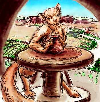
Xingu takes time. It's a tilde shape 450 km long and half as wide (280 by 140 mi)--the biggest land since Montalir. Xingu's mostly ridges of patchy, open tropical forest, with long grass slopes down to prairies in the west. You take a couple of days winding up the island, riding updrafts over the sun-heated open slopes. Short rocky canyons hide flox cliff-villages, with their distinctive round windows and doorways opening on sheer air. You stay the night in a potter village on a mesa. You could be in New Mexico--if Coyote still ran Earth.
Xingu narrows at last, but a line of islands extends northwest off its tip; the flyway's obvious. All next day you hop through Mediterranean islands up to 80 km long, until you reach the end of the central Hisagazis: Tambur. You're in the heart of the drybelt now, and the isles lack high peaks to snag rainclouds as Erkila can. Most islets are mere bare rocks a mile or two wide. On Tambur proper, a crescent 200 km long and 70 wide (125 by 45 mi), a few trees line streambeds, but the uplands are dry grass and scrub. Few call it home, but it's surprisingly busy--the final rest stop on the flyway from Montalir to huge Erkila, the last great land of the Polesotechnic strip.
But Erkila's 1500 km away--900 miles, with only a single islet midway. Two back-to-back all-day flights. Until a generation ago, travelers were warned to carry all their water, too. Crippled fliers often died of thirst before rescue could reach them. It's better now: an Erkilan group funded a ship to build several greenhouses down in a cove on Midway; they work as solar stills, turning a few gallons of seawater to flat but drinkable water for travelers. Spartan, but no one dies on Midway any more.
You make the long haul the recommended way: again, a night passage, looking for Midway at dawn when it stands out best. Landing, you drink one solar-still dry, then refill its troughs with seawater and sleep in a sea cave out of the sun, while it generates freshwater for the next night's travelers (a trusting custom that might not work for humans. Good thing Lyrans aren't.) At sundown, you beat on, shoulders sore, toward Erkila. Dawn or not, you won't miss it. Biggest land since Wersgorix, 8000 km ago!
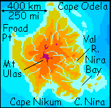
ERKILA
Erkila's a shield volcano complex over 800 km (500 mi) wide, like a Hawaii the size of Madagascar. The climate's Mediterranean. Mt Ulas, the central peak, reaches 3600 m (12,000'); the Odela, Nira and Val Rivers radiate out from its snow-streaked lava crags down through ferny meadows, then cloud forest, then open woods near the coast. The southwest side from Nikum Bay to Cape Froad, in the peak's rainshadow, has rugged desert canyons; Froad River and the northwest coast are grassland.
You land and sleep on Cape Nira, a ragged, rocky hand reaching southeast from mainland Erkila. The next morning you find that once Nira's cliffs heat up in the sun, they create pleasant updrafts you can ride north for hours. To the west of Nira's forested central ridge is a series of fjords running down to Nikum Bay. To the east, is Nira Bay, a great half-moon with the four Nira Islands, up to 70 km (45 mi) long, on the eastern horizon. Coral reefs dot the shallow bay.
At the north end of the bay is the delta of the Nira River, flowing down from central Mt Ulas, still invisible 370 km (230 mi) to the north. The upper Nira is subalpine, but the coast here is warm, open subtropical forest.
You flap leisurely along this pleasant coast all day, stopping to swim in the hot afternoon, and camp at evening at the mouth of Erkila's largest river, the Val, some 500 km/320 mi long. The Val, too, arises high on Mt Ulas, but it flows east, dropping into lush broadleaf forests. This is the rainiest and lushest of Erkila's varied coasts.
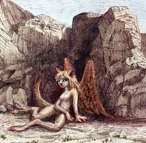
You stay in a mixed village, part on the ground, part in the trees, full of cheetaurs, lebbirds, antel, and a species you haven't seen in the Hisagazis before: sphinxes, immigrants from Troisleons to the northwest. There's no other possible translation for their name; their stance is more catlike than a lebbird, their faces more human... and most importantly, their minds are full of riddles. Bright, insatiably curious, but kooky--sphinxes catnap all round the clock, and dream-logic colors their waking speech and thought: peculiar metaphors, great intuitive leaps.
You stay with a sphinx family, and spend the evening entertained by their odd flashes of insight. But a little dazed--your end of the conversation is mostly "Huh?" Yet their grace attracts you, and you feel instantly comfortable around them, as you do around lebbirds; catlike sensuality and emotional warmth is a winning combination. Their strong feline vanity just seems charming.
Not just to you; walking round the willage at dawn, you notice quite a few mixed families. The two feline species seem to adore each other nearly as much as... well, themselves.
As the sun climbs, a steady wind's blowing off the sea, and the sphinxes suggest you ride it. Upstream you go, rising steadily all morning, until the complex of Mt Ulas looms before you--a scattering of summit cones and broken calderas 3000-3600 m (10-12,000') high, rising from a wide, grassy plateau at about 2700 m (9000'). It's distinctly greener than the stark summit of Hawaii, Earth's closest twin to Erkila; and much greener than the top of Mt Olympus on Mars. And when you add the underwater half of Erkila, it's really pretty comparable to Olympus in size and structure--a bit lower but broader, as you'd expect on a high-gravity world like Lyr.
Why are these highlands so green, when Hawaii's aren't? Erkila's further north, and experiences stronger seasons due to Lyr's more eccentric orbit. Snows are heavier and melt more in summer. But then, the air at this altitude is denser, too; it holds more moisture and shields against radiation better. Alpine deserts are rare, on Lyr.
You cross the highlands just south of the central cluster. Further cones loom beyond, to the north. On the southern horizon, over 200 km away, water gleams: the head of Nikum Bay, a shallow island-dotted gulf 160 km across (100 mi). The shores are steep, often cliffs, with many heads and bays, and scattered groves of trees. It's quite Greek, quite scenic, and quite out of our way. We're headed northwest, toward a less poetic place: Cape Froad, in the rainshadow of Mt Ulas.
On your left, to the southwest, desert canyons march down to the sea. Only the irrigated beanfields of cliff-dwelling floxes vein the red land with hidden green. A few antel roam the mesas, grazing on dry grass, but it's a dry, dull life compared to the attractions of multispecies villages on the wet side of Erkila. Only the jumpiest of antel, whose nerves just can't stand living with omnivores, still graze alone. Eventually they may form separate races--if the mesa-antel survive at all. All their fawns may emigrate, leaving the mesas to unintelligent grazers. We think of intelligent life as if it has some sacred obligation to spread everywhere, but... would desertion be so bad here? If so, would you volunteer for mesa duty--for life?
How do you keep 'em chewin' weeds
after they've seen Paree?
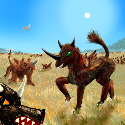
There's another reason these lands are relatively unpopulated. Below you, the Froad River descends from alpine meadows through a wide veldt which stretches north 500 km, nearly to Cape Odela. This dry grass sea sustains large grazers and carnivores with only vestigial wings--analogous to the giant flightless birds of Madagascar and New Zealand. But these look mammalian--quite African in fact. At least if you ignore their absurd-looking little tacked-on chickeny wings, now used only to flash signals across the veldt. Erkila's isolated, and its species have diverged a lot from the surrounding islands.
Flightless giants, everywhere you look!
Well, sort of giant. On Lyr, most "big game" would fit on your sofa. Since a species must stay light to fly, any creature over 40 kg (90 lbs) seems big to Lyrans--and they aren't common. But here in the Froad Basin, predators grow as large as Terran lions, and the largest grazers top half a ton in mass--even more in sheer weight, in Lyr's higher gravity. There are analogues of hyenas, wildebeest, and rhinos--just as irritable as their Terran parallels, though smaller.
And not shortsighted. All these Erkilan monsters of the veldt, being descended from fliers, retain sharp eyes--no matter how much else they've lost. They can see you a long way off. "The better to trample you with, my deer."
Big scary wildlife isn't an unmixed curse--monsters have their good side too! Froad's economy is built around hosting the hordes of winged tourists who come to gawk at the spectacle of these giant flightless wonders, "red in tooth and claw". If you ignore a few details, it's practically a little slice of Earth--Ngorongoro, perhaps.
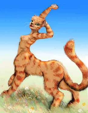
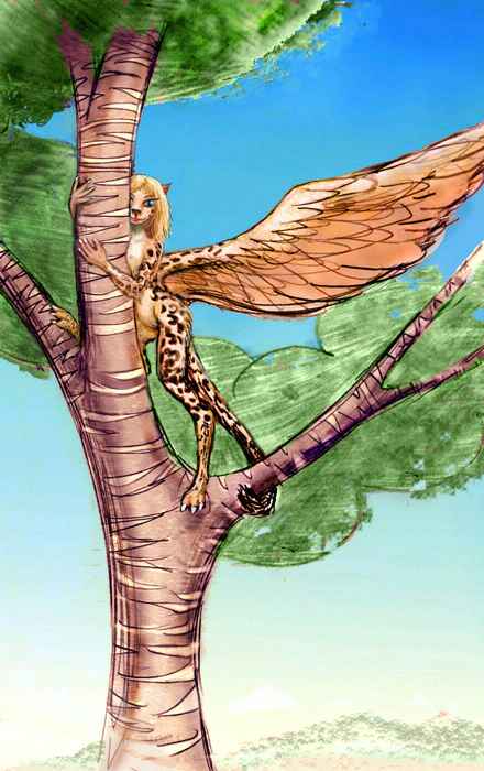
This wingless gigantism seems infectious: the local cheetaurs, descendents of a rafting expedition from the south, are large and sturdy and faintly tiger-striped, weighing as much as you--quite unlike the familiar, delicate, dappled cheetaurs of the equatorial belt. The quick paint-sketch to the right is rough but should give you the idea.
Impressive though they are (you certainly wouldn't want to fight one of these solidly muscled tigroids! Not that you'd ever have to; they're as good-natured as the lowland cheetaurs you've met) they still go armed when they must cross the veldt alone. That's a rarity on Lyr, where most animals instinctively know not to mess with confident strangers--there are just too many intelligent species around, packing fatal surprises.
But these wingless veldt creatures are really acting out a Darwinian nightmare. While most adult grazers and predators have learned not to stalk tool users, anyone can inadvertently get in the way of a hunt, or a dominance fight, or a mating ritual, or a pack of stupid, frustrated adolescents (well, it's usually tourists, but theoretically anyone).
So be cautious, carry a big stick, and always take cheetaur advice while in the Froad.
At last, you tear yourself away from the pseudo-African theme park of Froad River and fly on. You veer inland to take advantage of the updrafts on a long north-south ridge. You discover a long slender stream heading your way--the Odela, 370 km long (230 mi), flowing from central Mt Ulas north through high meadows down into tropical forest--almost rainforest, rare on Erkila. You follow the river down to the sea, about 100 km southeast of Cape Odela. An hour up the coast, you're at land's end. You stay in a music inn on Odela Island, just off the point, resting up, like most pilgrims, for the hard flight out to Troisleons. You're nearly at the end of your journey--just 4000 km to go!
THE TAROU FLYWAY
You have no desire to visit Diell, the final island of the Hisagazi Group--it's 1500 km due north, and little closer to Troisleons. But the flyway forces you to detour. Tarou, directly in line with your goal, is over 2000 km nonstop--no resting places, not a reef, not a rock. Only athletes and fools take the short cut. At least Diell is reachable, due to an islet midway (called, brilliantly, Midway, like how many other islets on Lyr? Seems like there's one in every cluster!)
So you spend the next day chugging north to Midway. At least it has real water; you're heading into a rainbelt, and the place has trees and a tiny creek. Tired, you sleep early, then lift off at dawn for an all-day flight--nearly seven hours--until near sunset you spy the hills of Diell. It's a big land, 220 km long and half as wide--a Jamaica or Puerto Rico.
Your two tiring days were well spent. You've clearly crossed into a new climate belt--Diell's dense unbroken green forest rivals Erkila's jungle coast, but this wood covers the whole island. No dry side! The air is mild and cumulus clouds dot the sky. You're nearing the temperate wet zone.
Rest up a day, then push on west to Tarou. Short flights, an hour or three, from reef to islet to rock. The last flight is the long one, five hours over deep water--not a trench, not a true geological boundary, but significant. Tarou is the border. It's either the loneliest outlier of the Swan Islands off Troisleons, or the first of the Hisagazi Islands, depending on which way you're headed.
You find Tarou's a pleasant enough little land--or at least, it looks like it should be. A hundred-km patch of forest with mild climate and generous rain. But Tarou's curiously shabby, run-down, over-grazed and littered. A classic case of Bus Station Syndrome!
Lyrans feel a strong cultural obligation to clean up after themselves, but this interzone passage is busy--and grueling. Too many exhausted travelers for little Tarou's capacity! The locals, too, are busy handling crises. No time for graces.
Or even, sometimes, necessities. During peak season, the island's not even self-sufficient in food--extraordinary for Lyr. The mainland--usually meaning Troisleons, here, not Erkila--has to ship supplies in, or see the flyway shut down.
Over the next three days, you find out why fliers from Troisleons are so hungry and tired. First, north a few hundred km, via two islets, and then the big flight over the deeps--real deeps this time, a short trench. Over a thousand kilometers, and it takes you eleven hours nonstop--a day and a night.
You land on Anchor in the southern Cromdhu Islands--still just a modest rock, still a long day's flight from the mainland--but that landmass is Troisleons, a true continent, four times the size of anything in the Polesotechnic Strip. You could wander for months and never see the sea.
But let's look back at that sea, for a second. In the last eighty Lyran days, you've flown the length of the Strip--48,000 km, 30,000 miles. If Lyr were Earth, your flyway would have circled the globe, and more! Around the world in eighty days... under your own power.

TOUR LYR! Climb volcanoes, swim seas, meet weird creatures. First: survival tips! Then, pick a region:
Ythri -- Polesotechnic Chain -- Troisleons -- Roland -- Oronesia -- Gaiila -- Flandry -- Diomedes -- Ak'hai'i -- Averorn
World Dream Bank homepage - Art gallery - New stuff - Introductory sampler, best dreams, best art - On dreamwork - Books
Indexes: Subject - Author - Date - Names - Places - Art media/styles
Titles: A - B - C - D - E - F - G - H - IJ - KL - M - NO - PQ - R - Sa-Sk - Sl-Sz - T - UV - WXYZ
Email: wdreamb@yahoo.com - Catalog of art, books, CDs - Behind the Curtain: FAQs, bio, site map - Kindred sites