 But the flowering trees aren't really "broadleaves"; they're consistently feathery. Small leaves, toothy, pinnate, palmate, clustered--the details differ, but they're always divided.
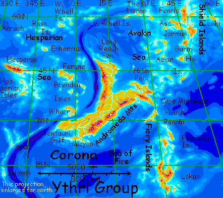
CORONA
by Chris Wayan, 2006
dedicated to Poul Anderson for his remarkable world-building
Lyr (home) - map - creatures - cultures - evolution - climate - geology - gazetteer - nomenclature - definitions - building Lyr - more worlds? Planetocopia!
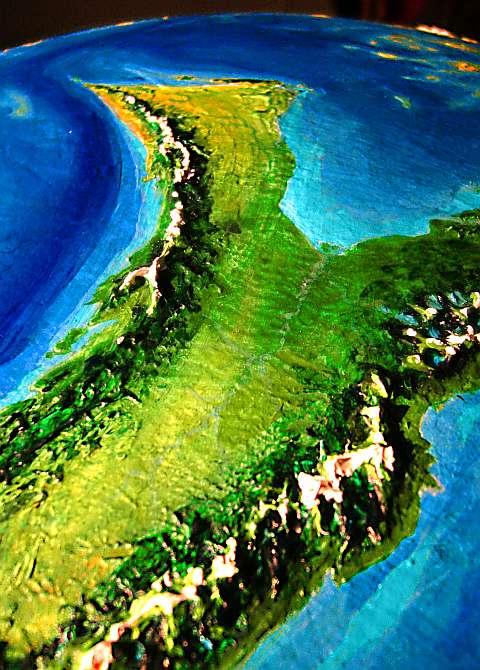
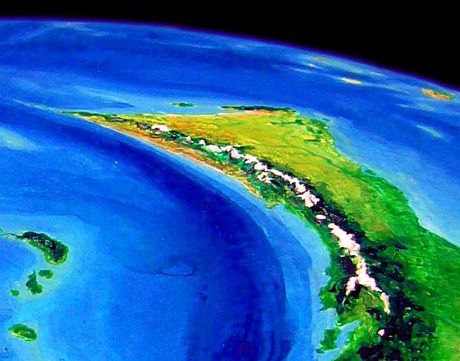
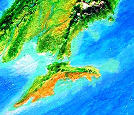
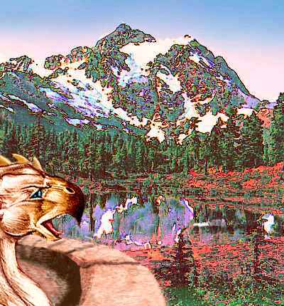
You're flying over a sunny sea toward Corona, the largest continent on Lyr, from the east--from the Shielding Islands. Slowly, two steep isles rise before you--tall volcanic cones called the Holm Twins. And beyond South Holm is a green mountain wall stretching the length of the immense Lyran horizon. Mainland Corona, heart of the Ythri Cluster.
EASTERN CORONA
Before you lies a great sunny forest of broadleaf trees, with boggy meadows along some streams, rising to modest mountains: Holm Peninsula. Really a subcontinent of its own, 1800 km (1100 mi) long, it's nearly cut off from the mainland by Mist Bay (far east of us) and Holm Bay, which we're heading for. To the southeast rises a rugged range. Snowy volcanoes thrust above the jumble like fangs in a mouthful of molars.
Slowly you climb into the mountains, fighting a headwind dropping off the peaks. At last you reach a pass, the wind funneling through the gap, feathery trees bending and sighing like aspens. In these tours, I keep distinguishing between "conifers" and "broadleaf" trees, since Lyran trees do fall in two broad groups analogous to Terran flowering trees and conifers.
But the flowering trees aren't really "broadleaves"; they're consistently feathery. Small leaves, toothy, pinnate, palmate, clustered--the details differ, but they're always divided.
The reason's simple. Even in rainforests, winds on Lyr really pack a punch--air pressure is six times Earth's, remember? In the first real storm, a broadleaved tree would be stripped or torn apart. Here, in a windy pass, you really feel the power of it. And this is just a stiff wind, not a gale--30 mph/50 kph.
On the horizon beyond, water gleams: Holm Bay, a shallow sound 1000 km long and 2-300 km wide (600 by 150-200 mi) nearly cutting off the Holm Peninsula from eastern Corona. The wind's still in your face, but it's an updraft now. Though the headwind slows your ground speed by half, you glide and soar down the far slopes with ease, letting its strength enfold you, lift you. Ride it down to the shore! You spend a full day resting on the beach, swimming in this warm sheltered sea.
The next morning, when you strap your wings back on, you head due west along the shore. The coast starts bending north: but you don't follow. Holm is a long and quite scenic peninsula, but a dead end. Beside, if you came here from the tour of chilly Hesperia and the northern isles, you'll want to head south. I sure do.
So you bank left and veer out to sea, toward a line of hills or islands on the hazy southwest horizon.
Holm Bay is long, but not that wide: in an hour or two, the far shore nears--and it's lush. We've been slipping south into a rainbelt for days; now we're reached the heart. Broad plains of subtropical rainforest, like a plush green nappy rug the size of Carolina.
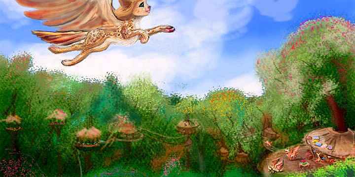
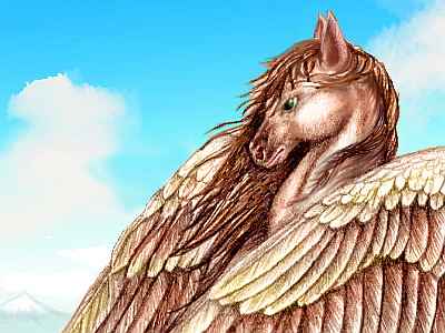
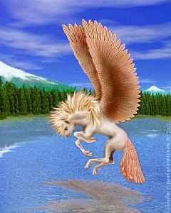
 Sphinxes and griffets share canopy villages near the coast, the little griffet-huts above (looking like rattan beehives), the sphinx dwellings on platforms below, on stouter branches. You spot a few pegasus pioneers, even, of the southern (gracile) variety, looking more like a lean winged greyhound with equine mane and tail than the Greek myth. Inland, beyond the sea breezes, it's too muggy even for these rangy, heat-adapted pegasi. Further in, away from the fisheries, even the sphinxes fade...
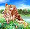
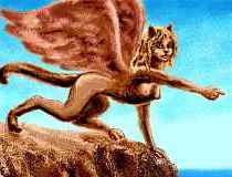
Only griffets now. A monotonous afternoon. Until, in one village, you spot several families of funny-looking sphinxes. Tall, slender, with small torsos and long hind legs, they rear to greet you in an almost bipedal fashion uncharacteristic of sphinxes. Elegant dappled leopard coats, long prehensile tails they use almost like monkeys. You've never seen sphinxes so at home up a tree!
Turns out you still haven't. These aren't sphinxes at all--they're not even related. They evolved twenty thousand miles away! They're lebbirds, a classic case of convergent evolution. Similar conditions in the Polesotechnic Strip led to similar solutions--similar, not identical. More arboreal, more heat-tolerant, lebbirds have slowly been spreading around the equatorial regions.These are pioneers--but they're clearly better suited for this forest than the sphinxes.
The local griffets say the two felines get along far better than pegasi and antel, who see each other as parodies, distorted versions of themselves. Lebbirds and sphinxes find their differences delightful, not disgusting. Good old cat-vanity! In nearby villages, there are already several intermarriages, with complex arrangements of fertility-mates and marriage-mates to assure cubs for everyone...
The lebbirds were a sign of things to come. The species-monotony reverses as you cross the Tarn Delta. Near the water live more sphinxes, many griffets, a few more lebbirds, and even gracile pegasi again.
You can feel the difference in mood, too; all those funny-looking neighbors with different approaches to life lend a flexibility, a playful air to these coastal villages. Big crazy pets everywhere; only they talk. It's hard to sink into tradition here. Whose tradition?
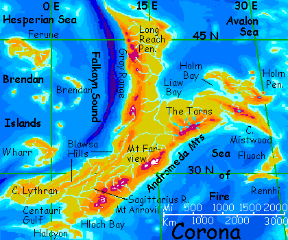
From here to the even bigger delta of the Farview River, we follow the shore of Liaw Bay, ("lee-YOW!") a thousand-mile gulf splitting Corona into a Y shape. The bay is (very) slowly filling in with sediment from the Farview as it tears apart the Andromeda Range and widens Corona's central plain--the great forest we're crossing.
After we rejoin the lazier members of this tour, we'll ride the winds up the spine of the Andromedas, but for now all you need to know is: the Farview isn't just the longest river on Lyr, 3200 km (2000 mi)--it's the muddiest.
 And since its mouth is on this sheltered bay in a relatively shallow sea, the Farview can do what few Lyran rivers can--build up a real delta. It's worthy of the Missisippi and then some--in fact, the delta made Corona the world's largest continent. Once it was almost certainly two monster Sumatras--big, but not continental--split by a shallow sound. But erosion builds as much as it destroys.
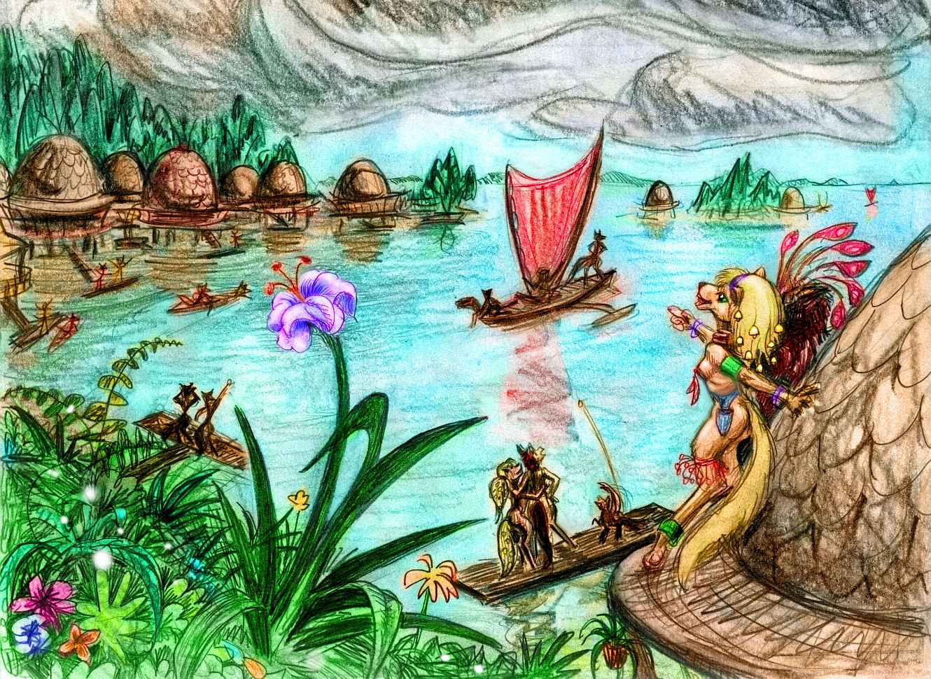
Along the mouths of the Farview, stilt villages look like clusters of derby hats on wood stork-legs, standing in shallow water. The brims are verandas and landing decks. Most have a stair down to a floating dock, for up and down the great river, in the delta, and along Liaw's sheltered shore, people actually build boats. Not for travel, of course, strictly to haul heavy trade goods. They're not large--small catamarans with wishbone sails--but they're the first real boats you've seen since the Isle of Whell, ten thousand miles ago.
Most Lyrans aren't mariners. "Every wing casts a shadow" as their saying goes--the opposite of our cloud with the silver lining. In this case, though, the proverb's literal--the speed and ease and sheer glory of wings have stunted Lyran boatbuilding, roadbuilding, transport in general. What travels? Only people, ideas, and small treasures--spices and seeds, jewels, rare metals, art, light fabric, round Lyran books--nothing too heavy to fly with. Shipping bulk goods like lumber, fiber, paper, nuts, cloth and iron is new here--barely a thousand years old, and regional, not worldwide.
INLAND CORONA
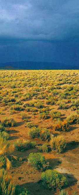
What lies inland? The forest slowly opens a bit, the air grows less humid, at least in spring and fall--like Ohio, summers here get sticky and winters cold for the latitude (though still not freezing). Gradually, as the storms off the sea grow rarer and more anemic, meadows open up into tallgrass savanna, green-veined where lazy tributaries wind across the endless plain. I'm not exaggerating much; even the headwaters of the Farview, a thousand miles inland, are just low hills dividing this basin from the equally huge Sagittarius River plain beyond, gradually greening again as it nears the southwest coast.
This great inland plain is surprisingly empty. Sphinxes fish along the rivers, and the hills have nomadic bands of gracile little heat-tolerant pegasi in winter and spring, eating the fresh grass, and again in fall, to harvest the fruit trees they've planted along the creeks. But the summers are too hot and muggy for them, and they retreat to the foothills of the Gray Range and the Andromedas. During the summer--now--the savanna's largely deserted.
Lyr has at least three species who'd love this hot, open country: cheetaurs, bos and antel. But it's thousands of km outside their ranges, with one exception--the antel who've recently settled the Isle of Halcyon are only days to the south. So far, they've shown little enthusiasm for a land with such chill winters. Pegasi in reverse!
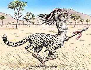
Cheetaurs, with their stout sod houses, wouldn't mind the winters a bit, but the nearest live 6000 km away, and they're diplomats in southern Oronesia, Lyr's cultural capital. What's to motivate a few families of sophisticated linguists and scholars to emigrate to, well, Kansas? Especially when they're a flightless species. It'd be an epic journey, months by boat and then on foot. For what?
The case of bos is just as bad. Bos are native to the southern hemisphere, and they too are flightless. Corona is 15,000 km away (9000 mi); it might as well be the moon.
My suspicion is that Inland Corona has a great cheetaur future, once a few eccentric pioneers discover its potential; but we'd better not stick around waiting for it.
NORTHERN CORONA
So for the next two days, we head up the Long Reach Peninsula, the northern arm of Corona. 3000 km long, it's nearly a continent in itself. This eastern shore is a plain up 500-1000 km wide. Along the coast it seems an endless temperate forest.
But endless it's not. On the third day, we turn inland, following the shallow Tabitha River. As hills rise on the coast to the east, blocking at least some storms, the humid air dries a bit and the Liaw Forest grudgingly opens up, slowly giving way to a great tall-grass prairie, veined with tree-lined tributaries of the Tabitha.
It looks quite a bit like the upper Farview River, but with a crucial climatic difference: we're both further north and not as cut off from the sea. Summers here get hot, but are more bearable than in Corona's continental heart.
As a result, great year-round herds of pegasi--nomadic towns, really--follow the grass in a seasonal circuit. These nomads store most of their gear in boatlike longhouses rather than carry it about. The land's so rich they can afford to keep whole sleeping cities used for only a season...
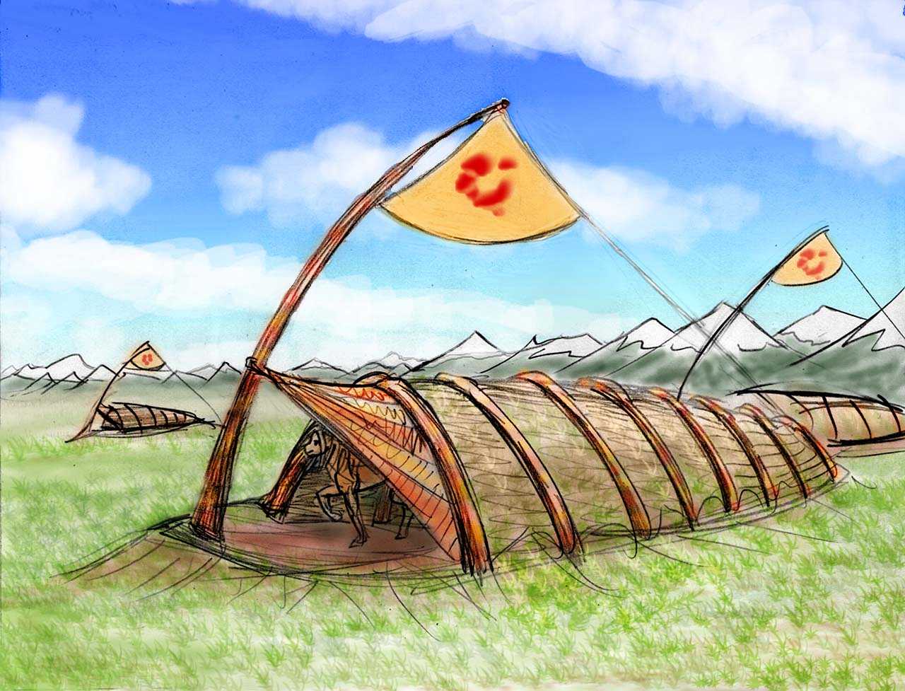
The longhouses of these towns vary: out on the high prairie they may be just cellars of bent saplings, woven "willow" twigs and sod, but nearer the forested mountains they can get quite elaborate--painted and carved. The sketch above shows the large, simple, clean designs typical of the Upper Tabitha Herd. The colors of banners identify clans, but, curiously, not the designs, which can vary a lot by whim. To pegasi, color not shape is primary. The identical banners in the sketch suggest a tight, cohesive family, or a banner-painter in love with this particular splotch, or an in-joke (the design looks suspiciously like a huge pegasus paw-print).
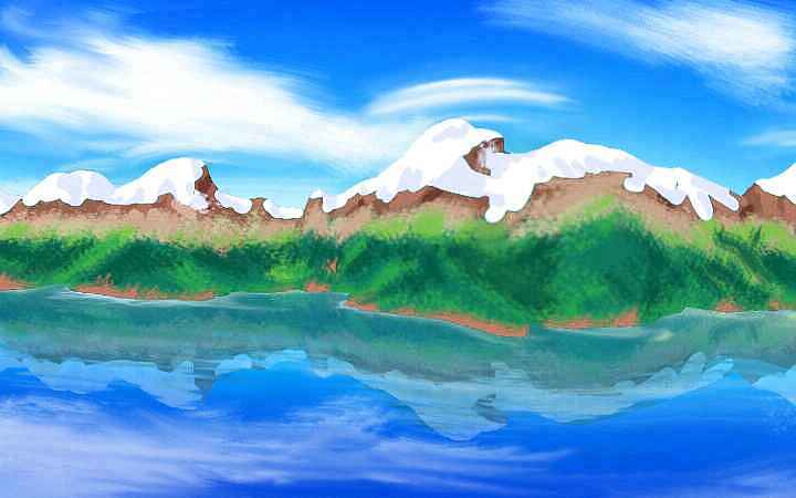
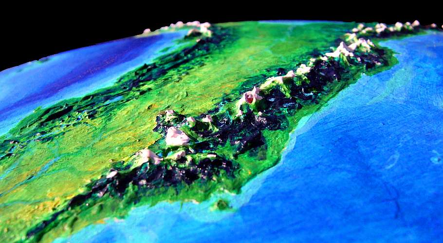
On the western horizon, the Gray Range slowly grows. And grows, and grows! Mt Tabitha, ahead of you, is the highest, 4300 m (14,200'), but the alpine crest stays above treeline for 300 km north and south. It's a tiring climb over Tabitha Pass, with the wind in your face, but bear with me; wait til you see the far side! From ridges 4 km high, the Grays plummet into the western sea.
Geologically, the range is even more impressive. The Falkayn Trench is just offshore, and the Grays really stand up to 20 km tall--66,000 feet. Lyr's full geological vigor is masked by the the sheer depth of its seas... not that the Grays aren't spectacular as they are--reminiscent of New Zealand's Cook Range, or parts of the Andes.
While the Long Reach Peninsula runs another 1500 km north, let's not do the same--you're probably as eager as I am to head south. And sailing down the west coast is a joy--at this latitude, the wind blows steadily from offshore, up the steep western slopes of the Grays. A perpetual updraft you can ride a thousand miles!
Beyond Mt Falkayn, the range drops quickly to a sound and ends; the western, coastal ridge survives as a line of sheltering islands.. Between the ridges, the white-water Falkayn River runs down to the sound. The eastern ridge persists, staying snowy for a hundred km or so, but beyond, the mountains dwindle; as an alpine range, the Grays are done.
Around Falkayn Sound the coast also starts curving west. We're heading toward Cape Lythran (that maritime part of Corona I've covered in the tour of the Hesperian Isles). This coast is gentler than the dramatic north--coastal valleys and the modest Blawsa Hills, long low parallel ridges like the Appalachians, stretching 4000 km (2500 mi). Though perhaps California's coastal ranges are a better analogy: we're back in temperate rainforest here, nearly as tall as redwoods.
Down these valleys run parallel streams, most of them collecting into the Blawsa, the northwest branch of the Sagittarius River. We follow it for two or three days, as it occasionally cuts through long ridges and jumps another few miles inland. At last the long river runs south out of the hills, and winds over a rich sunny Mediterranean plain to its delta on Centauri Bay. Veterans of the Hesperia tour will recognize the spot. We've come full circle--after twenty thousand miles.
Journeys end in travelers meeting! Those of you who looped 25,000 km (16,000 mi) around northern Ythri's islands, capes and seas, and then crossed Corona, here rejoin a group who skipped all that and just basked in the sun, flapping a mere thousand miles along the beaches of warm Centauri Gulf. (Sorry if this sounds confusing; I originally led one grand tour around Ythri, and only later realized its immense size required three tours: Hesperia and the northern isles, then mainland Corona, then Lokon and the Sea of Fire.)

But the lazybones who skipped the hard northern tour didn't have a Club Med time. You see, the local people vacation here too--and they're mostly sphinxes. Lovely to watch--they circle and dive with a splash like giant pelicans and coming up with lunch (fishing is excellent in Centauri Gulf, since the Sagittarius River (2400 km long) feeds megatons of fertile silt into it, while the long island of Halcyon shelters it to the south), climbing the sea-stacks and digging sandholes like oversized, overenthusiastic dogs, lounging on beach-towels with a feline grace, but a self-conscious feline grace... well, in contrast, humans may feel geeky, even ugly.
But not ignored. Sphinxes are curious--and flirtatious. But getting hit on by winged leopards with sharp claws and few inhibitions can be embarrassing--or intimidating. The only thing worse is not being flirted with, because they think you look ridiculous. Like humans (and most hunters) sphinxes are quite visual, but shape and color are secondary to a very feline concern: motion. And you never know who sphinxes will think moves beautifully...
After a month or two of this, our southern vacationers may not be a little tanned (the orange Lyran sun can't muster much ultraviolet, and Lyr's dense air blocks most of that--so a tan takes a month), but they'll certainly be a little burned--their egos, their sexual confidence, their orientation, their personal and species identity... Culture shock is nothing next to species shock!

Tired veterans of the north or insecure beach bunnies, we're all in the next bit together--so let's take wing! We'll follow the coast a couple of days, as it bends south.
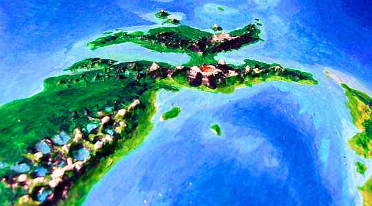
At last a line of hills rises ahead, marching out to sea--a great peninsula? Not quite. A channel opens up, winding east. The hills offshore are the Isle of Halcyon, a low, slender twisting land 1500 km (900 mi) long. It's nearly a twin to Cuba, though drier--rather Mediterranean. Think of it as Crete times ten.
Sphinxes live on the cooler northern coast and hills of Halcyon, but the south-facing slopes are pretty hot and dry. This open savanna is a country fit only for antels, but they've settled only in a few creekside villages. It's a long way here from the Ayan Islands, and only a few eccentric travelers made it this far; these settlements are only a few generations old. They've been expanding slowly, as they learn the soils, weather, herbs and pests. Halcyon's not a grudging land, except for irregular droughts, but antel are naturally cautious.
We follow winding Halcyon Strait all day, for 300 km. It steadily narrows, from 100 km (with Lyr's low curvature, the isle's quite visible on the southern horizon) to under 45 (27 mi), so close the green hills loom, tempting you...
At last the far shore turns away out of sight to the south. It doesn't end--Halcyon stretches another 600 km southeast, sheltering this wide gulf, Hloch Bay. But it's a flyway to nowhere. We follow the mainland shore. For two days we fly lazily due east--endless beaches backed by warm forests opening to little meadows here and there, with aromatic scrub. Southern France? Less obviously cultivated, more heavily wooded, but as the inland hills rise, and the coast grows more dramatic, you start to be reminded of the Riviera.
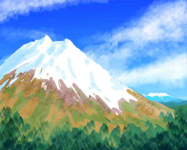
At last the hills grow to mountains, darkening as evergreens take over. Inland looms a distant, high white cone. You turn up the Stormgate River, green and winding the first few miles, but swiftly growing loud and white as the land climbs. Ahead, the peak grows into Fuji's big brother--Mt Stormgate, 4000 m high (13,200'), first peak of the Andromeda Range. Tired out from the long climb and the thin air (oxygen's no problem for humans on Lyr, but your wings have less to grab), we sleep in an alpine meadow on the mountain's shoulder.
In the morning we can see the coast far behind us. On tiny, curved Earth that'd be impossible--it's over 300 km away and three below us (190 mi back and two below). But on Lyr, views are long. The natives could be excused for believing their world is flat! Compared to little marbles like Earth or Mars, it nearly is.
Of course, most Lyran cultures knew from time immemorial Lyr was round--spiral a few miles up and the curvature's obvious enough. The horizon expands and distant peaks change shape as their foothills appear. And as you dive back down, they're swallowed again, from the bottom up.
It's suggestive that only five Lyran species ever did believe in a flat Lyr--and every one is wingless. Of course, none believe it now, not even the witweets in their jungle, who've never seen a horizon. Travelers' tales get around.
We soar round the shoulder of Stormgate and look out over 200 km of dark forested ridges to the northeast, fading into haze. But floating above them's a still larger cone, a broad, muscular mountain, battered-looking Mt Anrovil. The highest peak in the southern Andromedas, Anrovil reaches 4300 m (14,200')--a twin to Mt Shasta, though it looks more like Kilimanjaro.
We zigzag above the ridges between, seeking updrafts to ride. Invisible sky-paths! You're starting to realize mountain flying is as much mental as physical. You can't sniff out updrafts instinctively--it takes observation and planning. Still, it beats yesterday--that grueling climb into the heights, the shock of thin air with limited lift. Now it's a joy to ride these fierce impulsive winds, in a slow sky-dance toward Anrovil.
By noon, you soar up its slopes. Yes, soar--you've learned your mountain-lesson by now: this time, you circle the peak to the upwind side, and let the gale lift you, up past the forest into the meadows, up to bare rock, snow, glaciers...
...and then the world drops away! A caldera five miles wide, cliff-walled, snow-mantled, its floor a hummocky desert of cinder cones. Like Haleakala (House of the Sun) on Maui, faint, dark rainbows tint the desert, flitting as you fly along the rim--refractions in the exposed crystalline lava.
Still, these villages have something special going on. The central Andromedas are a meeting-place, due entirely to their sheer verticality. Climate zones are so close that polar and equatorial species meet constantly, routinely. Cross-cultural fertilization!
On the fourth day, great glacial peaks loom ahead, and above them, thunderstorms: the Weathermothers. This central range of the Andromedas stays over two miles high for a good 700 km (450 mi), with peaks up to 4500 m (14,500').
As the name implies, they're stormy--we're creeping into a rainier zone, if not exactly a Rainier one (the Weathermothers do resemble the Cascades but they're warmer--no glaciers extend below 3000 meters (10,000').
Three days later you reach the shoulder of Mt Farview, highest peak on Corona, and one of the highest in the world--a glacier-capped monster 4800 m high (15,800')--a near-twin to Mont Blanc.
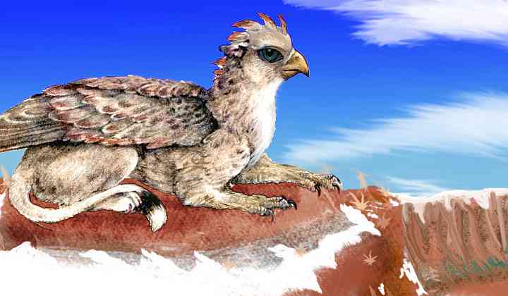
That evening, near treeline, you stop in a small sphinx/pegasus village with a pub. You notice how many gryphons there are. The night, chilly for you, is warm for them, but tolerable--they can mix. Four musicians jam in the corner--two gryphons, a sphinx singer, and a pegasus. The music's extraordinary--scales and rhythms shift in a restless, hotblooded way, clashing with the dark harmonies. Eerie, haunting... voicing hybrid dreams.
As you fly east, the range lowers a bit, but feels just as high, for you're creeping north too. The next region is The Tarns, a lovely lake-country flirting with the treeline--the approximate border between sphinx and gryphon zones.
The surrounding peaks, also called The Tarns, reach as high as 4100 m (13,500'). They're craggier, more broken, less obviously volcanic (though some of the lakes nestle in old calderas). It looks like Scotland, with rusty heaths of low bushes bearing black fruit that gryphons, sphinxes and pegasi all relish.
Over the next few days, the crags slowly soften, the alpine meadows shrink, and the forest takes over. Below the dark evergreen ridges, broadleaf trees appear in bright green creekside veins, spreading as the ridges dwindle to hills, until a sea of feathery green stretches to the hazy horizon.
Welcome to Mistwood! Andromeda's peaks, alps and tarns were above most of the clouds, yet it wasn't dry country. Here in the lowlands, we're getting the full brunt of the storm belt centered on 36 north. A warm-temperate rainforest! Earth's closest equivalents would be the southeast coast of the US or China--except that both those regions have been logged and farmed out of all recognition by an ape that (strange and ungrateful as it sounds) chops down trees.
But the people of Mistwood live in the trees. This is griffet country. They didn't evolve here, but further south on the equatorial isle of Lokon, and migrated here. They weren't the last! You meet lebbirds too, more recent immigrants from further along the equatorial Polesotechnic Strip.
So you stay in a griffet treetop village--thatched tree-huts and little flight decks, each circular, cantilevered out from a central tree-trunk. You're in a guest room designed for visiting lebbirds (the regular rooms are too small, of course). Between your hut and the ones around you, loose suspension bridges sway. The griffets don't need them, of course, and neither do lebbirds--they're strictly a courtesy for big clumsy tourists like you. Not catwalks--apewalks?
Beyond the forest basin rises the Mistwood Range, whose highest peaks reach 3700 m (12,200'). We climb slowly into the highlands, stopping to rest often in the humid heat. The central uplands have a much cooler cloudforest with alpine meadows above. Refreshed by the cool breezes and wide vistas, you head for a jagged little range on the horizon. Smooth lines sweep up to brutal scarps. It looks like Fuji with its head ripped off--and that's exactly right. We swing round the slopes until the wind pushes us up to the crags...
...and an azure gulf opens. Lake Mist blinks below us, a vast eye 40 km wide, ringed by cliffs up to a kilometer high. The caldera was a huge stratovolcano that exploded, leaving only this crater to fill with rainwater. It's still 3 km high--with spectacular views for hundreds of km all round.. The Mistwood Range runs out of sight both northwest and southeast.
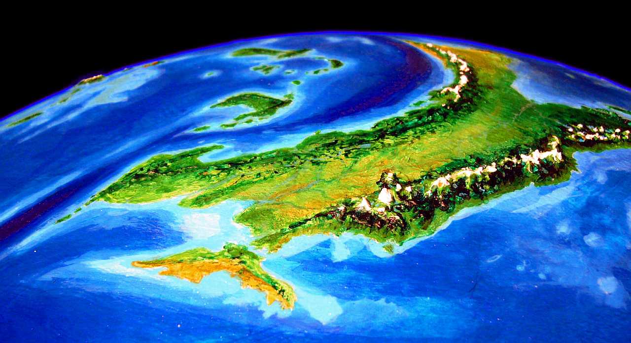
Here above Lake Mist, our path splits--momentously. You can fly south, down Cape Mistwood, the southeastern tip of Corona, then along the Fiery Islands to the Polesotechnic Chain, a strip of tropical not-quite-continents: Kraoka, Larsum, Ikrananka, Ulash, Wersgorix and the Hisagazi Isles... an arc 40,000 km (25,000 mi!) long, leading at last to Troisleons, the other great northern continent. Warm, but as long as Magellan!
Or, you can skim down from the highlands to the north shore, where a wooded isthmus leads to the Holm Peninsula, big as England, and then on north via the Shielding Islands to subarctic Scania, then down again to Troisleons. It's twelve thousand miles shorter--but rough, lonely country. No need for a link, I'll cover that one below--though personally I prefer the warm route.
We're heading north from the east end of Corona, bound for Troisleons via the Shield Islands and Scania. From the peaks of Cape Mistwood you glide down to green Holm Isthmus and up into the hills of Cape Holm. Nearly cut off from the mainland by Mist Bay and Holm Bay, Holm's a subcontinent of its own, 2400 km (1500 mi) long. The west end is low, but here in the east it's rugged. Ahead is a cluster of 3-km peaks (10,000'), smooth on their outer faces, but with jagged cliffs facing inward. It's a stratovolcano that collapsed, catastrophically. Later the caldera filled with water, and now Lake Holm reflects cliffs half a kilometer high.
You'd be stunned if you hadn't been so recently jaded by seeing even bigger caldera catastrophes--Lake Mist to the south, and the somber ruins of Trauvey. Familiarity breeds contempt--among primates. The chittering griffets, purring sphinxes, whistling pegasi (despite their equine look, pegasi whistle like an elk when excited)... they all seem to appreciate Holm. Oh well. That's what you get for being born an easily bored ape. Next time pick better ancestors!
There's a white beacon leading you down to the coast--the snows of a surviving volcano 3 km high (10,000'). You're surprised to find a silver channel between the shore and the peak. You'd like to know its name, but a squall comes up (this is the peninsula's rainy side) and the locals have all taken shelter in their tree villages, invisible in the rain.
Regretfully you slog up through the clouds to sunlight and wheel away from the shining peak, floating over the cloud-sea.
From here, the flyway runs east to Holm's end, and on. Goodbye, continent, Hello islands. You've heard it before on Lyr...
THE AESIR ISLANDS
Or maybe not Hello islands. It's several hours out to sea before you spot any land at all, a green little islet. You rest up in a sphinx/pegasus village. It takes all the next day to reach Odin, though you're never quite out of sight of land--three more islets.
All these including Odin itself are part of the Aesir Chain, a smaller, warmer group before the central Shieldings. Smaller, not small. Odin is 500 km long (320 mi), with forested highlands and river valleys and a western prairie full of grazing pegasi. It doesn't feel Nordic at all.
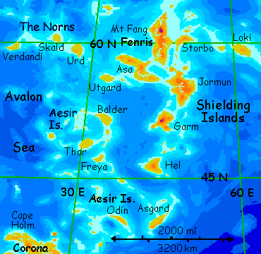
Nor does the next isle, Asgard, a few hours to the east, 560 km long (350 mi)--more fertile land in a mild climate, dominated by pegasi--nomadic grazers to the west, orchardists and farmers to the east.
You rest up on Asgard. It's a long flight due north, some eight hours, to the next climate belt. To the Shieldings. To... well, you're going to Hel.
It's not quite as bad as it sounds. Jean-Paul Sartre, or was it Camus, said "Hell is other people", but after a few hours of crossing Hel's lonely prairies, you start to think meeting anyone sounds good. Hel is just 500 km of low, endlessly repetitious short-grass hills and flats--Oklahoma in perpetual autumn. A cold dry wind blows steadily, though there are still some trees huddling in the river valleys and on the lee side of steeper hills.
 Hel's just on the edge of the high pressure zone that dries most of the Shieldings--it's the warmest and lushest of the lot. A very big lot--the Shieldings are as big as Scandinavia, some 1,650,000 sq km (650,000 sq mi).
Aside from a few other travelers, all the people hiding in Hel's arroyos are pegasi and gryphons. It's cold enough for them to be comfortable.
ON LYRAN ECONOMICS
Crossing Hel all morning, you rest at noon on the north coast, then cross to an islet a few hours out to sea. Near sunset you reach a second, even smaller islet, and sleep in a gryphon-run lodge. The isle's so small and sandy, its water and grazing land can't support the herds of a full-sized gryphon village; so they rely on income from travelers. It's the nearest thing to a human hotel you've seen, instead of the informal hospitality universal on Lyr. But in this dry climate zone, with so many inter-clusteral travelers, the isle's ecosystem just can't support normal hospitality unaided. You contribute jewels to the supply fund, to pay for the extra food boated in from Garm every month or so.
I haven't spoken much of Lyran economics because, well, it doesn't exist. Lyrans lack the concept. They're so biologically oriented, they'd see our money economies as sloppy, primitive ecological models, models oblivious to the land's carrying capacity, projects' social utility, people's feelings about them... and all other social and physical consequences! Their non-economic economy isn't ideological or idealistic, just a natural consequence of a multi-species society. Only a monoculture like ours would invent a measuring system trying to reduce the complexity of the world to a single scale, ignoring all other considerations--and species! Money mimics our loneliness.
The concept of money, or measurable value at least, does exist on Lyr, but it's more a tool to monitor trade flows than a thing to collect. Projects happen not from a collection of capital but a gathering of, well, credibility, of social momentum.
Doesn't competition exist? Absolutely! Individual Lyrans compete all the time over social status, desirable mates, honor, fame, politics, and tangible wealth--good food, the resources to throw great parties, a fancy clanhouse full of impressive art. But trying to amass money itself? To a Lyran that's like trying to hoard sleep, or popularity, or inches.
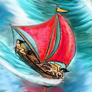
At dawn, you set out north toward the big isle. A red dot grows on the horizon--a red-sailed supply boat heading south, crewed by a couple of sphinxes, the first you've seen in a while (gryphons just aren't mariners, though they'll occasionally hire on as scouts. They're just too impatient to creep along at a few knots, cargo or no cargo).
THE GREATER SHIELDINGS
After three hours of steady flight through a cloudless, endless sky, as it usually is all summer in this dry zone--Garm rises from the sea.
One of the largest of the Shieldings, Garm's as big as Utah, and nearly as dry, with cool, windy steppes on its eastern slopes, sparse forests and alpine meadows around Mount Garm (3000 m/10,000') and true desert on the west coast--rarely hot and never freezing, but quite dry.
 The Garm Desert's caused by a high-pressure zone of cool, dry, descending air--a bit like Earth's polar desert, but far milder.
In these cool, dry, broad lands, the northern subspecies of pegasus comes into its own. Gryphons hug the coasts and rivers and the eastern woods; but pegasi, needing little water, can still graze the prairies and deserts in winter as well as alpine meadows in summer. Large nomadic herds travel loops over the year, following the sparse rains, careful not to overburden the land. Like the Long Reach Peninsula of northern Corona, the plains and canyons are dotted with part-time cities--lodges and cliffdwellings used only a month or two a year by the main herd. There are a few year-round caretakers, solitary sorts, though they're quite willing to host you for the night--they certainly have room.
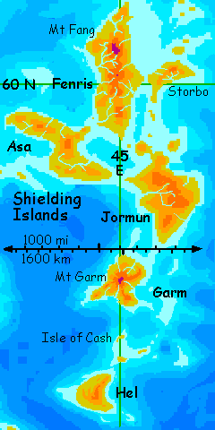
You fly on north, reaching the shore mid-morning. Before noon, you set out northeast over the sea; four hours later you make landfall at dusk, on Jormun.
Second largest of the Shieldings, Jormun's much like Montana--the same size, with similar sweeps of cool, dry grassy hills and plains, though its mountains are lower (2400 m/8000'), and in the east not the west. Most importantly, Jormun winters aren't nearly as harsh as Montana's--sparse chilly rains, some hail, but no lasting snow except on the heights. The west coast, in the rainshadow of the mountains, is a desert with red rock canyons winding from the highlands. Life here huddles along the shallow, chattering, stony rivers. Again, a few gryphon families ranch the greener eastern slopes of the mountains, but most of the vast land is pegasus country, sparsely settled.
Flying up the west coast, the desert canyons are striking--red cliffs opening on the sea. Past the wide Jormun Valley you have a decision to make--due north to Fenris, heart of the Shieldings, around the east side of the little Shielding Sea, or west to Asa, then north to Fenris. Our route's long and hard enough--let's skip Asa.

A rough Z shape 1000 km long (600 mi), Asa's yet another broad, cool, windy prairie the size of Wyoming, broken by isolated ranges up to 2200 m (7300') that catch most of the precipitation. The only trees line streams. You're getting tired of lonely country like this; let's go straight to Fenris. It's only an hour west over a strait broken by a mid-way island, called, like a hundred others on this island-infested planet, Midway. After the really difficult sea-passages you've faced, it's nothing; you don't even pause for lunch.
Largest and northernmost of the Shieldings, Fenris is 1300 km long (800+ mi). The south is familiar prairie, with trees only in river valleys. But as you fly patiently north, mountains rise, their slopes dark with pseudopines. As the forest spreads down to the coast, its top frays: crags and meadows start breaking through the summit ridges. They rise steadily until snowdusted peaks two miles high march along to the west. Ahead, Mt Fang gleams white, mantled in glaciers from its summit at 3400 m (11,300') down to 2500 m or so.
Beyond, in the far north, is another climate zone, one Earth lacks, a near-polar wet zone called the sleetwood belt. Let's not go there. Please. Even the local gryphons (whose ranch-holdings dot all southeastern Fenris) find the north end's weather foul--cold, damp, treacherous for fliers. When it's not storming, it's fog or a white-out. The land's just as treacherous--rotten logs, moss and bogs. Plant heaven, animal hell.
Luckily, the flyway to Troisleons leads east here, not north. The edge of the arctic will do. You cross the narrow strait to Storbo, just 30 km/20 mi east of Fenris. Much lower than Fenris, its hills don't capture as much rain; it's another low, windswept, treeless prairie 450 km across (280 mi). Half a day and more, you fly east over endless grass. An empty-seeming world, though you spot a few pegasus lodges. No banners, so their owners are elsewhere, following the rains to the coast.
You sleep in an echoing shell above the shore, and in the morning fly on over the cold north sea, an hour or two at a time, hopping from islet to islet. Fresh water is scarce, but empty lodges have wells.
On and on! It's two more days to real land--Loki, one more cool, windy prairie 400 km (250 mi) wide. Last of the Shieldings--"and good riddance!" you think. I did warn you that this route to Troisleons, though it's only half as long as the alternate--the immense Polesotechnic Arc--is still tedious, cold, bleak and seemingly endless.
But it does end; the worst is over. As you set out from Loki's last eastern satellite, the gray sea under you isn't the Avalon Sea any more, but the narrowest point of the Ys Ocean, the size of the Pacific.
You've left Ythri at last! You're entering a new region: Scania, in northern Troisleons.

TOUR LYR! Climb volcanoes, swim seas, meet weird creatures. First: survival tips! Then, pick a region:
Ythri -- Polesotechnic Chain -- Troisleons -- Roland -- Oronesia -- Gaiila -- Flandry -- Diomedes -- Ak'hai'i -- Averorn
World Dream Bank homepage - Art gallery - New stuff - Introductory sampler, best dreams, best art - On dreamwork - Books
Indexes: Subject - Author - Date - Names - Places - Art media/styles
Titles: A - B - C - D - E - F - G - H - IJ - KL - M - NO - PQ - R - Sa-Sk - Sl-Sz - T - UV - WXYZ
Email: wdreamb@yahoo.com - Catalog of art, books, CDs - Behind the Curtain: FAQs, bio, site map - Kindred sites