Lokon and the Fiery Islands
by Chris Wayan, 2006
dedicated to Poul Anderson for his remarkable world-building
Lyr (home) - map - creatures - cultures - evolution - climate - geology - gazetteer - nomenclature - definitions - building Lyr - more worlds? Planetocopia!
INTRODUCTION
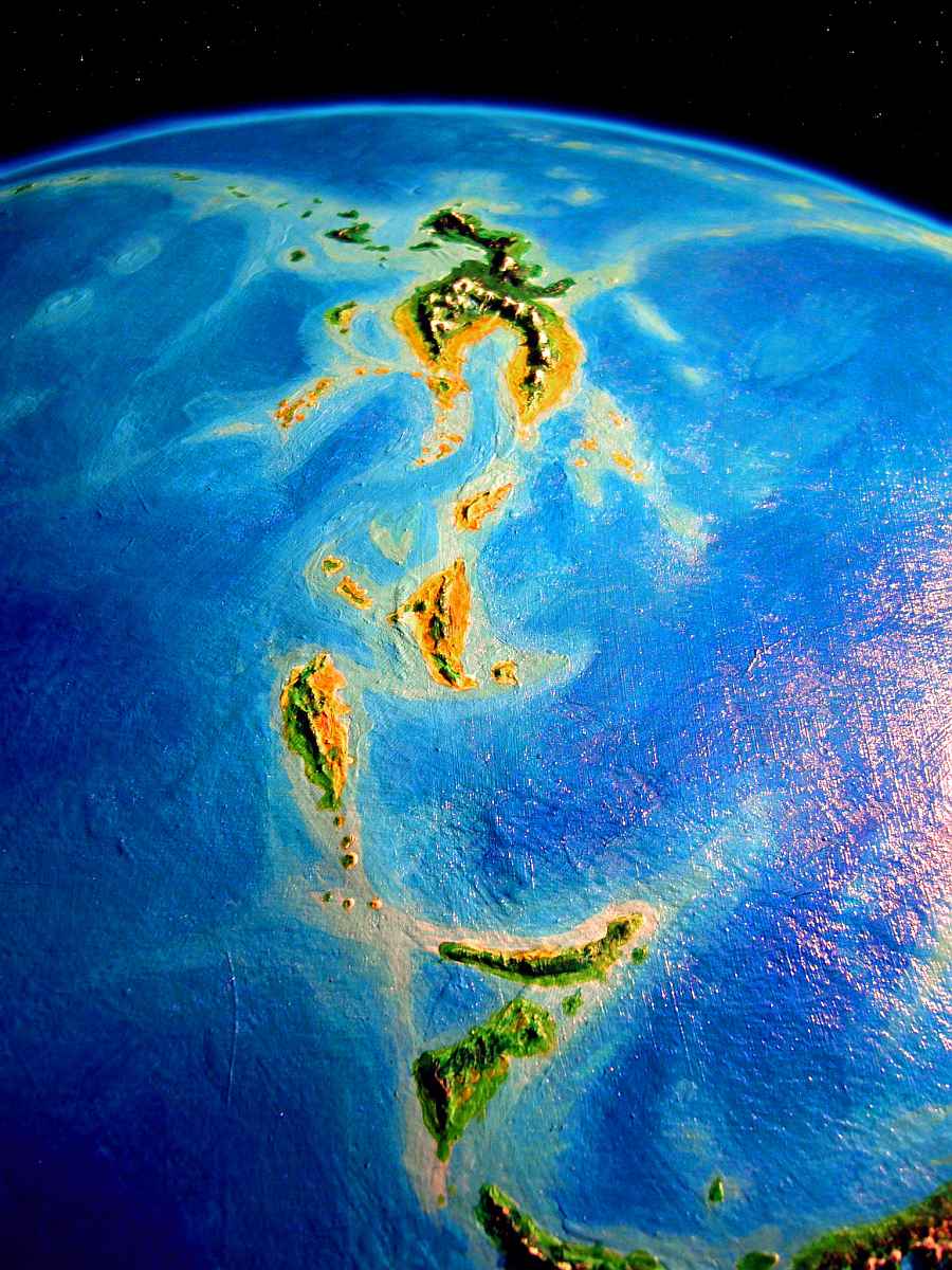
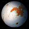
We'll start on Cape Mistwood, the eastern tip of Corona, and head south into the Sea of Fire. In the orbital photo to the left, you're looking south: in the foreground is Cape Mistwood, then Fluoch, Rennhi, North and South Ferranian, and near the equator, the largest, Lokon.
After two days of soaring over the spine of Cape Mistwood, you're tired of even lush cloudforest. It's always damp (if never truly cold). You descend with some relief to the honest if constant alternation of rain and sun in the lowland forests, and camp under fruit trees at the edge of a beach (dry sand! genuine dry sand!) at the peninsula's very tip, watching the waves roll in from the Sea of Fire.
An equatorial sea 50% larger than the Pacific, the Sea of Fire stretches 10,000 km to the south. It's tropical but not as scorching as the name suggests--Lyr's poles are much warmer than Earth's, but its equator is mild. Dense air distributes heat more evenly! And it has other benefits--which you're about to indulge in. At sunrise, you strap on your wings, grab that lovely dense air (after the last tour, struggling through Corona's rugged highlands, flying down here seems so easy!) and head south over the deepening sea toward the Fiery Islands.
FLUOCH AND RENNHI
It's a few hours to Fluoch, 300 km (180 mi) offshore. Not a pretty name--the flu you catch from falling in a loch? But it's lovely land. Low hills and gentle valleys--not as lush as Mistwood, but sunny and open subtropical forest, friendlier-looking to human, savanna-bred you. And as a tourist in rented wings, your new flier's eye approves too: easier to find meadows to land in, when you tire!
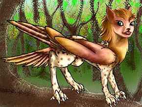
Fluoch is dotted with treetop and ground villages of lebbirds, those arboreal parallels to sphinxes. Halfway down Fluoch, you sleep as a guest in one of their treetop houses, hoping to get a sense of their difference. The short, leopard-spotted fur and rangy limbs gives them a tropical air. Not misleading--their homeland, Wersgorix, is right on the equator, and they like warmer climates than sphinxes. Lebbirds think this Mediterranean island gets bracingly cold in winter.
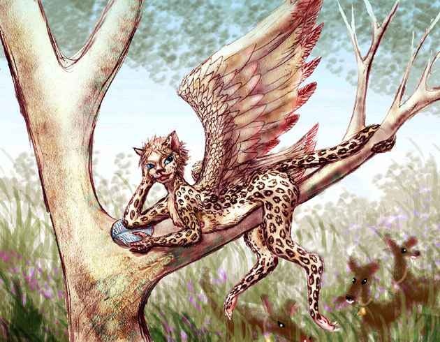
But it's the similarities that strike you. Catlike ancestors may explain their sensuality, vanity and delight in beauty, but what explains the serenity, the sunny temperament sphinxes and lebbirds share? Terran cats vary a lot in sociability, but many are pretty solitary, and some have real tempers. Is it flight that makes these people so optimistic? (Or, to be fair, is it having to slog over endless savannas at a risk of getting eaten by lions that made humans so grumpy?)
Herding milk-monkeys is a big industry here. They look more like chocolate-colored goats to you, if goats had stubby wings and long, tubular snouts and perpetually puzzled eyes (unlike goats, whose eyes have seen everything), but still... goats. Yet "milk-monkey" is how the name translates. You eat the cheese, which isn't bad, but decide not to ask exactly how they milk the monkeys. As long as it's not you...
In the morning, you fly on south. And on. And on! Fluoch 's a big land, some 800 km long. Around sunset, you reach a narrow strait of golden fire. The one time of day this sea lives up to its name! Over the channel to Rennhi, and sleep on a bluff.
Rennhi's a narrow island 900 km long, though you won't have to fly all that; your landfall's in the middle. Looking inland, long east-west ridges block your path. Rennhi's woods are more open, with dry grass and brush showing between and beneath. Mediterranean, and getting hotter and drier with every mile south! You ride the wind up to the ridgebacks, and follow the island's spine east all day. Rocky canyons between ridges, the first bare ground you've seen in weeks.
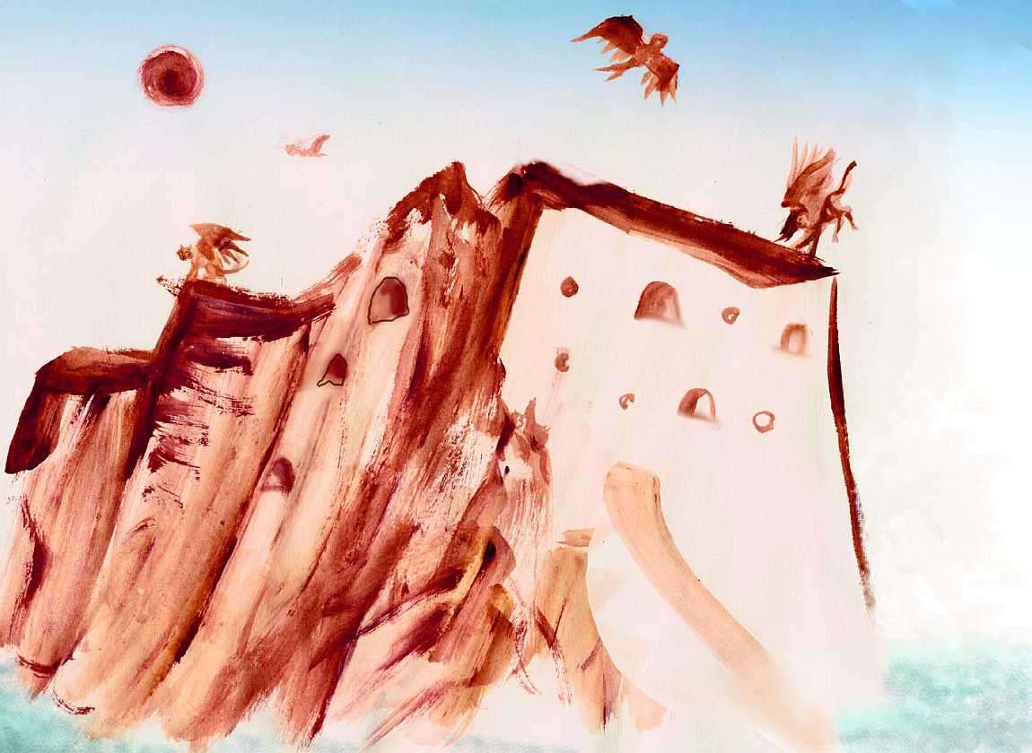
In one canyon wall with a steady updraft, a string of round holes--windows and doors dropping into air--mark a nest of floxes, pioneers from the Polesotechnic Strip! This is the frontier of their expanding range. The gardens below look raw and new. You're curious, tempted to invoke hospitality customs, but it looks like they're struggling--you don't want to be a burden. So you ride the standing wave on south. Slowly the land narrows, and near sunset you camp on a sandy point--Rennhi's end.
For two days you hop between islets, following a turquoise path of reefs and shallows in the great ocean, curving south to...
THE FERRANIANS
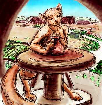
Another set of twins! Rougher ones than Fluoch and Rennhi, though. North Ferranian's a narrow, mountainous land 700 km (450 mi) long, with oak groves and lowland meadows and rocky, pine-studded plands with rugged canyons. Here floxes are well established--raising beans (well, large high-protein seeds) and chiles (well, a hot red fruit--come on, the oaks aren't oaks and the pines aren't pines either) down on the canyon floors.
Up on the walls, near their own caves, they tend chattering cities of domestic cliff-swallows for their tasty eggs. Now you do invoke hospitality, to find the rumors are true: it's all those bugs that give that special flavor.
Looking around at the sunset meal, eating your cliff omelet, you think of New Mexico--cliff dwellings, canyons, even the cuisine tastes similar. If winged wolves weren't dishing it out...
... into those clay bowls, that look so much like Pueblo pottery... No, wait, don't think everything's parallel! The designs are flowing spirals, not geometric, and they were made on a potter's wheel, and are as close to perfectly round as the potter could get. Floxes love things round--their windows, their cave-mouths, their paintings, their beds...
Oh, so you're skeptical that such a preference could be hardwired into a species? Look around you, human, and deny it! I'm sorry, but... you're square.
South Ferranian, a wedge 600 km across, is drier still, except the central mountains which top 2500 m (8300'). The west side of both Ferranians is dry golden veldt, quite treeless, broken only by great lichen-crusted crags--geology's fists punching up through the web of life. It's the closest to a desert you've seen on Lyr. Antel could live here, it's their sort of place. Perhaps they will someday--but right now, it's ten thousand miles from their nearest colony, through wet lands they aren't adapted for. Lyr's sheer size keeps it from being a melting pot! In this case, it's a shame; while a few flox colonies have settled in crags and tried herding small grass-eaters (looking like dinosaurian kangaroos), there really isn't enough water for them to flourish. The land feels empty--and lonely.
Three hours off South Ferranian is Rogar, a genuine desert isle. Rogar's in the heart of the drybelt at 18 degrees north, and unlike the rugged Ferranians, its modest central mountains lack the height to squeeze rain from the few clouds. The east coast is dry veldt, and the west's a true desert, just bare red rock, though only a twenty-mile strip--Rogar may be 270 km long, but it's less than 70 wide.
Near the south end, you spot a great red sea-stack with holes in it--it's a fishing colony of sphinxes. You spiral in to land clumsily on a stone terrace, and ask if you can stay the night.

They practically mob you with delight, rubbing against you, purring. So happy to meet anyone new! They tell you sadly "A couple of lebbird families used to live with us, they married in. But when their cubs grew, they got restless--they just missed trees too much, and moved north." You would too. Life here looks hard. Water from the cisterns is rationed. You're glad just to sleep, have a little sushi, and be on your way south.
Not the way you planned, though. The villagers in Seastack warn you "The Donli Islands are closest, but even drier than here. The summer drought is bad there, this year. Head for Cape Fiell, due south. Water in the mountains year-round."
It's still difficult--300 km to a long bare islet, just a razorback ridge of fluted stone like a monster's dorsal fin. You perch on a ledge, drink the last of your water and sleep.
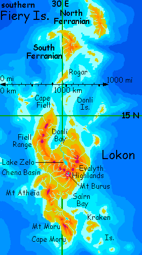
LOKON
At dawn you ride the wind down the isle, then beat over the last channel ("water, water everywhere, and not a drop to drink") to the tawny mainland of Cape Fiell: pale beaches, low cliffs, a plain of rippling gold, then low hills mounting steadily, dotted with lone oaks, then groves, then pines along streambeds, and at last, a trickle of water in a shady canyon. You've made it alive to Lokon, the nearest thing to a continent in the Sea of Fire. Don't assume it's all like this! Cape Fiell is just one finger; Lokon is huge and diverse, a full million sq km (400,000 sq mi, nearly two Madagascars).
Slowly, over the next two days, you climb into Fiell's highlands, reluctant to return to that dry coast below, along Donli Bay. Though in truth, the views you get from these pine ridges reveal fields and groves, steadily greener as you slip out of the dry zone. Up here the hills rise to true mountains--forests open to alpine meadows, and a few peaks reach 3000 m (10,000'). Alpine flowers splash color amid lichen-painted rocks. Though snow-free now (it's a dry summer) these peaks clearly acquire a snowpack in orbital winter. Remember, Lyr has mild global seasons even here, near the equator, due to its eccentric orbit.
Below, the coast of Donli Bay recedes and the land grows wide and green. Past the dry zone now! The mountains curve east and you follow as they widen into the Evalyth Highlands, a mild, fertile triangle 600 km across (400 mi). What's Earth's closest parallel? Not New Guinea--its mild highlands float above a sea of rainclouds, and Lokon's got the reverse pattern--Evalyth is wetter than the lowlands, not drier. More like Ethiopia, or northern Mexico.
A gleam on the horizon to your left. Not the sea--not up here! That's Lake Zelo, largest on Lokon. Zelo is a lens shape 150 km (90 mi) long. Near its outflow is Zelo Island, a lurid green whaleback no bigger than Manhattan; this mere speck is the second largest freshwater island on all Lyr, a world of few lakes and short rivers. Lake Zelo's 1000 meters up, in a Mediterranean transition zone from the "oak" groves downstream to the cooler "pine" forests of Evalyth. A lovely climate for flying!
Ahead float white teeth--a volcanic complex called Mt Burus. The centerpiece is a wide lake-filled caldera whose cliffs, mere slopes of a huge collapsed cone, still rise to 4100 m (13,500'); lesser cones form a wide V, the backbone of the Highlands. You sleep on the near slope of Burus, by the source of the Zelo River--here just a pleasant little mountain stream in a pine canyon. Lava dikes create strange ribs and islets in the river, all honeycombs of hexagonal basalt columns, black and sun-warmed, holding their heat most of the night. Feels like the ruined palace of a civilization of bees. Bees who liked black. Goth bees.
In the morning you ride updrafts around the shoulder of Burus. Ahead the Highlands fall away to the Chena Basin. There, the New Guinea analogy does apply--most of the year. We're only 11 degrees north now, so these lowlands are wetter monsoon forest--it's dry now, just big puffy clouds marching by, but later in the year the rains are torrential.
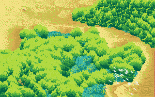
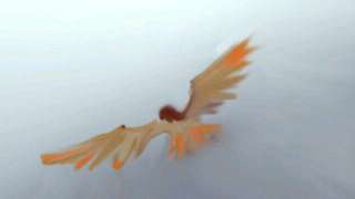
From here to Cape Moru is the griffet heartland--the jungle where they evolved. Treetop villages are every few miles. Your progress is slowed by all the hospitality. It's hard to say no to impromptu songfests, when griffets are so enthusiastic--though their small bodies push the rhythms to a feverish speed, and their squeaky voices make griffet singers sound like the Chipmunks on too much coffee.
But what performers! From saintly to wry and world-weary, from bouncing to sultry--and you really do find griffet singers sexy, while they're singing. Their flamboyant courting gestures should be meaningless or absurd to you, but these master performers not only convey their passion but infect you with it, over the gulfs of language, species, size, instinct. You long for these chipmunks... til the music's over.
And so you're slowed... but not stopped. Every time you leave a village songfest and wheel up above the canopy, a white tent looms bigger on the southwest horizon: Mount Atheia, a shield volcano 3400 m high (11,300'), forming a cool cloud-forest island above the hot Chena Basin.
By the next day you're skirting Atheia's eastern slopes, until silver gleams ahead: Sairn Bay. 250 km (150 mi) wide, Sairn divides central Lokon from densely rainforested Cape Moru. Sairn's north shore is still monsoon forest, but to the south it rains all year. There are still seasons, of course--this is Lyr. Warm rainy winters, hot rainy summers. With rain in between.

We follow the Griffet River inland--it's something to dive in when the slow climb into the hills gets you too hot. At last the ridges close in, the river narrows and loudens. A winding canyon, feathery green. And then suddenly it opens to a broad valley cupping Lake Griffet, 45 km long. To the west rise real mountains, the Moru Range, rising to 3200 m (11,700'). They form a wedge of cooler cloudforest above the jungle--though all you can see from here are gleams of snow through a the mist-streamers and cloud-wrack. It's rare to see even a glimpse from here.
THE KRAKENS
To the northeast, over a turquoise channel of coral reefs, lies Sairn Island, gateway to the Krakens. But it's a bit out of our way, and you'll soon need the practice in long sea-flights, so we'll take a more direct route, east and a bit south, to Kraken itself.
You swoop down from the hills to the shore and sleep early on the edge of the beach. Two hours before dawn, lit by lurid Oisinlight (four times as bright as our full moon) you set out over the sea for Kraken.
You had to start early! You make landfall just after sunrise--and the glare's right in your eyes, doubled by its reflection in the sea. It's a relief to reach the forest's shade. Flying east over a tropical sea's a headache at dawn! An hour or two of rest, and you're ready to wander down Kraken, a wedge of jungle hills 190 km across (120 mi). From here we'll fly southeast along the lesser Krakens. The chain trails off to mere coral specks, but these low atolls matter--they're the only flyway between the Ythrian and Polesotechnic cluster.
We're near the equator now--even modest coral islets are wall-to-wall jungle, offering rest, food and fresh water for fliers. This may be the Sea of Fire, but the heat's quite bearable--great cumulus clouds dot the sea, their shadows darkening the turquoise and indigo water to slate. When you get hot, you zigzag a while between clouds--or straight through them, flying in a cool white void.
When you cross the equator, you cross another line. You've left Ythri at last--after wandering 75,000 km on various flyways, through a region half the size of Earth!
Your final flight's an all-nighter--nine hours, from noon to the next dawn, when a low but unmistakably volcanic islet's silhouette rises ahead. It's the threshold of the Polesotechnic Strip, an equally vast but all-tropical island realm. First stop: the Kraoka Archipelago, and the lebbird pioneers...

TOUR LYR! Climb volcanoes, swim seas, meet weird creatures. First: survival tips! Then, pick a region:
Ythri -- Polesotechnic Chain -- Troisleons -- Roland -- Oronesia -- Gaiila -- Flandry -- Diomedes -- Ak'hai'i -- Averorn
World Dream Bank homepage - Art gallery - New stuff - Introductory sampler, best dreams, best art - On dreamwork - Books
Indexes: Subject - Author - Date - Names - Places - Art media/styles
Titles: A - B - C - D - E - F - G - H - IJ - KL - M - NO - PQ - R - Sa-Sk - Sl-Sz - T - UV - WXYZ
Email: wdreamb@yahoo.com - Catalog of art, books, CDs - Behind the Curtain: FAQs, bio, site map - Kindred sites