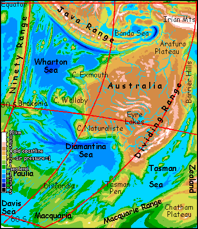
The drier Eyre and Darling Basins are prairies--hot in summer, cold in winter; the Darling gets dusted with snow, though the Eyre Lakes keep that region from freezing. The Barrier Range is snowy now; glaciers mantle Mt Kosciusko and the Tasman Range.
Even the low, sinuous Macdonnell Ranges around Alice are white in winter; their snowmelt guarantees year-round water in the Eyre prairies and lakes, intermittent-to-dry in our time.
The cold winters haven't killed off the old Australian fauna and flora, though; it's merely migrated to the capes and slopes of the old continental platform. Halfway up, 2 km above the sweltering Wharton Sea and 2 km below the cool plateaus, the coastal slopes and capes like Exmouth, Wallaby, Naturaliste and Tasman form a strip of mild climate suitable for roos, platypi, gums, etc. It's rainier than much of old Australia and with richer soils, but life ain't complaining--in fact the biomass along this strip rivals all that of our Australia.
Arafura
Nor is the whole plateau cold. The former Gulf of Carpentaria is a huge, gentle, tropical plateau much like the Papuan highlands were on old Earth. The Papuans, not being stupid, migrated here when their own land grew cold and thin-aired. Their old home is now about the largest tropical icefield after the Andes, but their new home, called Arafura, is just as fertile--and much, much bigger. The climate is springlike year-round.
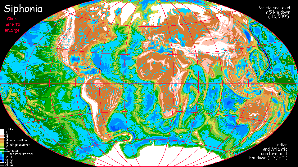
Arafura's a world population center, one of the few in Siphonia's highlands--not quite a former continent, but about as close as it gets. No, wait, that's not true: see the Amazon Highlands, solid land before the Big Slurp; it now sustains a much denser population, despite its thinner air and lower temperatures, than when it was a rainforest...
TOUR SIPHONIA! Click a region above, or choose from:
|
|
Siphonia's homepage - map - peoples of Siphonia - Siphonia's evolution - Gazetteer
LISTS AND LINKS: More worlds? Planetocopia! - dreams of other worlds - ecology - climate change - evolution - natural disasters - terraforming - sculptures and 3D art -
World Dream Bank homepage - Art gallery - New stuff - Introductory sampler, best dreams, best art - On dreamwork - Books
Indexes: Subject - Author - Date - Names - Places - Art media/styles
Titles: A - B - C - D - E - F - G - H - IJ - KL - M - NO - PQ - R - Sa-Sk - Sl-Sz - T - UV - WXYZ
Email: wdreamb@yahoo.com - Catalog of art, books, CDs - Behind the Curtain: FAQs, bio, site map - Kindred sites