THARN
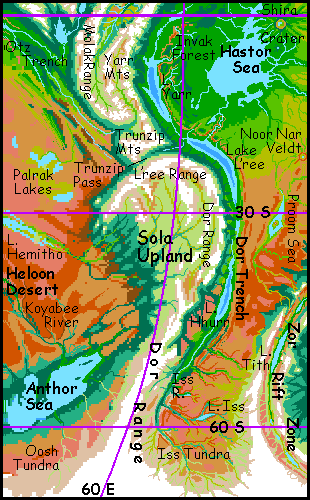
Sola Upland
by Chris Wayan, 2005-6
Map, Tharn's homepage, Peoples of Tharn, Regional tours, Geology and Evolution, gazetteer, terms explained. More worlds? Planetocopia!
INTRODUCTION
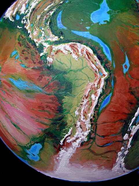
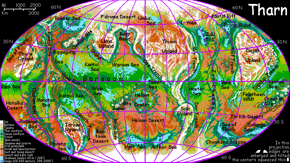
Sola is a southern highland over half the size of Australia and 4-5 km up (13-16,000'). Sola's linked by an "isthmus" of mountains to the (still larger) Thuvia Upland to the north. On the east, Sola has a typical, rather Andean "continental shelf"--the Dor Range rises to 8 km high (27,000'), then plummets 10-15 km (33-50,000') into Dor Trench.
But to the west, Sola's altiplano simply angles down slowly for 2300 km (1400 mi) through subalpine groves and meadows, evergreen forest, open mixed woods, then chaparral and grassland, fading at last into the Heloon Desert. This is unique on Tharn (or Earth): a "continental shelf" that ramps smoothly down all the way to the sea floor (or equivalent): no escarpment at all. Yet the Sola Plate is being squeezed from both sides by active spreading zones. To the north, both spreading plates slide under Thuvia Upland, a set-up rare on Earth but common on Tharn. But only one plate slips under Sola, pushing up the Dor Range, much like the Andes though on the wrong side. Now if Tharn had oceans, silt eroded from the tilted plate would build up a broad sea-level plain on the western shore of Sola; offshore, the land would drop off quickly. But without seas, the tilted continental foundation stays exposed; the alpine meadows steadily sink into forest, then scrub, savanna and desert. Earth does have sloping plains (such as the American prairie states), but Sola on a different scale, both horizontally and vertically.
These (very) High Plains are drained by the five branches of the Sola River: (clockwise from northwest) the Hemitho, the West and East L'ree, the Sola, and the Dor. The North and South Anthor drain the southern third of the upland; the Iss, the far southeast.
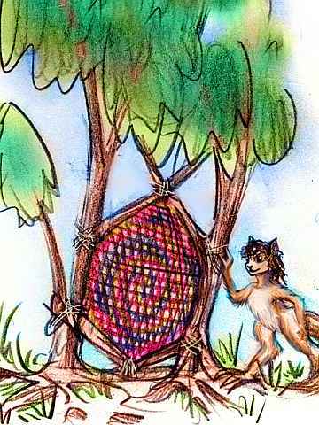
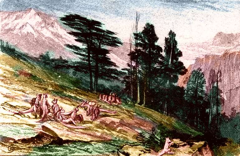
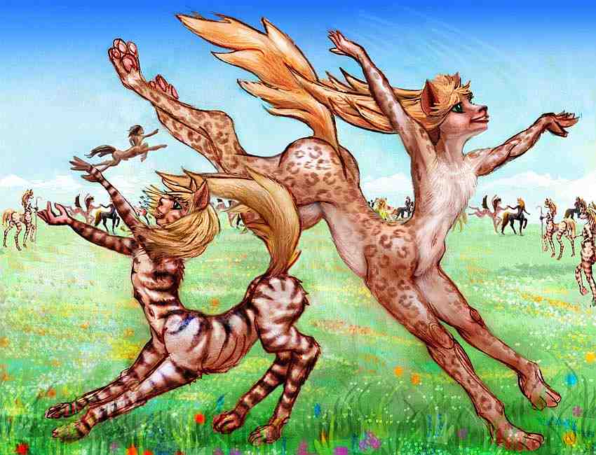
The northern alps (uncapitalized, this means high-altitude meadows, not a European mountain range) are camaroo country, almost exclusively.
Most unispecific cultures are less advanced than multispecific ones, but not northern Sola. These camaroos are cosmopolitan and prosperous, for they profit from the caravan trade over Trunzip Pass, and Solan camaroos dominate caravan routes over much of this hemisphere. They don't just profit materially; even families and villages devoted to stay-at-home herding and weaving hear from their neighbors about innovations in the trenches and basins.
Call it the trickle-up theory of economics.
Not only do the camaroo herders and weavers of Sola benefit from east-west travelers, but (surprisingly, perhaps, for Terran readers) from north-south travelers too. Sola is about the only link between the northern and southern populations of mamook; for these huge people preferring near-Martian climate, it's a cool snowy bridge across that sweltering, deadly equator.
The whole southern half of Sola Upland, plus many higher alpine valleys in the north, and all the mountain slopes, are mamook country. And from southern Sola, mamooks fanned out across the far lower, but cold (hence bearable) steppes all around the south polar cap, eventually reaching Tarkas Upland as well. Three-fourths of Tharn's mamooks still live in the north, but trade and travel is extensive, and nine-tenths of it comes through Sola.
TO THE WEST
The only "oceans" at the foot of this great western waterslide are Lake Hemitho, the Palrak Lakes, and the Anthor Sea to the south. Hemitho is 1200 km long (750 mi!), but shallow, with a variable size and shifting shoreline (even for Tharn, I mean). The huge Heloon Desert surrounds Lake Hemitho, so most of its water is seasonal snowmelt from Sola; the alternate flooding and drought has left much of Hemitho's shore relatively barren--partly salt- and clay-pans, some brackish marshes, and very few trees.
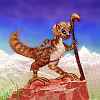
Hemitho is a centah name, for these feline centauroids are common here; while they hardly think of the long lake as paradise, they're a mobile people herding a sort of antelope, and Hemitho is useful: flood-prone, a little brackish, but always drinkable. So the centahs visit Hemitho, grazing and watering their herds here, but they live on higher, safer ground.
The Palrak Lakes to the north are equally variable; depending on the season, you may find two, three, or four lakes surrounded by marsh, savanna, or dry mudflats. The locals don't have to rely exclusively on the lakes for water, for the Palrak Veldt gets more rain than the Hemitho region--it's the edge of the great Barsoom Basin to the northwest. Fairly reliable streams cross the plains most of the year.
The Anthor Sea, well to the south, is the only one a Terran would call a sea. Anthor is large, cold and stable, since rivers feed it from many directions in all seasons; winter rains, summer thunderstorms and snowmelt all add to its waters. The Anthor Sea is not alone; it's just the east end of a long strip of quite Earthlike evergreen forest dotted with lakes and seas--an antipodal Canada!
MOLAK ISTHMUS
Molak Isthmus is the triangular alpine tail of Thuvia Upland, linking it to Sola Upland to the south. On the east side, the Yarr Range rises out of Yarr Trench. Nearly as high, the West Yarr Range parallels the front range, with an alpine valley between. Lesser but still snowy ranges and basins--southern spurs of the Mrr Mountains--stretch west for 5-600 km, to the huge Molak Range, the western rim of the uplands. To the south, the uplands narrow steadily and twist into the curving, tangled, transverse Trunzip Range. Below them lies Trunzip Pass; beyond, to the south, Sola Upland. Camaroo farm and herd woolly anoxia in the greener valleys; lumbering mamooks wander the heights.
Trunzip Pass, at 19 degrees south, is the lowest pass between the eastern and western hemispheres, over the formidable wall of Thuvia and Sola Uplands, averaging 5 km high. Trunzip is still 3.2 km (2 mi) high--usually snow-free, and more to the point, having air thick enough not to kill or brain-damage trench species like lebbirds, allowing caravans to carry them (even if they can't walk) between Barsoom Basin and Zor Chasma. Thus Trunzip functions much like the Panama Canal between the Invak and Barsoom Basins.
Caravans climb from the west shore of Lake L'ree in Dor Trench. The pass is a long curving valley between the Sola and Trunzip Ranges, with dwarf evergreen woods and subalpine meadows. Scenic country!
But don't forget basics. Be sure to bring a breathmask with a good sunpowered recharger; the air pressure here is stratospheric. Lebbirds may be notorious on Tharn for their vulnerability to altitude sickness, but they manage the forested approaches on their own paws, in air thinner than Everest's summit; it's only here in the pass itself that they collapse and must be carried saddleback, like mail. Gasping mail.
But still--they're breathing unaided in this near-Martian air. You'd die in minutes.
After three long plodding days through the alpine meadows of the Pass (assuming no unseasonable blizzards) most Trunzip caravans turn northwest, following long snowmelt creeks down toward Lake Foosh in Otz Trench--a lebbird haven. Some caravans veer off westerly toward the Dusar Sea in huge, fertile Barsoom Basin, following a creek between two long parallel desert ridges.
But many caravans take a harder road: due west over all these washboard ridges--the slow-motion shockwaves of two naked plates colliding. Up, down, up, down, a hot, dusty, rocky, shadeless road climbing pass after tedious pass to emerge onto the dry, rather African plains hemming the Palrak Lakes.
After days of dull but easy travel (bring a lot of bandanas if you go; the fine clay dust clogs breathmask filters), another great range heaves over the horizon: the Lothar Mts, outer ring of Heloon Crater, largest in the world. Lothar's passes are nearly as grueling as Trunzip itself, but the reward is great--a vast, deep, lake-dotted impact-basin with air as dense as the trenches, or Tibet. Even you can breathe freely there. Heloon is the planet's greatest biological and cultural hotspot--a million square miles of almost-Earth!
YARR and DOR TRENCH
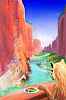
For a full tour of this huge oasis see Yarr Trench, in which you hang-glide down the length of the great canyon. Here I'll just give an overview:
Yarr and Dor Trenches are just names for the southern half of the Mrr Trench complex; they're all one huge subduction zone. Yarr is the arcuate section between Thuvia and Sola Uplands, below the Molak Isthmus.
 For once, the analogous Terran structure is more extreme, not less: consider the long island arc and trench in the South Atlantic linking Patagonia and Antarctica. Unlike the rest of the Atlantic coastline it doesn't reflect the rift zone's shape at all--such arcs may represent "stuck" bits of crust that refused to move with the plate around them. Yarr is a gentler arc, though equally arbitrary-looking.
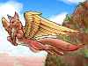
From 5-13 south, the trench floor is flooded by narrow Lake Yarr, 600 km long. In this rainy zone, so many streams feed the lake that it's fairly deep for a trenchlake; the surface lies only 2.5 km below datum. Lake Yarr drains south into Lake L'ree. The combination of warmth and thin air around Lake Yarr has selected the native lebbirds here for small size; it's easier to fly, and they don't need to retain heat.
Lake L'ree marks the somewhat arbitrary start of Dor Trench. L'ree is a huge lake, 1300 km (800 mi) long. The climate's drier than Yarr, though of course anywhere would be! L'ree's shores are 3.5 km down, giving them air thick enough for easy flight; they're densely settled by lebbirds, considerably larger ones. Yarrans look like mere kittens next to them.
To the south is Lake Hhurr, a trench lake fully 5.5 km below datum. While Lake Hhurr is small, only 500 km long, the climate's mild and Mediterranean; many lebbirds have settled here, too. The local subspecies is even larger than around L'ree; so large, in fact, that they find flying difficult up in shallower Yarr Trench. The depth of Dor Trench also keeps the climate subtropical beyond 50 degrees south, and temperate forest continues up Iss Canyon to 60 south. Big, shaggy leonine lebbirds share these woods with equally big, shaggy (flightless) mops.
INVAK AND THE HASTOR SEA
Hastor Sea is a pear-shaped bedlake 900 km long (560 mi), northeast of Sola. The south shore is a patchwork of open woods and savanna; the north, east and west are all equatorial rainforest, called Invak Wood. On the west, the Invak Rim drops into Yarr Trench. This wide fertile region, nearly as lush as the Trench, merits its own page.
South of Invak Wood, the trees fray into groves dotting a huge golden savanna settled mostly by veltaurs. This is Noor Nar Veldt, about 600,000 sq km (250,000 sq mi) in area, green in winter, gold in summer, inhabited by a mixture of veltaurs, centahs and flyotes. The Midwinter Dance, when the new grass is green, is one of Tharn's largest and happiest celebrations: four days of dance, song-duels, and general flirtation.
South of the crater, the veldt slowly fades into an endless red plain: the Proom Desert, 1000 km wide and several thousand long. If this were Earth, it'd be the Proom Ocean. But this is Tharn, and so the Proom Sea is only a shallow, salty bedlake in the low point of the great plain, fed mostly by streams from the ridges around Zor Chasma to the east. Proom Sea is 600 km (380 mi) long and half as wide, though large Kindasharo Island takes up much of the center; the lake's a mere moat around it. The low, hilly island is largely just an apron of debris around Washi Crater. This impact scar is 20 km (12 mi) wide, with a lake flooding its floor. Washi's just the southernmost in a line stretching at least 3000 km north, all apparently the same age; even huge Parthak and Rapass Craters to the northeast may be part of the same chain. Though Kindasharo Island's a rubble-heap, its climate is milder and rainier than the desert around it; thotters fish its shores, and the scant woods of its inland valleys shade veltaur and centah villages. It's a pleasant oasis.
A thousand km south of the Proom Sea, the desert gradually cools and turns to steppe. What grass grows is dusty and dry most of the year, for it gets some winter precipitation in the form of snow, but little rain. Summer thunderstorms are more likely to burn the grass than green it; there's no sea to humidify the airmasses clashing overhead. Winds are constant: the dusty plains stretch all the way to the polar cap.
To the east, the desert rises in rugged box canyons--fracture zones around Zor Chasma, a rift valley where crust is spreading. The ridges flanking the rift are high enough to catch rain-clouds; ribbons of evergreen woods line the watercourses. Down in Zor Rift lies Lake Tith, a fingerlake 320 km (200 mi) long. It's a brackish mineral stew fed less by surface streams than by hotsprings in its depths. Bacterial blooms stain Lake Tith a lurid chartreuse each summer. It's a bizarre, rather unfriendly place.
Out on the plains, as we head south, these steadily cooling steppes start to look like Terran tundra, though there's little permafrost--that's an Ice Age hangover, on Earth, and Tharn hasn't suffered one recently. The chilly plain's broken by a sort of vertical oasis: the River Iss. Its many branches have cut valleys merging into a Grand Canyon twice as deep as Arizona's, with cliffs up to 2 km tall in spots. The floor descends as much as 3.5 km below the steppe; the dense air in Iss Canyon is mild for this latitude, and forest grows around the shore of Lake Iss.
One of the youngest features on Tharn, Lake Iss is only a few thousand years old, born of a great landslide into the canyon, damming the stream. Today the lake is 190 km long and 20-40 wide (120 by 20 mi), though it's steadily silting up; in another few millennia it'll be a long, marshy meadow, then a forest-lined river again.
Mops and flyotes farm these canyon bottoms--plus a few bold lebbirds, settlers from Lake Hhurr to the north. They don't venture above Lake Iss; the air is just too thin.
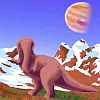
These upper branches, in shallower canyons (or none) up on the beds, are nearly treeless; the plains here are harsh. Iss Tundra, between the river and the south polar cap, is as big as Baffin Island or Alaska's tundra. Again, the name's deceptive--the soil's not technically tundra. But you could be forgiven for thinking it is--an endless, cold, windy plain with topsoil frozen nearly all year instead of subsoil frozen all year. The only hills are living ones: twenty-ton, nomadic mamooks.
World Dream Bank homepage - Art gallery - New stuff - Introductory sampler, best dreams, best art - On dreamwork - Books
Indexes: Subject - Author - Date - Names - Places - Art media/styles
Titles: A - B - C - D - E - F - G - H - IJ - KL - M - NO - PQ - R - Sa-Sk - Sl-Sz - T - UV - WXYZ
Email: wdreamb@yahoo.com - Catalog of art, books, CDs - Behind the Curtain: FAQs, bio, site map - Kindred sites