 Like humans, they're primarily ground-dwellers but are able to climb trees. The best Terran analogy might be bears, which they look nothing like.
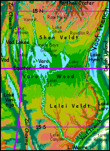
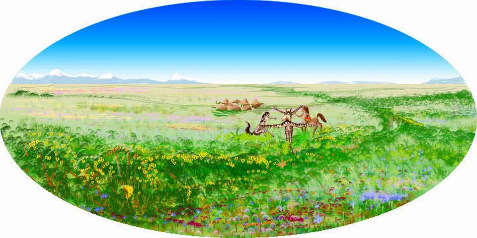
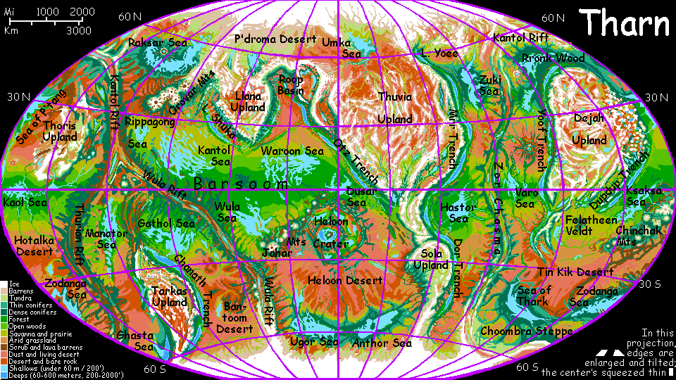
Varo Basin
by Chris Wayan, 2005-6
Map, Tharn's homepage, Peoples of Tharn, Regional tours, Geology and Evolution, gazetteer, terms explained. More worlds? Planetocopia!
INTRODUCTION
The Varo Sea basin is one of the greenest regions on Tharn, quite Terran except for its thin air; it's nearly as rainy as the Hastor Basin to the west, over the ridges of Zor Chasma. The basin is equatorial; heated by the sun, the air rises, cools, and precipitates rain, which collects in the Varo Sea, 900 km long and half as wide (560 by 280 mi). The sea's far northern shore is a patchwork of savanna and open woods, but all the rest is rainforest--though the word means something drier on Tharn than on Earth. Varo Wood gets up to 1.2 m of rain (50") per year--but equivalence is hard to determine, since the year's shorter and evaporation's faster in the thin air. Soil moisture's roughly like a Terran forest getting 900 mm of annual rain (36"). Hardly rainforest, on Earth!
Yet Varo is a true rainforest, for its plants (like all good Tharnians) are thriftier about water; to them, so much rain (falling year-round, too--no dry season) is a bonanza. Varo Wood's almost as lush as Amazonia's--and taller. Trees here rival California's redwoods: in the low gravity and relatively mild equatorial winds, they climb wildly toward the sky, routinely topping 100 m (330'). It helps that the gravity's low, of course. Far less massive than redwoods, yet with huge crowns, they look top-heavy to a Terran eye. And a bit bluish.
Broccoli gone mad.
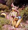
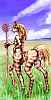
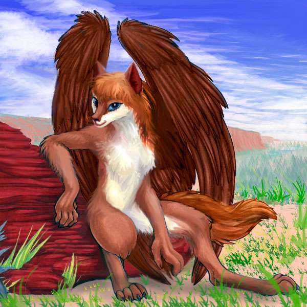
Varo Wood, like Invak Rainforest over the mountains to the west, is bo country. These semi-arboreal folk are as close as Tharn gets to apes--admittedly, not very.
Like humans, they're primarily ground-dwellers but are able to climb trees. The best Terran analogy might be bears, which they look nothing like.
But then bos look like no one else. Or everyone else! A bizarre mix of cow, velociraptor, kangaroo, ape and bear-traits, with scales, mammalian skin, and patchy fur. Crazy-quilt people. Good thing they're natural clowns...
VAD LAKES AND ZOR CHASMA
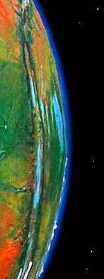
Varo is a typically shallow bedsea, dotted with islands. The most distinctive feature is the washboard terrain of the west coast. Outlying ridges of Zor Chasma run parallel here, leaving long parallel valleys between them. The easternmost two valleys form the West and East Zhirada Bays. Further west, the ridges rise. The first few snag much of the rain off the Varo Sea; inland, the great trees slowly shrink to merely Terran heights and break into groves. The long ridges are randomly cut by fracture zones: knife-slashes at right angles to the watercourses, so all the region's rivers and lakes must drain through these few gaps. In these long, rather Appalachian valleys lie the Vad Lakes.
The three largest, Gerboon, Inkip and Tsip, are all fingerlakes lying in cliff-walled fossae in the fracture zone just east of the rift; linked by creeks to the Varo Sea downstream, their valleys and waters are fertile, though less rainy than the Varo plain, and drier the further we go. As the forest opens, the population shifts--bos cling to the wooded patches, while veltaurs and centahs garden and graze the growing meadows. The Tsip Valley, the westernmost, has mere groves of hundred-foot trees studding long golden-grass hills where centaurs herd small dinosaurian sheep: a cartoon Arcadia.

Beyond Tsip, the evergreen ridges of Zor Chasma to a rugged climax and drop in cliffs into the Chasma itself, a great dry rift with a weird sunken sea: Lake Vad. No streams link this brackish, alkaline riftlake to its neighbors outside the rift; it's a sea with no outlet. Vad is 410 km long and up to 120 wide (260 by 75 mi). Its dominant fauna are multipedes, bottom crawlers up to 1.5 m long (5'). With their spines, legs and feelers, they look a bit like lobster-centipede hybrids--or Hallucinaria fossils from our Cambrian Explosion, all grown up... They haven't yet made it onto land, but if they do, Tharn will have a line of fauna with really odd metabolisms... and minds. These Hallucinaria have a brain at each end, like the Pushmi-Pullyu...
To the south, Zor Chasma cups an even larger riftlake called Vantija. Fully 800 km long and up to 100 wide (500 by 65 mi, quite similar to Lake Malawi or Tanganyika), Vantija's brackish, mineralized, stained flamingo-pink by bacteria, and home to a fauna nearly as weird as Lake Vad's: giant five-legged "crabs." One species crawls onto land to forage, though they still return to the lake to reproduce. Evolution continues!
In a way, Vad and Vantija are time-capsules: Tharnian life probably first crept onto the land from a lake much like these, though these particular two are far too young to be the primal source.
Over the cliffs to the west, out of the rift, a matching set of ridges (of crumpled, spreading crust) descend slowly to a rainforested plain much like Varo's, but even larger and greener: the Hastor Basin.
SHEN VELDT and PARTHAK CRATER
The northeast shore of Varo Sea, cut off by a line of islands, is called Ghadoor Bay. At its north end is the Shen Delta. Let's head upstream; the current's slow, no obstruction at all to the thotter boats sailing up to Lake Shen to trade.
Lake Shen, 270 km long and up to 60 wide (170 by 35 mi), is a shallow, segmented lake shaped like the body of an ant, fed mainly by two rivers rising in the radial ranges around Parthak Crater: the Shen to the northwest and the Rani Hu to the southeast. This second river watering Shen Veldt arises in Rani Hu Lake, a mountain lake 50 km (30 mi) long in the southwestern ranges around Parthak Crater. Several other branches drain the valleys between rays (debris-ridges from the crater). The Rani Hu flows southeast to Lake Shen, then the Varo Sea, and, ultimately, Lake Murra in Yoof Trench, about 3200 km south (2000 mi); the Shen and Rani Hu together form the longest river system on Tharn.
Shen Veldt is a triangular plain 1500 km wide, east of Zor Chasma, southwest of Parthak Crater, and north of the Varo Sea. It's a warm, pleasant savanna veined with creeks and dotted with groves of veltaur-tended fruit trees, especially in the south, where the trees thicken into Varo Wood.
LELEI VELDT and LELEI CANYON
The south end of the Varo Sea narrows and fills with leaf-shaped islands where thotters flourish: a delta in reverse, like Lake Ontario's Thousand Islands. The isles and shores are rainforested. The Lelei meanders south through the forest. Over hundreds of km, the woods thin and open into Lelei Veldt, green in winter, gold in summer--as big and flat as Texas. But not culturally flat: it's home to three very different peoples, centahs, veltaurs and lobbras.
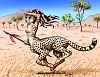
In the southeast, the flat dry prairies are dissected, opening into deeper and deeper redrock canyons. These shelter another species hovering between animality and personhood: flyotes. Like wingbok, they can't grow very large in the thin air of the plains and still fly; but the deeper you climb down these canyons, toward Yoof Trench, the larger and more elegant the cliffdwellings get--and so do the flyotes, until on the trench floor, over 3 km (2 mi) below the plains, they're undeniably people.
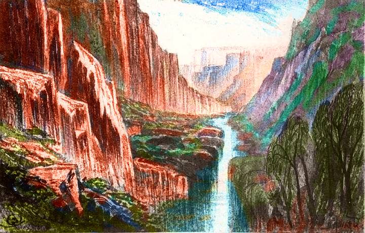
The Lelei Valley winds south across the veldt, but deepens steadily. The south end is a spectacular gorge 3 km deep with sheer cliffs up to 2 km high in spots (6600')--Lelei Canyon.
The canyon debouches into Yoof Trench; the river feeds salty Lake Murra, 3.5 km below datum.
I've described how Tharn's little seas tend to wander over time, with plate-drift and climate changes. Here, a few long-gone seas have left a strange legacy. Most of Tharn's beds are basaltic--cut through the thin topsoil and you'll find this dark heavy lava rock in beds hundreds of meters thick. But Lelei Canyon cuts so deep it reveals ancient history. Three major and a dozen minor limestone beds, each a few meters thick, were laid down by old seas just passin' through ages ago. This relatively soft stone erodes faster, leaving overhangs, caves, whole hanging galleries high on the canyon walls. Water seeps out at these levels too; the basalt floor's less permeable. Not just natural cliffdwellings but whole cliff palaces with plumbing!
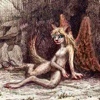
These free apartments, plus the relatively dense air friendly to fliers, have lured two peoples into settling the canyon. Life together has shaped them into distinct subspecies: the majority of canyondwellers are unusually large, intelligent Lelei flyotes (below); with them live a large minority of rangy, gracile (heat-adapted) Lelei lebbirds (right). These jaunty, confident rock-climbers are the least arboreal lebbirds on Tharn--not physically so different, but few other lebbirds would be comfortable with so few trees around--only a few can root on the canyon walls, though irrigated hanging gardens have slowly developed, and the canyon floor is wall-to-wall orchards the Navaho would be proud of.
Thrown together by prime free housing, these two subspecies are on more intimate and equal terms than their kin elsewhere on Tharn. A few have even intermarried, though of course they must adopt cubs; they're not cross-fertile, being genetically as distant as mushrooms and whales. Their ancestors crawled out of different seas! That they've arrived at such similar solutions to the problems of daily life on Tharn shows how deeply your environment sculpts you.
Yes, O beloved reader, you too. Life's not easy for nonfliers like humans in deep, flood-prone desert canyons--the safest living sites are often up the walls, while the water's at the bottom.
But for these fliers, Lelei is Eden! Many cliff-caves have springs--and even those with no water are habitable. It's only seconds from home to field to swimming hole--and no need to climb ladders with the daily waterbasket. Everyone just swoops down at dawn and dusk, fills their basket in river, and lugs it up to slosh it in the cistern. Just a minor chore!
The Lelei River does fluctuate yearly, but never fails or severely floods, due to its equatorial origin; it's safe to live and work down near the water. The Lelei tends to flow in oxbows for miles, then drop in Niagara-like falls of 30-100 meters (1-300') to a new level. Canals tapping the river atop a fall can irrigate downstream slopes, not just bottomlands, so the farms and groves are wide. All told, Lelei Canyon has a larger population than all the rest of the Murra region together.
The rest of Tharn may be a (placid, furry) echo of Edgar Rice Burroughs's Mars--Barsoom--but Lelei is remarkably like Malacandra, C.S. Lewis's Mars in Out of the Silent Planet, with its barren uplands and fertile Mariner Canyons (prescient, and not part of Percival Lowell's then-dominant picture of flat deserts with artificial canals, nor part of his critics' picture of a biologically AND tectonically dead world; give Lewis credit for realizing deep Martian canyons were both plausible and the best places to live!)
Southwest of the Canyon, Lelei Veldt slowly fades into an endless red plain, hot by day, chill by night: the Hinarr Desert, two million square kilometers of silence and dust. A few bands of stunted plains wingbok, hardly even qualifying as people by Terran standards, are the only inhabitants. It's a classic Tharnian landscape I recommend only for homesick Martians--you'll be all comfy there.
The rest of us... well, let's not go and say we did.
World Dream Bank homepage - Art gallery - New stuff - Introductory sampler, best dreams, best art - On dreamwork - Books
Indexes: Subject - Author - Date - Names - Places - Art media/styles
Titles: A - B - C - D - E - F - G - H - IJ - KL - M - NO - PQ - R - Sa-Sk - Sl-Sz - T - UV - WXYZ
Email: wdreamb@yahoo.com - Catalog of art, books, CDs - Behind the Curtain: FAQs, bio, site map - Kindred sites