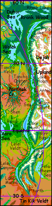
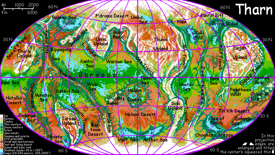
Yoof Trench
by Chris Wayan, 2005-6
Map, Tharn's homepage, Peoples of Tharn, Regional tours, Geology and Evolution, gazetteer, terms explained. More worlds? Planetocopia!
INTRODUCTION
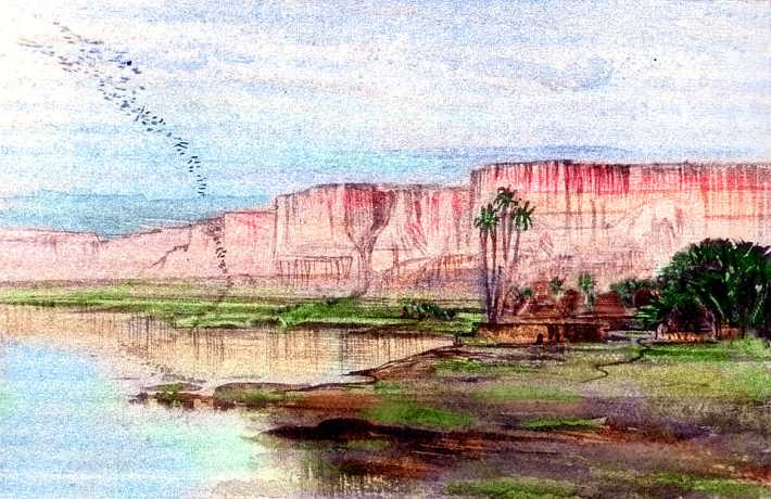
Yoof Trench is a subduction zone, where the spreading crust from Zor Chasma, a rift valley, slips under the "continental" plate of Dejah Upland. Such trenches are common but hidden on Earth, deep beneath our generous seas. On dry Tharn, they're bared--the only sea is the sea of denser air down in their depths. That air makes Yoof a biological hotspot--or rather, hotstretch. Long and narrow as Chile! Yoof Trench is one of Tharn's longest--6000 km long, up to 160 wide, and 3-5 km deep (nearly 4000 miles by 100 wide and 2-3 miles deep).
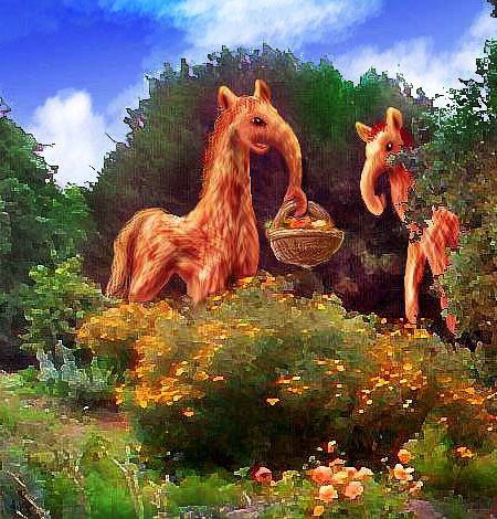
Yoof's north end is the homeland of elaffes, a huge, flightless, elephant-snouted people. Its south-central stretch is the hottest place on Tharn, the adopted home of lebbirds and flyotes, who don't mind the heat and like the dense air down in the trench, which eases flight.
Is it really called Yoof? Well, it's hard to transliterate elaffe names--these cratures are so big, their hearing ranges into the subsonic. "Yoof" is just an approximation--it's a loud, slow, deflating sigh, like a tired two-ton businessman falling on a sofa. You need a long rubbery resonant nose and hundred-pound lungs to say it right.
We'll start in the far north and work south, lake by lake--starting with...
LAKE RRAO
Rrao is a trenchlake north and west of Dejah Upland, near the Duhor Sea. This is where elaffes probably evolved, but the mild lake basin is now also colonized by lebbirds; the lebbird name is commonly used because the mostly-subsonic elaffe term is unpronounceable by species smaller than a truck. The lake's 1050 km long and 120 wide (650 by 75 miles), with densely forested shores. Though it's nearly 50 degrees north and at the foot of a towering, glaciated range, the Yoof Mts, the Rrao Valley is subtropical; winters get cold and stormy, but a hard frost is rare. 4 km (13,200') below the plains and 10.5 km (35,000') below the peaks, the trench is an oasis of dense, mild, moist air.
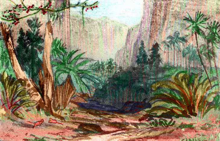
It's tree heaven, of course--like the Olympic rainforest or the Redwood Coast. But the biggest groves here are taller than any on Earth. The gravity's lower, of course, so trees don't work as hard to raise water to their crowns. And wind-shear forces are less: the air's thinner, and the walls shelter the valley from extreme winds. The result: while redwoods can reach 115 m (380'), some giants in the Rrao groves are 140-150 m (nearly 500'). The average is only half that, but these are unquestionably gigantic forests.
Here elaffes developed silviculture, breeding dozens of species of fruit and nut trees (though they never adopted the human practices of clearing wild trees for a mono-crop of trees in straight rows--these ease harvesting for our short, non-arboreal species, but elaffes can pick fruit 6 m up (20') without even stretching. The forests of Rrao still look wild, and in a sense they are--just a wilderness much richer in fruit, seeds, nuts, and edible leaf-shoots, year-round.
But the elaffes left the womb. Yoof Trench bends east here, away from its usual north-south orientation. So the Rrao Valley has a south-facing slope warmed by the sun; even kilometers above the valley floor, daytime temperatures were pleasant (though nights were cold, since the air was thin). Settlers crept slowly up this slope, planting seeds and rootstocks from the shadier, colder south slope around little Lake P'p'p. Over time, the heights became a great test-farm of hardy trees.
But while the elaffes were shaping the heights, the heights were shaping them! Warmer coats, bigger lungs, a stockier build... Over generations these pioneers crept up toward the rim.
Beyond sprawled a huge boreal forest, home only to a scattering of mops, plus a few thotters on streams and lakes. The elaffes named it Rronk Wood, and set out to colonize it--and spread their high-yield trees. Such an altitude- and climate-jump is extraordinary, quite as startling as humanity's leap from African savanna through the temperate zones up to the edge of the ice.
Such habitat-leaps are rare on Tharn, because so many intelligent species share the planet; most such habitats are already filled. It helped that elaffes were amiable, mixing well with other species, for they'd had no natural enemies in their native trench. (Even if they'd been grumpy, who wants to argue with people six meters tall?)
When one human tribe invades another's land, the conflict often leads to famine--or war, to protect food sources. But when elaffes started exploring Rronk Wood, they brought so many new tree-crops that the local thotters and mops ate better, not worse.
Food for all, and malice toward none! Not a bad policy. And for elaffes, it was no slogan, indeed never a policy consciously planned. They just took peace for granted.
So the elaffes spread all around the Duhor Sea, and south to the Wolak Sea, and east to the Ohhh Forest on the Sea of P'tang--7000 km east to west (4500 mi).
The great diaspora changed them further, of course; Rronk Wood elaffes are taller and shaggier than their trench cousins; their lungs are 50% bigger, their blood can carry nearly twice as much oxygen. They need it; a short run leaves a Rronk elaffe out of breath, and they have trouble crossing mountains much above bedlevel. After all, the air up here is as thin as the air atop Everest--even a Sherpa would soon collapse.

Thotters and elaffes rarely become close friends. It's not the size difference, or that their temperaments clash; it's speed. A thotter's metabolism, perceptions and speech all flow four to five times faster as an elaffe's; and they hate to sit around for answers. Still, the two species trade extensively.
Mops are a different story. Well, their own name for their species is something like "BrakkakekyakwoshoshOSH" or "us gorgeous people"; a bit long and pretentious for daily use. Hence the universal adoption of the condescending mamook name for them--and I do mean universal: even mops use it, in mixed company.
 This says something about mop nature: they're often vain and volatile, getting into quarrels, but they can laugh at themselves; elaffes are natural straight men for mop jokes and drama.
So despite the size difference, the two peoples get along well. In fact, mops find slow, calm, trusting elaffes (with no enemy in the world--like Terran giraffes, or some whales) reassuring--and more trusted as arbitrators than their own kind! Thus, in mixed communities, you often find elaffes as counselors and judges.
Oh, and the obvious: contractors for heavy construction. To build a tower or a nut storage silo, the crew with a few 20-foot-tall workers has a distinct competitive edge! Darwin has spoken...
THE YOOF RANGE
On Earth, wherever you find a subduction trench, there's a great mountain range nearby on the upper plate. The stacking of two plates pushes the rim up. Also, as the lower plate slides into the Earth, it heats and melts; lighter material rises as magma. Volcanoes rise atop the mountain chains! They're extraordinary in the Solar System as a whole; no planet with comparable gravity can match, say, the Andes rising 14 km (46,000') above their trench. Even low-gravity Mars has few peaks that much taller, and they're far less steep. But Earth's sea hides just how extreme these altitude jumps are.
Tharn's similar plate-boundaries are naked, exposing their full ruggedness. The Yoof Mountains, paralleling the trench for most of its length, are Andean to Himalayan in altitude, but measured from their feet deep in the trench, they average 12 km high: 40,000', with peaks up to 15 km/50,000'. And they're not unique on Tharn.
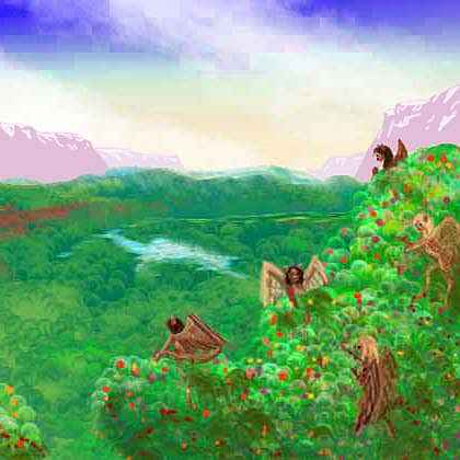
This great jagged wall squeezes nearly all the rain from lowland winds; so the western slopes are lush, from alpine deserts where shaggy mamooks roam, to high meadows where camaroos herd flocks of woolly anoxia, to deep hanging forests where mops raise their lodges and totem poles; the lower gorges have air dense enough for small winged species like flyotes, and the depths support tropical lebbirds.
That's only a partial list--so many species with diverse habitats rub shoulders on these steep slopes that a rich multiculture has arisen: the Yoof Slope is one of Tharn's hotspots of innovation--biological, cultural and technological.
In contrast, the far side of the mountains, Dejah Upland, is as stark as Tibet. Cold brackish lakes in redrock basins below icy peaks, with no trees, few meadows and fewer people--of any species.
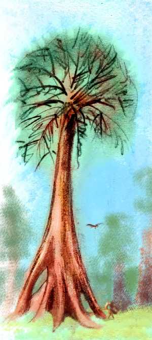
I suppose I'm making the slopes of Yoof sound vaguely Californian. Well, I may have California in mind for an added reason: here, in a rugged little hanging valley, is the tallest known tree in the world, 153 m (just over 500').
LAKE HOOM
Southwest of Lake Rrao, the trench first rises a bit, then deepens steadily for 700 km down to Lake Hoom (another rough transcription of an elaffe name: a growling deep-throated boom). Hoom is a long, quite irregular salt-lake (almost a chain of small seas, really). The lowest trenchlake in the world, Hoom lies fully 7.2 km below bedlevel.
This dip is a couple of thousand km long, and if it lay at another latitude, it might have created a narrow but very deep sea--a true ocean in terms of volume (and bad for Tharnian life; much of the world's water, sunk in one narrow crack!) But at this latitude, the valley is hot and dry; a high-pressure zone pushes storms away. The Yoof Range squeezes out what rain it can out of the dry winds, sending hundreds of small creeks down to feed the lake. Even with these, its deepest point is just 400 meters--impressive for Tharn, but Earth's oceans average ten times that deep. So I feel justified in calling it Lake Hoom, not the Hoom Sea, despite its depth and salinity. Though I guess if the Dead Sea qualifies merely because it's salt, Hoom really should too--it's far bigger.
In this dry heat, the local elaffes must irrigate their famous orchards; so they cluster round those snowmelt creeks. The heat (and, perhaps, the shorter, domesticated trees) has made Hoom elaffes a gracile subspecies--a mere 4-5 meters tall and just 4-700 kilos (13-16 feet, half a ton). Downright dainty!
Most Hoomian elaffes cluster round the northern end of the lake, where it's several degrees cooler than the south; even here, they're not numerous. Hoom is at their adaptive limit, at least for now. Maybe in another thousand years...
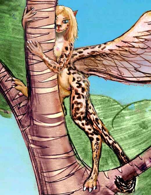
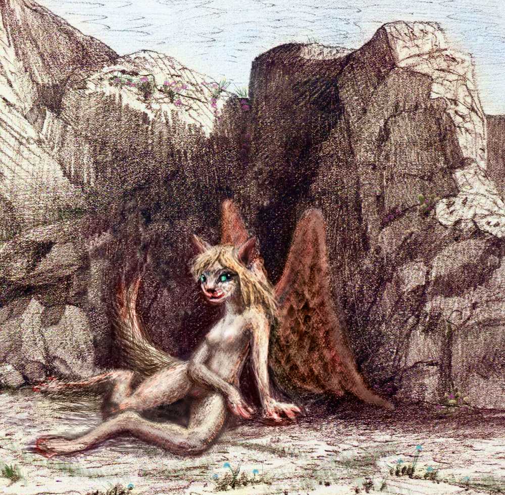
Lebbirds and flyotes also live here, attracted by the densest air on Tharn, easing flight. In fact, Hoom is the home of some of the largest flyotes in the world, with the biggest brains. Up on the desert plains, just a few kilometers away (though all of them vertical!) flyotes are considered only semi-intelligent creatures. But here in the trench, they have a presence and fire you can't help but respond to even before they speak. And speak they will. These aren't clever flying dogs--canine versions of the Winged Monkeys of Oz--but unmistakably people.
It's hard for a Terran to grasp that these people owe their beauty and brains to the blessing of something invisible. No, not God--nor Darwinian selection, at least not in its usual sense. They simply had the good luck to be born in a place with a high (for Tharn) partial pressure of oxygen. As natives of a thin-aired world, flyotes are extraordinarily sensitive to the conditions encountered in their first years; pups limit their growth to practical flightweight, even if that means limiting brain size. But take an orphaned flyote pup from the plains above, and raise her in a cliff palace by the shores of Hoom; she'll grow over twice the size and brainweight of her scrawny parents. Here in Hoom, the sky's the limit; here flyotes become what their cells long for them to be. Human Potential is an abstraction; Flyote Potential is palpable in the bone.
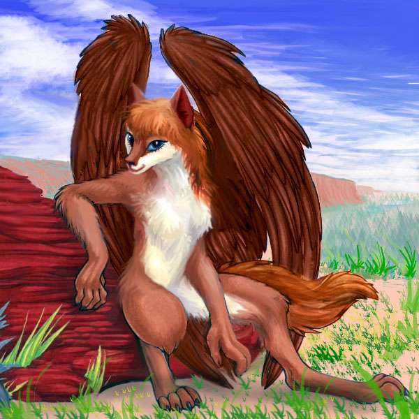
Lebbirds, always larger on average than flyotes, here keep up their end of the competition--the locals are the biggest fliers on Tharn, up to 2 or 2.5 m long, including tail (7-8'), with wingspans up to 5 m (16.5'). The heat has kept them slender, even rangy; still, they mass from 20-35 kg (44-77 lbs)--though in Tharn's weak gravity, they weigh only 12-21 kg (27-45 lbs). Light as a human toddler! A dancer will routinely lift and toss a partner into the air with one arm.
Indeed, there's a single word for that, zuzú; a basic move in air-ballet.
Dance is a passion for lebbirds in this region--maybe it's the heady air, I don't know. Or their physiques: there's a long tradition of tall, willowy but powerful dancers from Hoom achieving fame in ballet troupes elsewhere on Tharn, impressing even the sophisticates of Heloon Crater--and that's not easy, given the cosmopolitan mix of species in that largest of air-oases.
These lebbird tribes irrigate orchards in the greener valleys, along streams. Fortunately, irrigation's relatively easy: these streams are very pure snowmelt (little salt buildup) running down steep valleys, making them simple to divert. My Peruvian readers will recognize the pattern--it's like the dry coastal valleys of southern Peru, which nurtured a dozen irrigation-based societies.
But Hoom's culture is more unified; fliers are less insular than flightless human farmers! And the lake's far safer sailing than the Pacific; thotters sail its length, fishing, visiting and trading. Thotter villages are usually in coves near stream-mouths; while they can survive without fresh water, getting it from seafood, thotters prefer both salt and fresh. Thotters in freshwater lakes often settle on islands, but Hoom thotters cluster near creekmouths, close to the lebbirds, flyotes and elaffes; this too unifies Hoom culture.
But unified is not homogenous. As the days pass and we sail down Lake Hoom, the valley's population mix changes. Fewer and fewer elaffes--just too hot for them--and more lebbirds and flyotes.
Then, in southern Hoom, the lebbirds start to disappear too, despite ideal flying conditions--it's just too dry here to grow many trees tall enough to support these large lebbirds' weight. And they just don't feel comfortable sleeping on the ground! Why, an elaffe could step on you in your sleep! Earthworms could crawl in your ears!
Build sleeping platforms or stilt-huts? Sleep on dead wood? Why not just sleep on a bed made of bones!
Habitat suitability isn't always about practicality or logic. More often than we'd like to admit, we're driven by our feelings.
So in this heart of the dry zone, lebbirds are few. No matter! That just lets the flyotes come into their own, digging cliff palaces and irrigating wide fields of berries, vegetables, flowers and herbs, swapping produce to thotters for fish and lotus seeds and watercress. Dance and drama troupes still compete, but as the proportion of flyotes increases, the prevailing mood's changed from elegance to sly comedy, from lyricism to narrative. From lebbird cuisine, tending toward light and sweet with aromatic spices, you have to adjust to the food in the cliff-inns where you stay each night: rich, smoky, fiery, heavy, fishy, occasionally too ripe for human tastes. Did I mention that flyotes have a very canine sense of smell? Farewell fruit and cinnamon; hello blue-mold cheese, wormwood salsa, smoked sardines rolled in pepper...
Come to think of it, that describes their drama, too.
It grows so hot (the weather I mean, not the cuisine. Well, not only the cuisine) that you start flying at dawn and dusk, lengthening your siesta through most of the twelve-hour Tharnian afternoon; though you don't fully adopt flyote customs and stay up all night partying in the cool night air, under the lurid light of Zeus...
THE RIVER SSA
Lake Hoom narrows again--but it's done that repeatedly. Alluvial fans from the mountains have nearly choked it several times already. But this time the salt lake is truly coming to an end. After 1400 km, the trench floor has begun rising again, until a last alluvial fan dams the valley entirely. A marsh curves round the fan's foot: the delta of the Ssa River. Upstream, the trench continues, lakeless--just a green thread along the river. This is an urban strip full of lebbird treehouses and streamside thotter huts. Outside this shady ribbon, the rest of the rift is flyote land, sparingly irrigated or left as dry pasture. For a trench, it seems austere. Still, lebbirds are back in the mix, entirely due to the freshwater Ssa.
Upstream only a few dozen kilometers the river widens into Lake Arroo, 150 km (90 mi) long. Again, orchards and their attendant lebbirds hug the shores; semiarid scrub beyond, though a second strip of settled land's along each canyon wall, where flyote villages burrow in and the few creeks dropping down from the mountains irrigate fields.
South of Lake Arroo is a stretch of semiarid valley, with trees only along the banks of the Ssa again. This strip, unspectacular except for the trench walls, hazy on both horizons, drags on for 160 km (100 mi); hours around sunrise, then the mandatory riverside siesta in the midday (nearly a full Terran day long; might as well get some serious sleep) then another long flight once the sun drops below the western wall, through the slow dusk.
I did warn you Yoof Trench is huge.
But the next morning, a green line appears ahead: the groves around freshwater Lake Ssa, 250 km long (160 mi). But it's not just the lake; the plains and alluvial fans are gold dappled with olive green, not the brown of the last few days. We're creeping out of the dry zone. By the next day the south end of Ssa is in sight. Here there's a distinct monsoon climate--a winter drought and summer rains. Trees spread beyond the watercourses for the first time since the northern tip of Lake Hoom. Lebbirds grow more numerous, though flyotes are still common; they nest in cliff palaces along two large rivercanyons, not mere streams, descending from Dejah Upland. Upstream is a great lake-dotted basin, Miarr Shelf, one of the lower and more fertile parts of Dejah; the mountain crest bends hundreds of km east here. Camaroos flourish on this cool, grassy subalpine plateau. Miarr even has scattered woods, unusual for Dejah Upland.
A day or two later, as we reach the next great lake, the trees are everywhere and the weather's muggy. And that's just the beginning...
LAKE HYNH?
Lake Hynh? (a high, querelous honk, meaning "too hot!" in Elaffe) may be hard for non-giraffes to pronounce, but it's accurate. Lake Hynh? is the hottest place on Tharn--it straddles the equator 4.5 km below the plains; the dense air greenhouses it, doubling the heat. In orbital summer it can reach 320 K (117 F) in the shade--fortunately there's a lot of that, and water, too, for a belt of rising equatorial air generates year-round rains feeding a lush, hothouse forest. It'd be even hotter without all those trees transpiring...
Elaffes, even the delicate Hoomians, can't bear the climate. Lebbirds tend the wood instead; they sleep while the sun's up. Since the trench walls loom east and west, hours of direct sun are short anyway, in many lakeshore towns; it's a land with long dawns and dusks. The cities of Hynh? really come alive at night, under the vast golden glow of Zeus, Tharn's primary, a gas giant twice Jupiter's mass.
In the sketch below, the small white moon is Pegasia, larger and biologically richer than Tharn--Earthlike, in fact, if not quite Earth-sized. Together their brilliant, warm light outshines our dead little moon a thousand times; even a half-blind human like you could see full color at midnight! The tree-towns of Hynh? are like Tolkien's vision of Elfland: a luminous twilit world.
Just tropical, furry, and spotted.
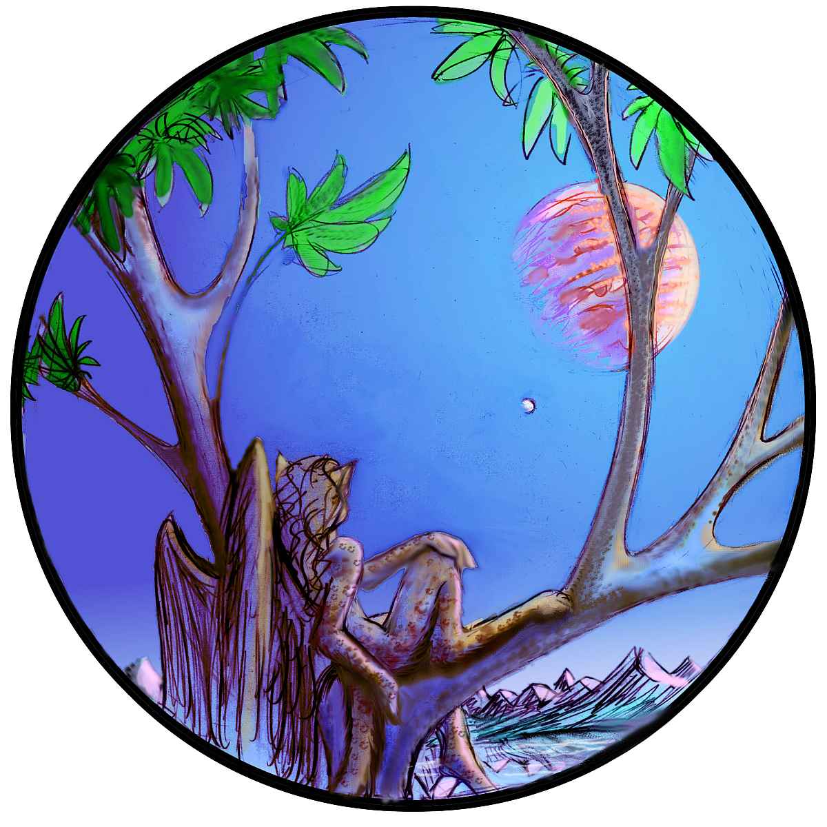
My advice is to take your time as you travel the length of Lake Hynh?--it's a good 1500 km (940 mi), winding along the trench floor, with a major coastal town every hundred km or so. And travel native style--fly a few hours at dawn and dusk, take an eight- or ten-hour siesta in that long Tharnian afternoon, and at night, go out and explore the tree-cafes. Listen to music, hear a good storyteller, try lebbird drama (character motivation gets peculiar but the acting will grab you by the scruff of your neck!) and most of all, see some ballet. Air-ballet for certain, and love-ballet if you're not squeamish (yes, it involves sex on stage, but as it breaks no taboo, it's somehow not raunchy. Rather sweet, really).
It's up to you, but however you spend your nights, don't sleep through them! This arts-mad, social culture is deeply nocturnal--not because they're cats, but because night here is so pleasant. Free romantic lighting, too!
But all trenchlakes come to an end, even this giant. After Hynh?, the great gash runs lakeless for 300 km, just an improbable Amazonian forest gouged into a desert plateau, like Amazonia below the Altiplano--but with only a mile or three of cliffs between them.
Slowly, the canyon floor rises from 4.5 km down to an invisible pass less than 3 km below datum. As the air thins and cools, you start flying days again, as do the locals. Trees and the villages in them grow more modest; the lebbirds themselves grow smaller.
Streams stop running back toward Lake Hynh? and start meandering marshily, then running firmly along your flightpath as you swoop down toward...
LAKE LARR
This triangular lake is 200 km long (130 mi) and lies in the junction where small Wrr Trench joins Yoof Trench. The lake lies fully 3 km below datum (10,000' down), with air dense enough for lebbirds (almost enough for humans). Its depth and low latitude make Larr, like Hynh? and Hoom, one of the hottest places on Tharn. The climate's drier than Hynh?--still rainy in orbital summer, but with a long sunny spell in winter. Still, the shores are lush; the plains above the trench are savanna, but heat-adapted "monsoon" forest rings the lake, in which lebbirds have planted hidden, scattered orchards. Larr drains south to salty Lake Murra... but first we have a side trip to make.
THE WRR BASIN
Northeast of Lake Larr lies the Wrr Basin, about the size of Spain, at the southwestern tip of Dejah Upland, just below the equator. Wrr is fairly dry, for the equator. On the southeast side, below the P'tarth Mountains, the basin's riven by a branch of Yoof Trench. In it lies Lake Wrr, 2.5 km down (8000')--just far enough so the denser air will support flight for lean, small lebbirds, though the tropical heat probably has just as much to do with the local race's gracility.
Culturally, the Wrrians are a bit isolated, off in their side-spur. Only upland species like camaroos can cross the high snowy Yoof and P'tarth Ranges boxing the valley in, and the valley below is too hot for them. The savanna plains above the lake are home to centahs and lobbras; but they too are largely cut off from the rest of the world. Aside from the trench in the west, no pass out is low enough to allow lobbras to breathe; centahs can manage Wrr Pass to the south, leading to their numerous relatives around the Felatheen Sea.
LAKE MURRA
Murra, at the southern tip of Yoof Trench, resembles Lake Hoom, with good reason--it's the same distance south of the equator that Hoom is north, in a high-pressure zone of little rain. A salt lake 600 km long (375 mi), Murra lies fully 3.5 km down, just west of the P'tarth Range. The great depth and low latitude make Murra's climate hot and rather dry--though the lake's big enough to make its own rain, and deep enough so it all falls back in the trench. Most rain here falls in summer thunderstorms.
Crops here must be irrigated and few streams flow down to the lake, especially on the west shore--the plains above are desert. The lakewater itself is brackish--drinkable, but bad for irrigation: salt builds up in the soil.
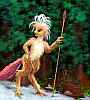
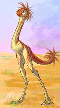
The result of this is that Murra's streamless west coast is nearly all unfarmable; only fishers, herders and hunter-gatherers can make a living here. Lebbirds are as rare as trees. Some thotters do fish the western shore (they don't really need creek water, especially in the north where the lake's fresher). Small lobbra herds roam--elsewhere they farm, but here they're mostly reduced to gathering and grazing. Centah bands herd losha (flightless, egg-laying ostrich-like mammals; sketch to right) for milk, eggs and meat.
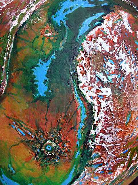
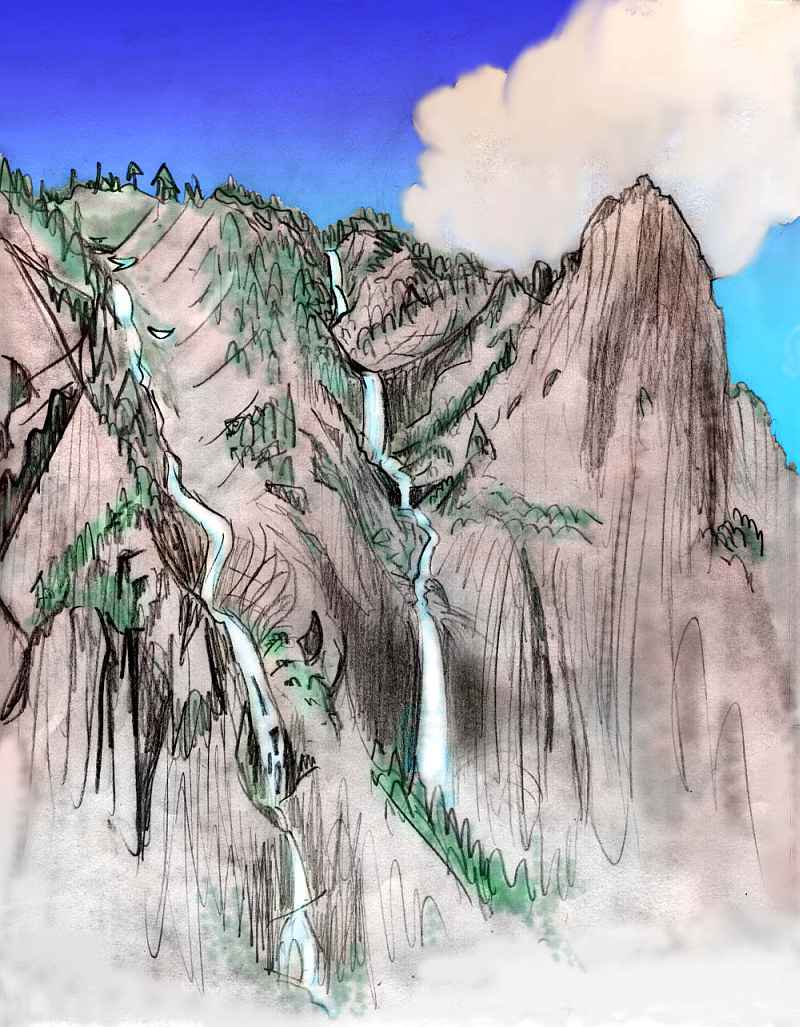
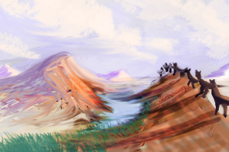
There's one great city of fliers near Murra's north end, in Lelei Canyon, a great gash two miles deep, far bigger than Grand Canyon, with cliffs up to 2 km (6600') high (remember, Tharn's gravity is low). Even Lelei's minor side canyons are impressive by Terran standards; here's a sketch of one.

Life's not easy for humans in deep, flood-prone desert canyons--the safest living sites are often up the walls, while the water's at the bottom. But for these fliers, Lelei is easy! It's only seconds from home to field to swimming hole--and no need to climb ladders with the daily waterbasket. Everyone just swoops down at dawn and dusk, fills their basket in river, and lugs it up to slosh it in the cistern. Just a minor chore!
The Lelei River does fluctuate yearly, but never fails or severely floods, due to its equatorial origin; it's safe to live and work down near the water. The Lelei tends to flow in oxbows for miles, then drop in Niagara-like falls of 30-100 meters (1-300') to a new level. Canals tapping the river atop a fall can irrigate downstream slopes, not just bottomlands, so the farms and groves are wide. All told, Lelei Canyon has a larger population than all the rest of the Murra region together.
The rest of Tharn may be a (placid, furry) echo of Edgar Rice Burroughs's Mars--Barsoom--but Lelei is remarkably like to Malacandra, C.S. Lewis's Mars in Out of the Silent Planet, with its barren uplands and fertile Mariner Canyons (prescient, and not part of Percival Lowell's then-dominant picture of flat deserts with artificial canals, nor part of his skeptics' picture of a biologically AND tectonically dead world; give Lewis credit for realizing deep Martian canyons were both plausible and the places to be!)
Murra's east shore is a series of lebbird villages in irrigated groves where creeks descend from the P'tarth Range. Thotters live along the shore and on islands. Since the northern lake's brackish but drinkable, they're not restricted to creek-mouths, as on saltier Lake Hoom, so the association between the two species is less intimate than in Hoom; the ground-level species the lebbirds are closest to are the strange-looking lobbras, who are natural gardeners--with their mothlike antennae, they can smell plant variations and illnesses long before they're visible to lebbirds (or anyone else). There's a good reason many of Tharn's crop species are Lobbran.
This colony of lebbirds is the southeasternmost in the world; though they'd probably thrive in Dupdup Trench to the east, reaching it would mean a flightless trek of nearly 3000 km (1800 mi), around the P'tarth Range and over the huge Felatheen Veldt. Physically possible, especially since camaroo caravans do make the journey and a lebbird could ride; but so many weeks of flight-deprivation seem like death to the lebbird mind. Only a few eccentrics have emigrated; Dupdup belongs to lobbras and flyotes.
THE P'TARTH RANGES
The P'tarth Mountains are a rugged southern extension of Dejah Upland, looking like a forked, dangling tail of dark forests and snowy peaks contrasting with the red deserts and golden veldts around them. To the west lies Lake Murra in Yoof Trench; to the east, the Felatheen Sea and a vast savanna plain.
Between the east and west ranges lies Lake P'tarth, 450 km long and only 60 wide at most. Despite its shape, depth, and geology (apparently a nascent, secondary trench), Tharnians don't consider Lake P'tarth a true trenchlake, for it lies only 1.3 km (4500') below bedlevel; the air's too thin and dry for a full trench ecology, though large, big-brained flyotes do live here.
 Scattered lobbra farms surround the lake, wherever they can divert snowmelt streams for irrigation. Thotters fish from the shores, and centah ranches range far up the slopes. Even a few mops can be found in the cooler hill-forests above the savanna.
Each orbital winter, caravans trek south along the West P'tarth Range. Most of its streams flow either west into Lake Murra or east into Lake P'Tarth, but at its southern tip, where it trails off into the desert plain, is one river that doesn't--the Mintibom flows due south over the desert to the Sea of Thark. Some years it sinks into its bed halfway south, becoming a mere chain of pools or a gravel groove... but digging always reveals drinkable water.
Earth's trade was shaped by straits and isthmuses; great ports are often world-wise and progressive, while continental interiors languish in monocultural absolutism. Poor oceanless Tharn's best equivalents to our straits and ports are caravan-routes with reliable water, favorable temperatures, or dense air. Mintibom is one. Due entirely to the annual caravans, lonely-looking P'tarth is a distinctly more cosmopolitan region than, say, the Wrr Basin to the north; for it's the gateway to the South Seas.
World Dream Bank homepage - Art gallery - New stuff - Introductory sampler, best dreams, best art - On dreamwork - Books
Indexes: Subject - Author - Date - Names - Places - Art media/styles
Titles: A - B - C - D - E - F - G - H - IJ - KL - M - NO - PQ - R - Sa-Sk - Sl-Sz - T - UV - WXYZ
Email: wdreamb@yahoo.com - Catalog of art, books, CDs - Behind the Curtain: FAQs, bio, site map - Kindred sites