Venus Unveiled: South Seas
LEAVING THE NEST
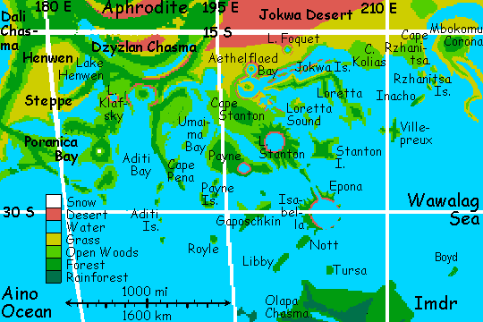
Your tour group meets at dawn on Aethelflaed Bay on the south coast of Aphrodite. Behind the beach the coastal hills are grassy, fresh from night rains--a welcome change from the Jokwa Desert and the dreary, dry-veldt plains around it, which you had to cross to reach this staging point.
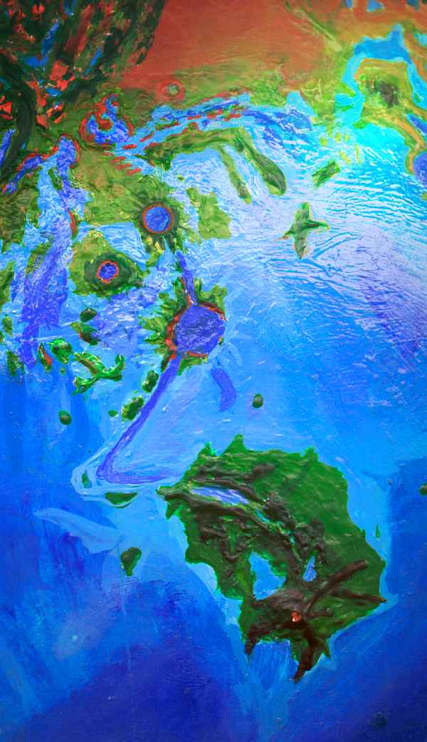
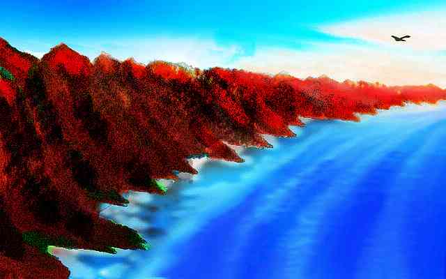
The coastal ridge here curves around the bay with suspicious regularity, and in the bay's exact center stands conical Aethelflaed Island. Figured it out yet? Aethelflaed's an impact crater 75 km wide, breached by the rising sea. Its floor is now a coral lagoon.
We all have wings, of course--mostly strap-on, but some native-borns have living angelwings. The air's pressure's nearly four times Earth's, so you can fly--and to tour the South Seas, you'll need to. We'll start off gently, though, hopping down Cape Stanton to its tip, resting frequently, getting you novices used to landings and take-offs. We start off west, round the curve of the bay. The miles melt beneath you--like wild geese, we cruise at 80-90 kph! In under an hour, Aethelflaed's behind us.
Ahead's an even broader curve to the coast and its ridges, and an even bigger mountain offshore in the center of the bight, this one linked to the mainland by a low grassy neck. Yet this "crater" has no official name, for it looks less neat and obvious on radar scans--it may be a corona, a huge, popped lava blister, not an impact scar at all. Whatever it is we're inside, to Terrans it looks bizarre--half Luna, half Red Sea coral.
Bizarre and big. Takes us a good two hours to cross it. No, you don't skirt this one--you need to practice terrains other than a flat beach. Out along the sandy neck, rippling with silvery dune-grass--and crosswinds! Over the low but rugged central peak, working unfamiliar muscles, buffeted by sudden windshifts over crags and gullies where low trees huddle--the first we've seen in a thousand miles. The summit is a luminous, lurid red--just tall enough to catch the first rays of the rising sun to the west (yeah, west. You did read the orientation leaflet, right?) For a minute, at the summit, we too catch fire, like a flock of moths around a stumpy candle. But we're more disciplined, aren't we? We can leave the light for later. Still, you can't help circling to gawk--the sun's still low enough to view painlessly, so you can spot the restless freckles of orbital sunshades passing in front of it, dimming its light significantly (and a good thing, too).
Come on, tear yourself away. Down the far side into blue shadow... and out across the bay. Take it slowly and steadily, and if you do crash, remember the drill: stall just above water, land loose and feet-first, take one big breath and duck under, unbuckling your wings immediately. It won't happen. Even novices can't cramp up in the 15-20 minutes it takes to reach the south shore: the Stanton Peninsula.
Well, I think Stanton's a peninsula. That curving ridge I suspect is a crater rim may be the only thing linking the land ahead to Aphrodite. If it has a gap I haven't noticed, we're landing on a gigantic island.
Island or cape, Stanton's 1000 km from its desert base to green tip. The stretch of low hills before us is in between--only a few shallow, obviously intermittent creeks, but scattered trees and greener grass than we've seen. It's not densely populated--just a few tribes of wandering prezebras. The climate's a bit too dry for megaparrot orchards without a lot of irrigation, and that's hard work. Parrots don't want to spend all day digging in the dirt.
Elephants should like such open, uncrowded country. I'm baffled why we haven't seen a single one yet--not that you often see a single elephant.
You do see lone winged coyotes--some of this species, like certain humans, can't tolerate too much company. Not elbow room--they're not much for elbows. "Wingroom", they call it.
We flap southeast until the coast reappears, a steady line of bluffs and heads (blond, crewcut heads) leading south. To the east, golden nameless islets dot Stanton Sound. Its far shore is invisible, just over the horizon--Loretta, 1000 km long but skinny as an anorexic.
Finally, the gulf coast bends east--the bluffs now face us. Here we turn inland, continuing south. The inland hills are higher here, and rise steadily. They look odd--ridges and valleys alike have random crags and boulders and weird waxy outcroppings, as if a nuclear bomb melted the landscape long ago. Long enough for open forest to cover the worst of the rubble... but under the green, even non-geologists can spot the scars. Something terrible happened here.
Ahead, the crest of the ridge glows with steady red flame--reaching up into sunrise again! You're tired by now, ready to camp, but push on, curious what's on the far side of the hills.
And you find out. They have no far side. They disappear beneath you, and you're fluttering in panic over a dark gulf, on the face of a great rugged scarp, dawn-lit, dropping into shadowy sea--no coral lagoon, but the midnight blue of an abyss. The cliffs march east and west straight to the horizon--no, not quite straight, a slight curve to them. It's a crater rim--a gigantic one, too big to see whole. This is Stanton--the impact that created this whole peninsula. All day, you thought you were climbing mountains when you were truly climbing... debris.
We camp near the rim, in the shade of a crag. You sleep twelve hours. And why not? You flew over 500 kilometers, 300 miles. You need the rest.
When you wake, it's Monday--meaning the sun's well up now, a big peach floating in the western sky. By now the low light's spread down the cliff face to light the Stanton Sea, in the pit. Suddenly you wonder just what world you're on. Red rimwall, blue abyss--Stanton, in this fiery light, is more Martian than Mars.
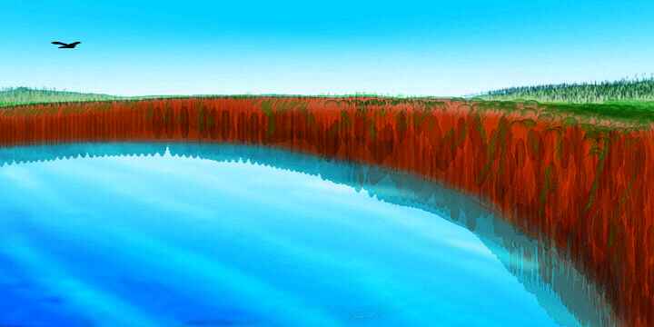
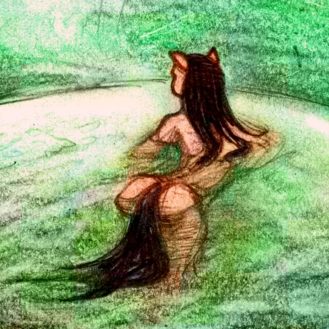
Lake Stanton? Stanton Sea? Debatable. The water's brackish and the fauna unique. At least three intelligent marine species have settled here. Along the steep shore are octopi and dolphins, both quickly diverging from their marine kin. And the deep water hides giant squid, cut off from all the rest of their kind--not that squid care. Twenty thousand square kilometers is enough to make a world. A sea of your own. That's the real reason we call it the Stanton Sea: its inhabitants do.
We'll follow the cliffs around the crater--I'm not leading novices over a hundred-mile abyss, not yet. Which way, then? To the east, the morning sun hits the scarp full-face, warming it and awakening updrafts--you can ride like a hawk over the brink of the abyss, effortless. To the west, the flying's harder, and the low sun's in your eyes at first. But stick with it--the rim soon curves south and dips to a low point. The coast nears--Payne Gulf, a long coral moat between Stanton and huge Payne Island, 550 km long and 300 wide. We stop to swim in the coral shallows and rest by its shore, then cross to Payne, a sea-passage of an hour or more, but a safe one--coral islets dot the gulf.
Payne's greener than Stanton--mostly a gentle quilt of forest and meadow. Mostly. Near the south shore is the exception--what we've come to see. Payne-Gaposchkin Patera is a volcanic crater half the size of Stanton, but with truly vertical cliff walls, scalloped into bays, mirrored in the lake on the caldera floor. I'm assuming, of course, that the patera's dormant! If it's active, the floor may be a bubbling mudpot hell. Either way, it's worth a day's detour.
On Tuesday, the sun's ambled up the sky far out of the orange zone into the gold. The higher light reaches down into Payne's waters--they glow an amazing spectral blue, like Crater Lake in Oregon. But these heavy basaltic cliffs are red and black. You're tempted to just sit all day and watch the colors change (sore muscles might have a bit to do with that), but we have islands to see. So you head east, away from the crater. Several hours over low but rough country, across the narrow strait of Payne Gulf (if it's not a river, if the gulf's not a freshwater lake--relief here is low and hard to be sure of. Yep, all that coral's contingent!).... Across Stanton's debris fan, near the great cape's tip. You've learned to hunt for updrafts--a sunlit cliff, the upwind face of a ridge. At first, the splash-ridges from Stanton's impact run south across our path, but slowly they turn southeast, and at last, you pick a big one and ride its updrafts like a highway.
Below, the coast is as lush as Payne. Rivers cascade down the valleys between splash ridges--the first large permanent streams you've seen. Out of the desert zone!
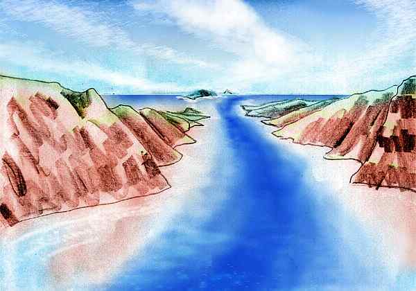
An hour or two later, the rivers end in narrow sounds, and even the rival ridges give up reluctantly, breaking into islets and sea-stacks and reefs. But you chose well--your ridge marches straight on to the horizon. This is Cape Stanton proper. But why's it here, why's this one string of debris so much large than the rest? That little mystery grows a bit when you reach the tip and find a long, ridgy island leading out into the Aino Sea. You could camp, it's been a full day, but you decide to take that symbolic step: cross the dark water. A cautious half-hour flapping over a 25-km strait, and you've left Aphrodite. The real journey's begun.
FLYING TO IMDR
All Wednesday, midday on Venus, you head southeast, gliding along the spine of this long nameless island, then over water again for a good hour, beating patiently toward Isabella, which at first looks like a mere low hump on the horizon. After landfall, you rest a long while, eat a huge lunch--for suppressing fear takes more energy than flight itself. Yet you know a 50-kilometer strait will soon seem like nothing.
No more sea-passages for a while, though--Isabella looked small, but you were seeing only its tip, end-on. The ridge rises steadily higher from the sea, like Cape Stanton in reverse. Soon a parallel ridge heaves out of the sea to the east--Epona Island. The sound between, straight as an arrow, is dark blue--deep for Venus. A trench with two flanking ridges--this looks like a small, flooded chasma! In hindsight, you wonder now--was Cape Stanton really just a line of debris, or this same chasma-ridge disguised by rubble? Epona rises too, the bluffs and cliffs growing taller until both sides of the sound are sea-mountains a kilometer high, and still rising.
And then both isles end abruptly in a dramatic gate. Beyond, the open sea is indigo--miles deep, deeper even than Stanton. Is it a blue hole, a sunken corona?
You pass through the gate, and hover in shock. It's Stanton all over again--but even bigger, harsher, more violent. Left and right, jagged cliffs at least a kilometer high drop into midnight sea, curving to the horizon. The long narrow islands you've been following for 100 km were mere fingers of the real Epona and Isabella. The high jagged rim's like a vastly scaled-up version of Santorini, in Greece--origin of the Atlantis myth. But this isn't volcanic--away from the blast rim, splash ridges fan out like the spikes on a great diadem. Here the crags and upended mountains and fused lumps are harder to recognize as debris, for these outer slopes of Isabella are lushly forested. This land's much rainier than Stanton--still not in the torrid zone, but much nearer the edge.
Thursday you ridge-hop south along Isabella. Over the hours, the inner cliffs slowly lower until they're mere sea-bluffs, then reefs. 250 km south of the great gate, Isabella ends meekly, slipping under the sea. Of course the arc of reefs, islets, and the deep central pit curve east and north again to meet Epona 100 km east of the great gate. But our flyway lies south. Again, there's a trench, and on the west side, a ridge following it--the Isle of Nott, about 80 km long. Are this rift and ridge an extension of the Stanton-Isabella rift? And did the impacts crack the crust and cause this chasma, or did they just happen to hit an existing rift? All I know is, the line continues south. Lucky for us! It's the only flyway to Imdr.
You sleep on Nott's south end, resting up, for Libby, the next island out, is a long haul, two or three hours over deep sea--the first time you've had to fly on faith, with no land on the horizon. In midflight, Nott sinks behind you, too, and you're alone in the center of a disk of blue. But your path is plain! A deep blue-violet stripe marks the chasma, outlined by twin turquoise coral-reef stripes--undersea ridges. The road to Libby.
Now, Libby's not Nott. Not at all. Oh, geologically, perhaps, but not ecologically. We've crept into the torrid zone. Libby's a roaring rainforest. Hot, fragrant, beautiful. The locals all live in treehouses 50 meters up, for the forest floor is a dim, moss-smothered maze, while the canopy's full of flowers and light.
Now comes your real flight test. It's four or five hours south over deep water, nonstop (250 miles, 400 km) to Imdr. For a wild goose that's nothing, but you're just a tourist, and this time there's no guide--the chasma-path does lead to Imdr, but with a large eastward bend that'd lengthen our flight by hours. So we cut straight across deep, featureless sea--just a turquoise bowl beneath you, and the flaming sky above.
Flaming? Yes. It's late Setterday now. Not Saturday, Setterday--when the sun sets. All day. As we've left Aphrodite's deserts behind, flat blue skies have gone dappled with huge cumulus, going up many miles in the thick air. The setting sun tints them gold, and slowly, over hours, the colors deepen through oranges and salmons to fiery magenta. You're more moved by this strange, frozen fireburst than by any of the islands you've seen. Just clouds over a sea--but what clouds!
But you're not quite easy. The sun's at the horizon now, and in an hour or two you'll be night flying over deep water. How can you see to land? Only the Terrans and Martians on the tour look nervous, though; and you find out why when the sun sinks at last. The light on the clouds shines for hours, and as your eyes adjust, you realize the sunset's not their main source of light. That's behind you--a great, blurry white arch in the northern sky. The rings! They don't just shield the dayside, they light the week-long nights--brilliantly. Depending on location (and we're prime) ringlight ranges from 500 to 2000 times brighter than Earth's moon ever manages. Once you adjust, it seems bright as day; colors aren't dimmed at all. The sky slowly fades from reds to golds to greens... and so you miss the green shore ahead, at first. Imdr. You've crossed an ocean under your own power.
And Imdr's worth it. It's a deeply isolated terra (mini-continent) the size of Scandinavia, or the eastern USA. Much of Imdr is Megazoic rainforest, with trees taller than Terran sequoias and a biomass denser than... well, than anything else known. It has a near-twin in the northern hemisphere, Tellus; how they'll diverge over time, and to what extent they'll manifest parallel evolution, are intriguing long-term questions. Long-term as in millennia, unfortunately.
We strike land in the far northwest--a cape that's part of Olapa Chasma, which leads straight inland, like an open trench for a pipe the size of New York. A narrow lake in the chasma floor reflects black cliffs laced with green vines and stripes with slender white waterfalls.
You've toured the Amazon, and at first the exuberant greet carpet below seems similar. When you land to sleep in a north-coast treetop village, where people live and work without ever leaving the forest canopy (what for?), even now this Megazoic rainforest, as it's called, still doesn't seem too different from Amazonian rainforest--just taller, the height of a coast redwood grove, perhaps.
That's because this isn't the Megazoic yet. The climactic zone's still hundreds of km south. This is merely Amazonian: rainforest second-class!
The next night, Eve, in the bright ringlight and faint blue remnants of day to the far east, you fly on south, into the heart of Imdr, and the clouds and showers grow more common (though most of the rain falls in the day, during great thunderstorms--one reason we came here at night), and the trees grow slowly taller, until they're routinely topping 120 meters, 130... twice the height and around six times the average biomass in Amazonia.
A few hours, and you're tiring, despite several stops in canopy villages and communes, populated by many nonhuman species--arboreals like sentient chimps, bonobos and lemurs, avians like giant parrots and cockatoos, with a 4-meter wingspan and 25-kg bodymass. (Even on Earth, they had the same social pressures towards intelligence as chimps (and our ancestors)--but Earth birds are severely constrained by flight weight. Not on thick-aired Venus. These big birds had room to evolve much bigger brains, giving them behavioral advantages... like civilization. Corvids find it too hot here, but the same holds true for them; mega-ravens are all over cooler, drier Ishtar.)
You push on, to L-shaped Lake Sandel, 150 km wide, by far the largest lake on Imdr. It was named for a nearby impact crater, though it's not a crater lake itself. It has no beaches--the jungle wades a mile into the lake--but you spend two nights here in a lemurian stilt village, resting and swimming off the piers, for the heat and humidity of Imdr are hard on unacclimated visitors, even at night.
Floating dimly over the lake is a great volcano on the southern horizon, looking like a snowless Kilimanjaro. It's Mt. Idunn, the highest peak on Imdr, indeed the highest for thousands of kilometers (and yet, it's less than 3 km tall--under 10,000' for you metric-impaired! Venus is flatter than Earth or Mars, overall.) Idunn's slopes have some of the densest jungles and heaviest rainfall on Venus--which is saying a lot. The ferny, grassy summit, above most of the rains, is about the only unforested patch in all of Imdr. We take our time flying up--we have all night. It's only early Witch by now, thirteenth in the two-week cycle. Dawn's still a full day off.
From Idunn's summit, at every compass point, north east south and west, you see jungle hills--indeed, jungle taller than the hills. But to the southwest and southeast, the sea shimmers on the horizon. We've reached Imdr's south end.
IN THE WAWALAG
Now we have a hard decision to make. Which blimp to take? For past Imdr, the Aino Sea sprawls unbroken for 1-2000 km, west, east and south--not a rock to rest on. And in the day, when the updrafts are best, it's hot and stormy--turning flight into drudgery and danger. Lightning kills! Only athletes, ecofanatics and suicides follow these flyways unaided. Blimps are the only way. Jets? Sorry, banned on Venus! They're too noisy and dirty and fast--so fast that your soul doesn't have time to catch up with you. Besides, in the dense Cytherean air, a blimp's payload is four times as big (read: comfort!), and jets can't travel all that fast anyway. Sailboats, blimps and angelwings are mainstays of Cytheran transport.
So we swoop down Mt Idunn like eagles, gliding to the southeastern tip of Imdr. The blimp station's offshore, on an islet kept manicured--lawns, flowers, trees, but no hundred-meter giants--they could snag the blimps. To our eyes, used to Imdr's jungles by now, woods and meadows look bald and unnatural. We get on--no, you don't pay! Money went extinct centuries ago--a social artifact that kept track of goods in an age of poverty. In the Age of Fusion, what's the point?
There are, however, tickets and waiting lines. Seating's so limited a couple of latecomers are told they'll have to wait a day. So you're puzzled, once we've boarded the Achek Run and cast off, to see several empty seats. You stay puzzled for some hours--until a midday stop at Boyd, a lonely volcanic island only 20 km across. The empties fill up with exhaused, crippled, stranded flyers, who were sure they could handle the sea-passage. They've been waiting days for their turn to leave. To hear them talk, Boyd is a prison for the crime of hubris. You're not too sympathetic--Boyd's a pretty little jungle island with mango and avocado trees all over; its only flaw is the humid heat, uncomfortable for most species. But they faced exactly that on the flight they chose, too.
On, with all seats full now, to the Achek Islands, 1000 km east, as the sun tries to rise behind us, and fails. Blimps are no faster than angelwings (or a migrating goose), around 100 kph; but at this latitude Venus spins at only around 80 kph, so the sun's pretty much frozen in mid-rise--even more than usual, I mean. We glide through fiery tower-clouds all the way.
We disembark at Achek Station, on a clifftop. The Acheks are rough, cliff-walled island-mesas worthy of Mars, rising from the Wawalag Sea. Achek itself, by far the biggest, is a fat J shape a good 120 km across, forested right to the cliff-brink. Achek's pleasantly hot, but not as muggy as Boyd. On our own wingpower again, we hop over deep water, then ride updrafts along black cliffs, steadily east through the chain. At some point (soon if you ask locals, never if you ask geologists) the Acheks turn into the Hlineu Islands. After the chain kinks south then east again? When the cliffs and crags soften into low islets? When you realize the woods are turning into jungle? But when was that?
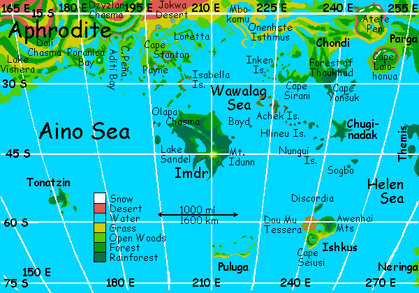
Well, wherever they start, the Hlineu Islands may be hard to pronounce (hint: the "hl" is an unvoiced "l", pronounced so loudly it hisses. Sounds more like a mix of "sh" and "th" than like "l". You're on you're own for the eu.) But they're easy to remember--just cut both ends off the name and you get "line"--and the Hlineus are just that, an east-west finger in the middle of the Helen Sea, pointing neatly at the lonely land of Chuginadak. Though not much larger than Hawaii, they're lush and full of unique species because of their warmth, rain, and isolation.
We hop along the island chain, and at the end, veer south to use the Nungui Isles as a bridge--a conveniently placed group of islets, satellites of larger Chuginadak. While small for Venus (none larger than Maui), these islands too are lush, with huge trees and rare species.
Then we fly up to Chuginadak itself. You're experienced now--you don't let a mere 200-km deep-sea flight faze you, even in the torrid zone. Sure, it's hot already (Tuesday, midmorning), but the worst of the thunderstorms don't roll in till Thursday or Friday. So you fly straight out toward nothing, guided only by the sun, confident land will appear over the horizon eventually--and Chuginadak's hard to miss. It's a shield volcano 350 km across, a craggy asterisk of a land, all tongues and bays, and every foot's smothered in Megazoic rainforest nearly as dense as Imdr's jungles.
Some bays are shallow enough so the megatrees have taken root, rising from the sea like a scaled-up Okefenokee Swamp. A local woman derived from some tropical cat (clearly one not averse to water; she swims every chance she gets) leads us through the flooded forest on her boat. Fluted flying buttresses reflect in the glassy water, dim and green-lit in the shade of the dense canopy. It's like some carefully carved Gothic apse, all graceful arches, yet grown, not made.
Your newfound confidence gets the better of you, and you propose flying to Ishkus. But that's 2000 km south, and though the Sogbo Islands make the longest hop a mere 1400 km (still 900 miles) that's a good 15 hours nonstop, in the air, on a little-flown route, during the stormy season in the torrid zone. Oh, you'd probably escape heatstroke, lightning, and drowning--but it's too risky, and as your guide I refuse to go along with it.
You reluctantly give in, and we board the Ishkus blimp. Over the next day and a half, as the monotonous Helen Sea rolls by, and thunderstorms roll by and over us, and lightning crackles and strikes our ship over and over like a whip-mad cowboy, you begin to realize how long and grueling this flyway is.
At sundown, the blimp stops on Discordia, a forested island around 100 km long, just before Ishkus. Discordia's just an above-water fin of a mass of ridges and arcs stretching 2000 km north to Chuginadak. Despite its name (the Muse of Obnoxiousness?), Discordia's nice enough, with gentle hills and a Californian climate. We get off and explore, leisurely. We can fly on our own to Ishkus; it's in sight on the southern horizon, only an hour or two away.
ISHKUS: WORLD'S END
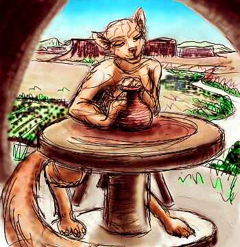
Ishkus is a heart-shaped island the size (and climate) of New Zealand. Northwestern Ishkus, where we land, is called Dou Mu, after a Chinese mother goddess. It's a tessera zone, a fairly dry one, with polygonal mesas of chaparral above canyons of oak and redwood. After the humid, overgrown lands we've been visiting, it seems almost Martian--so stark, so quiet, so spacious! People here are a different mix of species, too--ravens, angels, bears. You meet a family of quiet gliderwolves, potters who live in a pueblo atop a mesa. They ride the updrafts on their skin-flaps like huge flying squirrels...
We spend a couple of days exploring at leisure. It's not a dramatic land--just quiet, pleasant, oddly Earthlike (at least to a Californian or New Zealander). We head southwest, onto the plains. Here in the heartland lies Lake Ishkus, a crescent 120 km long with long beaches. But again like California, and unlike the humid, scented, sticky Torrid Zone we've left, the dry air here cools after sunset--night swimming's a bit chilly, unless you have insulation like the local otters.
To the east are the low, piny Awenhai Mts, whose forests hide villages of woodcarving bears living in longhouses you'd swear were Tlingit or Maori--totem poles, shell inlays and all. During the dark polar nights (the equatorial rings aren't prominent here) they put on great play-cycles in their torch-lit halls, full of masks and songs. But they won't start for a day or two yet--everyone's finishing costumes and smoking salmon and making jam from the daylight crop of berries.
So we fly on, south to Seiusi Corona, a wide, blunt peninsula with oak hills and meadows, a few redwood groves in the coastal valleys, and a pretty little central lake. Human and raven land, mostly. And then a shore--the back shore of Ishkus. Land's end. World's end.
You stand on that shore, staring out over a dark sea. This far south, the rings are largely cut off by the bulge of the planet, and now, at midnight, Venus's shadow falls on the central part that climbs over the northern horizon. It's the darkest night you've seen here--the sky turns indigo if not "midnight blue," colors dim and turn coppery--the ring-stumps are being lit by sunset light from all around Venus, just like the bloody moon sometimes seen when Terra eclipses Luna. It's spooky, and birds go silent. You count a hundred stars--a rare sight.
The dark fits your melancholy mood. Our tour is winding down. Ishkus does have a twin, Neringa, 1800 km to the east, but we won't detour to see it. Neringa's linked by island chains to Lada so it's at the end of the Lada tour.
Instead, our next stop, probably our last, is Puluga. This one, we can reach on our own wingpower--just barely. It's a long hop, some 600 km, but not too risky, as some islets 200 km out provide rest, water and food, and we're out of the thunderzone. Even the long hop is crossed in four or five steady hours. Of course, if for any reason you fall into these lonely seas, no one can rescue you in time. But in the late night, once the ringlight returns, it's a long but simple flight.
ISLES OF LONELINESS
Puluga is a long, low polar island, or islands--due to the poor quality of south polar altimetry I'm not quite sure if Puluga's a thousand-km cresent of low, grassy ridges, like some huge sandbar with satellite reefs, or a chain of two or more long sand-spits, or just a few smaller islands, the tips of the ridge, with long reefs between. In any case, the long ridge shelters a great crescent-bay to the north, which is dotted with either small islands or rocky, kelp-forested reefs (not coral--it's too cold). The climate is cool and dry for Venus, with more drizzle than rain. Days are sunny and mild, or foggy and cool. Though it's polar, Puluga never freezes. But the wind blows, and blows, and blows...
The Puluga islands are sparsely populated. That's a polite way of saying lonely--Puluga's somehow melancholy in a way that Ishkus isn't. Those extra few degrees south? Or the low, windswept, precarious nature of the land, so obviously just a few meters above blue oblivion?
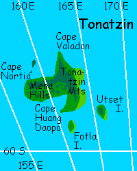
TONATZIN
Or maybe it's just my mood, realizing there's nowhere left to go, nothing left to show. Last of the Venus tours, over. Oh, wait. One last South Sea island I always forget--everyone forgets. It's so damn isolated! Tonatzin has to be the loneliest place on Venus. Even from here, its nearest neighbor, it's a long blimp ride west: fully 1600 km.
This close to the pole, the timezones are so crowded that the sun, still well below the horizon when we embark, rises within hours, at almost Terran speed. The sunrise colors calm and blend into blue sea, blue sky in only a few hours. You've been on Venus long enough now to find this unnatural...
At last Tonatzin crinkles the horizon to the northwest, a black silhouette in the morning light. Another day, another terra! Well, not quite a terra (a million square km or more) but a pretty big island--Tonatzin's a good 350 km wide, a sideways T shape riding the back of the Dsonkwa Rise, deep in the Aino Sea. That's all I know about it. We'll just have to see if it's as depressing as Puluga.
As we climb down the blimp ladder, the warmth and humidity startle us. What a difference twelve degrees make! We're back on the edge of the torrid zone, and now that pseudo-tropical air seems friendly. Even the fierce morning sun seems friendly after the chill of Puluga. A choir of parrots greets us visitors--just a local glee club, with screechy parrot voices, but full of red and green laughter.
Suddenly Venus looks pretty good. And suddenly you decide you'll quit touring, and take your time here, and get to know some people (of various species) before deciding when, or if, you'll take the blimp back to Aphrodite, and the spaceport, and practical, cynical, human old Earth.
I think I'll rest here a while. 300 pages, even if they're a webmaze, a mere frizz of electrons, nothing material, are--were--as much work as any novel. I think I've earned a hammock and a snooze. And maybe, if you read this and build Venus, Venus the way it should have been, then, a thousand years from now, you can name a bluff or something after me.
That's what this is, after all--Wayan's Bluff.
Talk is funny stuff. Water solidifies into ice; talk solidifies into... reality.
Talk the world you want into being! That's how it's done. And always was.
Our revels now are ended: these our actors,
As I foretold you, were all spirits, and
Are melted into air, into thin air:
And, like the baseless fabric of this vision
The cloud-capp'd towers, the gorgeous palaces,
The solemn temples, the great globe itself,
Yea, all which it inherit, shall dissolve,
And, like this insubstantial pageant faded,
Leave not a rack behind: We are such stuff
As dreams are made of, and our little life
Is rounded with a sleep.

World Dream Bank homepage - Art gallery - New stuff - Introductory sampler, best dreams, best art - On dreamwork - Books
Indexes: Subject - Author - Date - Names - Places - Art media/styles
Titles: A - B - C - D - E - F - G - H - IJ - KL - M - NO - PQ - R - Sa-Sk - Sl-Sz - T - UV - WXYZ
Email: wdreamb@yahoo.com - Catalog of art, books, CDs - Behind the Curtain: FAQs, bio, site map - Kindred sites