Venus Unveiled: Beta and Asteria

INTRODUCTION
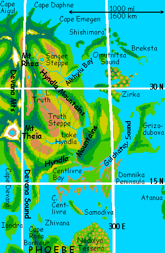
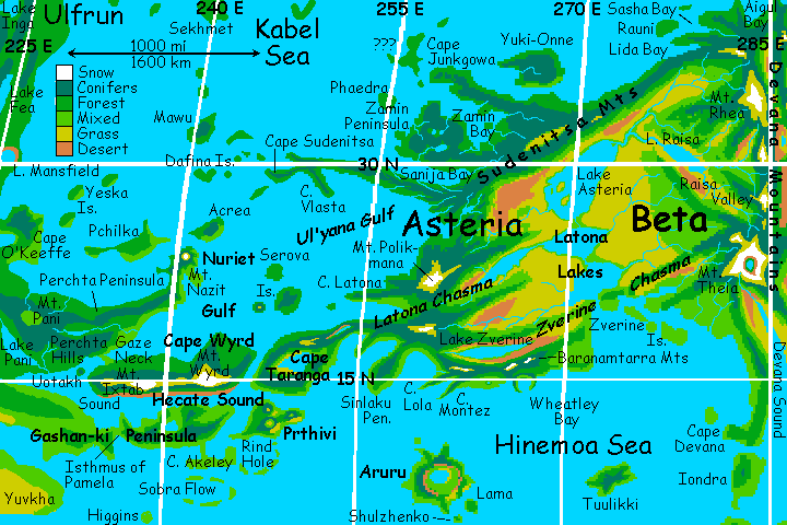
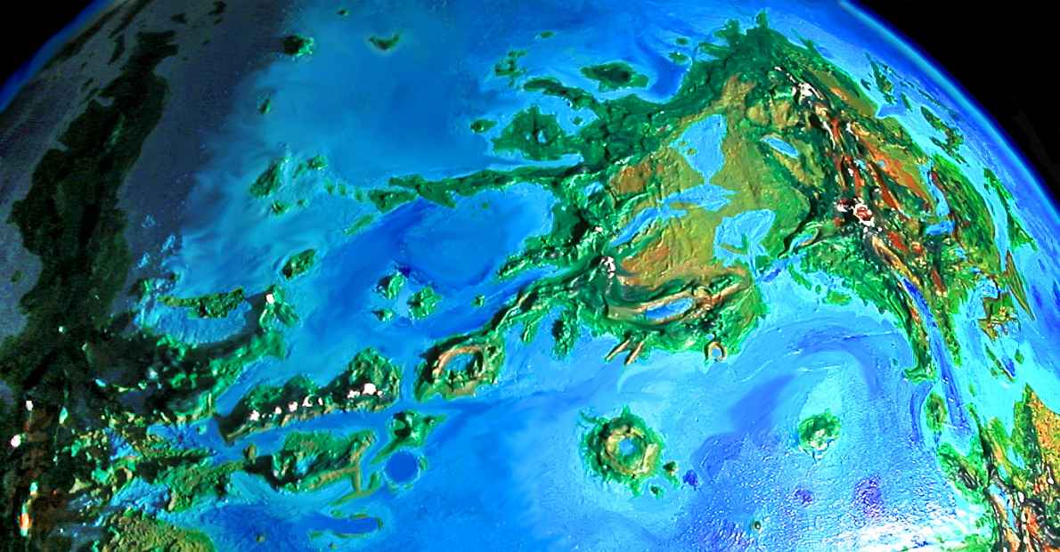
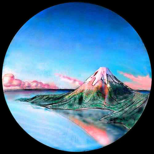
Beta's a continent in Venus's northern hemisphere the size of Australia. Beta rises southwest of Ishtar, east of Aphrodite; it has a rugged north-south spine with a rift down the middle, Devana Chasma. At least two peaks, Mt Rhea and Theia, are over 4 km high. The south and east coasts are green, and the north coast is lush rainforest, but much of Beta's interior is desert and prairie broken by pine-clad ranges. The same is true of Asteria, the western subcontinent, linked to Beta proper by a northern land-bridge. Asteria trails off into a tangle of ridges, islands and sounds called Hecate Chasma, leading west to Aphrodite.
BETA
We'll start at sunrise off Beta's southeastern shore, on Samodiva Island, the easternmost flyway from Phoebe to Beta. Samodiva's a diagonal ridge 300 km long, Hawaiian in climate, though turned around--the west is lush, the ridgetop is rainforest, but the east end has desert canyons like Waimea on Kauai. It's also a superb place for flight practice. Prevailing winds here near the equator are from the west and southwest; hitting Samodiva's long ridge full-on, they rise in a wave of updrafts we can ride for hours, while you learn confidence on the wing.
You'll need it. From Samodiva's northern tip, you can see the coast of Beta--the scalloped cliffs of Cape Centlivre. To reach it, we must fly nearly an hour (at a beginner's pace) over water. Crash and you'll almost certainly drown! So stay calm and try no tricks. Ready?
To the east, wedge-shaped Cape Domnika is scalloped too, and the cliffs continue north around Gulchatay Bay, which stabs 200 km deep into the Hyndla plateau and Cape Domnika. We wander northeast all day, gawking at the maze, then land to sleep near the brink of a cliff in northern Domnika (the edge is grassy and wind-blasted, free of the low trees found inland, so it's actually a safer landing site for beginners.) You're so tired you have no trouble sleeping in broad daylight on a cliff-edge.
When we wake, on Monday--spring on Venus--it's time for another sea-passage. Just offshore is Grizodubova Island, in the Guinevere Sea, part of the Navka Archipelago, a loose chain 6000 km long. "Griza" is really two triangular islands linked by a narrow ridge 150 km long, popular with gliders, as it too lies across the prevailing winds. We'll practice aerial maneuvers as we head north--the turbulence on the Centlivre Cliffs nearly slammed you against rock faces more than once. Griza is safer--gentle slopes, wooded along the ridges and along streams, otherwise oak savanna and sunny beaches, with a mild, dryish climate (Griza's slightly rainshadowed by the dry prairies upwind, on the mainland). We practice all day, and sleep on a beach near the north end. You're tired, but you can sleep as long as you like--that's one thing about Venus's strange cycle. The morning will always be there when you wake.
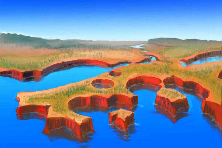
Now comes the test! Survive this and you're a real flier. We head northwest, into the sea. No breaks, no rests, no perches--no margin for error. And on the horizon, nothing at all. For a couple of hours, you have to take on faith what (in hour number three) finally emerges from the sea: the next island, bizarre Zirka. (Zorry! It's infectious. The place is even shaped like a Z). Zirka's terrain is mostly tessera. Here they're big mesas cut by canyons in two directions, like the Waffle Iron Of The Gods. So Zirka's covered with red-cliffed mesas capped in forest--not thin olive desert scrub, but lush forest, green as a punk hairdo--looming above shady, zigzagging, fern-forest canyons. All day we wiggle up the Z, dodging between mesas, cooling off in the creeks, and sleep on a northeastern beach.
Today we'll fly straight out into the Guinevere Sea--an easy flight this time, hopping from islet to islet. We'll sleep on the last one, rest up before crossing to Breksta, looming on the horizon. The Breksta Islands are a rugged ridge intermittently breaching the sea. Breksta itself,. the southernmost, ends the chain by forking into twin arcuate capes around a deep blue hole in the sea, like fingers around a plum. These blue holes, common on Venus, look like old impact craters--rimless round flat-bottomed pits--but they're mostly coronas, gigantic bubbles like those in mudpots, but hundreds of miles across. Most coronas bulge, but some pucker instead. Some, like Breksta Hole, even have a raised rim like a crater, and look like coral atolls.
That atollitude extends underwater.
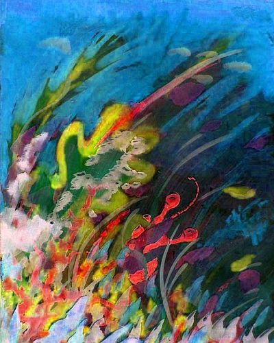
And that's the real reason we came--to take a break from flying, and dive down the lovely vertical reef-gardens of Breksta.
Just be careful--don't dive deep. In Venus's dense air, you're already on the verge of nitrogen narcosis (Rapture of the Deep, they used to call it). Here, the danger zone is well within reach by snorkel--it doesn't take scuba gear, as on Earth. Just five or ten meters down, you'll get woozy. Bad judgment. So stick to the shallows!
The Brekstas run parallel to most storms, and have no dry side, unlike most of these isles so far. We make our way up Breksta, the sea on both sides of us, a green dragon's spine under us. As noon approaches (this is Wednesday, remember?) the hills sink waist-deep in the sea, and channels appear between them. Time to sleep! A busy day, both over and under the surface.
At the north end of the chain, we cross to Shishimora, a second long, rugged land too--only 100 km wide but 450 km long. Shishimora's climate is Hawaiian, with a wet and dry side--a bit like Samodiva far to the south, though hotter and rainier overall.
By now you're a veteran flier--a few hours' steady work and Shishimora's western tip's beneath us. Out over unbroken sea with no more fear--in fact, the dark blue vein of deep water on our left isn't threatening, but a guide. It's Aikhylu Chasma, leading west to the mainland.
You do remember the mainland, right?
You land on the beach at Aikhylu Bay, and sleep 14 hours. The sun's moved visibly--you were tired! And why not? You flew 750 km--nearly 500 miles.
Today we fly straight inland a couple of hours over the coastal hills, a low stretch of the Hyndla Range, with few peaks topping a kilometer. Much lower than the volcanoes and mountains inland, but rugged--a mass of north-south whaleback tessera, bumps and fins like the pebbly skin of the World-Serpent.
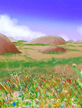
The hills end in a cliff dropping into a sea of golden grass--Truth Steppe, a prairie 500 km across. The basin drains south into Lake Hyndla, gleaming on the southern horizon--a narrow ribbon 500 km long, clinging close under the Hyndla cliffs, mirroring them.
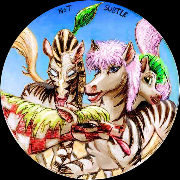
We set out over the grass sea, passing herds of locals who look like tie-dyed zebra-horse hybrids--prezebras, they're called. A loud, exuberant people prone to tall tales and clowning.
We pass like clouds over the endless veldt, stopping here and there in zebra camps, hearing gossip, enduring teasing, witnessing a song-duel.
Witnessing lots and lots of blue, screaming pink, chartreuse, and lurid purple manes & tails. Naturalism is all very well, but why stick to black and white when you can have color? Hard to argue purism while clinging to the golden mane of an engineered world. Zebras see Venus herself as a planetary dye job.
Plus cometary moisturizer. Lovely make-over! A thousand-year appointment, but beauty, as Venus (the goddess, I mean) has always said, takes art and time.
Slowly the grass sea frays from green and gold to tawny brown to rusty desert, though veined with green by streams from the high mountains on the horizon. This side of Truth is under the rainshadow of the high Devanas; as we near, the snow falling on the height means less rain down here.
You spot a strange butte to the north, and veer toward it. Seems perfectly round and flat-topped. A farrum? A feature unique to Venus, often called a pancake. Circular, miles across, maybe 100 meters high, a great puddle of congealed lava that formed exactly like a breakfast pancake, hardening at the edges first, holding the rest in...
Does the extra height snag enough rain to sustain a circular wood? It works on the High Plains--think of the Black Hills dark with pine. Climb the edge and see! The wind's from the west; updrafts form on the windward side, so it's no work. Just be mindful as you ride nature's escalator. For when you reach the summit-ridge, ready to see what a farrum-plateau looks like... you're in for a shock.
A gaping hole! Not a pancake, but an impact crater over 50 km wide, now holding a marshy lake--Lake Truth. Not truth in the abstract, but in one of its more heroic forms: the full name is Sojourner Truth. This particular sojourner was made of nickel-iron, and its journey ended abruptly.
We swoop down the inner slope of the crater and sleep by the lake. Resting secure in Truth.
It's hot when we wake--Thursday, high summer. To the north the Hyndlas swing inland to meet the Devanas. We fly up to the juncture, then veer northeast over the Hyndlas (easier than crossing the Devana Range!). They drop away to a second great prairie--Sanger Steppe, draining into Aikhyla Bay at its south end.
Ahead's another ring, but this time, from the heights of the Hyndlas, we're not fooled. We can see what's inside--Lake Sanger, a crater lake round as an ovum (this one's named for birth-control pioneer Margeret Sanger). Hmm. High gold plain, crater lake named for American feminist icon, mountain-wall to the west--why, it's "deja vu all over again"! Coincidence, or is God (well, NASA) trying to tell us something?
From Sanger we fly due west, over a prairie, a forested ridge, a high desert valley that could be in Nevada, even higher pine ridges, tiring as the air grows thin (merely triple Earth's--thin enough to make flying noticeably harder) and finally, alpine meadows. And, ahead and above, snow! But how much? Glaciers, or just snowpatches? Either way it's a shock, after days of warm sun. Thank God it's Friday! Mild spring weather, wildflowers instead of blizzards. (Well, actually, thank your tour director. Timed it to avoid the snowstorms on Rain and Witch.)
Mt. Rhea, looming over us, is the highest mountain (over 4 km) in northern Beta, rising above Devana Chasm much like the Ruwenzori does over the East African Rift. It was believed to be a volcano, but more recent interpretations of the radar scans lean toward a huge dome. In other fuzzy spots on the tour, I've made my best guess and gone with it, but I'm mentioning my doubts about Rhea's nature because I can't make sense of these radar scans either. It's there, it's big, it's going to be (given my climate model) alpine, but it beats me just what Rhea's like. Will glaciers form? How fast? And after centuries of freeze-and-thaw every two weeks, will Rhea be intact or an eroded mess? Venus's rocks are tough (they've survived acid and terrible heat) but they've never had to face seepage, frost heaving, oxidation, glacial carving. A dome, a volcanic cone mantled in glaciers, a Matterhorn, a maze of crags, a monstrous heap of rubble?
Well, let's leave Rhea to struggle with her identity. We ride the upwinds along the Devana crest all day, dropping as the mountains do, back down into real air. It's a free ride--all downhill to Cape Daphne, the northern tip of Beta. Daphne is a narrow, wooded ridge running some 180 km out to sea. The Daphne coast is lush rainforest--it's the only part of Beta in the torrid zone. Not bad--from ice to Amazon in one day. We sleep well on a palm-tree beach.
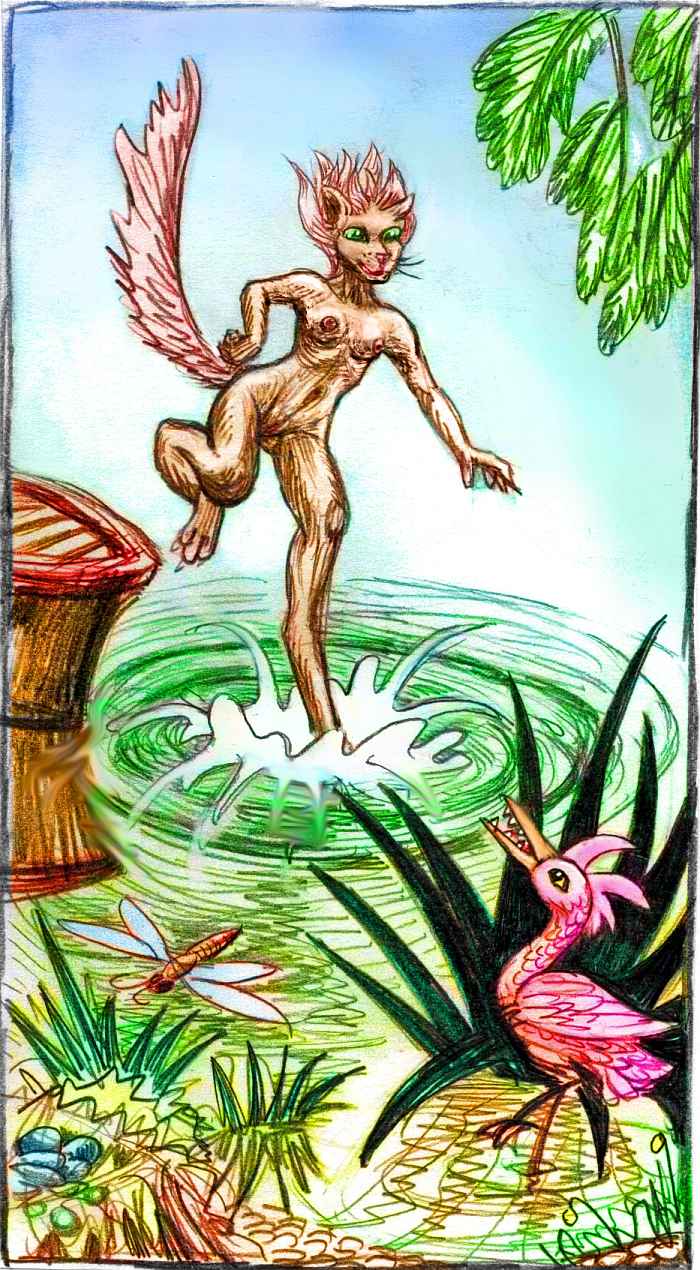
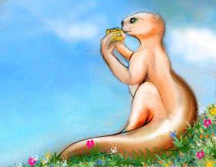
West of Cape Daphne the jungle coast wrinkles in and out: first Aigul Bay and Cape Aigul (the end of Devana Chasma's western ridge), then Sasha Bay. The sea here is as rich as the land: the currents in Kabel and Sedna Seas mix offshore, causing turbulent upwellings loaded with nutrients. Beyond the exuberant coral reefs, schools of deepsea fish abound, clam and oyster beds fill the shallows. I suppose it's inevitable that locals call it Sushi Bay. A maritime, fishing subspecies of leopard people live here, with tawny, unspotted coats and reddish tails and manes (both male and female), quite comfortable in the water (tiger genes, or fisher cats, or what?)
Another hour on the wing brings us to Rauni Island and Lida Bay. Next the coast sweeps southwest in a wide bight--deep water offshore. We follow the Coast Range. Inland, over the crest, are the Asterian Steppes--here just a strip bordering what looks like a second, southern sea. Not! It's Lake Asteria, largest of the Latona Lakes, its far shore over the horizon east, west, and south. But in the cool of the evening, the fragrant warmth of the jungle attracts more than the dry prairie inland. You turn and sail down the wooded northern slope to the sea, and sleep on the beach.
It's a bit arbitrary, but I say we've entered...
ASTERIA
When we wake, it's Eve already. Dusk passed quickly because we flew due west, fast enough to affect the length of the day. Jet lag without the jet! Remember, Venus spins only about as fast as you fly...
Flap northwest, over a narrow, coral-choked channel to Yuki-Onne, a densely forested tropical island 400 km long and 200 wide. It catches torrid-zone storms from the Kabel Sea, and so is entirely covered in hot, lush rainforest. Yuki-Onne somewhat shelters the mainland mountains, which are still warm and rainy, but not a steambath.
Next we cross to Cape Junkgowa, 500 km long, and fly along its steep ridges. Junkgowa, too, supports dense tropical forests. I'm tempted to lead you west to the tip and out to sea. Though nothing's on the horizon, just beyond it is a whole chain of islands I know nothing about--their names, their exact size and locations, their topography, their origins. Just low, wide nameless bumps on the altimetry scans--yet definitely there.
Oh, well, let's leave some mystery. Get some sleep...
When you wake, it's Yule. We fly south, toward the strange glowing rusty towers beyond the horizon. Venus's shadow has blacked out the middle of the rings, and the penumbra, the partially shaded areas on either side, are bloody and dim, tinted by light refracted from sunsets half the world apart. The two bent, leaning towers of blood are reflected in the sea, making a shape like a huge, bloodshot, blind eye--no pupil.
Well, a tiny one--Earth, which happens to be swinging close this month. Though it's no more than a dot, Earth shines as bright as our crescent moon. All those white clouds, seen full-lit! Luna huddles near Earth of course, and is full--it always is from here--but barely visible, it's so small and dim. Dark lunar soil! We don't realize, having no Earth in our sky for comparison, but Luna's quite dark as moons go.
Also barely visible: Mars, about 3/5 of the way up from the horizon, in line with Earth and Luna. That's as bright as Mars ever gets. Farther away than it is from Earth, swinging out in dim light, filtered by Venus's dense atmosphere, outshone even by the ring-stumps of Yule. As dim as Luna.
By stumplight, you see no land silhouetted on the horizon. But trust me! A couple of hours, and land will appear. Very big land...
It's Zamin Peninsula, a rounded, hilly corona the size of Ireland (though it looks more like a cluster of smaller coronas to me, probably with lake-strewn valleys between them). Zamin is verdant, with dense forests in most places, but not quite as hot or rainy as Junkgowa and Yuki-Onne. It's in that pleasant borderzone between warm and too damn muggy. Carolina? South China?
We sleep by a lakeshore in west Zamin. Offshore is the Isle of Phaedra--a hundred-km-wide island, mostly forest, with a few meadows. The climate's warm, mild, and maritime. Not big or important--just a nice place to live with an elegant name (at least compared to Junkgowa). We won't go there, it's a dead-end in the Kabel Sea; I want to cross Zamin due south, to reach the base of Cape Sudenitsa, which is a better land-bridge for us...
So when we wake and grab the cool, rainy night air (it's Rain now) we fly up, through the cloud layer, till the rings, now mostly healed, shine on a cloud-sea. South out of the rain, south toward the light. Through breaks in the clouds (but partly, I admit, through guesswork) we navigate over the narrow channel to the green ridges beyond--Cape Sudenitsa. We turn and follow the range west toward dawn. The clouds fade slowly, and we get a look at the land.
Sudenitsa: rugged slopes, a mass of parallel ridges knotted like muscles: stringy tessera! But softened, feathery with broadleaf subtropical trees. We climb to the peninsula's spine, where the forest darkens to pine. Sudenitsa's 1000 km long but only 120 wide--riding the winds high over the spine, we can often glimpse both shores at once, through the broken clouds.
It's a steady night's flight, hundreds of km, before we spot land off to the south: Cape Vlasta. The channel narrows steadily over the next two hours till Vlasta anchors in the side of Sudenitsa. We won't detour to explore it--Vlasta runs southeast, back toward the mainland, like the barb on a fishhook, to dead-end in the Ul'yana Gulf. Later a northern cape branches off--together they form a sort of crossbar.

Vlasta's mostly open woods--the climate's warm and fairly rainy, but not hot. I'm not sure if Vlasta has tessera or not. Certainly the Sudenitsa Peninsula does--ridges running in two directions intersect diagonally, making a mesh of raised veiny ridges with sunken lozenges between them.
In flatter lands like Tellus, you see a grid of lakes and ponds in the basins between ridges, but on this already tilted, rugged ground, the effect is partly masked. And on Vlasta, I'm just not sure what you'd see, underneath the tall dense forest.
The locals don't know either. They never go down there, into the gloomy understory. Why go visit muck? Life, light, views, fruit and flowers are all up in the canopy, and that's where people live. Not humans of course--arboreals. Locally, that means tree-cats and megaparrots, comfortable fifty or a hundred meters up. "The word for world is forest."
At the end of Sudenitsa, we face a decision: do we fly northwest, to Dafina and Mawu? Dafina's a crater-island--well, more the cone of ejecta around it, a heap just high enough above the shallow seabed to make an island. There's (probably) a central lake. Other islets around Dafina lead from Cape Sudenitsa to Mawu, a drowned corona that forms a land as big as Sicily. Like Dafina, it's very fertile--open forest dotted with lakes and meadows. The climate's warm, mild, and maritime. A long chain leads north to lonely Sekhmet, as big as Mawu--200 km long, 100 wide. They're not twins, though--Sekhmet is Megazoic rainforest deep in the torrid zone, with trees up to 130 m tall (400') and twice the biomass of old-growth redwoods. I don't think we'll go that way. Beautiful islands, but a dead end. Besides, the sun will soon rise, and it'd be right in our eyes for two days.
Instead... let's go southwest and tour the strange lands of Hecate Chasma before returning to Asteria and Beta.
HECATE CHASMA
We have a long flight now, 300 km over the narrowest point of Nuriet Gulf, 5-600 km wide--a warm subtropical sea with coral reefs around its fertile shores and big puffy clouds, rose and salmon in the dawn (sunlight hasn't reached us yet, but it's only a few miles up). We're headed for Perchta Peninsula, to the south, then east again via Gashan-Ki, Sobra and Rind Atolls, Prthivi Island, Cape Wyrd (I do NOT make these names up!) and the Taranga Peninsula, back to Asteria, then Beta. (Sound complex? I'm simplifying! Hecate Chasma's as complex as Terra's Spice Islands--and as vulnerable to transformation from modest changes in sea level. I thought most of these were one big Hecate Island till a few days ago, when I looked closer at the altimetry in the channels. Massive rewrite--based on a few narrow channels and isthmuses. Isthmi? Whatever.)
We make landfall on Acrea, a green island 150 km across, just off the tip of Perchta Peninsula on Ulfrun (the "scorpion's tail" of Aphrodite). Acrea's mostly open subtropical forest, with denser rainforest on the northwest slopes. It's pretty enough, but a beacon lures beyond: over a narrow strait to the south looms Mt. Nazit, the tallest peak on the Perchta Peninsula (named for the German goddess of spinsters, I think--or is that Berchta?)
Mt Nazit stands right at the peninsulas's tip, her toes in the water. Pine forests cover the volcano's slopes, but the summit's snowcapped. Well, dusted--it's probably just an inch or two, laid down in the cool of the night, soon to melt in the fiery light creeping down the peak. A lurid pink glow. Raspberry ice cream cone! In a burst of enthusiam or bad judgment, we cross the channel, circle the peak until we catch the updrafts on the back side, and ride them to the summit and camp in the sun and frost. A glary way to sleep! Over the long night, we've forgotten how to sleep easily in Venus's bright day. No choice but to relearn that one... So we nap and wake and nap...
When we blearily wake for good, all the lesser peaks flame with light. We've crossed into both Aphrodite and Sunday.
We glide southwest, down Gaze Bay (Gaze sounds more like "gauzy" than "gays"--the name's borrowed from a drowned crater near the mouth of the bay--the valley on Old Venus now flooded to create the bay wasn't notable enough on radar scans to merit an official names of its.) On our right loom the steep Perchta Mts. Originally, I thought Gaze was a strait between the Kabel and Hecate Seas, but there's a low, narrow isthmus at the head of the bay, a mere strip of sandbars and low bluffs covered in dune-grass, linking Perchta (a finger of Aphrodite) to Wyrd (no longer a great island). Despite the piny heights all around, down here on the coast, Gaze Bay is mild. Headlands and islets are grassy, the slopes are open subtropical woods. Reminiscent of the Acapulco coast, it's a pleasant habitat for unmodified humans.
South, beyond the neck, is the main channel of Hecate Chasm; this stretch is called Uotakh Sound. No, not a typo--Uotakh. Well, that's simpler than its official full name, Uotakh-Sulus, isn't it?
Eventually, we'll cross Gaze Neck into Wyrd. (Yes, I heard you mutter "crossed into weird a long way back".) But I want to detour, see the rest of Perchta first. It's a big beautiful land--northern New Zealand or south England but with a landbridge to the mainland. Up ahead a gap opens in the Perchta range, a valley mouth that looks positively Terran, though it sure wasn't cut by water. We follow the Perchta River up for two hours--open meadows and marshes in the middle, but mostly forested walls. It's notably drier, though, than we've been used to for days, as we skirted the edge of the torrid zone. The valley's north side has low but rugged hills--the edge of Pani Corona, dark with conifers.
Over a low pass, and Lake Pani sprawls before us. A narrow two-armed lake 300 km long, Pani is fed by streams from the green hills to the northeast, with a few contributions from the drier ridges to the east--the fringe of the Zisa Mountains. The Pani River winds and loops below us, indecisively bumbling its way to Uotakh Sound. The lake valley is a pleasant mix of grassland and oak groves, with brighter deciduous woods along streams and lakeshores. It's drier than the rest of Perchta because the deserts of huge Aphrodite cast a long rainshadow... The rift is a branch of long Hecate Chasma--the west end, more or less. No need to climb the ridge to deep blue Upper Lake, or cross Pani Bay to Cape O'Keeffe, lovely though they are...
I'm skimping here because we've strayed onto the continent of Aphrodite, technically out of bounds for the Beta tour. I only came this far because it's a corner I missed on the Aphrodite tour (on a continent that big--half the land on Venus--you can't cover every little corner the size of England.)
I think we'll also skip the maze of sounds and islands stretching 2000 km south of us--for one thing, it's mostly flat, grassy scrublands, not too exciting unless you like elephants or zebras, or are one yourself--like most of the locals down there. Another reason for not going. Elephants are very polite people, but they don't come equipped with rear-view mirrors. Every year a tourist or two gets inadvertently squashed.
Not on my watch.
No, we'll head more or less straight back to the Asterian mainland, along Hecate Chasma. Hecate is the north side of the "hot triangle" between Beta, Themis and Mt Maat on Aphrodite--the most volcanically active region on Venus, though nothing's erupting at the moment.
Sorry. I know it'd be scenic and all, but there's no evidence for any active eruptions now. I think the odds will have gone up in the last thousand years, what with all the stress Venus has been facing lately--comet bombardment, catastrophic cooling, flooding (shallow, but water does weigh a good bit)... it's enough to make any sensitive planet break out in volcanic pimples.
But the odds are also in favor of any eruption being underwater. Most of the surface is, now, after all. That was the point of the long hailstorm. And we've already got one active volcano on the far side of the world, Mount Ammavaru--there's evidence it's been erupting in our time, so leaving it active makes sense. But I won't create another one here, arbitrarily, just for effect. Besides, you see their effects, their real effects, all around you. This is a rift valley! Everything's on the move--up, down, sideways, cracking, bubbling up... New land, all of it. Just new as in a million years, not this year. Geology is a patient game.
We sleep in an otter village by the river. At least as friendly as elephants, and you can't get squashed. Well, you can and do, the Cytherean sentient species is descended from huge Amazonian river otters, massing as much as you do, and . But not squashed fatally. Just playfully, rambunctiously, flirtatiously, and repeatedly--that is, otterly. Oops. Utterly.
When you wake Monday morning at the bottom of an otter heap, somewhat pummeled but basically intact, you follow the stream down to Uotakh Sound. It's narrow but deep, a fjord cutting straight east to the horizon. The Perchta hills float on our left, and equally huge Gashan-Ki Peninsula looms on our right. Let's follow the Gashan-Ki shore. Perchta curves away north, widening the channel--there's Gaze Neck, from the other side, now. Now the land on our left, past the neck, is Cape Wyrd--and it is, it truly is.
Already, two days before we've reached the famous section, the shore is as steep as a Greenland fjord, and rising. Though we're flying in subtropical warmth, those highlands are dark with pines with pale alpine patches. Uotakh Sound, already a truer blue than most of Venus's shallow, turquoise seas, is deepening to midnight blue--the Wyrd escarpment doesn't end at the waterline! I'll sketch it for you when we reach the high point, Mt Wyrd--but that'll be a few days yet.
On our right, Gashan-Ki drops to a low neck--the Isthmus of Pamela. I bet you think that name's proof Venus was colonized by punsters or Panamanians. Not! There's a crater named Pamela on this narrow neck, linking what otherwise would be Gashan-Ki Island with the Ulfrun mainland. The neck makes Gashan-Ki a peninsula 2000 km long, instead. So the Isthmus of Pamela isn't a pun but an unavoidable fact.
Over the neck, we can see a slice of Yuvkha Channel to the south, not as deep, but so wide we can't see the far side--just shallow sea to the horizon. As we fly past the Isthmus, Gashan-Ki humps up into hills again, and throws out a rocky arm nearly blocking our path. It's the narrowest point in Hecate's long trench. Logically enough, it's called Pamela Head--what else'd be north of Pamela's Neck?
Rounding the head, we enter Sulus Sound. Sulus and its western twin Uotakh were both named for a small valley here, near the Isthmus of Pamela: Uotakh-Sulus Valle, now an undersea canyon.
Ahead, on Cape Wyrd, the mountain wall heightens until snowy Mt. Ixtab (Ish-tahb) drops abruptly into the sea--the high point of the Ixtab Mts, the backbone of Wyrd Peninsula. The drop-off's a startling sight reminiscent of New Zealand's Mt Cook--subtropical to ice in a couple of miles. But then, climates all along Hecate Chasma are as complex as its shape: a new microclimate over every ridge.
For now, let's turn away, south, across Gashan-Ki Peninsula. We'll get back to Wyrd, at its high point--but that's still 450 km down the sound. For now, let's enjoy the gentler delights of Gashan-Ki Corona, the leaf-shaped tip of the peninsula, a range of concentric hills with a lake 100 km long in the center. The uplands are pine forest, even some giant sequoias; the lowlands, mixed woods and savanna. It's warm, pleasant, tame-looking country, but with spendid views of the rugged, snowy Wyrd Mountains behind us.
Over the spine of Gashan-Ki is another world--Polynesia, or Cape Cod in summer? From the shore, a golden carpet leads straight out to sea: Akeley Neck, a long, slender, flat ribbon of grass and dunes. We camp in a dune-hollow shady enough for sleep.
When we wake it's Tuesday, and the sun's high enough to fill our hollow. It's getting warm. We cool off in the sea, and then, invigorated, ride the winds along this sandy sea-road for an hour before a low, wide land appears on the horizon--Akeley Peninsula, 250 km long and 50 wide, at right angles to the isthmus, like the bar of a capital T. Akeley has a warm but windy climate, with savanna and dune-grass behind the long beaches, and mixed woods inland, with permanent streams. It's low, gentle country, pretty but unspectacular. What tourists come for are the reefs--not just the extensive shallow ones, but the strange holes of Sobra and Rind.
Sobra Flow (Sobra Fluctus, an ancient lava flow) is a "blue hole" of deep water shaped like a tongue. As is common with Venus's blue holes, islands ring the lip of the abyss. The Sobras range from a few km long up to Sobra Island itself on the south rim, 150 km. All are narrow and low. The islands are drier and less lush than Polynesia, but pleasant, much like Akeley. Unlike porous coral islets, even the smallest of the Sobras have solid rock and permanent streams. But though the geology's quite different, Sobra does look astonishingly like a Terran atoll. Except the colors are inside out: a long indigo slipper (with green-gold trim) on a turquoise rug, while true atolls are light spots on an azure sea.
We spend a couple of days diving down the inner face of Sobra Hole--a vertical reef. In Venus's intense sunlight and clear water, light penetrates twice as deep as on Earth, so dense, colorful life extends as far down as we can safely go. Scuba on Venus requires an argon/helium mix, of course, with not too much oxygen or nitrogen--otherwise, the high pressures even thirty feet down can cause rapture, turn you stupid. And stupid tourists end up dead.
Just because that wolf snorkeler can do it doesn't mean you can. She's local, adapted to the dense mix; you're not.
From our sleeping place on Rind's east side, it's only an hour to a second blue hole, Rind. Why not? It's on our route. Rind Corona (rhyming with "sinned" not "signed") has formed a round "blue hole" 200 km wide. Arcuate islands ring the hole--the Rind Islands, from one to thirty km long. It's an even more classic (fake) atoll than Sobra, though again, the colors are inside out: a wide indigo eye (with green lashes) on a turquoise face. The longest arc on the rim isn't a free-floating island at all, but narrow Cape Rind, 200 km long, on the north edge, linked topographically (if not geologically) to Prthivi Island to the northeast, a large, hilly corona quite independent of the Rind complex. It's a weird echo of Akeley/Sobra, a geological parallel too close for chance--and I haven't a clue what it means. A giant paramecium had a mud wallow, an oval vent collapsed and drained, a tiny migrating hotspot left a stone wake?
I like Prthivi, and not just for its odd spelling. It's a lovely... I was about to say "little island", comparing it to the huge lands around it, but "little" Prthivi's 450 km long! Again the climate is mild--savanna and mixed woods in the lowlands, conifer forests in the central hills. The three highest volcanic cones, standing in a triangle, have prairies and pocket deserts on their east sides, and modest rainforests on their wests. Back to the west, over Prthivi Channel, we can see the end of Cape Gashan-Ki. Odd to think it's the eastern tip of Aphrodite. You could walk from that headland more than halfway round the world! On Venus, Columbus would've been right (he didn't just guess that the Spice Islands might lie across the Atlantic; he knew the Earth's circumference, and, adding up tentative mileages of caravan routes, he optimistically concluded Asia nearly circled the Earth. Slight overestimate!)
The dark sea before us is Sulus Sound again--its east end, where it forks into Taranga Strait heading north, Beecher Sound (named for a crater, long drowned, honoring Harriet Beecher Stowe) continuing east, and of course Prthivi Strait below us, heading back south.
Across Sulus Channel, Mt. Wyrd rises straight out of the sea, jagged and snowcapped. I did promise we wouldn't miss it! We've passed the Ixtab Mts, and now we're at the crest of the Hecate ridge: the Wyrd Range. It's a triangular wedge--a flat green plain in the north, rising steadily toward the south, cresting at Mt. Wyrd then dropping straight into the sea. It's so much like a tilted fault-block, like the Sierra Nevada! I wonder...
After Mt. Wyrd, dead ahead, the range just ends--drops into Taranga Strait. And that's our goal. For the Taranga Peninsula on the right is part of Asteria. Strange--Aphrodite and Beta are thousands of km apart, but in this one place, they reach out to shake hands...We fall asleep gawking at Mt. Wyrd reflected in the glassy sea beneath.
It's Setterday when we wake; the low orange sun in the east vividly sidelights the ramparts of Mt. Wyrd, while its hanging valleys retreat into blue shadow. We cross the strait now to the Taranga Peninsula. We'll be on it a while--it's a good 1000 km long. Taranga's a bit greener and more wooded on the coasts than the other Hecate lands--we're out of Aphrodite's rainshadow at last. The climate's mild, but the topography isn't. It's not as high as Wyrd, but equally steep. Taranga Corona forms an almost-island 500 km long and 300 wide, with jagged coastal walls around a prairie basin with an inland sea 150 km long--Lake Taranga. North and west, the coastal mountains drop sheer into the Ul'yana Gulf, and this outer slope harbors pocket rainforests; their steep inland downwind face has pocket deserts. We follow this shore, since it means the sun's not so much in our eyes. When it finally sets late in the day, we rest on the ridgetop, looking down at the lake to the east, reflecting the sunset like a pool of fire. Which it once was, not so long ago. That's how most of these basins got so flat, after all--they're frozen lava pools.
Offshore, too far off to see, and off our path, are the three Serova Islands, from 100 to 200 km across; they're mostly open subtropical woods, with rainforest on some northwest slopes. Serova Island, the nearest, is the smallest but the tallest too--a little Fuji rising from a shallow sea. The other two, which I'll dub Nuriet and Ul'yana, are coronas--wide, low, and so undramatic they're officially nameless; Nuriet and Ul'yana are small craters nearby. I've borrowed their names for the gulfs that drowned them, too. Name shortage!
We fly east along Cape Taranga, taking our time, in the blue evening light. Taranga slowly narrows--still high, but it shrinks till we're riding the updraft along a single wave of stone rising 1000 meters from the sea on both sides. You could be forgiven for suspecting I've led you off on another island-hopping, dead-end detour, but have a little faith! At last, ahead, the ridge forks, and a deep, narrow chasma opens reluctantly. Far below, a long lake glints like an almond eye. For two hours we fly on, teetering over the abyss, waiting for it to widen. It never does. The wound closes and the split cape mends. It's wider now... and a tongue sticks out to the right, pushing the sea back until it can't be seen at all. To the north, a second cape appears on the sea's horizon, and angles slowly toward Taranga till they fuse at the head of a bay--Latona Bay. The sea drops behind. Green mountains everywhere. Asteria! We make camp on the ridge and celebrate reaching the mainland.
Now the blue light's gone and the land's colors shine under the shadowless white ringlight, at its maximum. Ahead, the ridges rise to a snowy peak--Mt. Polik-Mana, a massive volcano that sends out flows and ridges and ranges in every direction--we've been following one for the last 1000 km. We'll be following another now--either Latona Chasma, cutting across the Asterian prairies, leaving a chain of lakes as it goes, or Zverine Chasma, which curves through southern Asteria back to Beta and spectacular Mt. Theia. I think Zverine is more scenic, so let's veer right and just follow the coast... (OK, I'm anti-prairie. Sue me.) In fact, I think we'll take a radical detour, out into the Hinemoa Sea...
ARURU
First stop: Cape Sinlaku, 200 km long, thrusting into Hinemoa Gulf. It's a hilly oval corona with wooded heights dropping to a warm sea--a bit like the French Riviera, with the the ranges of Zverine Chasma in place of the Maritime Alps. It even smells a bit like it--some of the aromatic herbs and chaparral of the Mediterranean do well here. We glide out to the tip of Sinlaku--it stands crossways to the prevailing winds, generating a steady updraft over the western shore. We're not the only ones using it--hawks float utterly motionless, except for an angry glare as they realize these big, noisy amateurs have scared off every mouse for miles.
We sleep on the cliffs at Sinlaku Head. Rested up, we fly southeast into the sea. The last side trip--I promise. The only reasonable flyways to the land ahead are from south Asteria, so this five-hour flight is the only place I can show people the Isle of Aruru. And tonight's a night to travel, not sightsee--it's Yule, and the rings are bloody shadowed stumps. We sail on over a dim purple sea, under a purple sky more Martian than Cytheran, toward two broken, leaning towers of fire. It's so patently theatrical you catch yourself wondering if it's a dream. Until, that is, Aruru appears, and we can land and rest. Soon, exhausted by that long nonstop flight, you are dreaming.
Aruru's as beautiful as its name--an oval island 400 km wide, with a Hawaiian climate and a broad, cliffwalled, grassy central basin like a huge Ngorongoro, holding a wide lake (and nearly a million grazers of various species, some of them sentient). Aruru feels like a world apart--Easter Island times a thousand. Partly that wide moat of exhausting sea, I guess, but the sheltering cliffs and hills help too--on Aruru, you look in, not out. As on ancient Manhattan, outside lands dwindle in your mind. And ecologically, Aruru is a whole world, very nearly: beside the central savanna, rainforests cover the west and north coasts; and the dry eastern slope has steep red gorges like Waimea, on Kauai. Venus in miniature. Aruru has two large volcanic islands to break the illusion it's the whole world--Lama, a steep cone off the east shore, and Shulzhenko off the south, a broken, craggy arc--the rim of a flooded caldera.
Early in Dawn, when the western sky's green, we return to the mainland via the eastern flyway. A mere three hours nonstop--seems like nothing after five! We land on the tip of East Montez Promontory, narrow and steep. West Montez, a rocky line on the horizon, is the only land visible. (The names are borrowed from a small crater nearby, named for dancer Lola Montez, I think. Nearby if you call 400 km east "near"! Not to belabor it, but on Mars (never mind Earth!) each of these ridges would be studied, defined, named in their own right--the Ginger Dorsae, Carmen and Miranda Rupes, choose any dancer you like (except Pavlova, of course; she's taken). I wouldn't have to beg and borrow like this.)
An hour or two of leisurely climbing inland brings us back to the coastal mountains bordering Zverine Chasma. It's gotten wider and deeper--as the dawnlight grows and our eyes stop down, the abyss below gets relatively darker. Ahead's an oddity--a good-sized volcano split in two by the rift! The halves glow lurid in the dawn, facing one another across a 15-km gulf of shadow. Well, that proves the chasma's spreading, not slipping or slurping, doesn't it? We sleep at the base of Split Tholus (not its official name--despite its geological importance, it too is anonymous.)
We wake at sunrise. Between the twin long shadows of cloven Mt. Nameless, the rift ahead dips below sea level. Ahead, water gleams--a small inland sea, Lake Zverine, about 300 km long. The rift walls are dry, with bare cliffs in spots, dark red now, though in full daylight they'll dull and darken to the brown of old blood. As we flap patiently along the glaring cliffs above the silver ribbon of lake, the coastal ridge on the right heightens into an imposing range--the Baranamtarra Mts. Now there's a name!
Only a few hundred km long, and narrow, this steep range cuts off rain to the chasma entirely, turning it into a red rock canyon. Its effects are felt even further inland--it keeps the vast Asterian prairie dry and treeless--just inland it's a scrubby desert plain much like the Outback--the whole region, red cliffs and all, looks as Australian as the name. Few poeple live in the Zverine Desert, just a few roo-ranching leopards on horseback (left).
The Baranamtarras' coastal side is much greener--again, rather like the Riviera--or Sydney. Given the appropriate Aussiness of the name, it's odd that no one uses it. Locals call it the Bananarama Range, after the 1970s band, now considered classical composers. Tourists often assume Bananarama is the real name--Venus's features are, after all, named for goddesses and famous women, and Bananarama fits both--an all-girl band whose biggest hit was... "Venus"! It even opened with the line "Goddess on a mountaintop..."
This is an example of Scientific Evidence.
You skim down the coast, over the five-mile crater Baranamtarra, real source of the name (but, I assure you, a mere one dose of fact is Purely Anecdotal), and sleep on the beach of Wheatley Bay, a half-moon 50 km wide. A far larger impact crater, Wheatley was right at sea level, so it half-flooded, forming a crescent bay--rare on Venus, though they're common as dust on Mars. Why so few craters here? Same reason as on Earth. Active geology, dense atmosphere. Hard to punch through, and even if you do, time erases it. In contrast, Mars flaunts all its scars; the war-god hangs on to old grudges.
Wheatley Bay has wildly popular beaches: fine sand, mild water and low surf, sheltered by the crescent-ridges. Beautiful coral heads too--just don't dive deep.
On Monday we follow the chasma east. Slowly the Bananaramas lower to mere hills, and the narrow desert valley turns gold--a finger of the great prairies to the north, now visible over the inner ridge. Soon we see the glint of water on the horizon, on the prairie, and in front of us. We've come to the divider between Asteria and Beta: the four Latona Lakes. Together, they're as large as the Earth's Caspian Sea. They all drain south into Hinemoa Gulf, just in front of us. All round the lakes are wide prairies, kept treeless by the rain-shadow of Asteria's mountains, though North Lake (also called Lake Asteria) has scattered trees on its northeast shore. North, South, and Middle Lake are broad and fairly shallow, but West Lake is narrow, and cuts right through Asteria's mountainous spine near Mt. Polik-mana, following Latona Chasma; the chasm and its ridges go on to form a bay and cape on the west coast of Asteria, though we saw them only in the distance, when we made landfall...
BETA AGAIN
We camp at the mouth of the Latona River--the Beta border. Next morning, the land ahead doesn't look too different, not at first. Here too the low hills can't block the rains off the sea. But even when the mountains rise again under us, Beta stays green. Off to the right, a line of islands stretches south out of sight--the Zverine Islands. Off to the left is prairie running all the way to the sky, but this one's spring-green and dotted with acacia trees. Straight ahead are dark ridges--high conifer forests. The ridge on the horizon seems so high it generates a banner cloud, a stable white line. An absolutely motionless white line... That's no cloud. It's a mountain. We're seeing Mt. Theia, still 200 km ahead. We take our time, as the land climbs steadily and flight gets more tiring, and camp in a valley only 2 km high, resting for the final ascent (and waiting for spring to catch up with us--it lags for days on Theia.)
Wednesday. High noon. It's warm in this valley, but Theia's shoulders are still cool and the summit snowy--it never melts up there, for Theia is 4500 meters high, the highest peak in Beta, rising above Devana Chasm much like the Ruwenzori does over the East African Rift. But it has something Ruwenzori doesn't. We flap heavily up over the snowfield, half-blind in the glare, and then... the abyss opens. Theia Caldera, 3 km deep, ten thousand feet, cliff-walled--the highest cliffs on Venus. Certainly Earth has nothing to compare with it. Mars has Pavonis Mons, but then its gravity is far lower--Martian cliffs are under less strain. It shows how tough the rocks of Venus are, to have held up such cliffs in tremendous heat. Or at least how tough they were--it may be that rain and oxidation will do what heat and gravity could not, and Theia will erode. And yet, the summit's so high, it's above most storms (OK, not as high as Pavonis, which rears above most of the Martian atmosphere). So the great caldera may be shielded by Theia's sheer height, and survive even while other features on Venus erode beyond recognition.
Another question--what's down there, in the pit? Will a lake cover the caldera floor, or will it be a sump or marsh or just a lava desert? On Earth, a rim 4 km high would keep out most rain, but Venus's thick air may loft stormclouds higher, and it wouldn't take a lot of snowmelt to form a lake, for it won't evaporate away in such a confined space--instead, it'd rain back on itself. Not much precipitation will get in, but water caught inside won't get easily out, either. Theia could be a sort of volcanic... terrarium! Personally, I'm convinced a wide lake will gleam on the floor, a blue oval eye with dark pine eyelashes, a searing white pupil (the reflected noon sun)--a bloodshot eye, red-rimmed where it mirrors the ten-thousand-foot cliffs. But you can have a desert with a central marsh, if you're from Mars and feeling homesick.
Whatever's down there, we get a good look, for the only warm place to sleep for 150 km is down in the sun-drenched pit. We spiral down till the air turns warm, and scout the cliff-faces for a ledge with a shady overhang, and nest like eagles.
Thursday, high summer, the sun on the caldera floor heats its air, which rises in a turbulent plume--less over the central lake, more over the talus and woods around it, but with cold downdrafts along the cliff-faces from the icefields above. At just the right distance from the cliffs, we can ride the thermals back up. But it's a tricky, exhausting couple of hours. As you try to leave the caldera, the hungry lip sucks you down--you flap like crazy and its rocky teeth still nearly get you. You barely skim over the lip onto the icefield--you could put out your foot and touch snow, for a moment. We stay low to take advantage of the ground effect, easing flight in this thin air. Skimming the glacier, dodging ice hoodoos, we decide it's time to leave Theia. Even now in full summer it's too dangerous. We could turn north along Devana Chasma, exploring the basin-and-range country from here to Rhea, but it might feel like deja vu--mountains, prairies, desert rifts. Let's follow Devana the other way, and make the tour a full circle.
To the south, we see a groove in the great mountain's flank. Ride the groove down! Devana widens and deepens into a great valley--at first alps, then forest, then red desert where the hot earth lofts us high, then grass again as we near the coast. Ahead, water shines--the sea has flooded Devana's floor. At this height, we can still see over the flanking ridges--east and west, water glints. The ridges are now peninsulas, the valley a sound. A deep one, too, by the dark cerulean blue. Exhausted by the drama and danger of the day, we spiral down to sleep early by the shore.
Friday, sun low on our left, over the Navka Sea, a limb of the rings faintly visible over the Hinemoa Sea to our right, twin capes flanking us like a green railroad track, and below, an indigo trench. We follow the rift south. At lat, ahead, the capes march down into the sea and drown. Not sea all around, though--ahead, on the right, the ridge re-emerges. Is Phoebe that close? No. It's the Isle of Iondra, Hawaiian in climate, 240 km long--long enough to pass for continental from here. To the east, a far smaller island, Zhivana. We veer left, and spiral up over Zhivana's modest central hills, using the updrafts to gain a wide view. The eastern horizon's blank at first, but at last, as we rise, a long ragged sihouette's revealed, faint and far in the sun's glare: Samodiva Island, where our tour began.
Full circle indeed! In the last month, you've flown twelve thousand miles, over eighteen thousand kilometers--in a straight line, that'd be halfway round the world.
FACT VS FICTION

World Dream Bank homepage - Art gallery - New stuff - Introductory sampler, best dreams, best art - On dreamwork - Books
Indexes: Subject - Author - Date - Names - Places - Art media/styles
Titles: A - B - C - D - E - F - G - H - IJ - KL - M - NO - PQ - R - Sa-Sk - Sl-Sz - T - UV - WXYZ
Email: wdreamb@yahoo.com - Catalog of art, books, CDs - Behind the Curtain: FAQs, bio, site map - Kindred sites