World Dream Bank
home -
add a dream -
newest -
art gallery -
sampler -
dreams by
title,
subject,
author,
date,
places,
names
Venus Unveiled homepage - new? prepare for shocks - map - peoples - gazetteer - glossary - more worlds? Planetocopia!
Venus Unveiled:
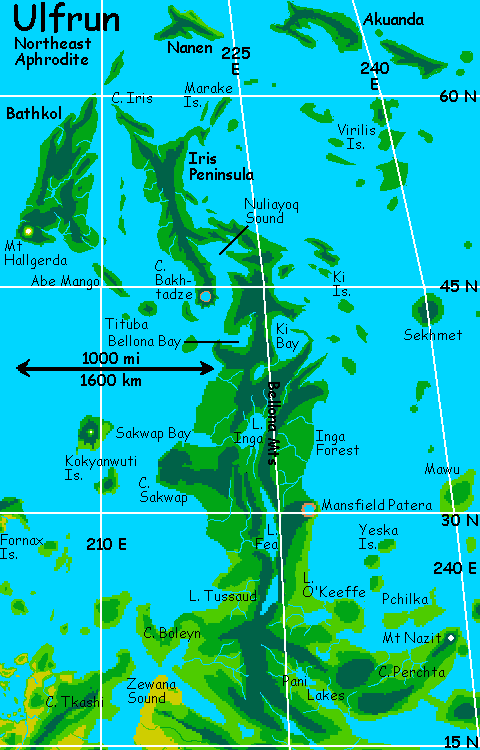
East Aphrodite
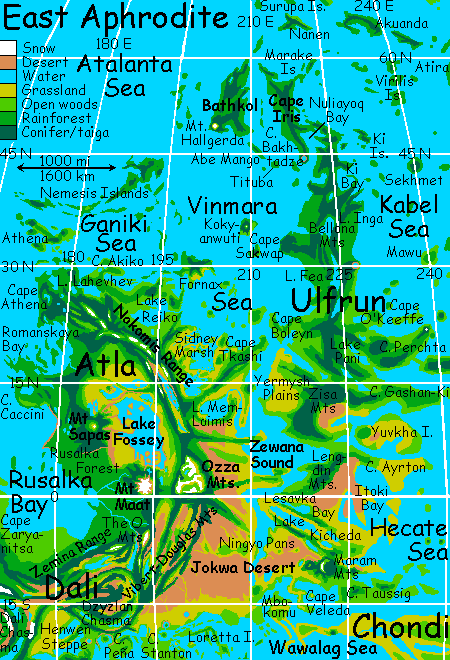
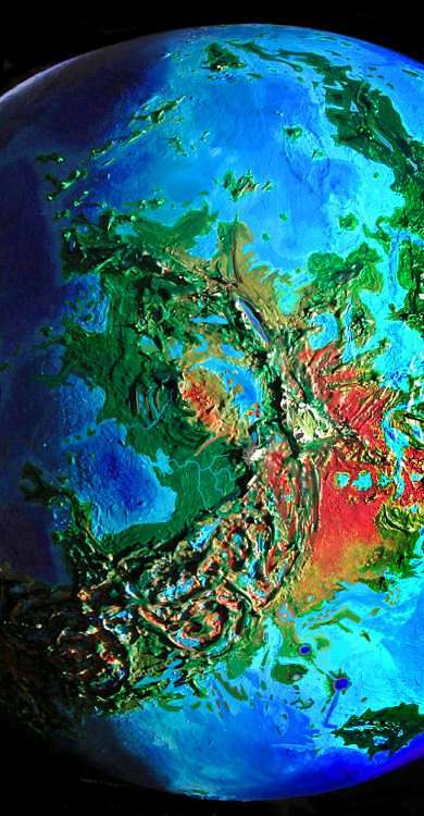
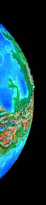
APHRODITE is a huge equatorial continent shaped like a scorpion, winding halfway round Venus, containing half its land. Aphrodite's main regions are:
- EAST:
- Ulfrun, a long jungle peninsula
- Atla's mountains and forests
- Lake Fossey's broad savannas
- Mt Ma'at, a freestanding Everest
- the Ozza Range, a wedge of Tibet
- The Jokwa Desert: Australia on Venus
- Zewana Gulf's lakes and marshes
- Rusalka Bay: green to brown
- Dali Chasma, the mother of all rifts
- MIDDLE:
- Thetis: forested mountains and great lakes
- the Ralk Desert: rainshadowed remnant
- the Veden-Emma Desert:
- the Hassttse-baad Desert: coastal
- the Gegute Islands: tessera canyons
- Artemis: vast ring of lake-filled rifts
- Cape Juno: lush maritime lowlands
- WEST
- Ovda: high, rugged alps
- Adivar Bay: green capes & islands
- the Hestia Range: Martian chaos
- Manatum: forested tessera
- Capes Disani & Salus: maritime tongues
ULFRUN
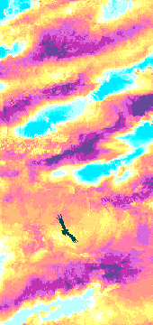
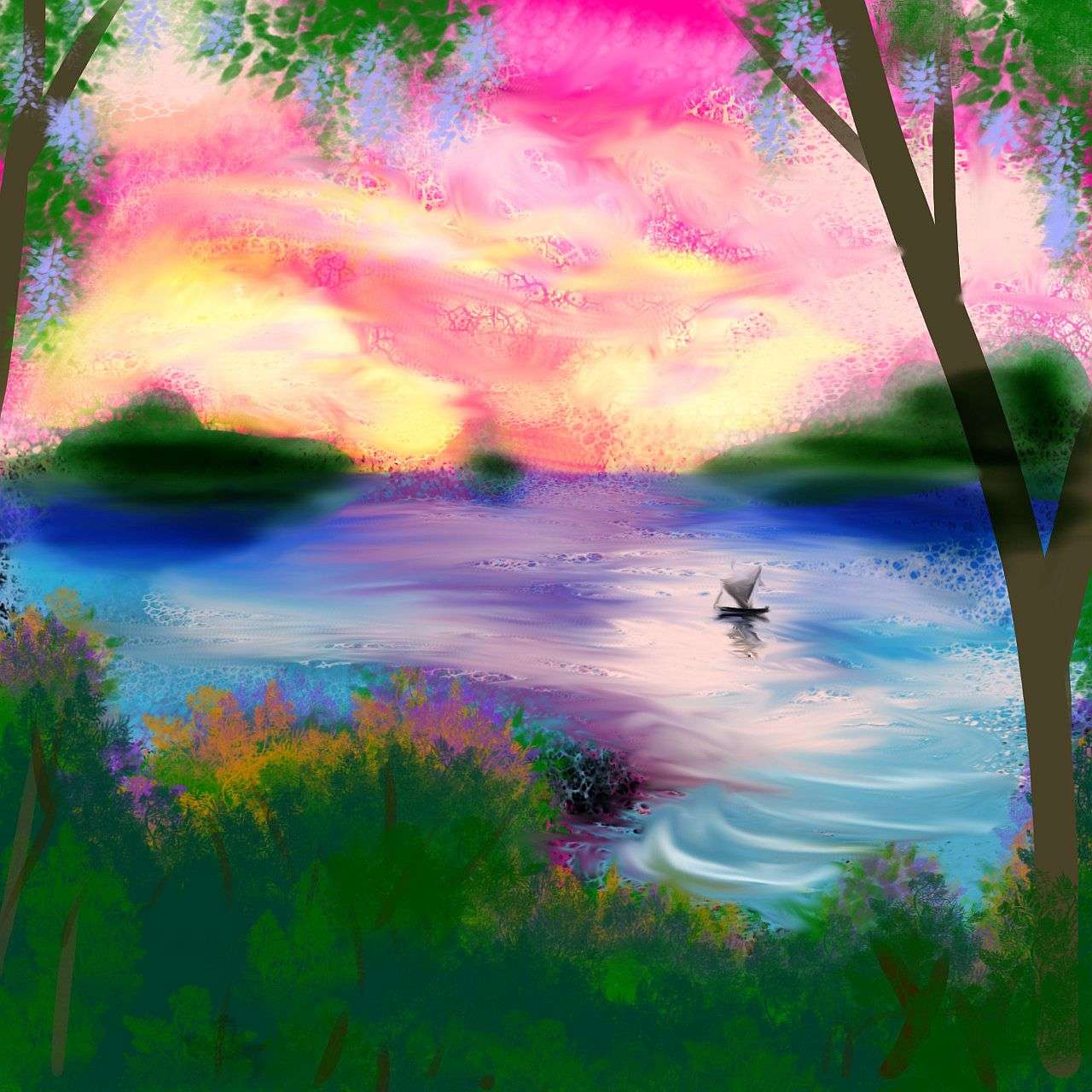
We'll start our tour in the same time and place as on our Ishtar tour--dawn, in the arctic Surupa Islands. Strap on your wings and make sure they're comfortable--we'll be flying over deep sea for several hours, with no perches. Now remember, the gravity's 10% lighter and lift is nearly four times what you get hang-gliding on Earth, but crosswinds and downdrafts are equally strengthened by the dense air. You locals with living wings can go ahead, gain some altitude while we check the strap-ons from Earth and Mars. So... comfortable? Then let's find a thermal, gain some height, and then flap southeast over the sea.
Surprisingly mild up here, yes? Despite its polar location, Surupa has a Mediterranean climate, even now, at sunrise--Sunday, by the Cytheran calendar. Sunday--when the sun rises. Then Monday, Tuesday etc up to Setterday at sunset, then the seven nightdays: Dusk, Eve, Ring, Yule (the darkest) Rain, Witch (the 13th), and Dawn, followed by Sunday. While the cycle is of course one Cytheran day, here it's more commonly called a "month." There is, after all, no moon, and the year doesn't bring seasonal changes--Venus has a near-circular orbit and it's barely tilted.
 So winter means midnight, spring is dawn, summer noon and fall dusk--each lasting only a few days. Got all that? So it's Sunday--the sun's just risen in the west, behind you. Yes, west. Venus spins backward! You did read the orientation pamphlet, didn't you?
For hours we flap across a pale sea, firelit angels between cloud-towers of gold and red--the sunrise display lasts half a day or more. At last we strike land, at 68 degrees north: the lurid green, rainforested shore of North Akuanda. We flap up to the central hills and ride the updrafts along the island's spine for a full day, before reaching the east shore, and spiral down to sleep on the beach.
When we wake, late Monday (midmorning), we cross the wide strait, an hour or two of deep sea, then fly dreamily southeast another full day along South Akuanda. The Akuandas are as big as Cuba, after all. We camp at the end of South Island.
This time, when we wake, it's getting on toward noon--hot and muggy. At over 60 north we're already on the fringe of the torrid zone--the huge sun, unshaded here, puts out almost the same energy per square meter as on Earth's equator.
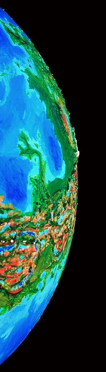
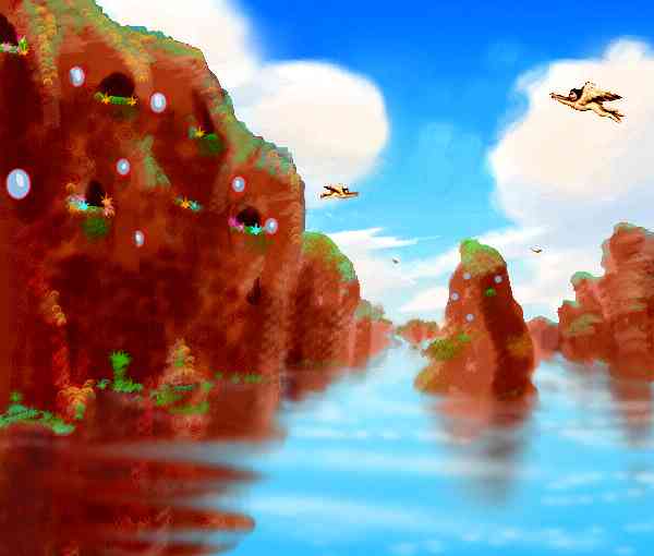
There are more islets ahead, to the east and south, but they lead to Atira, a wineglass-shaped island some 400 km across (the size of Luzon or Mindanao in the Philippines), covered in Amazonian rainforest--quite beautiful, but it's a dead end, out in the Kabel Sea. We need to veer southwest now, to reach Aphrodite. Here's an orbital photo (on a rare clear day) to give you the idea. You're looking east and a bit south; we're island-hopping toward Cape Iris, the mainland on the left.
A few hours over open sea, and we reach the Virilis Islands, several of which are the size of Sicily. The rainforest here is nearly as dense as Atira's. But we can't linger--we island-hop across the Virilis group, and by Thursday we reach the Marake Islands off the northern tip of Ulfrun--called Cape Iris. The first researchers saw Aphrodite as scorpion-shaped; this slender cape and the large islands west of it are often called the Stinger or the Tail. These low, green lands are as big as Great Britain... but utterly different.
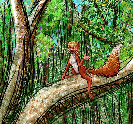
Hot, rainy jungle--and as we cross to Bathkol Island (the name means "Fate") and glide down the island's spine to its southern tip, the trees grow immense--well over a hundred meters. This is our first sample of Venus's unique climate zone, the Megazoic--warmer and wetter than anything on Terra. Here, every cliche from pre-space science fiction about Venus comes true. Shallow seas, steamy jungles, intricate life-webs up in the bright canopy, gloom at the swampy roots. Most residents live high in the trees themselves, genetically modified to grow hollow--doors, windows and all. We're grateful it's late Friday now, when the sun sinks in the east. Here, only mad dogs and tourists fly in the midday sun.
As we near the south end of Bathkol, a high peak looms ahead, the first we've seen--Mt Hallgerda. It stands on the south shore, wrapped in some of the densest jungle on Venus, and looks out over the Vinmara Sea. Above most of the clouds, its summit's clad only in cool, windy meadows full of ferns. But never snow--the torrid zone's so hot even Hallgerda rarely experiences even light frosts. Certainly not now, near sunset, after seven days of light--the summit is cooler than the shore below, but still warm. We camp on the shady west shoulder. When we wake in the middle of Setterday, Hallgerda's shadow stretches far out over the western sea. It's sunset and the air is cool. Invigorated, we grab air and fly.
We head east across Bathkol, then southeast to Abe Mango, a long jungle island named for an Amazonian sun-god's daughter. We hop to Tituba, then a couple of nameless volcanic islands. Ahead on the left is Cape Bakhtadze, the southern tip of the Iris Peninsula that we crossed days before and 1500 km north. The setting sun's in our eyes now; we must dodge between towering red clouds to avoid the glare. We veer over to Bakhtadze and look for a clear landing spot. There is no beach--towering trees wade out to sea. Inland, though, we find a cliff-walled lake, Bakhtadze Caldera, whose tough basalt walls aren't entirely smothered in vines, and land on a ledge. Sleep the sleep of the exhausted.
When we wake, it's Dusk. And will be all day--it's just the first of the seven nights. Dim green sky, bright rings and Earthlight--you still can see color. Might almost still be day. But it's a bit less muggy and that's a relief. You're grateful as you beat your strap-on wings for over an hour, crossing the mouth of Nuliayoq Bay east to the Ulfrun mainland.
Ulfrun's as long as South America, though rarely over 1000 km wide--generally low, with north-south ridges and a few volcanic cones--all so swathed in gigantic forests you can only see the broadest of landforms.
For the rest of Dusk we fly steadily south, 90 km an hour. The same for the next night, Eve, and the next, Ring--flying 8 hours every night, resting and sleeping in the endless canopy, then into the cool, scented air again.
By midnight on Yule, the darkest hour of night, when Venus's shadow chews a big gap in the equatorial rings and the gap stands at zenith, so their light dims to merely 100 times Earth's full moon from its usual 1-2000... by then we've crossed a million square miles of rainforest, crossing the Bellona Mts, visited a dozen cultures hidden in the jungles on the Inga Plain, passed long Lake Fea (rivaling Tanganyika or Superior) and Cape Mansfield and Lake Tussaud (no, no waxworks. They'd melt.)
I won't detail the sights along the way--the treetop villages peopled by giant cockatoos, the bonobo free-love communes, the people who live in trees, the people who ARE trees. In such a feverish, rich ecology, there's elbow room for social and biological experiments. But several other tours focus more on Megazoic rainforest cultures, like Eistla and Themis.
Here, our focus is the land itself, not social experiments--except the great one of building Venus at all. And what you need to know is: 187 known tree species over 100 meters tall, topping out at 135 (443')--and all that implies for the ten million species in the canopy, at least nineteen of them sentient. Aphrodite is Venus's heartland and this is its biologically richest province. And not by chance. Life follows rain.
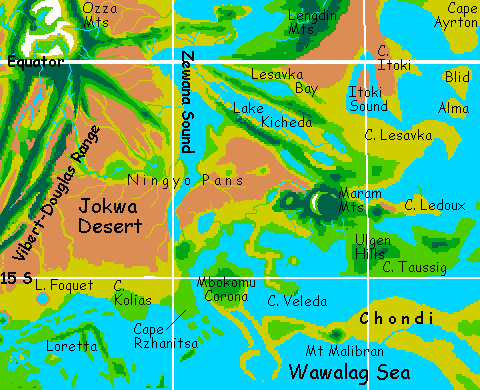
After days of lush but humid forest, we're ready for a change. From Lake Tussaud, we veer southwest a full day, down Cape Boleyn (past Anne's Head, the island offshore), and cross the mouth of Zewana Sound. This inland sea splits eastern Aphrodite into two subcontinents, Ulfrun and Atla. The tortuous gulf winds for 2500 km, nearly cut off by at least three chasma-ridge complexes. The shore grows drier to the south, until the sound peters out in a shallow tongue lined with salt pans in the middle of the Jokwa Desert. If the sea rose a few meters, Jokwa would flood, and Ulfrun would detach from Aphrodite completely. Indeed, the isthmus is already as narrow and barren as the Sinai, so if Africa and Asia are separate continents, perhaps Ulfrun is already. It's certainly big enough to be treated as one.
ATLA
South Ulfrun is just scrubland and desert plain, perhaps the least scenic part of Venus. So rather than follow Zewana Sound south, let's cross it and head west into Atla. We land on Cape Tkashi, which seems no greener than South Ulfrun. It looks quite African--brushy steppes and savanna. Some ridges radiating from the Nokomis Mountains ahead are sparsely wooded, but mostly it's dry, grassy hills.
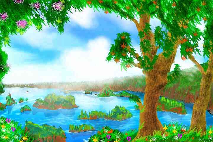
In early Dawn, the sky brightens to green in the west, then gold, then fire. Off to the south, a great mirror doubles the flame--Lake Mem-Loimis. As wide and shallow as Earth's Aral Sea, Mem-Loimis is a vital oasis here, with wide marshes full of birds, and wooded shores.
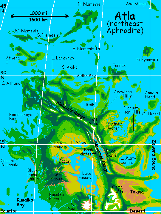
To the northeast is a chaos of bronze and silver---the Sidney Marshes, a filigree of sloughs and channels mixing salt water and snowmelt off the Nokomis Mts on the southwestern horizon. Dark, scattered islands rise from the marsh, outliers of the Nahastsan Hills below us, a corona punctuating Tkashi's ridge. We fly all day, zigzagging because the rising sun's in our eyes, and we skip from long cloud-shadow to shadow to beat the glare. We sleep on of the many islets, and wake to fly on toward the Nokomis front. Slowly the land rises, turns to golden veldt, then open woods. The sun swings slowly higher in the west, but the mountains rise even faster now, and we stay comfortably in shadow until we reach the summit.
Sidelit, in the low light, the Nokomis peaks are dramatic. Ganis Rift, miles deep, splits the range down the middle; the twin ridges rise to alpine heights, forests thinning to meadows--even a few peaks with snow. Flying is tricky, though--the coast has savage downdrafts, for the prevailing winds come from the land, and drop to the shore, creating a mistral, a dry wind keeping the coast semi-arid for 1000 km or more. Deep in the rift lies Lake Ganis, backlit silver, gashed by black silhouettes of craggy islets, some miles long.
We ride the high windy peaks all day and camp on the flank of Mt Yolkai. Here, a spur breaks off northeast--the Ardwinna Hills, the end of the Sidney Marshes below. Beyond lies a greener coast around Lake Reiko, even larger than Mem-Loimis--360 km across. We won't turn aside to explore the Isle of Fornax a few hours offshore in the Vinmara Sea. It nearly matches Reiko's size and starfish shape, as if a lazy god scooped out the lake and dumped the dirt right offshore. Fornax is mostly open woods with a few meadows, neither as dry as the nearby Atla mainland (still rainshadowed by the Nokomis Mts), nor as steamy as Ulfrun to the east. It's a lovely little country--but off our flightpath.
After Reiko, the Lahevhev Coast below turns grass-green and dotted with oval lakes. The mountain valleys grow lush. This northern tip of Atla, larger than France, is rugged, a mass of low ridgy tessera like whalebacks, but uniformly fertile. Offshore is Athena, 700 km long, a Y-shaped island with volcanoes at the tip of each narrow arm, and another where they all meet. Beyond Athena is the Nemesis Archipelago--an east-west chain with three major islands 400-900 km long, separating the Ganiki Sea from the Niobe Ocean. All the Nemeses are narrow, rugged and studded with volcanoes, rather like the island arc east of Java, and more torrid--rivaling Ulfrun.
Been there, done that! Let's head south instead. Atla's west coast is lower and much broken up--Cape Athena, island-studded Romanskaya Bay, Cape Caccini. Inland are tessera hills and river plains, mostly broadleaf woods with a few open meadows. The land's so friendly it's hard to say who the inhabitants will be--not because so few species could thrive here, but because so few couldn't--humans, ravens, sentient bears, winged coyotes, zebra camps, gliderwolf pueblos, cattle-ranching lions (or more likely antelope-farming leopards in their tree villas), fruit-growing parrots, sentient trees... see Peoples of Venus.
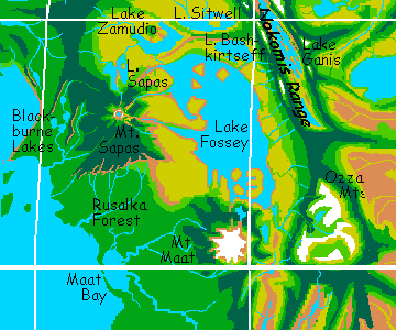
Further inland, up a steady, gentle slope, the woods deepen into rainforest--a modest subtropical one, not steamy like Ulfrun (a relief, for it's getting on towards noon). The coast stays much the same for 2000 km, widening into the great forest of Rusalka, so let's veer inland instead, and follow those highlands. To our left, inland of the hills, the land drops and turns golden--wide grasslands, patchy with shallow lakes. Grazing herds drift slowly across the gold plain like clouds. Ahead, the low but massive peak of a shield volcano rises--Mt. Sapas, the geological heart of Atla. It's wooded to the cool, cloudy summit crater, at 2000 meters, where we rest, looking east. The wide west slope of Sapas behind us is cloud forest, but the back side's a rainshadow--red desert. We sail over it, the hot air lifting us. Ahead, the prairie reappears--the vast steppes around Lake Fossey.
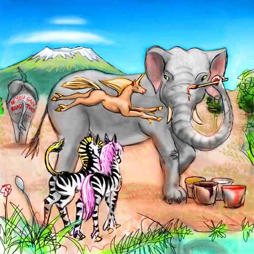
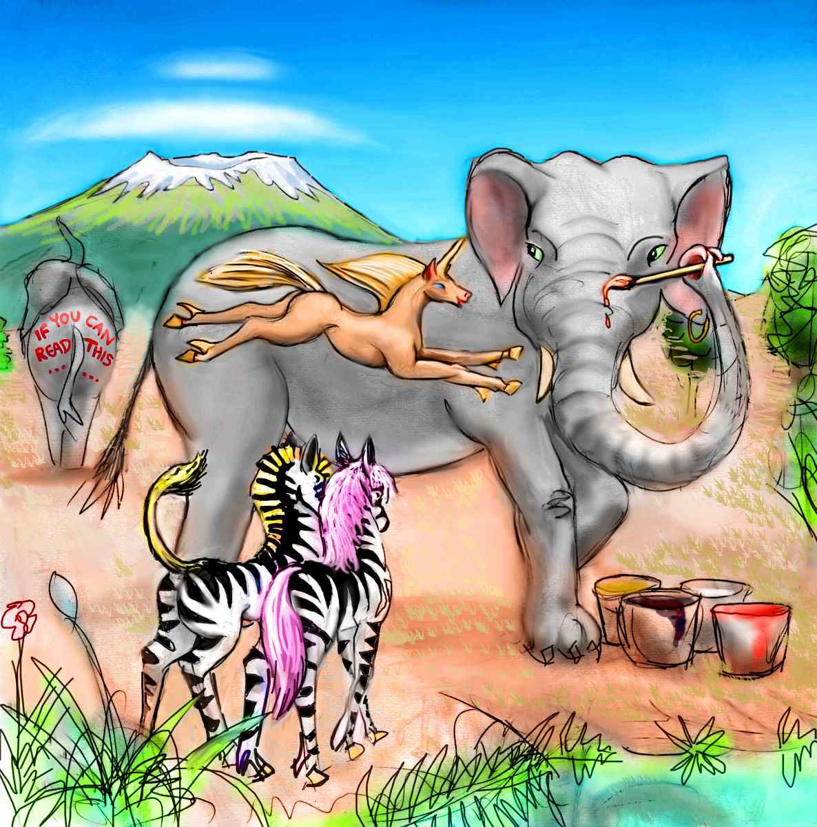
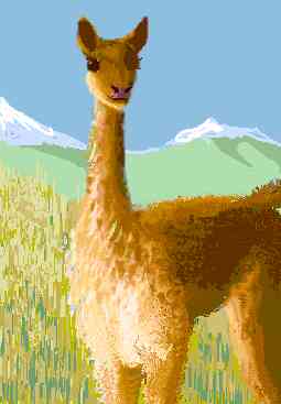
Below, closer now, we see herds of... well, who knows? Certainly elephants, and probably horses or prezebras, a gengineered mix of zebra and Przewalski's Horse, the wild, big-headed, intelligent Mongolian ancestors of the domestic horse. Like elephants, prezebras aren't mere animals--they seem to be evolving sentience, and oral culture.
I apologize for these science-fictional intrusions into a simple geographic tour, but in the last decade ethology's had to concede that many animals are brighter than expected--at least a dozen big-brained species are already self-aware or near it. That has implications as inevitable as high tech. After a thousand years, either other species will be given reservations where they can evolve toward intelligence on their own, or those species will already be on a par with us, via chip or genetic enhancement or symbiosis with AIs, and will simply be people by the broader definition of the future. Considering how the definition's broadened in just the last few centuries, this extrapolation is vastly more conservative than any scheme to terraform Venus!
In short--the Fossey Plains around the great lake may be a protected zone where big-brained equines and pachyderms can evolve oral (nasal?) cultures in peace. We may have to soar over the veldt, high and unobtrusive, only camping on islets in Lake Fossey like timid birds nesting on sea-rocks (Fossey is shallow but huge, 1200 km long and 400 wide--it'll be easy to find an uninhabited islet). Or the whole basin may be a no-fly zone! Or, conversely, it may be de rigeur for all tourists on Venus to land in an elephant or prezebra village on the Fossey Plains and listen to chanted epics, and admire how voice-controlled smart tools compensate for the lack of hands...
Of course, the name Fossey brings to mind another species: gorillas. They too will certainly be present, though not on the plains: on the rainy side of Mt. Sapas and the Rusalka Forest, and on the broad slopes of Mt. Maat, just south of the great lake named for their controversial savior. The same uncertainties about technology, culture and politics apply, but if humans are mean-spirited enough to deny gorillas their place on Venus, we'll never live to terraform the place at all. Chimps and bonobos, you ask? The forest of Rusalka, for sure, but the Megazoic rainforest may be better suited to our arboreal relatives than to us. Ulfrun may have been chimp cities all the way.
MAAT AND THE OZZAS
From Lake Fossey, our next stop is obvious. Snowcapped Mt. Maat looms to the south over the great lake like Kilimanjaro--but as tall as Everest. Yet Maat's not Himalayan in the least--radar images of Maat are the most common "photo" of Venus you see, but they're a lie--vertically stretched! It's really a broad shield volcano with gentle slopes, and its heights form an ecological island wider than Hawaii--we slowly climb through prairie, then savanna, then evergreen highlands, then a fern-brake thinning to rocky alpine meadows (light snow every night, freckled with flowers now in late afternoon), and, still 3 km above us, a broad icefield (one of the few nonpolar glaciers on Venus).
Fly to the top? No way! It's nearly as high as Everest, and the air's too thin to breathe comfortably, let alone fly in--little more than one atmosphere up there, and only 10-12% of it oxygen. If you were fresh from Earth, you'd gasp and get headaches but be able to walk around--it's no worse than Tibet. But by now, your body's adapted to the supercharged atmosphere; your blood's a watery orange, and any Terran doctor would call you severely anemic. It's not illness--your body's just protecting you from oxygen burn. Only at extraordinary heights does it become a problem (though just before leaving Venus, it'd be wise to camp out in these meadows, as high as is comfortable, for a few days, or you'll be faint even at sea level on good old oxygen-stingy Earth.
All right, all right, let's say you're unusually fit... you still won't do it. You're also used to being on the wing, and up there you'd be grounded. Even here, at 5 km, you gasp and labor to stay airborne. You skim the meadows just above the boulders, to maximize the ground effect--that cushion of compressed air trapped between wing and ground that every bird knows well. Dodge that rock! Ow. You didn't need that toe anyway.
So we skim over flowers and skirt boulders, like some scuba diver on Terra's reefs. Slowly you wheel round round Maat's west shoulder, where the prevailing winds form helpful updrafts, and rest on a pitted lava crag, looking south. The southeast slope is bony, red, much drier, with only veins of green--a pocket desert in Maat's rainshadow. On the horizon to the south, the snowy O Mountains (not a typo, that's the whole name) aren't nearly as high or famous, but they form another island forest rising from the hazy sea of gold below.
We sleep on the mountainside, adjusting to the altitude. When we wake, it's Friday and the sun's getting low in the east. There's a jagged silhouette there, whitecapped--the Ozza Mts, a bigger sky-island yet. Though lower than Maat, the Ozzas aren't a single mountain but a whole range, indeed two, meeting in a V sheltering a wedge of grassy altiplano 300 km across, like a shard of Lakshmi Planum displaced to the equator. All that lovely grass makes me hungry! Just the place for a llama civilization! They're already smart as sheepdogs, it wouldn't take much tinkering--you wouldn't even have to give them hands, just make those tongues prehensile. Drooly, but it works for winged antelope.
Or how about mammoths? Come on, you know some sentimentalist is going to bring them back. Perfect mammoth habitat. Let 'em have the Ozzas. They deserve it--first we extincted them, and then when we resurrect them, Earth is a hothouse due to our stupid ancestors' gas-guzzling, and all the ice and tundra is gone for good. What's a shaggy tusker to do? Emigrate, of course. Naturally, most will end up on Mars--after terraforming it's a perfect fit. But admit it. "Woolly mammoths on Venus" just turns you on, doesn't it. No? Well, you're not a romantic. Shaggy or bald or feathered, carbon or silicon, every species has a few kooks--and that's all it takes. There will be mammoths on Mt Maat. And llamas.
But no heroic mountainers. The radar images exaggerate vertically--Maat's a shield volcano, more a land than a mountain. But the Ozzas are different; they really are rugged.
The nearer range looks about an hour's flight away, but you've misjudged just how huge those mountains are. They take all day to reach, and even with a westerly breeze lofting us up the slopes, through a pass, and across the cool grassy plateau, it's near sunset when reach a pass in the eastern Ozzas and make camp, looking over the lowlands beyond. Half a dozen ridge and chasma zones thousands of miles long converge on the Ozza knot, and streams from their snows feed lakes in the desert basins below. The Ozzas, not Mt. Maat, are East Aphrodite's geographic heart.
We're so high up, we're bathed in red light when we wake--the Ozzas float alone in the last rays of sun. The deserts below are drab tan, pale in the ringlight. Rocks on the cliff's edge look stage-lit, absurdly dramatic: red on the east side, white on the south, bluegreen on the shadowy northwest.
JOKWA DESERT
We swoop like eagles down from Ozza's fertile heights into the desert. Wind-blown, we already feel dry. A few small snowfed streams form green strips, but they thin, and the ridges drop and the land grows flat. Hot, hot.
On the horizon, a sea appears. You assume it's a mirage from the heat, but over the next two hours it slowly nears. The south end of Zewana Gulf, cutting across our path again! Shallow, crusted with salt flats, only 50 km wide, this stubborn sea extends out of sight both north and south.
To our right's a chain of shallow lakes and mud pans, fed by the last gasp of the streams from Ozza and the long Vibert-Douglas range south of it. These marshy basins, the Ningyo Pans, are old lava beds, and the chain stretches across the Zewana Gulf, some 1200 km east to Maram Corona near the shore of the Hecate Sea. Ningyo is where the two subcontinents meet--we're crossing from Atla back into the southern tip of Ulfrun, as we beat patiently across Zewana Gulf, hot and bedraggled. No updrafts yet! Maybe by midnight, as the land cools, the warmer wetter air over the water will rise into clouds, and generate sparse rains or even a thunderstorm. Not yet--these cloud-castles are the remnants of day.
All around us is the Jokwa Desert--monotonous plains, dusty orange away from the pans, muddy with short grass around them. Elephant heaven, or at least purgatory. They're about the only people you'll meet. There are winged antelope, chasing thunderstorms to eat the tender new grass after the rains, but they're so shy you'll need binoculars and patience just to spot them. We camp alone, on the plain near the Gulf shore.
Ridges ahead now... grass and brush and a few small trees. We rise into the hills and the trees grow taller--long narrow strips of open woods. Small tree-lined creeks wind down to the desert. This is the south ridge of Kicheda Chasma, which cuts across east Aphrodite near the equator. Its ridge dips below Zewana Sound, then rises again to meet the Ozza Mts. The colors, still drab, have shifted from tan to olive--the ridge catches more rain.
Over the lip of the rift valley now... and we could be in East Africa. The golden, dry-grass valley holds Lake Kicheda, as long and narrow and deep as Tanganyika on Earth. Just the place for lions to run a roo ranch, I'd say. Let's not try to drop in for dinner, though--in a world squeamish about carnivores, lions are wary of voyeurs. Thumbs and technology haven't changed their, um, pride.
The north ridge on the horizon is dark-capped with denser woods, and veined with tree-lined creeks feeding Kicheda below. Why is this north ridge so much greener?
The winds here blow straight up the lake, not over the ridge, so it's tricky finding updrafts, but at last, flapping heavily up over the north ridge, we can see what's to the north. At first glance it seems to be a twin of Lake Kicheda, stretching to the horizon east and west. But that's no lake--Lesavka Sound is yet another narrow arm of Zewana Gulf. Like Kicheda, Lesavka Chasma crosses the trough of the Gulf, but the floor of Lesavka is a bit lower, so the sea floods the rift for 600 km. Surrounded by water on three sides, this ridge between lake and sea stays cooler and rainier than the mainland.
We ride the wind down this linear oasis, southeast. A night and a half, a thousand kilometers, pass like a dream before the horizon humps up into a range of green grassy hills--a corona, really. Their high point is Mt. Maram, a forested peak not far from the shore of the Hecate Sea. This is one corner of the Hot Triangle around the Hecate Sea, where most of Venus's volcanism takes place. Offshore are ridgy islands--the start of long Parga Chasma, a volcano-studded rift stretching to Themis on the far side of the world. But that's another tour.
We turn west. The long stretch of low capes, bays and islands west of Maram Corona is often called the Maram Coast. Warm dry-grass plains, with trees along the rare streams--not paradise, except for zebras, but at least it's not as dry as the Jokwa Desert inland.
The sea here is shallow, with coral reefs. Offshore is Cape Veleda, a narrow, forked peninsula some 400 km long, paralleling the coast. It's a low, narrow, grassy tongue, with coastal dunes and no streams or trees. Birds nest everywhere. Over a narrow strait to the west is Mbokomu Corona, sheltering Veleda Bay, a winding coral sound some 600 km long and about 100 wide, with a deep channel down the middle.
Mbokomu is a chunky almost-island, some 300 km across. Its north shore is dry and grassy, but the south side has a more maritime climate, with some trees along streambeds. We sleep on the beach. Here, two long duny ridges head out to sea, a trench of deep blue water between them. A day's flight out, they lead to a "blue hole", a round pseudo-atoll structure. One of these ridges bends and goes on, slender but stubborn, for 1000 km through the shallow sea--a land-bridge linking Mbokomu to the Terra of Chondi, a huge island off Parga. It's an unlikely structure--but mix chasmas and shallow seas, and this is what you get.
When we wake it's Yule, and the rings are just glowing stumps on the east and west horizons. Overhead they're invisible except for the lights of the orbital cities. The sky's midnight blue, and for the first time in weeks, a few stars punch through the residual light.
Up and over the western mouth of Veleda Bay, over low, rocky Cape Rzhanitsa (no, that's not missing a vowel) with its swarm of islands, to Cape Kolias, a blunt, hilly peninsula. Unlike Mbokomu, it's treeless, though its sparse nocturnal rains feed healthy grass--far more hospitable than the desert plains and dusty Oduduwa Hills inland.
Kolias will be a heartland for equine civilizations--unless it's a lion ranch, where the big-brained descendants of the most social feline species herd deer and cattle (unimproved ones, of course). But to say more would collapse the sheaf of possibilities here--so let's not land. Leave the Schroedinger cats-or-horses-or-maybe-elephants, or all of them at once, at peace in their uncertainty box, and fly on.
Let's stay offshore, flying along the Jokwa Islands, long, slender and rugged, where cliff-villages of winged coyotes and sphinxes fish the rich waters. Yes, those are glass windows. This isn't the Stone Age.
After a few hours the Jokwas coalesce into anorexic Loretta, an island 1000 km long with not one inch more then twenty kilometers from the sea. Like Mbokomu, it's an oasis of coastal savanna, with intermittent creeks in its wooded southern hills--a bit like parts of North Africa. It's now past Yule, into Rain, the next night, and true to its name, clouds cover the rings and drizzle comes down on Loretta. It's truly dark--scarcely brighter than a full moon on Earth. Colors are dim, you can barely read! We camp and sleep through it.
When we wake, it's Witch, the thirteenth day in the cycle, and the rain persists. But flying will warm us up, so we grab air and blunder on, half-blind, and soon discover how local the storm is; the ridges of Loretta force the damp air to rise, but on the mainland coast around Aethelflaed Bay, the clouds break up and the rings shine through.
While the coast is still treeless, the desert is clearly ending at last. There's more grass, and a few shallow streams come down from the dark Vibert-Douglas Mountains on the horizon inland. They're dark because the Vibert-Douglas front captures some rain from rare storms off the Wawalag Sea, supporting sparse pine forests--as dusty as the plains below, but a sign of things to come.
This is the edge of a different world: the Vibert-Douglas Range reaches north all the way to Mt Maat, and unlike the lonely ridges and chasmas we've been seeing, mere oases in the desert, Vibert-Douglas is just the front range for a wide mountain zone: the Zeminas to the northwest and the Dzyzlans to the west. (Not Bzob Dzyzlan, just Dzyzlan. I'm sure musicians will get their own planet eventually. But not Venus.)
Offshore is a fascinating chain of peninsulas, coral reefs, chasma-islands and cliff-walled craters, stretching from Cape Stanton 2000 km to the Terra of Imdr (yes, it's spelled right). But these South Sea lands deserve their own tour.
DALI CHASMA
We climb due west into the mountains, as the sky begins to brighten towards dawn. The ranges here start to curve into a whorl, though the bend's so big it's hard to see, even from the air. But the pattern's there: twin ridges, with a rift between them, bent almost into a loop--Dzyzlan Chasma. It's lower and gentler than famous Dali Chasma to the west, but a near-twin in shape and area.
Following the curve of the rift west, we reach Lake Dzyzlan, the lowest point of the rift. It's the largest lake in the region, 350 km long and 50-100 wide. Climbing the western ridge above the lake, we look down on a vast golden flat, veined with dull green streambeds and dotted with black lava outcrops, where leopards perch and purr, tending their antelope flocks. Henwen Steppe is 500 km wide, cupped on three sides by rugged ridge-and-chasm territory. To the south is Poranica Bay, as big as the Aegean Sea--a maze of low peninsulas and shallow coral bays, the hills clad in aromatic chaparral, studded with oak and olive and bay laurel.
But let's stick to the mountains. North, across pine ridges and sagebrush valleys... for a thousand kilometers. The north slopes grow greener, the valleys grassier. And then, the final ridge. Below is a wide green plain, the Zemina Coast. On the horizon glitters Rusalka Bay. We've crossed Aphrodite, at one of its narrowest points.
East and west, the Zemina Range abruptly rises from the coastal forest--this long wall reaches back northeast all the way to Mt Maat. Halfway there, behind the first ridge, is Lake Zemina, a classic rift-lake some 450 km long and 50-100 wide. The other way, to our west, the Zeminas stretch 2000 km to Diana Chasma.
Due north is a twisted, confusing knot of hills--a spur of the Zeminas. It thrusts out into Rusalka Bay, a sinuous peninsula a thousand km long--Cape Zaryanitsa (this part of Venus was clearly sponsored by the letter Z). It splits Rusalka Bay neatly into east and west arms. Underwater spurs from the Cape also surface as islands across East Rusalka Bay. Zaryanitsa is shaded by Venus's equatorial rings, so its climate is warm but not hot; a mix of meadows, open woods, grasslands (especially the east coast) and a small arid strip near the mainland, on the east side, in the rainshadow of Zaryanitsa's hilly central spine.
Even further offshore, an undersea ridge crosses the mouth of the Rusalka Bay, surfacing as islands now and then--notably the dry Urutongas on the west shore, bigger than Sicily, and small but fertile Asherat, in the exact middle of the bay, and near the geographic center of Aphrodite itself--yet nearly uninhabited, for only the most fanatically athletic fliers ever go there. Just too much work.
Unless you're in really great shape (and like to suffer) let's not go, and say we did.
Instead we ride updrafts and zigzag into the wind, west along the Zemina front range for a couple of days. This country is called Dali, after its greatest chasma. We'll veer inland to have a look--it's one of the deepest rifts on Venus, with ridges rising 4 km from the floor--well, a bit less today, for lakes fill the valley's deepest points. The surrounding peaks are some of the steepest and most imposing on Venus. The highest are snowcapped, for the ringshadow cools this region to subtropical temperatures, and it's still well before noon. By Friday the peaks will be mostly bare.
The deepest, tallest part of Dali is east-west and fairly straight, but after a day or two the chasma bends south, clockwise around Atahensik Corona, cradling Lake Gulnara (as big as the famous northern lakes--or Tanganyika) and ends up tangled in the hills of the delightfully named Bona Corona, well to the west again--not far from where it began. But it had fun getting there!
Like the Zemina ranges, Dali's backlands vaguely resemble Nevada or Utah in a wet year--pine-clad ranges, valleys of dry grass where shallow streams dead-end in marshes or lakes--the largest, Lake Bona, is 250 km long. Like Nevada or Utah except the cowboys have wings, the horses talk back and the cliffdwellings are full of vegetarian wolves.
For days we soar over this mutant American West, more than 1000 km north. Late in the afternoon, we reach a great valley--Diana Chasma, one of Venus's most scenic spots. Its peaks aren't quite as high as Dali. But Diana Chasma opens onto Rusalka Bay, and gets more rain. The slopes are still dry, forming red cliffs in many spots, but the rift floor is greener, the lakes larger, the peaks snowier than Dali--the most extensive snow since the Ozzas. The Zemina, Vibert-Douglas and Dzyzlan Ranges do experience frost, but only a few peaks get even ephemeral snow patches. Diana's dreamlike--snow, alpine meadows, forest, savanna, desert, lakes, all jammed together in a mad collage.
Diana's another sort of nexus, too. From here, all flyways enter Central Aphrodite...
 Venus main page - Peoples and Creatures - regional tours - gazetteer - glossary -
LISTS AND LINKS: two related world-models: Futures - more worlds: Planetocopia - dreams of other worlds - orbital dreams - global warming and climatology - terraforming - anarchy - utopias - genetic uplift - animal people - time: futurology, the deep past, time travel - more strange essays - volcanoes - water and seas - physics and natural law - air! - a Venerian prehistory for Earth?: What the Pteros Tell
World Dream Bank homepage - Art gallery - New stuff - Introductory sampler, best dreams, best art - On dreamwork - Books
Indexes: Subject - Author - Date - Names - Places - Art media/styles
Titles: A - B - C - D - E - F - G - H - IJ - KL - M - NO - PQ - R - Sa-Sk - Sl-Sz - T - UV - WXYZ
Email: wdreamb@yahoo.com - Catalog of art, books, CDs - Behind the Curtain: FAQs, bio, site map - Kindred sites
 So winter means midnight, spring is dawn, summer noon and fall dusk--each lasting only a few days. Got all that? So it's Sunday--the sun's just risen in the west, behind you. Yes, west. Venus spins backward! You did read the orientation pamphlet, didn't you?