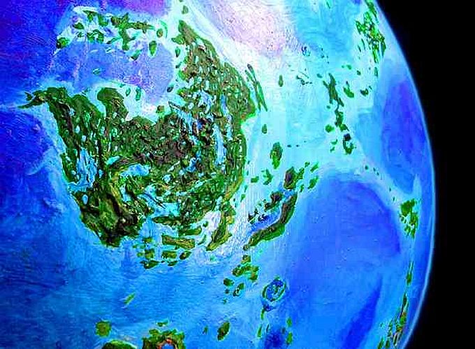
Venus Unveiled: Eistla, Bell and Tellus
OVERVIEW
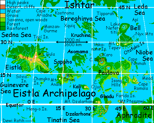
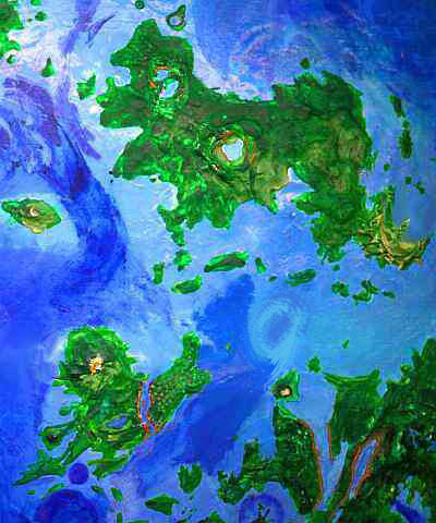
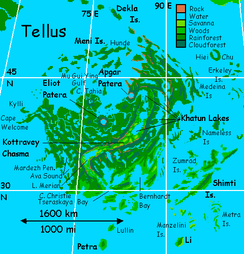
Eistla is a continent-sized archipelago between Aphrodite and Ishtar, sprawling a third of the way around Venus. Its northern islands, Bell, Tellus, and Kruchina, have some of the hottest, densest rainforest in the Solar System. The southern islands like Eistla itself, Sappho, and Pavlova, are cooler, drier, more Terran. Eistla is roughly pronounced "Aced law;" on early maps of Venus it's often misspelled Eisila.
FLYING TO EISTLA
Our tour takes off from three-headed Cape Ariadne, the southern tip of Ishtar, the arctic continent. Ariadne is the start of the westernmost flyway to the Eistla Archipelago. Unlike most of Ishtar, and a harbinger of things to come, Cape Ariadne's quite warm and rainy. Tropical hardwoods grow to great size, especially in south-facing valleys.
It's a few easy island-hops to Kostroma, the southernmost of the islands sheltering the Gulf of Belisama. Kostroma is a 200-km strip of lush tropical forest on low hills. One of the few parts of Ishtar that sticks into the torrid zone, Kostroma's downright steamy, though the sea winds relieve the heat a bit compared to the stifling inland jungles of, say, the Isle of Xquiq, 1000 km southeast. I said a flyway to Eistla begins here on Kostroma, but it's not popular--for the next islet south is a long exhausting trip over open sea. But the spectacular and fragrant jungle canopy, reminiscent of Earth's Spice Islands, is popular with arboreal and flight-capable visitors, while the long beaches on all three sides, with coral reefs offshore, make Kostroma equally popular with species who like to swim.
All travelers beyond Kostroma had better like to swim. You may have to.
After eight or nine full hours of nonstop flight over deep sea, no land in sight... but of course, it won't really be like that. Someone will anchor a floating hotel in the middle of the Sedna Sea. Or a whole city! But let's stick to the landscape and ignore the artifacts of civilization--except for terraforming itself! Maybe we're athletes, maybe we're eco-religious and under vows, maybe we're cheap and don't want to pay for rooms (though if people still use money by this point, I'd bet against a habitable Venus. Or Mars. Or Earth.) But never mind why we're ignoring tourist amenities! Just stick to nature and see where it gets us.
We fly nonstop, to the limit of our endurance, and at last the cerulean sea beneath us pales to turquoise and reefs appear. Ahead we see an island--a deep green whaleback 80 km wide, 120 long. We land, exhausted, on lonely Manzan-Gurme. I mean lovely Manzan-Gurme. The brochure said lovely. But we're too tired to care.
If we're smart, we've timed it so we land near sunset. After a long sleep, waking up sore in the dusk, going for a swim, going back to sleep... now it's night--for five days more, of course, this being Venus. In the heart of the torrid zone, night's wonderful. Warm, fragrant--many of the flowers in the island's lush forests are night-blooming. And bright! Lit by the brilliant equatorial rings, the sky's indigo and the land's as light as a well-lit indoor room--colors are bright and clear. A thousand times brighter than Earth's timid little moon!
Perhaps we'll rest our wings and walk the length of the island, along its coral-sand beaches. So, for the next few days--excuse me, nights--we hike our way down to the southern tip of Manzan-Gurme, gawking at Megazoic trees 140 meters tall... while our wing-muscles recover from the shock and toughen up for the long flights to come.
On Witch, the predawn day when the western sky glows blue and green but the clouds don't yet glow red, we grab air and beat south. It's a shorter hop, just a few hours, to the Toci Islands where we can rest and sleep. Then a still shorter strait full of islets, and the emerald coast of Eistla creeps over the horizon. The westernmost island in its Archipelago, the terra of Eistla has nearly two million square km. A terra is a land smaller than a continent but over a million square km. On Earth only Greenland's that size, and it's more ice than land. So we never had the need for such a term--but Venus has a dozen lands bigger than New Guinea but smaller than Australia. The Terra of Eistla is one.
The north shore is lush, with Amazonian rainforest (though not Megazoic, like Manzan-Gurme). The land is ridged and rugged under the trees: we landed on tortuous Cape Idem-Kuva and wind south. To the west across Idem-Kuva Bay is a second curving cape, Bakisat, sheltering oval Nissaba Bay beyond. Not all the coast is rugged; to the west, beyond Nissaba Bay, the hills flatten; low Cape Audrey shelters Heidi Gulf, where mangroves root in the broad shallows.
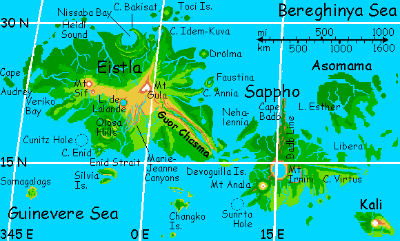
By Terran standards it's a tropical paradise. The palm beaches are tempting. Shall we land and make it a short day's travel? But straight ahead on the horizon's something so odd we're reluctant to descend and lose sight of it. 250 km due south of us, a rarity floats in the air--the glowing pink summit of Mt Gula, a snowy shield volcano 3 km high (10,000' for you metric-impaired); the tallest on Eistla. It stands in red dawn fully half a day before the sunlight reaches down to the coast. It's often snow-free--Eistla's warm. But thunderstorms from the south often turn to blizzards at that height, or pelt the summit with hail so deep it turns white--the only icy peak for thousands of miles, though it melts within days; no glaciers accumulate.
We flap inland, lured by the ice cream cone above the jungle. By the next day, officially Dawn, but well past it high on the mountain-shoulder. When we reach the summit, the snow's gone patchy. Still, even when entirely snowfree, Mt Gula's broad, cool summit is an ecological island, with rocky alpine meadows near the summit, fernbrakes and hanging gardens a bit lower down, then dense cloud forests.
West of the peak, subalpine meadows stretch hundreds of miles west to Mt Sif and beyond. Sif is the shield volcano dominating western Eistla, about 2800 meters high, and very massive. It might just be visible on the horizon (Venus's dense atmosphere acts bends light more than Earth's, so mountaintop vistas can sometimes extend up to 500 km) but it's hidden behind a lower but nearer ridge: De Lalande, only halfway to Mt Sif.
Let's veer west; De Lalande is only a few hours' flight. You're probably puzzled why we're bothering with a side trip; from afar, the peak doesn't look like much. But you glide down to the saddle patiently enoughly, and puff up the slope, getting some boost from a steady wind rising up the southeast face. You reach its broad, blunt summit... ...and the world drops away! De Lalande isn't a mountain at all, but a ring-ridge of rock and pine, cupping a deep sapphire lake under you. Your own wingshadow scuttles down the cliff like a spider to vanish into the depths. The rich indigo is partly from the lake's depth but partly just our high altitude--most Cytherean skies are pale, but in the Gula Highlands it's a truly Terran blue, contrasting wonderfully with the red and black rocks. They're strangely ropy and shining in spots--obsidian and other glasses formed in the fire of impact, as fierce as a hydrogen bomb. De Lalande is no volcano, but a huge meteor crater.
South of Lake De Lalande are open woods, much drier and cooler than the rainforests of the north. Lava flows radiating out from Gula and Sif have left rough north-south ridges with winding, quite spectacular canyons between them, where water today follows lava's ancient paths. We fly east across them--a challenging flight, for the Marie-Jeanne Canyons are like little Yosemites, though of course formed by fire not ice.
Downstream, the south coast is gentle, with wetlands in places where the slope flattens entirely, and rather Mediterranean groves and meadows on the hills. The long slope is broken by the more heavily wooded Olosa Hills, and a second craterlake whose debris has formed Cape Enid. But these are just shadows on the long southern horizon. Quite invisible, even with Venus's atmospherical lensing effects, are the rugged Silvia Islands across Enid Strait.
But our way lies east. As Mt Gula nears us again to our north, we see a ridge emerging from the volcano's shoulder--a great lava dike, heading southeast. Trust me again--I know the air is thin up here, but you want to climb that ridge! You flap and sweat--the winds here are mild and not much help--but at last you crest the dike. A deep crack yawns--Guor Chasma! Twin ridges with a long rift between--geologically akin to East Africa's rift valleys. Dry golden grass below red cliffs; the ridges block most of the rain.
Now you can rest on the wing, royally--gliding effortless down the great rift--the wind blows uphill, a headwind, but it gives you lift. Hours pass, as the rift drops from two miles up toward the sea. The riftr's the floor mostly dry or with a mere creek; but halfway down it widens into...
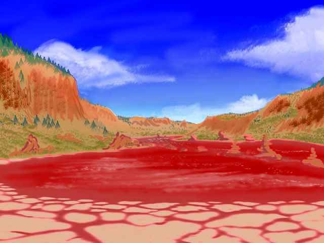
...this bizarre lake. You're thirsty by now, but it doesn't occur to you to drink the water. It doesn't occur to you it's water! But it is--not lava or beet juice or blood. The color's from thermophilic salt-tolerant bacteria. Tufa towers rise from the lake. So do bubbles--sulfur, CO2. This rift is currently quiet, but still active--spreading a few centimeters a year, creating new crust, enlarging Eistla while slowly splitting it apart. Brahma and Shiva in one.
Another hour down the chasma, a small but clean stream, and then a marsh, then silver: long Lake Guor. Drinkable this time, if a little... carbonated. Think of it as planet-sweat. No, don't. Sorry.
Trees line the shore and creep up the walls along creeks. But mostly the chasma stays open. Long views ahead...
Two hours more of steady flight and the great lake ends. A creek runs down to a salt sound between twin heads: Devoguilla Bay. You've crossed Eistla, from the Sedna to the Guinevere Sea.
Over the horizon, a few hours to the south, are the Changko Islands, the start of a long deep-sea flyway to Alpha. But that's another tour. Our way lies east, hopping along the Devoguillas. It's not a bad time to cross: high noon is warm but not as muggy as back in the rainforest, and there's no glare in your face, as there would be in a day or two, as the sun creeps east... I pushed you along for a reason. Trust your tourguide!
SAPPHO
Only a few hours on the wing through the warm, wooded Devoguilla Islands brings us to the second great land of the Eistla group: Sappho, the size of Madagascar. We make landfall in the forested Nehalennia Hills, an old corona whose northern rim creates an island off the north coast over 200 km long. We glide east along the sound between Nehalennia Island and mainland Sappho for two hours. As Nehalennia falls behind, a great forested wall rises on the horizon, marching out to sea. It looks as though a great plateau is ahead--central Sappho? But in fact it's the northern tip, Cape Badb, 150 km long but only a few wide. This great ridge, called the "Badb Line," continues south, arrow-straight, right across the island like a backbone or scar, sometimes disappearing under coronas and volcanoes but always resurfacing, until it dives into deep blue Sunrta Hole, off the south shore. Such strings of features are common on Venus around chasmas, but here on Sappho they happen without a clear chasma structure. Anyway, seeing the cliffs of Badb 100 km ahead is our sign to turn south, inland over the trees.
Most of Sappho is wooded, thickening to cloud-forests around its main peaks, thinning to open woods and savanna in the southeast. Ahead of us, the island's great northern volcano, broad Mt Irnini, looks as flat-topped as Kilimanjaro. But when we fly up the long slope (which takes hours), we discover Irnini holds a secret: a caldera 200 km wide with tall lava cliffs, their maroon and black reflected in deep Lake Sappho on the crater floor. This caldera dominates the island--not only is it spectacular, its lava flows radiate out to the coasts and capes--indeed, create them. The main southern peak, Mt Anala, is taller, but it's a far simpler cone. Anala's slopes support cloud forests, fern fields, and a summit meadow just high enough (here under the shade of the equatorial rings) to see occasional frosts, even snow. But by now, it's well after noon; the sun's been shining a good four-five days. Anala's just a faint blue snowless cone on the heat-shimmering southern horizon.
Cape Virtus, the eastern end of Sappho, looks from above like a cartoon hand sticking 200 km into the Tinatin Sea. Virtus, like Cape Guor, is really a short chasma; in fact it may be Guor again, emerging from under Irnini's lava deposits. From the forked tip of Cape Virtus, we fly northeast an hour to the long isle of Libera, and follow it like a highway through the sea to the third great land of the archipelago: Asomama.
Asomama is a volcanic island twice the size of Greece, and nearly as fractal. Far rainier, too, though by Cytheran standards Asomama's merely a pleasant little rainforest. There's hardly a tree on the island over 70 meters high, and around the southern bays, you can even see daylight now and then. It's barely on the edge of the rainy zone to the north in the Bereghinya Sea.
It's been a week since we reached Eistla, so it's getting on toward sunset; as on Manzan-Gurme, we rest up, do some reading and sightseeing for the first few days of night. We consider a side trip north, during the cool and calm of the night (Bereghinya's savage thunderstorms are sun-driven) to Kruchina, fourth of the great Eistla lands.
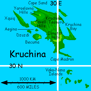
Hot, stormy, the size of Europe, the Bereghinya Sea drops most of its torrential rains back into its own waters, for it has few islands--only Manzan-Gurme, our entry point, and Kruchina, due north. The size of Great Britain, Kruchina's covered in lush Megazoic rainforest; the trees routinely top 100 meters. It's a long side trip, though. An island chain does curve north from Asomama to Cape Ilmatar, Kruchina's southern tip, but it's a dead-end trip 1000 km each way--quite a detour.
Though maybe it'd be worth it just to be able to say you've been to Xquiq. I bet you thought that was a typo, before. Nope. It's real (and pronounced "shkeek". Even by non-mice.) A narrow island 250 km long off the far west end of Kruchina, Xquiq's covered in lush Megazoic rainforest. Gorgeous, but off every flyway. Except locals, nobody goes to Xquiq.
Including us. It's just too far, too hot, too rainy, and we'd have to backtrack. Let's veer south instead, toward a much bigger land: Pavlova.
We decide to cross at night--well, predawn. The white arch of the rings says Saturn, but the deep blue sky and pale blue sea say Neptune. Strange to think all this was sulfurous once. Not just the color, though Old Venus did have skies and light the color of smog. I mean sulfurous! An endless drizzle of hot sulfuric acid.
Ecological purists complain that we wrecked old Venus, but you'll notice that while Mars has its Reds fighting to preserve some desert, Venus has no Yellow Party. Of course life and deserts can share a world, while life and boiling acid can't. Still, if you want to view Old Venus, you can come unpleasantly close in the Ralk Desert or Veden-Emma Basin on Aphrodite. But that's another tour.
Two rest-breaks on lovely (this time I'm not too tired to admit it) islands in the straits... So much nicer than they were a thousand years ago, bare tholi rising from a sulfurous plain under smoggy oven-skies... O this carbon bias of mine! Silicon readers, I apologize.
Pavlova is a long, rambling, hilly terra--a cluster of great coronas. Landfall on the rugged west end of Pavlova takes us over dense rainforest (though nothing like Kruchina). I'm tempted to steer you north for a couple of hours to see Karo, a perfect ring-island just off the coast--an impact crater about 50 km wide that happened to be just at sea level, so the crater wall forms an island around a perfectly circular lagoon... But after that long sea-passage, you're tiring, so we head southeast over the Didilia Hills, looking for a place to sleep. The hills level to a wide wooded plain. We camp on a sandbar in a meandering river. (Tropical readers are probably wondering if that's safe. Yes! Big freshwater crocs don't live here--though it was a narrow vote. The top predators in these streams are freshwater dolphins and otters, harmless to swimmers. Unless you count their taste for practical jokes. But they'll only pull your leg, not chew it.)
When we wake and take wing in the dawn, the sleepy sun's not quite up yet. Southeast of us is a second range of hills, looking a bit like Sappho's Mt. Irnini--indeed, early maps fooled me into thinking central Pavlova did have a similar spectacular caldera. But it's just a corona, a glorified blister. We do find a modest lake within a ring of ridges, even an arc of low cliffs, but it's not volcanic, and much shallower than Sappho. Just pleasantly cool wooded uplands with odd concentric ring-ridges, and pocket prairies on the southeast side, sheltered from storms off the Bereghinya Sea. In fact the first corona we passed over at landfall, Didilia, had this pattern of arc- and ring-shaped hills, even a sunken center with a couple of lakes--just less blatant.
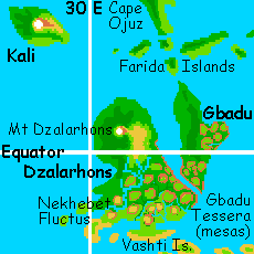
Soon the sun rises behind us (to the west, remember?) It's time to turn south, down the rough Ojuz Peninsula into the Tinatin Sea. Off to our left (east) stretches a thousand-mile chain of wooded isles, the Faridas. To the west the chain seems to trail off. Not quite! Beyond the horizon, though just within flying range, is the largest Farida of them all: the lonely Isle of Kali, rivaling Taiwan in size, shape, ruggedness and climate. The whole island's really one shield volcano, just an unusually steep, tall one. Despite its isolation it has a rich culture, because so many species can find comfortable habitat on its varied slopes, from tropic to snowy.
Though Cape Ojuz trails off at last into the sea, we continue south, hour by hour, hop by hop, blue and green. The Farida Isles look tropical, but the heat's quite mild, and not just because we're only one day into morning--with every mile south, we creep deeper into the cooling shade of the equatorial rings. Without them this latitude would be torrid--fatal by noon.
THE SOUTH
After a full day of island-hopping, we reach the shore of Gbadu. It's 500 km of tessera: a regular net of mesas and canyons. It's not desert and they aren't erosion features--the mesa tops are grassy, even savanna, and the canyons are now forested creeks or finger lakes. It all makes for tricky flying, but the cliffs create updrafts we can ride for miles, with care--and it's gorgeous. As we're growing sleepy, the land suddenly drops away--a blue channel of sea far below us, just a few km wide, cliff-lined. The gash winds out of sight in both directions; the vigorous current shows it's no bay, but a strait--the end of Gbadu. We sleep on the cliffs. When we wake, it's noon. The cliff-wind lifts us high, and we glide over dark water to Dzalarhons.
Dzalarhons (pronounced more like "it's all a wrong" than "dollar Hans,") is a conglomeration of three different terrains.
I'm tempted to follow the Farida chain and avoid returning to Pavlova--I have an emotional problem with its east end. I built a lovely caldera-lake there, based on early research. I'd sculpted and painted it, it looked great. But better data proved it was broken and half-flooded. Seeing it ruined by mere facts is so annoying!
But to get where we need to go next, we have to cross East Pavlova, so we may as well be direct. Veer left from the eastward line of the Faridas toward that green shore on the northern horizon: Cape Isong. This pleasant country looks nothing like the wet west end of Pavlova: it's all open woods and meadows, even a few extensive prairies. We'll angle northish for two days--as the afternoon sun creeps east not west, a course due east would put it right in your eyes.
Hidden in sun-glare is triangular Cape Romola, the only one of Pavlova's five regions that's not a corona, though on first glance at the radar scans I thought it was too. Such a nice lake, such great cliffs! Oh well... An even bigger mistake's offshore. Due east of the cape's tip, the sea is all turquoise shallows till a few long low islands near the horizon. But the water beyond them deepens fast. This circular pit of midnight blue is Mead Crater, an impact basin 250 km wide, and one of the best-known on Venus. For the first few drafts I mistook it for a corona, then thought it was right under us, confusing it somehow with Cape Romola. Bizarre, eh? I whined about losing my lovely caldera, and all the while I repeatedly misplaced the biggest crater in the world! Too bad it's underwater--it'd be a spectacular sight. Or would it? This isn't Mars--the high gravity and heat of Old Venus made crater walls sag over time. Even Mead's great wall is barely a kilometer tall--a few peaks form islands, but most of the ring is just coral reef. Dolphins, octopi, sea otters.
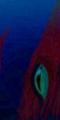
We can't see the real rulers of Mead, not in daylight--the giant squid hiding deep in the hole. For them, Mead's a homeland, an oasis of dark in Venus's shallow light-drenched seas. In the long day, only faint azure light reaches these depths; the squids' gigantic eyes give them a hunting advantage. During the week-long night, Mead's hunters fan out, prowling from Aphrodite to Sappho, returning to Mead to sleep and tell exaggerated fish-tales in their comforting pool of dark the way humans huddle round a campfire.
From Romola our way lies north along a savanna coast, then inland a bit: northwest across steadily greening hills, the Ninmah Hills. A long day's flight, with frequent rests but pushing hard, to reach the north shore. There's a reason to push a bit--we need to alert our bodies and toughen up for a long, hard flight ahead.
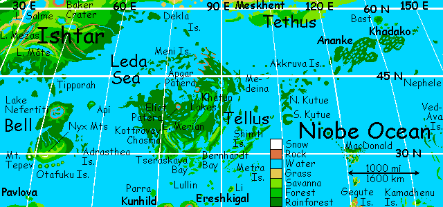
We camp on the beach on a small island off Cape Ninmah, the northeast corner of Pavlova. Sleep and rest for a full day, as the sun nears the horizon. We'll need our strength for the next passage--it's five or six hours over deep water with not one shoal or islet, north to Bell Terra. This jump is not just physical--we're leaving Eistla, at least its official boundaries. Bell and Tellus, ahead, were always considered their own regions. But terraforming's made them feel very Eistlan--two more terras, just further northeast in the very heart of the torrid zone, not flirting with its edge like Eistla proper.
Get a good sleep--when we wake, we'll be flying not only over the sea, but through time--back to visit the classic Venus of the science fiction pulps!
BELL
Late in sunset, in a red lurid light, we spot Bell Terra on the horizon--first a line of sharp volcanic cones, the Otafuku Islands, like the Aleutians. A rugged green shore rises beyond. The land creeps slowly into shadow as we near, but the highest peak, Mt. Nyx, flames red even after we make landfall. It's extraordinary to see Nyx cloud-free--normally the peak wears a fog skirt halfway up, where a ring of peculiar cloud-forest grows. But today, only a few streamers trail off the mountain, salmon and magenta.
We beat tiredly up Nyx's slope, through the wisps, back into fiery day, and drop exhausted amid the ferns and rocks of the summit. Ironic--Nyx, the Goddess of Night, an island of daylight! But it is, for many hours, every dawn and dusk. OK, OK, I just looked it up. Snow, not night. Well, it's still just as ironic: Mt Nyx is high enough for snow anywhere else in the world, but here we're in the heart of the torrid zone.
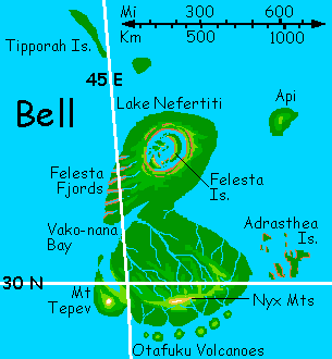
As we sleep, the sunset fades. When we awake, it's dusk, the white light of the rings warring uneasily with the blues and greens of early evening. The Nyx Mountains are like a rumpled carpet with a thick, bumpy nap (for the trees here are the size of hills), stretching north over the horizon--and at this height (plus atmospheric lensing) that's a good 200 km away. Even the slopes of Nyx below us are wearing a shaggy coat. To the south the green teeth of the Otafukus rise from the sea; to the east, the the sea gleams on the horizon. Beyond, invisible even from here, are the red cliff walls of the Adrasthea Islands. To the west, one tiny bump mars the horizon. Island? Mountain? We'll soon find out.
We're a bit sore from the sea-passage, but the first stretch is easy--we dive down the slope of Nyx (no need to worry about windblasting, in this humid air) and glide east up the coast for hours. The hills glow emerald in the soft shadowless ringlight, like a photo shot through a polarizing filter. A few hours of slender beaches, and ahead, a great peak like Fuji looms on the horizon--Mt. Tepev, highest in Bell. It stands offshore, its feet in the sea, but a wide marshy neck links it to the mainland, a surreal chartreuse in the glare-free ringlight. The Tepev Marshes, in the rainshadow of the great peak, are the only treeless stretch of Bell. Oh, wait, not quite the only one--like Nyx, Mt. Tepev is capped not with snow but meadows above the clouds. Though it's a formidable peak, even frost is quite rare; the climate's that warm.
And it's time to go north, past these timid outliers, and view some serious rainforest. As I said, Bell's big--a Borneo-sized land, rainy and hot, especially in the north where we're heading (one reason we landed at sundown). Trees there grow beyond anything Earth knows. Our goal is Nefertiti Corona, Bell's northern massif.
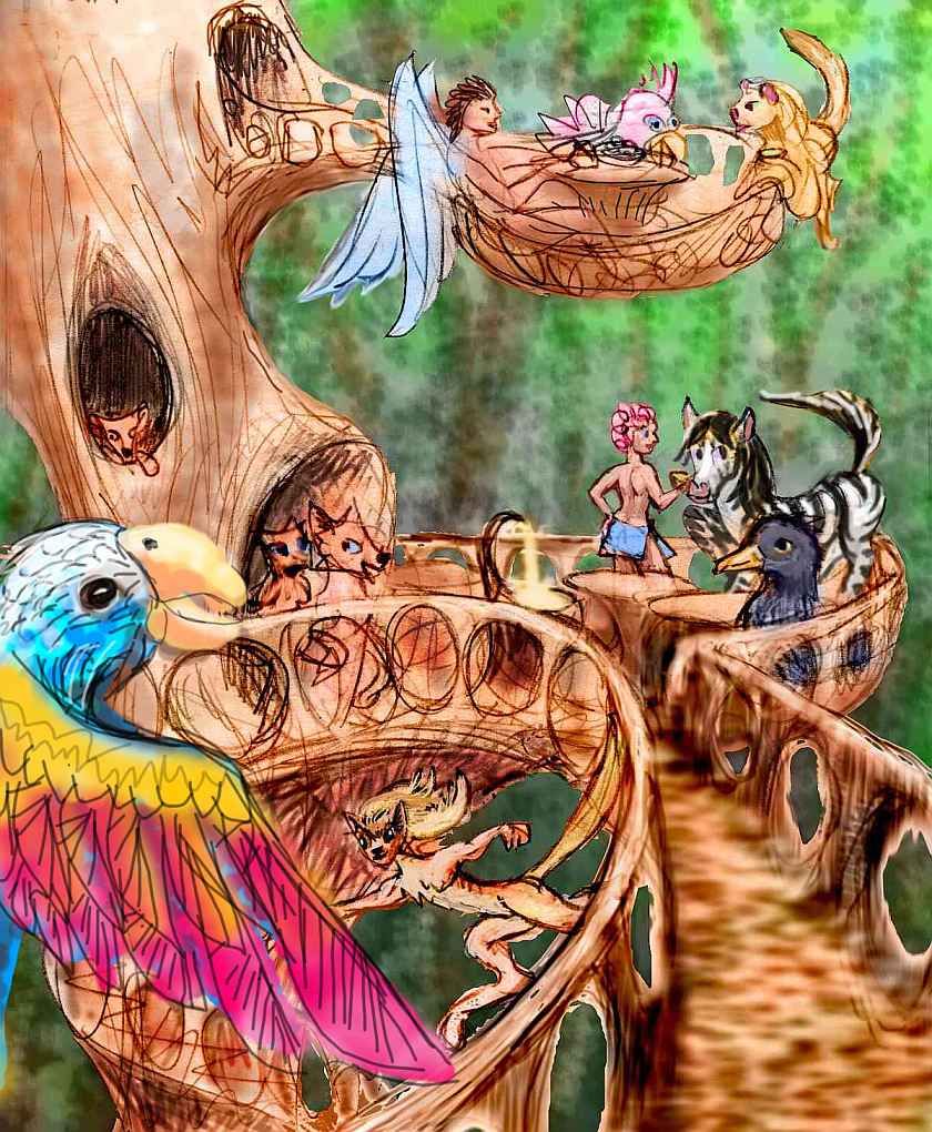
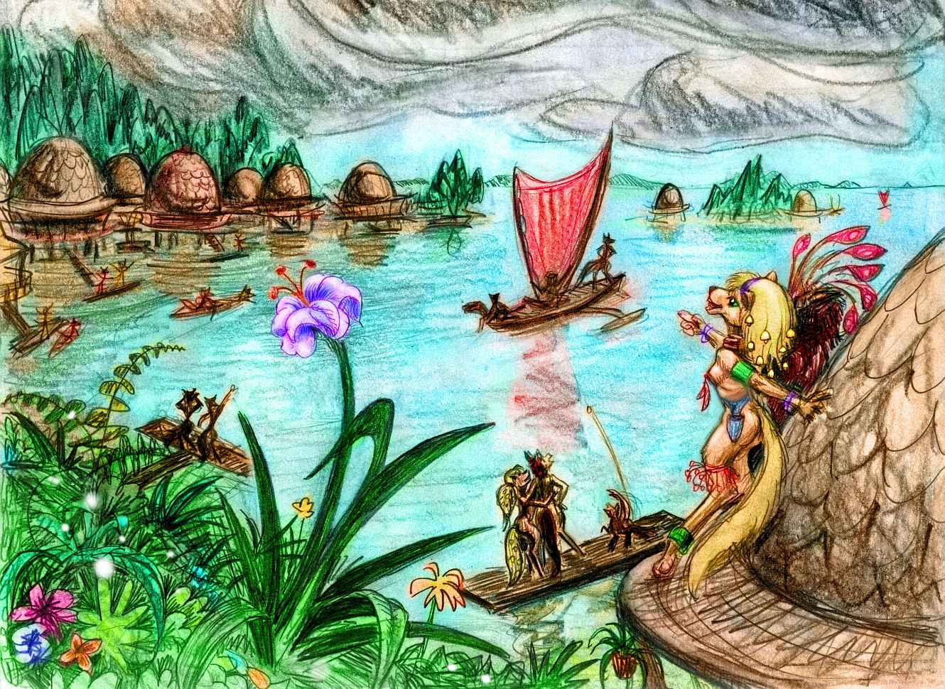
Vako-nana Gulf cuts northeast through the hills, and we follow. At its head, we sleep on the narrow beach, tree-shadowed. The next day, we flap through sun and rain up into the great forests of Nefertiti Corona--the heart of Bell. Some of the solar system's tallest trees are in the coastal valleys radiating out of the Nefertiti Hills. Not only do people of various species live in the trees, which grow hollow and as wide as houses... some trees themselves are sentient. Bell is one of Venus's great tree-cultures. Photosynthesizing appeals to a certain sort of soul, especially the idealistic, contemplative sort, so it's unsurprising that the politics of Tellus, Imdr and the other rainforests have a whiff of patchouli--both from Gandhi (trees don't have to eat living things, right? How noble!) and the hippies' anti-work ethic (grow your own! In fact, grow yourself!). Of course, whether you got started as an AI or in an animal body (including human), or grew up as a tree merely hearing about mobility and dexterity, you're going to want to make some improvements. So trees have hands, eyes, ears... they already have excellent taste, of course! And smell. Pheromones and scent signals...
Bell in particular is home to an art form we find hard to comprehend--bearing new species for esthetic reasons. Mothertrees combine and swap genes, then grow strange fruit that hatch into flowers or plants or creatures never seen--even strange new people. The competition's partly about simple beauty, but also about the role of the new creatures in the intricate ecological web of the rainforest, which, because of its sheer biomass and diversity, can tolerate a lot of novelty without instability. The prepondering biological themes shift slowly as the community's focus shifts, pulled this way and that by innovators. It's curiously like two other art forms: high fashion, which allows hot rivalries over style yet has broad annual trends, and whalesongs, a group creation that mutates slowly over the seasons.
We may be appalled at the idea of such casual genetic engineering, but the Treemothers would be as appalled at ours--cows dumb as rocks, corn unable to reproduce without us, turkeys who drown in the rain. One of the fundamental laws of beauty, (as Bell trees smell beauty) is that every gene in a new species must be of value to itself, not just its creators.
A species of tree-person less threatening to most human readers is the one we'll sleep inside tonight: the tree-inn, offering food, drink and shelter in exchange for compost, news and gossip.
Our particular tree-inn stands near the cliff-edge looking out over Lake Nefertiti, nearly round, but so big we can barely see the curvature, let alone the far side, faded by clouds. The rugged Felesta Islands dot the lake, as if it's a sea... With drinkable water, even the smallest crag is inhabited.
Bell's northwest coast is equally striking: a series of little jungle-canyons march down to the sea. The Felesta Fjords weren't carved by ice or water of course, but it wasn't lava either; they're cracks from the great swelling that formed the Nefertiti Massif. Today, busy rivers run down these canyons to narrow cliff-walled sounds miles long but often only a few hundred meters wide. The red rock's clothed in hanging gardens, striped with waterfalls, gauzed in mist. Oval windows glint on the cliff-faces, and round doors open onto sheer drops: the cliffhouses of sphinxes.
The sun will be rising in a day or two, so we face an awkward choice: beat the torrid-zone heat by flying northeast before dawn to cooler Ishtar (hopping to long Tipporah Island, then head for the Aushra Hills on the mainland--a long detour) or... taking advantage of the updrafts during the day and flying on, despite the heat and probable thunderstorms.
We decide to risk it. We glide due east out of the Nefertiti Hills, to sleep on a small, nameless island (really, I did check, but no one's named it yet) just off Bell's east shore. Waking at Dawn (one day before sunrise) we take another easy day, just one three-hour flight northeast to Api, an oval Polynesian gem in the middle of the Leda Sea. Api's unique in that regard--Leda is small (for Venus), but deep (for Venus), with islands only round its edges. The ridge between Bell and our destination Tellus surfaces exactly once, and in just the right place for fliers. Couldn't have planned it better! Oh, wait, we did. Sort of. The sea level, too, is a human artifact...
The sun rises to the west as we sleep on Api. At least it won't be in our eyes on the longest leg of the journey, four or five hours of hot flying east to the aptly named Cape Welcome, the westermost tip of Tellus. It's a good 300 km long, a single narrow ridge for the last hundred--but that slender green hook makes the passage merely exhausting, not deadly. We camp on the shore, drink fresh water, sleep until morning (and it is morning), and fly on to the mainland of Tellus--the largest terra on our tour.
| 
|
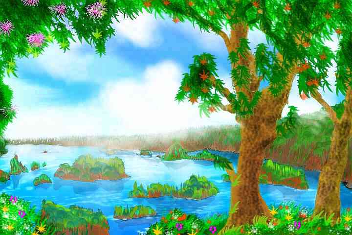
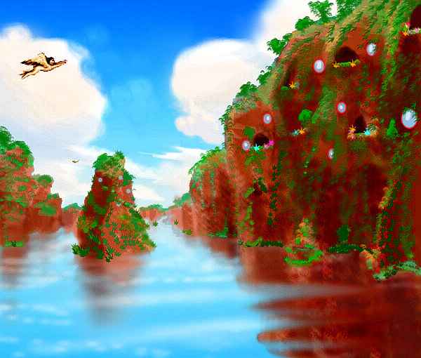
Tellus, named for the Roman earth goddess, is unbroken Megazoic rainforest, with the densest biomass and the most diversity in the northern hemisphere. In fact it holds more biomass than all Amazonia, though Tellus is half its size. Until nightfall, we'll stick to the coast where it's cooler--we take it easy, a few hundred kilometers a day, along Cape Welcome past Kylli Island, south along the shore of Olwen Bay and the gulfs and islands of Cape Christie. We swing inland toward Lake Merian and join its outflow down Kottravey Chasma, a drier ravine where the trees shrink and open up to an almost Terran forest. Down to Tseraskaya Bay and a mouth full of mangroves, then east to Bernhardt Bay (yes, for Sarah Bernhardt). Looking inland, the land looks strange if you look under its steamy green carpet--craggy, pitted... a karst landscape of eroded limestone? But this is Venus! They have to be tessera.

"Normal" tessera are a regular grid of mesas or hills--a landscape unique to Venus. But Tellus is strange even for Venus--ridges form a diamond pattern, as if a thick rope net, stretched diagonally, had been laid on the land just before a green nappy jungle-rug was draped on top. Each node of the net's a craggy hill, each string's a green ridge, each loop's a valley with a gleaming blue lozenge at the bottom, though the trees are so tall you can only see one sapphire at a time, from right above. Every spindle-shaped lake points northeast, like drunken compass needles! We can only obey--we follow the pattern, bemused, heat-stunned. On and on, up the east coast.
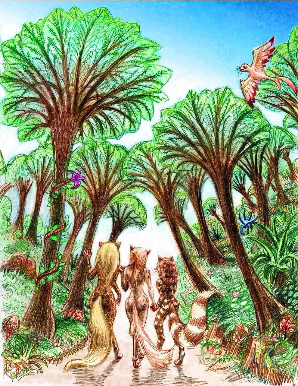
We meet few people above water, though octopi and dolphins abound. Hidden under the trees are several villages of wingless, semi-aquatic cats, slender and rangy to handle the heat. Tiger-striped (a consequence of genes from that swimmingest of cats) but as delicate-looking as the panthers of lost Florida--another heat-adapted ancestor, perhaps? It's said that some of their genes were saved before the species went under in the Big Thaw. Along with all of Florida, of course.
These folk dive for seafood from little boats under the shade of the coastal mangroves. They offer you lovely woven reed-and-featherwork, made of culls from local parrots and birds of paradise... beautiful, as I said. But you're even more moved by the beauty of these small, graceful grandchildren of the legendary tigers lost in the Thaw. So elegant, soft-spoken and kind. You're tempted to tarry, but you're just not adapted for this muggy heat.
The only bearable places are the water (and you can't sit in it forever, we have a tour to conduct; come on, you don't want to wrinkle into a prune) or the slightly cooler air two kilometers up. A hot climb, but then it's almost fun--you zigzag to stay in the shadows of the cumulus clouds tumbling over the land. You dive through warm rainshowers, watching warily for lightning, and keep on.
Slowly the coast straightens and steepens. The mangroves disappear. A line of barrier islands marches offshore, coral-encrusted but not built by coral--they're high points of one ridge of a low chasma, whose other ridge seems to be the coast itself. In between's a deeper blue--we're gliding up a trench 1000 km long.
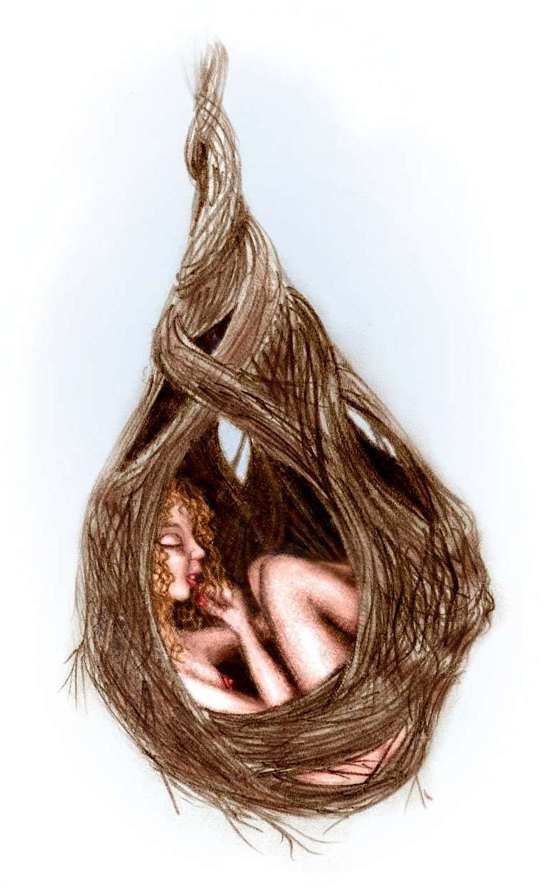
At last the sun begins to set. Amid cloud-castles in flames, we head into the highlands, hoping for slightly cooler weather, and sleep in nests in the flowering canopy.
No, no, you don't have to ask an "owner". Or weave one like a Terran gorilla. Such nests are all over, of course. Trees grow them. Houses, here, are just another kind of fruit.
We wake in the bright dusk to a bit of a shock--we were so tired, we missed that our treetop is near the edge of a cliff! Not a tessera-crag, but the curving wall of a cenote, a pit-lake miles wide. We made the summit and never knew. We should have--the heat is gone. Well, more bearable.
South and west of us curves a long chain of great lakes, not the deep blue of a chasma but shallow: the Khatun Lakes, old lava pools flat as a table, now water-covered a few meters deep. The Khatun Hills north and south seem higher than our cliff-perch--we're in a saddle, perhaps. Or the dim heights could just be clouds, a thunderstorm miles high. Or both--a storm provoked by the mountains' updrafts. Can't be sure--too many clouds in the way. They, too, look tesserated--that regular look seen sometimes over the Amazon, a grid of white and deep blue lit by the rings, sliding over a grid of emerald and silver. The slaty cloud-shadows form an interference pattern between the two, a moire. It's hypnotic. And around us, endless activity, even at night--insects and flowers, birds, scampering animals, all in competing, riotous colors. For all the scene's life, it's bewildering: a sensory overload. Though if we were down among the dark roots like our ancestors instead of flapping around the treetops, it'd seem a dim oppressive world where ears are more use than eyes... and I'd be complaining about "les tristes tropiques," I suppose.
We spend three days slowly hopping from grove to grove through the Khatun highlands, gawking, overwhelmed, meeting tribe after tribe, of various species--red megaparrots, black gorillas, white cockatoos, sentient trees who live in a different pattern than those of Bell--each mind here manages a whole grove, reading and sending sap-messages tree to tree. They call themselves Ents, though they aren't mobile. One calls herself a Huorn, though she doesn't seem hostile. Just kidding? I never get plant jokes.
We sleep with a friendly, sentient hive of bees, each big as a thumb. They dance a warning--their bee-senses predict bad weather to the north. I'd planned to finish the tour by hopping north to Ishtar via the Dekla Islands, still warm but not stifling... with perhaps a side trip to the six major Meni Islands ("not many", as the bee joke goes. Something to do with their ancestral way of counting: "none, one, two, three, six, many..."? I don't get bug jokes, either.)
The web only concedes the forecast's iffy. We decide it's wiser to trust local bees over remote AIs, and skip the Deklas. Too bad, they're pretty--a Cytherean Polynesia! There is a longer alternate route--slender Medeina Island off the northeast coast, part of an undersea chasma, is a jumping-off point. We cross more valleys where the tessera disappear under shallow lakes and smooth plains--more old lava flows. Though it's hard to be sure what's under trees an eighth of a km high. The light's dim too, down there--even in full sun, but especially now, on Witch, the predawn day. Bluegreen sky to the west, the rest dusky.
A final two hours, gliding over a low coastal range to the sea, over the deep coastal passage, midnight blue, to ridgy Medeina, and out over the shallow sea toward an empty horizon, fleeing the steamy dawn.
ANANKE
East of Tellus is a scattered island chain called the Akkruvas, stepping stones across 2000 km of open sea to Ananke, an archipelago the size of Japan. First are Hiei Chu and Kurukulla, mere mountains jutting from the sea, then a swarm of islets, then Akkruva itself, nearly 250 km long, a low gentle land with a halo of small to midsized isles, all of them uniformly cloaked in rainforest so thick it overhangs the beaches--islets look like green plush mushrooms. It take four days to cross the Akkruvas to Ananke. We won't detour south to the much larger Kutue and Shimti Islands--these wedges of tessera could just as well be detached shards of Tellus. Nappy green rug scraps in a coral sea--scraps bigger then Cuba. They'd only lead us south through Ereshkigal to Aphrodite, the biggest continent of all--and that's another tour.
After the Akkruvas, the Ananke Islands feel like a mainland--low, but rugged, in fact as corrugated as Tellus. They're just as green, too. The main islands are Ananke (600 km long) and Khadako (350) just to its east. Endless rolling ridges intersect, creating a diagonal diamond-pattern of hills linked by ridges, like waves in a harbor, with small lakes in between, each ringed by a marsh. We ride updrafts three kilometers high and soar over the islands--flying's more work up here, where the air's merely double Earth's sea-level pressure, but it's worth it--a bit cooler! Below, Ananke looks like a giant green brain dotted with drops of blue syrup deep in the cracks.
Here, as on the Akkruvas, most land-people live on the coast, either in the trees or in stilt-houses. Mangroves for shade and boats in the basement....
There's only one way to go from here. To the south, the long Nephele Ridge surfaces once, 500 km out, but from Nephele Island there's nowhere to go. To the southeast, it's 1600 km to the Nemesis Islands off the subcontinent of Atla--you can't fly to Aphrodite that way either! This is, emphatically, the end of the island-tour, for the Ananke archipelago simply ends here in the Atalanta Sea--the deepest on Venus. Atalanta's roundness has led some to suspect an ancient impact bigger than Hellas on Mars. Few native fliers can cross its islandless depths; certainly not you, in your rented wings.
The only tourist-friendly flyway is north, via the large round Isle of Bast, back to Ishtar where we started. After a marathon of islet-hopping to Bast, it's a straight flight of several hours over featureless sea to Ishtar. We reach the shore at sunset--as we began.
Of course, every word of that is a lie. Well, Bast is there, even today--waiting. But even once it's an island, it won't lead us back where we started--on Ishtar. We're halfway round Venus, so it isn't the Ishtarian mainland, but Tethus, one of its outlying terras (though Tethus will look continental enough, after the little rocks we've been perching on). More lies: It wasn't the only path out! A closer look at the newest altimetry scans shows small islands south of Nephele crossing the Niobe Sea, and other links to Aphrodite from Akkruva via the Gegute Islands or from Tellus south to Ereshkigal. Even the chronology is probably wrong. Say Venus rotates every fourteen days, backwards--even then, by going halfway round the world, we should gain nearly half a Venus day--an Earth week! No, wait, we'll simply have had days lengthened by an hour or two whenever we flew east all day... assuming anyone can fly on Venus at all. Will we all have to be pygmies with metabolic superchargers, as in Olaf Stapledon's "Last and First Men"? I don't think so, but the parallels with his old book are unsettling. His fliers died out.
But do the details of my frame-story really matter? You've learned the geography of a huge swath of Venus, in detail, the hard way--under your own wingpower. Not that you probably care about the details as such, but I do--the whole point is to open people's eyes to Venus as a world. You all love Mars like a brother. Can't you love your sister too?
FACT VS FICTION

World Dream Bank homepage - Art gallery - New stuff - Introductory sampler, best dreams, best art - On dreamwork - Books
Indexes: Subject - Author - Date - Names - Places - Art media/styles
Titles: A - B - C - D - E - F - G - H - IJ - KL - M - NO - PQ - R - Sa-Sk - Sl-Sz - T - UV - WXYZ
Email: wdreamb@yahoo.com - Catalog of art, books, CDs - Behind the Curtain: FAQs, bio, site map - Kindred sites