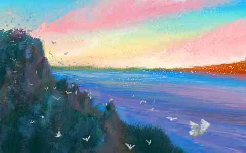
Venus Unveiled: West Aphrodite
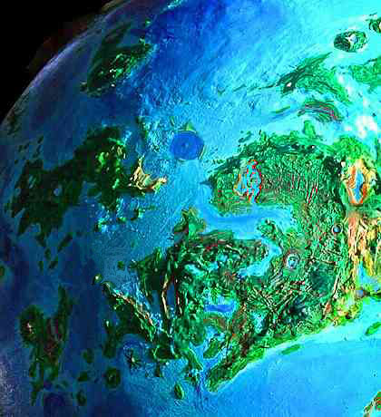
APHRODITE is a huge equatorial continent shaped like a scorpion, winding halfway round Venus, containing half its land. Aphrodite's main regions are:
OVDA
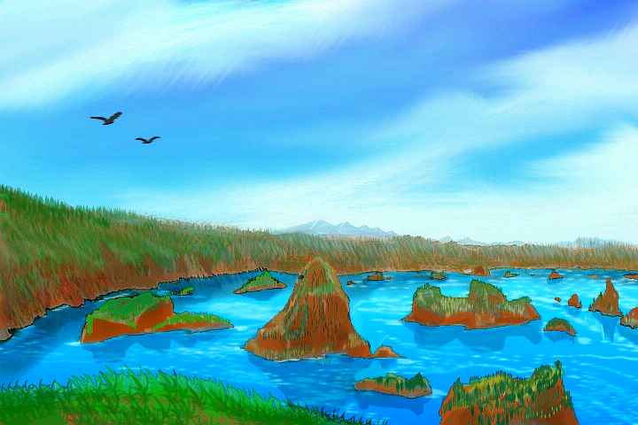
We're riding the wind up a redrock canyon north into Ovda, the highest, ruggedest region of Aphrodite. We bend west, then north again, following Kwanja Chasma. Here the slopes are dry, often bare red rock. Below us is Lake Kwanja, filling the floor of the rift. It's no more than 60 km wide--often far less--but fully 600 long. The marshy lake shores are fertile, and a few small wooded streams descend from the Zulma Mountains, but the valley slopes and cliff-walls are desert and bare rock.
Past the valley-mouth, cut off from sea winds by high ridges all around, the day is hot, even under the protection of the equatorial rings, and if we stayed for it, the night'd be equally cold. Those of you here fresh from the central Aphrodite tour have gotten spoiled by the maritime air of Juno, back on the coast. This is a harsher place. Grand, but without the lake, it'd be near-dead.
We could have followed Le Shen Valley, 500 km to the west, for it's nearly identical: a twisting canyon, harsh climate, and Lake Le Shen, 600 km long, narrow and deep.
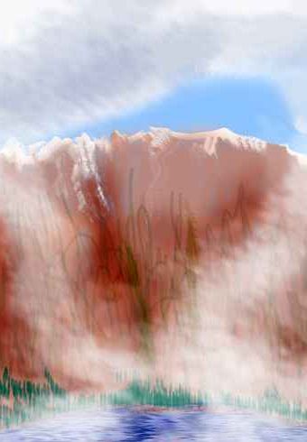
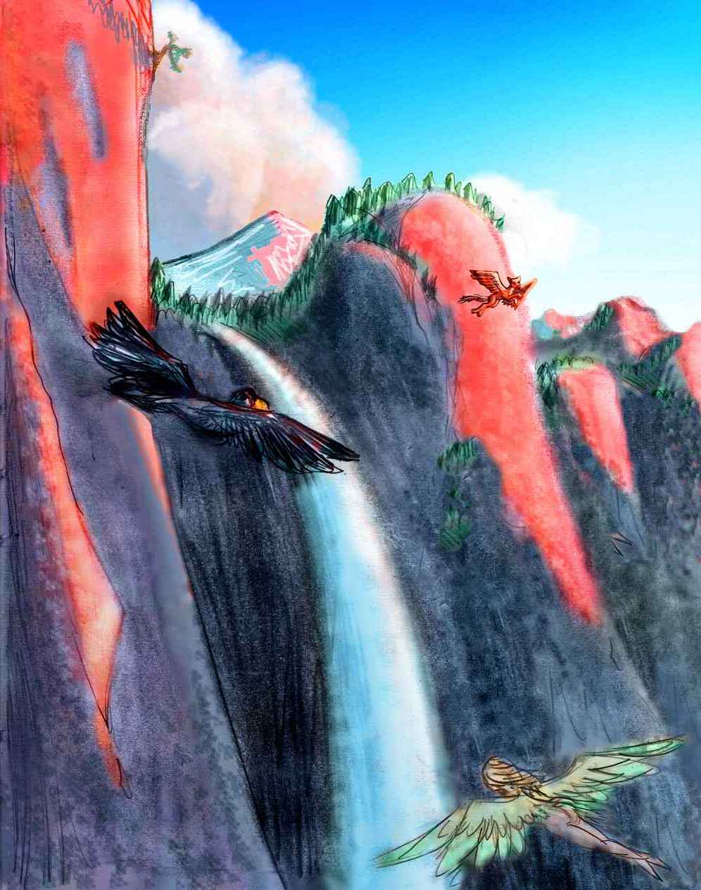
The twin canyons wind into the mountains of Ovda. Unlike Ishtar's simple Lakshmi Plateau, neatly outlined in high ranges, Ovda is the jaggedest highland on Venus--a tangle of ridges rising to nearly 5000 meters in the southeast Zulma highlands, which we'll have to cross. The highest peaks have alpine tundra and even snow. Climbing up to Zulma is easy--the hot rock walls of the chasma create powerful updrafts. It's maintaining altitude once you leave the chasma. Tangled topography, cooler heights sending down rivers of cold descending air, and worst of all, thin air--barely twice the pressure of Earth's! Why do those crazy Terrans bear such thin, cheap air? You can't even fly in the stuff!
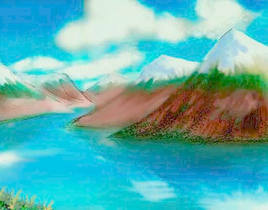
But Ovda today is worth sore shoulders tomorrow. Utterly gorgeous--around us is a patchwork of dark pine and blue spruce, golden aspen, alpine meadows flowering now in the afternoon, black and red cliffs, deep cobalt lakes, and white peaks. (Ovda is equatorial, remember--under the shadow of the cooling rings.)
At long last, the land drops a bit into Ovda Fluctus Valley. As its name implies, it contains an old lava flow. Today the basin holds two great lakes and many lesser ones. They're the largest high-altitude lakes on Venus--bigger and higher than anything on the more famous Lakshmi Plateau. The northern, Lake Ovda, 250 km long, covers the flow itself and is dammed by a lava dike at the east end; the southern, Lake Fluctus, fills a nearby basalt basin--essentially, a congealed lava lake with a water skin on top. The Fluctus Valley has dense woods (and denser, more flyable air!), with meadows and marshes around the lakes. Scenic as the Zulma Mts were, this is a nice respite. Maybe we'll spend a day by the lake, though the swimming's a bit cold.
It's near sunset. Ready for a change? OK. North of Fluctus is the narrow Salika Range, with peaks up to 4 km high. We thread our way through passes and flowering meadows for hours... and then, just at sundown, the world abruptly falls away into dusk, in one of the most precipitous drop-offs on the planet. Below is another subcontinent entirely--the warm lands around Adivar Bay. We pause for an hour, catching our breaths in the thin air, admiring the view. To the west, firelit full-face by the eastering sun, is the Nayunuwi front range. Behind them to the southwest, the even taller Fava Mts glow a ridiculous orange. The ridges hide huge Lake Kokomeis.
It only takes an hour to dive at crazy speed down the long slope. Behind us the Salikas float, glowing red castles in the air--already it seems unreal we were ever up there, so high. Another world. Drunk and invigorated by thick moist air, but feeling a bit wind-blasted, we slow down and take our time crossing the warm green land below us--the Unelanuhi Peninsula. It'd take time anyway--Unelanuhi, our highway around the Adivar region, is 1600 km long. We spend all of Dusk just skirting the shores of Lake Habonde, triple the size of Lake Superior, at the base of Unelanuhi--nearly turning the cape into a huge island. The lake drains west into Habonde Bay, an arm of Adivar, but that's far over the horizon. On early Eve, we angle northwest and soon come to smaller, crescent-shaped Lake Helvi. It seems only a puddle, after Habonde--200 km across, a mere couple of hours' flight, with a great tongue-ridge down the middle to rest on. It drains south into Habondi--in fact the channel between them is so wide they might be considered one gigantic lake. We camp on its sandy shore. All through Eve and into Ring, with every hour as we sail north, there's a subtle increase in warmth and humidity. Night here is gentle. Trees grow taller, denser--broadleaf woods, colorful and varied after all the somber evergreen uplands of Central Aphrodite, touched only with aspen-gold on the heights.
NORTHERN ISLES
Northwest a few more hours and we reach the sea, and sleep on the tip of a modest head, perhaps forty km long and half that wide. Bays and capes lead west out of sight, but it's more of the same--instead, follow me straight out into the Niobe Sea! It's early Yule (midnight) so the rings are shadowed, turning the sky deep indigo. In the dim light of the ring-stumps, only a few islands break the horizon, and soon they sink beneath the dim silver plain. But trust me. An hour or two of patient flight, and at last the shore of Ereshkigal rises from the sea. We camp on the beach. We'll sleep for many hours, a whole day if you like--you've earned it! When we wake, the rings will be brighter again--good for exploring, or if you're lazy, just lying on the beach, swimming, and reading by ringlight.

The Isle of Ereshkigal is a single great shield volcano 300 km across, whose outer slopes rise gently to a deep central caldera. (In fairness, NASA/JPL thinks it's a corona with a caldera-like subsiding center, and on second thought they're probably right. Oh well, regardless of geological cause, Ereshkigal's indisputably there.) In the southeast, the rising sea breached the crater, and now black cliffs rise from a oval gulf. Well, green and black striped--every crack and shelf supports a tree, every cliff a flowering vine, for we're nearing the edge of the torrid zone. Down Ereshkigal's west slope, we pass over a small but true rainforest.
A narrow, shallow strait leads us west to Kunhild, Ereshkigal's unbreached twin. Another Hawaii 300 km across, again with a great caldera or coronal pit in the center, this one a cliff-lined freshwater lake, with slender white waterfall-threads. The reflections of the cliffs in windless Lake Kunhild are famous... when clouds don't get in the way. The cliffs are that tall.
Just half an hour's flight off the northwest shore is Parra, a peculiar island as jagged as an ancient Chinese painting--an unbroken crag-field 120 km wide, though softened by lush trees and ponds in its cracks and hollows. Besides being beautiful, it's the gateway, via the small Isle of Lullin two hours away, to the northlands: the Terra of Tellus and huge Ishtar beyond.
Back to Kunhild's western tip... A last sea-hop, only an hour but beating into the wind, and we reach long Cape Mosaido on Lemkechen, an isle about the size of Spain or Japan, and resembling southern Japan or Taiwan in climate, with deep broadleaf forests--lovely land, in the brilliant ringlight of Rain. It's only two more nights to Dawn.
Lemkechen's barely cut off from the western tip of Unelanuhi--it's the same geological structure. We head south past Mosaido Straits, the northern passage into Adivar Bay. It has fierce currents, but a halfway island to rest on, and neither passage is over 40 km. We could have had it easy, but I wanted to show you the twins.
A day of steady western flight, and the land starts rising: Uti Hiata, highest peak on Lemkechen. We ride the updrafts on its windward side, ride it to the top, and land in a stony meadow. Traces of frost show that we've climbed out of the subtropics into a tiny temperate zone. Still, this is the coldest day of the month up here, and it's snowfree, though some months the story would be different. No matter! We didn't come to cool off, anyway, but to scout the flyway ahead.
To the south, across wide, turbulent Riley Strait, reflecting streaks of green and sooty yellow dawn light, are the long, tree-topped, broken cliffs of North Riley. Half an hour swooping down Uti Hiata's steady slope, an hour over the water, and we're there. Rough treetopped east-west ridges wind across our path. The wind's from the west, following the ridges, so updrafts are hard to find; we have to climb on our own, ridge after ridge. After an hour or two, hot and shoulder-sore, you get sick of Riley and wish he'd go away.
Atop the next ridge, he politely does--you nearly stall and crash as the land vanishes in a cliff. You're floundering over a deep blue channel with a strong current. To the south is a rugged, facing cliff--South Riley. These two islands, each 400 km long, clasp each other like hands in prayer, but with this small chasma cutting a sinuous channel between them. A million birds shriek from their home crags and islets, jutting from the uneasy sea.
We feel like trespassers. Still, we're exhausted, so we camp on the clifftop.
Birds cry in your dreams.
When we wake in early Witch, the 13th day, we cross the channel. It's not quite as tricky as it was last night when we were tired, but South Riley turns out to be no easier than its twin. We're relieved when we reach its southern shore.
We flap south across Huraru Strait, as colors fill the western sky. To the east gleams a shallow coral sea dotted with islands--Adivar Bay, the irregular, nearly landlocked sound we're been circling, over 1200 km wide and long--half the size of the Mediterranean if you include the Lake Habonde/Helvi complex. Is Adivar really a bay, a sea, or a gigantic lake? Even the water can't tell you: it's brackish, half-fresh from all the rivers draining into it. The bay's very name betrays its vague identity: the basin, unspectacular on radar scans, never had a name of its own. Adivar's just a crater it drowned during the Great Rains--the only named feature for hundreds of km...
HESTIA RANGE
We follow twisting, rugged Cape Huraru south toward the great wall of light on the horizon--the Hestia Rupes. Not cliffs, but a steep, unbroken slope or scarp kilometers high, with forest clinging to its shoulders, and fiery now with alpenglow. Up there, it's day already. Hestia looks out of place in this gentle country--like a continental slope, or something Martian. The great ridge marches out of sight both east and west--in fact the wall is 1500 km long, jutting west into the sea, forming the upper jaw of Aphrodite's scorpion-shape. Rather than climb the wall, we'll go round.
A few hours east along the green shore below the Hestia wall, two or three winding ridges create nameless capes and fjords in the gulf. We sleep by the shore of a sheltered sound, sleep as the sun creeps down toward us. Next to Hestia, these aren't even foothills--barely a toe.
Now a sight we've grown unaccustomed to! As the Hestia Range curves south and grows higher, the woods at its foot turn drier and scruffy, and start to open up. Patches of grass appear. Ahead, the Hestias end abruptly, in a peak dusted with pink sunlit snow. Shady red cliffs drop to grasslands by the shore of Adivar Bay. We turn away from the shore, along this new rift heading straight inland--south. Soon, silvery Lake Kaltash sprawls ahead, reflecting the morning sky but still in blue shadow, filling the deepest part of the rift. The shores grow drier and steeper as we head inland. We sleep at the head of the lake--we'll need the rest. For looming above us is an arc of red cliffs, pine-haired, cloud-capped.
When we wake late Monday, we spiral for two hours in the updrafts to the top, where dark conifer highlands link Hestia and Ovda.
We sail south slowly over this plateau, descending with its small streams. They gradually collect into a shallow river, the Tawera, in a wide, winding, desert valley. To the west, mesas dot the valley floor. Strangely, they crawl up the canyon walls, too, casting long shadows in the low morning light. They're tesserae, polygonal mesas peculiar to Venus. Not being erosional (probably created by crustal stretching), they're don't have to fit neatly in strata like Earth's desert mesas. The effect's unsettling to a Terran or Martian--as if "up" has been twisted in a funhouse mirror.
Slowly the red desert turns golden, and the main branch of the river enters from the east, from Lake Kokomeis, a winding, branched 700-km fingerlake in a chasma between the mountains of West Ovda. The grasslands go from tan to gold to pale green, and trees appear lining the shore of Lake Tawera, ahead. A couple of hours along it lead to a low, broad but unmistakably volcanic cone. A caldera at least 50 km wide, partly flooded--Kvasha Patera. Lake Tawera bends off to the west, along a wide valley: Ix Chel Chasm (Ix rhymes with fish, OK?). Ahead looms a green range, the Kvasha Mts. But they have a gap: a muddy green finger of a bay ahead, slowly widening. More fingers, pockets of marsh, and then, ahead, open sea and islands on the horizon. We've reached Tawera Bay, on the southern Tahmina Sea. We've crossed Aphrodite, north to south--in less than 1000 km! The last time Aphrodite was that narrow was one-third of the way around Venus, at the Jokwa Isthmus between Atla and Ulfrun. The Tawera Isthmus divides subcontinents too: to our east is Manatum, the last lobe of Aphrodite--the scorpion's jaws.
I wish we had time to take a side trip south into the Tahmina Sea to Dylacha--it's gorgeous. A rugged green cliff-walled triangle over 500 km wide wrapped around Ruit Bay, Dylacha looks like a slice of swiss cheese. The holes are cliff-walled valleys, oval to scalloped like tamarind pods. Most have cenote-lakes on their floors. Dylacha's attended by a halo of rugged islets, like the Rosna Tholi (an Aleutian chain of volcanic cones) and Nishtigri in the west, a stepping stone to the Xiwang Mu Islands, the first of the huge Alpha Archipelago. But that's another tour...
MANATUM
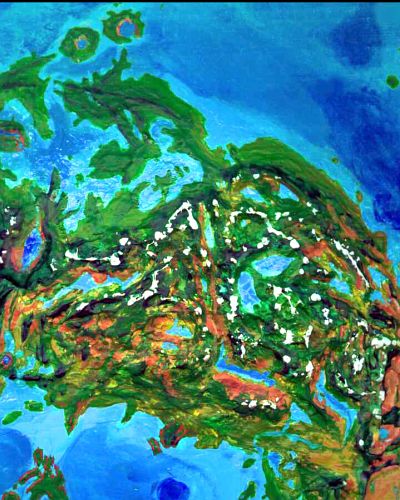
There's no way into Manatum but up the wall to the west, though it's gentler than the cliffs above Lake Kaltash. Still, it's a long climb with the morning sun right in our eyes, up stony ridges--with no help from the winds, either, for they're mostly downdrafts here. But the climb is worth it. Manatum's green, yet crawling with tessera--endless red-cliffed, tree-topped mesas with green canyons between them, all polygonal and neatly spaced.
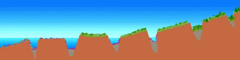
It's an absurd, theatrical, overstylized landscape, a set for Roadrunner cartoons that got left out in the rain to warp and turn green. Ten thousand tesserae, a million square miles? Nearly! In the north, the back side of the Hestia Range is a plateau studded with these mesas, gently sloping down for 500 km from the heights to the Curie Gulf (the scorpion's mouth) where the canyons become mini-fjords and the mesas cliffed islands, all polygonal and much the same size. The isles march out into the gulf until their cliffs disappear, and the mesas are just unnaturally straight-edged islands with deep channels between them. And then they're coral reefs with undersea drop-offs, turquoise polygons between indigo veins. And they go on, indifferent to the depths, to re-emerge on the south side of the gulf--reefs, islets, cliffy sea-stacks, mesas.
Around us, the tessera are unbroken but for a few lakes, paved with islands like stepping stones. Oh, and the Verdandi Plateau, a smooth coronal dome just northwest of us. Our path takes us over it, up the great smooth hump, blue-black with pines. Beyond, as we near the elbow of Joliot Gulf, the mesas start looking lumpy, then half-buried in debris, and then simply blasted away. Something terrible happened here! Ahead is the wall of an impact crater over 100 km across, cupping circular Lake Joliot-Curie. We can rest and have a swim in the lake without a single mesa in sight--unless you count the two strange islands in the lake's center, which clearly once were the central peak of the crater. But a rift has opened up right through the crater--now a cliff-lined, meandering channel separates them into a crescent-island in the north and a small pie-wedge of the original peak near us. Clearly the tessera came first, then the crater, then the rift. So what's changed? Newer tesserae in the crater zone would make some geological sense. Why's the motion changed? Stretch or crush, spread or slide! Decide! Venus, of all goddesses, has a mythological reputation to live down. Nobody likes a planet who can't commit.
We follow the Joliot-Curie River out of the crater, southwest, through hundreds of kilometers of woods, and once we're out of the blast zone, red-cliffed tesserae. At last a great lake appears, deep enough to drown the mesas: Rae Lake, 400 km wide. It drains south into Rae Sound, a three-armed bay some 600 km long, opening into the Tahmina Sea. The shores are wooded, warm, and mild (equatorial but shielded by the rings). The bay's east side is all dramatic red cliffs, but the western shore is low and green--Mars to the east, Terra to the west! We've reached the edge of the tessera, where the Manatum Range peters out into long Cape Recambier, sheltering Rae Sound. From its tip, an athletic flier can island-hop the 500 km to Umay-Ene, largest of the Alpha Islands--a quasi-continental archipelago worthy of its own tour.
To our north is the Disani Peninsula, part of the complex "tongue" or inner mandibles, between the scorpion's jaws. The name properly applies to a corona which forms a cape and bay in the northwest, but eventually, by extension, Disani started meaning all the land between Curie Gulf and Rae Sound, from Joliot-Curie Crater in the east to Cape Salus in the west. Greater Disani's twice the size of France; the country's hilly, forested, and warm but not hot, as it's directly under the shadow of the sunshade-rings.
Let's take our time crossing Disani--this is our last flight, after all, the very end of Aphrodite. From the mouth of Rae Bay, we fly north. Bathsheba Island passes on our left, then Cape Magdalena. Then a strange island across a deep blue gulf, unlike the turquoise, coral-reefed waters we've seen: Nabuzana Island. It's shaped like an octopus or giant spider, with ridges radiating into the strangely deep sea--a ring of deep water. Tarantula in a bowl! Officially its name is Nabuzana Corona, because of that circular rim--but those radial ridges look like lava flows or dikes to me. Could Nabuzana be a formerly introverted corona that changed its mind, had a little volcanic afterthought?
Far off to our right is a cliff-lined valley heading north. Water gleams on the horizon: Lake Disani. The name shortage here is maddening! It should be named Lake Ness, for it looks Scottish--a deep, rugged, narrow lake-filled rift biting into a chaotic highland. Spectacular, especially side-lit in the setting sun, but it dead-ends in the hills--and you're tired by now, I know. Let's end it. Not far now.
Northwest toward Cape Salus (sah-loose), divided from Disani Peninsula by a long straight sound, Salus Bay, lined with cliffs like England's Channel (though these cliffs, fierce red in the dying sun, sure aren't chalk like Dover). Cape Salus is the western tip of Aphrodite--the tip of the scorpion's tongue--about the size of Spain, but greener. Offshore, this arm of the Tinatin Sea is deep, at least for Venus. But south of Salus is a grand coral bank (well, okay, lava flows with a skin of coral only a few centuries thick). It's studded with green volcanoes 1-200 km across--the Vashti Islands.
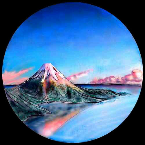
North now to the very tip of Salus, as the sun sets. There's a coda here, a last note to the long song of Aphrodite: over a strait so narrow even the wingless could swim across, shines a steep volcanic cone, higher than anything we've seen in thousands of kilometers: Mt. Ptesanwi, its snow blushing pink in the slow Cytherean sunset.
Go ahead, indulge me, fly to the top. You've come this far! Ride the trade winds up--though they get cold and capricious, that last kilometer. Ptesamwi is high. Most clouds, and winds, go round. You wish we had, too.
But tired and shivering atop Ptesanwi's windy summit, glowing like spotlit actors in the last seconds before the curtain ends the play, feet in snow, heads in fire, we can see the end of the world. To the east, an island-studded sea lit magenta and turquoise by the sinking sun. West, an islandless sea, indigo in the oncoming night. South, the green hills of Salus, under the white arch of the rings. North, faint low and far (even with Venus's atmospheric lensing), the Farida Islands dot the horizon. Four or five hours' flight would bring us there, to long green islands like stepping stones across the sea. And they're just the first islets of the vast Eistla Archipelago, to the west and north--millions of square kilometers of fertile land. But that's another tour.
Shorter, though.
Of course, they all are! Aphrodite's the largest continent in the solar system. Terra's "Old World", once a landmass rivaling Aphrodite, has now broken in three, thanks to the Big Thaw.
So how big is Aphrodite? 65,000,000 square km--half of all the land on Venus. We just flew thirty-eight thousand kilometers--if we hadn't zigzagged, a flight that long would've circumnavigated the planet! Magellan without a ship! On your own wings, unaided, you effectively flew around the world in the last 78 Earth days.
Two days to spare. Jules Verne would be proud.

World Dream Bank homepage - Art gallery - New stuff - Introductory sampler, best dreams, best art - On dreamwork - Books
Indexes: Subject - Author - Date - Names - Places - Art media/styles
Titles: A - B - C - D - E - F - G - H - IJ - KL - M - NO - PQ - R - Sa-Sk - Sl-Sz - T - UV - WXYZ
Email: wdreamb@yahoo.com - Catalog of art, books, CDs - Behind the Curtain: FAQs, bio, site map - Kindred sites