Venus Unveiled: Ishtar
INTRODUCTION
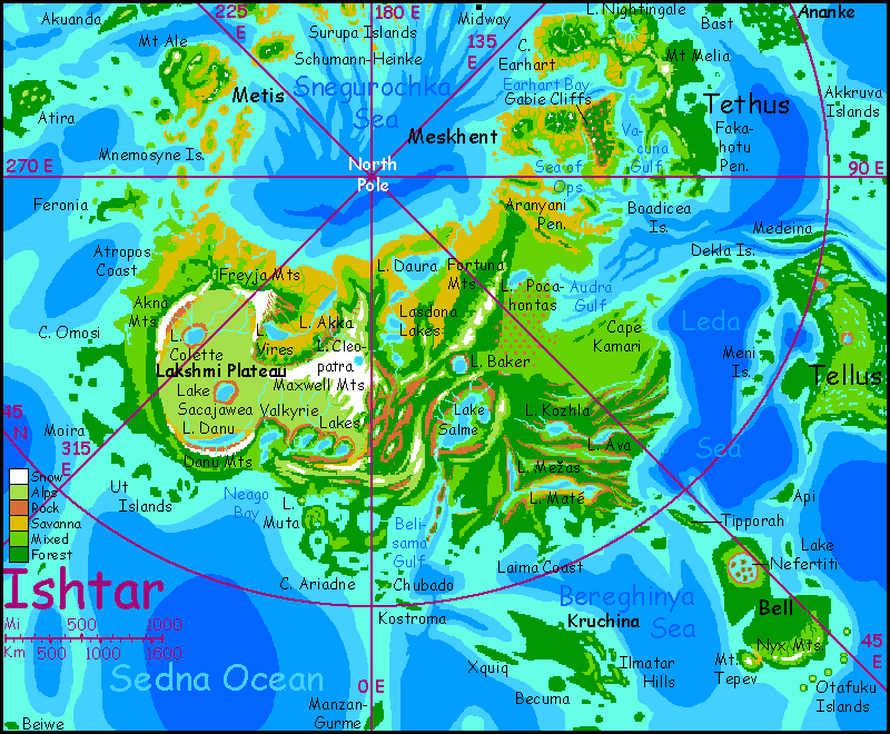
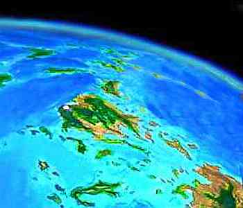
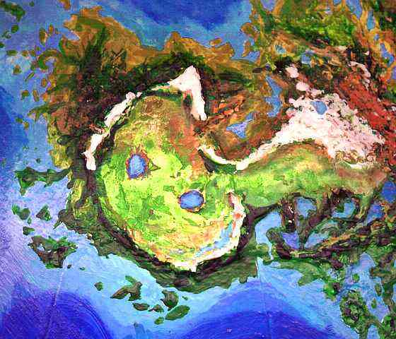
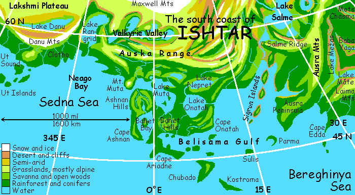
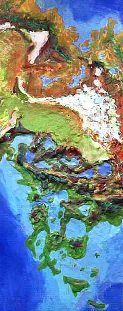
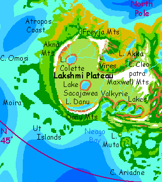
ISHTAR is the great northern continent. In the west, Lakshmi Plateau resembles Tibet, with some of the highest peaks on Venus and a truly Terran continental feel. Eastern Ishtar is lower but much larger, and today it has some of the biggest lakes and longest rivers on Venus. Northern Ishtar has a cool, mild, fairly dry climate (think coastal California); central Ishtar is high, cold, and fairly dry--grassland, desert, alpine tundra, or open pine forest. South Ishtar is much lower, warmer, and wetter, climaxing in Megazoic rainforests on the southeastern shore.
THE DAYBIRDS
Ishtar nights get very dark up north, for the bulge of the planet and the mountains to the south hide most of the light from the equatorial rings. And the region's Mediterranean climate typically means a mild, dry cloudless week of low sun, then a week of dark cloudy nights with fog and drizzle. It's led to a peculiar settlement pattern: the rainbirds. Named after the "snowbirds" of North America (migrants who fled its snowy pre-Melt winters), the rainbirds of Ishtar flock to the north coast with sunrise, and fill the coastal towns, then spread their wings at dusk and hop south over the great mountains, where the nights are drier and lighter, leaving the off-season towns to melancholy authors and other indoor sorts.
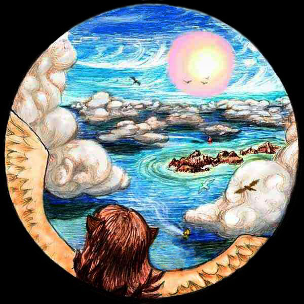
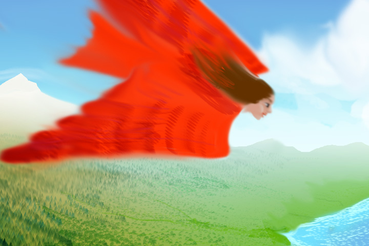
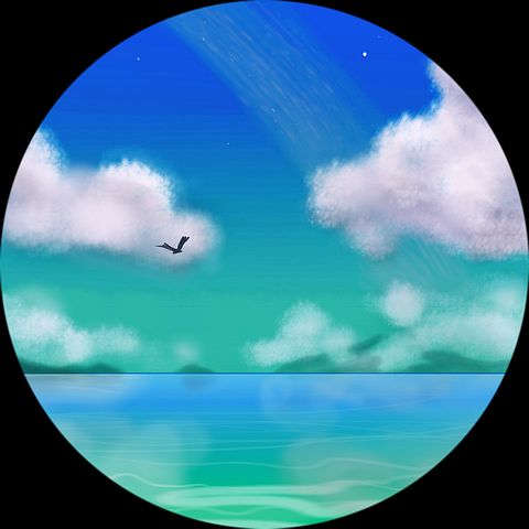
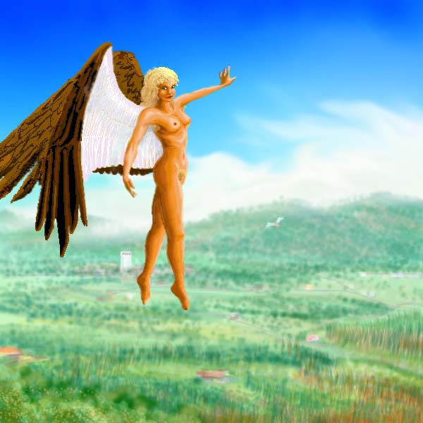
But the migratory champions are the much rarer daybirds, who circle the Arctic Sea ahead of the night, living in perpetual day, riding the steady winds like surfers on Old Earth. To keep up with the sun, one must fly about 700 km a day, quite feasible for a dedicated flier, who can average 90-100 kph, just like migrating geese on Terra--and geese must struggle along in stronger gravity and thin air, just 30% of Venus's sea-level pressure. It's amazing birds survive on Terra at all. On Venus, of course, nearly every animal 60 kg and under can fly, or at least glide on skinflaps. Even tourists in strap-ons, unused to flight, can lumber around. They need to. On Venus, anyone smaller than a horse who insists on staying wingless is perverse--like being carless in ancient Los Angeles.
Of course, few people want to just fly, sleep and fly again forever. But nearly every flight-capable young person has circumnavigated Venus as a daybird once, just to do it. It's quite an experience--waking as the sun rises in the west, flying east all day through perpetual dawn, falling behind when you rest but outracing the sun on the wing, so that in your final stretch the sun re-sets. And then you land, eat, and bed down. And while you sleep, the sun rises again...
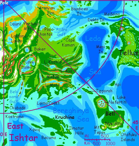
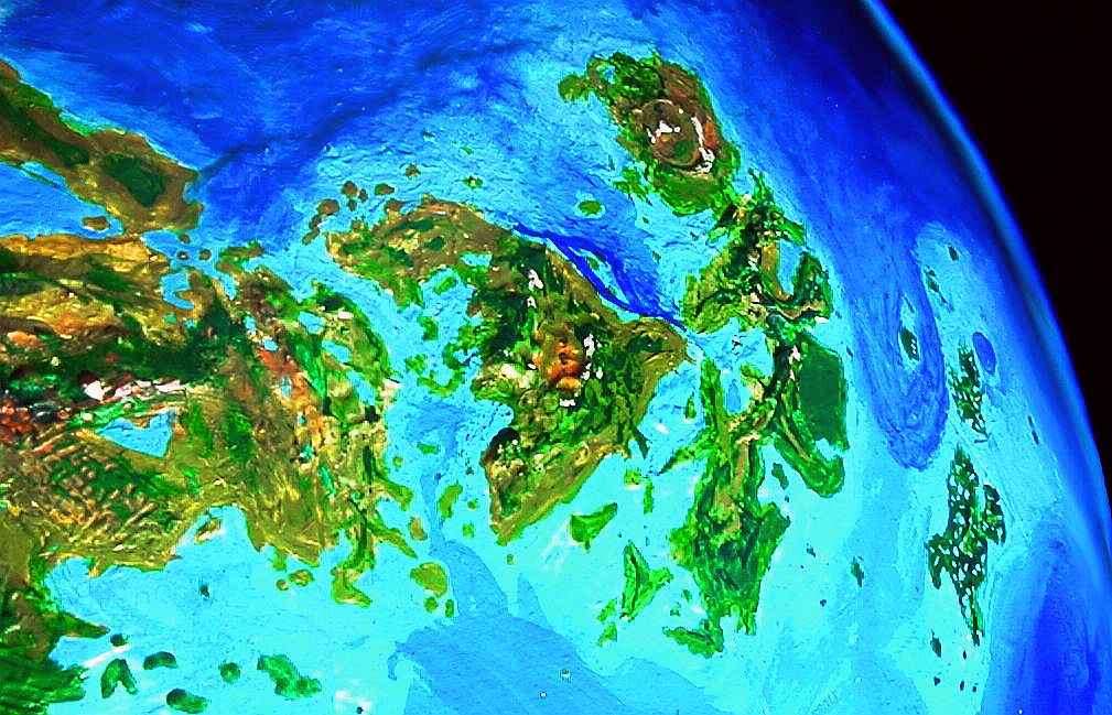
THE WESTERN ISLES
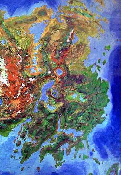
Let's start in the far northwest, on the floating town of Midway (upper right of the orbital photo--lost in horizon-haze, really). As its name suggests, it's halfway across the long sea-passage from Tethus to the Surupa Islands, the only stretch of northern sea too wide for daybirds to cross without rest. Hence Midway! Small, lively--a town for singles, for the young. No philosophers on Midway! Daybirds aren't introverts.
It's Sunday, of course--the day the sun rises. You rise with it, and fly east over the sea for hours. The daybird flocks recede ahead of you--you can't keep up, not that it really matters. At last, humps appear on the blue horizon--the modest Dickinson Islands, first of the Surupa chain. The Surupas extend 1200 km in a great triangle; they're the western tip of greater Ishtar. The islets below are typically Mediterranean--rocks, grass, brush, few trees. You rest on an islet, like gulls, then fly on, more slowly. Pick an isle to sleep on--there are so many it doesn't matter which. Whenever you're tired enough.
You wake and head east. It's Sunday again, though not sunrise--you're not a real daybird, not THAT fast. All day, the islands steadily grow--Dickinson, Lukelong, Molpe, culminating in two giants: Schumann-Heinke in the north, on the daybird's path, and Surupa itself, on the southern horizon. Surupa's long, narrow, warm and rainier than these northern isles under you. Schumann-Heinke is chunky, mountainous, dark-forested--high enough to catch the rains, despite being in the polar dryzone. You sleep on its east shore. When you wake, it's early Monday.
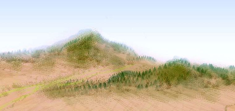
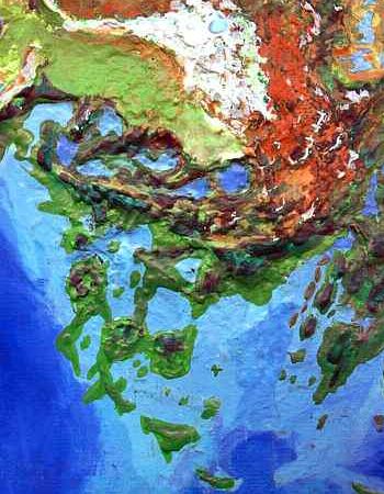
Just ahead is a corona (a great geological blister, common on Venus) forming a land called Metis, the size of Spain. It even resembles Spain a bit, with warm coastal valleys, quite rainy in the south, and a drier central plateau ranging from steppe to dark pine forests in the mountains. The most dramatic peak on Metis is Ale Tholus, on the southwest coast, a volcanic cone dusted with snow this morning. Mount Ale ("Ah-leh" not "ale" as in beer) catches storms from the south, and supports thick redwood and cedar forest. Northern Metis, along the flyway, is drier: mostly oak groves and grass hills. But they're green in the early morning light, fresh from the night rains. A pleasant place to camp and sleep while the sun climbs into the sky. It's mid-Monday. For mere amateur daybirds, you're doing well.
Off Metis's east coast is a swarm of hilly isles--the Mnemosyne Archipelago, filling the narrow sea between Metis and Ishtar. The largest of the Mnemosynes is Feronia, a fish-hook some 500 km long. Feronia's a pleasant warm green wooded strip rather like coastal California pared off from America. The southernmost Mnemosynes are rainforest; like the Surupas, the Mnemosynes steadily cool and dry to the north, ending with a group northeast of Metis that's quite San Franciscan--cool, mild, prone to fog but not much rain. And that's where you sleep.
WEST ISHTAR
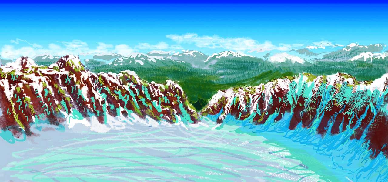
Like the daybirds before us, we hop across the Mnemosynes to the Atropos Coast of Ishtar, a wide triangle of Italian hills and plains. All Tuesday it's fly, rest, swim, fly. Gradually, a great snowy range looms off to the south--the Akna Mountains, whose peak are up to 7 km (23,000'). The Aknas are one of the few ranges on Venus with extensive glaciers, though only a few tongues descend below 4 kilometers. The range rises spectacularly from tawny grasslands and oak woods at its feet, through a belt of dark pine forests up past three kilometers (10,000'), then pale green flowery alpine meadows up to 5km in spots (16,500'). Snow and ice predominates only on the peaks above.
The inland face of the Aknas is much drier--great bare ramparts frowning above the windy Lakshmi Plateau--which the daybirds' path avoids.
The north coast here has a strange climate pattern: cool and rainy at night, warming in the morning as the low but huge Cytheran sun rises from the west, then cooling in midday as the sun swings south and the long shadow of the Freyjas covers the coast for miles... only to warm again in late afternoon when the low sun wheels round to the east. Winds here usually blow off the polar sea, creating powerful updrafts along the Freyja front, but during the noon shadow, cold air from the Freyjas fights with the polar tradewind. Noon fliers may encounter abrupt fogs, squalls, even occasional tornadoes--one reason wise daybirds prefer dawn. Besides, it's beautiful then--red light on the snowy peaks, dramatic long shadows, fiery clouds, a pale turquoise sea and tawny hills, the sun under your feet (no annoying glare), and splendid updrafts all the way to Vires-Akka. The early bird gets the world!
You've got your stride, now--or should I say wingbeat? You're keeping up with the few daybird stragglers--it's been early Tuesday for several sleeps now. And 1200 km later, it still is, when a narrow bay opens to the right, between two ridges. This is the mouth of Vires-Akka Chasma. The great valley extends a thousand km to the south, winding between the highest ranges on Venus. It's cool and rather dry--a patchwork of sparse pinewoods, oak savanna, prairie, scrub and even desert. Katabatic winds from both the Maxwell Range and Lakshmi Plateau make the climate harsh except around the great lakes: Akka is 300 km long and 100 wide, fed by Lake Vires, nearly as large, nestled right under the edge of the Lakshmi Plateau. Rimmed with forest and marsh, they're large enough to make their own weather. From the shores of Akka, a white mirage hovers to the south, so faint you're not sure you're seeing it: the Maxwell Mts, 250 km away--and eleven km high. It's late Tuesday--late morning, that is--and the southerly sun's glare in your eyes makes it hard to be sure.
Let's stray still further off the daybirds' path--you've followed them halfway around the world already, after all. Climb south up the canyon, then east beyond Lake Vires. Not an easy flight--at one, even two km up, the air's still much denser than Earth's and flight isn't a strain; but by three you start to feel it you're in a vacuum. Flap and flap and there's nothing to grab...
At last, exhausted, you reach the Lakshmi Plateau, some 3 km high, surrounded by the highest mountains on Venus. Lakshmi, unlike Tibet, is a true plateau--fairly flat except for two large crater lakes, Colette and Sacajawea. It's cool, windy, and grassy, rather like the Andean Altiplano. Though here in the north, in the rainshadow of the Freyja Mts, the grass thins to a truly Tibetan landscape--a chill dry-grass desert, unlike anything else on Venus.
In the greener west, near the foot of the Akna Mts, lies the largest break in the plain: the caldera of Colette. It's a volcanic crater like Haleakala, but two kilometers deep and over 100 wide, now with a great lake on its floor. This sunken lake, particularly its cliff-lined, sun-warmed north shore, is a temperate oasis in Venus's coldest region. Even now, barely noon, the water's warm. You swim briefly, then watch the local creatures sun, read, play and swim until you fall asleep. Don't worry. In Venus's thick atmosphere and the low angle of that warm sun, you won't burn.
Skimming southeast across Lakshmi again, the great pit behind you disappears and it's prairie to the horizon. The grass is lush and flowers peep out everywhere. It's early summer--that is, Thursday--and Lakshmi's at her best. Only the chill, thin air up here reminds you of the frost last night, that will return tonight, in just a few more days.
A few hours of labored flight, and a new caldera opens up--Sacajawea, also now filled by a lake. With shorter cliffs and a lake-level a kilometer higher, Sacajawea's colder and less scenic. As a result, Colette's the tourist mecca, while Sacajawea is nearly pristine, and its cold clear water sustains many species rarely found on Venus. It's afternoon, the huge sun beats down, but none of us can stay in the water long but a few locals, four Martians and an old Inuit couple from Earth.
As in Colette, many of the locals are wingless; less use on this thin-aired plateau where conditions are nearly (shudder) Terran. When traveling they have to strap on wings just like you--and instantly, all over the lowlands, be mistaken for offworld tourists. On their own planet! Lakshmi really is its own world.
Three hours across the great plain. It seems warmer and drier south of Sacajawea, more so than just one extra day from the dawn rains can explain. Here in the southern stretch of Lakshmi, the noon sun stands a full thirty degrees above the horizon. If you were still north of the Freyjas, you'd be in shadow right now. And the sun is huge, of course--this is Venus! Even filtered through the thick air, it glares in your eyes.
There's a second reason this part of Lakshmi is drier. It's in a mild rainshadow. Red, snowy crags climb over the horizon, but you don't see the highest of Venus's great lakes until you're nearly over it: Lake Danu, some 300 km long and 50 wide. Beyond it rise the Danu Mts, a steep wall 4-5000 m high--the south lip of Lakshmi. The Danus are often snowy but lack large glaciers, being lower and further south than the Maxwell, Akna, and Freyja Ranges. The inland face of the Danu range, looming above the lake, is rather dry--largely bare cliffs, though pines fill the canyons.
In contrast, the south face looms over the warm Sedna Sea, and gets torrential rains, feeding tall cedar and redwood forests. Rather than face a hard climb over the mountains, you head west around them. Here the Danu range drops to mere hills at the edge of Lakshmi.
Hills on the inland side at least; seaward is a great mountain-slope two miles high, breaking into cliffs here and there. This escarpment is called Vesta Rupes, the Vesta Cliffs. While not low, this gap allows more rain onto Lakshmi, greening the central plateau.
Far below you, the lush Vesta coast is lurid green and silver, sidelit by the sun in the east (you flew west into Friday; it's now late afternoon). On the horizon, shrouded in clouds, are the Ut Islands, a long arc paralleling Lakshmi's edge, but 200 miles out to sea. You dive like a falcon down to the shore, laughing and a bit giddy as you briefly reach 150 kph. The air grows dense and humid--the sea!
When you wake, the setting sun's in your eyes; better to just swim and rest and explore the forest till sunset, and fly by cloudlight. Huge cumulus castles glow gold and red as you ride the steady updrafts on the Vesta Rupes, sailing east along the great wall as it grows into the snowy Danus (a spectacular range on this side, though from high Lakshmi they were just red cliffs and hills), and slowly subsides again, bending north as Lakshmi finally ends. You flew well--caught up with the sun a bit, in fact. It peeps over the eastern horizon as you reach Neago Bay, under the Danu Mts to the west and the Auska Mts (a southern spur of the great Maxwells) to the east. Neago's waters gleam silver, backlit in this second sunset. At the head of the bay, wide Lake Rangrid is just the first great lake in the Valkyrie Valley, cutting deep into the highlands under the Maxwells--a tempting, scenic flyway, but let's follow the coast for now. Sleep first--you don't want the sun's glare in your eyes.
When you wake, the sun's down. It's my favorite night: Dusk. You Terrans and Martians probably wondered why I capitalize it, but that's the proper name of the first day after sundown. Dusk, Eve, Ring, Yule (you'd say midnight), Rain, Witch (the 13th day in the cycle) and Dawn--and then Sunday again, when the sun rises. Such a simple calendar!
So it's not just dusk, but Dusk, and on Venus, that's special. As the Auska coast bends southeast, the cloud-towers are a fluorescent magenta--you're flying through flame. Wrapped in the cloud-extravaganza, you hardly notice that the Auska Mts slowly retreat from the shore, leaving you in a gentle, warm lowland. Most un-Ishtarian!
SOUTH ISHTAR
The brightest is a steady blue-white lamp with a small white satellite. They say that around Yule, the darkest time of night, if you're up near the poles where the rings can't be seen and the stars really come out... in months when Terra is close, you can read by Earthlight. It's much brighter than Venus-light on Earth, for Venus is always either full-but-distant or near-but-a-crescent. But Terra is no crescent when it swings close to Venus, it's full. And its clouds rival those of Old Venus for albedo. After the Meltdown, there are a lot more clouds, too. Terra's a rainy world, these days. But that's another tour.
You fly leisurely down the Auska Coast for hundreds of kilometers. There's no night-chill here--warm, mild maritime air.
Ahead, a lone mountain looms--Mt. Muta, a volcanic cone, tall enough to be snowcapped if it were anywhere in the north, but you're over 30 degrees from the pole now, in the subtropics. Pine forests on its shoulders and open meadows at the summit, that see late-night frost sometimes... but that's all. Quite a few in your party aren't sure they can land safely in treetops, so you keep climbing, and sleep on Muta's grassy summit. So ends Eve.
When you wake, it's early Ring, the nightday after Eve. Below you, to the south, a strait? A river? There's a current, you can see the ripples from here. You swoop down the volcano, land on a sandbar, and taste the water. Fresh. It's the outflow of huge Lake Muta, a shallow, island-studded lake stretching 400 km south and east. Muta is shallow, irregular, reedy and swampy, full of islands--though unlike the Everglades it resembles, the islands are bedrock and often hilly.
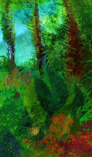
You cross the outflow and along the lake's south shore. Forested hills to the right--huge trees! The Ashnan Hills, the first true rainforest you've seen on Ishtar.
Near the south end of the lake, you climb a ridge, expecting to see more hills... and it's a sham! A single wall of green, dividing Lake Muta from a long, oval bay, with a central island, like some lunar crater that got stretched north-south, then drowned. Bahet Bay! Despite appearances, Bahet's a corona--a popped blister--not an impact crater. Thin, rugged capes surround the bay except at its narrow southern mouth. The shores are warm and rainy, with tropical hardwoods growing to great size.
You fly out the mouth of Bahet Bay. On the left stands an emerald wall of jungle. At last, curious, you climb up its steep slope (it's not the land that's steep; it's the sheer size of the trees). On the far side: sea! This too is just a narrow cape. You follow it for over an hour, as it bends and branches, to the end. This is Cape Ariadne, named for a now-drowned crater just offshore. A narrow, three-headed peninsula 300 km long, it's the southern tip of Ishtar--as warm and rainy as the Amazon, on Terra. From here, you have to go north--there is no other way.
Clouds gather, making this (early Yule) the darkest night you've seen. Colors are actually dimmed! When the rain starts, you put up a tent. All right, I'm being too eco-purist. Of course such land will be inhabited--at the very least there will be gorilla villages and sentient hollow trees who welcome travelers. Let's just hope there's not a Club Med. Whoever's there, you won't need to camp. But you're here to see the land, so let's pretend you're roughing it. Tents of ripstop arachnon you have to lug around--a full kilo! Such a burden! Inside the tents, it's dim enough to need lights to read. The Cytheran natives in your group, tourists from the drier equatorial zones under the rings, where nights are brighter, find simple darkness exotic and a little unnerving. The Terrans and Martians find this comical.
When you wake, it's early Rain, and you learn how it got its name. Rain all day (not cold, of course, and fortunately not stormy--just stubborn). You fly back up Ariadne an hour or so. When the mouth of Bahet Bay appears, dim on the northwest horizon, a new arm of Ariadne branches off to the east. Following it to the end, you keep on, noting that the water's pale turquoise--shallow. You're following what on Earth would be called an island arc. Geologists are wary of applying Earth plate tectonics to Venus, but you've been following an arc that could easily be mistaken for the Malay Peninsula and Java: from Auska Ridge to Mt Muta to the hills of Ashnan to the ridges around Bahet to Cape Ariadne, and now the land on the dim horizon: Chubado Island, a triangular wedge 200 km long, all lush tropical forest on low hills.
Along with narrow Kostroma Island beyond, Chubado's one of the few parts of Ishtar truly in the torrid zone (though the sea winds relieve the heat a bit, compared to the stifling inland jungles of Tellus or Bell). The spectacular and fragrant jungle canopy, reminiscent of Terra's Spice Islands, is popular with avian and arboreal visitors, while the long beaches on all three sides, with coral reefs offshore, make Chubado equally popular with species who like to swim (and you do, in the rain, past midnight, and still find it warm). You explore the coral reefs. Bioluminescent creatures zip by, green white and blue, swarming excitedly, making the most of the relative dark.
Not everyone visits Kostroma and Chubado for the scenery. The two islands are also the only sensible jumping-off points if you're flying from Ishtar to Eistla. But that's another tour.
You wake thinking "I've been south. Let's go north." Tired of the rain (though Rain is over and now it's Witch, the thirteenth day, just one before dawn, the lower-case rain goes on and on--how'd you think this land got so green?) you fly northeast, over the Belisama Gulf between Chubado and the mainland, stopping to rest on a verdant tropical islet. Tropical as in 48 degrees north!
As you make landfall over Onatah Corona, the rain eases and the rings break through, a brilliant white arch behind you. The lush green hills ahead have concentric folds and arcuate fingerlakes, silver eyes gleaming under the trees. It's hours before Lake Onatah appears: a pale sheet reaching the western horizon, where it nearly meets Lake Muta, just over narrow Nepret Neck. The two lakes nearly sever the whole South Coast from Ishtar--it'd make a fine tropical island--a Cytherean Java. But Onatah's not a bay, but fresh--a squarish, marshy lagoon 250 km across. It and Muta are Venus's answer to the Everglades. You stick to the east shore, a narrow strip of forest--to the east, the sea is following you. Belisama Gulf is the deepest bite in Ishtar's chunky shape.
You reach the Onatah, that joke of a river, "five miles long and two miles wide", really a strait with a steady outward current, draining the lake of its constant heavy rains... You land here, on a beach, and sleep. You've flown 600 km north in one swoop, and you're still in jungle--though now you're on the fringe of the torrid zone, where occasional cold katabatic winds come down from the Maxwell massif. So the trees here huddle lower than the Megazoic giants to the south, though they're still impressive by Terran standards. It's late Witch when you fall asleep. CENTRAL ISHTAR
You wake at Dawn. (I've been waiting two weeks and 7000 km to say that!) Ahead, Nepret Neck curves round to the coast. Over its ridge, inland a bit, is Lake Nepret, smaller, higher, and deeper than Onatah or Muta. And cooler. Beyond Nepret, Ishtar rises--and cools. And rises and cools. And rises...You fly up into sunrise, though the world behind's still in shadow.
Soon the ridge-tops are alpine, the slopes coniferous; the valleys support hardwood forests, bogs and meadows. You're in the Auska Mountains--but this time, the business end. The cold is a shock, but you're exercising heavily just to stay aloft, here. Updrafts are weak and whimsical--the prevailing wind sweeps up these valleys lengthwise--only where ridges intervene do they snarl into rising vortices, full of gusts and petulant downdrafts. The real drain isn't the cold, but thin air. You've gotten used to Cytheran sea-level air, 3.5-4 bars (1 bar roughly equals sea level on Earth)--plenty for wings to grab, and more available oxygen than Mars or Terra. Not up here! The air's worn thin as a threadbare sheet.
For a full day you cross plateaus and ridges, a few bearing old snow in the cracks. What is this, Mars? Pines, alps, mini-deserts on the back side of ridges, away from the sea. At last a plateau, and you skim low, gaining a little ground effect. The difference in temperature between the sunwarmed plain and the cool night air just a few meters up is so great that you see mirages--the plateau before you appears to be a huge gulf, while beyond, huge mountains hover, scarlet in the dawnlight, ten times their real size... Or is it fatigue and oxygen shortage?
And then the world suddenly drops away. Cliffs, Martian in scale. The escarpment runs out of sight to the west; to the east, it bends round to face you due north. This west-facing wall flames red in the rising sun. You're hovering on the rim of a gigantic... canyon? caldera? bathtub? Well, tubs--the cliff-feet turn to alpine meadows and two wide, chilly-looking lakes, still sunk in shadow and pale ringlight. This is the Valkyrie Valley, a chain of half a dozen linked fossae or sinkholes, each with a great lake. The chain runs 1200 km back east, all the way to the biggest, Lake Rangrid at the mouth of Neago Bay.
You've had a hard day flying, in such thin air, so you dive down a thousand meters to the valley floor and sleep by the lake, to recharge in that sweet air, though it's thin and dry after the scented rainforests of Chubado, just two sleeps ago. While you sleep, the sun creeps down the walls to reach you.
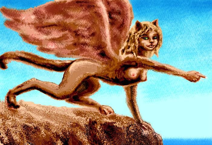
You wake to the chattering of a family of sphinxes. These are the only winged mammals light enough to be quite comfortable in this high, thin air; the Valkyrie rim is dotted with cliff-dwellings. Though as large as cheetahs, they're far lighter: hollow bones. They talk and flirt with you, torn between touch-hunger and caution, for sphinxes are as social and sensual as domestic cats, but more vulnerable, with that delicate build and wings.
What's that girl saying? "You'll need your strength today! Over the north cliffs, across the plateau, you'll hit the south flank of the Maxwell Mountains."
"I thought that was anoxia."
"No, no, you weren't hallucinating; they're so tall they really do climb over the horizon hundreds of kilometers away."
And you'd better believe her. The Maxwells are the highest mountains in the inner Solar System, some 11 km above sea level (that's 36,000 feet, for you metric-impaired). And unlike the great peaks of Mars, they're not broad, dull shield volcanoes, but real mountains, young and sharp. Maxwell's higher than Everest, yet the air pressure even at the summit roughly equals that at 3 km (10,000') on Earth. The Cytheran atmosphere contains less oxygen overall, so the partial pressure of oxygen is still dangerously low atop Maxwell, if not as deadly as Everest. But plants grow up to 7 km high on Maxwell's flanks, though not many--it's cold up there. And the rocks are hostile to life. You see, even back in the bad old days when most of Venus was an oven, the peaks of Maxwell were so high they collected snow. Well, Cytheran snow. Light metals, liquid elsewhere, condensed on the peaks. Lead, tin? I'm not sure what-all's in that mix. But these peaks got plated! As they cooled, the armor just hardened. Today, these high shoulders just shrug off the Terran cryosystem of water and carbon-based life. Rain runs right off, roots can't grip.
Still, it's not utterly dead up to 7 km; that's 23,000'. Show me where life survives at that height on Earth! Denser atmosphere and lower gravity together create a biosphere deeper than Earth's. The same thing happens on Mars, of course, but it's countered by thin air and harsh verticality. On Venus, where relief is mostly gentler than Earth, the result is a nearly unbroken biosphere--some deserts and a few glaciers, but no Saharas, Tibets, Greenlands, or Antarcticas. Maxwell is about the only true hole, where geology defeats life. Well, geology and metallurgy.
The Maxwells are a region in chaos--steep and unstable, weighed down and chewed on by new glaciers, while the same forces that thrust them up keep trying to enlarge them. Because water and ice are new to Venus, though, the Maxwells haven't had time to dig the deep canyons of the Himalayas, so they lack the life that huddles in such altitude-oases. Over time the Maxwells may become more Himalayan, a fractal net of canyons ridges cirques and horns; or they may become a solid dome of ice, a mini-Greenland.
The youthful instability of these recently iced mountains presents your tour with a real problem. Flying's hard enough here, just two miles up--you can't possibly fly over the Maxwells. Nor are they safe to climb--steep and unstable. I think we'll just skim the plateau to the base of the mountain wall, steep and spectacular on the south side, and fly round the range to the west, not trying for the summit.
No, wait--as long as I'm inventing a world, I can invent tourists' services! We shall dine in comfort as we glide over the Maxwells in the pressurized cabin of a blimp, arguing eco-politics with Martian radicals on tour. A blimp at this altitude? Sure. The high Cytherean air pressure can support blimps, planes, even helicopters well above the highest peaks. In fact the Martians want to open
the windows--"It's our only chance to feel at home after that muggy soup you call air..." No way!
And so you cheat, and hop right over the whole rugged, wrinkled, confusing mass.
Well, let's open that window a little bit. We'll get off at the first stop, still 6 km up (almost 20,000'!) on the northwest flank of the range. The partial pressure of oxygen here resembles 3-4 km (13,000') up on Earth--you can walk, you can breathe, but it's work. Young glaciers and snowfields are all round; lurid orange and yellow lichens crust the rocks. Only a little grass--without strong seasons on Venus, the growing season this high is only a day or two each afternoon--the sun takes five days to thaw the ground, and it refreezes soon after sundown. Not too many Terran plants have adapted. It's late morning now, and still cold, cold, cold.
In this chill desert, you've come to see an oasis. Over the lip of a cliff is a vast round white disk--Lake Cleopatra, nearly half a kilometer deep, sunk in a hundred-mile impact crater. It's the only large ice-covered lake on Venus. Not frozen solid; Cleopatra may be like Terra's old Arctic Sea before the Thaw, when algae supported a rich community under a meter or two of sheltering ice, or it may be more like Europa, with ice too thick for sunlight to penetrate, limiting the biomass.
Life in Cleopatra will be exotic, but how rich? Hard to tell, without knowing how hot the floor is, and to know that you'd have to be sure what created the Maxwells. Is it a hot spot, an overthrust, or is cool crust being sucked into a sort of subduction-funnel? How hot is it down there? If it is a hot spot, Cleopatra may be like Lake Baikal--so warm it's ice-free, steaming in the cold, spreading a plume of fog hundreds of km downwind, changing the local climate.
This high up, there's only one way to get back into the air: jump off the Cleopatra cliffs. Down, gaining speed, to skim northwest over the lake-face toward its outlet, a mere 4500 meters high now. Over the lip and down the alpine valley below, following the icy cascade of the Anuket River back into life.
East of the Maxwells and Cleopatra is the heart of Ishtar--a wide wedge of dry, rugged uplands, whose edges are somber pine forests, thinning into a cool high desert plateau with sparse ponderosa and juniper. The centers of continents are often hinterlands, and Ishtar is no exception: this upland, nearly a million square kilometers but in Maxwell's shadow, lacks an official name. The heights are often snow-dusted on cold nights and mornings, but if you're sick of snow by now, don't worry; you're crossing the narrow northern end of the triangle. Beside, you won't see much frost from now on. You're leaving the famous Ishtar (that chip off frigid old Earth) for a warmer, greener world--all the rest of Venus.
You struggle east across the highlands for hours, until you reach the lip of the Lasdona Valley, a winding, ill-defined chasma with a chain of good-sized lakes. Lower than the Valkyries, the Lasdona Lakes soon start to be forested as you descend. But a cold dry wind pours off the Maxwells behind you, stunting and wind-blasting the low woods. South-facing ridges, cut off from the sea winds entirely, are often pocket deserts. But slowly the valley widens and greens, and the lakes grow. You sleep on a rocky islet, under pines. It could be inland California on a cool day--hills with oak savanna, fed by sparse nocturnal rains.
Immense Lake Daura is last and lowest, barely above sea level--a wedge 600 km long and 400 wide. Between the lake and the polar sea is the Daura Strip, oak-wooded inland where hills rise, catching fog and the night-rain, open and grassy along both shores. You've rejoined the daybirds, if only briefly: the Daura Coast is the next stop on the flyway after Vires-Akka Bay. They take one day to do what took you... how long? And you must turn south yet again; there's a very different Ishtar that the daybirds miss.
EASTERN ISHTAR
Southeast of Lake Daura stands a wide swath of mountainous country called the Fortuna Tessera. Mesas and canyons form a regular grid, like a waffle iron; these aren't desert mesas formed by erosion, but by crustal stretching and compression in two directions. Rivers here form strange netlike patterns, often splitting and rejoining. Occasional volcanoes pierce the tessera mesh. The highest peak, Mt. Pocahontas, actually gets appreciable snow, though by now, in mid-afternoon, it's bare black rock. Below it to the east is Lake Pocahontas, about the size of Lake Erie.
The Fortuna region's dry for Venus--the lowlands and tessera-canyons are mostly oak savanna, with hot days, cool foggy nights, and light rains at most. Sparse pine forests cover the cooler highlands and mesa-tops, which get more rain, but also some frost.
At the southwest end of the Fortuna highlands is Lake Baker, a great impact crater holding a round lake 100 km wide. The Baker region is a mix of open woods (oak below, pine above), brush, and dry grasslands.
I'm trying to think what sort of people would like this immense stretch of country, fertile but not lush, rugged but not spectacular, cold for Venus but hardly harsh--brushy, full of berries and thorn-thickets... oh.
Bears, of course. Bear heaven. This will be the homeland for grizzly/brown bear culture. With nearly chimp-size brains even in ancient times, it didn't take much engineering to push them over the top into sentience. We won't explore their salmon-fishing culture, so like the Northwest Coast tribes before them, with their longhouses and totem poles and epic masked dramas about mythical trickster beasts like Raven and Human, during the long dark ringless nights. No, that'd be science fiction, and this is just an ecological study--you're just noting prime bear habitat.
Southwest of Baker is a great inland valley like Sichuan on Earth: the Salme Basin. In its center is Lake Salme (sahl-meh), the largest in Ishtar, twice the size of Earth's Lake Superior. The basin is mostly brush and prairie, but tree-lined streams drop from the colder, wooded highlands all around, and forests ring the lakeshore.
Horse heaven? Elephant heaven? Or both! These two species, so similar (herbivores, herd creatures with a paradoxical individualism, sensual and earthy, oral tale-tellers prone to body-painting) yet so different (swift, handless, patriarchal equines. Slow, clever-trunked, matriarchal pachyderms), may coexist here. If you don't like horses or elephants, you can do the work of inventing appropriate humanoid societies--I'll stick with mutant quadrupeds. I like them, and it's not like they'll break my special effects budget (hint: zero).
At its south end, Lake Salme drains through a deep, jagged, twisting gorge. You follow it down, from a safe height--spectacular waterfalls, but with equally spectacular downdrafts in places, so severe that Salme Gorge kills flyers every year. At last the gorge widens, softens, greens, and opens at last on Belisama Gulf.
The shores of Belisama are much rainier than the Salme valley--mostly woods and marshes, with a few open meadows. A few of the higher peaks around Salme and northern Belisama occasionally bear night snow, but the lowlands are warm, even now, near sundown.
The strange Sigrun Islands begin on land, as a cluster of long mesas and canyons. They were originally dubbed fossae (cracks) but are more ridges than holes. The ridges wade out to sea, forming red-cliffed islands with deep channels beneath--a wall of them down the middle of Belisama Gulf. You camp on a ledge, though it's hard finding one not already crowded with trees, birds and flying mammals, notably a whole cliff-village of sphinxes. You're out of austere northern Ishtar now, back in the lush south.
When you wake, it's dusk. Fiery clouds tower over the Aushra Mts. Often all southeast Ishtar is called Aushra--also spelled Ausra, with a diacritic mark on the S that probably won't show on the Web. However you spell it, it's pronounced Aushra (Ow!-shruh). The Aushra hills resemble western Oregon, with pine woods and river-bottom meadows. Days are generally sunny and warm, with mild rainy nights.
Through Dusk and into Eve, you push on into far southeast Ishtar--Laima. This is tessera country, but not the mesa-pattern you've seen. Here the mesh is stringy, wrinkled--rounded ridges and dead-end valleys full of fingerlakes fed by the near-tropical rains.
Beyond the east-west Laima Mts, down around Cape Tipporah reaching toward the great island of Bell, flowering trees taller than Terran sequoias interlock to form a treetop country 120 meters up. Most locals, naturally, live in the trees (literally in them--some species form room-sized hollow crowns, organic windows and all). Here, the tessera are swallowed by Megazoic forests and swamps--the great trees root in soil, mud and water with equal enthusiasm.
But Bell and the Megazoic zone are another tour. You're out to see Ishtar and circumnavigate the world, remember?
Back north of the Laimas, in merely Amazonian forests, the Baba Yaga Chasmas stand out as giants amid the tessera canyons: cliff-lined valleys full of marshes and lakes. The largest are Lake Mate (MAH-teh) in the southernmost rift, and north-south Lake Mezas (there's a circumflex on that z, though it may not show right on the Net; it softens the z to a zh sound, a voiced sh) in the deepest, cutting into the Ausra Mts. Each is nearly the size of Lake Michigan.
You glide north, over rich warm land, ringlit, flowerscented, lush as Southeast Asia. Over Baba Yaga Chasma, then shorter Mots Chasma, then the big one: the Kozhla-Ava Valley, 1000 km long. Lake Kozhla (100 km wide and long) drains into narrower Lake Ava and then to the coast. South of Cape Kamari it's often called the Ava Coast.
Of all the lands on Venus, ones like this are hardest for me to talk about. Many of my readers probably live in landscapes that once were like this--prime lands with reasonable rains and temperatures. It's why people concentrated there to start with! But they changed those landscapes--cutting down forests, farming, herding. Nearly every such easily-settled place on Earth was quickly settled and altered.
Meanwhile, steppes, tundras, taigas, deserts and rainforests hosted smaller, warier populations who learned the hard way they couldn't afford to alter the land carelessly--the land couldn't take it.
Now East Ishtar has a couple of million square kilometers of warm land with moderate rains--and all your instincts say "farmland" and expect a patchwork of woods and fields and roads, not endless subtropical forest tended by people who fly and need no roads, who get their sun by living high in the canopy not by clearing land for housing tracts, who plow no fields but harvest their food from easily accessible treetops.
No, if these woods are unbroken, you suspect there's some dark reason--harsh winters, flooding, drought, plague. Venus is alien--some danger lurks!
As readers from an older, crowded, suspicious world, we look for the catch--when it's in our own hearts. Venus fools us through her sheer innocence.
Eden. Of course, a responsibly managed Eden. But then any utopia, even a semitopia, has to be.
Two sleeps later, you reach Cape Kamari at sunrise--twin capes really, each around 100 km long, with a broad bay between them. Offshore, the Dekla Islands stretch east out of sight. They curve south through the Leda Sea, between Ishtar and the terras (mega-islands, semicontinents) of Tellus and Bell. Leda is narrow, but very deep (for Venus--a whole mile!), with few islands, and the Dekla chain is the only flyway to cross Leda, north of Cape Tipporah.
Beyond Cape Kamari, the thousand-kilometer coast along the Audra Gulf is mild, usually frost-free, with some palm and citrus--Mexico, not the Amazonian jungle you left in the south.
Further northeast is the very end of Ishtar: wide, blunt Cape Aranyani. Like much of the north coast, Aranyani is low Mediterranean hills, disrupted here and there by branches of Aranyani Chasm--pairs of north-south ridges with narrow lakes between them. Except for the rings shining to the south, one could be in California, staring at the San Andreas Rift below San Francisco. Onshore and off, the rifts make for a complex coastline of long capes, islands and sounds, especially in the south, where the shallow island-dotted sea resembles Earth's Aegean: the Sea of Ops.
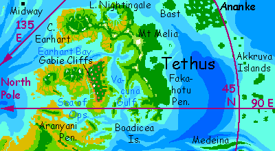
TETHUS AND MESKHENT
In northern Cape Aranyani you rejoin the daybirds for the last time--though it's late morning, and you meet only stragglers. Still, one is enough to show you the way. You leave Ishtar here and cross the Sea of Ops to the great terra of Meskhent. This hilly, sprawling triangle, larger than Borneo, shares the Californian pattern of the far north: oaks, olives and laurels, open fields, many seasonal streams (in flood at sunrise, ebbing or even drying up by sunset a week later), with pine and redwood in the central Tusholi Hills and along the rainier coasts.
The daybirds cross northern Meskhent, seeing only the northern plains, bypassing the spectacle of the Gabie Cliffs south of the Tusholi Hills--a thousand-km escarpment crossing the land from sea to sea, like some mad Hadrian's Wall.
But the daybirds just skirt the Meskhent shore, roosting briefly on small isles in the middle of Earhart Bay, then head east to the last great terra in the north, Tethus. The Mediterranean hills of Earhart Corona, in the far north, are all that the daybirds see.
Yet to the southwest, Tethus stretches fully 2000 km, steadily getting warmer and greener; the Nightingale Hills and twin-lobed Melia Bay could almost be France. In the far south, Cape Fakahotu and the Boadiceas offshore have subtropical rainforest, and even taller forests grow on the Ananke Islands 800 km southeast, an archipelago the size of Japan that a gorilla could swing across 100 meters up, never seeing the ground. Not to mention even larger Tellus and Bell, to the southwest, with the tallest trees and richest, craziest ecologies in the solar system...
But the monomaniac daybirds don't care. From the northeast shore of the Earhart Hills, the birds, obsessed with light, set out across open sea to the floating town of Midway--and then on to the Surupa Isles, completing their polar circuit, outracing the sun. And on. And on! Until they grow tired--or grow up.
Until they accept complexity, and night.
World Dream Bank homepage - Art gallery - New stuff - Introductory sampler, best dreams, best art - On dreamwork - Books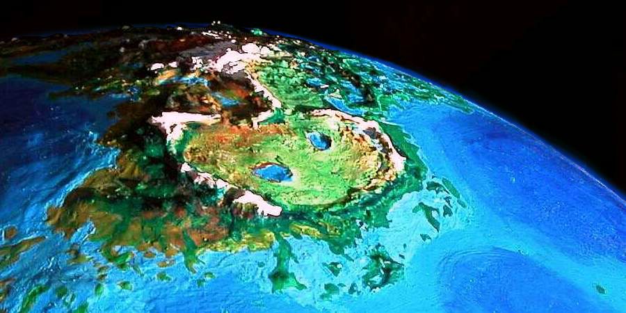


LISTS AND LINKS: two related world-models: Futures - more worlds: Planetocopia - dreams of other worlds - orbital dreams - global warming and climatology - terraforming - anarchy - utopias - genetic uplift - animal people - time: futurology, the deep past, time travel - more strange essays - volcanoes - water and seas - physics and natural law - air! - a Venerian prehistory for Earth?: What the Pteros Tell
Indexes: Subject - Author - Date - Names - Places - Art media/styles
Titles: A - B - C - D - E - F - G - H - IJ - KL - M - NO - PQ - R - Sa-Sk - Sl-Sz - T - UV - WXYZ
Email: wdreamb@yahoo.com - Catalog of art, books, CDs - Behind the Curtain: FAQs, bio, site map - Kindred sites