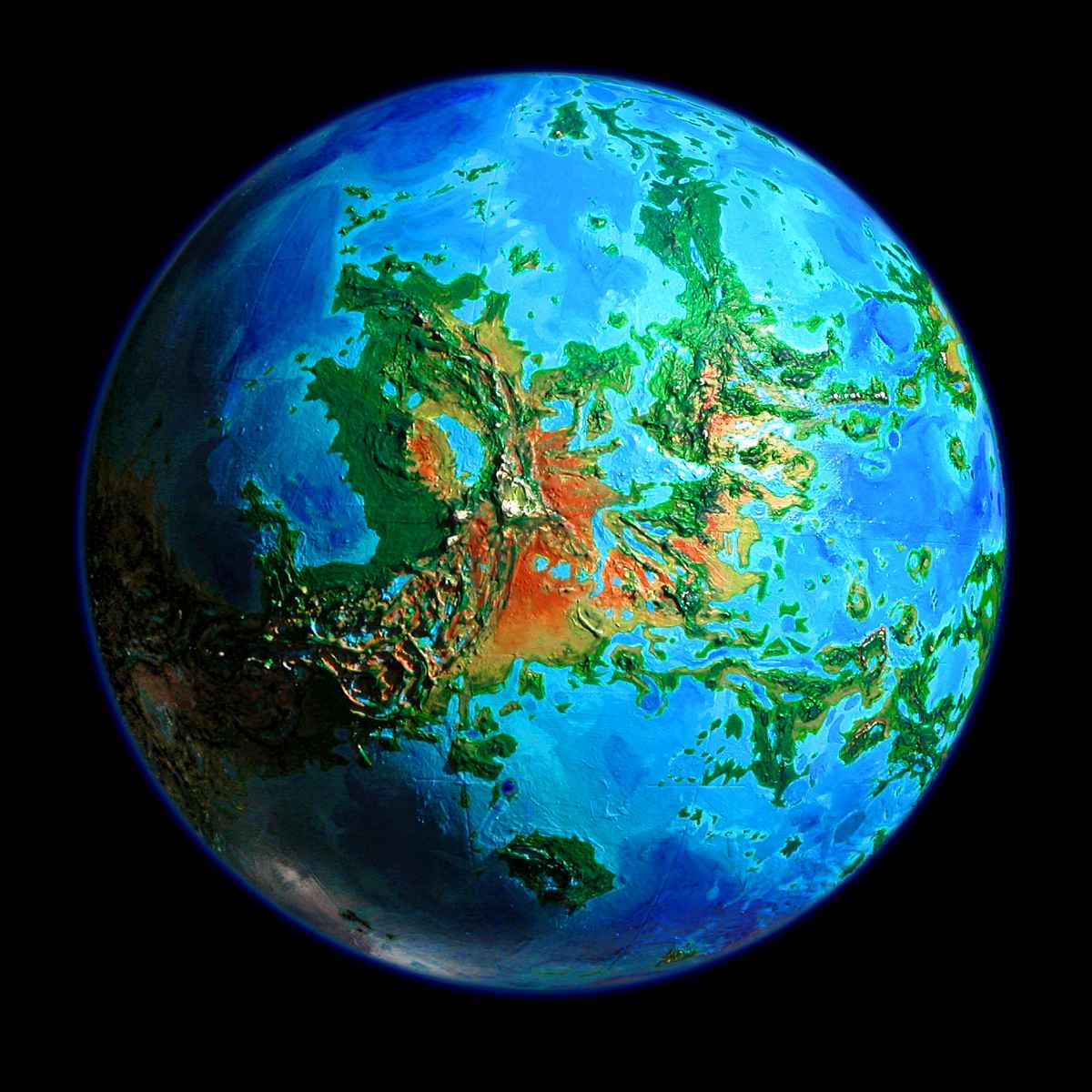
Venus Unveiled: Dione and Navka
OVERVIEW
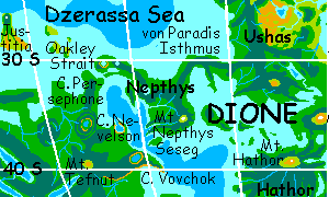
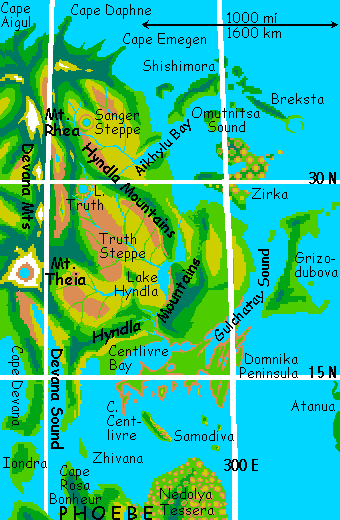
DIONE is a small but fertile continent--really five large volcanic islands linked by land-bridges, curving around the central Dione Gulf. Clockwise, they are:
NORTHERN DIONE
You start on the tip of Cape Persephone in Themis. Persephone is subtropical forest, but not swampy jungle like the mainland further south. From here, it's less than an hour over narrow Oakley Strait to the west coast of Dione: the subcontinent of Nepthys.
Nepthys is 1200 km long, a twisting dragon-shape with a long western neck--Cape Oakley. The dragon's eye is Lake Oakley, an impact crater that's now flooded--a round lake reflecting steep walls where trees still struggle to root--the blast left the rocks glassy and nutrient-poor.
You spend all day riding the wind down Nepthys's hilly spine, past Dragonmouth Bay, a brackish lagoon 100 km long, then down the neck to the dragon's hilly shoulders. The land's warm and wooded, but not as hot, rainy or rugged as the mainland behind you--or what's to come.
Veering southeast, you cross Heart Lake, with Heart Mountain (highest in northern Nepthys) on your right, and skip the lowlands of his belly to the southwest, which end in a clawed chasma-foot guarding an egg offshore--Seseg. Both island and cape are named for a drowned crater in the Dione Gulf.
It's a full second day of flight down the dragon's back before you reach Mt Nepthys at the southeast end (we won't specify which part of the dragon it represents, but given what volcanoes do, it's appropriate). Mt Nepthys is big enough to create its own climate--cloud forests, fern-fells and windy meadows near the summit, and a tiny desert inside the crater.
From Mt Nepthys, you head north and east, along Von Paradis Isthmus, a long green tail narrow enough to see the coral reefs on both sides from your flyway over the hilly spine. To the right, huge nameless islands slowly pass--so large you keep mistaking them for the mainland you're seeking. Forested hills, warm seas--a third full day passes before the sea drops back and a vast land opens before you--Ushas.
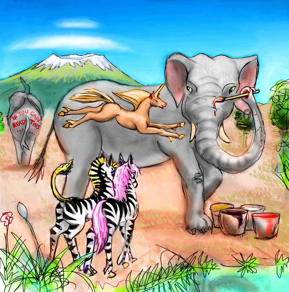
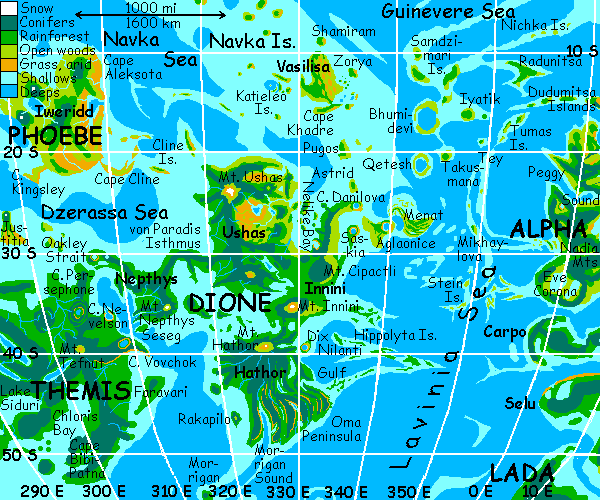
Ushas is a mountainous terra 1200 km wide--over a third of the land area in Dione, in a huge rectangular chunk. It's fertile, warm, mostly open woods. Megaravens and parrots share the canopy, with villages every few km. It's mild enough for elephant matriarchies to live here too, a slender, smallish species more Indian than African.
A dexterous, highly visual breed, they're famous for body-murals. You check out the Ushas Art Institute, where you hear one's in progress. Only the main figure's roughed in: an image of a licorne on the painter's own side. It looks innocently decorative to you, but judging by the zebra gossip you overhear, it's anything but--a political gesture mocking zebra pretensions, with touches of self-mockery too--contrasting equine grace to the artist's (and canvas's) shambling mass.
You ride the winds north along the coast range until a gleam of white far inland beckons: the snows of Mt Ushas. Volcanic Ushas is one of the highest peaks in Dione, indeed, in the southern hemisphere. It generates its own miniclimates all round the mountain--cloud forests, hanging prairies, pocket deserts.
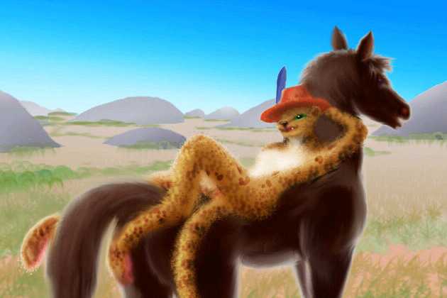
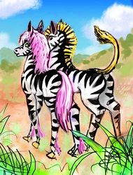
Taking your time, you glide slowly south down the heartland, Ushas Valley, a wide quilt of woods and savanna, dappled with lakes. It looks quite African--antelope ranches run by lions, elephant storytelling troupes, communes of prezebras (intelligent hybrids of zebras and Przewalski's horse). But the prezebras here aren't like the Martian and Terran herds you're used to--these sport flowing horselike manes.
Oops, not all flowing--magenta spikes? Polka dot hides, checkered bottoms, sloganed flanks... you feel trapped in a cartoon. Punk rebellion never dies, it just jumps species.
As you ride thermals slowly south, the land grows greener and the woods close in. Elephants, humans, cockatoo villages. A high shield volcano looms on your right, the second biggest on Ushas. (I've looked and looked, but big though it is, it lacks even an unofficial name.) Let's nickname it Mt. Dione, as it looks over the Dione Gulf. And the wide silver sheet at its foot, to the east--Lake Dione? (Again, nothing...) How does Mt. Neglect sound? Mt. Underfunded? Hmm... I know! Mt. Victim of Mars-Obsession! A certain ring to it...
You hunt for updrafts and start zigzagging your way up the long slope to the summit, and at last, you look out on the sea.
If you were following the land-bridges, here you'd turn east for a few hours to Mt. Cipactli, then south, then west again to the rest of Dione. But you have wings--why not use them? From the summit of Mt. Nameless-Because-Venus-Is-Neglected, there's a faint white cloud on the blue horizon, a cloud that never moves. Snow? You dive down the sea-slope, over the coastal cliffs, out over the Gulf of Dione. From near sea level, the white beacon sinks below the horizon for the first hour, then creeps up, bigger and clearer. The water's blue lightens to turquoise again and a green line appears ahead. You've reached Innini.
Innini is a modest island, just 600 km long and 250 wide (c.400 x 150 mi), built up by lava flows from Mt. Innini, the massive, snowy shield volcano you're flying toward. The open lowlands canopy here is Parrot Central, loud with their chatter, bright with their jaunty villages.
But as you start up the great peak's slope, it grows cooler and rainier, the trees taller and denser, the inhabitants darker, their voices deeper: megaravens, black blue white and purple (borrowed genes from their jay and magpie kin. Why? Quoth the Raven, "Why not?") They're huge birds, with 4-meter wingspans (13').
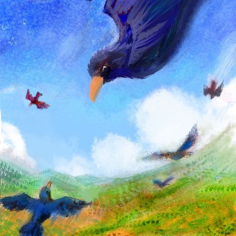
They laugh at your clumsy flying and parody your earnest, steady chugging. Then they show you how it's really done. Black rockets loop and roll around you. Couples hold handfeet and twirl in aerial vol-a-deux...
They follow you up to the snowline and lead you to a steep slope with smooth, worn chutes. Landing, they take turns tobogganing down the slope and flying back up--fat black bullets squawking, laughing, going too fast and crashing out.
A thousand years, a thousand model changes, yet raven souls haven't changed a bit.
The snows of Innini are no match for Kilimanjaro--a few square miles at most. From the summit, a wheel of colors around the white hub--the blue-black of conifers to the west, golden aspens on the drier south and northeast face, lurid greens northwest (facing the sea, and getting the most rain), pale dry grass east and south, and the red rocks of a tiny alpine desert on the southeast slope. All round the rim, softened by the thick air of Venus, is the bluewhite horizon. Except in two places: the indigo Dione Gulf below you, and a silver gleam to the south: Lake Innini.
Dive down the volcano, due south along the east shore of the great lake, the largest on Dione. It takes two hours to pass, for the lake is 170 km wide. That may sound respectable to Terran and Martian newcomers, but if you're a Venus native or you've taken other Venus tours, you were just startled that Lake Innini's so small--every other continent has lakes bigger than anything on Earth. Dione is lake-poor, for it was built mostly by volcanoes, not chasmas.
Now you catch your first glimpse of the east coast. A low green mesa stands offshore, seeming almost perfectly round, except for a long polliwog tail to the north. A lava flow? Then why's the mountain so neatly symmetrical? It's so odd-looking you spend the extra half-hour to flap across the channel and have a look. Is it a farrum, a Cytherean lava pancake? But they usually come in swarms--whole herds of pancakes.
You sail up the ridge and over... into a private little world. A crater-lake, many miles wide. The Isle of Dix! You circle the lake, riding the updrafts of the ridge-ring. The outer rim's quite circular everywhere but the north. Dix is an impact crater, a big one! Is the tail a pre-existing ridge or a splash of molten debris? It's so overgrown now, there's no way to tell.
Back to the mainland, and inland. The land rises. And rises. And rises...
You're on Hathor now--south Dione. A land bigger than Borneo, and all of it dense, nearly unbroken hardwood rainforest. The rest of Dione is fertile, wooded and mountainous, but Hathor is extraordinary--its biomass averages four to six times the Amazon's density, with trees up to 130 meters high (400'). Temperatures average 35-40 C (45-50 on some afternoons), with twelve meters of rain a year (that's over 100 degrees and forty feet of rain, for you metric-impaired). The heart of the Megazoic zone!
Slowly you fly west, from village to village high in the treetops, until the dark cone of Mt. Hathor appears far ahead. It's one of the tallest mountains in the southern hemisphere--yet here in the heart of the torrid zone, it's mantled in cloud forest nearly to the top. The crater and its lip are meadows above most of the rains, but trees don't conquer the summit more because of the winds than because of cold. Even 3 km up, Hathor's summit rarely even sees frost, let alone snow. While there's presently a small lake in the crater, it's hot, and the volcano is classed as dormant, not dead. Megaparrots have settled its heights, but they keep a wary eye on the seismograph, and don't get too attached to their orchards, despite the rich soil.
From the summit, the Gulf of Dione shines to the north; in every other direction, it's the same dappled landscape--white puffy clouds over verdant rainforest, lime-green in the light, dark green under the cloud-shadows.
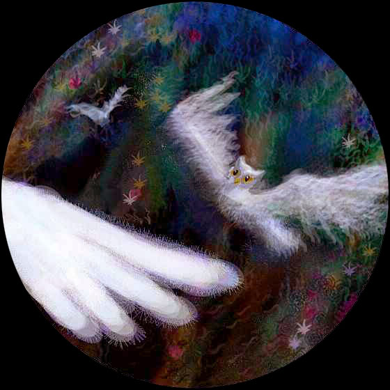
Beyond Mt. Hathor, in the climax forest, no single species of people dominate; the locals are of many arboreal and avian species, having in common only a tolerance for heat and rain. Skinny, graceful, long-tailed lemurs seem to be the dominant primate, instead of the gorillas, chimps and bonobos of Themis. Megaparrots and cockatoos of course, and many sentient trees. Who else? Of particular interest are the white owls, a newly sentient species. No one expected that raptors could ever catch up to clever, vocal psittacines and corvids, but they were wrong. (Farley Mowat's OWLS IN THE FAMILY is a deceptively low-key look at owls' social smarts (playing tricks on dogs, for example) and adaptability (preferring cooked food to raw mice)). Owls' nocturnality makes them especially fit for the torrid-zone nightlife. No longer needing to hunt wild prey, they've reverted to white year-round--it's cooler. With their extremely sensitive hearing, owls are quickly making a reputation as musicians, though cetaceans still dominate the charts. But for any tourist who likes dance, the owl ballet is a must-see. Ghostly ringlit aerial ballets full of drama as the ballerinas dodge trees uncannily, more by ear than by sight.
An interesting consequence of the owl ballet is an increased refinement among the younger generation, to the point where some owl ballerinas have turned vegetarian, living on high-protein seeds and nuts like parrots--the only herbivorous raptors in the solar system! Some of their conspecifics see this as a neurosis or illness, something like human anorexia. Dancers and food--it seems to transcend species! But these vegan owl dancers do seem to be thriving on nuts (and, admittedly, vitamins--dancers everywhere seem to be pill-poppers). Is a new species in the making?
What else is new in Hathor? Well, the deeper lakes and rivers have fructivorous river dolphins (they borrowed a few enzymes from Amazonian fructivorous fish, who harvest windfalls in Brazilian rivers--there, the feeding frenzy usually ends in the dolphins feeding on the feeders. Here, the dolphins go direct for the sweet stuff.) These dolphins have the best sonar of any cetaceans (while whales could sometimes be fooled by echoes into grounding themselves, river dolphins were navigating blind amid complex shallows and tangled roots). However, they're almost blind--their eyes were nearly useless in the muddy Amazon tributaries. Now, their descendants are hotly debating whether to regain full sight via gengineering. Would this destroy their preternaturally good hearing--and oral culture? On the other hand it'd make them better starship pilots...
Well, you get the idea. "There are a million stories in the naked jungle." Or at least a million species.
On Rain (and it does) you cross back to the mainland and east across Cape Morrigan. On the far side around the Sound, the rings peek through cloud-gaps, and color returns. The land turns lovely! Across your flyway, to the horizon, wind the Fossae of Oma--deep little rifts, sinuous as snakes, their red cliffs cloaked in green jungle, wreathed in warm white mists and laced with waterfalls arcing into the dark blue lakes along their floors.
Morrigan Sound is deeper still, a classic Cytherean chasma on a continent poor in them. Gorgeous country, bizarre ecology--but you have a long way to go still, all of it north--and after a week wandering Hathor in the relatively cool night, it's dawn.
Near sunrise you head northeast across Oma to the shore. And on, over the Lavinia Sea, two hours of nothing but pink clouds and pale water. You're outflying the sun, which hovers just below the horizon behind you, unable to rise! (I told you Venus turns slowly, but I bet you didn't realize how slow). At last, the cliffs of the South Hippolyta Islands rise from the sea, red and green and black, and you wheel around them and turn north, letting the sun rise at last. The Hippolytas are rough ridges overgrown with lush forest--this is still the torrid zone--but the sea-winds keep them cooler, more Polynesian than Megazoic. Here the mix of lemur and bird civilizations resembles Hathor, but with a strong cetacean contribution--the islands rise from fairly deep water, forcing nutrients to the surface, attracting fish; and dolphin and orca tribes followed. The isles have many sheltered coves where tourists can meet them. Several amphitheatres on South Hippolyta specialize in presenting cetacean drama and musicals to mixed-species audiences.
On Monday, you head north across the Central Hippolytas, then over a wider channel to the cliffs of another archipelago I have to call the North Hippolytas, for they're still officially nameless, though the group's far from the Hippolyta formation and nearly the size of Denmark. You're escaping the torrid zone, which is wise: it's full daylight now. Because it's light, you probably won't see too many of the other Hippolytan species famed for the arts, though plenty of their sculptures will no doubt be in evidence. But the octopus artists themselves are shy and nocturnal. Still, artists do keep odd hours. Maybe in the darkest corner of a porpoise bar...
Tuesday morning: a long sea-flight northwest to the mainland again, below Mt Cipactli. This shield volcano is as big as any in Dione, just not very high. I said shield, but really it's more of a giant pancake or flattened cylinder--quite steep at first, then a lava plateau (forested of course--this is Dione). Cipactli is like the pedestal for a real volcano that never showed up. Lost in the mail or something...
So you head north along the east shore of Cipactli, its slope looming up steep and impressive until the lop-off. Some hours of tedious flying (it's hot) and short swim-breaks, the shore jags west in a squarish point. But straight offshore is another tadpole tail. This time you suspect it's no lava flow, and fly out to it, and north along it. It rises to a second round ridge hiding a lake: Saskia Crater. This one's parklike, looking planted: forest around the lakeshore, meadows above. Wow! Non-forest! Now you know you've left the torrid zone.
From Saskia, you could hop north to Cape Danilova, the end of the Cipactli Peninsula and the northeast tip of Dione. On its very end is Danilova, a third great craterlake. From the cape, it's an easy flight to the small islands of Astrid and Pugos (well, not that small--the size and climate of Hawaii), and straight on to Cape Khadre on Vasilisa, first of the Navkas.
But I want to lead you by a slightly longer route east...
THE HEMISPHERIC FLYWAY
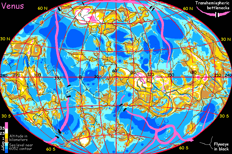
This island-hopping route from Dione to Alpha is the only non-polar flyway bridging the great gap between Eastern and Western Hemispheres. Either you fly 10,000 km north, or 5,000 south, or sail or ride a blimp... or you fly this airway. And it's no simple land-bridge.
So early Wednesday, you first head east from Saskia to Aglaonice, a triangular island 250 km wide, largely shaped by a fourth great impact crater: its east end is a ring of rock and debris 150 km across, with a wide central lagoon--shallow compared to Martian or Lunar craters (and a classic proof that old Venus's "solid" surface was as deceptive as a glacier--over eons, it crept up to fill the wound). Still, it's too deep for coral, which only hugs the shore. The trio, Aglaonice, Danilova and Saskia, make a nice orbital photo--look up Venus and one of the first NASA scans you'll see is a family portrait. These three, and Dix too, are probably all scars of a single catastrophe--a comet-chain like Shoemaker-Levy. Well, clump not chain.
Despite its violent origin, Aglaonice today looks quite Polynesian--warm, wooded, coral reefs, lagoon. It's a surprisingly busy place, full of fliers. Virtually all are travelers, not locals or sightseers like you--for most, Aglaonice's just a nice stopover on the flyway from Dione to Alpha. Or the other way. Passin' through, they barely see it.
Don't be like that. Go lie on the beach. Swim. The daylight will last... another three or four days!
Next out is Menat, a goose-shaped island, the last gasp of the rise that creates Dione and Themis. At first it seems a narrow little island north of Lake Aglaonice, but once across the strait, you follow a long gooseneck that curves slowly east for hours, splitting off odd winding ridges. The wedge of forest slowly widens till the sea's lost in the haze. Menat's a good 400 km long and 150 wide, all gentle forested ridges like the ripples in a sandy shallow--only they wind as randomly as drunk snakes. They're called undae (as in "undulations").
Next it's north an hour or two through the Goslings, a winding water-maze of half-drowned undae offshore. They dwindle to reefs and sink away. Deep sea. Two hours later, you reach what looks for all the world like a coral atoll, though Venus hasn't had time to build any such thing, of course. Qetesh Corona is a classic "blue hole": an oval pit 150 km across ringed by islands and reefs--like a Terran atoll but far too big. The islets around the lagoon are low and narrow but up to 100 km long--wooded, with long beaches and coral reefs on both shores, inner and outer.
From Qetesh, fliers to Alpha and the Eastern Hemisphere proceed to Takusmana, the top of a hilly corona, then to steep little Tey, a lone volcano rising from the sea, named for writer Josephine Tey. Next they hop to the Tumas Islands. Though small, these are pleasant subtropical islets, a welcome stop for travelers--Tey is a bit stark, and fresh water is scarce. The larger Dudumitsa Islands come next, then Cape Dudumitsa itself, and at last the northern coast of Alpha. It's a long crossing, tedious at times--wayfarers are mostly too tired to socialize much during the stopovers. Still, you could go that way--Alpha's fascinating. But that's another tour!
So on Thursday, you veer off for Navka. The flyway from Qetesh leads due north, to a second "atoll"--Bhumidevi Corona, deeper, steeper, and wider than Qetesh, a blue hole some 200 km across. And its rim has no mere islets and reefs, but real islands 20 km wide and 150 km long, with steep wooded ridges, streams and waterfalls.
Bhumidevi has some of the best diving on Venus, for its inner lagoon has vertical coral gardens going 200 meters down--in the bright sun of Venus, coral grows twice as deep as on Earth. And hot colors stay bright twice as far down, so the displays in the shallows surpass anything Terran. Use caution diving, though. The higher air pressure on Venus means nitrogen narcosis ("Rapture of the Deep") can start just 5-10 meters down, not 30 meters down as on Old Earth. Casual snorkelers are unlikely to get in trouble, but... don't go deep.
From Bhumidevi, fliers bound for Eistla and even distant Ishtar veer east to Iyatik, a low, broad island an hour or two away. Then it's a long flight northeast to huge, rugged Radunitsa (well south of the now-drowned Labyrinth that gave it its name), then the Nichka Chain, and on via Heng-O Chasma and the Changkos to the coast of Eistla. If Alpha's a long hop, Eistla's a marathon. But that's another tour!
Navka is much nearer: on Friday, you hop north from Bhumidevi through the four large Samdzimari Islands. These are rugged isles with wooded ridges full of little waterfalls and chains of pools, above windy sea-cliffs, much like Radunitsa to the east. You sleep on the last of the Samdzimaris, in the far northwest.
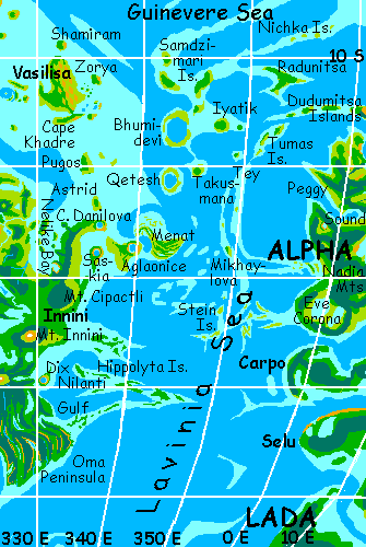
NAVKA: VASILISA
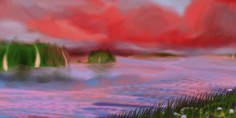
On Setterday you fly three hours over deep water to the Navka Archipelago, with the sun at your toes and your shadow before you. By flying west, you double the speed of the sunset, of course; you're flying nearly as fast as lazy Venus turns. It's low and red by the time you see land ahead.
First landfall is Zorya, a volcano waist-deep in the sea, lit luridly by the dying sun in the east. But Zorya's not alone: behind it flock dozens of small cones, randomly studding the shallow sea, like Sufi dancers in wide skirts spinning on a turquoise floor. Or like a mob of toddlers. No sensible, disciplined island arcs here! In fact the Chernava Islands spill right up onto the tawny coast of Vasilisa, as conical hills. Why not? Earth coasts are shaped by their seas, but the Cytherean sea's a newcomer. Before it flooded an arbitrary half of the Chernavas, they were called Chernava Colles: Chernava Hills. "As old as the hills" is as valid on Venus as Earth, but there are people living on Venus older than the sea. Some of them built it.
Vasilisa is as big as England--800 km long and 400 wide--and several other Navkas rival it. It's fairly dry for Venus (making it popular with Terrans and Martians who find the torrid-zone rains of Dione oppressive). Its inland saddle and much of the east coast are grassy, while the forests of the west and north are open and sunny. Its highest peaks sustain cloud forest, though. Their eastern faces (like the Chernava coast where you landed) have microdeserts with red canyons rivaling the Waimea Gorge on Kauai--flaming now in the sunset as you pass. The red land looks Australian.
Much of Vasilisa is tessera--rhythmic terrain. Here, the repeated form is a huge rock fin, as if great sharks or dolphins swam just under the veldt. While tessera elsewhere are often overgrown, here they're mostly as bare as Uluru, and all the fins point north. The effect of hundreds of these fins bursting from the veldt, neatly spaced, is like Australia's termite-mound country--if termites were dino-sized! Ponds and what woods there are always huddle under the west side of the fins, (the shady side during hot afternoons) while the east side is veldt.
Vasilisa's a center for both lion and leopard culture; both species ranch the extensive grasslands, the lions mostly running cattle, the leopards, smaller antelope and (increasingly) roos. These are friendly, sensual, earthy people, well worth visiting, though their dinner parties are not for the squeamish.
The flyway now leads west to the Katieleo group, the size of Crete (but greener). They curl round a blue hole that's not round but closer to spiral--on its east side, a trench cuts through the isles, curving like the arm of a spiral galaxy. (I could be wrong. Katieleo may be a bull's eye, not a spiral--a central peak with a double ring of islets... and the Big Island hovering above like a mama hen.)
Now you head north through the Gulaim Islands, broad low mountains scattered over the sea like the Cyclades in Greece.
On Eve, you reach the low Yanbike group, near the equator. These small islands (none over 100 km long) clustering around a shallow blue hole, are our turning-point toward the much bigger lands of Central and Northern Navka. Small chains like the Tingois and Gudruns continue well north of the equator, but they dead-end in the Guinevere Sea, so it's time to head west to the main Navka line. It's a long flight, fortunately broken in the middle by a nameless, grassy island 120 km long. You sleep there, and when you wake on early Ring, you fly on, to Var.
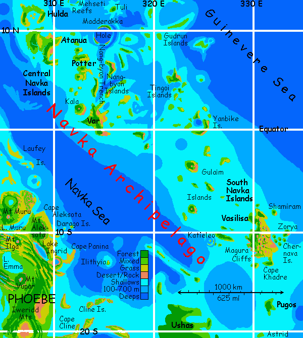
CENTRAL NAVKA
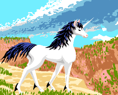
Var's an irregular land 300 km across, all stumpy arms and not much body, like some octopus amputee. It's right on the equator, under the rings, so the climate is mild. The cool equatorial air creates a dry, high-pressure zone, so Var's a bit dry--only the highlands and riverbanks are wooded. It's herbivore heaven, and that's what certain idealistic equines are aiming for here. Not just a social experiment, a genetic one: the first test-herds of licornes, pseudo-unicorns with a non-zebra gene base--a lean, scaled-down racehorse chassis, with some antelope springs and suspension. They're less feisty than prezebras (half zebra, half Przewalski's horse), the dominant equine population on Venus, who do have tempers and indulge in constant, well, horseplay. Most prezebras make fun of the whole venture and call the licornes (and naming themselves in French sums up what either charms you or puts you off) wusses. True, licornes are quieter, even shy (at least around zebras). Domestic horse and antelope genes will do that. But even zebras can't deny they're fast, gorgeous, clever, and sweet-tempered--that last, a side effect of giraffe genes. Giraffes had no natural enemies (except of course humans--vicious pack creatures who'll attack anyone). Giraffes are just too big for predators to consider messing with, so... everyone's a friend! Ooh, look, nice kitty with big teeth and a mane! Like that.
Why giraffe genes, you ask? They have prehensile tongues, almost as dexterous as elephant trunks or human hands! Sound clumsy and slobbery? Well, for finer motor tasks, who needs fingers when you've each got a family of symbiotic hand-birds? "If you want something, just whistle."
Life on the hoof could be worse.
On Yule, in the dusky red light, you fly north along the islands lining Nang-Byon Trench, to Madderakka Hole. Modest islands and reefs, but in the middle, a huge blue hole with coral gardens down the cliff faces. No need to carry in masks and fins--they have them! The place is organized. The biggest underwater aquatic concert stadium in the worlds! Eerie delayed echoes from the circling walls create a ghost chorus. And the Guinevere whalesingers are the best on Venus. That's not just my opinion or local boosterism, it's a geographic inevitability. The Guinevere Sea is the crossroads where all Venus's seas meet--and all the cultural strains blend. Guineverans hear everyone. Jared Diamond's theory that geography and ecology constrain cultural development (it's too far-reaching to summarize here--read his Pulitzer-winning "Guns, Germs and Steel", or see Jaredia) applies to marine civilizations as well as to continental ones. Crossroads always have a cultural advantage.
But Madderakka hosts something rougher, too, a controversial show that surface-dwellers can see only one night a month, the darkest night. Squid wrestling! Spermwhales against giant squid--or squid against squid. It's primal, frightening--and for some, shameful reminder of a cannibal past (in the current broader meaning of cannibalism: treating people of any species as mere food). But... some whales, some squid like to fight. I don't mind that, it's their choice. It's when they bite...
On Rain, you head west, to a long, low, grassy island named Potter--no, no, not Harry! This is Venus. Famous women, not wizards. Beatrix! Come to think of it, this island's ecologically ideal for Beatrix Potter (and "Harvey") fans to realize their lapine dreams--isolated, mild climate, grassy hills, relatively dry soil good for digging... So Potter is the first, experimental home of meter-long, chip-boosted, stubby-handed, long-tailed rabbits. Their burrows are reminiscent of Watership Down--though they're communes, not the old alpha-male hierarchies. Visitors are welcome, but claustrophobes may have difficulties--even megarab tunnels are a tight fit for humans and large avians. But rab murals are worth the squeeze--as joyful as Minoan art! Just don't wear your nice clothes. In fact, don't wear clothes. You'll be teased for your baldness, but you never know--maybe you'll get complimented. Megarabs are flirtatious. Be careful or you'll end up at the bottom of the furpile in a bunny orgy. (The warning to claustrophobes applies double here.)
Only an hour northwest, Atanua is quite different. Big, for one thing--a solid chunk of fertile land 350 km across--big enough you can forget the sea for the first time since Var. The population's mostly human, feline ranchers, and equines--the grassy hills are ideal for grazers, sentient or not. Racial tensions between felines and equines still run high, though the situation's improved in recent years, as a generation raised in this multispecies environment has come of age. Visitors are advised that certain food jokes may be inappropriate, and greeting equines with "Heyyyyy, lunch!" (even if locals do it affectionately) may get you kicked. Also, double-check flight directions from lions and prezebras. Both species are too heavy to fly, and some consider winged tourists fair game for teasing. Ask a bird instead.
On Dawn, you hop north to the Hulda Islands, a narrow (50 km wide, 250 long) crescent sheltering a lagoon with islets and reefs. Hulda looks modest next to Atanua, but it's the submerged tip of a corona quite a bit larger than Atanua. These wide coral reefs are renowned. You should spend the day diving here...
...and resting up. For on Sunday you face a long sea-passage from the Central Navkas to the North Group, and the end of your journey. It's over 500 km, with just one islet to rest on midway. You could push it, but safety first! So you take all day to reach the southern tip of huge Grizodubova... and sleep.
NORTHERN NAVKA
On Monday, you explore Grizodubova. "Griza" is really two triangular islands linked by a narrow ridge 150 km long, popular with gliders and avian athletes, as the ridge lies across the prevailing winds, generating a steady updraft one can ride all day, like a surfer shooting a tube hours long. You practice aerobatics as you head north, over gentle slopes. Griza's wooded along the ridges and along streams, otherwise oak savanna and sunny beaches, with a mild, dryish climate (Griza's slightly rainshadowed by the dry prairies upwind, on the mainland). You dodge ravens all day, as they laugh, shriek, roll, loop, and grab each other in aerial duets, spiraling around clumsy old you. Tired, you sleep on a beach near the north end. At least you can sleep as long as you like--that's one thing about Venus's strange cycle. The morning will always be there when you wake.
Tuesday. It's three hours to the next island, bizarre Zirka.
Zorry. I mean sorry. It's just infectious--Zirka is even shaped like a Z. The terrain is mostly tessera. The word just means "tile", as in repeated element--it doesn't specify what. On Zirka, they're big mesas cut by canyons in two directions, forming a grid like the Waffle Iron Of The Gods. It's beautiful but odd-looking to a Terran: red-cliffed mesas capped in forest--not thin olive desert scrub, but lush forest, green as a punk hairdo--looming above shady, zigzagging, fern-forest canyons. All day you wiggle up the Z, dodging between mesas, cooling off in the creeks. You sleep on a northeastern beach.
Only a few hours until noon. It's getting hot--you're far enough from the equator now to be less shielded by the rings. Today you fly straight out into the Guinevere Sea--an easy flight this time, hopping from islet to islet, resting and swimming to cool off. You sleep on the last islet, resting up before you cross to Breksta, looming on the horizon.
Early on Thursday you reach the Breksta Islands, a rugged ridge intermittently breaching the sea. Breksta itself, the southernmost, ends the chain by forking into twin arcuate capes around a deep blue hole in the sea, like fingers around a plum. Like many blue holes it looks like an old impact crater--or another coral atoll. Really, that's why you came: to take a break from flying, and dive down the lovely vertical reef-gardens of Breksta Hole near noon, when the colors are bright even 20 meters down.
The Brekstas run parallel to most storms, so they have no dry side, unlike most of the Navkas. Early Friday, you make your way up Breksta, the sea on both sides of you, a green dragon's spine under you. By midday, the hills sink waist-deep in the sea, and channels appear between them. Time to sleep! A busy day, both over and under the surface.
On Setterday, with the sun crawling lazily down the eastern sky, the clouds turning gold, orange, and slow, slow red, you cross to Shishimora, our very last isle. Shish is a second long, rugged land too--only 100 km wide but 450 km long. Shishimora's climate is Hawaiian, with a wet and dry side. By now you're a veteran flier--a few hours' steady work over lurid firelit hills, and Shishimora's western tip's beneath you.
Flying away from the sun, you hasten its setting--though you only flew six hours today, the sun sinks behind you into the sea. The highest clouds still flame red and purple above you as you land on the beach at Aikhylu Bay, on Beta. You sleep 14 hours--it's full Dusk when you wake. You were tired! And why not? You flew 750 km--nearly 500 miles.
Of course, next to the 10,000 miles you've flown in the last weeks, that's just a raindrop in the Guinevere Sea.
FACT VS FICTION

World Dream Bank homepage - Art gallery - New stuff - Introductory sampler, best dreams, best art - On dreamwork - Books
Indexes: Subject - Author - Date - Names - Places - Art media/styles
Titles: A - B - C - D - E - F - G - H - IJ - KL - M - NO - PQ - R - Sa-Sk - Sl-Sz - T - UV - WXYZ
Email: wdreamb@yahoo.com - Catalog of art, books, CDs - Behind the Curtain: FAQs, bio, site map - Kindred sites