Venus Unveiled: Alpha Archipelago
INTRODUCTION
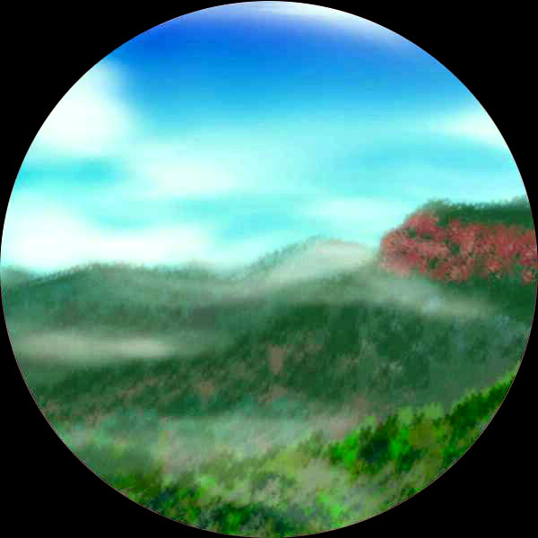
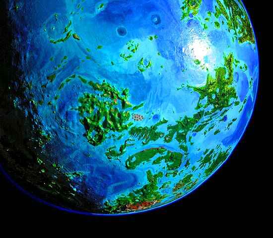
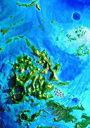
The Alpha Region is an archipelago a bit like Indonesia times three. Its islands stretch far east of Alpha itself--one island, Umay-Ene, is larger than Alpha. Just to the south is the even larger archipelago of Lada; together the two form an X-shaped landmass nearly as big as Ishtar or South America, but broken up by shallow channels. Alpha is highly fertile, with a band of Megazoic rainforest across its center, lesser forests north and south, and savanna at the edges. Not a single desert.
UMAY-ENE
Let's begin on Cape Rae, near the western tip of Aphrodite--the jumping-off point to the Alpha Region. From here, it's only an hour to Bathsheba Island. We glide down its pleasant shores, resting in glades and swimming, taking our time, and then sleep at Bathsheba's south tip. We need to rest up: it's an unbroken flight from here across the Tahmina Sea to Umay-Ene.
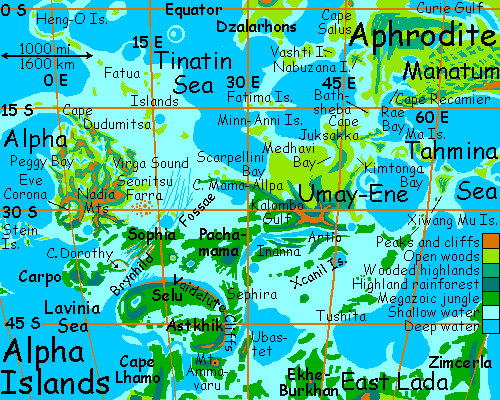
Umay-ene is the largest land in the Alpha region, bigger than Alpha itself, though lacking Alpha's dramatic, crazy maze of ridges and peaks. Umay-Ene has wide fertile plains in the north, with open woods and meadows, and low, thickly forested hills in the south. Its coastline is jagged, a steady sequence of capes and bays a few hundred km deep and wide all the way round. Medhavi Lagoon, Cape Michelle and the Minn-Anni Islands, Scarpellini Bay, long Cape Mama-Allpa, the Kalombo Gulf... So scalloped! It's almost like a ragged, vastly scaled-up version of that unique Cytheran landform, the "tick". One only hopes it's more stable than classic arachnoids!
We make landfall at Cape Juksakka and head south along the hilly spine of the island. We'll skip the west coast--it's a couple of million square kilometers of warm, wooded plains, fertile but not too scenic. All this land below us is hard to describe, because it's a type we've forgotten. Statistically, most of you reading this live in landscapes that once were like Umay-Ene--prime lands with reasonable rains and temperatures. That's why people concentrated there! But they changed those landscapes--cutting down forests, farming, herding. Nearly every such fertile place on Earth was quickly settled and altered, while deserts and rainforests stayed sparsely settled and their peoples alter the land with caution.
Now here on Umay-Ene are millions of square kilometers of warm land with moderate rains--and all our instincts say "farmland" and expect a patchwork of woods and cleared fields, not endless forest. If the woods are unbroken, our instincts say, there must be a reason--harsh winters, flooding, droughts, plague. Venus is alien--some danger lurks! Readers from an older, crowded, suspicious world, we look for the catch--when it's in our own hearts. Venus fools us through her sheer innocence.
Oh, well, even if we can't fully appreciate the sheer benevolence of the land beneath us, at least the sea breezes are nice. The Ma Islands to the east are very tempting--coconut trees on endless beaches, mango forests inland... But it's a long detour, and our way lies south.
So we fly on, over endless wooded hills and bays--hookshaped Medhavi Lagoon is on our right for a good four hours, 200 km or more. On our left is the convoluted shore of Kimtonga Sound, the edge of an offshore corona. Ahead, the hills heap into mountains--Umay-Ene Corona itself--a knot of cloudy uplands hundreds of km wide.
We veer southeast to Cape Umay and over the strait to Pasom-mana, a rectangular island 270 km long. Low ridges run in two directions here, intersecting in a regular grid of knobs, and each diamond-shaped hollow between ridges holds a pond. It looks like a dream-landscape--appropriate, since Pasom-Mana is the Hopi goddess of madness and dreams. It's a fine example of an "innie" tessera landscape, less spectacular than the "outie" tessera with their polygonal mesas, cliffs and canyons, but the expression of similar forces. But what, exactly? No one's quite sure. Bi-directional squeezing?
Further offshore are the Xiwang Mu Islands, a long diagonal island chain in the Tahmina Sea. Xiwang Mu ("Western Queen Mother", a Sichuanese goddess; the X is pronounced SH) is the far east end of the Alpha Archipelago. Huge Umay-Ene makes them look like a line of mere rocks on the map, but the largest isle is over 300 km long, and half a dozen of them are bigger than Hawaii. They're as fertile as Hawaii too, if not as dramatic--just gentle, wooded hills. The northern Xiwangs are subtropical, with mixed vegetation; the southern isles are steamy, with quite Amazonian rainforest.
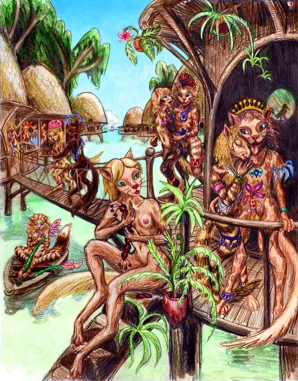
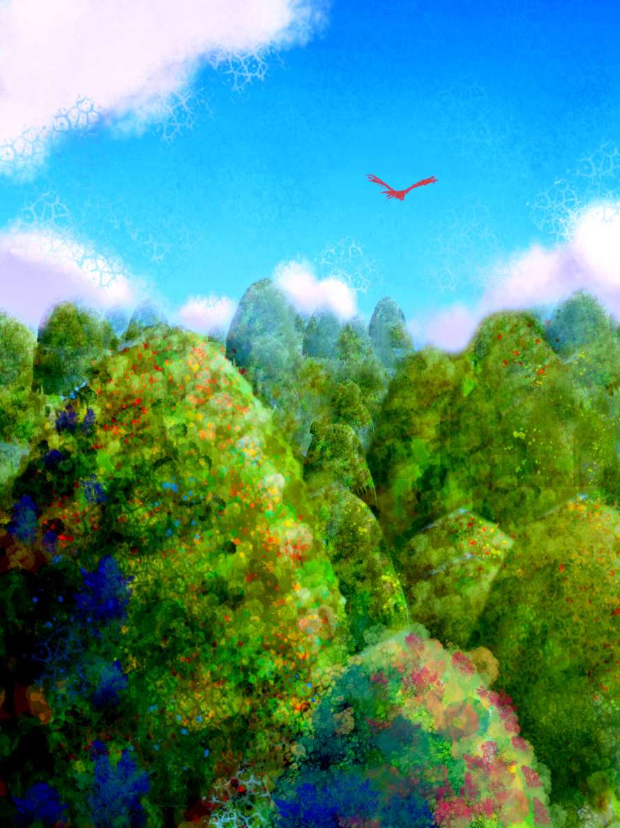
The biggest isle of all, Tushita, 700 km south of us, has Megazoic superforests, with trees up to 130 m tall (400') and twice the biomass of old-growth redwoods, in some sheltered western valleys--house-trees, even canopy villages, with a high percentage of avian people of parrot and cockatoo descent, who don't mind the heat. Tushita, like Pasom-mana, is tesserated, though the jungle softens the peculiar landforms like a plush carpet. On Tushita, the trees are taller than the hills.
All the Xiwangs are ringed in narrow coral reefs--the sea is warm but unusually deep for Venus, with a nearly Earthlike dropoff. Their abrupt rise forces nutrients to the surface, so the sea's rich--intelligent octopi inhabit the reefs and cetaceans and giant squid come in from the deeps to hunt at night.
In fact, we'll fly over such a hole, next. Between Pasom-Mana and the mainland is Zemlika Corona, a huge round cerulean well in the otherwise turquoise sea. We're strangely uneasy during the hour's flight across. Though it's no riskier than any other sea-flight (you drown just as dead in shallow water) the place feels solemn and a bit ominous. A holy place---or unholy--a mouth to the underworld? Whatever the reason, no one jokes over a blue hole.
"Except", as a wingwolf cracks when we reach the far side, "dolphins." True, but dolphins never stop--and she waited to say it until we were across, didn't she?
We glide west, along the south shore of Cape Pasom-Mana. Blue water still--Artio Sound, a long trench. Flanking it, on the southern horizon, is slender Artio Island. Beyond it, invisible still, is Xcanil Island--"Shka-neel" to its friends. Several times larger than Hawaii, and hotter--muffled in rainforest--it curves round gigantic Xcanil Hole--much deeper than Zemlika, and 200 km across.
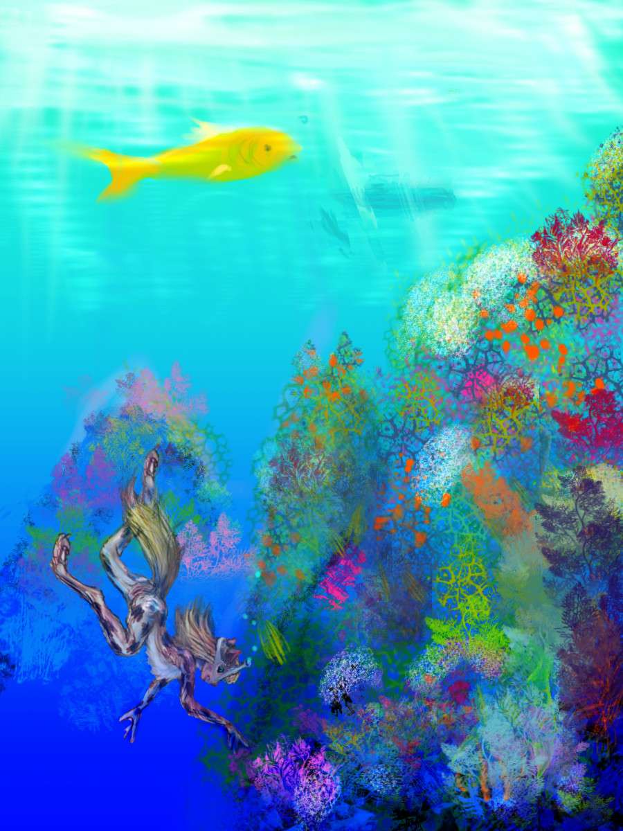
The island ends in cliffs that drop into the blue abyss--spectacular vertical coral gardens go down over 100 meters in the clear water. Venus's brilliant sun reaches deep.
You can visit such gardens here in Artio Sound, but be cautious. You can't dive 100 meters like the dolphins. Or even that wolf--she's local, she's adapted for it. For you, 10 is risky! Venus's atmosphere is so dense, Terrans are always close to mild nitrogen narcosis; effectively, sea level here is like 25-30 meters (c.90') on Earth. Another ten meters and... well, just snorkel near the surface. Five meters, max.
Let's stick to this coast and keep on soaring west-southwest in the updrafts. Below, on the mountain slopes, rainforest now. As we creep south, rain increases--the opposite of Earth, where the equator's the wettest. Here the rings cool the tropics; the hottest and wettest latitudes are 30-45°.
Artio Channel, that indigo streak, stretches on even after Artio Island's bent out to sea and disappeared. Another ridge takes its place offshore, and another--arms of Inanna Island, a great maze of over 1000 km of parallel ridges, randomly linked. They all look alike--for our sanity, we stick to the Umay-Ene shore. Beside, southern Innana, on the edge of the Torrid Zone, is all Megazoic rainforest down to the beach. We stick to the Artio coast, stopping now and then to swim and cool off--even up here, it's hot.
Late in the second day of steady flight west, a channel opens inland. To the right, Kalombo Gulf shimmers on the horizon--well, the east wing of it. Kalombo's a big blue butterfly between Umay-Ene and Pachamama, the next big island in the Alphas. The two wings, separated by Cape Kalombo, are turquoise coral bays, each about 300 km wide; the narrow capes sheltering them are warm, rainforested ridges, but not as hot as Inanna or Pachamama to the south.
That's really why we're not heading any farther south. It's high summer--mid-afternoon, that is--and for the next couple of days, the Megazoic zone will be too hot for serious exercise. That's a long siesta! So we cross into Pachamama but hug the north shore, where the trees are so big that they create an updraft nearly as effectively as coastal bluffs. Not that we could get far from the shore if we wanted to. Pachamama's a cat's cradle 1200 km long and 800 wide--a skein of submarine ridges that barely surface. Nowhere are you far from the sea, except the Ninhursag Hills in the far south--insufferably muggy, at present.
Fly, sleep, fly--small bays, capes, coves, beaches, all green and turquoise, with dark lava rocks offshore. Ironic--it's so hot, yet looks so cool. Now we're forced to go south--we've run out of island. Southwest to the tip of Cape Stuart, the end of Pachamama, 300 km long, a lowland plain covered in rainforest. By now, though, the sun's getting low--it's autumn, or as they'd say on Earth, late afternoon. The edge of the heat is gone. Ahead, at the tip of the cape, Stuart Crater rises dramatically from the green jungle-plain like a Mayan step-pyramid. Lake Stuart, inside the crater, has a central island where we sleep--birds in a fifty-mile nest. Cooled by the surrounding lake, we sleep well.
SELU
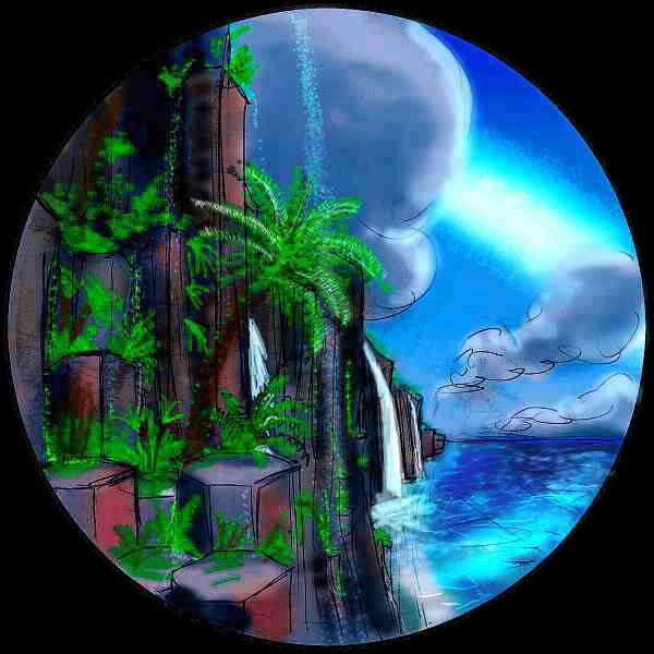
Southwest across the channel is Selu. A three-hour flight, and the channel is deep. But the effort's worth it. At last, a green line appears on the horizon--a flat, forested island? But it rears from the sea, taller, taller... the Vaidelute Cliffs, a line of red and black and chocolate rock rising hundreds of meters, and out of sight both east and west. Indeed, we could be in low orbit and still not see the end of it--the Vaidelute scarp runs a couple of thousand km! Ferns and trees cling to every crack, emerald-green in lurid contrast to the ruddy igneous rock. Waterfalls arch into the sea every kilometer or so, and in the low sun, rainbows gleam in the spray at their feet.
This island, Selu, is nearly the size of Sumatra--with an even hotter, rainier climate. We'll stick to the coast and its updrafts, darting inland now and then to visit bird-towns and primate villages 100 meters up in the treetops, where the life is--the light, growth, flowers, fruit, birds and animals that surface-bound, unimproved humans can't reach, can't even see. After sunset, in the cooler light of the equatorial rings, the forest really comes to life. We flap leisurely down the Selu coast, sampling its strange cultures, the arboreals and avians and tree-people who photosynthesize by day and move by night... The cliffs bend southward, and slowly lower to ordinary sea-bluffs... until Selu slips meekly under the sea. Across a narrow strait, the cliffs slowly rise again, on the next island, Astkhik.
Astkhik is the southernmost of the Alpha Islands--or the north edge of Lada, take your pick. It's a flattish chunk of Megazoic rainforest the size of Japan. Its main claim to fame is its name, usually distorted into Ass-Kick. Schiaparelli, namer of all those mellifluous Martian features, would certainly kick the Venus naming committee's collective ass for passing this one. But cheer up! Terraforming is slow: by the time people settle on Asskick, those who named it for an Armenian love goddess without ever saying her name out loud will all be safely dead and immune to mockery.
Still, despite its name, Astkhik is pretty--especially in full ringlight, when shadows disappear and colors glow as if seen through a polarizer. Below the cliffs, the Vaidelute Deeps flicker with comet-streaks where squid leave bioluminescent trails of their hunts and chases, like particles in a cloud chamber. On the eastern horizon, low hills glow an unearthly green--Sephira, another Megazoic jungle. It looks like an island, but after the next sleep, still gliding south, the deeps slowly become shallow, and a narrow landbridge leads across to Sephira... Peninsula.
We ride the updrafts till we drop. But when we wake and dreamily start south again, the Vaidelute Cliffs soon bend round to the west. We've reached the south shore of Astkhik at last--the edge of the Alpha Archipelago. Offshore, the volcanic cone of Mt. Ammavaru looms, dark even in the ringlight--it's so tall, its slopes reach into cooler air, and are cloaked in somber pines. Dark, that it, unless it's erupting! Ammavaru may still be active, a lurid red torch in the night. It certainly poured out a spectacular, fresh-looking lava flow that twisted through the Lada region, curling round islands but never giving up--a contorted black dragon 1200 km long. Though the Ubastet Flow is now drowned under the Aino Sea, the ridge that twisted the lava out of shape was also high enough to survive--Ubastet Island, that jagged silhouette all along the eastern horizon.
As long as we have to go north again, we might as well go a new way... So let's swing west for a few hours, and when the long channel between Astkhik and Ammavaru widens into a sea, we camp and rest up--though we don't really need to, for it's an easy hop of an hour or so over the channel (still that deep, luminous blue with luminous streaks, as if we're orbiting over some storm on Neptune) to Cape Sarpanitum on the Lhamo Peninsula.
We're cheating, now--outside our itinerary. Lhamo Peninsula is part of Lada, a mini-continent south of Alpha. But it's not really out of our way, and it's spectacular--great tessera (here, a grid of mesas and canyons) are covered in thick, misty jungle, with red cliffs sprouting emerald ferns and trees from every crack. Manatum Tessera in west Aphrodite shares this paradoxical mix of forest and dramatic desert mesas, but Lhamo is much hotter and wetter--so rainy that every mesa generates waterfalls, like the plateaus of Roraima on Earth, though lower.
Its only real rival is the nearby Isle of Cocomama, which isn't quite as lush (though Terran and Martian tourists may find the cooler, drier climates of Manatum and Cocomama more bearable). Still, by now it's early morning, just a day or two to sunrise--the coolest part of the cycle. We fly straight across, dropping down into canyons, wandering through the endless maze, flying under waterfalls, playing at being lost... We can't be, of course, not with the white arch of the rings looming to the north and a green predawn glow ahead of us in the west. Hard to get lost for long on Venus.
We sleep in a stilt-village of fish-catching lemurs, at the northern tip of Lhamo. Many hours of little catnaps, broken by the noise. The lemurs drum and dance and sing all night--and lemurian howls could deafen an opera singer.
Near Dawn, we cross back into Alpha near dawn, for the final leg of our tour--to Alpha itself. It's three to four hours, several hundred kilometers, across a deep channel to western Selu.
The low coast appears at sunrise--no cliffs here, not on the south side--all the big rivers run down to this swampy shore in wide oxbows overshadowed by giant trees--like New Guinea's lowlands, scaled up a notch or three. We push on a bit, to rest up in cooler, breezier country--the island's only real hills, formed by Selu Corona.
From the summit, we can see the sea gleam on the western horizon--the thousand-mile island has come to an end. North, across it, in a zigzag course to take advantage of the shade of the highest trees (some, the locals claim, topping 150 meters (500 ft.), though we're skeptical. 120, yes, 130 maybe ...)
Ahead shines Lake Selu, in the sunken center of the corona. On a map it looks like the staring eye of the great whale that's Selu. To us, not in orbit, it's a nice place to swim when you're overheated. Though it's hard to land on its overgrown shores! We end up finding a log floating far out in the lake. A single tree, waterlogged, nearly awash, yet still the size of a small aircraft carrier. A perfect runway!
Refreshed, we fly on for an hour to the north coast, land in a tree-village and get a good night's sleep. When we wake, the gaudy colors of sunrise are gone--it's full day now. But it's not too hot yet, and we're heading north out of the torrid zone. You see, I had my reasons for that detour into Lada.
NORTHWEST ALPHA
We fly due north, toward Carpo--about the size of New England, but a steamy prehistoric New England. It's even shaped like some creepy-crawly from the Burgess Shale, some marine scorpion or copepod, with a head, two limp antennae, a segmented body, and a long forked tail. In the west the monster's head (Carpo Corona) is a classic bull's eye with arcuate islands and peninsulas. Lovely country, but out of our way. We land on an islet halfway across, rest, and beat on toward the segmented body of Carpo, dominated by Tamfana Corona in its southwest. Since the body's about as big as the Carpo section, Tamfanans often call the whole island Tamfana and refer to "Cape Carpo." Have you noticed how islands foster localism, as deserts foster globalism? (Consider Islam... or Mars).
We head for the tip of the tail--Cape Dorothy. It's over 200 km long and only 10 wide. Cape Glinda, even longer, parallels Dorothy to the north. The two nearly enclose oval Dorothy Bay--120 km wide, 250 long, it's a shallow coral sea cut by narrow north-south canyons of deep water, so blue it's nearly purple, like veins--underwater gashes called the Brynhild Fossae.
The name Glinda is a rare exception to my rule of using official names of features. I named Cape Dorothy for a nearby drowned crater, since the ridge lacks an official name so far. But no named features are near Cape Dorothy's northern twin. I first considered Auntie Em... and Toto, too. Not very divine! Other Dorothys? Hmmm.... Dorothy Parker? And her little dog, too! Not so divine either, unless she's the goddess of drunks. I went back to Oz. Ozma, from the sequels? Too easy to confuse with the Ozza Mts, near Mt Ma'at. But why not Glinda? The saccharine fairy in the movie wasn't Baum's concept at all--Glinda's a wise Art Nouveau sort of sorceress--the real Wizard of Oz. She fits the Cytherean pantheon rather well--a demigoddess trivialized by Hollywood. So... Cape Glinda. If it bothers you, you can call it North Cape. Very evocative! Anyway, the real point of this confession is to re-emphasize that I didn't coin all the other fanciful names you see--they're the real names of real features on a real world. Just one that's a bit hotter and drier at present.
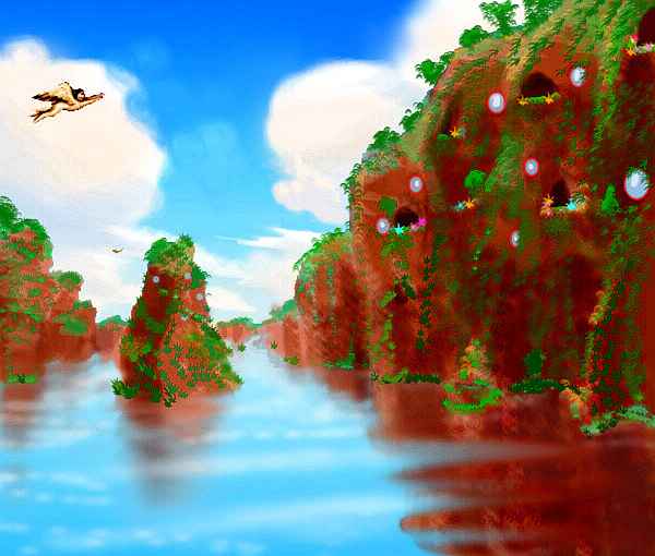
The cliffsides of the Brynhild Fossae form spectacular vertical undersea gardens off Cape Glinda. Just to the north, an easy flight over a shallow, islet-dotted sea, the fossa walls surface, forming dozens of tropical fjords, all parallel, most of them lined with low cliffs. These little coves, miles long and often just a hundred meters wide, are one of my favorite places on Venus. The cliffs, the ferns and little waterfalls, the sheltered reefs and underwater cliff-gardens. Other places have more grandeur, but Brynhild is intimate.
The grooves go inland, too, holding lakes and marshes, climbing over the northern ridges to sink into the sea, where they continue over 1000 km north, even crossing a blue hole. They may look like miniature fjords or stream-cut canyons, but the Brynhild Fossae are really cracks formed by stretching. It's a huge formation--this is the only part on land.
Sophia, one of the larger islands of the Alpha group, is shaped like a fat flying parrot flying east, with the Brynhild Fjords as the left wing. Most of Sophia is dense tropical forest on low plains. But the eye of the parrot, in the far southeast, is Sophia Crater, rising dramatically from the green jungle-plain like some Roraima plateau--it cups a crater lake 50 km across. We won't detour to see it--we camped inside Stuart, just east over the strait to Pachamama, and Sophia Crater is nearly Stuart's twin.
Instead, we fly northeast into the sea, toward another only-on-Venus: the Seoritsu Farra.
That sounds more exotic than the Seoritsu Pancakes, huh? But that's what "farra" means. Seoritsu, a couple of hours off Sophia's north shore, is a shallow sea studded with giant pancakes--flat round lava mesas, 1-10 km across, with 100-meter cliffs at the edges. The name's not just whimsical: they really formed much like pancakes, from frothy lava-upwellings that solidified first at the edge like pancake batter. Pancakes aren't rare, but Seoritsu's had the strange luck to end up right at sea level, so as the slow solar tides rise in the morning, they eventually top the cliffs at roughly the same time, and a concentric tidal bore rushes in, on the rounder isles creating a noon "tidal spout" as the ring-wave crashes together, like a gigantic waterdrop-splash in reverse. With or without spouts, such concentrated churning erodes the center more than the rims, accentuating the tidal-bore effect. The pancakes become mere reefs for three days or so, then slowly drain to become low islands full of pools at sunset. The pools turn fresh in the evening rains, until the sea returns at midnight... The channels between pancakes teem with sea life, being lined with caves from gas bubbles in the lava. But diving's risky, as the porous rock's unstable; only their living coral skins hold these soggy pancakes together.
We can't spend too much time diving the Seoritsu Reefs, for it's getting on toward noon--high tide! Soon the tidal bores will breach the edges of the pancakes and head inland, and very little will be left above water to perch on. Before the last pancake founders, we fly west toward the crags visible on the horizon--the peaks of Alpha itself. Alpha, last and craziest. First feature named on Venus, and yet one of the hardest to describe.
ALPHA PROPER
Start with the basics--Alpha's an oval terra (large island or mini-continent) on the prime meridian--longitude zero. No coincidence--in ancient times, when savage humans bounced the first radar waves off Venus, it was a bright feature making a clear reference point (OK, it helped that the Maxwell Mts were also on the zero line).
But what was reflecting? Alpha's a steep, chaotic, spectacular jumble of ridges and saddles and sounds and knobs and lakes. It's a mixture of the Philippines, the surreally steep hills around Rio--you've seen Sugarloaf--and the fjordy edges of Greenland. But Alpha's much, much bigger. In the southern Nadia Range the peaks are high, the climate hot, the slopes rainy--a green carpet clinging to rounded, fluted near-cliffs, like a scaled-up Hawaiian wet-side escarpment. North Alpha is lower, with more fjords, and drier--some eastern slopes have open meadows. But some northern peaks are high enough, and far enough out of the hot zone, for frost, perhaps even for occasional snow.
Our first goal is west across Alpha's south coast--Eve, a great corona at the southwest tip. Half-flooded, Eve forms a cape enfolding a craterlike bay. But it's not a normal corona--it looks as if a researcher at JPL flipped out and cranked up the vertical too far, exaggerating all the slopes by two or three. The ridges are steep and gaunt, the peaks and knobs and fins sharp as the crags on some low-grav moon. You look for a carved signature of Roger Dean.
It's not just that Eve is young and all the other coronas on Venus are old, or something--crossing the south coast, we saw similar sights everywhere: mountains like Sugarloaf in Rio, great bulbous ridges sheltering deep bays, all steep as a Chinese painting.
Why's Alpha so feverishly vertical? I still haven't heard a convincing explanation, unless the whole region is young, perhaps still bubbling and thrusting up. Or maybe Alpha's just a scum of light, "continental" rocks squeezed together and increasingly piled up by a titanic downwelling beneath them, pulling them all in, bunching them. Whatever the explanation, something's seething here, under the surface as well as above.
On Earth, such heights are scenic, but not settled--or if they are, like the favelas of Rio, they're the poorest parts of town, despite the views. Just to hard to get to! Quite the opposite on Venus. Wings make all the difference. Views and light are best up top, and fliers don't have climb far when leaving home. The valleys' only boon is more water; and on most of Alpha, that's not a rare commodity. The sketch shows a fairly settled region, by the way; the forest is so lush it hides most artifacts, and Alphans build light and small. Given the region's active geology, it's not wise to tempt the tectonic gods by building big, in stone, steel or diamond. That stuff can fall on you. Wicker, some wood, and a sort of organic glass like thick cellophane are the materials of choice. Light, with some flex.
It's high noon in Alpha, and we're still on the edge of the torrid zone, so the lowlands can get quite hot. Luckily the southern Nadia Mountains rise steeply to 2 km or more, where temperatures are milder--pine ridges above subtropical jungles. We sleep comfortably enough atop Mt. Nadia. And as the day progresses, we head north into the ring-shade--riding the tricky, chaotic winds of the high ridges, where it's coolest and the views are best--looking down like eagles on deep valleys and lakes.
Heading north, along the green west coast, we come in a few hours to Peggy Bay. Ahead, the horizon's rugged--Cape Peggy, narrow but 150 km long, with islands and reefs trailing off in the Lavinia Sea. We turn inland here--following Peggy Bay for hours, a twisting fjord between steep Sugarloaf hills. It branches, narrows, opens again... We sleep on a beach and wake in mid-afternoon and fly on. More narrows... and then the sound opens up and ends suddenly, in a round bay. The far shore is uncharacteristically low, and water gleams beyond, between the hills. This is a strange point at Alpha's heart, where the land's three great gulfs all meet--nearly. Peggy Bay from the west coast, Dudumitsa Sound from the north, and cross-shaped Virga Sound from the east, each at least 500 km deep.
It's still hot, given the time of day, but less humid now. The western slopes are open woods, eastern ones are savanna and meadows. We fly north along Dudumitsa Sound, half the time over land as the fjord twists like a broken-back dragon. Hours pass before water predominates and the chaotic ranges of green crags become chaotic islands. Only two directions offer clarity: open sea gleams to the west; and a solid line of peaks marches west to our north--Cape Dudumitsa. Unlike Cape Peggy, which dead-ends in the sea, Dudumitsa's islands and reefs continue across the Lavinia Sea--and this is important.
It's the only flyway bridging the great gap between Eastern and Western Hemispheres, between the Arctic and Antarctic. Either you fly 10,000 km north, or 5,000 south, or sail or take a blimp... or you island-hop here. It's not an easy bridge--from Dudumitsa to Tumas Island, to Mt. Aitchison, a lone volcano rising from the sea, then low, broad Iyatik, then a long hop to the Bhumidevi Islands. A few fliers turn northwest through the Bhumidevis to reach Vasilisa and the Navka Archipelago; the majority, heading for the western continents of Themis, Phoebe, Beta, Parga and Dione fly south to Takusmana and the Qetesh Islands, an arcuate group around deep blue Qetesh Hole, then west to Aglaonice (yes, that's spelled right--the "ao" rhymes with "how") and Saskia, two impact-born ring-islands. Saskia's in sight of the coast of Dione. Now it's just 2500 km across the jungles of Innini, the Ushas veldt, the forests of Nepthys, and a narrow strait leads you to the mainland of Themis, and on to Parga, Phoebe, Beta...
Simple, right?
Insane, right?
From now on you'll take a jet, right?
Sorry--none on Venus. Wastes energy. Too noisy. Too fast! To understand the Cythereans, you have to face their wanderlust, their insistence on seeing their planet in such terrible, even dangerous detail. Love of place gone mad? The Cythereans say "You love what you know." The uncomfortable corollary is... What you don't know, you don't really love.
And in case you haven't guessed, I'm with them. I walk or sail or drive, camping and taking days, rather than ride a plane and get magically whisked across continents--with no link between here and there. Air passengers even complain "You're spoiling our movie" if you open the window to look at the world! They talk about caring for the environment, but they shut Earth out just as well-bred English ladies touring the Continent used to shut out the horrid irregularity of the Alps. Have plane-riders and webheads really acquired any more land-literacy then their savage, imperial ancestors?
My father was a teacher and took every summer off. We camped all over the American West. I didn't realize as a kid how rare it was, even among Westerners, to have really explored their own land in detail. I write landscape now because I learned to read landscape then--where peaks are, to navigate by; where passes are, to get through; where the rain falls and rivers run, to seek life; and where zones change, to seek drama and beauty. People aren't born land-rapists. Nor are they born land-literate. I learned to see, learned to love. It took time. Georgia O'Keeffe learned to see:
"Nobody sees a flower really--it is so small--we haven't time--and to see takes time like to have a friend takes time... So I said to myself--I'll paint what I see--what the flower is to me--but I'll paint it big and they will be surprised into taking time to look."That's exactly what "Venus Unveiled" is! Not imagination, not scientific speculation, just a trick to make you SEE. If you're an airport sort, you may be blind to Venus (and Earth)--not by temperament, but because you haven't been taught to read the patterns of land, climate and culture I'm presenting. That's as frustrating as being autistic, seeing human interactions you just can't read.
But frustration's a good first step. Just recognize the patterns are there... and learnable. If you make the effort.
End of rant. End of confession. End of tour.
One afterthought: a flight through the archipelagoes of Fatua and Heng-O in the Guinevere Sea. These lovely little islands aren't strictly Alphan--but they can be reached most easily from Alpha, so I've appended them here.
Instead of following Cape Dudumitsa, we cross its spine and head northeast over the deep Tinatin Sea--it's a good four hours with no sight of land, so you'll have to trust me--Fatua will appear. It's an archipelego midway between Alpha and the Scorpion's Jaws (far west Aphrodite). Fatua has three groups, from two to four times the size of the Hawiian chain, all with Hawaiian climates. They're clustered in roughly circular patterns: weak coronas?
The south group, Fatua, is the largest--a C-shape around a deep "blue hole," looking much like a Terran coral atoll, though the geology's quite different. But coral has taken root--in a few eons, the underlying corona's igneous rocks may be irrelevant; coral's imperatives will shape these islands into true atolls.
The northern Tiffany Group is isolated, for it's on no flyways at all--unless you count the handful of fliers who can reach Tiffany from the islands off the Jaws, and that's an unbroken 800 km flight!
The western group, the Xantippes, are small but interesting--and on our path. 200 km north of the Xantippes is a very large, very deep "blue hole": Thouris Corona. It has a flawless round raised rim that simply doesn't reach the surface--a couple of hundred meters down. But in the clear pelagic water and brilliant sun of Venus, coral can grow at that depth--just barely. So in a few eons, Thouris may become a gigantic coral atoll.
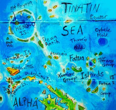
Cybele, a second blue hole east of Thouris, has a much lower rim that'll never be a reef, but a central peak that may be near enough to the surface to anchor coral. Even if Venus stays tectonically and volcanically quiet (and in the long term that seems unlikely), life will change the world, carving, burrowing, building. Life built, after all, the new Venus itself.
Our next perch is 500 km northwest of Xantippe is lonely Atargotis, not quite a part of any archipelago. Well, maybe not lonely--it may have a chain of little sisters leading south to Alpha. Next is a hard flight of 500 km to Dewi Ratih, the first of the Heng-O Islands. A rugged giant 180 km long, Dewa Ratih's the flanking ridge of an undersea chasma. The other ridge is no more than a reef--don't ask me why. The big isle's climate is quite Hawaiian, with rainy patches on upwind hill-slopes and pocket deserts downwind.
Past Dewa Ratih is Heng-O proper--a gigantic ring of arcuate islets and reefs, some of them very long but quite low and only a few kilometers wide. They encircle a vast blue hole, about the largest I've found on Venus so far--and so far unnamed, not called a corona--NASA considers the Heng-O complex a chasma instead. Of course, looks are deceiving: Heng-O looks even more like a huge impact crater--it even has a (slightly off-)center peak, Mt. Perynya. But it's no crater--strip away the sea, and the radar scans show no white ejecta, no black floor. You might as well compare Heng-O to a Terran atoll scaled up ten or twenty times, far larger than the Fatua circles, which were impressive and puzzling enough. Well, maybe even that comparison's not absurd; Heng-O's no atoll now, but it'll soon become one--its reefs are already one of the loveliest sights on the planet.
From Perynya, the enterprising and hardy tourist can island-hop round the ring to the northeast, and via the large, fertile but little-visited Changko Islands, reach Eistla in a few days of hard, steady flying--back in the land of, well, land. But that's another tour.
FACT VS FICTION

World Dream Bank homepage - Art gallery - New stuff - Introductory sampler, best dreams, best art - On dreamwork - Books
Indexes: Subject - Author - Date - Names - Places - Art media/styles
Titles: A - B - C - D - E - F - G - H - IJ - KL - M - NO - PQ - R - Sa-Sk - Sl-Sz - T - UV - WXYZ
Email: wdreamb@yahoo.com - Catalog of art, books, CDs - Behind the Curtain: FAQs, bio, site map - Kindred sites