Venus Unveiled: Phoebe
 INTRODUCTION
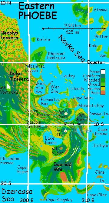
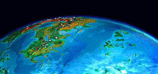
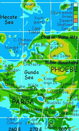
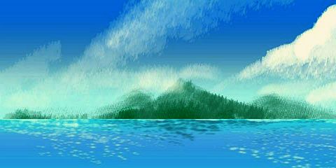
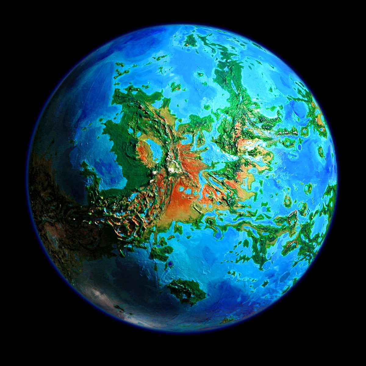
Phoebe is an equatorial continent larger than Australia. Northern Phoebe, like its neighbor Beta, is dominated by the Devana Mts. In the south, Dzerassa Bay nearly cuts Phoebe in two. East and West Phoebe both have fertile south and west coasts, with rainshadow deserts in the east. Northeast Phoebe, called Dolya, is covered in tessera--a grid of grassy mesas and wooded canyons. South of this is wide, marshy Lake Emma, the heart of a more wooded region, including Cape Aleksota and the far southeastern peninsula, Cape Iweridd. West Phoebe is a series of forested ridges sinking into the Hecate and Gunda Seas, forming long peninsulas: Cape Chimon-Mana, Cape Rabie, the Isthmus of Udaltsova, Cape Ellen. Between these, like webbing between fingers, are wide fertile prairies dotted with shallow lakes and marshes, veined with tree-lined streams from the high rugged Devana Mts around central Dzerassa Bay. Southwest Phoebe ends in the wide Pinga Peninsula, where half a dozen lesser ridges and chasmas radiate out from Mt. Yunya-Mana.
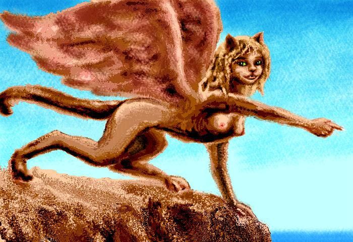
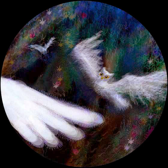
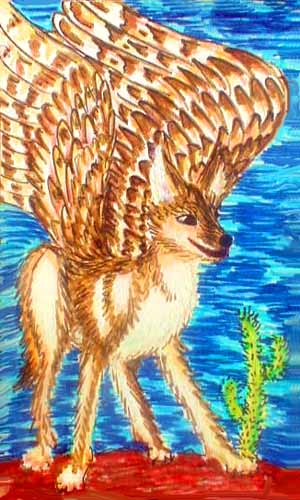
Of all the regional tours, this one is the least speculative--as an experiment, I've focused closely on the land and climate, nearly ignoring the question (answered to various degrees in other tours) of what creatures would inhabit such land. No zebra storytellers, no winged coyotes, no dam-building octopi, no otter villages, no sphinxes on the cliffs or elephant muralists on the plains.
An "empty" land, as we humans say. Without a play to entertain you, can you see the set--see how it'll shape the play?
TOUR: EASTERN PHOEBE
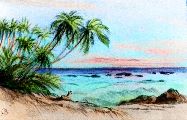
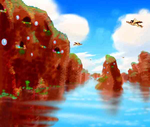
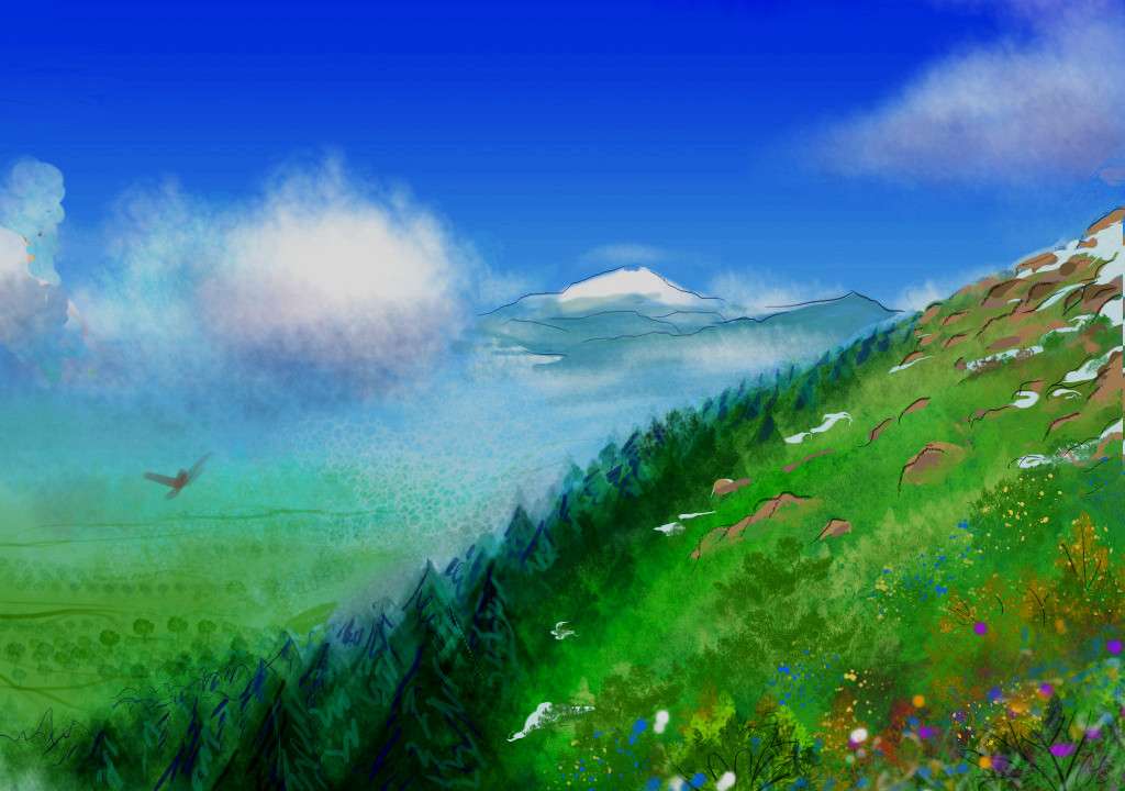
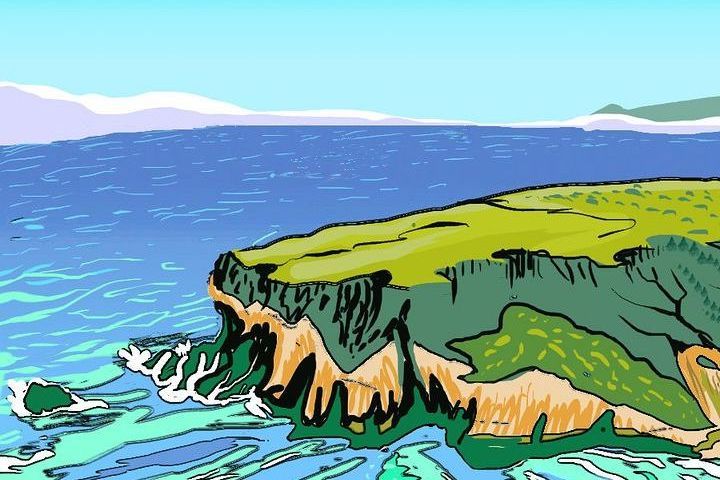
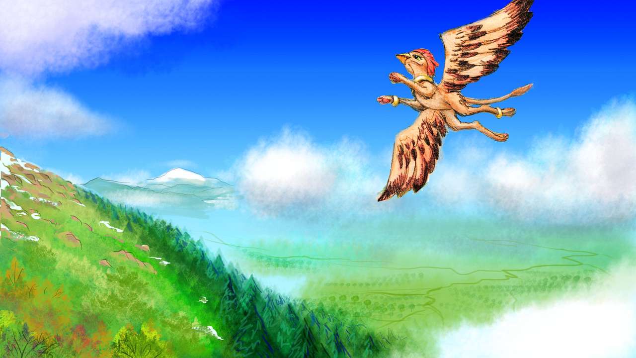
Sunday. The huge Cytherean sun, fifty percent wider than Earth's, is rising in the west. You're testing your strap-on wings in the winds above Cape Cline, the southeast tip of Phoebe, in the warm Navka Sea. Tall windy cliffs, rugged uplands gold with dry grass, ponds and hollows dappled with low trees.
After all the Greek muses and demigoddesses on Venus, you probably read Cline as Klee-NEH, but here's a pronunciation hint: Cline's first name was Patsy. And her namesake resembles her these days--slender, blonde, and known for flight accidents.
I wasn't being flippant. Cline is a great flyway--you see locals all round, riding the updrafts along the cliffs--but a flight hazard for novices. You follow the crest upwind, slowly, learning caution from these rugged knolls and tors, for they generate tricky whorls and downdrafts as well as upwinds. And you're flying half-blind, the sun in your eyes. A good 300 km long, Cline will take you many hours to traverse even on the wing. At last it narrows, and just when you think I marooned you in mid-ocean, a long coast appears, hard to see in the sun's low glare: Iweridd.
Iweridd (the double d sounds like this) is a corona, one of the great blisters Venus forms like a slow-motion mud pot. It's a huge one, a blunt oval peninsula 800 km wide, dominating southeast Phoebe. Though surrounded by sea, it's surprisingly dry, being partly in the rainshadow of the high Devana Mts. Some inland valleys are desert. But the uplands support pine forests, and grasslands in most valleys. Much of the coast is green, especially the south and west, where storms stray in from the Dzerassa Sea.
But to go that way now means flying straight into the rising sun--it's low in the west all day, remember? So you wander up the drier east coast, out of the glare, practicing landings and takeoffs on conveniently grass-topped bluffs. Slowly the red cumulus towers in the sky turn gold, and the sidelight creeps down the hilltops until the tawny coastal bluffs are on fire. When you sleep on the wide beach (it's low tide--it always is, at dawn) sunrise is fading into plain day. When we wake, the display's over--it's Monday.
Ridges and spurs comes down to the coast, and you practice flying over the them. The inland faces have useful updrafts. They force you inland, at an angle. From their heights, you can see far inland. Behind you, to the southwest, dry plains, almost deserts, with dark mountains beyond, jagged with pine, even tipped with a few snow patches. You imerceptibly alter course, following the ridges into the Iweridd Mountains.
Over its spine, you can dimly see savannas far below. To the left on the horizon, a low lumpish volcano--Mt Vupar. Further north, the gleam of huge Lake Emma--its near shore, at least. Below and a bit to the right is a strange round eye, red-rimmed--Lake Panina, a cliff-walled caldera, now flooded. Beyond, narrow and rugged, Cape Panina stretches east, groping unsuccessfully for Ilithyia Island, a volcanic cone still over the horizon, even at this great height. Why mention an invisible island? Well, Ilithyia may be isolated, but it's not lonely--it's a popular resting place for fliers heading for the huge Navka Archipelago to the east.
An abyss opens below your wings--a chasma. In its depths, a windless mirror 300 km long, stretches across your path--Lake Ingrid. To reach the green hills on the north shore, you must cross at least 20 km of water. Like migrating hawks forced to cross the Golden Gate (creating the incongruous spectacle of birds of prey congregating almost like geese as they reluctantly cross the strait), you're forced by geography to cross water, ready or not. Climb as high as possible first, expect to lose altitude during the passage (no updrafts out there!), stay calm, and stay aloft. A novice trying to land in water is likely to drown--or at least break an arm.
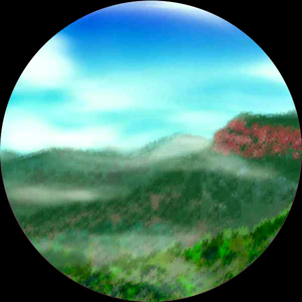
So... it's a nervous half-hour as you beat steadily and self-consciously over the lake to the Aleksota Mountains. Land on the beach and take a long break, swimming in the lake till the smell of fear is washed away and you look at the green hills above with interest. Aleksota is really a single flat-topped mountain (dome, or shield volcano?) forming a wide egg-shaped peninsula sticking out of the Devana rainshadow and thus quite a bit greener than Iweridd. Pine woods on the plateau ends suddenly in red scarps, with oak hills and savanna below. You spend all afternoon wandering the heart of this little country, over little Darago Sound, scarcely ten km wide (you're not scared this time, though perhaps you should be; how far can you swim?) with its flock of islets stretching offshore to the horizon. More hills, coves, points. Below the inland scarps, the veldt can be dry, but even there it's dissected by winding, tree-lined streams. Mostly, though, Aleksota is just prime human habitat, and as such, it's really quite hard to describe to a Terran, human readership. You're used to seeing such lands heavily settled and used--farmed, ranched, paved! Europe, China, river valleys in India and America, they've all been so heavily altered by humans for so long it's hard to imagine them without us.
But try, for once. Picture parkland--but not the obscure corners usually reserved for national parks, scenic but infertile--hot, cold, dry, rugged. Good land utterly untouched. Open forests, meadows along winding rivers, warm and mild climate. Bland and vague, isn't it? It'd jump into focus the moment I described it as human farmland, or even placed some nonhuman sentients here--a grazing-based elephant civilization, or cattle-ranching cats, or giant parrots tending their orchards (the best ecological fit, I'd say). Seeing the land itself, by itself, for itself--it's a trick we still have trouble with, for humans focus on figure, not field. And here, the fields are literal.
Still, try to imagine the unimaginable--a world without wonderful you. Of course, it won't be--sentient beings will surely inhabit this world they went to so much trouble to build. You don't build a house and leave it empty, do you? (But... what if Venus, by the time it's done, is more an experiment in hands-off ecology, or a lab for the evolution of new intelligent species, or an art project of deep-space AIs who dabble in carbon-based life? Do we live in museums, factories... churches?)
Well, soon you'll get to practice in landscapes less human-primal. Unearthly, in fact. Sleep on it, out on the beach at the northern tip of Aleksota, ignoring the chatter of the parrots, who just wouldn't go away once I postulated them--they're just too inevitable. With thick air, flight's so easy! So parrots evolve bigger and bigger, their brains grow (and they were super-efficient to begin with--as smart as a chimp's yet much lighter), until you have sentient parrots with 4-meter wingspans and dextrous feet/hands, tending fruit and nut orchards. Nice people, but noisy...
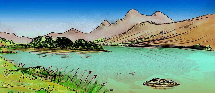
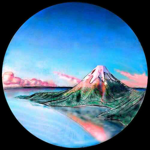
In the morning--sorry, still morning--Tuesday now, mid-morning. When you wake, that's better, you veer west, up Aleksota Bay to the river at its head, and on west, up the wide gentle valley. Gentle except for the sharp volcanic cone of Mt Muru, looming ever larger. A substantial snowcap, though later in the day (say, three Earth days from now) most of it'll have melted. Soon the river widens into Lake Muru, reflecting the peak--the tallest we've seen since the snowy heights of the Iweridds. A beautiful sight.
The west end of Lake Muru breaks up into odd little fjords with red cliff walls--the first of the Perunitsa Fossae, cracks running hundreds of km up the coast. We'll follow them later--but now Mt Ilga beckons to the south, a perfect little Fuji, nearly a twin to Muru. Beyond is huge Lake Emma, the largest lake (30,000 sq km) in East Phoebe. A third, more massive shield volcano hulks on the far shore: Mt. Vupar. Lake Emma gets enough storms off both Dzerassa Bay and the Navka Sea to sustain open forest and veldt--the surrounding plains look quite African, and wide, rich marshes surround the shallow lake (an old lava bed). Above, the slopes of Ilga and Vupar are dark conifer forest. Their summits are alpine meadows, windswept and rocky, seeing nightly frosts, but not much real snow. Oh, well, it does happen, and it's Tuesday, early enough so it wouldn't necessarily all have melted, so let them be snow-dusted! Twin snowcapped Fujis reflecting in the lake--how scenic! Well, one Fuji and one big-shouldered lump. Vupar is no one's god of beauty.
Further northwest, a strange round mesa looms over the fossae. Wondering if it's one of those Cytherean lava oddities like spiders or pancakes, you flap up to the lip to see... and hover in shock as the world drops away. It's a huge impact crater, cupping Lake Bascom in its depths. The ringwall's 40-50 km wide. You ride the troubled winds around the wall, and fly north. Mt Muru reappears far to the northeast. Below, the land becomes a sea of cracks again--the Perunitsa Fossae. Shall we follow them this time? You sleep on it (literally on it, on a clifftop--fossae make for easy take-offs in the morning. I mean, when you wake. At noon. Wednesday.)
All the next day you glide northwest along the Perunitsa canyons, using the cliff-face updrafts as highways. What caused these? My guess is the crust here was forced to stretch, but the top layer was cooler and less elastic, so it cracked. Mind you, I see elasticity everywhere on Venus--stretching, warping, squeezing till it corrugates. I'm a sculptor used to flexible clays and acrylics, not a geologist. Earth scientists raised on plate tectonics tend to see Venus differently--either they hunt for Terran-style plates or emphasize the contrast (as I write, the trend is to reject plate tectonics entirely, going so far as to deny large-scale crustal movements, and only allow local spreading along rifts, and bubbling-up via coronas and volcanoes. I disagree--I see wider movements, but not in plates--more elastic, like skin. Rubber tectonics... string cheese tectonics.)
Ahem. Now where were we? Oh, right. It's high noon on Venus, and you're riding updrafts northwest along the Perunitsa Fossae, over fingerlakes, past cliff villages full of sphinxes--oh, wait, I wasn't supposed to mention them, was I?
Well, ignore them and they'll ignore you. You're just another tourist, after all. Half of them natives of Venus.
After several hours of this lazy gliding, the coast turns due north, and so do you, leaving the fossae to run stubbornly inland, unbending. Working your wings now, you beat north. Ahead on the horizon, a line of cliffs extends into the sea--Cape Wen Shu. You're entering a new region, Dolya--Land of the Giant Pimples.
No, really. The coastal plain before us is covered with tessera--endless polygonal grassy mesas cut up by a regular meshwork of wooded canyons with oxbow lakes and shallow streams. Thousands of them--red and gold cliffs and caves and springs, above green groves and meadows. In Dolya, the crustal stretching and squeezing that built Perunitsa must have happened in two directions--or three, or four.
Ignore the winged coyotes, too.
You have (slightly dangerous) fun riding thermals and wandering through Dolya's canyon-maze, dodging cliffs all day. You sleep in a cove on Wen Shu Bay--oddly, the capes and islands here lack tessera. They could be grassy headlands over a California beach...
When you wake, it's Thursday, and the sun's shifted east enough for clear, glare-free views to the west. Inland, the pimples recede to infinity, though the land rises and darkens--pine ridges, slowly concealing the tessera. You grab air and climb over a mesa, then ride a thermal, spiraling up, up, up.
As your horizon expands, a faint white wedge appears on the horizon--Mt. Vostruka, 250 km inland. It's the southern end of the Devana Range that winds down Dolya's west side, creating these semi-arid prairies here in the east. Some inland valleys are true deserts, though small ones, and not too hot: Dolya's shaded by the equatorial rings. The uplands are cool and support pine woods, and Mt Vostruka's an ecological island of dwarf forests and alpine meadows. The peak even sees occasional snow, though it's no more than 3000 meters, and practically on the equator. But Venus's equatorial rings cool this zone enough to make it subtropical, not tropical.
You fly over mesas and green canyons all day. Swim in the rivers, nap under trees, then cruise on. You pass unspellable Cape Pölöznitsa, land of, um... lost umlauts? There should be two dots over each O in Poloznitsa, but I bet they're missing (or alphabet soup, depending on your browser). Oh, well. There's a long arcuate island, the edge of a large corona--it curves round in a hundred-mile arc, sheltering a warm, shallow bay behind it. Much like Scammon's Lagoon on Terra, Pölöznitsa Lagoon is a calving ground for the whales of the Guinevere Sea.
You spend a nice day visiting the whales, swapping news of land and sea. There's a huge music festival in Madderakka Hole (a natural undersea stadium) only 1200 km northeast, off the Hulda Islands. But there's no easy flyway from here--the Laufey Islands on the horizon, unlike Ilithyia (remember Ilithyia?) just don't go out far enough. Too bad! Guinevere singers are the best on Venus.
That's not mere local pride--it's geographical logic. The Guinevere Sea is the crossroads where all Venus's fractal seas meet--and all the innovations collect. Guineverans hear everyone. (Jared Diamond's theory that geography and ecology shape cultural development is too far-reaching to summarize here--read his Pulitzer-winning "Guns, Germs and Steel", or see Jaredia for a test case. But his logic applies to marine civilizations just as well as land cultures. Crossroads always have an inherent cultural advantage.)
On Friday, you fly north past hilly Cape Rhpisunt, another separate little country like Aleksota, fertile and un-pimpled. Rhpisunt is smaller, a fat wedge only 240 km long--still substantial, and much greener than the coast, where the pimples are now pimplier than ever--polygonal pyramids now, with steep gold grassy slopes and red rocky flat summits. They look so much like baby cinder cones (ten thousand volcanoes, brrr! Like baby spiders) that you doubt your guide, and spiral far up over the tessera till you can look down onto the "craters" and verify they're flat. See, you can trust me!
Well, maybe not. The radar scans aren't really detailed enough to be sure what forms of tessera are here. The pyramids are just my best guess. I'm more confident about the climate, actually--you're entering a drier zone, no matter what the terrain. The valleys have trees along streambanks, but they're less shaded than the narrow mesa-canyons further south, and support only scattered oaks away from the water. The streams are shallow and intermittent--full nights and mornings, sinking to pools in the long afternoon, like now. It's not the pyramids' fault, really. Inland, the Devana Mts are higher here, blocking storms from the west. So what rain does fall comes from the weaker winds off the Navka Sea. It's not a full desert, but a fairly dry shortgrass prairie. Prairie tilted every which way.
You don't have to buy the pyramids, but there is some change in the tessera here. Believe the geologists, if not me--this northern zone has its own name, Nedolya. Dolya is the Slavic version of Lady Luck, and "ne" mean "not", so Nedolya is the Lady of Rotten Luck. Enough said!
So... the coast continues, but the tessera change (somehow) and the climate changes (definitely). You spot a little smudge out on the sea, at the horizon--the hilltops of little Ketzia Island, hardly more than a pimple itself--narrow, and only 80 km long. Hardly big enough to do more than build ten Manhattans on! It's hard to remember the sheer scale and generosity of Venus, after exploring cramped little Mars or moons like Europa or Titan, places so small you could lose them under your bed (if you don't dust much).
But even a relative speck like Ketzia is big enough to nurse a civilization--big enough to be your whole world, if you grew up on it.
CENTRAL PHOEBE
Late Setterday (not a misspelling. The day after Friday. The day the sun sets... all day) you reach Cape Nedolya, the northern tip of Phoebe. Due north, offshore, is a deep blue hole, but to the northwest a ridge breaks the shallow sea: Samodiva Island. Samodiva's the easternmost flyway from Phoebe to Beta, the northern continent. The island's a diagonal ridge 300 km long, Hawaiian in climate, through reversed of course, as Venus spins backward and its winds are broadly the reverse of Earth's: the west is lush, the ridgetop is rainforest, while the east shore has desert canyons like Waimea. Beyond is the coast of Beta--the scalloped red cliffs of Cape Centlivre, far wilder than the white cliffs of Dover. But you turn west--away from the glare of the setting sun. The cloud-towers loom around us, on fire.. You fly on through Dusk, beating west over the mouth of Rosa Bonheur Bay. Lake Bonheur gleams pink to the south. You head on toward the cape, and sleep at its tip.
Offshore, visible in the bright dusk light when you wake, lies Zhivana Island. Hawaiian in size and climate, little Zhivana's another stepping-stone from Phoebe to Beta. Zhivana's part of the east ridge of Devana Chasma. The west ridge, across the trench, rises higher above water, forming hilly Iondra Island, 240 km long. But from here, Iondra's just a hump on the horizon, even when you spiral up high over the peninsula. A western cape goes right out to it, so Iondra's the shortest, safest passage to Beta. But that's another tour!
Your flyway heads south, along Devana Chasma, one of the longest and jaggedest on Venus, dominating two continents--Phoebe and Beta. The chasma gives Beta a mountainous spine, then marches into the sea on its south coast. Crossing the strait as a trench with two flanking ridges that create Zhivana and Iondra Islands, the chasma resurfaces on Phoebe, nearly cutting it in two; branches of the Devana Mts are the spine of both East and West Phoebe. As Devana generally cuts across prevailing winds, its ridges block rain, and much of the chasm floor is desert. But some parts dip so low they've flooded--and that's where you're headed.
It's Eve now, and by brilliant ringlight you're flying south along Devana Chasma's western ridge. Ahead in the abyss, Lake Joshee gleams, 2-3 km below us, narrow but over 320 km long. The peaks around the lake are high enough to be snowcapped, though when you land to scrape at it, it's a mere dusting. Maybe in a couple more days of night...
Many of the canyon slopes here are semi-arid, with steep bare red rock. It's a dramatic place, reminiscent of Dali Chasma. With the equatorial rings at their luridest overhead, it's a sci-fi landscape out of a Charlie Bonestell painting.

The landscape off to the right, over the western side of the ridge, is quieter--the mountains drop steadily to a green coastal plain. This is Mirabeau Bay, a triangular gulf about 400 km wide, where the north-south Devana coast suddenly turns due west, running straight along the equator for 2000 km to Cape Toklas. It's the greenest part of north Phoebe, catching storms off Hinemoa Gulf.
Let's veer across the rift to the eastern ridge. (We have to--the northwest coast is fascinating, fertile land with a spectacular blue hole, several small scenic bays and subtropical islands--but the low relief here makes exact shorelines uncertain, and most features aren't even classified, let alone named. Rather than fake it, I'll leave it alone till we get better data.)
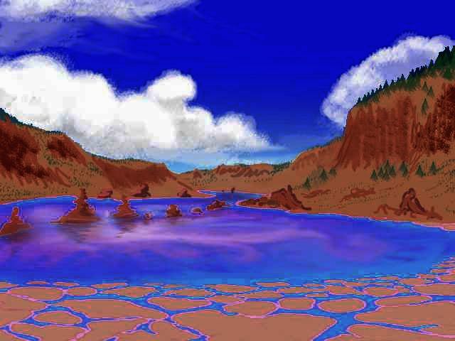
So, you turn southeast. Let's camp on the East Devana ridge--it's a great view. The Devana desert valley goes on south; a second large lake gleams below. Just don't swoop down for a drink or a swim. Devana is an active rift, and this lake's loaded with alkaline minerals--note that caked, cracked shore. Bitter, but probably not poisonous. But the bacteria staining the lake that weird berry-purple--no, that's not my inept sketching, that's real--may be toxic. I wouldn't risk it. Even on Earth, any lake capable of erecting tufa towers over a fault down its midline is venting stuff you don't want to eat. Sniff. Faint but noticeable even up here--rotten eggs. Sulfur.
Just follow the lake south. At last, on the far horizon, a silver line grows that might be the sea--Dzerassa Bay.
On Ring, you follow the East Devana range a while, then head southeast over rifts and ranges, outer echoes of the great chasma. It looks like Nevada beneath us, except for the titanic white arch lighting the scene instead of an Earthly sun.
At last you come to a desert gulf like Sea of Cortez--dry red peaks dropping into a shallow turquoise sound. This is Madeleine Bay, the head of the Dzerassa Sea. Madeleine Island, a steep orphaned chunk of the Devana range offshore to the southeast, separates this first bay from the wider gulf beyond--Dzerassa Bay, itself just a 1000-km-long northern finger of the Dzerassa Sea that nearly splits Phoebe in two. Ringed by mountains casting rainshadows, it resembles the Red Sea on Earth, with desert shores, especially the west side where the Devana Range drops sharply into the sea. The east shore is gentler and only semi-arid--from grassy gold to the tan of chaparral, with only ribs of bare rock, not the stark red escarpments of the west.
You sleep on the beaches of Madeleine Island--what's left of them. It's near high tide, and still rising. But the land is too thorny for comfort, so it's beach sand or hard rock! Waves here in sheltered Madeleine are gentle so it's unlikely you'll get soaked.
On Yule, in the red dusk (which makes the bare rock stand out and the blue sea recede, so the desert seems even drier than it is) you cross to the mainland and ride updrafts along the sea-cliffs south, to Boye Peninsula. Despite the unflattering light, Boye's grassier and brushier than the Madeleine coast. You're reaching the desert's fringe.
You sail on, not low on fresh water (streams do descend from the high mountains now and then) but hungry to see green land again. Down the Giselle Coast all Yule, watching the grass slowly return, along with the ringlight. As you start to tire, an island appears. An island with (wonder of wonders) scattered trees amid the dry gold grass. You veer west and camp on Mowatt, too tired to explore now. Besides, when you wake, there'll be real light again. You fall asleep under the stars--you count at least a dozen, in the deep blue sky. Truly a dark night, for Venus.
On Rain you wake on in a strange little land. It's a ring with quite a large lake in the middle. Mowatt is an impact crater that happened to be just at sea level. Common on Mars, they're rare here: I only know of half a dozen--a famous trio off Dione's east coast--Saskia, Danilova, and Aglaonice; and little Karo, off Pavlova, and O'Connor, in Lake Onissya, which sometimes (when the lake's low) isn't even an island. Mowatt's about the largest such island on Venus--150 km across, and a near-perfect ring. The meteor struck a bull's eye: right in the mouth of Dzerassa Bay, creating a perfect stepping-stone for the flyway across the narrows. Which, I think, you'll take advantage of, for heading south along the east shore will just lead back to the Khosedem Fossae and Lake Bascom. It's time to explore West Phoebe.
So you cross the western strait, and climb into the Devana Mountains, against the wind. Slow going, with few updrafts. It's Rain, but there isn't a cloud in the sky--all that descending air dries out...
Ahead, a gleam of white--but it's no cloud. Mt. Yunya-Mana, a shield volcano, the highest peak in southwest Phoebe. From it radiate half a dozen ridges and chasmas. One creates the narrows you just crossed (Mowatt wouldn't be an island, just a forgotten seamount, without the undersea ridge it stands on). Another, Pinga Chasma, runs south to form Cape Atai, the southern tip of Phoebe. Others head a thousand km west to become Udaltsova Isthmus and Cape Rabie in the Gunda Sea.
The Yunya-Mana high country is rough, mostly pine and rocky meadows. Deep gorges (not cut by water--just part of the Devana folding and crumpling) sometimes hold rivers now, but many are dead-end sumps where fingerlakes find no outlet.
Northwest over the Devana Mts, down along the Chimon-Mana range. Technically tessera, but to your eyes, a continuation of the mass of ridges in Yunya-mana--braided ridges like ropy lava magnified a thousand times. Planetary dreadlocks!
It's tricky country for fliers--the dreads braid the winds above them, too. But on this side, the winds mostly rise, so it's worth the trouble. You glide for hours, steering warily, but rarely having to beat for long. Another updraft always comes.
You camp on a pine ridge--it's chilly, and the darkest night yet--clouds come up and block the ringlight, leaving us in a colorless shadow. It's nearly as dim as a full moon on Earth--why, you can barely read without a light!
On Witch, you continue down Chimon-Mana. The clouds turn patchy and the rings shine through, and color returns to the world, though up here, it's mostly dark pines and basalt cliffs. Off to the south, through cloud-gaps, are dim gold and pale-green fields--the Chimon Plains, the greatest prairie on Venus, a million square km or more. Lake Isako, in its center, is 250 km wide, a marshy lake with many islets, but it's somewhere beyond the hazy horizon, veiled in its own night-mists.
A few hours later, you spot a huge round mesa on the horizon: De Witt Crater, a big impact scar.
You glide down to the prairie, skimming low over the grazing, sleepy herds of antelope and bison. From here, you can't tell if they're herbivorous people or stock on a lion ranch.
Is that an elephant? Yes, a family, rolling in a creek. You're tiring and just call a greeting, and fly on toward De Witt. Over the low rim and down to its hidden lake, to land on its reedy shore. You go to sleep early.
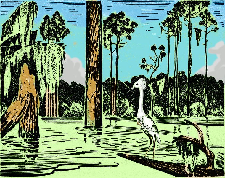
Waterbirds rustle and call in your dreams.
When you wake, a blue-green glow in the west says it's Dawn today. Up and over the crater rim, skimming over the plains. Lake De Witt comes into view, a wide band of lime-green reeds, then silver--you skim its shore for hours. Lake De Witt's a good 300 km across, an immense twin to Isako.
Slowly the dim predawn blue brightens to an odd spectral green, rare on Earth but commoner on Venus, with its denser atmosphere.
After lunch, wanting a change, you climb back over the mountain spine--not that high now--heading north until the view is clear. Here too, water gleams--not another lake, but the sea. Phoebe's like a webbed but bony hand; as you follow this finger out to the tip, you've left the palm, and now the webbing too is drawing in.
Now the sky is pale gold in the west and the white rings fade in the wash of morning light. Ahead, a spur of the mountains splits the sea. Cape Toklas.
The northwest shore of Phoebe's nearly straight, hugging the equator for 2000 km west from Devana Chasma. Cape Toklas, at the west end, is the only exception--a sharp little thorn, 150 km long, sticking into Hinemoa Gulf. The east shore of the cape has dunes, grass and pine barrens; subtropical hardwoods soften the spine and the west shore.
You ride the winds over the ridge out to its end, camp on the lee side of the promontory, and sleep early again, resting up for tomorrow: you have a long detour out to sea. Good cliffs for launching tomorrow, at sunrise.
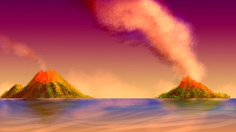
350 km due north is Xochiquetzal, a volcano rising from the sea--a useful one, for it creates the only flyway across the western Hinemoa Gulf, from Toklas to Xochiquetzal to the Isle of Aruru to Cape Montez on the coast of Beta. But Xochiquetzal (Show chee KETS all) also anchors the only flyway to Tuulikki--right in the center of Hinemoa Gulf, it's surrounded by land yet profoundly isolated--at a "pole of inaccessibility" as Victorian explorers used to say. I'm including it on the Phoebe tour because it can only be reached from Phoebe--from this spot. Besides, if you stuck with Cape Chimon-Mana right now, as the sun rises, it'd be in your eyes for days. The detour's actually easier flying!
The first day doesn't seem long. Multicolored clouds of a perpetual sunrise reflected in the sea, until a pink flying saucer appears ahead--a lenticular cloud floating over Xochi's head. The peak's shoulders are wrapped in stray cumulus like a shawl, but you ride the updraft on the windward slope right to the summit. Rest and explore the little island--mango forests and ferny cliffs on the upwind side, long grassy slopes on the sides, one red canyon in the peak's tiny rainshadow. You sleep early, preparing for the long flight tomorrow.
The flight to Tuulikki takes seven hours, with not a rock to rest on. The Aita Reefs, halfway, mock you with their pale coral-sand shallows--but Aita, though it's trying hard, won't break the surface for ten thousand years. Coral's slow. You wheel, frustrated, seeking a single sandbar, and fly on at last, defeated. Three hours later, when you reach Tuulikki's shore, you're exhausted, and promptly fall asleep under the trees on the coastal bluffs. A lost day.
Tuesday, you explore. Tuulikki is the size of Sicily, with a forested central volcano--nothing next to Etna, but a respectable shield volcano perhaps a mile high. Tuulikki has a mild climate, with a wooded north and west coast, pine uplands on the volcano, savanna on the south coast, and a small desert on its eastern slope--a Cytherean microcosm!
It's hard to know what to say about Tuulikki without sliding further into fiction than I like to. In most places, I extrapolate from the climate and terrain--what sort of plants and animals will live there? What species of people would like such a place? But Tuulikki is so Terran, so generally friendly, nearly any species could flourish here! No limits--hence no hints. About the only large species with sapient potential that I'm sure you won't see on Tuulikki a thousand years from now are polar bears.
Maybe they'll all be there. Giant squid in the depths, cetaceans and manatees and octopi in the shallows, humans and parrots on the subtropical coasts, equines and elephants in the eastern savanna, apes and sentient trees in the forests, ravens and wolves and bears in the highlands...A fertile microcosm.
It's a five-day side trip; you return to Cape Toklas late Thursday, and rest after the long sea-flight. Though by now, the final four-hour leg seems like nothing, and you actually fly on south to the base of Cape Toklas before sleeping.
Early Friday, you fly south across the Chimon-Mana hills, then over the green shores of Nin Bay. The winding bay looks like a fat snake 600 km long and 200 wide, wiggling east into the great plains. Nin's shores have a mild climate, forested uplands, and open woods with patches of savanna. Like Tuulikki, it's hard to characterize this land; nearly any species could settle here happily.
O for something difficult!
You sleep on Cape Nin, on the south side of the bay. Early Setterday, you continue southwest, over narrow Rabie Bay to the hills of Cape Rabie, green and gold. Rabie is the end of a second ridge paralleling Chimon-Mana for 2000 km. As with Chimon-Mana, only the last 500 km run out past the plains into the sea. To the south is the landlocked little Gunda Sea. The peninsula is rather Italian in climate as well as size, even forking into a sort of toe and heel. We'll fly out to the heel, for there's something there no tourist should miss.
AROUND THE GUNDA SEA
The sun's low, the sky gold, as if you're lost in the eye of a great cat. Not a cloud. No, wait--there are two, over the cape's tip, stacked one over the other like planes at an ancient "airport". As you near, the upper keeps shifting yet stays in place; a lenticular cloud, a standing wave. The low never moves--finally you realize, with a shock on this hot day, that it's snow. A beautiful little snowcone, Fuji-shaped if not quite as tall, soars gracefully over the sea at the cape's very end: Mt. Uretsete (rhymes with "Ooh! Jet set, eh?").
Snow on the equator? Don't be too surprised. The region's mild, but shielded by the rings. The peak's high enough, and precipitation here's just heavy enough, that Uretsete always has snow--not quite glaciers, for now and then on hot afternoons nearly everything melts back...
You sleep in a sequoia forest halfway up, sheltering from the heat. Low gold sunbeams slip under the dark canopy, lighting the red trunks like a cathedral. Beautiful, but hard to sleep in!
When you wake at sunset, you head southeast, the dying sun in your eyes. You zigzag, seeking the rare clouds and flying up their trails of shadow, to avoid the glare. Cloud-tag on the shore of the Gunda Sea. This mini-Mediterranean is nearly landlocked, caught between Phoebe to the north and east, and Parga to the southwest. To the north, over the Rabie range, are the great plains; south, over the sea, are Parga's volcanoes and coronas and rifts--a rich but uneasy zone.
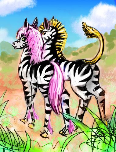
Because you're flying into the sun, it can't set. No, really. You're racing the sun and winning--going as fast as Venus turns. The sun freezes at the moment of setting, and hovers helplessly for hours. The miracle is annoying. You should just land and wait for it to set, but you're feeling melancholy and impatient. The vast, empty, beautiful grasslands bother you. Maybe I should have thrown in more biology, and had you visit an elephant matriarchy, a lion ranch, a zebra commune--they'd fit the niche.
But then so would American Gothic farmers...
Oh, well, too late now. You can survive one tour without them all, those busy, talkative creatures who shape the land but rarely notice how the land shapes them.
Silhouetted in the perpetual sunset, a black line of low, ragged islands appears, rough ropy lava that still hasn't broken into soil. Tufts of dry grass like an old man's sparse hair, a few trees in sheltered spots where night-streams come down the rocks. All the rest, rippling black. These are the Kasagonaga Islands. This north-south chain, running down the middle of Gunda, is an old lava flow, the Kasagonaga Fluctus. The largest island, well to the south of us, is 100 km long. But most are small and low like this--gnarled, muscular rocks.
Tired of the spectacular red glare ahead, you veer south and land like gulls on the first of the Kasagonagas--little more than an offshore rock. You lie back and watch the lurid sky, and sleep on bare lava--the body of Venus. Black, hard, ropy muscles. Not a gentle goddess, under the skin. But then, Love never was.
When you wake, and on through Dusk, you fly fitfully south along the line--lonely islands, but growing in size, grassier, a few pioneer trees creeping beyond pits and gulches. The eastern sky's green, slowly fading to blue as the rings brighten behind you. It looks like a scene from the Time Machine, at the end of the world--rocks, a sluggish moonless sea, something flopping--"not with a bang, with a whimper."
But the look's deceptive. The beginning, not the end! As the lava slowly cracks, seeds get a foothold. The Kasagonagas don't get much rain, but they needn't be desert isles, and won't be, in time. Once all Venus looked like this. Well, not quite--sterile dark lava and pale rubble under a smog-brown sky. All's changed, even here--blue sky, white rings, green sea, tawny tufts of grass.
Early in Eve, the shore of Parga appears at last: low hills, plains, scattered trees--not so different from Phoebe behind us. If this is Parga. It's debatable! You're near the undefined end of a land-bridge between the two continents, the Isthmus of Udaltsova--1000 km long and 250 wide. Most would call this Parga, but there are no signs here of the chasma that gave it the name. The Gunda Sea basin is very much of a piece.
You sleep on the quiet shore--the tides and waves in the Gunda Sea are gentle, you needn't fear them.
It's late Eve or early Ring by now, as you fly east over the oak-clad Kapenopfu Hills. The wide, marshy lake behind them drains north through a short river beneath you. It's a bit arbitrary, but most would say the Kapenopfu River means you've crossed back into Phoebe. Ahead on the coast is a new range of hills that look odd, sharp--a bit like Diamond Head. And they should, for it too is a crater: Udaltsova. The ancient impact was exactly at today's shoreline, so now it's a cape with a central lake--very nearly a ring-island like Mowatt, the isle in the desert sea where you slept so long ago.
From Udaltsova you veer southeast, across the Isthmus to its other coast: Mielikki Sound. Reaching the shore by ringlight, you follow a nameless cape (at least so far) out into the sound and land on a green island to sleep...
On Yule: a short cautious flight over Mielikki Sound, in the dim red dusk, fighting the urge to just sleep through it, like hooded falcons. Yule-drowsiness is a sign you're switching at last from a circadian sleep cycle to a... Cytherean! Soon as you reach the Parga shore, you give up and sleep in a field, like bewildered birds in a noonday eclipse.
When you wake, it's light again. Time to explore. Ahead is Ellen Strait, shallow and no more than 10 km wide--the mouth of Mielikki Sound. On the south (Parga) shore looms Mt. Mielikki, a shield volcano hundreds of km across. Quite high. Snow up there? You can't tell. All you can see from down here is an endless, rising slope, dark with forest, night-fragrant, the thickest you've seen in weeks. Subtropical here, but up there? A mountain that big makes its own weather.
On the north side of the strait is Cape Ellen, named for a drowned crater. It's of the ridges radiating from Mt. Yunya--the last gasp of the Devana Mts. It's 300 km long and 150 wide, a mixture of woods and prairies, with moderate rainfall and mild temperatures.
You sleep on the southern headland, in Parga. Tempting to just go on, into the volcanos and rift lakes of that twisted green land... but that's another tour. Looking back to Phoebe, the white rings are at their peak--a brilliant arch reflected in the strait, forming the sign of a great, open eye. It's hard to sleep, with the Goddess's eye staring like a searchlight...
All through Witch, you fly east, over fields and woods, across the low but rising ridges of Pinga, the southwest corner of Phoebe. The Pinga Peninsula has a fertile coast and drier steppes inland--never true deserts, but grass and brush between the wooded spurs from Mt. Yunya-Mana at the south end of of the Devana Range. It's big, spare, lonely country, and you fly high and fast. You've seen enough empty land.
Though of course it won't be empty. There will be people. Lots of them. Oh, those elephant poets, zebra singers, raven comedians! Maybe even a few humans in the mix.
|
|
|
|
|
|
|
|
|
|

|
|
|
|
|
|
But that's another tour. Actually, all the other tours. A little social fasting's just as healthy as food-fasting.
Today, the land. The land that sustains and shapes those people.
So... on Dawn, you fly down Pinga Chasma. Because you've been heading directly away from the sun the last few days, you're racing it and almost winning. The local calendar slows! It's still only mid-Dawn when you camp at at the tip, Atai Head, a mountainous near-island with a deep blue rift at its feet. Atai is rugged, a mix of woods, brush and meadows. It's about the size of Hawaii, and nearly as warm. The western sky glows, but it'll still be half an Earth day till sunrise. Get some sleep. You've earned it.
You rise before the sun, though the western sky's on fire now. You take wing in the cool morning air, rising over the orange cliffs of Atai, catching what updrafts you can, till you're high above the chasma. And then you wheel south, into the sea, toward the cone of gold floating over the horizon--Kwannon Island, a Fuji reaching up from night into the early sun. The volcano, like the deep dark channel beneath you and the cliffs of Atai, are all creations of the Pinga Chasma complex. Kwannon's a narrow, steep peak, but lava flows have built up an island 100 km wide.
As you near the cone, the light slowly slips further down its flank. The lit side has turned to gold. You wheel round to it and climb into the sun. Newly heated air lofts you to the summit. To the north, Atai Head is just catching fire; to the south, a second cone rears from the sea: Justitia. Kwannon and Justitia, Mercy and Justice, facing each other. Beyond Kwannon and the lurid clouds piling over its height, lies the jungle continent of Themis, just a few hours away. But that's another tour.
For now it's enough to stand in the sunlight, as the tropical sea below mirrors the red dawn, and know you're on Venus. Venus brought to life.

World Dream Bank homepage - Art gallery - New stuff - Introductory sampler, best dreams, best art - On dreamwork - Books
Indexes: Subject - Author - Date - Names - Places - Art media/styles
Titles: A - B - C - D - E - F - G - H - IJ - KL - M - NO - PQ - R - Sa-Sk - Sl-Sz - T - UV - WXYZ
Email: wdreamb@yahoo.com - Catalog of art, books, CDs - Behind the Curtain: FAQs, bio, site map - Kindred sites