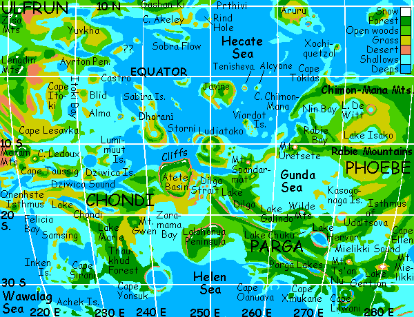
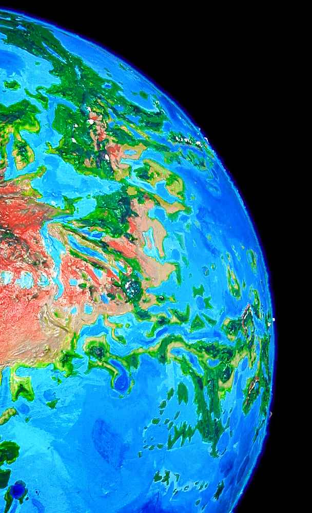
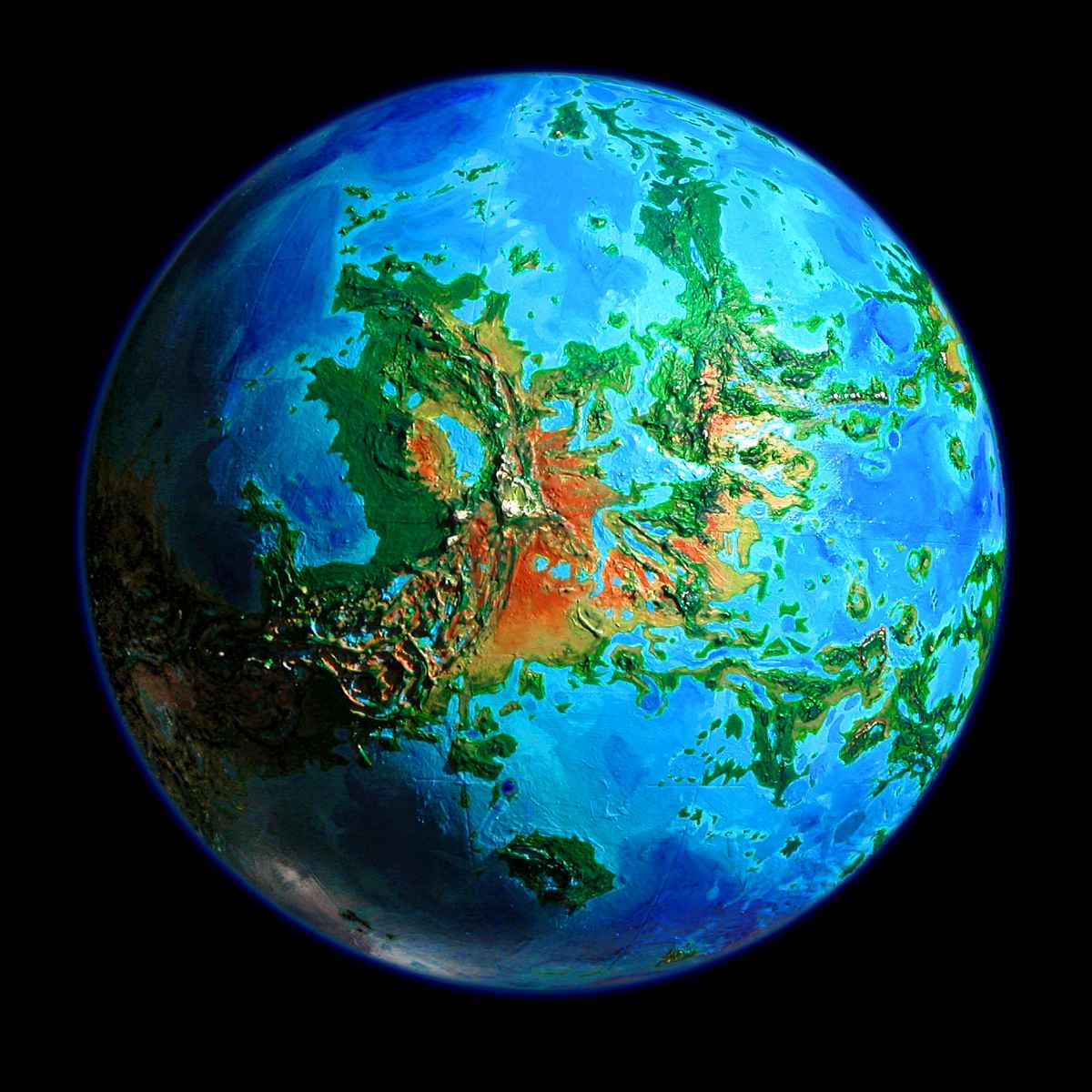
Venus Unveiled: Parga Chasma
INTRODUCTION
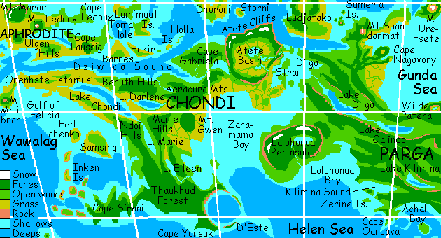
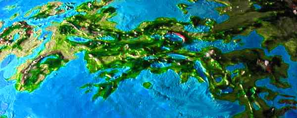
Parga Chasma's the south border of the Hot Triangle, the most volcanically active region on Venus today--a wedge bounded by Beta, Themis and Mt Maat on Aphrodite. The chasma winds 6000 km from Mt. Maat southeast through shallow seas, tossing up parallel ridges that form a small continent gashed by trenches (now mostly filled by long lakes). Volcanoes bracket the east and west ends. Eastern Parga is wooded, but the west (notably the huge island of Chondi) is mostly savanna--but that "mostly" hides spectacular exceptions, like the alpine, cliffwalled corona-plateaus of Atete and Lalohonua.
We'll also look at the strange, uncertain topography of the Hecate Sea...
TOUR: SOUTHERN PARGA
Let's start in the far southeast on Mt. Mielikki, a shield volcano hundreds of km across--more a small country than a mountain. It's visible from far across the Gulf of Angerona, for it's tall enough to get night and morning snow. Mielikki's actually less visible the closer you get--a gently rising landscape, with the summit hidden by lava knolls on its knees and shoulders.
From the savanna and groves of the coast, you slowly ascend through deepening forest to somber pine woods. Down at the shore, giant parrots and cockatoos were still in the majority, but once you reach the conifer belt, you encounter your first megaraven villages. Corvids find most of Themis too hot, though they're all over cooler, drier Ishtar, where parrots are common only in the far south.
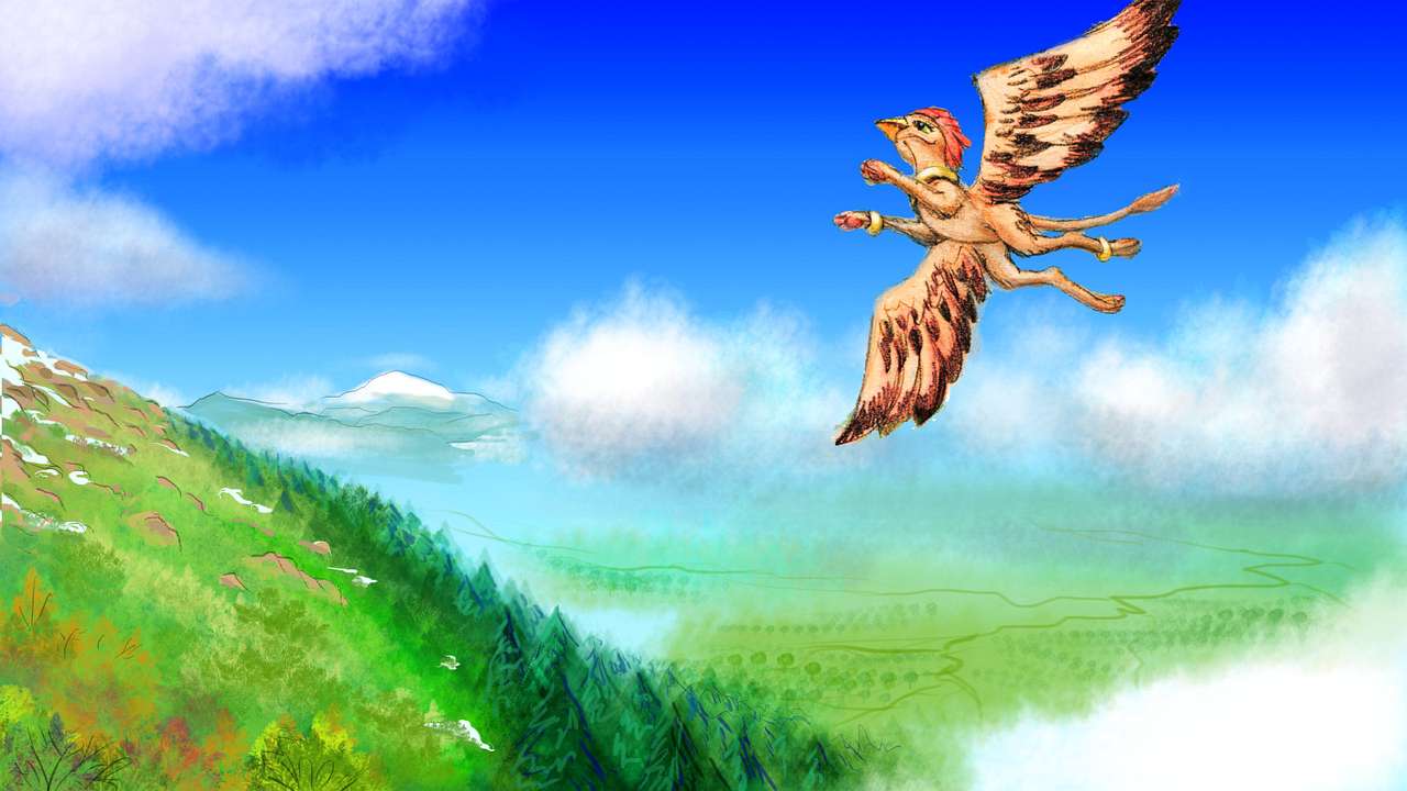
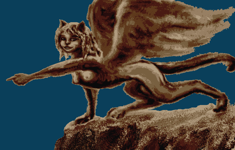
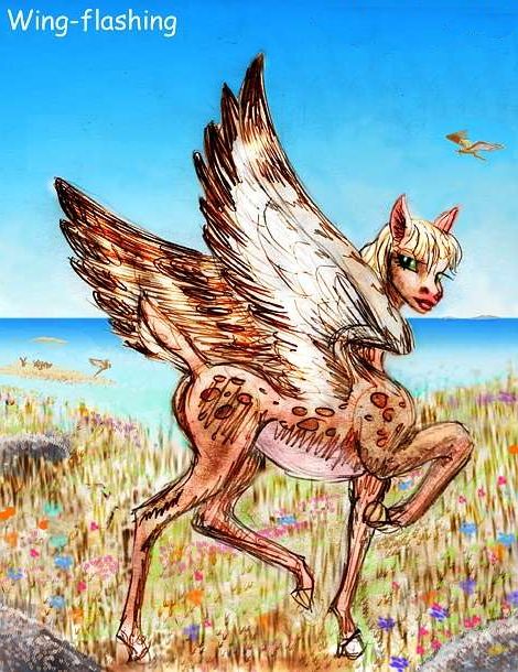
The trees thin and wizen and dwarf. Alpine meadows ahead, turning rockier and redder as you climb above most of the clouds. Summit desert! Patches of snow glare in the oversized sun. You shiver in the cold wind, and look down on the world: green hazy hills and lakes to the south and west, Angerona behind you, and to the north, another continent--Cape Ellen, in Phoebe, across a narrow strait. A gryphon rides the updrafts over Mielikki's shoulders--a lot more gracefully than you can manage. Along with ravens, they're the best-adapted people for these windy heights. Rare in the lowlands; too hot for them. But for them, Mielikki's a sky-island with pleasant climate and tremendous views.
When you wake, it's mid-Tuesday. You wander west along the shore of Mielikki Sound, dividing Parga and Phoebe. Once past Cape Ellen, you can't see the far shore--the sound's 2-400 km wide and nearly 1000 long. You break up the long day's flight--pretty country, but monotonous--with swims at subtropical beaches.
The lowlanders seem diverse, with no single species predominating. Most are furry or feathered; a good half have wings. Even the wingless generally run small and light-boned--staying within easy flight-weight with strap-ons, so they don't have to flounder like poor old you.

Humans? Oh, sure. A few. A tiny minority.
But only diehard traditionalists stick closely to the unimproved model. I mean, what for? No great advantages. You won't see many.
Head west. Sleep on the shoulder of Mt Ts'an-Nu, named for the silkworm goddess. Smaller than Mielikki, but still a major peak in eastern Parga, Ts'an-nu is wide enough to form a peninsula halfway across Mielikki Sound and tall enough to be an ecological island, with cloud forest on the west side, a pocket "desert" of chaparral on the east, and fern meadows near the summit.
On Wednesday you keep on, due west. Offshore, the sea turns dark and deep--a trench, another branch of Parga Chasma. Late in the day, Mielikki Sound ends abruptly--cliffs rise ahead, marching out to sea. A river breaches the cliffs, and you follow the canyon in. An hour of Utah scenery, between rock buttresses, before the notch opens out.
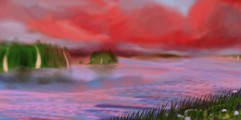
Before you, an inland, freshwater sea spreads out below an arc of red cliffs. Hardwood groves line the shore; pines cling to the cliffs.
Fly straight out into the sea. An hour later proof of where you are rises all around you: just as the cliffs behind you are are vanishing, leaving you stranded in a circle of islandless sea, identical cliffs appear on the horizon before you. This is no sea; it's Lake Hervor, a classic corona-lake, a flooded oval cliff-lined pit, like a flooded caldera but far too big--200 km wide.
You fly on across to the far side. Red cliffs, a canyon... You wonder if perhaps, with the sun near noon, you got turned around! But this river's running into the lake, not out. The Chuku River.
Thursday, you follow the river canyon (but is it really a small chasma that the river just found?) up to Lake Chuku, the source of Hervor. It's smaller, but still over 100 km wide, its arms winding up branches of Chuku Valley, an irregular hollow between coronas and ridges. The area looks like a cove in the southern Appalachians--long low ridges, hardwood groves, and warm rainy weather.
You head east beyond the lake, following the ridges. On the left is a dark nameless range a mile high, pine-capped. The valley below has marshes and grassy patches, stands of hardwood, but eucalyptus and palm as well. Over the lower ridge to the north, you see the glint of water: the Gunda Sea, nearly landlocked and half the size of the Mediterranean.
Tired by the nonstop crossing, you sleep on a bluff by the rivermouth.
Ahead, too, water gleams in the bottom of the valley: Lake Galindo, narrow but 250 km long. For three hours you skirt the north shore, riding updrafts. Cliffs rise now and then, but mostly it's just an arrow-straight rift valley with smooth slopes--a spreading zone, some of the youngest land on Venus.
After Galindo, the valley's opener--wide prairies between wooded strips. An hour after Galindo fades behind you, a new lake gleams ahead: long Lake Dilga, the size of Lake Superior--largest on Parga. You spiral down to a sandy shore near the little delta of the Galindo River, and fall asleep under a tree by the beach. And why not? It's hot, high summer--Thursday--and you've just flown 750 km, nearly nonstop... and there's no sign of an end to the green ridges and rifts and lakes. Consulting a map, you find there is next to no end of it--you could go on for days. Lake Dilga reaches almost to the western shore of the Parga subcontinent, a sound called the Dilga Strait. Lying in the rainshadow of the Chondi's high Atete Mts and Parga's Lalohonua Plateau, the shores are rather dry and rocky, the inland plains, savanna. The strait's full of islands and sounds, resembling Greece in size and character. Or, if you veered southwest, you'd end up on Cape Lalohonua, a green peninsula the size of Spain. Like Atete, it's bounded by cliffs, not as high or dramatic, but a sharp edge to the central plateau, mostly conifer forest, except the Lake Lalohonua basin in the east. Vast coral reefs encrust the peninsula's shallow shores. Again, exploring would take days--but from what you've seen today, you can easily extrapolate. No surprises there, so...
When you wake, you veer north over the low ridges toward the Gunda coast, away from Parga Chasma. The coast's bent north, away from you, so instead of sea, the far side of the ridges flattens into a tree-studded savanna with green winding stripes around streambeds. The plain widens till the hills are lost in summer haze.
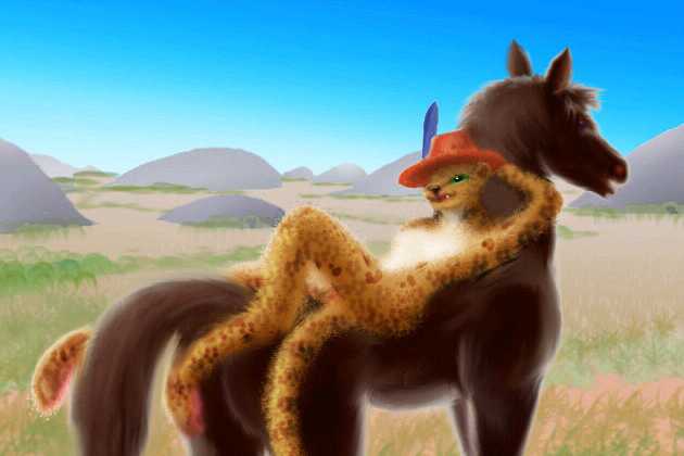
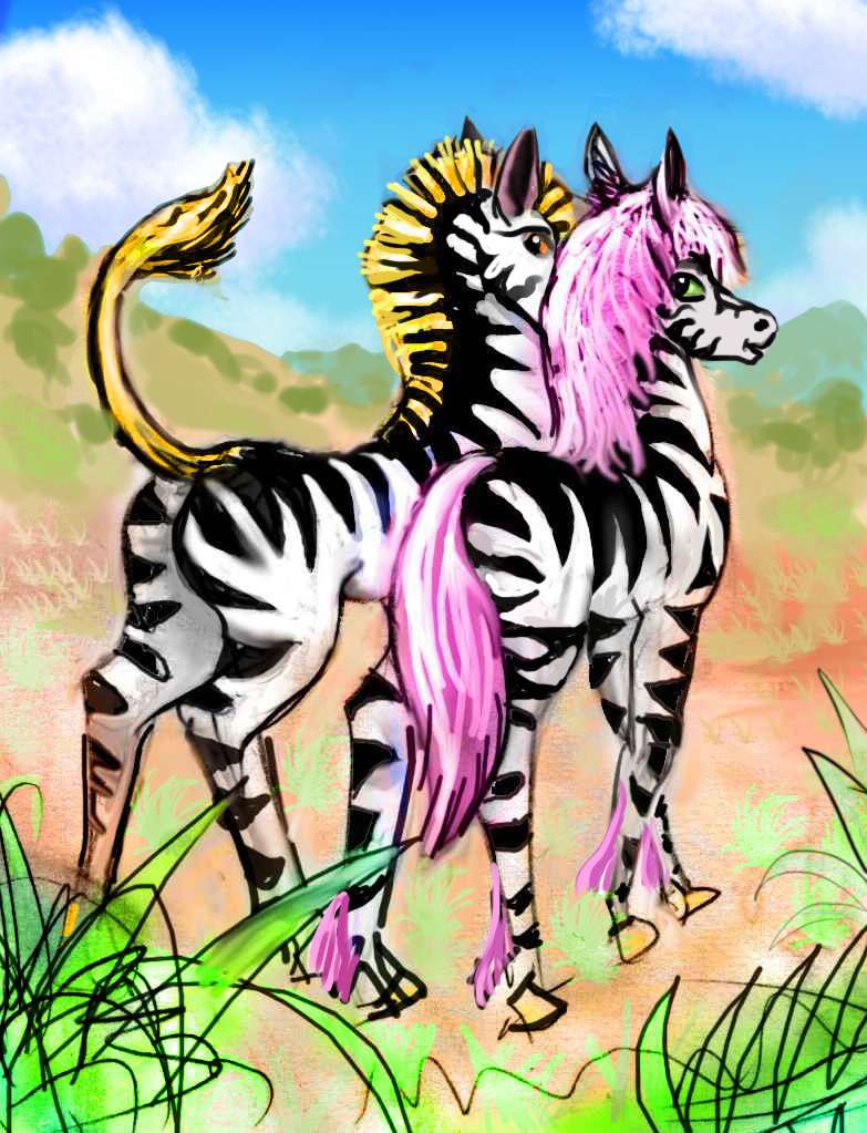
Elephant villages cluster along the streams. Out on the plains, you see herds of prezebras, a gengineered mix of zebra and Przewalski's Horse, the wild, big-headed, intelligent Mongolian ancestors of the domestic horse. Like elephants, prezebras are no longer mere animals--they're evolving sentience, and oral culture. (Sorry if this seems like a science-fictional intrusion into a simple geographic tour, but in the last decade it's become clear that wild animals are smarter than expected--at least a dozen big-brained species are already sentient or near to it, from elephants to ravens to dolphins and orcas. This has implications as inevitable as high tech. After a thousand years, other species will either have reservations where they can evolve their own cultures (this plain?), or they'll already be part of a common culture--whether on their own or in symbiosis with AI implants, they'll simply be different-shaped people. Think how much personhood's definition has already broadened in the last few centuries! This extrapolation is far more conservative than any scheme to terraform Venus--indeed, the radical position is that humans will be the only sentients. When else in evolution has the pioneer species in a new, rich niche stayed the only one?)
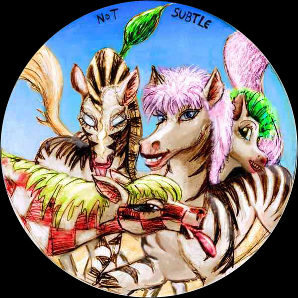
So... herds of zebralike but highly intelligent, feisty, individualistic grass-eating people dot the plains below. When you tire of the endless plain, you land in a zebra camp resting in the shade of an acacia grove. Three storytellers start a song-duel! They look like different breeds or races, but it turns out they're cousins--that's how variable the species is, and how whimsical. From horse manes and tails to obvious perms to punk mohawks, from plain coats to stripes to... checkerboards? Someone's bratty little sister with lime-green hair keeps heckling them, and even barges into the prize photo. Their color palette's so loud it deafens you to the poetry you landed for. Oh, well, now you know prezebra designers added color vision to the mix.
Too bad good taste's not genetic.
This particular bodypainting fad isn't even a zebra thing--it began among elephants on Dione, halfway round the planet, spread to the equines there, and hopped here. The (literally) insular nature of Venus encourages a patchwork of island cultures (unlike Mars's continental unity), but winged travel makes the spottiness random--ideas spread with travelers. And I'm ignoring the role of the Web.
NORTHERN PARGA
Rested, you head on north toward the hills faint on the horizon--the Nagavonyi Mts. Over the first ridge, a narrow bay, up the next jagged ridge, an arm of the central mountainous knot, dark with trees. You notice a cooler breeze with a faint sea-scent. Water glitters gold under the lowering sun to the east, and pale blue to the north. You find a meadow on the south flank of the Nagavonyis and touch down, to nap on a black pine-shaded boulder.
When you wake on Saturday, you dive off the rock into a canyon and hunt for an updraft. Normally the southeast face of Nagavonyi is the lee side, but now the low sun's heating cliffs and slopes facing east. Up, spiraling like a hawk, until you can wheel round the Nagavonyis' shoulders. At first all the comes into vies is more northern sea, until, far to the northwest, floats a great snowcapped volcano, gold in the low light.
You glide over ridges, down to the sea, across a channel, along a wide bay shore, as Mt. Spandarmat slowly looms larger and larger. Like Nagavonyi, only more so, Spandarmat forms its own peninsula and is tall enough to be an ecological island, with cloud forests on the slopes and even snow at the summit. As you near, the sunset slowly reddens until only the mountain's in sun. Taking advantage of the last thermals of Venus's long day, you ride up the east face of the great mountain, taking an hour or two, until you land on its summit.
Here there's surprisingly little wind--maybe it's a sunset lull. Of course, sunset lasts all day... On the horizon, sister volcanoes glow like coals on an ash bed--to the northwest, the nearby Sumerla group rises from the sea, and a nameless peak to the southeast, and behind you, Nagavonyi Corona. The largest of them all, to the east, should only be visible on your map--tall Uretsete on Phoebe's Cape Rabie, is too far off--a degree or two below the horizon, despite its height (and Spandarmat's). But Venus is tricky: the dense atmosphere bends light more than Terra's. Even on Earth, the setting sun you see isn't real--it's up to two sun-widths above the real sun's position, but the image gets refracted a degree or so. Here, the refraction's 2-3 degrees. So Uretsete's snowy tip hovers just above the Gunda Sea, though the volcano's over 500 km (300 mi) away. Astonished by the vision, you rest and stare... and fall asleep.
It's dusk when you wake--turquoise sky, cool air, though even atop this great peak, surrounded by snowfields, not truly cold. Uretsete still floats in the east, a white tent. You're tempted to head east along the Spandarmat Peninsula to Phoebe. But that's another tour.
You glide down the great peak's north slope...to discover that a civilization of wolves has colonized the peninsula.
Now, these aren't your familiar Martian wolves, those huge shaggy people who finished their rise to civilization on the snowy north shores of Tharsis, as cold as Old Canada before the Thaw. These are closer to old Terran wolves--smaller and more muscular (low-grav Martian wolves are as leggy as ballet dancers). And of course, no Terran or Martian wolf has skin flaps like a flying squirrel. While all wolves have opposable thumbs, only Cythereans climb trees and jump off cliffs, gliding over their canyons, through their forests...
(For those readers ignorant of basic ethology: start with Farley Mowat's "Never Cry Wolf"--NOT the movie, the book. This ground-breaking study has been unfairly dismissed as fuzzy-headed--it was too well-written, too sympathetic, and worst of all, funny. Most intriguing tidbit: Inuit hunters think wolf calls are a true language, capable of specifics--including a future tense! Why not? Arctic wolves aren't dogs. Their brains are the size of chimps'--and they need them. Even now, wolf culture and intelligence are nearly unstudied. But trust me--tweak the genes for longevity, frontal lobes and thumbs, and wolves will do the rest.)
Despite their classification in the order of Carnivora, most canids, unlike cats, are truly omnivores--they'll eat fruit, nuts and vegetables when they can get them. Once you have hands, farming's a much stabler food-source than hunting. So we have the somewhat incongruous image of tofu-eating wolves living in cliff dwellings, gliding like squirrels down to their beanfields on the canyon floors, or to tend their dairy herds on the coastal savanna. Wolf cheese is famous. Wolves live for enchiladas. (Pure logical extrapolation, of course. Would I make this stuff up?)
The Spandarmat wolves are famed for their handmade pottery. In their cliff-dwellings, playing with clay, you feel like you've wandered into a Hopi translation of the Jungle Books. You spend the evening with the wolves--all thirty-six hours of it.
You've reached the end of the mini-continent called Parga, but not the end of Parga Chasma--not by a long shot. Leaving Wolf Nation with a mighty ballast of beans and cheese, you flap northwest, out to sea--and from the look of it, out of Kipling into Jurassic Park.
And you wondered why the wolves lived up in cliff dwellings, not down on the shore where it's easy to build. No tsunamis for them, thank you! Unlike some humans we know, wolves understand the future tense.
From the lovely, deadly Sumerlas, it's an easy flight west to southern Ludjatako (say "after the deluge, a taco" without the first four syllables. Yes, now you see my fiendish plan. I stand by my predictions of wolf cuisine and Venusian Krakatoas, but timing those little digressions was indeed the world's longest set-up--dare I say 'shaggy-dog story'?--for this mnemonic pun. It was that or detour up a volcano where Olympic teams of sledding otters luge down the snowy slopes, and the ski lodge has a taco stand... so you could 'luge a taco'. Ugh, no. We stand for Elegant Scientific Diction.)
The size of Ireland, Ludjatako lies just north of the strait between Parga and Chondi. The climate's Hawaiian, though a bit drier, with microclimates based on altitude and rainshadows. Here in the southeast, around Sumerla Bay, are open woods, prairies and desert canyons issuing from the hills. Horse heaven, and most of the inhabitants are just that--communes of prezebras (intelligent hybrids of zebras and Przewalski's horse).
North Ludjatako is hillier, with more woods. Here be elephants. And humans. And leopards running antelope ranches.
CENTRAL HECATE SEA
When you wake, it's early Yule, lit by the rusty stumps of the shadowed rings. You stretch thoroughly, for next comes a nonstop flight over deep water. I'm leading you on a short detour away from the Parga complex, just because we're here, and no other tour covers these islands of the Hecate Sea, or the southeast shore of Aphrodite. If you're strictly interested in following the rest of Parga Chasma, just jump ahead. Otherwise, say your farewells, jump out of that leopard treehouse, and glide down to the beach--and keep going, straight out to sea.
Four tiring hours later, you spot Javine ahead. It's 450 km across, a fusion of two coronas. The western is a merering-wall 200 km wide cupping a shallow coral lagoon; the eastern is a grassy plateau with a wide plug of wooded mountains in the center, like a stack of dimes on a quarter--a round step-pyramid. You make landfall in the south, on a diagonal sand-spit 100 km long, like a subtropical Cape Cod, and sleep on the beach.
When you wake on Rain, it isn't.
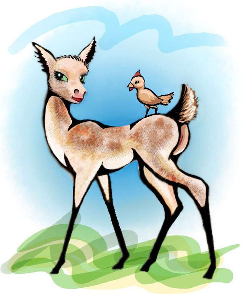
Now you know why Javine's mostly treeless--just grass. Still, Javine's savanna is herbivore heaven. Not equines, here--small deer are the dominant life form. Such bodies require a lot of genetic tweaking to acquire personhood, so they didn't bother--chip implants give them intelligence and language. Antelope brains aren't large, so they're not freestanding individuals--they're host bodies symbiotic with their AIs.
What an incongruous mixture! The shy, delicate grace of deer, with the geeky, brassy wit of artificial intelligences. Somehow you find it charming--Web entities trying out physical existence and discovering it's not the physical world that counts, but the emotional... You begin to suspect these shy cyberdeer live alone on this island so more social species can't make fun of them. A very deerish solution!
What do they do for hands? Simple. They just whistle. Symbiotic birds with clever little beaks and claws.
You wander up Javine Bay, a triangle between the two coronas and the cape, then northwest along the shore of the great lagoon.
The Javines have satellite islands in every direction--you can't explore them all. To the east are two lonely volcanic isles, Tenisheva and Alcyone. Tenisheva's basically just a caldera awash in the Hecate Sea, 120 km off the east coast of Javine. Grassy outer slopes with only a few trees in the hanging valleys (old lava flows). A brackish central craterlake, below dark cliffs. 250 km out is Alcyone, a smaller volcanic cone. Together they're a perfect flyway to nowhere.
To the southeast are Viardot and the Grechukha Islands, a cluster of volcanic cones much like Sumerla but rising from deep sea, with nothing on the horizon except (on a clear day) the snows of Spandarmat to the south. But never mind how lonely they look, the Viardots are no dead end--lurking just over the horizon to the southeast is the north coast of Phoebe.
Islands in every direction? I lied! To the north there's nothing but sea for 1000 km and more. And for Venus that's a long landless stretch. Seas are shallow; it doesn't take much to break the surface.
Late in Rain or early Witch, you head west from Javine, out to a large but nameless island--in our time, I mean. It'll have a name to the locals! But not one feature for hundreds of miles has a name on Venus now, so we can't guess what it is. Not a hard flight though--what's in a name? It's just a couple of hours out, a broad V-shaped island 160 km long. Basically one great grassy dune with coral trimming. But you waste an extra hour to find a drinkable stream. Fresh water is scarce on low-lying islands here, downwind from Aphrodite's deserts. Near the equator, where the air's naturally dry on Venus, it takes a long stretch of sea to fully re-humidify the winds, and mountains to push clouds up enough to cause regular rains.

Three anxious hours southwest, you spot at last a chain of of three or four low islets you can rest and sleep on--the first of the Sabiras, breaking up the trip to Dhorani. You don't spot any fresh water, though. Lucky it's night, and cool. Well, not luck. Clever planning by your ever-modest guide!
When you wake, late in Witch, it's another three hours over deep water to the shore--first a nameless northern island, then due south to the Dhorani mainland. Maybe it's that soft Dawn light, but Dhorani looks good. It's a twin to Ireland--a grassy 500-km oval with a wide marshy lake in the north-center. The weather's better, though--Dhorani's equatorial. On a world where coastlines seem willfully fractal, Dhorani is a simple patch of warm, fairly fertile land. It's dryish, like many islands in the Hecate Sea (too near the Aphrodite deserts for much rain) but the hills around its rim are quite green. Not the Emerald Isle, but at least Topaz.
Or perhaps the Gray Isle. This is elephant country! Elephants don't live much with other species, participating in Solar civilization mostly via the Web, due to the size problem. Neighbors who can't fit in your house and can squash you inadvertently just intimidate a lot of people. And of course they've never gotten along with lions or leopard people; a gut-loathing comparable to human arachnophobia.
But they welcome nonfeline tourists. Before sleeping in a hostel (Babar to the contrary, elephants don't use beds much) you get to hear your first live infrasonic band. It really does get you in your bones, like they say--some cliches are true.
On Dawn, you wander south to Lake Dhorani, then east over the central hills, and down the east coast. Green, gold, blue sea, all luminous in the shadowless twilight. Offshore, the long grassy isle of Storni paces you for an hour or two. A mini-Dhorani.
Southeast end of the island. You sleep on a ledge above the beach, where no absent-minded local's likely to pancake you.
A few hours before sunrise, you step off the cliff, and go looking for the final stretch of Parga Chasma: the Terra of Chondi.
An hour at sea, and the water beneath you turns midnight blue. You're crossing Dziwica Trench. Then a pink neon ridge climbs over the horizon: the night snows of the Atete Mts, catching the sunrise. For two hours you approach, looking for the shore, for foothills. Nothing but deep sea.
CHONDI
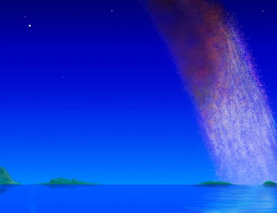
At last a red line grows--the Atete Cliffs, a stairway with steps a kilometer high, climbing from the tropical sea to snows. Waterfalls worthy of Roraima leap into the sea. It's a spectacle topping the Drakensberg on Earth--a Drakensberg with no coastal clutter.
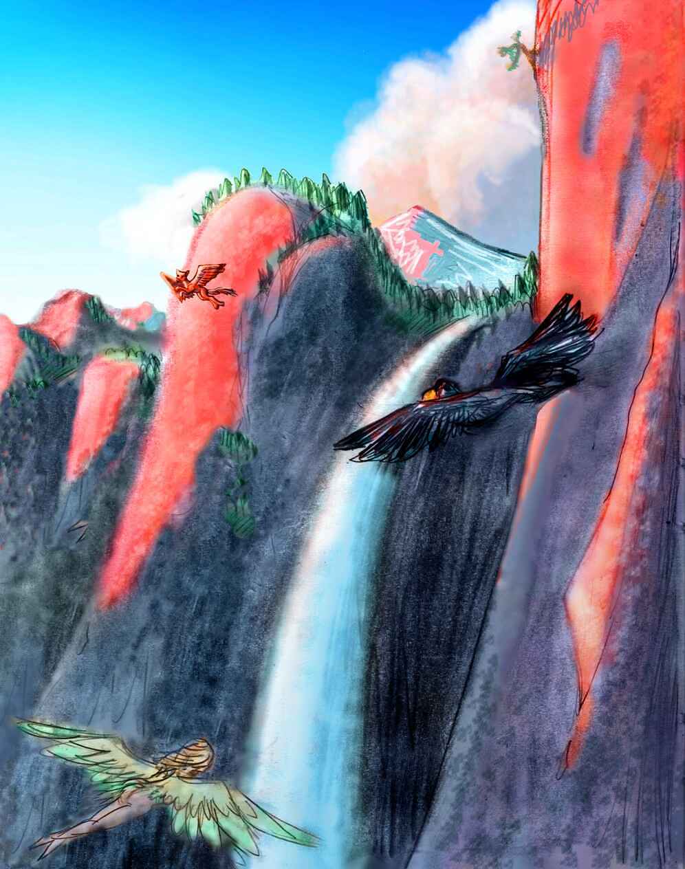
Up the great stair, cliff by cliff. The prevailing winds blow across the face, so each buttress creates updrafts on its red-glowing west face, downdrafts on the blue-shadowed east. Hovering near the sunlit crags is a balancing act between getting soaked by waterfalls (always just upwind, of course!) and being slammed against the cliffs.
Hours. You never realized being a bird is such a hard risky job. You loft two kilometers, more, as the mango forests on the lower ledges turn to oak and pine. Shaded cracks gleam with blue snow. The ledges broaden and break up into the peaks of the front range. Aspens burn fiery gold in the morning light, over pink snowfields with violet shadows. You'd swear this was Mars! The fauna's rather Martian, too: more wolf villages, but also bear and even a few mini-mammoths (I know that sounds as oxymoronic as jumbo shrimp, but they are--Martian mammoths scaled down to half-size in this heavier gravity, like small, shaggy Terran elephants).
Shivering, heavy as lead in this thin mountain air (a mere two and a half Earth atmospheres) you struggle over a pass and down onto the conifer-clad Atete plateau, 100 km wide and 500 long. It's still cold, and light snow streaks in the shadows, but you find a sunny outcropping and sleep with only your head in the shade...
When you wake, it's early Monday, and the dusting of snow's retreated under the trees. Grabbing air and stepping off the crag, you wheel in the warm air column, gaining height, then follow the streams down the gentle slope south. You come to no back rim--the plateau just gently slumps. 150 km later you're in low brushy foothills, and ahead, acacia trees are thinning into dry savanna. Atete is a huge bowl-shaped corona; the northern seacliffs are just a high spot on a rim all around you on the horizon. No wonder this basin's dry--rain's blocked on all sides. Though all the streams are merging... if the climate were wetter, this'd be an inland sea 400 km wide. But the basin's low points ahead have only modest lakes and marshes--landlocked and brackish.
Southeast of Atete, over a piny rim, are the Dilga Straits, a complex little sea full of rocky islands and heads--rather Greek-looking. Instead, let's go west, toward greener Cape Gabriela. The Atete Rim is lowest in the southwest, so you curve away from the marshes and slowly climb the rim--tedious, with the sun in your eyes. At least it's not hot yet--cut off from the sea's influence, the Atete Basin gets quite hot by mid-afternoon. You top the pass, and Lake Gabriela glitters below, directly under the sun.
You skirt the north shore of the lake to escape the reflection of the sun, if not the real thing overhead. Tiring of the glare, you quit early, swim in the lake, lie on a beach, and nap under green, shady cottonwoods by the shore. What a change from Atete's savanna!
Late Monday you push on an hour or so to the end of the lake, the sun still in your eyes. Cape Gabriela's ahead, visibly greener than Atete--maritime. But you're tired of facing the sun, and decide to skip the cape itself. You follow the lakeshore as it bends southwest, and when it ends, you follow the Gabriela River down to Aeracura Sound. Here you sleep in earnest. A long day, from the snows of Atete to a near-desert and back into lake country.
On Tuesday, you stick to the north shore of the sound, where the sun can't glare at you. Heading west, you do end up seeing quite a bit of Cape Gabriela after all. Across Aeracura Sound, the hills grow higher and greener, though the shores are golden grasslands. The climate here on Chondi's affected by the Aphroditean deserts to the west; dry savanna is common.
A small point narrows the sound ahead. On impulse you cross, and climb southwest into the Aeracura Hills. They're a cool green ecological island, wooded along creeks, and, as you climb inland, the higher peaks have forest crowns. On the south side, all the streams run down to another savanna plain, where they merge into a river winding west. Across the valley's a taller highland, this one looking a bit odd by Terran standards--a high, even, curving ridge--what appears to be the rim of a circular plateau. Having toured Mars, you instantly suspect it's an impact crater wall.
Climbing it, you're surprise to find nothing of the sort--just a flat piny upland 150 km across--as round as a pancake. And that exactly what Mt. Gwen is--the world's biggest pancake. An eruption spreading lava over a plain in all directions, that cooled at exactly the same distance from the vent. Did it happen just once, or over and over, building up Gwen's great disk--a pedestal with no statue? Lava pancakes ("farra") aren't rare on Venus, but they're usually well under 50 km wide. So maybe I'm wrong--the difference in scale suggests some different process at work. But until otherwise proven, I declare Gwen a pancake. With ponderosa pines on top. Mmmm, pancakes with vanilla syrup! (Yes, your author is writing this before breakfast and is getting hungry, but no, this isn't an irrational intrusion. Ponderosas smell like vanilla--their sap is loaded with vanillin. Mt Gwen really does smell like vanilla syrup. Believe me--things are already too weird on Venus to require embroidery.)
You glide back over the lip of Gwen and back down to the valley. The river winds west to narrow Lake Darlene. Well, not that narrow! 50 km wide, but since it's a good 250 km long... It's one more chasma lake. Aeracura Sound and Darlene Valley are both spurs of Parga Chasma--still with you, under various names, after 4500 km. And not ended yet...
The day's growing warm--it's late Tuesday--so you take a swim in the lake before flying on, down its south shore. Across the lake are the Beruth Hills, a long chain of small coronas--curving ridges intersecting like overlapping mud-pot bubbles. Which is, of course, just what they are. Their south side, facing you, is the dry side, so few streams descend to feed the lake. But below you, on the south shore, many creeks run down from the southern hills--the Marie Mountains.
The Maries have more trees than the Aeracuras--far more than the Beruths, at least the side you saw. Streams here seem Appalachian, that is, following north-south valleys that seem not to be erosional but structural--regular folds. Now and then, as in the Appalachians, streams cut through the ridges, draining the valleys, always to the west. Curious, you follow the largest stream. An hour later the river emerges from the hills, ending at the wooded shore of Lake Marie, 250 km long. In fact, the whole valley is wooded--the savanna's at an end. You've reached the edge of Thaukhud Forest, which covers most of southern Chondi. Marie looks like a typical chasma lake, long narrow and deep. But it's much shallower, just as the low ridges and coronas in Thaukhud are gentler than most chasma formations--an old, tired, Appalachian sort of chasma, perhaps. Marie has a little sister to the south, Lake Eileen, and two very big sisters to the north: Lake Darlene, and even bigger Lake Chondi, into which Darlene and Marie both drain. To the west you see the low Ndoi Hills, a small corona, as green as the higher Marie Mts behind you.
You're tempted to push south and sleep only once you've left Marie behind, so you can say you slept between Marie and Eileen. My, that sounds promiscuous! But common sense says to call it a day (a literal act on Venus, where days are a human construct) and sleep on the beach right here. After all, you flew nearly 1000 km today--with breaks and naps, it's true, but still...
You wake on mid-Wednesday, and fly down Lake Marie. The woods grow thicker, the air softer. You're leaving the arid equatorial zone. Past the lake, the Marie Valley continues for an hour or two, before ridges break it up. You veer left over the first few. Broadleaf forests quilt the hills in varied colors. A second wide valley opens ahead... Eileen Valley.
When you reach Lake Eileen, it seems modest for Venus. A mere 40 km wide, and 150 long--so short compared to its sisters that, halfway down the lake, you can see both ends--barely. It drains southeast--the Eileen River bursts through a break in the ridges (cut by lava, not water, of course--the river's only a few centuries old), and heads east to the Gulf of Zaramama. You do too, for the warm humid air is starting to make vigorous flying seem like work.
South of Eileen, the mountains grow taller, the woods denser--the heart of Thaukhud Forest. It lacks the crags of South China, but it's as lush. And like South China, the further south you go, the more Vietnamese it looks. You cling to the coast, where the humidity's relieved a bit more by sea breezes. Still, instead of four of five hours to Cape Yonsuk, the southern tip of Chondi, it takes you eight, for you constantly had to stop and rest or swim to cool off. This is true rainforest--the only one on Chondi.
You sleep in a tree, high on Cape Yonsuk. To the southeast the cape narrows to a ridge between the Zaramama Gulf and the Helen Sea, with sea cliffs 100 meters high on both sides. The ridge narrows and lowers, but extends past the horizon, curving like a corona's arcuate ridge. And it does border a roughly circular deep with a second claw enclosing it from the north. So maybe Yonsuk is a huge, shallow, tired corona, one the experts never bothered to name.
From Cape Yonsuk, an athletic flier can reach the Hlineu Islands to the south, leading to Chuginadak, a lonely land nearly as big as Iceland, in the middle of the Helen Sea--the torrid zone. Chuginadak's an asterisk 300 km across, all capes and bays lined with Megazoic rainforest nearly as dense and tall as the jungles of Imdr--a place with an interesting future, as its species and ecosystems diverge from Imdr's. But the south sea islands are another tour.
Instead, on Friday your way lies west along the verdant Yonsuk coast toward Cape Sirani. A long, leisurely day of intermittent travel and swimming, exploring the beautiful coral reefs. Since you're heading due west, away from the sun, time flies; when you bed down on the south shore of Sirani, only halfway out to the tip, the sun's quite low for Friday.
When you wake in the low warm light of mid-Setterday, you explore Cape Sirani. It's an odd land, an irregular W, all low hills and plains, solidly wooded, but with sounds and sloughs everywhere--a maze of oysterbeds more like a warm Puget Sound than the Forest of Thaukhud. You wander west across its ridges and bays for another 300 km... and abruptly reach the end.
Across a shallow passage is a cliff-walled isle like a fortress or a ship--a sharp contrast to Sirani's gentle hills. You cross the water to Inken Island and wheel round it like a gull, savoring the cliff-born updrafts, boosting you as if you were a small child again being tossed in the air by your dad. You ride the island 100 km to its northwest end, and find others... the Inken Gulf stretches 600 km north and west, full of isles, all cliff-walled and forested, the larger ones laced with waterfalls. The east-side cliffs echo the red clouds above, and in the low sunset light, rainbows appear in the spray as you pass, with the hot hues lurid and the blues subdued.
You ride the winds on and on, the light slowly dimming, until sheer fatigue makes such cliffwork dangerous, and you have to stop and land. You sleep in a cliff-village with a mixed population of winged coyotes, fish-eating angels and sphinxes, with of course the ubiquitous megaravens. All winged peoples, of course. To live in the Inkens, fishing off the cliffs or trading between islands, you need true wings, not tourist strap-ons.
You wake at dusk on a nameless isle in the Wawalag Sea, wrapped in velvet fog. You're disoriented at first--the wind has shifted and the updrafts are on the western, windward side of the island, now that the sun's down. You walk along the cliff edge, an open meadow, not forest as on the islands to the south. Which way?
You meet a sphinx, and ask directions. She laughs and points. "The fog clings to the island; once you're offshore it'll clear up and you can head north by ringlight."
North of Fedchenko is only the Gulf of Felicia. From here the chain bends east to the mainland. The last island, Samsing, is by far the largest--250 km across, a low, gentle, wooded island with shallow, meandering rivers, more like Sirani or the Forest of Thaukhud on the mainland than the cliffy Inkens. Though its woods are patchy like Fedchenko's, Samsing still gets more rain from the south than the grassy Ndoi Coast just to the north, on the mainland--which you reach late in the day. You camp on a grassy bluff with sweeping views of Felicia Gulf all blue and silver, the pale gold coastal plains, and the Ndoi Hills dark with pines.
When you wake, it's early Eve, and the rings are at peak brightness--2000 full moon's worth of light. You could drift like a ghost over the pale grass of the Ndoi coast for days, up narrow Cape Onenhste ("Oh nen stay"), skirting the Gulf of Felicia. But Onenhste is a huge side trip--after the cone of Mt Malibran, a day to the northwest, it narrows to nothing more than a low ridge of dune-grass and nesting birds, and wanders through shallow seas another 1200 km west, like some lost, anemic Panama, until it dead-ends in mountainous Cape Mbokomu, within sight of the deserts of Aphrodite. And that's another tour--a very long one, for Aphrodite's the biggest continent left in the Solar System, now that Terra's flooded.
Instead, you turn inland, over the Ndoi Hills, and down to Lake Chondi. On a tour full of huge lakes, this one is by far the biggest: fully 800 km long, up to 100 wide, it fills yet another branch of Parga Chasma. Thought I'd forgotten Parga Chasma, didn't you? But nearly everything you've seen is a manifestation of this vast complex. And you're still not quite at the end. Let's not linger at the lake--you've seen others, and Chondi's dry-grass shores are paradise for horses, but a bit bare for humans, unless you're from Kansas (or Kazakh.) Cross the lake at the narrows--the last gasp of the Ndoi Hills--and keep on, over the northern ridge, and down to the wine-dark sea. No, really. You've seen it before--it's the same dark trench you crossed to reach the cliffs of Atete a week ago: Dziwica Sound. Just 1500 km further west this time, and going strong. Parga Chasma, still at it.
WEST HECATE SEA
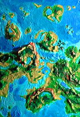
Across the sound to the Dziwica Islands. Roughly pronounced "divitsa," this is an undersea ridge paralleling the trench you just crossed; it breaks the surface intermittently. The Isle of Barnes, where you've made landfall, is a 360-km triangle of grassy hills; the largest island, though not by much. Lofting over its modest central hills, you can see most of it--a rumpled gold picnic blanket on the dark sea. On the eastern horizon, a hazy line announces the next largest: Erkir, long and narrow. 400 km further east, a long chain of islets, the Hollas, begin. In a few centuries, the growing coral reefs in the shallows along the ridge will make Dziwica a diver's mecca, enlarge and unite the Holla Islands, and perhaps link Barnes and Erkir too. But you've explored coral shallows already on this trip. You've come here for something different. For the north shores of the islands abruptly drop off into a round blue hole, the Toma Deep.
You sleep on the highest hill of Barnes, though it's hard, in the bright ringlight. Not a cloud in the sky. Back in the dry zone!
Oh well, if you can't sleep, you can read. Without a flashlight.
Poetic exaggeration, right? Wrong. Ringlight in a clear sky is hundreds of times as bright as Earth's full moon. You can see color; you can read fine print. It's why all these tours haven't shut down during Venus's long nights. No need!

Toma's blue hole is 200 km wide and ringed by arcuate islands like a mirror in a frame. In the center of the deep is a seamount, Mt Toma, which nearly breaks the surface; the hole looks quite like an impact crater with a central peak--but no apron of ejecta. A sunken corona, most likely, though NASA hasn't labeled it that, either. The islands flanking it, the Dziwicas and Lumimuuts, are nothing like the usual arcuate slivers you find around coronas, but hefty islands shaped like molars, totaling 100,000 square kilometers or more.
The two Lumimuuts are each 150-200 km wide, curving around the rim of Toma Deep in typical corona fashion, but with odd fat fins radiating outwards, each a wide grassy plain. Low and warm like the Dziwicas, the Lumimuuts do have sparse trees--they're not quite as close to the Aphroditean deserts. Not Polynesian yet, but a bit like some of the lower, drier Caribbean isles.
You stick to the business end of the isles, next to the Deep--you hop to North Lumimuut and circle to the northeast end of the rim, and there you find an inn and sleep, though you really didn't fly that far today. You can't just camp, there are too many other tourists here, waiting for what happens tomorrow. And you must wait, for Toma Hole has something that only surfaces one night a month, tomorrow--the darkest night.
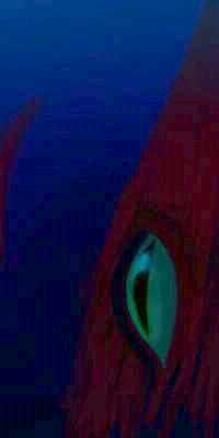
On early Yule, you dive in Toma, down the steep reef face. On this dark night, when their huge dark-adapted eyes can tolerate the surface light, the giant squid rise. Nights on Venus are brighter than Earth's, and only in Yule's dim red light or on cloudy, stormy nights do the squid hunt the surface waters. In the day they prefer waters at least a kilometer deep, for sunlight penetrates further here than on Earth or Mars. Coastal waters on Venus are rarely deep; only at Toma and a few other blue holes, and around offshore chasmas, can surface people meet them. A strange, fierce, clannish people, they're worth meeting if only to see their strange pictographic speech in person, speech composed not of sound but of pictures they will onto their chameleon-like skin. Living movie screens!
They're huge--up to 50 meters tip to tip, far bigger than any blue whale, though lighter of course. And old, really old, here where no sperm whales ever eat them. Some remember the Settlement. A few remember Earth. They feel even older--archaic. Still hunters, spending most of their time in deep solitude, watching, stalking, with their huge eyes. Owls of the deep. Owls with beaks big enough to swallow you like a gumdrop. These are not quaint, charming primitives. They're majestic, alien--terrifying.
Given all this, it's odd that they use the Web a lot. Dextrous arms have no problem with keyboards, of course, as long as the keys are large; and mixtures of words and pictures are familiar to them. But it's startling how well these savage hunters handle such a wilderness of alien concepts.
Or is it? Isn't the chaos of the Web rather like the deep sea? Squid minds track things in multiple dimensions. Air breathers, even birds and whales, think in planes. Even fish tend to swim at one level. But squid range so deep, and are so flexible, they can tolerate great pressure changes. They alone navigate a truly three-dimensional space, a dark, infinite wilderness with no reference points. The closest analogies are webspace and interstellar space--and some squid have ambitions to become starship pilots, although their size is a problem.
On early Rain, you head west, to Aphrodite. There's no rain on Rain--what little rain falls here falls in the day, during thunderstorms. You're on the fringe of Venus's desert zone now. The shadow of the equatorial rings creates a cooler belt, and a high-pressure zone of dry, falling air. That doesn't absolutely prevent rain--traveling over a few thousand miles of sea warm and humidify the wind enough to green the west coasts of Aphrodite and Phoebe. But on the east coasts, the prevailing winds come from the land, and the central mountains have wrung out all their rain. So here and eastern Phoebe have desert coasts and islands.
Every world has them: Earth has Baja California, western Sahara, Atacama, Namibia, western Australia; Mars has Cydonia, western Elysium, and the Lycus Sulci. Those deserts are all west coasts around 30 degrees latitude, where cool dry air descends in a three-cell Hadley system. On Venus, with its two-cell system, such places are all equatorial east coasts. But some such places are inevitable. Hot air rises, so cool air must descend somewhere; and those somewheres will be dry; clouds will clear.
Even worlds without solid surfaces have them--think of Jupiter's Great Red Spot. Or even sunspots. Relatively cool gas falls... cloudless sky. No rain--whether water, ammonia, or plasma.
All that's a polite way of saying:
Welcome to the armpit of Venus.
Okay, I exaggerate: Cape Taussig, our first look at the Aphrodite coast, isn't that bad. A low peninsula 900 km long, it's dry savanna, with some open forest in its central hills and in the Ulgen Mts near its base--neither range very high, but catching a bit more rain. There's pleasant swimming and reef-diving along its shores.
Inland are roving bands of prezebras--zebras with added genes from Przewalski's horse, the big-brained Mongolian wild horse. Their social structure is unlike the domestic horse--humans and apes are far closer. Horses were tamed and zebras were not, precisely because horses have a herd hierarchy into which humans can insert themselves. Zebras won't stand for that--they have a far more complex tangle of interlocking friendships crossing age and gender lines--following personal whim. And zebra whims are strong as iron. Donkeys are proverbially stubborn, but they were, after all, successfully domesticated. No one's ever tamed a zebra.
Prezebra culture is intensely oral, materially spartan, and quite competitive, though physical fights are rare today. One's status depends on wit, artistry, and force of character, as revealed in storytelling- and song-duels. Even cetaceans (notoriously specist when it comes to audio arts) concede they show considerable style, and Taussig's story-duels are particularly good; since the cape's on a major flyway, its storytellers are sophisticates, exposed to many cultures and species. Indeed, after being exposed to multilevel zebra irony, you may feel like a hick.
Only an hour north, over a shallow sound, is Cape Ledoux, 450 km long, but almost lost between Cape Lesavka and Cape Taussig, both much larger. It's named for Mt. Ledoux, a lovely little cone like Fuji, at a narrow point midway out the peninsula, where the sea both north and south reaches almost to its foot. You sleep on the shoulder of Mt Ledoux, in a cool upland forest, looking north over the Gulf of Ledoux, thinking that the "armpit of Venus" seems pretty nice.
On Witch, you fly north across Cape Lesavka, a low, flat, dry tongue sticking 6-700 km into the Hecate Sea. The name's deceptive; it's not really much of a spur of Lesavka Chasma to the west. The tip gets some rain off the sea, sustaining a few trees, but most of Lesavka is a vast veldt--just dry grass and a little brush. It's a wide tongue, and crossing the dusty gold plain takes hours. It seems even longer after your fresh water runs out... An elephant family finally directs you to a waterhole 50 km off your route--and it's just gritty mud. This isn't quite desert--it does rain now and then, and drizzles at least once a month. Drought-adapted herbivores like prezebras and nomadic elephant matriarchies do well enough here--but the plain is dreary. A grudging land.
At last you reach the south shore of Itoki Bay, 700 km wide. Properly, "Bay" applies only to the inner bay and its long desert island, sheltered by Cape Itoki. The outer part, between the cape and the barrier islands of Alma and Blid, is Itoki Sound. The whole region was once a lava flow, and the inner bay and cape are still rather stark--near-desert, low and brown. But the shores of the outer sound and islands have a few trees and waterholes.
In contrast to the land, the reefs alongshore teem with life. Whales calve here in the warm sheltered waters. It resembles the Sea of Cortez, or the Cydonia Coast on Mars.
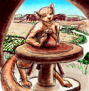
Off Itoki Island, octopi living in the shallows have developed steam power, using parabolic reflectors to solar-heat small boilers. Arthur C. Clarke used to say high-tech civilizations throughout the galaxy would be land-based, because marine species, no matter how clever, are crippled without fire. The octopi are out to prove him wrong. A steam-powered civilization without fire! Of course, the mirrors are landmade--silvered glass still beats anything marine. Now the octopi are building a dam to harness tidal power, made entirely of local materials--except for the wiring! Octopi are understandably touchy about vertebrate dominance, but Cytherean civilization is a web, even if the molluscs wish they could go it alone.
The octopi reefs on the east side of Itoki Island are surprisingly quiet. Octopi are still primarily nocturnal, though that's changing somewhat now with solar power, just as humans started colonizing the night after Edison built his bulbs (did you know he was an insomniac? Sleep was a waste of time to him--and he imposed his vision (pardon the pun) on the rest of us). Predawn's a busy time for the octopi as they prepare for the energy-collecting dayshift. But they're not the best of conversationalists: preoccupied, and near the end of their waking period, and... well, engineers. Nothing like the octo sculptors of Dione, who'll sign your ear off about their latest projects...
Bored by octonerds, you fly on northeast, to the shore of the outer sound (well north of the bay mouth), and sleep on the beach.
Early on Dawn, you cross to Alma Island. A low, rocky, oval sheltering Itoki Sound, Alma's 150 km across, and though the coast has a few trees, its interior is still semi-arid--cactus and dry grass, with stretches of stringy, ridgy, low brown rock--the lava flow that built the whole region. You land only at a shallow pond between lava outcrops, for water, and head on north to Alma's twin, Blid.
Blid's a rocky triangular island, 200 km long. A few hundred kilometers out to sea, Blid has a ghostly namesake, Blid Corona--but it's just a coral bank now. Initially I miscalculated Blid's position and altitude, concluding it'd be a large, low island. Eventually a sea of better data drowned Blid like Atlantis. So I dubbed the real island "Blid" as a memorial, since the rise has no official name (nor does anything much in the area--it's all just the Itoki Fluctus).
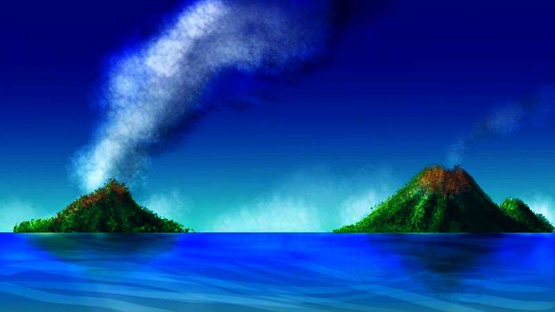
In fact, there are half a dozen other hazy islands out to sea here, low, nameless isles as uncertain as a cat trapped in Schroedinger's black box. The relief data's so low and ambiguous here that no shoreline's sure for hundreds of km out, until you reach the volcanic vigor of Cherskaya and Dietrich Isles, two peaks rising a mile from the sea.
A white flickering in the distance signals our first contact with a unique species: the only winged hayburners I can think of. Even on Venus, Pegasus is impractical; equines are just too heavy. But antelope fly just fine! And they need to, on the Alma-Blid Islands; a population confined to a single small dry island faces obvious risks of overgrazing, inbreeding, drought. Their wings allow them to follow the sparse rains around the archipelago. To flash a signal that can be seen for miles, they half-raise their wings, showing the white underside. It's an extension of antelope tail-flashing, but far more effective in their scattered island territory.
Antelope psychology will sound strange to readers of other races, unless you're very shy. The contrast with prezebras could not be more extreme. They're constantly on alert, wary of novelty, acutely sensitive to the subtlest threats. And yet, they don't find this troublesome, for their etiquette takes it for granted and defuses it with reassurances. And they socialize constantly. Emotionally perceptive, astute readers of character, antelopes are never bored, for the smallest stimulus is enough. Just as every glance is a potential threat, every bird-cry is a poem, every rock a sculpture. A touch inflames, and lovemaking overwhelms. Though they seem an austere and materially impoverished culture, they're sensorially and emotionally rich. A race of graminivorous Emily Dickinsons, walking the hills, unable to bear cities and crowds.
Leaving the Antelope Isles, you're nearing the end of our long tour. Across to Cape Ayrton, a peninsula 1000 km long--the size of Italy, but semi-arid. The western mountains support open forest--much greener than Itoki, due to a gap in the mountains on the mainland, letting storms through from Zewana Gulf--when there are any. Mt Ayrton, a shield volcano near the peninsula's base, with a large caldera-lake at the summit, is the source of the name--a relatively green ecological island. East of the mountains are lower veldt hills, flickering with red and white--distant herds of winged antelopes nervously wing-flicking, telegraphing your arrival. You spot a dusty mass of flickering black-and-white too--prezebras in a ring around a song-duel. But you don't detour to listen. Just make your camp and sleep. A long, hard, dry day--like the last, and the day before. See why most tourists stick to Ishtar or Mt Maat?
At sunrise, you cross a narrow, shallow strait--little more than a river, really (in fact, the radar scans are so low-relief here that maybe it is just a river)--to your last stop, Yuvkha Island (if it is an island). Well... whatever Yuvkha is, it's as big as Great Britain. The west end has piny mountains and foothills with acacia savannas. The central steppes are quite dry--semi-arid plains and hills. The climate grows more maritime to the east; the coast is fairly green. Under the shade of the equatorial rings, the climate is warm but not hot, except afternoons on the inland deserts. Like the Ayrton Peninsula, Yuvkha is greener than Itoki, because it's downwind of the Isthmus of Lengdin and its storms. Whether Ayrton Sound is a true arm of the sea or a brackish lagoon, it sends a long arm into the heart of the island, also moderating the climate of the central steppes, though it brings no rain to speak of. In the north, Yuvkha Channel ends the topographic uncertainty: wide, deep, and 1000 km long.
Cape Ayrton, Yuvkha Island, and the dry Zisa Basin, north of the Isthmus of Lengdin in the rainshadow of the Zisa Mountains, are all elephant country. I haven't said much about elephant culture because recent books on Earth elephants already cover the basics so well. Try Cynthia Moss's "Elephant Memories", or for a novel catching the feel of elephant society, try Barbara Gowdy's "The White Bone."
North of Yuvkha, over the sound, is huge Gashan-Ki Peninsula, part of the Hecate Chasma complex. It has much more rain, sustaining open woods and savanna in the lowlands, and thick pine forests in the heights. From here, whether you head north into Ulfrun, or west into Atla, or east along Hecate Chasma, the land is rich--in Ulfrun, you'll soon reach rainforest rivaling the Amazon. You've passed through the desert zone to the far side. It's morning, and over the horizon, the forests of a green world call to you.
But that's three other tours.
FACT VS FICTION

World Dream Bank homepage - Art gallery - New stuff - Introductory sampler, best dreams, best art - On dreamwork - Books
Indexes: Subject - Author - Date - Names - Places - Art media/styles
Titles: A - B - C - D - E - F - G - H - IJ - KL - M - NO - PQ - R - Sa-Sk - Sl-Sz - T - UV - WXYZ
Email: wdreamb@yahoo.com - Catalog of art, books, CDs - Behind the Curtain: FAQs, bio, site map - Kindred sites